Woods Bank

Settlement in Staffordshire

England

Woods Bank

Richards Art Gallery & Museum, Wednesbury Built in 1890 to a design by Wood and Kendrick, and now housing a collection of art and craft exhibits, along with period architecture including a fine stone staircase with cast iron balusters. It attracted a Grade II listing <span class="nowrap"><a title="https://britishlistedbuildings.co.uk/101077118-richards-art-gallery-and-museum-wednesbury-south-ward#.YXGDThrMLIU" rel="nofollow ugc noopener" href="https://britishlistedbuildings.co.uk/101077118-richards-art-gallery-and-museum-wednesbury-south-ward#.YXGDThrMLIU">Link</a><img style="margin-left:2px;" alt="External link" title="External link - shift click to open in new window" src="https://s1.geograph.org.uk/img/external.png" width="10" height="10"/></span> & <span class="nowrap"><a title="https://historicengland.org.uk/listing/the-list/list-entry/1077118" rel="nofollow ugc noopener" href="https://historicengland.org.uk/listing/the-list/list-entry/1077118">Link</a><img style="margin-left:2px;" alt="External link" title="External link - shift click to open in new window" src="https://s1.geograph.org.uk/img/external.png" width="10" height="10"/></span> in 1987.
Richards Art Gallery & Museum, Wednesbury Credit: Richard Law

Woods Bank is a small village located in the county of Staffordshire, England. Situated approximately 4 miles south of the town of Rugeley, Woods Bank is nestled in a picturesque rural setting, surrounded by rolling hills and lush green fields.

The village itself is characterized by its quaint charm and tight-knit community. With a population of around 500 residents, Woods Bank offers a peaceful and tranquil living environment for its inhabitants. The village is known for its friendly locals who often organize community events and gatherings, fostering a strong sense of camaraderie among its residents.

Woods Bank boasts a range of amenities to cater to the needs of its residents. The village is home to a primary school, providing education for local children, and a village hall, which serves as a hub for various social activities and gatherings. Additionally, Woods Bank features a small local shop, providing essential goods and services to the community.

Nature enthusiasts will find plenty to explore in and around Woods Bank. The village is surrounded by picturesque countryside, offering numerous walking and cycling trails for outdoor enthusiasts to enjoy. The nearby Cannock Chase, an Area of Outstanding Natural Beauty, provides further opportunities for outdoor activities, including wildlife spotting, picnicking, and hiking.

In summary, Woods Bank is a charming village in Staffordshire, offering a peaceful and close-knit community, a range of amenities, and ample opportunities for outdoor recreation.

If you have any feedback on the listing, please let us know in the comments section below.
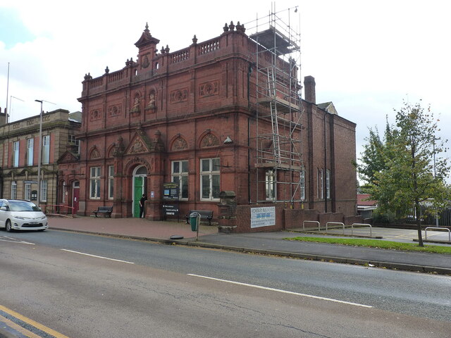
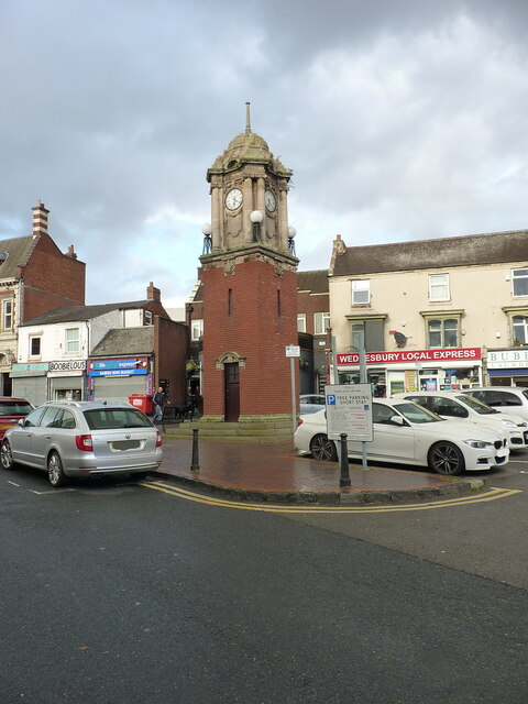
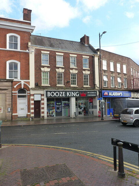
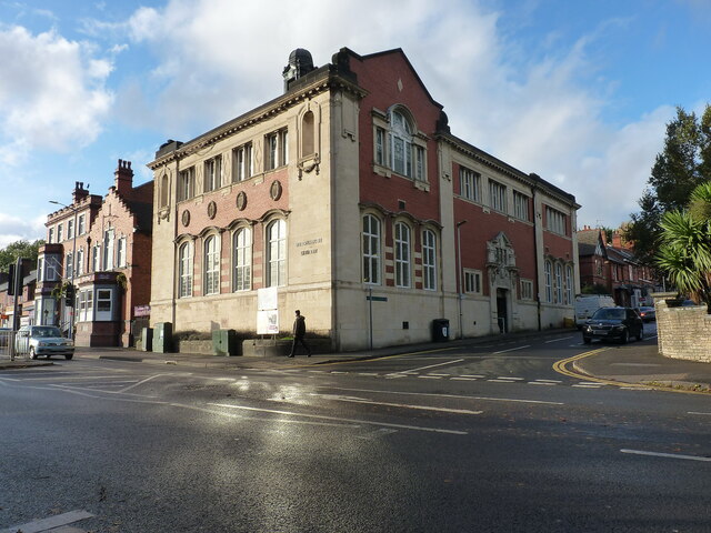
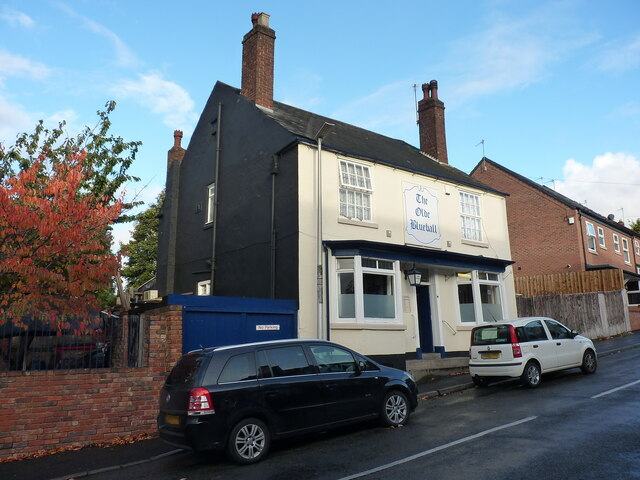
Woods Bank Images

Images are sourced within 2km of 52.56233/-2.0392108 or Grid Reference SO9796. Thanks to Geograph Open Source API. All images are credited.

Richards Art Gallery & Museum, Wednesbury Built in 1890 to a design by Wood and Kendrick, and now housing a collection of art and craft exhibits, along with period architecture including a fine stone staircase with cast iron balusters. It attracted a Grade II listing <span class="nowrap"><a title="https://britishlistedbuildings.co.uk/101077118-richards-art-gallery-and-museum-wednesbury-south-ward#.YXGDThrMLIU" rel="nofollow ugc noopener" href="https://britishlistedbuildings.co.uk/101077118-richards-art-gallery-and-museum-wednesbury-south-ward#.YXGDThrMLIU">Link</a><img style="margin-left:2px;" alt="External link" title="External link - shift click to open in new window" src="https://s1.geograph.org.uk/img/external.png" width="10" height="10"/></span> & <span class="nowrap"><a title="https://historicengland.org.uk/listing/the-list/list-entry/1077118" rel="nofollow ugc noopener" href="https://historicengland.org.uk/listing/the-list/list-entry/1077118">Link</a><img style="margin-left:2px;" alt="External link" title="External link - shift click to open in new window" src="https://s1.geograph.org.uk/img/external.png" width="10" height="10"/></span> in 1987.
Richards Art Gallery & Museum, Wednesbury
Built in 1890 to a design by Wood and Kendrick, and now housing a collection of art and craft exhibits, along with period architecture including a fine stone staircase with cast iron balusters. It attracted a Grade II listing LinkExternal link & LinkExternal link in 1987.
OS benchmark - Wednesbury, Town Hall An OS cutmark beside the entrance door to <a href="https://www.geograph.org.uk/photo/863858">SO9894 : Town Hall and old Post Office</a>, last levelled in 1962 at 131.497m above Ordnance Datum Newlyn. It does appear on the 1937/38 1:2500 map at a height of 431.47 ft above Liverpool datum, which rather suggests it was used in the 1st Geodetic Levelling survey, a supposition that is supported by the style of the cuts.
OS benchmark - Wednesbury, Town Hall
An OS cutmark beside the entrance door to SO9894 : Town Hall and old Post Office, last levelled in 1962 at 131.497m above Ordnance Datum Newlyn. It does appear on the 1937/38 1:2500 map at a height of 431.47 ft above Liverpool datum, which rather suggests it was used in the 1st Geodetic Levelling survey, a supposition that is supported by the style of the cuts.
OS benchmark - Wednesbury, 30 Lower High Street The OS cutmark lies on one of the quoin stones of the one-time bank in the market place, and was last levelled in 1956 at 139.150m above Ordnance Datum Newlyn.  The building appears to be empty at present (Oct 2021)
OS benchmark - Wednesbury, 30 Lower High Street
The OS cutmark lies on one of the quoin stones of the one-time bank in the market place, and was last levelled in 1956 at 139.150m above Ordnance Datum Newlyn. The building appears to be empty at present (Oct 2021)
OS benchmark - Wednesbury, shop on Walsall Street The shop is described in the OS database as Boots Chemist, but that appears to be no longer the case. The mark was last levelled in 1956 at 141.888m above Ordnance Datum Newlyn, and appears on older maps at 465.56ft Liverpool Datum. It was probably cut as part of the 1st Primary Levelling survey in 1843/44 at which point it was documented as "Mr Anslow's Grocery Shop"
OS benchmark - Wednesbury, shop on Walsall Street
The shop is described in the OS database as Boots Chemist, but that appears to be no longer the case. The mark was last levelled in 1956 at 141.888m above Ordnance Datum Newlyn, and appears on older maps at 465.56ft Liverpool Datum. It was probably cut as part of the 1st Primary Levelling survey in 1843/44 at which point it was documented as "Mr Anslow's Grocery Shop"
Wednesbury Clock Tower Built in 1911 to celebrate the coronation of George V, and constructed of sandstone and red brick, with carvings in a Baroque style. It was Grade II listed <span class="nowrap"><a title="https://britishlistedbuildings.co.uk/101077119-clock-tower-in-wednesbury-market-place-wednesbury-south-ward#.YXGR7RrMLIU" rel="nofollow ugc noopener" href="https://britishlistedbuildings.co.uk/101077119-clock-tower-in-wednesbury-market-place-wednesbury-south-ward#.YXGR7RrMLIU">Link</a><img style="margin-left:2px;" alt="External link" title="External link - shift click to open in new window" src="https://s1.geograph.org.uk/img/external.png" width="10" height="10"/></span> & <span class="nowrap"><a title="https://historicengland.org.uk/listing/the-list/list-entry/1077119" rel="nofollow ugc noopener" href="https://historicengland.org.uk/listing/the-list/list-entry/1077119">Link</a><img style="margin-left:2px;" alt="External link" title="External link - shift click to open in new window" src="https://s1.geograph.org.uk/img/external.png" width="10" height="10"/></span> in 1987.
Wednesbury Clock Tower
Built in 1911 to celebrate the coronation of George V, and constructed of sandstone and red brick, with carvings in a Baroque style. It was Grade II listed LinkExternal link & LinkExternal link in 1987.
31 & 33 Market Place, Wednesbury The 'Booze King' shop occupies a pair of late 18th century town houses which were Grade II listed <span class="nowrap"><a title="https://britishlistedbuildings.co.uk/101287437-31-and-33-market-place-wednesbury-south-ward#.YXGUahrMLIU" rel="nofollow ugc noopener" href="https://britishlistedbuildings.co.uk/101287437-31-and-33-market-place-wednesbury-south-ward#.YXGUahrMLIU">Link</a><img style="margin-left:2px;" alt="External link" title="External link - shift click to open in new window" src="https://s1.geograph.org.uk/img/external.png" width="10" height="10"/></span> & <span class="nowrap"><a title="https://historicengland.org.uk/listing/the-list/list-entry/1287437" rel="nofollow ugc noopener" href="https://historicengland.org.uk/listing/the-list/list-entry/1287437">Link</a><img style="margin-left:2px;" alt="External link" title="External link - shift click to open in new window" src="https://s1.geograph.org.uk/img/external.png" width="10" height="10"/></span> in 1950.
31 & 33 Market Place, Wednesbury
The 'Booze King' shop occupies a pair of late 18th century town houses which were Grade II listed LinkExternal link & LinkExternal link in 1950.
OS benchmark - Wednesbury, 2 Union Street An early OS cutmark on the wall of no 2 Union Street, last levelled in 1956 at 140.860m above Ordnance Datum Newlyn. It also appears on early maps at a height of 462.21ft above Newlyn Datum, based on the 1st Primary Levelling in the period 1912-1921.
OS benchmark - Wednesbury, 2 Union Street
An early OS cutmark on the wall of no 2 Union Street, last levelled in 1956 at 140.860m above Ordnance Datum Newlyn. It also appears on early maps at a height of 462.21ft above Newlyn Datum, based on the 1st Primary Levelling in the period 1912-1921.
Wednesbury District Public Library The library was built in 1907 to a design by Crouch, Butler and Savage, and attracted a Grade II listing <span class="nowrap"><a title="https://britishlistedbuildings.co.uk/101077099-district-public-library-wednesbury-wednesbury-north-ward#.YXGYDhrMLIU" rel="nofollow ugc noopener" href="https://britishlistedbuildings.co.uk/101077099-district-public-library-wednesbury-wednesbury-north-ward#.YXGYDhrMLIU">Link</a><img style="margin-left:2px;" alt="External link" title="External link - shift click to open in new window" src="https://s1.geograph.org.uk/img/external.png" width="10" height="10"/></span> & <span class="nowrap"><a title="https://historicengland.org.uk/listing/the-list/list-entry/1077099" rel="nofollow ugc noopener" href="https://historicengland.org.uk/listing/the-list/list-entry/1077099">Link</a><img style="margin-left:2px;" alt="External link" title="External link - shift click to open in new window" src="https://s1.geograph.org.uk/img/external.png" width="10" height="10"/></span> in 1987.
Wednesbury District Public Library
The library was built in 1907 to a design by Crouch, Butler and Savage, and attracted a Grade II listing LinkExternal link & LinkExternal link in 1987.
OS benchmark - Wednesbury Library An OS cutmark low on the side wall of <a href="https://www.geograph.org.uk/photo/6997045">SO9895 : Wednesbury District Public Library</a>, which was levelled in 1956 at 145.475m above Ordnance Datum Newlyn.
OS benchmark - Wednesbury Library
An OS cutmark low on the side wall of SO9895 : Wednesbury District Public Library, which was levelled in 1956 at 145.475m above Ordnance Datum Newlyn.
Central War Memorial, Wednesbury Located in the Memorial Gardens, this limestone obelisk was erected in 1926 as a memorial to the fallen of WWI, and Grade II listed <span class="nowrap"><a title="https://britishlistedbuildings.co.uk/101342660-central-memorial-in-memorial-gardens-wednesbury-north-ward#.YXGbSxrMLIU" rel="nofollow ugc noopener" href="https://britishlistedbuildings.co.uk/101342660-central-memorial-in-memorial-gardens-wednesbury-north-ward#.YXGbSxrMLIU">Link</a><img style="margin-left:2px;" alt="External link" title="External link - shift click to open in new window" src="https://s1.geograph.org.uk/img/external.png" width="10" height="10"/></span> & <span class="nowrap"><a title="https://historicengland.org.uk/listing/the-list/list-entry/1342660" rel="nofollow ugc noopener" href="https://historicengland.org.uk/listing/the-list/list-entry/1342660">Link</a><img style="margin-left:2px;" alt="External link" title="External link - shift click to open in new window" src="https://s1.geograph.org.uk/img/external.png" width="10" height="10"/></span> in 1987.
Central War Memorial, Wednesbury
Located in the Memorial Gardens, this limestone obelisk was erected in 1926 as a memorial to the fallen of WWI, and Grade II listed LinkExternal link & LinkExternal link in 1987.
War memorial in Wednesbury Located in the same gardens as <a href="https://www.geograph.org.uk/photo/6997054">SO9895 : Central War Memorial, Wednesbury</a>, and originally erected in 1926 as a memorial to the fallen of WWI, then additional dedications were made for those lost in WWII. It too attracted a Grade II listing <span class="nowrap"><a title="https://britishlistedbuildings.co.uk/101229515-memorial-attached-to-north-wall-of-memorial-gardens-wednesbury-north-ward#.YXGcgxrMLIU" rel="nofollow ugc noopener" href="https://britishlistedbuildings.co.uk/101229515-memorial-attached-to-north-wall-of-memorial-gardens-wednesbury-north-ward#.YXGcgxrMLIU">Link</a><img style="margin-left:2px;" alt="External link" title="External link - shift click to open in new window" src="https://s1.geograph.org.uk/img/external.png" width="10" height="10"/></span> & <span class="nowrap"><a title="https://historicengland.org.uk/listing/the-list/list-entry/1229515" rel="nofollow ugc noopener" href="https://historicengland.org.uk/listing/the-list/list-entry/1229515">Link</a><img style="margin-left:2px;" alt="External link" title="External link - shift click to open in new window" src="https://s1.geograph.org.uk/img/external.png" width="10" height="10"/></span> in 1987.
War memorial in Wednesbury
Located in the same gardens as SO9895 : Central War Memorial, Wednesbury, and originally erected in 1926 as a memorial to the fallen of WWI, then additional dedications were made for those lost in WWII. It too attracted a Grade II listing LinkExternal link & LinkExternal link in 1987.
The Woden Inn, Wednesbury Despite the writing on the blackboard in the original central doorway which proudly proclaims "Disco, Saturday", there appeared to be significant rebuilding work underway, and I rather suspect it's not currently open or trading as a public house. Happy to be corrected on that front.
The Woden Inn, Wednesbury
Despite the writing on the blackboard in the original central doorway which proudly proclaims "Disco, Saturday", there appeared to be significant rebuilding work underway, and I rather suspect it's not currently open or trading as a public house. Happy to be corrected on that front.
OS benchmark - Wednesbury, St Batholemew's Church An OS cutmark on the wall of the porch at the main entrance to the church; last levelled in 1956 at 163.699m above Ordnance Datum Newlyn.
OS benchmark - Wednesbury, St Batholemew's Church
An OS cutmark on the wall of the porch at the main entrance to the church; last levelled in 1956 at 163.699m above Ordnance Datum Newlyn.
St Bartholomew's Church in Wednesbury The church was built around 1827, but contains remnants of a much older (14th century) arch as part of the tower structure; the pulpit is early 17th century, and a table tomb in the nave is of similar date.  It attracted a Grade II listing <span class="nowrap"><a title="https://britishlistedbuildings.co.uk/101342678-church-of-st-bartholomew-wednesbury-north-ward#.YXLQmRrMLIU" rel="nofollow ugc noopener" href="https://britishlistedbuildings.co.uk/101342678-church-of-st-bartholomew-wednesbury-north-ward#.YXLQmRrMLIU">Link</a><img style="margin-left:2px;" alt="External link" title="External link - shift click to open in new window" src="https://s1.geograph.org.uk/img/external.png" width="10" height="10"/></span> & <span class="nowrap"><a title="https://historicengland.org.uk/listing/the-list/list-entry/1342678" rel="nofollow ugc noopener" href="https://historicengland.org.uk/listing/the-list/list-entry/1342678">Link</a><img style="margin-left:2px;" alt="External link" title="External link - shift click to open in new window" src="https://s1.geograph.org.uk/img/external.png" width="10" height="10"/></span> in 1950.
St Bartholomew's Church in Wednesbury
The church was built around 1827, but contains remnants of a much older (14th century) arch as part of the tower structure; the pulpit is early 17th century, and a table tomb in the nave is of similar date. It attracted a Grade II listing LinkExternal link & LinkExternal link in 1950.
OS benchmark - Wednesbury, Church Hill (wall) An OS cut benchmark in the churchyard wall; last levelled by the OS in 1956 at 162.193m above Ordnance Datum Newlyn. It is probably a fair bit older than that, as it appears on the 1941 map at 532.15 feet above Newlyn.
OS benchmark - Wednesbury, Church Hill (wall)
An OS cut benchmark in the churchyard wall; last levelled by the OS in 1956 at 162.193m above Ordnance Datum Newlyn. It is probably a fair bit older than that, as it appears on the 1941 map at 532.15 feet above Newlyn.
St Mary's Catholic church in Wednesbury Built in the mid 1870s by Gilbert Blount, and Grade II listed <span class="nowrap"><a title="https://britishlistedbuildings.co.uk/101077090-church-of-st-mary-wednesbury-north-ward#.YXLUVRrMLIU" rel="nofollow ugc noopener" href="https://britishlistedbuildings.co.uk/101077090-church-of-st-mary-wednesbury-north-ward#.YXLUVRrMLIU">Link</a><img style="margin-left:2px;" alt="External link" title="External link - shift click to open in new window" src="https://s1.geograph.org.uk/img/external.png" width="10" height="10"/></span> & <span class="nowrap"><a title="https://historicengland.org.uk/listing/the-list/list-entry/1077090" rel="nofollow ugc noopener" href="https://historicengland.org.uk/listing/the-list/list-entry/1077090">Link</a><img style="margin-left:2px;" alt="External link" title="External link - shift click to open in new window" src="https://s1.geograph.org.uk/img/external.png" width="10" height="10"/></span> in 1987.
St Mary's Catholic church in Wednesbury
Built in the mid 1870s by Gilbert Blount, and Grade II listed LinkExternal link & LinkExternal link in 1987.
OS benchmark - Wednesbury, St Mary's Catholic Church An OS cutmark on the north wall of the church, photographed with a bit of zoom through the fence that surrounds the church. It was last levelled by the OS in 1956 at 155.866m above Ordnance Datum Newlyn, but is shown on the 1941 map at 511.37ft above Newlyn.
OS benchmark - Wednesbury, St Mary's Catholic Church
An OS cutmark on the north wall of the church, photographed with a bit of zoom through the fence that surrounds the church. It was last levelled by the OS in 1956 at 155.866m above Ordnance Datum Newlyn, but is shown on the 1941 map at 511.37ft above Newlyn.
The Old Blue Ball public house A 19th century public house, with a history of cockfighting when it was landlorded by a publican named Jonah Spittle. It attracted a Grade II listing <span class="nowrap"><a title="https://britishlistedbuildings.co.uk/101077110-old-blue-ball-public-house-wednesbury-north-ward#.YXLnzhrMLIU" rel="nofollow ugc noopener" href="https://britishlistedbuildings.co.uk/101077110-old-blue-ball-public-house-wednesbury-north-ward#.YXLnzhrMLIU">Link</a><img style="margin-left:2px;" alt="External link" title="External link - shift click to open in new window" src="https://s1.geograph.org.uk/img/external.png" width="10" height="10"/></span> & <span class="nowrap"><a title="https://historicengland.org.uk/listing/the-list/list-entry/1077110" rel="nofollow ugc noopener" href="https://historicengland.org.uk/listing/the-list/list-entry/1077110">Link</a><img style="margin-left:2px;" alt="External link" title="External link - shift click to open in new window" src="https://s1.geograph.org.uk/img/external.png" width="10" height="10"/></span> in 1979.
The Old Blue Ball public house
A 19th century public house, with a history of cockfighting when it was landlorded by a publican named Jonah Spittle. It attracted a Grade II listing LinkExternal link & LinkExternal link in 1979.
Show me another place!

Woods Bank is located at Grid Ref: SO9796 (Lat: 52.56233, Lng: -2.0392108)

Unitary Authority: Walsall

Police Authority: West Midlands

What 3 Words

///token.logic.crew. Near Darlaston, West Midlands

Related Wikis

Darlaston Loop

The Darlaston Loop was a railway which connected the towns of Walsall, Darlaston and Wednesbury in the West Midlands of England. It was so named because...

Darlaston railway station (1863–1887)

Darlaston railway station was a station built on the South Staffordshire Line in 1863. It served the town of Darlaston, and was located to the east of...

Darlaston Urban District

Darlaston Urban District was a local authority which existed within the West Midlands conurbation, England from 1894 until 1966. It was centred on the...

Darlaston Community Science College

Darlaston Community Science College was a secondary school located in Darlaston, West Midlands, England. The school had Specialist Science College status...

Grace Academy, Darlaston

Grace Academy is an Academy in Darlaston, Walsall, England. It is a non-selective co-educational secondary school. It was formerly Darlaston Community...

Moxley, West Midlands

Moxley is a village near Darlaston in the Metropolitan Borough of Walsall, West Midlands County, England. It was first developed during the early part...

Darlaston

Darlaston is an industrial town in the Metropolitan Borough of Walsall in the West Midlands of England. It is located near Wednesbury and Willenhall....

Patent Shaft

Patent Shaft, formerly The Patent Shaft and Axletree Company, established in 1840, was a large steelworks situated in Wednesbury, West Midlands, England...

Nearby Amenities

Located within 500m of 52.56233,-2.0392108
Bus Stop
Darlaston Rd / Bright St
Bus: yes
Naptan AtcoCode: 43000682201
Naptan Bearing: NW
Naptan BusStopType: MKD
Naptan CommonName: Bright St
Naptan Indicator: opp
Naptan NaptanCode: nwmjdmpm
Naptan PlusbusZoneRef: BHAMNWS
Naptan Status: ACT
Naptan StopType: BCT
Naptan Street: DARLASTON RD
Naptan Towards: Darlaston
Naptan Verified: no
Public Transport: platform
Source: WMCA
Lat/Long: 52.5636398/-2.0324998
Bus Stop
Darlaston Rd / Bright St
Bus: yes
Naptan AtcoCode: 43000682202
Naptan Bearing: SE
Naptan BusStopType: MKD
Naptan CommonName: Bright St
Naptan Indicator: adj
Naptan NaptanCode: nwmjdmpt
Naptan PlusbusZoneRef: BHAMNWS
Naptan Status: ACT
Naptan StopType: BCT
Naptan Street: DARLASTON RD
Naptan Towards: Wednesbury
Naptan Verified: no
Public Transport: platform
Source: WMCA
Lat/Long: 52.5636578/-2.0323375
Bus Stop
Dangerfield Lane / Banfield Rd
NaPTANAreaCode: 43000683101
Bus: yes
Naptan AtcoCode: 43000683101
Naptan Bearing: S
Naptan BusStopType: MKD
Naptan CommonName: Banfield Rd
Naptan Indicator: opp
Naptan NaptanCode: nwmjdmtj
Naptan PlusbusZoneRef: BHAMNWS
Naptan Status: ACT
Naptan StopType: BCT
Naptan Street: DANGERFIELD LANE
Naptan Towards: Wednesbury
Naptan Verified: no
Public Transport: platform
Route Ref: 79
Shelter: yes
Shelter Ref: 204402
Source: WMCA
Lat/Long: 52.5587809/-2.0374743
Bus Stop
Dangerfield Lane / Banfield Rd
NaPTANAreaCode: 43000683102
Bus: yes
Naptan AtcoCode: 43000683102
Naptan Bearing: N
Naptan BusStopType: MKD
Naptan CommonName: Banfield Rd
Naptan Indicator: adj
Naptan NaptanCode: nwmjdmtm
Naptan PlusbusZoneRef: BHAMNWS
Naptan Status: ACT
Naptan StopType: BCT
Naptan Street: DANGERFIELD LANE
Naptan Towards: Darlaston
Naptan Verified: no
Public Transport: platform
Route Ref: 79
Shelter: yes
Shelter Ref: 204401
Source: WMCA
Lat/Long: 52.5591882/-2.0377331
Bus Stop
Dangerfield Lane / Margaret Rd
Bus: yes
Naptan AtcoCode: 43000683201
Naptan Bearing: S
Naptan BusStopType: MKD
Naptan CommonName: Margaret Rd
Naptan Indicator: opp
Naptan NaptanCode: nwmjdmtp
Naptan PlusbusZoneRef: BHAMNWS
Naptan Status: ACT
Naptan StopType: BCT
Naptan Street: DANGERFIELD LANE
Naptan Towards: Wednesbury
Naptan Verified: no
Public Transport: platform
Route Ref: 79
Source: WMCA
Lat/Long: 52.5605007/-2.0377637
Bus Stop
Dangerfield Lane / Margaret Rd
Bus: yes
Naptan AtcoCode: 43000683202
Naptan Bearing: NW
Naptan BusStopType: MKD
Naptan CommonName: Margaret Rd
Naptan Indicator: adj
Naptan NaptanCode: nwmjdmtw
Naptan PlusbusZoneRef: BHAMNWS
Naptan Status: ACT
Naptan StopType: BCT
Naptan Street: DANGERFIELD LANE
Naptan Towards: Darlaston
Naptan Verified: no
Public Transport: platform
Route Ref: 79
Source: WMCA
Lat/Long: 52.5614084/-2.0388119
Bus Stop
Dangerfield Lane / Victory Avenue
Bus: yes
Naptan AtcoCode: 43000683301
Naptan Bearing: S
Naptan BusStopType: MKD
Naptan CommonName: Victory Avenue
Naptan Indicator: opp
Naptan NaptanCode: nwmjdmwa
Naptan PlusbusZoneRef: BHAMNWS
Naptan Status: ACT
Naptan StopType: BCT
Naptan Street: DANGERFIELD LANE
Naptan Towards: Wednesbury
Naptan Verified: no
Public Transport: platform
Route Ref: 79
Source: WMCA
Lat/Long: 52.5636915/-2.0398318
Bus Stop
Dangerfield Lane / Victory Avenue
Bus: yes
Naptan AtcoCode: 43000683302
Naptan Bearing: N
Naptan BusStopType: MKD
Naptan CommonName: Victory Avenue
Naptan Indicator: adj
Naptan NaptanCode: nwmjdmwd
Naptan PlusbusZoneRef: BHAMNWS
Naptan Status: ACT
Naptan StopType: BCT
Naptan Street: DANGERFIELD LANE
Naptan Towards: Darlaston
Naptan Verified: no
Public Transport: platform
Route Ref: 79
Source: WMCA
Lat/Long: 52.5640959/-2.0402453
Bus Stop
Pinfold St / Moxley Rd
NaPTANAreaCode: 43000683401
Bus: yes
Naptan AtcoCode: 43000683401
Naptan Bearing: SW
Naptan BusStopType: MKD
Naptan CommonName: Moxley Rd
Naptan NaptanCode: nwmjdmwg
Naptan PlusbusZoneRef: BHAMNWS
Naptan Status: ACT
Naptan StopType: BCT
Naptan Street: PINFOLD ST
Naptan Towards: Wednesbury
Public Transport: platform
Route Ref: 79
Shelter: yes
Shelter Ref: 203231
Source: WMCA
Lat/Long: 52.565229/-2.0392578
Bus Stop
Moxley Rd / Woods Bank Terrace
Bus: yes
Naptan AtcoCode: 43000683501
Naptan Bearing: SW
Naptan BusStopType: MKD
Naptan CommonName: Woods Bank Terrace
Naptan Indicator: opp
Naptan NaptanCode: nwmjdmwj
Naptan PlusbusZoneRef: BHAMNWS
Naptan Status: ACT
Naptan StopType: BCT
Naptan Street: MOXLEY RD
Naptan Towards: Bilston
Naptan Verified: no
Public Transport: platform
Route Ref: 30;39;79
Source: WMCA
Lat/Long: 52.5627912/-2.0434305
Bus Stop
Moxley Rd / Woods Bank Terrace
NaPTANAreaCode: 43000683502
Bus: yes
Naptan AtcoCode: 43000683502
Naptan Bearing: NE
Naptan BusStopType: MKD
Naptan CommonName: Woods Bank Terrace
Naptan Indicator: adj
Naptan NaptanCode: nwmjdmwm
Naptan PlusbusZoneRef: BHAMNWS
Naptan Status: ACT
Naptan StopType: BCT
Naptan Street: MOXLEY RD
Naptan Towards: Darlaston
Public Transport: platform
Route Ref: 30;39;79
Shelter: yes
Shelter Ref: 203232
Source: WMCA
Lat/Long: 52.5626377/-2.0438888
Bus Stop
Moxley Rd / Sandwell Avenue
NaPTANAreaCode: 43000683601
Bus: yes
Naptan AtcoCode: 43000683601
Naptan Bearing: NE
Naptan BusStopType: MKD
Naptan CommonName: Sandwell Avenue
Naptan Indicator: adj
Naptan NaptanCode: nwmjdmwp
Naptan PlusbusZoneRef: BHAMNWS
Naptan Status: ACT
Naptan StopType: BCT
Naptan Street: MOXLEY RD
Naptan Towards: Darlaston
Naptan Verified: no
Public Transport: platform
Route Ref: 30;39;79
Shelter: yes
Shelter Ref: 203233
Source: WMCA
Lat/Long: 52.5617697/-2.0455624
Bus Stop
Park St / Hewitt St
Bus: yes
Naptan AtcoCode: 43000686101
Naptan Bearing: SW
Naptan BusStopType: MKD
Naptan CommonName: Hewitt St
Naptan Indicator: opp
Naptan NaptanCode: nwmjdpgm
Naptan PlusbusZoneRef: BHAMNWS
Naptan Status: ACT
Naptan StopType: BCT
Naptan Street: PARK ST
Naptan Towards: Darlaston
Naptan Verified: no
Public Transport: platform
Route Ref: 30
Source: WMCA
Lat/Long: 52.565697/-2.0426972
Bus Stop
Park St / Hewitt St
Bus: yes
Naptan AtcoCode: 43000686102
Naptan Bearing: NE
Naptan BusStopType: MKD
Naptan CommonName: Hewitt St
Naptan Indicator: adj
Naptan NaptanCode: nwmjdpgp
Naptan PlusbusZoneRef: BHAMNWS
Naptan Status: ACT
Naptan StopType: BCT
Naptan Street: PARK ST
Naptan Towards: Bilston
Naptan Verified: no
Public Transport: platform
Route Ref: 30
Source: WMCA
Lat/Long: 52.5655691/-2.0436251
Bus Stop
Moxley Rd / Pinfold Court
Bus: yes
Naptan AtcoCode: 43006830002
Naptan Bearing: NE
Naptan BusStopType: MKD
Naptan CommonName: Pinfold Court
Naptan Indicator: opp
Naptan Landmark: JMI School
Naptan NaptanCode: nwmpmdwg
Naptan PlusbusZoneRef: BHAMNWS
Naptan Status: ACT
Naptan StopType: BCT
Naptan Street: MOXLEY RD
Naptan Towards: Darlaston
Naptan Verified: no
Public Transport: platform
Route Ref: 30;39;79
Source: WMCA
Lat/Long: 52.5647003/-2.0407978
Source: bing
Traffic Calming: bump
Lat/Long: 52.5614265/-2.0394817
Turning Circle
Source: bing
Lat/Long: 52.5611448/-2.0428085
Turning Circle
Source: bing
Lat/Long: 52.5607786/-2.0425771
Turning Circle
Source: bing
Lat/Long: 52.5633599/-2.0454068
Turning Circle
Source: bing
Lat/Long: 52.5643501/-2.0451098
Give Way
Direction: forward
Lat/Long: 52.5599605/-2.044112
Give Way
Lat/Long: 52.5596433/-2.0437978
Source: bing
Traffic Calming: bump
Lat/Long: 52.5616108/-2.0437793
Source: bing
Traffic Calming: bump
Lat/Long: 52.5620752/-2.0423686
Source: bing
Traffic Calming: bump
Lat/Long: 52.5627612/-2.0414207
Source: bing
Traffic Calming: bump
Lat/Long: 52.5632372/-2.0404506
Source: bing
Traffic Calming: bump
Lat/Long: 52.5594707/-2.039846
Source: bing
Traffic Calming: bump
Lat/Long: 52.5595633/-2.0382601
Crossing
Crossing: traffic_signals
Lat/Long: 52.564364/-2.0411009
Crossing
Crossing: traffic_signals
Lat/Long: 52.5643513/-2.0408979
Give Way
Lat/Long: 52.5650543/-2.0399327
Bus Stop
Wolverhampton Street / Park Street
Bus: yes
Naptan AtcoCode: 43003201202
Naptan Bearing: SE
Naptan BusStopType: CUS
Naptan CommonName: Park Street
Naptan Indicator: before
Naptan NaptanCode: nwmwgmja
Naptan Status: ACT
Naptan StopType: BCT
Naptan Street: WOLVERHAMPTON STREET
Naptan Towards: Bilston
Public Transport: platform
Route Ref: 39
Source: WMCA
Lat/Long: 52.5664752/-2.041634
Catherines Cross / Park St
Naptan AtcoCode: 43000686502
Naptan Bearing: N
Naptan BusStopType: CUS
Naptan CommonName: Park St
Naptan Indicator: adj
Naptan NaptanCode: nwmjdpjm
Naptan Status: ACT
Naptan StopType: BCT
Naptan Street: CATHERINES CROSS
Naptan Towards: Bilston
Source: WMCA
Lat/Long: 52.5662055/-2.0416042
Catherines Cross / Park St
Naptan AtcoCode: 43000686501
Naptan Bearing: S
Naptan BusStopType: CUS
Naptan CommonName: Park St
Naptan Indicator: opp
Naptan NaptanCode: nwmjdpjg
Naptan Status: ACT
Naptan StopType: BCT
Naptan Street: CATHERINES CROSS
Naptan Towards: Herberts Park
Source: WMCA
Lat/Long: 52.5662506/-2.0413682
Bus Stop
Wolverhampton Street / Park Street
Bus: yes
Naptan AtcoCode: 43003201201
Naptan Bearing: NW
Naptan BusStopType: MKD
Naptan CommonName: Park Street
Naptan Indicator: after
Naptan NaptanCode: nwmwgmgw
Naptan Status: ACT
Naptan StopType: BCT
Naptan Street: WOLVERHAMPTON STREET
Naptan Towards: Darlaston
Public Transport: platform
Route Ref: 39
Source: WMCA
Lat/Long: 52.5664033/-2.0417077
Give Way
Lat/Long: 52.5645831/-2.0406488
Give Way
Source: survey
Lat/Long: 52.5645407/-2.0404905
Traffic Calming: chicane
Lat/Long: 52.5631883/-2.0395786
Cafe
Bab's Café
Addr Postcode: WS10 7SE
Fhrs Id: 194131
Source Addr: FHRS Open Data
Lat/Long: 52.5581115/-2.0378807
Generator Method: photovoltaic
Generator Output Electricity: yes
Generator Source: solar
Generator Type: solar_photovoltaic_panel
Location: roof
Power: generator
Lat/Long: 52.5614265/-2.0458469
Woods Bank
Place: suburb
Source: OS_OpenData_StreetView
Lat/Long: 52.5623329/-2.0402379
Generator Method: photovoltaic
Generator Output Electricity: yes
Generator Source: solar
Generator Type: solar_photovoltaic_panel
Location: roof
Power: generator
Lat/Long: 52.559323/-2.0401579
Generator Method: photovoltaic
Generator Output Electricity: yes
Generator Source: solar
Generator Type: solar_photovoltaic_panel
Location: roof
Power: generator
Lat/Long: 52.5596247/-2.039486
Crossing
Crossing: traffic_signals
Lat/Long: 52.5597887/-2.0440838
Crossing
Crossing: traffic_signals
Lat/Long: 52.5598327/-2.0439276
Traffic Signals
Traffic Signals: crossing
Lat/Long: 52.5598551/-2.0439906
Traffic Signals
Traffic Signals: crossing
Lat/Long: 52.5597679/-2.0440247
Crossing
Crossing: traffic_signals
Lat/Long: 52.5615114/-2.046256
Traffic Signals
Traffic Signals: crossing
Traffic Signals Direction: backward
Lat/Long: 52.5614955/-2.0463265
Traffic Signals
Traffic Signals: crossing
Traffic Signals Direction: forward
Lat/Long: 52.5615275/-2.0461841
Barrier: bollard
Lat/Long: 52.5599513/-2.0439718
Barrier: bollard
Lat/Long: 52.5597858/-2.043497
Give Way
Direction: backward
Lat/Long: 52.5597545/-2.0433226
The data included in this document is from www.openstreetmap.org. The data is made available under ODbL.

Have you been to Woods Bank?

Leave your review of Woods Bank below (or comments, questions and feedback).