Wood House

Settlement in Yorkshire Ribble Valley

England

Wood House

Sheep at pasture Behind the long stay car park.
Sheep at pasture Credit: Phil and Juliette Platt

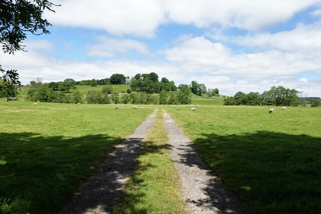
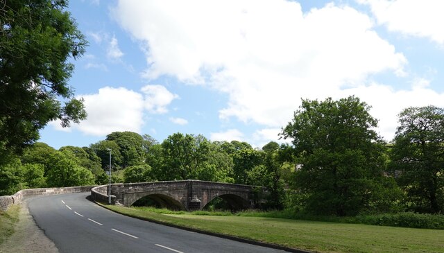
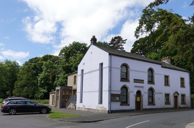
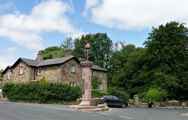
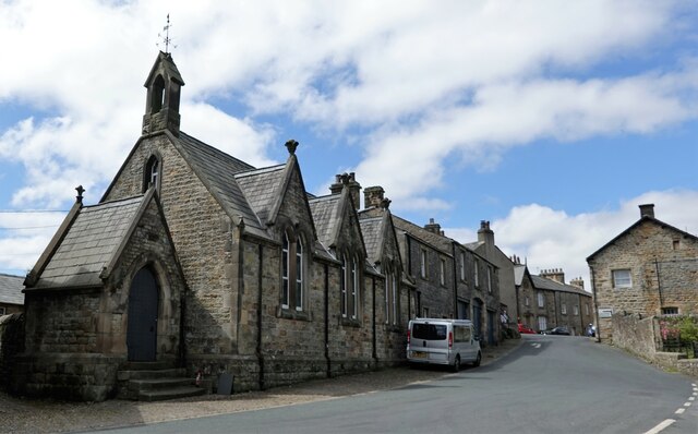
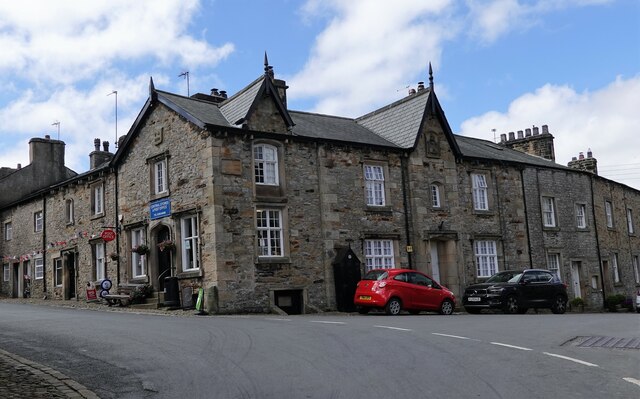
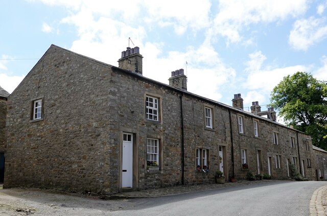
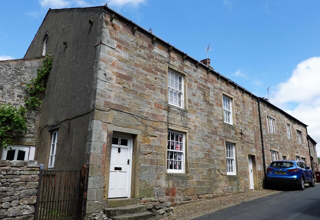
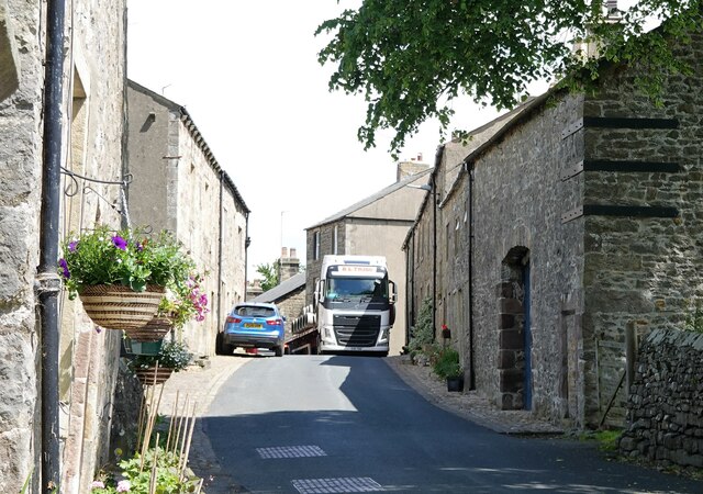
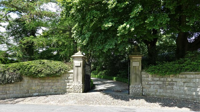
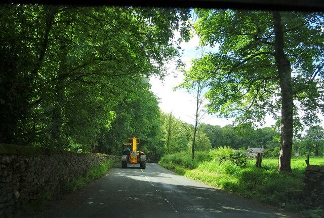
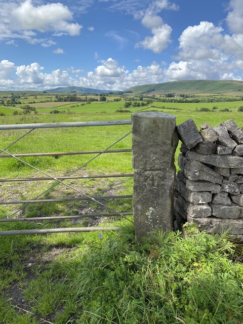
Wood House is a charming village located in the county of Yorkshire, England. Situated amidst the beautiful countryside, it offers a picturesque setting with its rolling hills, lush green fields, and peaceful atmosphere. The village is known for its quintessential English charm, with a scattering of traditional stone houses and cottages.

Wood House is a small community with a tight-knit population, fostering a strong sense of community spirit and togetherness. The village boasts a range of amenities that cater to the needs of its residents, including a village hall, a local shop, and a pub that serves as a social hub for locals and visitors alike. The pub often hosts community events and gatherings, further enhancing the village's sense of community.

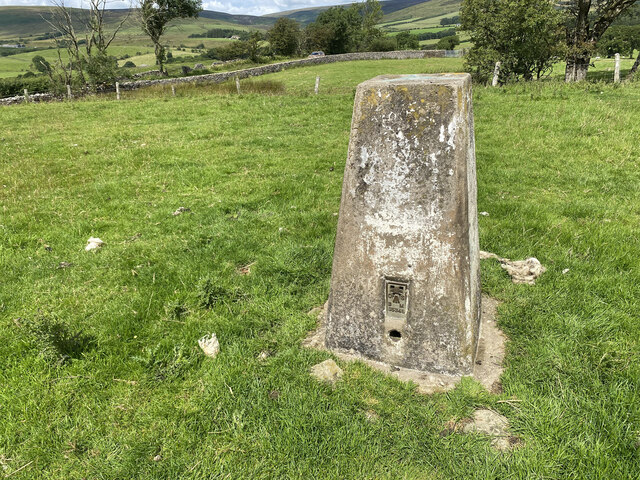
Nature lovers will delight in the abundance of outdoor activities available in and around Wood House. The village is surrounded by scenic walking trails and bridleways, offering stunning views of the Yorkshire Dales National Park. The nearby river provides opportunities for fishing and boating, while the surrounding countryside is perfect for picnics and leisurely strolls.

Wood House is conveniently located near larger towns and cities, making it a desirable place to live for those seeking a balance between rural serenity and urban accessibility. The village provides a peaceful escape from the hustle and bustle of city life, while still offering easy access to amenities, schools, and employment opportunities in the nearby areas.

In summary, Wood House, Yorkshire, is a charming village nestled in the scenic Yorkshire countryside. With its traditional architecture, strong community spirit, and abundance of outdoor activities, it offers a tranquil and idyllic place to live or visit.

If you have any feedback on the listing, please let us know in the comments section below.

Wood House Images

Images are sourced within 2km of 53.972191/-2.4588407 or Grid Reference SD7053. Thanks to Geograph Open Source API. All images are credited.

Sheep at pasture Behind the long stay car park.
Sheep at pasture
Behind the long stay car park.
Slaidburn Bridge Carrying the B6478 over the River Hodder.
Slaidburn Bridge
Carrying the B6478 over the River Hodder.
Slaidburn Village Hall Originally a Wesleyan chapel built in 1821 and restored in 1889. The later conversion to a village hall included an extension at the rear.
Slaidburn Village Hall
Originally a Wesleyan chapel built in 1821 and restored in 1889. The later conversion to a village hall included an extension at the rear.
Slaidburn war memorial
Former school in Slaidburn The village girls' school was on chapel street.
Former school in Slaidburn
The village girls' school was on chapel street.
Waterloo Buildings Built in 1843 and grade II listed, the buildings are on the corner of Church Street, where the shop entrance is, and Town End in Slaidburn.
Waterloo Buildings
Built in 1843 and grade II listed, the buildings are on the corner of Church Street, where the shop entrance is, and Town End in Slaidburn.
Houses in Slaidburn A terrace on Church Street.
Houses in Slaidburn
A terrace on Church Street.
Houses in Slaidburn Nos. 18 and 20 Church Street are grade II listed.
Houses in Slaidburn
Nos. 18 and 20 Church Street are grade II listed.
A tight squeeze An H.G.V. carefully (and successfully) negotiates a hazard in Church Street, Slaidburn.
A tight squeeze
An H.G.V. carefully (and successfully) negotiates a hazard in Church Street, Slaidburn.
Entrance to Glebe House On Church Street in Slaidburn.
Entrance to Glebe House
On Church Street in Slaidburn.
St. Andrew's Church Slaidburn C. of E. parish church is grade I listed. It was built in C15 (probably) with C17 alterations.
St. Andrew's Church
Slaidburn C. of E. parish church is grade I listed. It was built in C15 (probably) with C17 alterations.
Entering Slaidburn Approaching Slaidburn Bridge which spans the River Hodder. Also known as New Bridge, it was built in the late 18th century and is grade II listed.
Entering Slaidburn
Approaching Slaidburn Bridge which spans the River Hodder. Also known as New Bridge, it was built in the late 18th century and is grade II listed.
Slow moving traffic on the road to Newton in Bowland Near Bluebutts Farm.
Slow moving traffic on the road to Newton in Bowland
Near Bluebutts Farm.
Approaching Slaidburn St. Andrew's church can be seen in the right middle ground.
Approaching Slaidburn
St. Andrew's church can be seen in the right middle ground.
Country road near Slaidburn
OS Cut Mark - Slaidburn, North, Wood House Gate <span class="nowrap"><a title="https://www.bench-marks.org.uk/bm113544" rel="nofollow ugc noopener" href="https://www.bench-marks.org.uk/bm113544">Link</a><img style="margin-left:2px;" alt="External link" title="External link - shift click to open in new window" src="https://s1.geograph.org.uk/img/external.png" width="10" height="10"/></span>
OS Cut Mark - Slaidburn, North, Wood House Gate
Location of OS Cut Mark - Slaidburn, North, Wood House Gate
Woodhouse Gate Trig Point Flush Bracket S5348
Show me another place!

Wood House is located at Grid Ref: SD7053 (Lat: 53.972191, Lng: -2.4588407)

Division: West Riding

Administrative County: Lancashire

District: Ribble Valley

Police Authority: Lancashire

What 3 Words

///shame.hubcaps.lays. Near Waddington, Lancashire

Related Wikis

King's House, Slaidburn

King's House is a Grade II listed building in Slaidburn, Lancashire, England, now used as a youth hostel. It was originally built in the 18th century,...

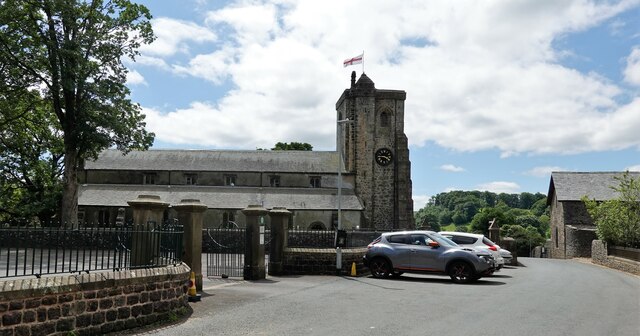
St Andrew's Church, Slaidburn

St Andrew's Church is in Church Street, Slaidburn, Lancashire, England. It is an active Anglican parish church in the deanery of Bowland, the archdeaconry...

Lancashire Witches Walk

The Lancashire Witches Walk is a 51-mile (82 km) long-distance footpath opened in 2012, between Barrowford and Lancaster, all in Lancashire, England. It...
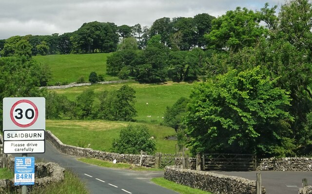
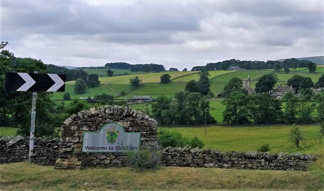
Slaidburn

Slaidburn () is a village and civil parish within the Ribble Valley district of Lancashire, England. The parish covers just over 5,000 acres of the Forest...

Newton-in-Bowland

Newton or Newton-in-Bowland is a village and civil parish in the Ribble Valley district, in the county of Lancashire, England, formerly known as Newton...

Stocks Reservoir

Stocks Reservoir is a reservoir situated at the head of the Hodder valley in the Forest of Bowland, Lancashire, England (historically in the West Riding...

Geography of the United Kingdom

The United Kingdom is a sovereign state located off the north-western coast of continental Europe. With a total area of approximately 248,532 square kilometres...

Easington, Lancashire

Easington () is a civil parish within the Ribble Valley district of Lancashire, England, with a population in 2001 of 52. The Census 2011 population details...

Nearby Amenities

Located within 500m of 53.972191,-2.4588407
Barrier: stile
Lat/Long: 53.9705222/-2.4586519
Barrier: stile
Lat/Long: 53.9713535/-2.4611819
Barrier: kissing_gate
Lat/Long: 53.9724363/-2.4527313
Barrier: stile
Material: stone
Source: survey;gps
Stile: stepover
Lat/Long: 53.9685591/-2.4632234
Barrier: cattle_grid
Bicycle: yes
Foot: yes
Lat/Long: 53.969221/-2.4630674
Barrier: cattle_grid
Bicycle: yes
Foot: yes
Lat/Long: 53.969266/-2.4624955
Barrier: stile
Material: wood
Source: survey;gps
Stile: stepover
Lat/Long: 53.9693064/-2.4621914
Barrier: stile
Material: wood
Source: survey;gps
Stile: stepover
Lat/Long: 53.9693163/-2.4622193
Barrier: stile
Material: wood
Source: survey;gps
Stile: stepover
Lat/Long: 53.9700471/-2.4588794
Barrier: stile
Material: wood
Source: survey;gps
Stile: stepover
Lat/Long: 53.9704998/-2.4586287
Barrier: stile
Material: stone
Source: survey;gps
Stile: stepover
Lat/Long: 53.9724484/-2.4610391
Barrier: stile
Material: wood
Source: survey;gps
Stile: ladder
Lat/Long: 53.973901/-2.4629433
Barrier: stile
Material: wood
Source: survey;gps
Stile: stepover
Lat/Long: 53.9690813/-2.4633335
Barrier: stile
Source: survey;gps
Stile: ladder
Lat/Long: 53.9692455/-2.4631708
Barrier: stile
Material: stone
Source: survey
Stile: stepover
Lat/Long: 53.9696871/-2.4646897
Barrier: stile
Lat/Long: 53.9724839/-2.4527934
The data included in this document is from www.openstreetmap.org. The data is made available under ODbL.

Have you been to Wood House?

Leave your review of Wood House below (or comments, questions and feedback).