Wollrig

Settlement in Roxburghshire

Scotland

Wollrig

A symbolic gravestone in Ashkirk Parish Churchyard This 18th century stone, which is leaning forwards, displays the classic symbols of mortality with crossed femur bones, a horizontal hourglass and a death’s head skull. A winged soul at the top of the stone is a symbol of immortality representing the human spirit.
A symbolic gravestone in Ashkirk Parish Churchyard Credit: Walter Baxter

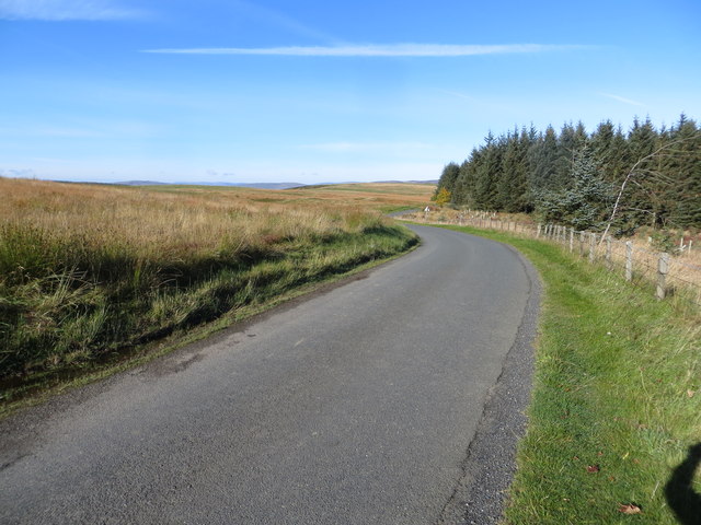
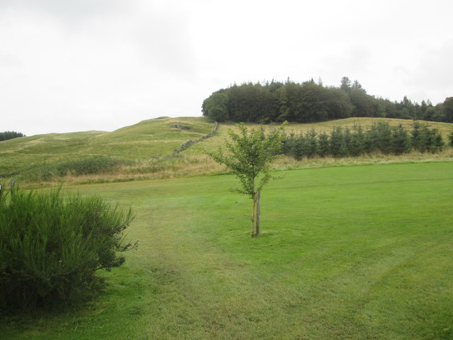
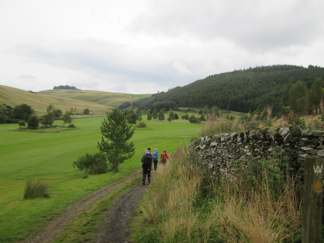
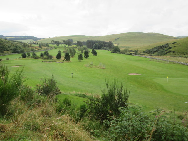
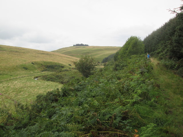
Wollrig is a small village located in the historic county of Roxburghshire, in the Scottish Borders region of Scotland. Situated approximately 5 miles northeast of the town of Hawick, Wollrig is nestled amidst picturesque rolling hills and offers stunning views of the surrounding countryside.

The village is characterized by its quaint charm and rural atmosphere, making it an idyllic destination for those seeking a peaceful getaway. Wollrig is known for its traditional stone houses, which add to the village's timeless appeal. The local community is tight-knit and friendly, creating a welcoming environment for residents and visitors alike.

Although Wollrig is primarily a residential area, there are a few amenities available to cater to the needs of its inhabitants. These include a local pub, which serves as a social hub for the community, and a small convenience store where basic necessities can be purchased. For more extensive shopping and entertainment options, residents often travel to nearby towns such as Hawick.

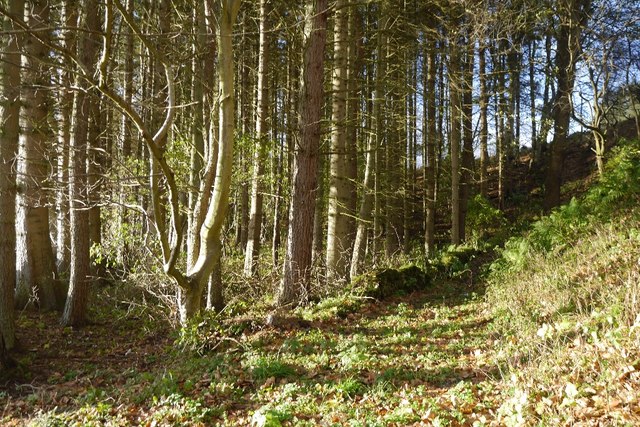
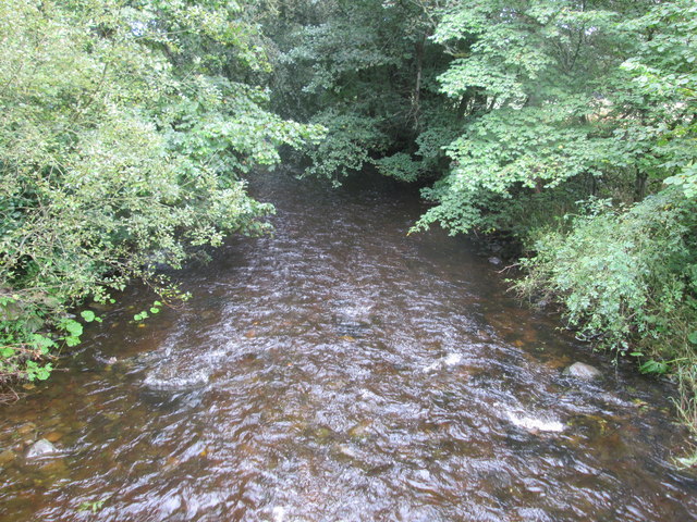
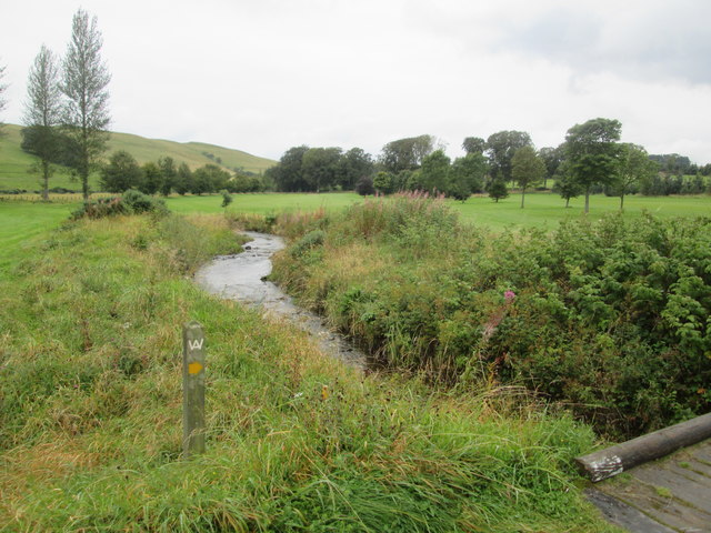
For nature enthusiasts, Wollrig offers a range of outdoor activities. The village is surrounded by beautiful countryside, perfect for walking, hiking, and cycling. The nearby River Teviot is also a popular spot for fishing enthusiasts, boasting an abundance of salmon and trout.

Overall, Wollrig offers a peaceful and scenic retreat for those seeking a tranquil village setting amidst the natural beauty of Roxburghshire.

If you have any feedback on the listing, please let us know in the comments section below.
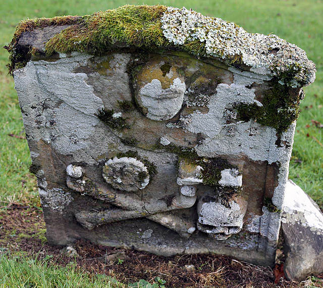
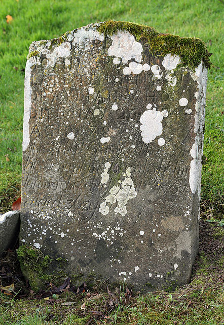
Wollrig Images

Images are sourced within 2km of 55.48869/-2.8719499 or Grid Reference NT4522. Thanks to Geograph Open Source API. All images are credited.

A symbolic gravestone in Ashkirk Parish Churchyard This 18th century stone, which is leaning forwards, displays the classic symbols of mortality with crossed femur bones, a horizontal hourglass and a death’s head skull. A winged soul at the top of the stone is a symbol of immortality representing the human spirit.
A symbolic gravestone in Ashkirk Parish Churchyard
This 18th century stone, which is leaning forwards, displays the classic symbols of mortality with crossed femur bones, a horizontal hourglass and a death’s head skull. A winged soul at the top of the stone is a symbol of immortality representing the human spirit.
He was only 363 when he died The inscription on this Crawford gravestone in Ashkirk Parish Churchyard is interesting and amusing because the 18th century mason has carved the age of Robert Crawford as 363 when he died. The inscription reads:

HERE LYES
JOHN CRAWFORD
LATE TENNENT IN
DRAYDIAN WHO
DIED MAY 26 1744
AGID 78

Also Robert Crawford Son
late tenant in Branksholme
Town who died Sept 7 1767
Aged 363 years

For a view of the other side of the stone, see <a href="https://www.geograph.org.uk/photo/4739479">NT4622 : A symbolic gravestone in Ashkirk Parish Churchyard</a>.
He was only 363 when he died
The inscription on this Crawford gravestone in Ashkirk Parish Churchyard is interesting and amusing because the 18th century mason has carved the age of Robert Crawford as 363 when he died. The inscription reads: HERE LYES JOHN CRAWFORD LATE TENNENT IN DRAYDIAN WHO DIED MAY 26 1744 AGID 78 Also Robert Crawford Son late tenant in Branksholme Town who died Sept 7 1767 Aged 363 years For a view of the other side of the stone, see NT4622 : A symbolic gravestone in Ashkirk Parish Churchyard.
Moorland road at Bishop's Stone Looking north-westward.
Moorland road at Bishop's Stone
Looking north-westward.
Woodland path, Easter Essenside A short stretch of woodland before the hill pasture to the north.
Woodland path, Easter Essenside
A short stretch of woodland before the hill pasture to the north.
Yellow road, Easter Essenside
Hill pasture, Wester Essenside Whins on steep ground, they seem to thrive where snow drifts form.
Hill pasture, Wester Essenside
Whins on steep ground, they seem to thrive where snow drifts form.
Todrig Burn Joins the Ale Water on the way to the Tweed.
Todrig Burn
Joins the Ale Water on the way to the Tweed.
A farm house and other buildings A quick shot from the car - I had not noticed the wire across the image of the farm buildings.
A farm house and other buildings
A quick shot from the car - I had not noticed the wire across the image of the farm buildings.
The edge of Ashkirk The village of Ashkirk is very spread out but does have a small concentrated group of houses near the junction with the A7. This picture was taken just on the edge of the village close to the Ale Water which is the stream / burn that runs through the village.
The edge of Ashkirk
The village of Ashkirk is very spread out but does have a small concentrated group of houses near the junction with the A7. This picture was taken just on the edge of the village close to the Ale Water which is the stream / burn that runs through the village.
Access  road  from  Salenside  Shiel It bridges the Ale Water then out onto a minor road
Access road from Salenside Shiel
It bridges the Ale Water then out onto a minor road
The  Ale  Water  toward  Ashkirk
The Ale Water toward Ashkirk
Wrapping  bales  of  hay  in  field  with  tractor A one man operation. From B A Way
Wrapping bales of hay in field with tractor
A one man operation. From B A Way
Wrapping  bales  of  hay  in  field  with  tractor  (2) Picks a second bale up while first is being wrapped, when wrapped dropped off the back and the second bale brought up to start wrapping, a one man operation
Wrapping bales of hay in field with tractor (2)
Picks a second bale up while first is being wrapped, when wrapped dropped off the back and the second bale brought up to start wrapping, a one man operation
Stream  through  Woll  Golf  Course The footbridge is the route of B A Way
Stream through Woll Golf Course
The footbridge is the route of B A Way
Woll  Plantation  above  Woll  Golf  Course The B A Way goes through the golf course to the Thief Road (tk)
Woll Plantation above Woll Golf Course
The B A Way goes through the golf course to the Thief Road (tk)
Borders  Abbeys  Way  through  Woll  Golf  Course The route marker is on the right by the wall
Borders Abbeys Way through Woll Golf Course
The route marker is on the right by the wall
Looking  back  from  the  Thief  Road  (tk)  over  Woll  Golf  Course
Looking back from the Thief Road (tk) over Woll Golf Course
Borders  Abbeys  Way  on  the  Thief  Road  (Track) Not much better than an overgrown footpath. Named after the notorious Moss Troopers who would regularly use this route, lawless brigands who preyed on civilians. The Woll Burn can be seen in the valley to the left
Borders Abbeys Way on the Thief Road (Track)
Not much better than an overgrown footpath. Named after the notorious Moss Troopers who would regularly use this route, lawless brigands who preyed on civilians. The Woll Burn can be seen in the valley to the left
Show me another place!

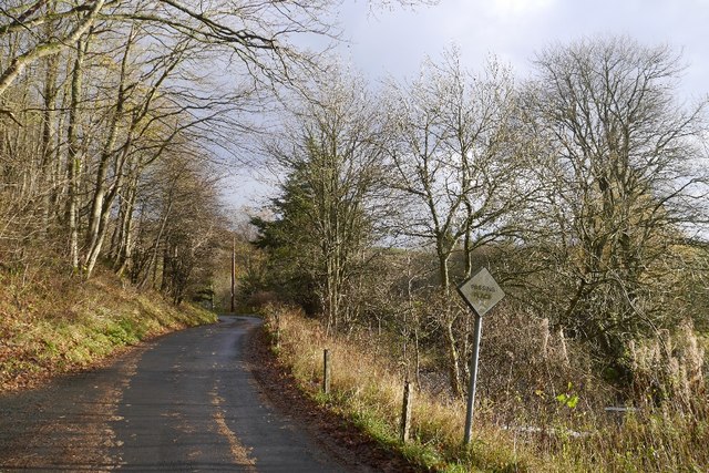
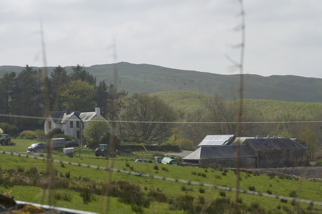
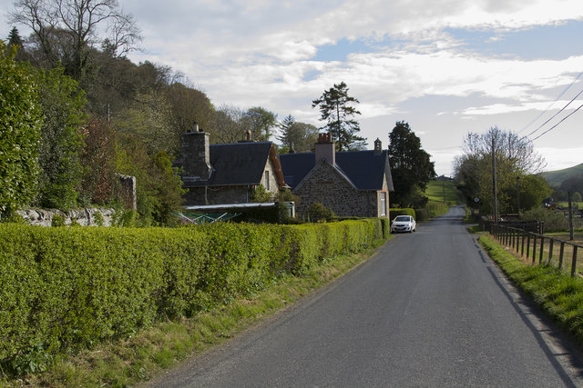
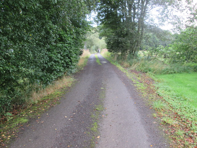
Wollrig is located at Grid Ref: NT4522 (Lat: 55.48869, Lng: -2.8719499)

Unitary Authority: The Scottish Borders

Police Authority: The Lothians and Scottish Borders

What 3 Words

///proceeds.prospers.hills. Near Selkirk, Scottish Borders

Related Wikis

Woll

Woll is a village on the Ale Water, off the A7, in the Ettrick Forest, north of Hawick, and south of Selkirk in the Scottish Borders area of Scotland....

Salenside

Salenside is a village off the A7, on the Ale Water, near Ashkirk, in the Scottish Borders area of Scotland, in the former Selkirkshire. There was a Salenside...

Ashkirk

Ashkirk is a small village on the Ale Water, in the Scottish Borders area of Scotland. It is located just off the A7 road, approximately 6 miles (10 kilometres...

Oakwood Roman Fort and Camp

Oakwood Roman Fort and Camp is a British archaeological site, a Roman fort and nearby Roman camp, about 3.5 miles (5.6 km) south-west of Selkirk in the...

Have you been to Wollrig?

Leave your review of Wollrig below (or comments, questions and feedback).