Branthwaite

Settlement in Cumberland Allerdale

England

Branthwaite

Cottages at Fell Side The Cumbria Way low level alternative route from Skiddaw House to Nether Row follows the minor road from Green Head past these cottages at Fell Side (next photograph <a href="https://www.geograph.org.uk/photo/7389300">NY3037 : The Cumbria Way, Fell Side</a>).
Cottages at Fell Side Credit: Adrian Taylor

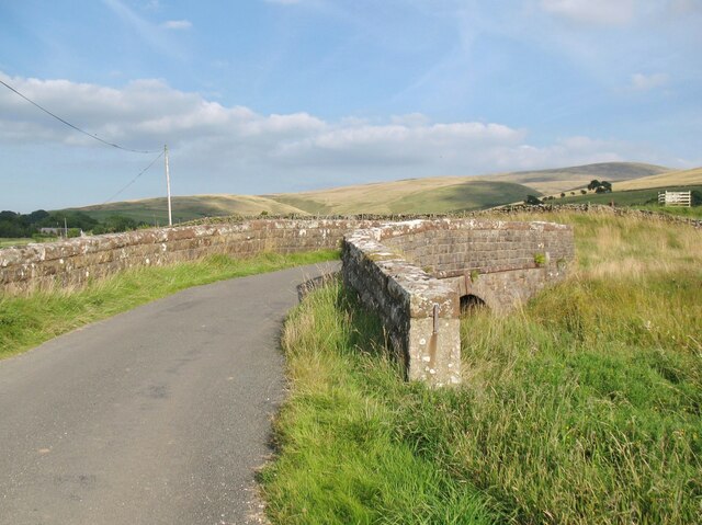
Branthwaite is a rural village located in the beautiful county of Cumberland in North West England. Situated amidst the picturesque landscapes of the Lake District National Park, the village is nestled within the rolling hills and green pastures that typify this region. With a population of around 200 residents, Branthwaite offers a peaceful and tranquil setting, perfect for those seeking an escape from the hustle and bustle of city life.

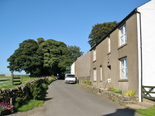
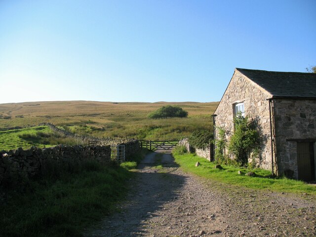
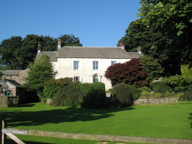
The village itself comprises a collection of charming stone houses, many of which date back several centuries, giving it a sense of history and character. The local community is tight-knit and friendly, creating a welcoming atmosphere for both residents and visitors alike. Branthwaite is known for its strong sense of community spirit, with various social events and activities organized throughout the year, such as summer fairs and Christmas markets.

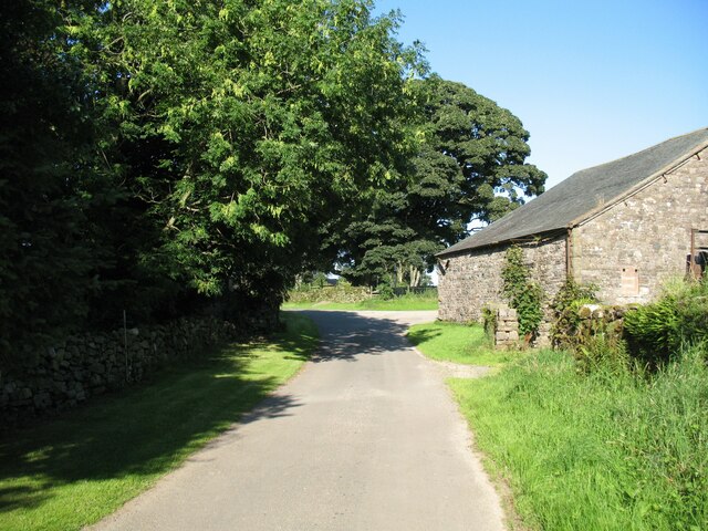
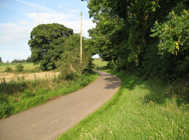
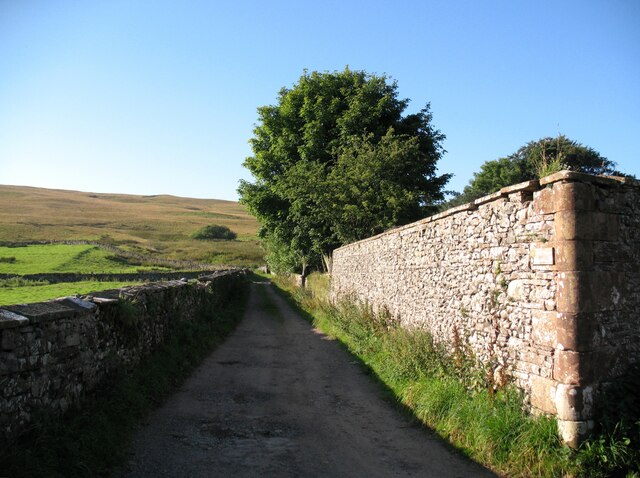
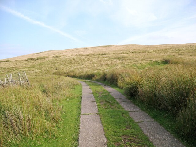
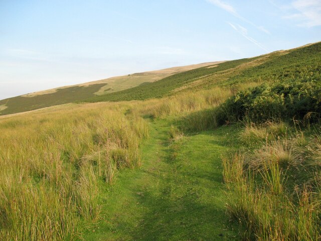
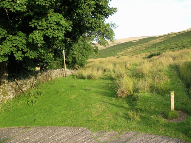
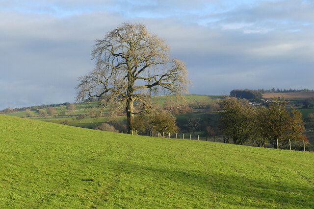
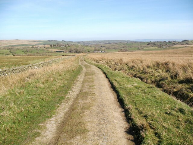
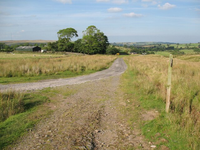
Nature lovers will find plenty to explore in and around Branthwaite, as the area is abundant with natural beauty. The village is surrounded by lush woodlands, meandering rivers, and picturesque walking trails, making it an ideal base for outdoor enthusiasts. Additionally, the nearby Lake District offers endless opportunities for hiking, boating, and enjoying the stunning scenery.

While Branthwaite may be a small village, it benefits from its close proximity to larger towns and cities. The market town of Cockermouth is just a short drive away, providing residents with access to a range of amenities, including shops, schools, and healthcare facilities. Overall, Branthwaite offers a peaceful and idyllic lifestyle in the heart of the Cumberland countryside.

If you have any feedback on the listing, please let us know in the comments section below.
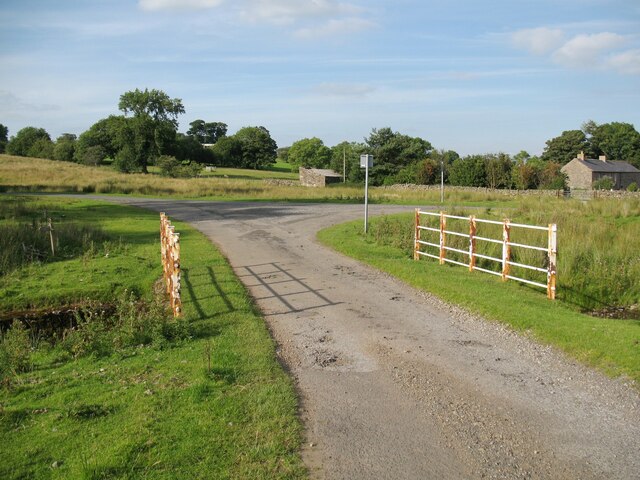
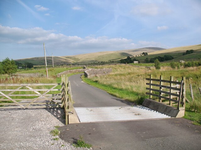
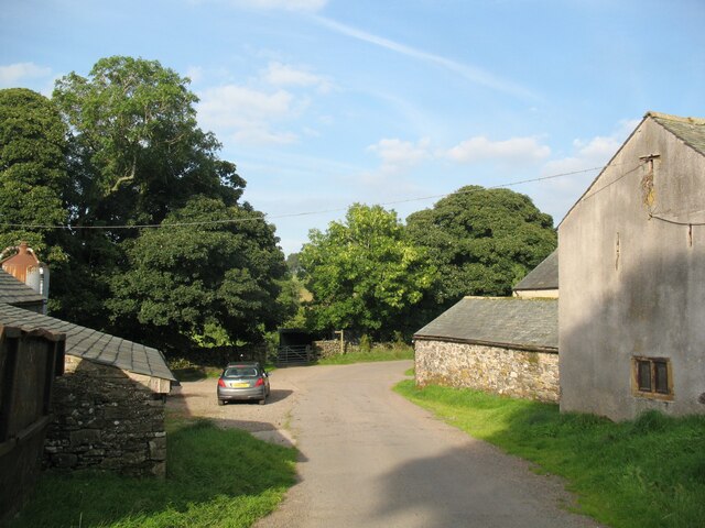
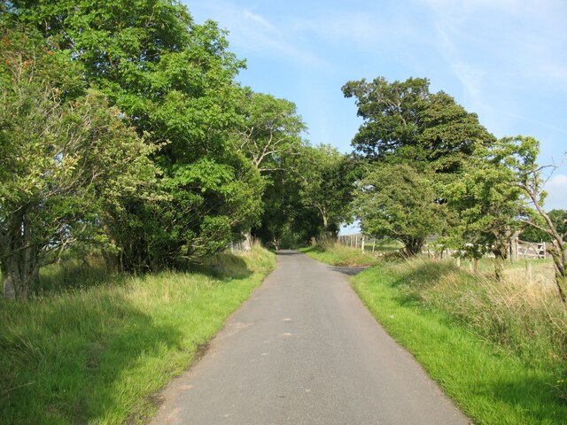
Branthwaite Images

Images are sourced within 2km of 54.725338/-3.091512 or Grid Reference NY2937. Thanks to Geograph Open Source API. All images are credited.

Cottages at Fell Side The Cumbria Way low level alternative route from Skiddaw House to Nether Row follows the minor road from Green Head past these cottages at Fell Side (next photograph <a href="https://www.geograph.org.uk/photo/7389300">NY3037 : The Cumbria Way, Fell Side</a>).
Cottages at Fell Side
The Cumbria Way low level alternative route from Skiddaw House to Nether Row follows the minor road from Green Head past these cottages at Fell Side (next photograph NY3037 : The Cumbria Way, Fell Side).
The Cumbria Way, Fell Side Fell Side is a small farming community at the northernmost edge of the Lake District fells.  It is on the route of The Cumbria Way low level alternative route from Skiddaw House to Nether Row (next photograph <a href="https://www.geograph.org.uk/photo/7384814">NY3037 : Cottages at Fell Side</a>).
The Cumbria Way, Fell Side
Fell Side is a small farming community at the northernmost edge of the Lake District fells. It is on the route of The Cumbria Way low level alternative route from Skiddaw House to Nether Row (next photograph NY3037 : Cottages at Fell Side).
The Cumbria Way near Branthwaite This minor road is the low level alternative route of The Cumbria Way long distance path, from Skiddaw House to Nether Row (next photograph <a href="https://www.geograph.org.uk/photo/7384823">NY3037 : The Cumbria Way, Fell Side</a>).
The Cumbria Way near Branthwaite
This minor road is the low level alternative route of The Cumbria Way long distance path, from Skiddaw House to Nether Row (next photograph NY3037 : The Cumbria Way, Fell Side).
The Cumbria Way, Fell Side The Cumbria Way long distance path leaves the road at Fell Side and follows an access track between stone walls (next photograph <a href="https://www.geograph.org.uk/photo/7389466">NY3037 : The Cumbria Way, Fell Side</a>).
The track is a public footpath leading to Little Fellside and Nether Row.
The Cumbria Way, Fell Side
The Cumbria Way long distance path leaves the road at Fell Side and follows an access track between stone walls (next photograph NY3037 : The Cumbria Way, Fell Side). The track is a public footpath leading to Little Fellside and Nether Row.
The Cumbria Way near Fell Side The low level alternative route of The Cumbria Way follows the public footpath from Fell Side to Nether Row along the access track to Little Fellside.
The Cumbria Way near Fell Side
The low level alternative route of The Cumbria Way follows the public footpath from Fell Side to Nether Row along the access track to Little Fellside.
The Cumbria Way, Fell Side The low level alternative route of The Cumbria Way follows the public footpath from Fell Side to Nether Row along the access track to Little Fellside (next photograph <a href="https://www.geograph.org.uk/photo/7389459">NY3037 : The Cumbria Way near Fell Side</a>).
The Cumbria Way, Fell Side
The low level alternative route of The Cumbria Way follows the public footpath from Fell Side to Nether Row along the access track to Little Fellside (next photograph NY3037 : The Cumbria Way near Fell Side).
Caldbeck Bunkhouse Located beside The Cumbria Way at Fell Side, Caldbeck Bunkhouse is run by the Youth Hostel Association and is reserved for group bookings.
Caldbeck Bunkhouse
Located beside The Cumbria Way at Fell Side, Caldbeck Bunkhouse is run by the Youth Hostel Association and is reserved for group bookings.
The Cumbria Way, Little Fellside This grassy track is a public footpath from Fell Side to Potts Gill and Nether Row.  It is the low level alternative route of The Cumbria Way between Skiddaw House and Nether Row near Caldbeck.
The Cumbria Way, Little Fellside
This grassy track is a public footpath from Fell Side to Potts Gill and Nether Row. It is the low level alternative route of The Cumbria Way between Skiddaw House and Nether Row near Caldbeck.
Little Fellside The public footpath from Fell Side to Potts Gill and Nether Row leaves the concrete access track to Little Fellside and continues ahead along a grassy track in the direction of the waymark arrow.
A second public footpath follows the concrete track down through Little Fellside to Moor House.
The Ordnance Survey indicates that the low level alternative route of The Cumbria Way follows the stone intake wall at the edge of the open fell on a former, now lost, footpath.  This route leads to a missing stile and boggy ground and is impassable.  The Cumbria Way waymarks direct northbound walkers along the public footpath to Potts Gill (next photograph <a href="https://www.geograph.org.uk/photo/7421356">NY3137 : The Cumbria Way, Little Fellside</a>).
Little Fellside
The public footpath from Fell Side to Potts Gill and Nether Row leaves the concrete access track to Little Fellside and continues ahead along a grassy track in the direction of the waymark arrow. A second public footpath follows the concrete track down through Little Fellside to Moor House. The Ordnance Survey indicates that the low level alternative route of The Cumbria Way follows the stone intake wall at the edge of the open fell on a former, now lost, footpath. This route leads to a missing stile and boggy ground and is impassable. The Cumbria Way waymarks direct northbound walkers along the public footpath to Potts Gill (next photograph NY3137 : The Cumbria Way, Little Fellside).
Pasture, Caldbeck A large ash seen from the footpath north of Little Fellside.
Pasture, Caldbeck
A large ash seen from the footpath north of Little Fellside.
Old road between Charleton Wath and Holborn Now no more than a farmer’s access track, this old road runs from Longlands to Green Head and is the low level alternative route of The Cumbria Way long distance path (next photograph <a href="https://www.geograph.org.uk/photo/7366762">NY2836 : The Cumbria Way near Holborn</a>).
Old road between Charleton Wath and Holborn
Now no more than a farmer’s access track, this old road runs from Longlands to Green Head and is the low level alternative route of The Cumbria Way long distance path (next photograph NY2836 : The Cumbria Way near Holborn).
The Cumbria Way near Holborn The low level alternative route of The Cumbria Way long distance path follows the old road from Longlands (next photograph <a href="https://www.geograph.org.uk/photo/7393148">NY2837 : The Cumbria Way, Green Head</a>).
Approaching Holborn the old road joins the track from Rough Close and Norman and it is a surfaced from here to Green Head.
The Cumbria Way near Holborn
The low level alternative route of The Cumbria Way long distance path follows the old road from Longlands (next photograph NY2837 : The Cumbria Way, Green Head). Approaching Holborn the old road joins the track from Rough Close and Norman and it is a surfaced from here to Green Head.
The Cumbria Way, Green Head The low level alternative route of The Cumbria Way long distance path crosses a small bridge on the approach to the road junction at Green Head.
Northbound walkers following The Cumbria Way turn right here (next photograph <a href="https://www.geograph.org.uk/photo/7373604">NY2837 : Cattle Grid, Burblethwaite</a>).
The Cumbria Way, Green Head
The low level alternative route of The Cumbria Way long distance path crosses a small bridge on the approach to the road junction at Green Head. Northbound walkers following The Cumbria Way turn right here (next photograph NY2837 : Cattle Grid, Burblethwaite).
Cattle Grid, Burblethwaite The road from Green head to Fell Side crosses this cattle grid on the approach to the bridge over Burblethwaite Beck.
This is the low level alternative route of The Cumbria Way long distance path (next photograph <a href="https://www.geograph.org.uk/photo/7384599">NY2837 : Bridge over Burblethwaite Beck</a>).
Cattle Grid, Burblethwaite
The road from Green head to Fell Side crosses this cattle grid on the approach to the bridge over Burblethwaite Beck. This is the low level alternative route of The Cumbria Way long distance path (next photograph NY2837 : Bridge over Burblethwaite Beck).
Branthwaite The Cumbria Way low level alternative route from Skiddaw House to Nether Row follows the minor road from Green Head to Fell Side through Branthwaite (next photograph <a href="https://www.geograph.org.uk/photo/7384860">NY2937 : Branthwaite</a>).
Branthwaite
The Cumbria Way low level alternative route from Skiddaw House to Nether Row follows the minor road from Green Head to Fell Side through Branthwaite (next photograph NY2937 : Branthwaite).
The Cumbria Way near Bonners Farm The Cumbria Way low level alternative route from Skiddaw House to Nether Row near Caldbeck follows the minor road from Green Head to Fell Side (next photograph <a href="https://www.geograph.org.uk/photo/7384593">NY2937 : Branthwaite</a>).
The entrance to Bonners Farm is on the right.
The Cumbria Way near Bonners Farm
The Cumbria Way low level alternative route from Skiddaw House to Nether Row near Caldbeck follows the minor road from Green Head to Fell Side (next photograph NY2937 : Branthwaite). The entrance to Bonners Farm is on the right.
The Cumbria Way near Bonners Farm The Cumbria Way low level alternative route from Skiddaw House to Nether Row near Caldbeck follows the minor road from Green Head to Fell Side (next photograph <a href="https://www.geograph.org.uk/photo/7384594">NY2937 : The Cumbria Way near Bonners Farm</a>).
The Cumbria Way near Bonners Farm
The Cumbria Way low level alternative route from Skiddaw House to Nether Row near Caldbeck follows the minor road from Green Head to Fell Side (next photograph NY2937 : The Cumbria Way near Bonners Farm).
Bridge over Burblethwaite Beck This bridge carries the minor road from Green Head to Fell Side over Burblethwaite Beck.  It is also the low level alternative route of The Cumbria Way (next photograph <a href="https://www.geograph.org.uk/photo/7384595">NY2937 : The Cumbria Way near Bonners Farm</a>).
Bridge over Burblethwaite Beck
This bridge carries the minor road from Green Head to Fell Side over Burblethwaite Beck. It is also the low level alternative route of The Cumbria Way (next photograph NY2937 : The Cumbria Way near Bonners Farm).
Show me another place!

Branthwaite is located at Grid Ref: NY2937 (Lat: 54.725338, Lng: -3.091512)

Administrative County: Cumbria

District: Allerdale

Police Authority: Cumbria

What 3 Words

///receive.plausible.revise. Near Wigton, Cumbria

Nearby Locations

Branthwaite Matthew Field

Related Wikis

Brae Fell

Brae Fell is a fell in the English Lake District, situated 12 kilometres (7+1⁄2 miles) north of Keswick it reaches a height of 586 m (1,923 ft) and is...

Whelpo

Whelpo is a hamlet in the civil parish of Caldbeck, in the Cumberland unitary authority area, in the county of Cumbria, England. It is about one mile west...

Caldbeck

Caldbeck is a village in Cumbria, England, historically within Cumberland, it is situated within the Lake District National Park. The village had 714...

Skiddaw Group

For the Skiddaw group of hills, see Skiddaw Group The Skiddaw Group is a group of sedimentary rock formations named after the mountain Skiddaw in the English...

Longlands Fell

Longlands Fell is a small fell in the northern part of the English Lake District. It is situated in the high ground known as the Uldale Fells, 5.5 kilometres...

High Pike

High Pike is a fell in the northern part of the English Lake District, it is located 4+1⁄2 kilometres (2+3⁄4 miles) south of Caldbeck. It has a height...

Lowthwaite Fell

Lowthwaite Fell is a hill in the Northern Fells of the Lake District in England. It is a grassy eminence, rising to a height of 509 metres (1,670 ft),...

Faulds Brow

Faulds Brow is a small rise in the English Lake District, northwest of the village of Caldbeck in Cumbria. It is the subject of a chapter of Wainwright...

Nearby Amenities

Located within 500m of 54.725338,-3.091512
Branthwaite
Place: hamlet
Lat/Long: 54.7259567/-3.0916183
Askew Mire
Place: locality
Lat/Long: 54.7252829/-3.0945036
Bench
Lat/Long: 54.7270517/-3.0843841
Power: pole
Lat/Long: 54.7279151/-3.0855729
Power: pole
Lat/Long: 54.728014/-3.0872482
Power: pole
Lat/Long: 54.7280836/-3.0888253
Power: pole
Lat/Long: 54.7281679/-3.0902901
Power: pole
Lat/Long: 54.7282505/-3.091999
Power: pole
Lat/Long: 54.7283429/-3.0936434
Power: pole
Lat/Long: 54.728432/-3.0953531
Power: pole
Lat/Long: 54.7284977/-3.0965176
Power: pole
Lat/Long: 54.7294237/-3.0929924
Power: pole
Lat/Long: 54.7288501/-3.0924901
Power: pole
Lat/Long: 54.7276299/-3.0914153
Power: pole
Lat/Long: 54.7270968/-3.0909411
Power: pole
Lat/Long: 54.7265094/-3.0904093
Power: pole
Lat/Long: 54.7243873/-3.0974451
Power: pole
Lat/Long: 54.7249561/-3.0986517
The data included in this document is from www.openstreetmap.org. The data is made available under ODbL.

Have you been to Branthwaite?

Leave your review of Branthwaite below (or comments, questions and feedback).