Brant Broughton

Settlement in Lincolnshire North Kesteven

England

Brant Broughton

Bridleway towards Carlton le Moorland After a kilometre or so this bridleway becomes a footpath.
Bridleway towards Carlton le Moorland Credit: Jonathan Thacker

Brant Broughton is a picturesque village located in the county of Lincolnshire, England. Situated approximately 10 miles south of the city of Lincoln, it falls within the district of North Kesteven. Brant Broughton is a small and tight-knit community, with a population of around 1,000 residents.

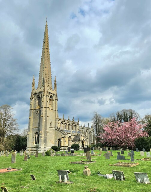
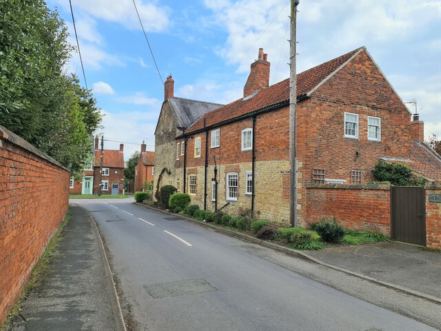
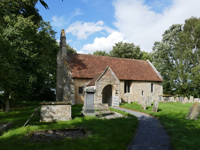
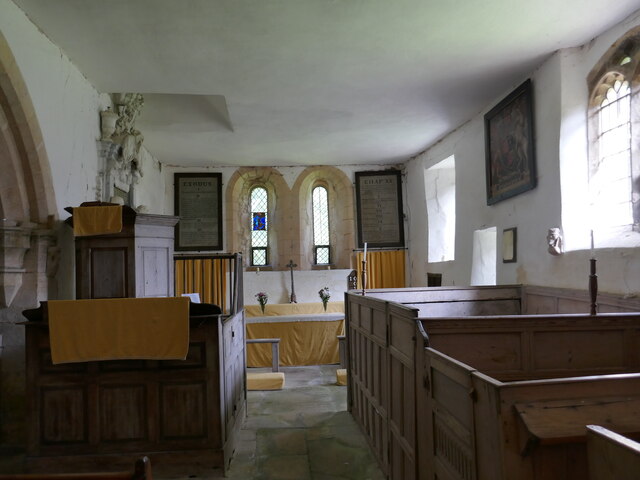
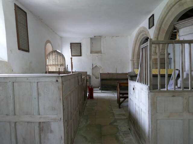
The village is known for its charming and well-preserved architecture, with many buildings dating back several centuries. The centerpiece of Brant Broughton is the beautiful St. Helen's Church, a Grade I listed building that dates back to the 12th century. The church is renowned for its impressive medieval stained glass windows and intricate stone carvings.

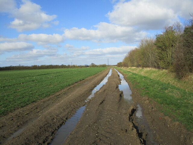
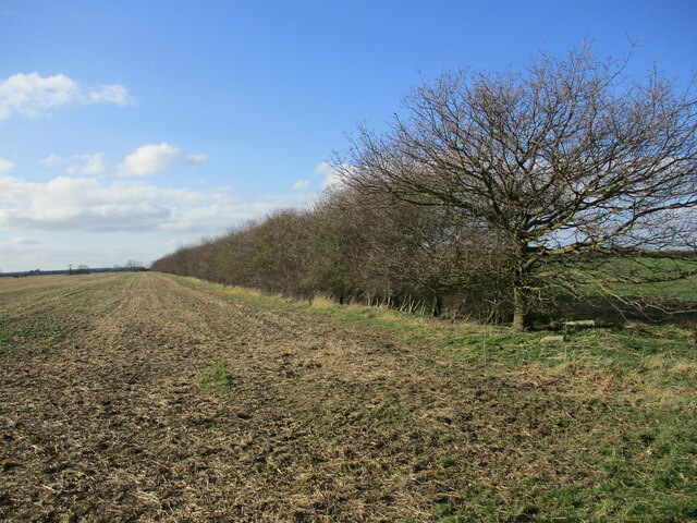
Surrounded by rolling countryside, Brant Broughton offers a tranquil and idyllic setting. The village is home to several green spaces and parks, providing opportunities for outdoor activities and leisurely walks. The River Brant meanders through the village, adding to its natural beauty.

In terms of amenities, Brant Broughton has a few local businesses, including a village shop, a pub, and a primary school. For more extensive shopping, entertainment, and educational facilities, residents can easily access the nearby town of Newark-on-Trent, which is approximately 10 miles away.

Brant Broughton hosts a range of community events throughout the year, including a summer fete and a Christmas market, which bring locals and visitors together. The village also has a strong sense of community spirit, with various clubs and societies catering to different interests and age groups.

Overall, Brant Broughton is a charming and tranquil village, offering a close-knit community, stunning architecture, and beautiful surroundings.

If you have any feedback on the listing, please let us know in the comments section below.

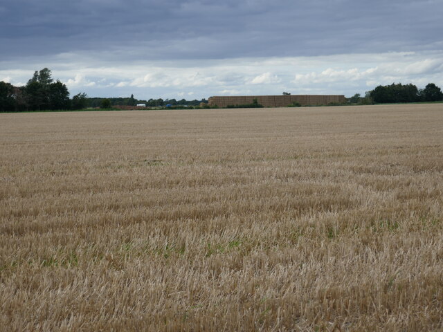
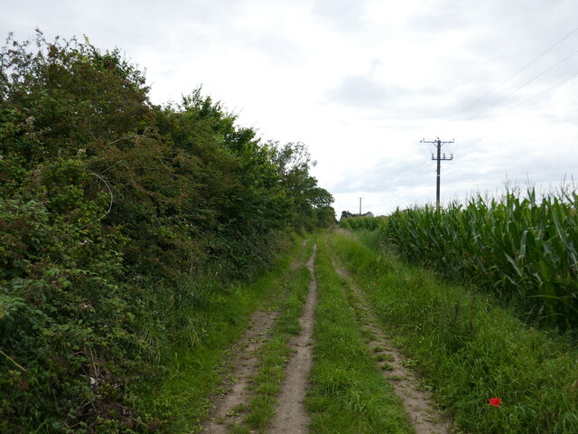
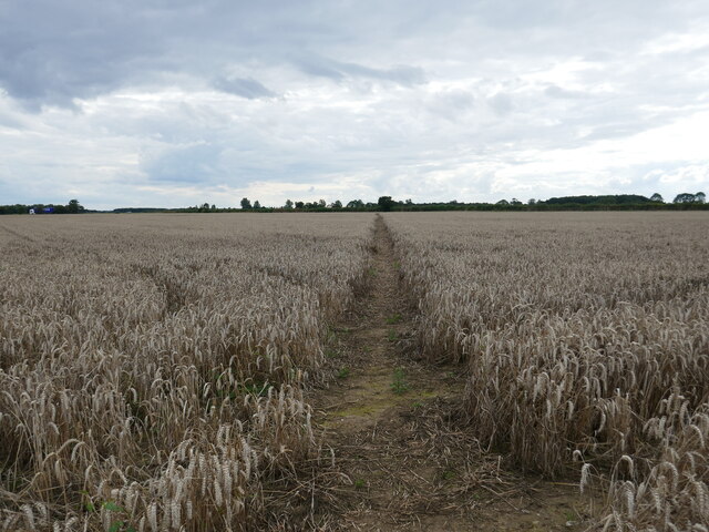
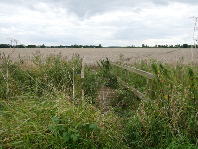
Brant Broughton Images

Images are sourced within 2km of 53.076318/-0.63397924 or Grid Reference SK9154. Thanks to Geograph Open Source API. All images are credited.

Bridleway towards Carlton le Moorland After a kilometre or so this bridleway becomes a footpath.
Bridleway towards Carlton le Moorland
After a kilometre or so this bridleway becomes a footpath.
Very muddy bridleway This bridleway turns into a footpath at the hedge ahead.
Very muddy bridleway
This bridleway turns into a footpath at the hedge ahead.
Change in status The post on the dyke bank marks the point where a bridleway becomes a footpath. It  also happens to be the boundary between the parishes of Carlton le Moorland (beyond the post) and Brant Broughton and Stragglethorpe.
Change in status
The post on the dyke bank marks the point where a bridleway becomes a footpath. It also happens to be the boundary between the parishes of Carlton le Moorland (beyond the post) and Brant Broughton and Stragglethorpe.
Well established hedge Not an old hedge. Probably planted 25-30 years ago.
Well established hedge
Not an old hedge. Probably planted 25-30 years ago.
Newly arrived from the stable floor
St Helen's Church, Brant Broughton
South porch, St Helen's Church, Brant Broughton
Church Lane, Brant Broughton
Gauging station on the River Brant
Footpath to Welbourn
St Michael's church, Stragglethorpe Parts date to the eleventh century <span class="nowrap"><a title="https://historicengland.org.uk/listing/the-list/list-entry/1061900?section=official-list-entry" rel="nofollow ugc noopener" href="https://historicengland.org.uk/listing/the-list/list-entry/1061900?section=official-list-entry">Link</a><img style="margin-left:2px;" alt="External link" title="External link - shift click to open in new window" src="https://s1.geograph.org.uk/img/external.png" width="10" height="10"/></span>
St Michael's church, Stragglethorpe
Parts date to the eleventh century LinkExternal link
St Michael's church, Stragglethorpe, interior looking east
St Michael's church, Stragglethorpe, interior looking west
Stubble field and the Great Wall of Stragglethorpe The 'Great Wall of Stragglethorpe' is a long strawstack which is still being added to.
Stubble field and the Great Wall of Stragglethorpe
The 'Great Wall of Stragglethorpe' is a long strawstack which is still being added to.
Southern Lane A field of maize on the right.
Southern Lane
A field of maize on the right.
Footpath near Brant Broughton This once went through to Fenton but several sections are missing and others not maintained.
Footpath near Brant Broughton
This once went through to Fenton but several sections are missing and others not maintained.
Footbridge on a footpath that once ran to Fenton Parts of this footpath were closed with the opening of RAF Fulbeck in WW2 and have never been re-instated. Other sections are not maintained.
Footbridge on a footpath that once ran to Fenton
Parts of this footpath were closed with the opening of RAF Fulbeck in WW2 and have never been re-instated. Other sections are not maintained.
Green Lane Or is this Southern Lane? OS doesn't make it clear.
Green Lane
Or is this Southern Lane? OS doesn't make it clear.
Show me another place!

Brant Broughton is located at Grid Ref: SK9154 (Lat: 53.076318, Lng: -0.63397924)

Division: Parts of Kesteven

Administrative County: Lincolnshire

District: North Kesteven

Police Authority: Lincolnshire

What 3 Words

///pothole.recruiter.fixtures. Near Bassingham, Lincolnshire

Nearby Locations

Brant Broughton

Related Wikis

Brant Broughton

Brant Broughton (pronounced Brew-ton) is a small village in the civil parish of Brant Broughton and Stragglethorpe, in the North Kesteven district of Lincolnshire...

St Helen's Church, Brant Broughton

St Helen's Church is an Anglican church in Brant Broughton, Lincolnshire, England. It is a Grade I listed building. == History == St Helen's Church a medieval...

Stragglethorpe

Stragglethorpe is a village in the civil parish of Brant Broughton with Stragglethorpe, in the North Kesteven district of Lincolnshire, England. The village...
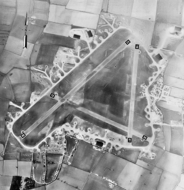
RAF Fulbeck

Royal Air Force Fulbeck or more simply RAF Fulbeck is a former Royal Air Force station located 6.3 miles (10.1 km) east of Newark-on-Trent, Nottinghamshire...

Nearby Amenities

Located within 500m of 53.076318,-0.63397924
Brant Broughton
Is In: Lincolnshire, England, UK
Place: village
Source: npe
Lat/Long: 53.0782321/-0.6333238
Bus Stop
Swan's Lane
Naptan AtcoCode: 270000007799
Naptan Bearing: S
Naptan CommonName: Swan's Lane
Naptan Indicator: opp
Naptan Landmark: Swan's Lane
Naptan NaptanCode: lingmawj
Naptan Street: High Street
Naptan Verified: no
Source: naptan_import
Lat/Long: 53.0798895/-0.6312257
Bus Stop
Swan's Lane
Naptan AtcoCode: 270000007800
Naptan Bearing: N
Naptan CommonName: Swan's Lane
Naptan Indicator: adj
Naptan Landmark: Swan's Lane
Naptan NaptanCode: lingmawm
Naptan Street: High Street
Naptan Verified: no
Source: naptan_import
Lat/Long: 53.0798463/-0.6313764
Bus Stop
Broughton House College
Naptan AtcoCode: 270000007801
Naptan Bearing: N
Naptan CommonName: Broughton House College
Naptan Indicator: adj
Naptan Landmark: Broughton House College
Naptan NaptanCode: lingmawp
Naptan Street: High Street
Naptan Verified: no
Source: naptan_import
Lat/Long: 53.0738667/-0.6336111
Bus Stop
Broughton House College
Naptan AtcoCode: 270000007802
Naptan Bearing: S
Naptan CommonName: Broughton House College
Naptan Indicator: opp
Naptan Landmark: Broughton House College
Naptan NaptanCode: lingmawt
Naptan Street: High Street
Naptan Verified: no
Source: naptan_import
Lat/Long: 53.0738022/-0.6334788
Bus Stop
Meeting House Lane
Alt Name: Generous Briton PH
Naptan AltCommonName: Generous Briton PH
Naptan AltLandmark: Generous Briton PH
Naptan AltStreet: High Street
Naptan AtcoCode: 2700LBBG1512
Naptan Bearing: N
Naptan CommonName: Meeting House Lane
Naptan Indicator: adj
Naptan Landmark: Meeting House Lane
Naptan NaptanCode: linamagj
Naptan Street: High Street
Naptan Verified: no
Source: naptan_import
Lat/Long: 53.0772559/-0.632832
Bus Stop
Meeting House Lane
Alt Name: Generous Briton PH
Naptan AltCommonName: Generous Briton PH
Naptan AltLandmark: Generous Briton PH
Naptan AltStreet: High Street
Naptan AtcoCode: 2700LBBGB179
Naptan Bearing: S
Naptan CommonName: Meeting House Lane
Naptan Indicator: opp
Naptan Landmark: Meeting House Lane
Naptan NaptanCode: linadgpj
Naptan Street: High Street
Naptan Verified: no
Shelter: yes
Source: naptan_import
Lat/Long: 53.0771656/-0.6327006
Bus Stop
Primary School
Naptan AtcoCode: 2700LBBP1676
Naptan Bearing: W
Naptan CommonName: Primary School
Naptan Landmark: Primary School
Naptan NaptanCode: linamgtd
Naptan Street: Mill Lane
Naptan Verified: no
Source: naptan_import
Lat/Long: 53.0776481/-0.6372385
Pub
Generous Briton
Lat/Long: 53.0775324/-0.6324126
Parking
Access: yes
Description: Layby offset from main road
Fee: no
Lat/Long: 53.0791559/-0.6317978
Generator Method: photovoltaic
Generator Output Electricity: yes
Generator Source: solar
Generator Type: solar_photovoltaic_panel
Location: roof
Power: generator
Lat/Long: 53.0801416/-0.6341789
Generator Method: photovoltaic
Generator Output Electricity: yes
Generator Source: solar
Generator Type: solar_photovoltaic_panel
Location: roof
Power: generator
Lat/Long: 53.0801117/-0.6340173
Generator Method: photovoltaic
Generator Output Electricity: yes
Generator Source: solar
Generator Type: solar_photovoltaic_panel
Location: roof
Power: generator
Lat/Long: 53.0801071/-0.633839
Generator Method: photovoltaic
Generator Output Electricity: yes
Generator Source: solar
Generator Type: solar_photovoltaic_panel
Location: roof
Power: generator
Lat/Long: 53.0767501/-0.6320746
Generator Method: photovoltaic
Generator Output Electricity: yes
Generator Source: solar
Generator Type: solar_photovoltaic_panel
Location: roof
Power: generator
Lat/Long: 53.0771876/-0.6345986
Generator Method: photovoltaic
Generator Output Electricity: yes
Generator Source: solar
Generator Type: solar_photovoltaic_panel
Location: roof
Power: generator
Lat/Long: 53.0780633/-0.6352249
Generator Method: photovoltaic
Generator Output Electricity: yes
Generator Source: solar
Generator Type: solar_photovoltaic_panel
Location: roof
Power: generator
Lat/Long: 53.0719425/-0.6345356
Telephone
Defibrillator
Booth: K6
Covered: booth
Defibrillator Location: inside old red phone box in Brant Broughton
Emergency: defibrillator
Listed Status: Grade II
Man Made: telephone_box
Old Phone: +44 1400 272438
Lat/Long: 53.0771821/-0.6326601
Post Box
Post Box Type: pillar
Royal Cypher: EIIR
Royal Cypher Wikidata: Q33102113
Lat/Long: 53.0772518/-0.632815
Defibrillator
Access: yes
Defibrillator Location: outside Brant Broughton Community Fire Station building
Emergency: defibrillator
Indoor: no
Lat/Long: 53.0720063/-0.6344228
The data included in this document is from www.openstreetmap.org. The data is made available under ODbL.

Have you been to Brant Broughton?

Leave your review of Brant Broughton below (or comments, questions and feedback).