Brantham

Settlement in Suffolk Babergh

England

Brantham

Brantham church The Church of St Michael and All Angels is a grade II*(star) listed building. Medieval with extensive 19th century rebuilding and restorations.
Brantham church Credit: Robin Webster

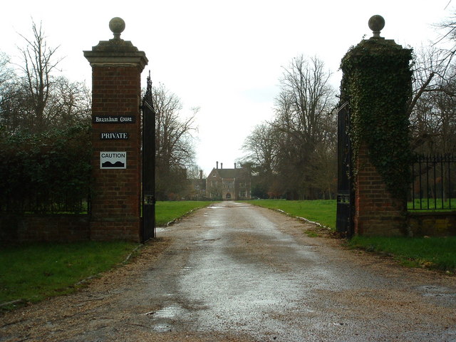
Brantham is a picturesque village located in the Babergh district of Suffolk, England. Situated on the banks of the River Stour, it is nestled amidst the stunning countryside of East Anglia. With a population of around 1,500 residents, Brantham offers a peaceful and idyllic setting for its inhabitants.

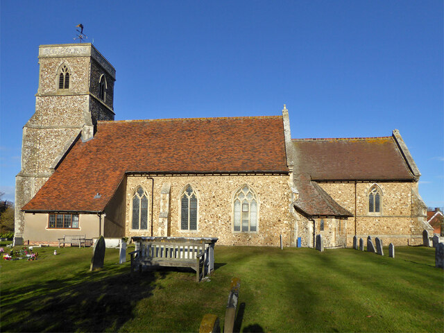
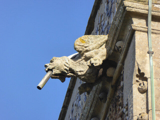
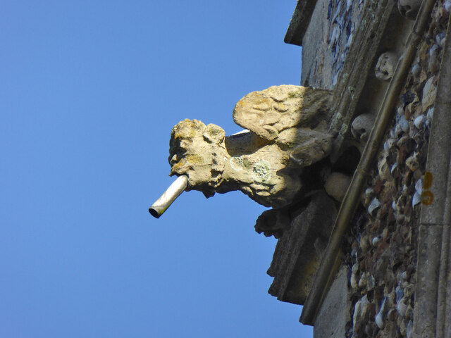
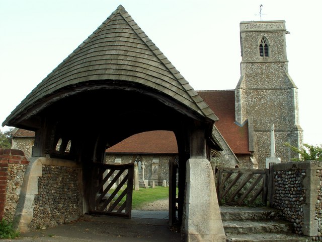
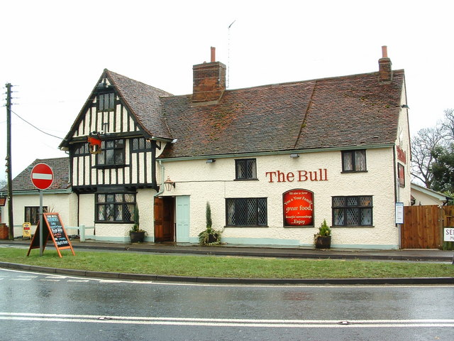
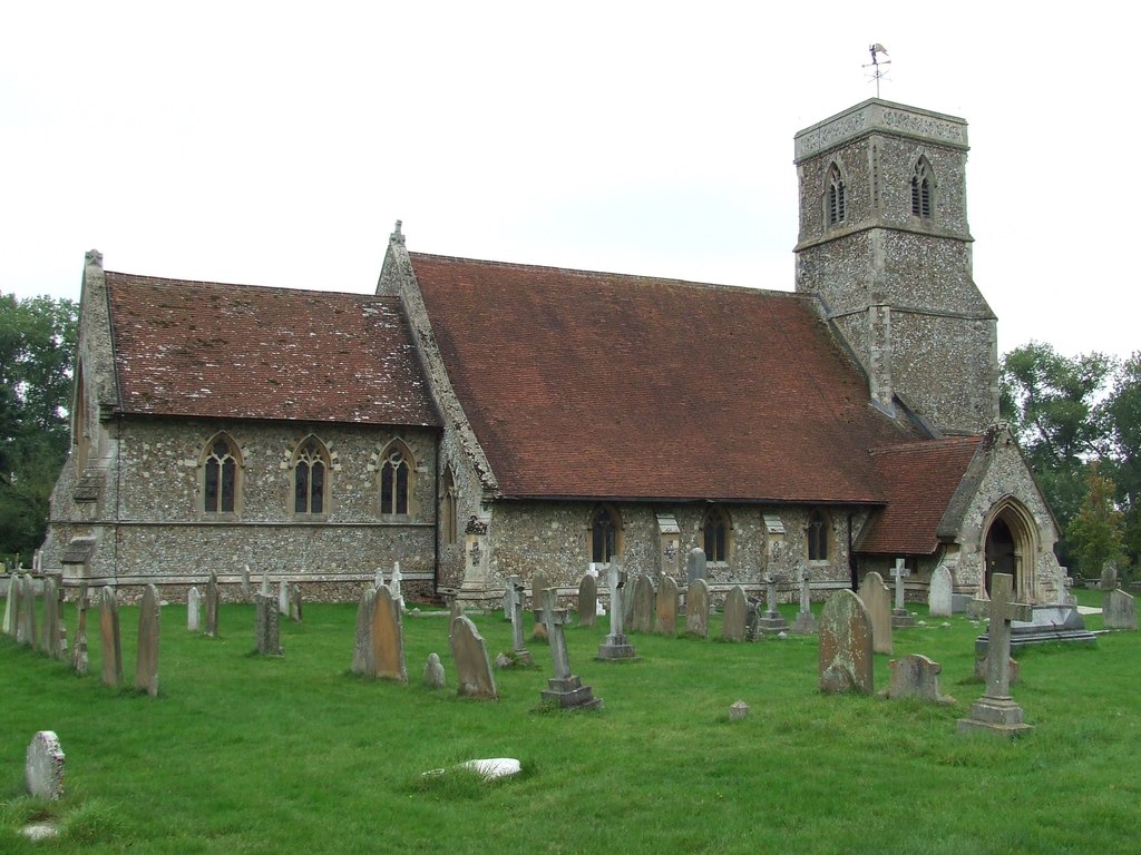
The village is known for its rich history, dating back to the Saxon era. It boasts several historic buildings, including the 16th-century St. Michael's Church, which features a beautiful Norman tower. The village also has a handful of charming timber-framed cottages, adding to its traditional and rustic charm.

Brantham is well-connected to nearby towns and cities, with Manningtree just two miles away, and Ipswich approximately 10 miles to the south. This makes it an ideal location for those who seek a tranquil rural lifestyle while still having easy access to amenities and transport links.

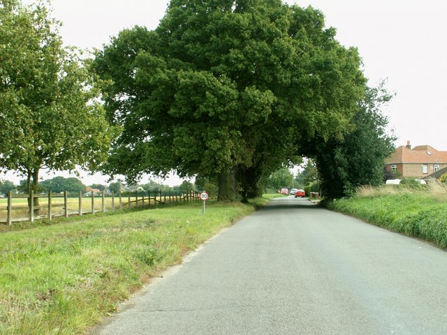
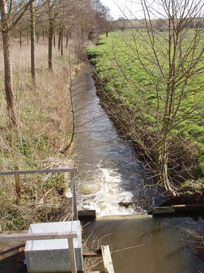
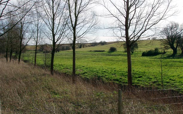
Nature enthusiasts will appreciate the stunning natural beauty of Brantham and its surrounding area. The River Stour offers opportunities for boating, fishing, and leisurely walks along its banks. There are also several nature reserves nearby, including the popular Dedham Vale Area of Outstanding Natural Beauty, which provides breathtaking views and a diverse range of flora and fauna.

Residents of Brantham enjoy a close-knit community spirit, with various clubs and societies catering to different interests. The village has a primary school and a local shop, ensuring that basic amenities are readily available to its inhabitants.

In summary, Brantham is a quaint and historic village in Suffolk, offering a peaceful and picturesque setting, a rich history, and easy access to nearby towns and natural beauty.

If you have any feedback on the listing, please let us know in the comments section below.
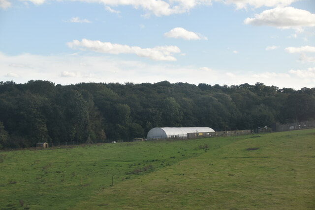
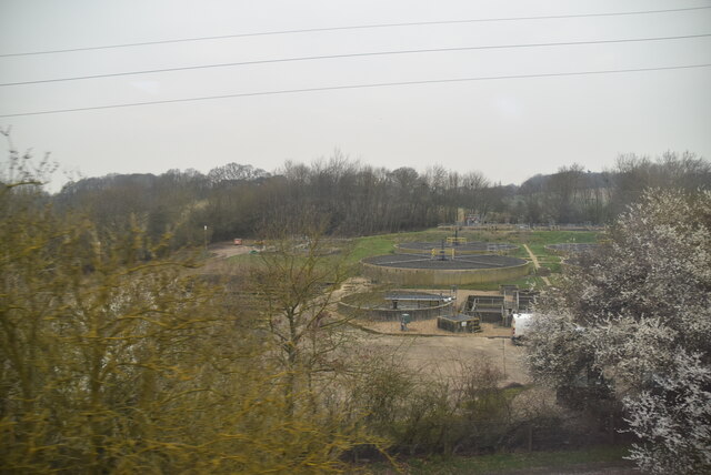
Brantham Images

Images are sourced within 2km of 51.968935/1.07011 or Grid Reference TM1034. Thanks to Geograph Open Source API. All images are credited.

Brantham church The Church of St Michael and All Angels is a grade II*(star) listed building. Medieval with extensive 19th century rebuilding and restorations.
Brantham church
The Church of St Michael and All Angels is a grade II*(star) listed building. Medieval with extensive 19th century rebuilding and restorations.
Gargoyle, Brantham church tower Draining the tower roof at the SW corner.
Gargoyle, Brantham church tower
Draining the tower roof at the SW corner.
Gargoyle, Brantham church tower Draining the tower roof at the NW corner.
Gargoyle, Brantham church tower
Draining the tower roof at the NW corner.
St. Michael's Pre-school, Brantham Mapped as an 'Institute'.
St. Michael's Pre-school, Brantham
Mapped as an 'Institute'.
Lower Meadows Farm
Lower Meadows Farm
Farmland by the Stour Estuary
Saltmarshes The River Stour is in East Anglia. It is 47 miles long and forms most of the county boundary between Suffolk to the north, and Essex to the south. It rises in eastern Cambridgeshire, passes to the east of Haverhill, through Cavendish, Bures, Sudbury, Nayland, Stratford St Mary, Dedham and flows through the Dedham Vale Area of Outstanding Natural Beauty. It becomes tidal just before Manningtree in Essex and joins the North Sea at Harwich.
Saltmarshes
The River Stour is in East Anglia. It is 47 miles long and forms most of the county boundary between Suffolk to the north, and Essex to the south. It rises in eastern Cambridgeshire, passes to the east of Haverhill, through Cavendish, Bures, Sudbury, Nayland, Stratford St Mary, Dedham and flows through the Dedham Vale Area of Outstanding Natural Beauty. It becomes tidal just before Manningtree in Essex and joins the North Sea at Harwich.
Cattawade Creek The River Stour is in East Anglia. It is 47 miles long and forms most of the county boundary between Suffolk to the north, and Essex to the south. It rises in eastern Cambridgeshire, passes to the east of Haverhill, through Cavendish, Bures, Sudbury, Nayland, Stratford St Mary, Dedham and flows through the Dedham Vale Area of Outstanding Natural Beauty. It becomes tidal just before Manningtree in Essex and joins the North Sea at Harwich.
Cattawade Creek
The River Stour is in East Anglia. It is 47 miles long and forms most of the county boundary between Suffolk to the north, and Essex to the south. It rises in eastern Cambridgeshire, passes to the east of Haverhill, through Cavendish, Bures, Sudbury, Nayland, Stratford St Mary, Dedham and flows through the Dedham Vale Area of Outstanding Natural Beauty. It becomes tidal just before Manningtree in Essex and joins the North Sea at Harwich.
Cattawade Creek
Cattawade Creek
Sewage works
Sewage works
Cattawade Creek
Cattawade Creek
End of Sweet Water, Cattawade This is Cattawade the point beyond which the River Stour is tidal. The causeway carries the A137 from Manningtree to Brantham. Immediately the other side of the road is Brantham Sluice that marks the beginning of the Stour Estuary. The marshes around Cattawade are an important wildlife habitat that also supports diverse and unusual plant life
End of Sweet Water, Cattawade
This is Cattawade the point beyond which the River Stour is tidal. The causeway carries the A137 from Manningtree to Brantham. Immediately the other side of the road is Brantham Sluice that marks the beginning of the Stour Estuary. The marshes around Cattawade are an important wildlife habitat that also supports diverse and unusual plant life
St. Michael's church, Brantham, Suffolk This church dates back to the 14th century but a lot rebuilding took place during the 19th century restoration. The picture also shows the lychgate by E. S. Prior.
St. Michael's church, Brantham, Suffolk
This church dates back to the 14th century but a lot rebuilding took place during the 19th century restoration. The picture also shows the lychgate by E. S. Prior.
Slough Road, Brantham, Suffolk
The Bull The Bull public house Brantham suffolk.
The Bull
The Bull public house Brantham suffolk.
Brantham Court Brantham Court Brantham Suffolk.
Brantham Court
Brantham Court Brantham Suffolk.
Stream and weir from Brantham Bridge on the A137 Showing the stream in full flow after a long spell of wet weather
Stream and weir from Brantham Bridge on the A137
Showing the stream in full flow after a long spell of wet weather
Willow plantation and fields near Brantham Bridge
Show me another place!

Brantham is located at Grid Ref: TM1034 (Lat: 51.968935, Lng: 1.07011)

Administrative County: Suffolk

District: Babergh

Police Authority: Suffolk

What 3 Words

///punctual.august.nags. Near Manningtree, Essex

Nearby Locations

Brantham

Related Wikis

Brantham

Brantham is a village and civil parish in the Babergh district of Suffolk, England. It is located close to the River Stour and the border with Essex, around...

Dodnash Priory

Dodnash Priory was a small Augustinian priory located in Bentley, Suffolk, England, near the village's boundary with East Bergholt. It was situated close...

Brantham Athletic F.C.

Brantham Athletic Football Club is a football club based in Brantham, Suffolk, England. They are currently members of the Eastern Counties League Premier...

Cattawade Marshes

Cattawade Marshes is an 88.2-hectare (218-acre) biological Site of Special Scientific Interest between East Bergholt and Manningtree in Essex and Suffolk...

Samford Rural District

Samford Rural District was a rural district within the administrative county of East Suffolk between 1894 and 1974. It was created out of the earlier Samford...

Bentley, Suffolk

Bentley is a village and civil parish in the Babergh district of Suffolk, England, about 6 miles (10 km) southwest of Ipswich. The 2011 Census recorded...

Bentley railway station (Suffolk)

Bentley railway station, also known as Bentley Junction between 1849 and 1878, was located in Bentley, Suffolk on the Great Eastern Main Line. It opened...

Mistley Towers

Mistley Towers are the twin towers of the now demolished Church of St. Mary the Virgin at Mistley in Essex (sometimes known as Mistley Thorn(e) Church...

Nearby Amenities

Located within 500m of 51.968935,1.07011
Brantham
Place: village
Source: NPE
Wikidata: Q2653901
Wikipedia: en:Brantham
Lat/Long: 51.966985/1.0681798
Turning Circle
Lat/Long: 51.9649032/1.0673896
Turning Circle
Lat/Long: 51.9662645/1.0662335
Post Box
Post Box Type: pillar
Ref: CO11 40D
Royal Cypher: EIIR
Royal Cypher Wikidata: Q33102113
Lat/Long: 51.9690596/1.070057
Bus Stop
Church
Naptan AtcoCode: 390010053
Naptan Bearing: NW
Naptan CommonName: Church
Naptan Indicator: adj
Naptan Landmark: Church
Naptan NaptanCode: sufadgam
Naptan Street: Ipswich Road
Naptan Verified: no
Public Transport: platform
Source: naptan_import
Lat/Long: 51.9686265/1.0757446
Bus Stop
Gravel Pit Lane
Local Ref: adj
Naptan AtcoCode: 390010055
Naptan Bearing: NE
Naptan CommonName: Gravel Pit Lane
Naptan Landmark: Gravel Pit Lane
Naptan NaptanCode: sufadgat
Naptan Street: Ipswich Road
Naptan Verified: no
Public Transport: platform
Source: naptan_import
Lat/Long: 51.9689915/1.0695566
Bus Stop
Gravel Pit Lane
Local Ref: opp
Naptan AtcoCode: 390010056
Naptan Bearing: SW
Naptan CommonName: Gravel Pit Lane
Naptan Landmark: Gravel Pit Lane
Naptan NaptanCode: sufadgaw
Naptan Street: Ipswich Road
Naptan Verified: no
Public Transport: platform
Source: naptan_import
Lat/Long: 51.9690058/1.070617
Power: pole
Lat/Long: 51.966566/1.0659085
Power: pole
Lat/Long: 51.969396/1.0678839
Power: pole
Lat/Long: 51.9659984/1.0672106
Power: pole
Lat/Long: 51.9673172/1.0684444
Power: pole
Lat/Long: 51.9664727/1.0682567
Power: pole
Lat/Long: 51.9686987/1.0687663
Power: pole
Lat/Long: 51.9714847/1.0650729
Power: pole
Lat/Long: 51.9708121/1.0659875
Power: pole
Lat/Long: 51.968036/1.0686107
Power: pole
Lat/Long: 51.9701396/1.0668941
Power: pole
Lat/Long: 51.9670676/1.0647484
Access: no
Barrier: turnstile
Foot: yes
Lat/Long: 51.9677764/1.0667853
Bench
Lat/Long: 51.9647237/1.0705362
Grit Bin
Lat/Long: 51.9667003/1.0735946
Shelter
Lat/Long: 51.9690245/1.0695527
Turning Circle
Lat/Long: 51.9676366/1.0641713
Board Type: nature
Information: board
Operator: Woodland Trust
Tourism: information
Lat/Long: 51.9677311/1.0667474
Bicycle Parking
Bicycle Parking: stands
Capacity: 2
Lat/Long: 51.969028/1.0695758
Leisure: playground
Lat/Long: 51.9707394/1.0727938
The data included in this document is from www.openstreetmap.org. The data is made available under ODbL.

Have you been to Brantham?

Leave your review of Brantham below (or comments, questions and feedback).