Branston

Settlement in Lincolnshire North Kesteven

England

Branston

Country road near Branston (1) The bridge ahead carries the railway between Lincoln (left) and Sleaford (right).
Country road near Branston (1) Credit: Stephen Richards

Branston is a picturesque village located in the county of Lincolnshire, England. Situated approximately four miles south of the city of Lincoln, it is part of the North Kesteven district. The village has a population of around 1,800 residents.

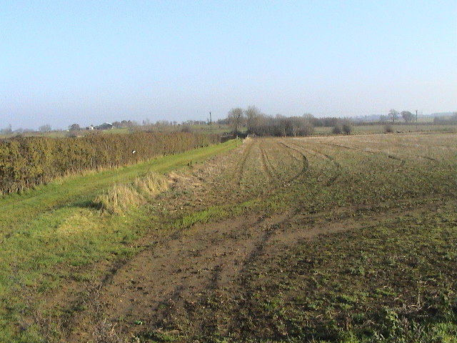
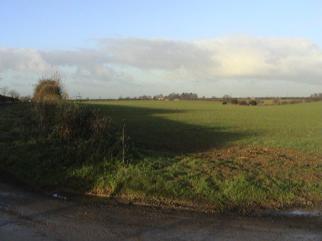
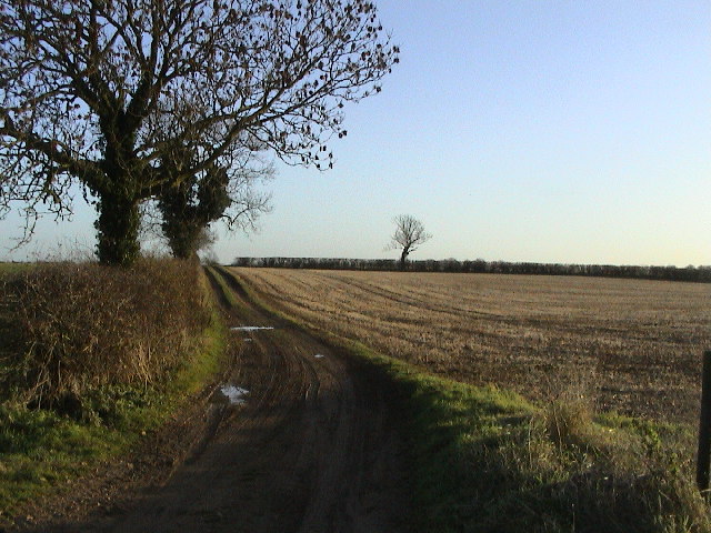
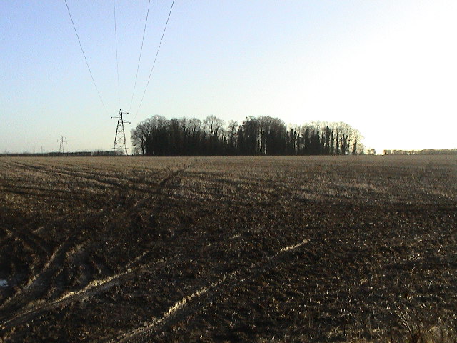
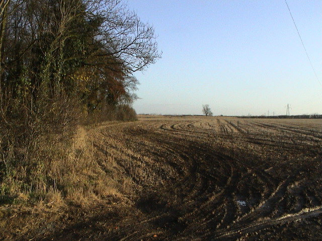
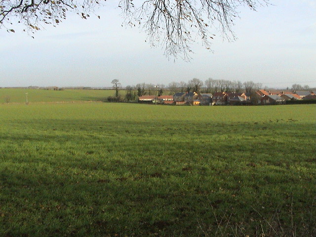
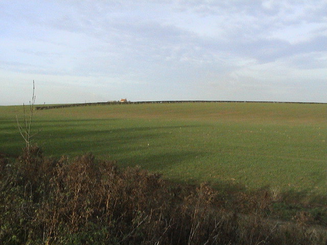
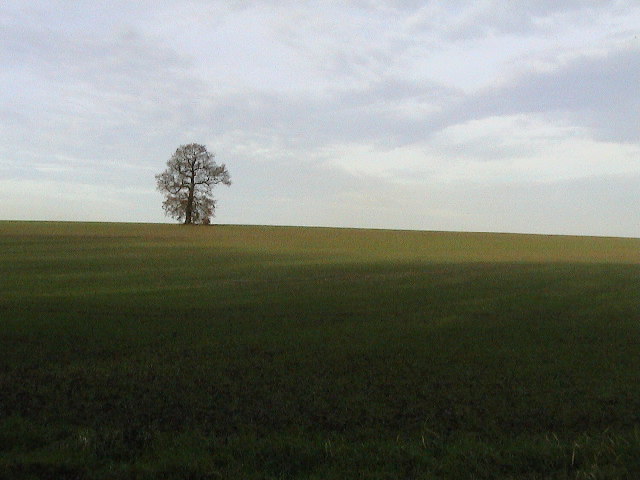
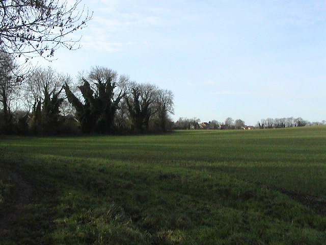
Branston is surrounded by beautiful countryside, with rolling hills and open fields, making it an idyllic rural retreat. The village itself boasts a charming mix of traditional stone houses and modern developments. Its well-maintained streets are lined with trees, adding to the overall appeal of the area.

The heart of the village features a range of amenities to cater to the needs of its residents. Branston has a primary school, a medical center, a post office, and a community center, providing essential services to the local community. Additionally, there are several shops, pubs, and restaurants, offering a variety of options for leisure and entertainment.

For those who enjoy outdoor activities, Branston has plenty to offer. The village is home to several parks and green spaces, including the popular Branston Hall Park, which provides a tranquil setting for walking, picnicking, and enjoying nature. Furthermore, the nearby Lincolnshire Wolds, an Area of Outstanding Natural Beauty, offers a range of opportunities for hiking, cycling, and exploring the stunning countryside.

Branston benefits from excellent transport links, with easy access to the A15 and A607 roads, providing connections to Lincoln and other nearby towns. The village is also well-served by public transportation, with regular bus services to Lincoln and surrounding areas.

Overall, Branston is a delightful village that combines the tranquility of rural living with the convenience of nearby amenities. Its scenic surroundings and strong community spirit make it an attractive place to live or visit in Lincolnshire.

If you have any feedback on the listing, please let us know in the comments section below.
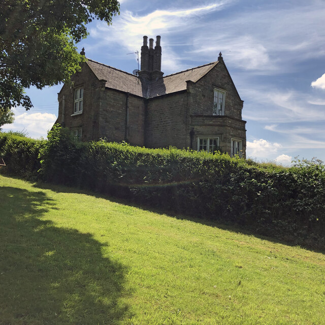
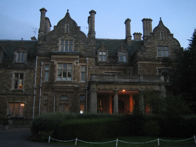
Branston Images

Images are sourced within 2km of 53.193681/-0.47206148 or Grid Reference TF0267. Thanks to Geograph Open Source API. All images are credited.

Country road near Branston (1) The bridge ahead carries the railway between Lincoln (left) and Sleaford (right).
Country road near Branston (1)
The bridge ahead carries the railway between Lincoln (left) and Sleaford (right).
Cliff Farm, Cliff Lane, Washingborough Partially extant 19th century farmstead. Regular courtyard with linked working buildings to all four sides of the yard. The farmhouse is detached from the main working complex. There has been a partial loss (less than 50%) of traditional buildings. Isolated location. Large modern sheds are located to the side of the site. More recently the site has been redeveloped with the working complex being rebuilt and roadway improved. Described in the planning files as ‘…to form holiday letting complex comprising 8 no. units inclusive of managers dwelling and store/leisure block, car parking and amenity area landscaping.’
Cliff Farm, Cliff Lane, Washingborough
Partially extant 19th century farmstead. Regular courtyard with linked working buildings to all four sides of the yard. The farmhouse is detached from the main working complex. There has been a partial loss (less than 50%) of traditional buildings. Isolated location. Large modern sheds are located to the side of the site. More recently the site has been redeveloped with the working complex being rebuilt and roadway improved. Described in the planning files as ‘…to form holiday letting complex comprising 8 no. units inclusive of managers dwelling and store/leisure block, car parking and amenity area landscaping.’
West Lodge to Longhills Main house attributed to Basevi (1838).
West Lodge to Longhills
Main house attributed to Basevi (1838).
Branston Hall Built in 1885, this stately home was converted to a hospital by the RAF during WWII. It was closed in the 80's and stood empty for some years before being reopened as a retirement home. It was finally converted into a posh hotel
Branston Hall
Built in 1885, this stately home was converted to a hospital by the RAF during WWII. It was closed in the 80's and stood empty for some years before being reopened as a retirement home. It was finally converted into a posh hotel
Track & Field Looking E from the Potterhanworth Road. A cutting hides the Lincoln - Sleaford railway among the bushes in the middle distance.
Track & Field
Looking E from the Potterhanworth Road. A cutting hides the Lincoln - Sleaford railway among the bushes in the middle distance.
Nr Heighington Looking NW on the Potterhanworth Road
Nr Heighington
Looking NW on the Potterhanworth Road
Railway Bridge Looking W to the Lincoln - Sleaford railway line crossing Moor Lane.
Railway Bridge
Looking W to the Lincoln - Sleaford railway line crossing Moor Lane.
Fox from Folly Looking SW to Fox Covert from the Folly Lane/Hall Lane junction.
Fox from Folly
Looking SW to Fox Covert from the Folly Lane/Hall Lane junction.
Field from Folly Looking N from Folly Lane/Hall Lane junction, with Ashfield House just visible on the skyline.
Field from Folly
Looking N from Folly Lane/Hall Lane junction, with Ashfield House just visible on the skyline.
Further from Folly The byway running ESE from the Folly Lane/Hall Lane junction.
Further from Folly
The byway running ESE from the Folly Lane/Hall Lane junction.
Hare Wood Worryingly close to Fox Covert <a href="https://www.geograph.org.uk/gridref/TF0066">TF0066</a>! Looking S from Hall Lane.
Hare Wood
Worryingly close to Fox Covert TF0066! Looking S from Hall Lane.
Woodland Edge Looking ESE from the bridleway junction on Hall Lane.
Woodland Edge
Looking ESE from the bridleway junction on Hall Lane.
Branston Road Looking N to the houses at Pudding Busk Lane.
Branston Road
Looking N to the houses at Pudding Busk Lane.
Track & Field
Track & Field
Town & Country Many villages in Lincolnshire are expanding fast. Here new housing pushes Branston deeper into the fields.
Town & Country
Many villages in Lincolnshire are expanding fast. Here new housing pushes Branston deeper into the fields.
Country from Town Looking NW from the northern edge of Branston village. Washingborough Top Farm can just be seen on the skyline.
Country from Town
Looking NW from the northern edge of Branston village. Washingborough Top Farm can just be seen on the skyline.
Last One Standing Open farmland north of Branston
Last One Standing
Open farmland north of Branston
Borderline The northern edge of Branston looking west
Borderline
The northern edge of Branston looking west
Show me another place!

Branston is located at Grid Ref: TF0267 (Lat: 53.193681, Lng: -0.47206148)

Division: Parts of Kesteven

Administrative County: Lincolnshire

District: North Kesteven

Police Authority: Lincolnshire

What 3 Words

///opposing.culminate.larger. Near Branston, Lincolnshire

Nearby Locations

Branston

Related Wikis

Branston, Lincolnshire

Branston is a large village in the civil parish of Branston and Mere, in the North Kesteven district of Lincolnshire, England, 4 miles (6 km) south-east...

Branston Rural District

Branston was a rural district in Kesteven in Lincolnshire, England from 1894 to 1931. It was formed under the Local Government Act 1894 from the part...

Branston Community Academy

Branston Community Academy, (formerly Branston School and Community College) is a secondary school for 11- to 18-year-old students on Station Road in Branston...
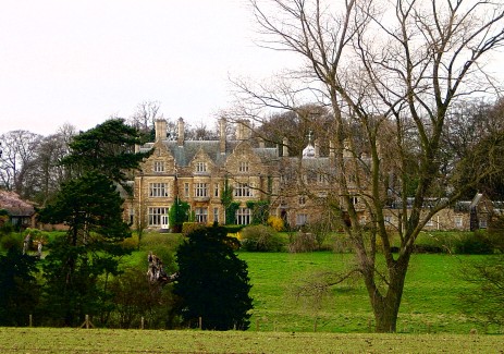
Branston Hall

Branston Hall is a country house in the village of Branston, Lincolnshire, England. The hall, a Grade II listed building, is set in 88 acres (3.56 square...

Nearby Amenities

Located within 500m of 53.193681,-0.47206148
Branston
Is In: Lincolnshire, England, UK
Place: village
Lat/Long: 53.193893/-0.4700913
Traffic Signals
Lat/Long: 53.1931418/-0.4695351
Bus Stop
Station Road
Naptan AtcoCode: 270000008106
Naptan Bearing: E
Naptan CommonName: Station Road
Naptan Indicator: adj
Naptan Landmark: Station Road
Naptan NaptanCode: lingpagd
Naptan PlusbusZoneRef: LINCLNC
Naptan Street: Sleaford Road
Naptan Verified: no
Source: naptan_import
Lat/Long: 53.192947/-0.4687463
Bus Stop
Curtois Close
Naptan AtcoCode: 270000009992
Naptan Bearing: SW
Naptan CommonName: Curtois Close
Naptan Indicator: adj
Naptan Landmark: Curtois Close
Naptan NaptanCode: linjgmpm
Naptan PlusbusZoneRef: LINCLNC
Naptan Street: Station Road
Naptan Verified: no
Source: naptan_import
Lat/Long: 53.1937326/-0.4690177
Bus Stop
Curtois Close
Naptan AtcoCode: 270000009993
Naptan Bearing: NE
Naptan CommonName: Curtois Close
Naptan Indicator: opp
Naptan Landmark: Curtois Close
Naptan NaptanCode: linjgmpt
Naptan PlusbusZoneRef: LINCLNC
Naptan Street: Station Road
Naptan Verified: no
Source: naptan_import
Lat/Long: 53.1936722/-0.4692145
Bus Stop
Fairleas
Naptan AtcoCode: 270002700321
Naptan Bearing: NE
Naptan CommonName: Fairleas
Naptan Indicator: opp
Naptan Landmark: Fairleas
Naptan NaptanCode: lindawmg
Naptan PlusbusZoneRef: LINCLNC
Naptan Street: Station Road
Naptan Verified: no
Source: naptan_import
Lat/Long: 53.1952117/-0.4686806
Bus Stop
Fairleas
Naptan AtcoCode: 270002700322
Naptan Bearing: SW
Naptan CommonName: Fairleas
Naptan Indicator: adj
Naptan Landmark: Fairleas
Naptan NaptanCode: lingdtdj
Naptan PlusbusZoneRef: LINCLNC
Naptan Street: Station Road
Naptan Verified: no
Source: naptan_import
Lat/Long: 53.1954965/-0.4684608
Bus Stop
War Memorial
Naptan AtcoCode: 2700LBC02880
Naptan Bearing: W
Naptan CommonName: War Memorial
Naptan Indicator: adj
Naptan Landmark: War Memorial
Naptan NaptanCode: linatwtp
Naptan PlusbusZoneRef: LINCLNC
Naptan Street: Sleaford Road
Naptan Verified: no
Source: naptan_import
Lat/Long: 53.193383/-0.4704972
Pub
Branston Home Guard Club
Lat/Long: 53.1936396/-0.4728019
Pub
Waggon & Horses
Lat/Long: 53.1934628/-0.4734618
Turning Circle
Lat/Long: 53.1953268/-0.466165
Turning Circle
Lat/Long: 53.1955385/-0.469983
Turning Circle
Lat/Long: 53.1955238/-0.4709405
Turning Circle
Lat/Long: 53.1966701/-0.4668714
Turning Circle
Lat/Long: 53.1949077/-0.4714534
Generator Method: photovoltaic
Generator Output Electricity: yes
Generator Source: solar
Generator Type: solar_photovoltaic_panel
Location: roof
Power: generator
Lat/Long: 53.1952183/-0.4658094
Generator Method: photovoltaic
Generator Output Electricity: yes
Generator Source: solar
Generator Type: solar_photovoltaic_panel
Location: roof
Power: generator
Lat/Long: 53.1949902/-0.465906
Generator Method: photovoltaic
Generator Output Electricity: yes
Generator Source: solar
Generator Type: solar_photovoltaic_panel
Location: roof
Power: generator
Lat/Long: 53.194778/-0.4661876
Generator Method: photovoltaic
Generator Output Electricity: yes
Generator Source: solar
Generator Type: solar_photovoltaic_panel
Location: roof
Power: generator
Lat/Long: 53.1913681/-0.4673276
Generator Method: photovoltaic
Generator Output Electricity: yes
Generator Source: solar
Generator Type: solar_photovoltaic_panel
Location: roof
Power: generator
Lat/Long: 53.1913938/-0.4672095
Generator Method: photovoltaic
Generator Output Electricity: yes
Generator Source: solar
Generator Type: solar_photovoltaic_panel
Location: roof
Power: generator
Lat/Long: 53.1910675/-0.4693231
Generator Method: photovoltaic
Generator Output Electricity: yes
Generator Source: solar
Generator Type: solar_photovoltaic_panel
Location: roof
Power: generator
Lat/Long: 53.1911961/-0.4701895
Generator Method: photovoltaic
Generator Output Electricity: yes
Generator Source: solar
Generator Type: solar_photovoltaic_panel
Location: roof
Power: generator
Lat/Long: 53.1912443/-0.4702458
Generator Method: photovoltaic
Generator Output Electricity: yes
Generator Source: solar
Generator Type: solar_photovoltaic_panel
Location: roof
Power: generator
Lat/Long: 53.1912041/-0.4701224
Generator Method: photovoltaic
Generator Output Electricity: yes
Generator Source: solar
Generator Type: solar_photovoltaic_panel
Location: roof
Power: generator
Lat/Long: 53.192742/-0.4681564
Generator Method: photovoltaic
Generator Output Electricity: yes
Generator Source: solar
Generator Type: solar_photovoltaic_panel
Location: roof
Power: generator
Lat/Long: 53.1933768/-0.4658202
Generator Method: photovoltaic
Generator Output Electricity: yes
Generator Source: solar
Generator Type: solar_photovoltaic_panel
Location: roof
Power: generator
Lat/Long: 53.1950576/-0.4669735
Generator Method: photovoltaic
Generator Output Electricity: yes
Generator Source: solar
Generator Type: solar_photovoltaic_panel
Location: roof
Power: generator
Lat/Long: 53.1950159/-0.4666798
Generator Method: photovoltaic
Generator Output Electricity: yes
Generator Source: solar
Generator Type: solar_photovoltaic_panel
Location: roof
Power: generator
Lat/Long: 53.1950102/-0.4666181
Generator Method: photovoltaic
Generator Output Electricity: yes
Generator Source: solar
Generator Type: solar_photovoltaic_panel
Location: roof
Power: generator
Lat/Long: 53.1952355/-0.4676964
Generator Method: photovoltaic
Generator Output Electricity: yes
Generator Source: solar
Generator Type: solar_photovoltaic_panel
Location: roof
Power: generator
Lat/Long: 53.1954637/-0.4675596
Generator Method: photovoltaic
Generator Output Electricity: yes
Generator Source: solar
Generator Type: solar_photovoltaic_panel
Location: roof
Power: generator
Lat/Long: 53.196055/-0.4672618
Generator Method: photovoltaic
Generator Output Electricity: yes
Generator Source: solar
Generator Type: solar_photovoltaic_panel
Location: roof
Power: generator
Lat/Long: 53.1960856/-0.467345
Generator Method: photovoltaic
Generator Output Electricity: yes
Generator Source: solar
Generator Type: solar_photovoltaic_panel
Location: roof
Power: generator
Lat/Long: 53.1970995/-0.4677366
Generator Method: photovoltaic
Generator Output Electricity: yes
Generator Source: solar
Generator Type: solar_photovoltaic_panel
Location: roof
Power: generator
Lat/Long: 53.1970898/-0.4678197
Generator Method: photovoltaic
Generator Output Electricity: yes
Generator Source: solar
Generator Type: solar_photovoltaic_panel
Location: roof
Power: generator
Lat/Long: 53.1967363/-0.4672753
Generator Method: photovoltaic
Generator Output Electricity: yes
Generator Source: solar
Generator Type: solar_photovoltaic_panel
Location: roof
Power: generator
Lat/Long: 53.1937234/-0.4689248
Generator Method: photovoltaic
Generator Output Electricity: yes
Generator Source: solar
Generator Type: solar_photovoltaic_panel
Location: roof
Power: generator
Lat/Long: 53.1928187/-0.4715641
Generator Method: photovoltaic
Generator Output Electricity: yes
Generator Source: solar
Generator Type: solar_photovoltaic_panel
Location: roof
Power: generator
Lat/Long: 53.1922257/-0.4725377
Generator Method: photovoltaic
Generator Output Electricity: yes
Generator Source: solar
Generator Type: solar_photovoltaic_panel
Location: roof
Power: generator
Lat/Long: 53.1961044/-0.4757121
Generator Method: photovoltaic
Generator Output Electricity: yes
Generator Source: solar
Generator Type: solar_photovoltaic_panel
Location: roof
Power: generator
Lat/Long: 53.1964225/-0.4748619
Generator Method: photovoltaic
Generator Output Electricity: yes
Generator Source: solar
Generator Type: solar_photovoltaic_panel
Location: roof
Power: generator
Lat/Long: 53.1966218/-0.4753849
Generator Method: photovoltaic
Generator Output Electricity: yes
Generator Source: solar
Generator Type: solar_photovoltaic_panel
Location: roof
Power: generator
Lat/Long: 53.1968226/-0.4755834
Generator Method: photovoltaic
Generator Output Electricity: yes
Generator Source: solar
Generator Type: solar_photovoltaic_panel
Location: roof
Power: generator
Lat/Long: 53.197769/-0.4747117
Generator Method: photovoltaic
Generator Output Electricity: yes
Generator Source: solar
Generator Type: solar_photovoltaic_panel
Location: roof
Power: generator
Lat/Long: 53.197859/-0.4745722
Generator Method: photovoltaic
Generator Output Electricity: yes
Generator Source: solar
Generator Type: solar_photovoltaic_panel
Location: roof
Power: generator
Lat/Long: 53.1973754/-0.4728931
Generator Method: photovoltaic
Generator Output Electricity: yes
Generator Source: solar
Generator Type: solar_photovoltaic_panel
Location: roof
Power: generator
Lat/Long: 53.1973625/-0.4729521
Generator Method: photovoltaic
Generator Output Electricity: yes
Generator Source: solar
Generator Type: solar_photovoltaic_panel
Location: roof
Power: generator
Lat/Long: 53.1973127/-0.4730702
Generator Method: photovoltaic
Generator Output Electricity: yes
Generator Source: solar
Generator Type: solar_photovoltaic_panel
Location: roof
Power: generator
Lat/Long: 53.1972982/-0.4731158
Generator Method: photovoltaic
Generator Output Electricity: yes
Generator Source: solar
Generator Type: solar_photovoltaic_panel
Location: roof
Power: generator
Lat/Long: 53.1971247/-0.47362
Generator Method: photovoltaic
Generator Output Electricity: yes
Generator Source: solar
Generator Type: solar_photovoltaic_panel
Location: roof
Power: generator
Lat/Long: 53.1970733/-0.4735047
Crossing
Lat/Long: 53.1907979/-0.4717427
Crossing
Lat/Long: 53.1910364/-0.4717781
Turning Circle
Lat/Long: 53.1964409/-0.4732809
The data included in this document is from www.openstreetmap.org. The data is made available under ODbL.

Have you been to Branston?

Leave your review of Branston below (or comments, questions and feedback).