Branston

Settlement in Leicestershire Melton

England

Branston

Waltham Lane, leading to Eaton The spire of St Denys, Eaton, visible on the right horizon. The footpath (extreme right) connects to Eaton and Eaton Grange.
Waltham Lane, leading to Eaton Credit: Tim Heaton

Branston is a small village located in the county of Leicestershire, England. Situated approximately 3 miles southeast of the town of Burton upon Trent, it falls within the district of East Staffordshire.

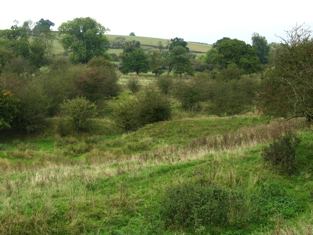
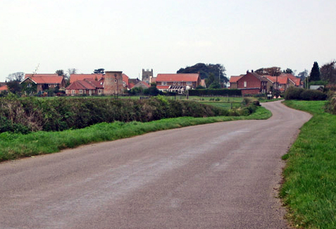
The village is known for its picturesque countryside and is surrounded by farmland, offering a tranquil and rural setting. It is predominantly a residential area with a population of around 1,500 people.

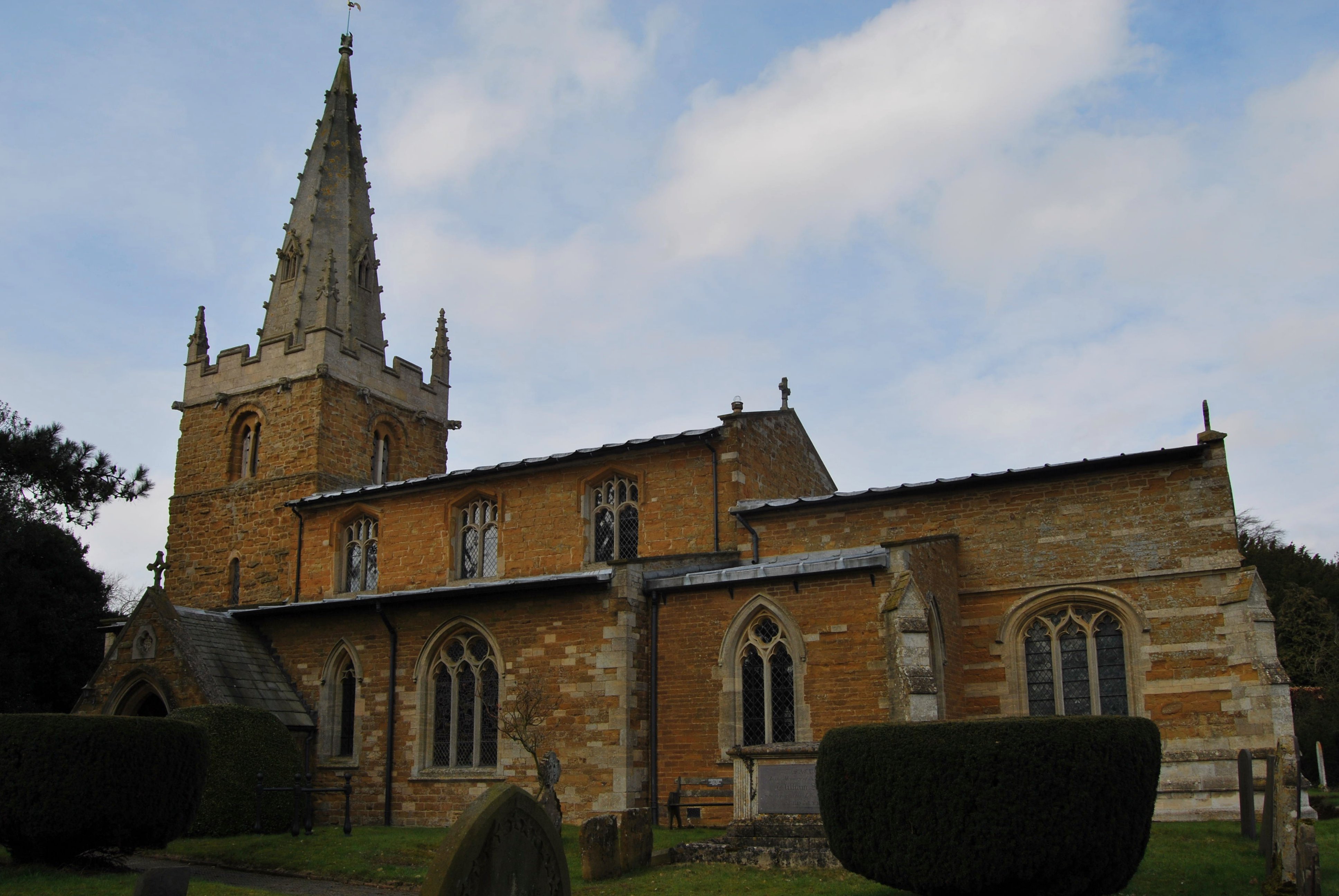
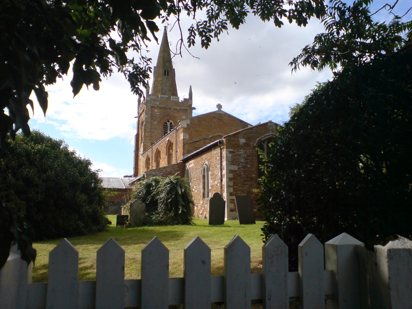
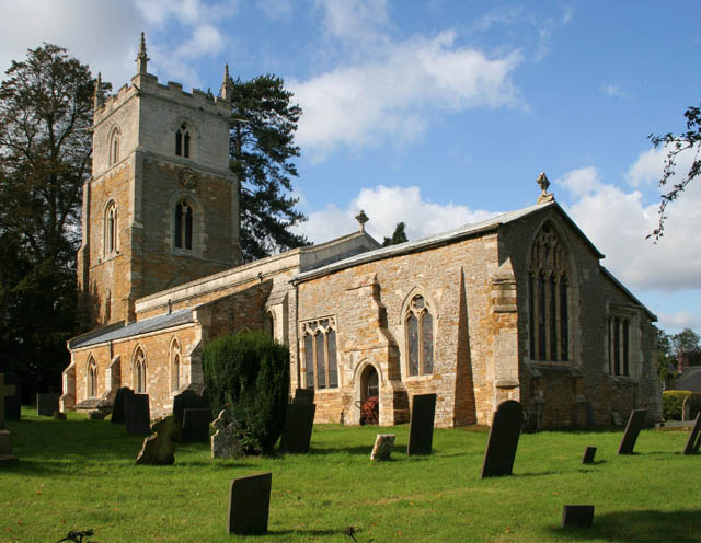
Branston has a rich history, dating back to the Domesday Book of 1086, where it was recorded as "Brandestone." Over the years, it has evolved from a predominantly agricultural community to a residential village. However, remnants of its past can still be seen in the form of historic buildings, including St. Saviour's Church, which dates back to the 13th century.

The village offers a range of amenities to its residents, including a primary school, a post office, a convenience store, and a pub. It also benefits from being in close proximity to larger towns, such as Burton upon Trent, which provides additional services and facilities.

Branston is well-connected transportation-wise, with easy access to major roads, including the A38 and the A50, providing links to nearby towns and cities. The village is also served by several bus routes, facilitating travel within the area.

Overall, Branston is a charming village with a rich history, offering a peaceful and idyllic lifestyle to its residents.

If you have any feedback on the listing, please let us know in the comments section below.
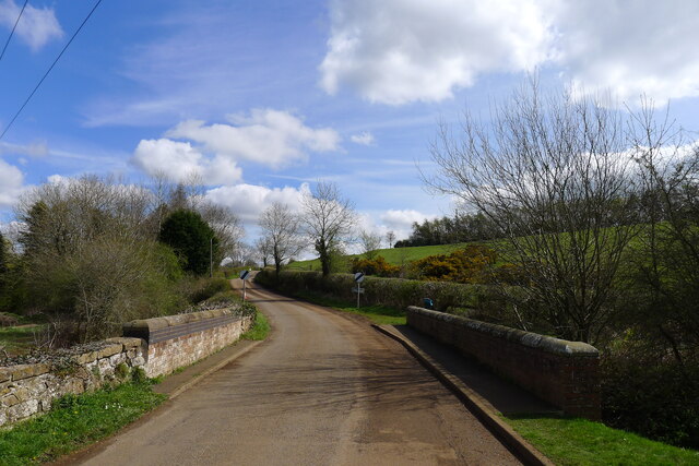
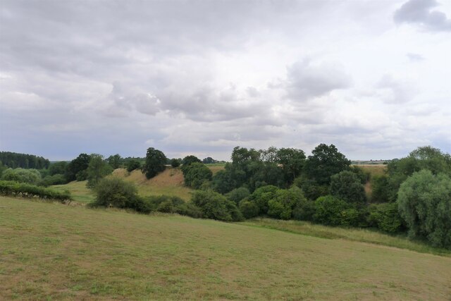
Branston Images

Images are sourced within 2km of 52.855861/-0.795059 or Grid Reference SK8129. Thanks to Geograph Open Source API. All images are credited.

Waltham Lane, leading to Eaton The spire of St Denys, Eaton, visible on the right horizon. The footpath (extreme right) connects to Eaton and Eaton Grange.
Waltham Lane, leading to Eaton
The spire of St Denys, Eaton, visible on the right horizon. The footpath (extreme right) connects to Eaton and Eaton Grange.
Waltham Lane leaving Eaton
Main Street, Eaton A village of narrow lanes
Main Street, Eaton
A village of narrow lanes
Church of St Denys, Eaton Listed Grade I, 13th and 14th centuries, using local ironstone (now heavily weathered) <span class="nowrap"><a title="https://historicengland.org.uk/listing/the-list/list-entry/1360902?section=official-list-entry" rel="nofollow ugc noopener" href="https://historicengland.org.uk/listing/the-list/list-entry/1360902?section=official-list-entry">Link</a><img style="margin-left:2px;" alt="External link" title="External link - shift click to open in new window" src="https://s1.geograph.org.uk/img/external.png" width="10" height="10"/></span>. St Denys was the first bishop of Paris, martyred on the hill of martyrs - Montmartre - in 258 AD.
Church of St Denys, Eaton
Listed Grade I, 13th and 14th centuries, using local ironstone (now heavily weathered) LinkExternal link. St Denys was the first bishop of Paris, martyred on the hill of martyrs - Montmartre - in 258 AD.
Bridleway south of Eaton Leading towards Waltham Lane before joining the Jubilee Way
Bridleway south of Eaton
Leading towards Waltham Lane before joining the Jubilee Way
Green Lane leading west from Lings Hill .
Green Lane leading west from Lings Hill
.
Branston Road leaving Eaton Crossing a headwater stream of the River Devon
Branston Road leaving Eaton
Crossing a headwater stream of the River Devon
Sewage pumping station, Eaton Discharging to the River Devon
Sewage pumping station, Eaton
Discharging to the River Devon
Bridleway to Eaton Grange
Bridleway past Bottom Farm Leading towards Eaton Grange
Bridleway past Bottom Farm
Leading towards Eaton Grange
Junction of Croxton Lane and Croxton Lane The main Croxton Lane goes to Knipton, and the Croxton Lane to the right goes to Harston
Junction of Croxton Lane and Croxton Lane
The main Croxton Lane goes to Knipton, and the Croxton Lane to the right goes to Harston
Branston Lane passing the entrance to Keeper's Cottage The lane takes Cycle Route 64 past Knipton Reservoir, but views of the reservoir are limited
Branston Lane passing the entrance to Keeper's Cottage
The lane takes Cycle Route 64 past Knipton Reservoir, but views of the reservoir are limited
View north-east of Branston Looking along the route of a bridleway to Croxton Lodge
View north-east of Branston
Looking along the route of a bridleway to Croxton Lodge
Track up to the A607, west of Croxton Kerrial During the driest July for over a hundred years, the rare sound of running water. The stream by the side of the path comes from Croxton Kerrial's famous spring-fed water spout <a href="https://www.geograph.org.uk/photo/30072">SK8328 : Water spout, Croxton Kerrial</a>. The spring emerges at the base of the Lincolnshire Limestone, and the miniature waterfall on the right is formed from tuffa.
Track up to the A607, west of Croxton Kerrial
During the driest July for over a hundred years, the rare sound of running water. The stream by the side of the path comes from Croxton Kerrial's famous spring-fed water spout SK8328 : Water spout, Croxton Kerrial. The spring emerges at the base of the Lincolnshire Limestone, and the miniature waterfall on the right is formed from tuffa.
The A607 east of Lings Hill Continuing the straight line of the Salt Way in the direction of Croxton Kerrial.
The A607 east of Lings Hill
Continuing the straight line of the Salt Way in the direction of Croxton Kerrial.
The end of Baulk pit, Branston This shows the furthest end of Baulk pit, Branston. This ironstone quarry was started in 1951, and abandoned in 1957. Ore was taken away on the 3 foot gauge Eastwell tramway, for transshipment into standard gauge wagons at Stathern Ironstone Siding on the Melton Mowbray - Bottesford Junction line.
The end of Baulk pit, Branston
This shows the furthest end of Baulk pit, Branston. This ironstone quarry was started in 1951, and abandoned in 1957. Ore was taken away on the 3 foot gauge Eastwell tramway, for transshipment into standard gauge wagons at Stathern Ironstone Siding on the Melton Mowbray - Bottesford Junction line.
Baulk pit, Branston A general view of this quarry, abandoned in 1957, near its end. The working face, from which iron ore was about to be extracted, is on the right.
Baulk pit, Branston
A general view of this quarry, abandoned in 1957, near its end. The working face, from which iron ore was about to be extracted, is on the right.
Working face, Baulk pit, Branston A working face of Baulk pit, Branston, an ironstone quarry abandoned in 1957. The top layer of soil has been removed and put aside for use in restoration, and the ironstone is exposed ready for excavation.
Working face, Baulk pit, Branston
A working face of Baulk pit, Branston, an ironstone quarry abandoned in 1957. The top layer of soil has been removed and put aside for use in restoration, and the ironstone is exposed ready for excavation.
Show me another place!

Branston is located at Grid Ref: SK8129 (Lat: 52.855861, Lng: -0.795059)

Administrative County: Leicestershire

District: Melton

Police Authority: Leicestershire

What 3 Words

///redeeming.sensitive.shuttled. Near Long Clawson, Leicestershire

Nearby Locations

Branston

Related Wikis

Branston, Leicestershire

Branston is a village and former civil parish, now in the parish of Croxton Kerrial in the Melton district, in the county of Leicestershire, England. It...

St Guthlac's Church, Branston

St Guthlac's Church is a church in Branston, Leicestershire. It is a Grade II* listed building. == History == The church dates from the 13th century but...

Eaton, Leicestershire

Eaton is a village and civil parish in Leicestershire, England, situated in the Vale of Belvoir. The population at the 2011 census (including Eastwell...

Croxton Park

Croxton Park is a 97.3-hectare (240-acre) biological Site of Special Scientific Interest south-west of Croxton Kerrial in Leicestershire.This medieval...

Knipton

Knipton is a village and former civil parish, now in the parish of Belvoir, in the Melton district, in the county of Leicestershire, England. It lies about...

Terrace Hills Pasture

Terrace Hills Pasture is an 11.3-hectare (28-acre) biological Site of Special Scientific Interest north of Eastwell in Leicestershire.This site has been...

Waltham Iron Ore Tramway

The Waltham Iron Ore Tramway was a 1,000 mm (3 ft 3+3⁄8 in) gauge industrial tramway serving the ironstone pits of the Waltham Iron Ore Company, a subsidiary...

Croxton Kerrial

Croxton Kerrial (pronounced [ˈkroʊsən ˈkɛrɨl]) is a village and civil parish in the Melton borough of Leicestershire, England, 6.6 miles (10.6 km) south...

Nearby Amenities

Located within 500m of 52.855861,-0.795059
Branston
Is In: Leicestershire,England,UK
Place: village
Wikidata: Q4957569
Lat/Long: 52.8579569/-0.7975023
Bus Stop
The Rock
Bus: yes
Naptan AtcoCode: 260000700
Naptan Bearing: S
Naptan CommonName: The Rock
Naptan Indicator: outside
Naptan Landmark: 1 on cnr with Main Street
Naptan NaptanCode: leidmwjt
Naptan Notes: Non-Hourly - County
Naptan Street: Main Street
Naptan Verified: no
Public Transport: platform
Source: naptan_import
Lat/Long: 52.8554488/-0.7980345
Knipton Turn
Naptan AtcoCode: 260000705
Naptan Bearing: E
Naptan BusStopType: CUS
Naptan CommonName: Knipton Turn
Naptan Indicator: outside
Naptan Landmark: side of 8 Main Street
Naptan NaptanCode: leidmwmj
Naptan Notes: Non-Hourly - County
Naptan Street: Knipton Road
Naptan Verified: no
Source: naptan_import
Lat/Long: 52.8561773/-0.7981313
Knipton Turn
Naptan AtcoCode: 260000706
Naptan Bearing: W
Naptan BusStopType: CUS
Naptan CommonName: Knipton Turn
Naptan Indicator: opposite
Naptan Landmark: side of 8 Main Street
Naptan NaptanCode: leidmwmp
Naptan Notes: Non-Hourly - County
Naptan Street: Knipton Road
Naptan Verified: no
Source: naptan_import
Lat/Long: 52.8561044/-0.798134
Village
Naptan AtcoCode: 260080101
Naptan Bearing: NE
Naptan BusStopType: CUS
Naptan CommonName: Village
Naptan Indicator: outside
Naptan Landmark: junction
Naptan NaptanCode: leimadgj
Naptan Notes: Non-Hourly - County
Naptan Street: Main Street
Naptan Verified: no
Source: naptan_import
Lat/Long: 52.854857/-0.7990756
Post Box
Ele: 99.1408691
Post Box Type: wall
Royal Cypher: EIIR
Royal Cypher Wikidata: Q33102113
Lat/Long: 52.8559713/-0.7981032
Pub
The Wheel
Addr City: Grantham
Addr Country: GB
Addr Housenumber: 13
Addr Postcode: NG32 1RU
Addr Street: Main Street
Addr Village: Branston
Description Floor: stone
Ele: 100
Fhrs Authority: Melton
Fhrs Id: 16801
Fhrs Local Authority Id: 05300/0013/2/000
Food: yes
Real Ale: Batemans XB, 2 guests, may vary
Real Fire: yes
Source Addr: FHRS Open Data
Lat/Long: 52.8564118/-0.7985109
Bench
Ele: 99.8619385
Lat/Long: 52.8566385/-0.7981998
Ele: 100.8232422
Information: board
Tourism: information
Lat/Long: 52.8569106/-0.7985538
Ele: 101.7845459
Removed Amenity: telephone
Lat/Long: 52.8575908/-0.7983929
Ele: 98.1796875
Lat/Long: 52.8540035/-0.7955447
Ele: 90.2487793
Lat/Long: 52.8556145/-0.792854
Barrier: stile
Ele: 98.9006348
Steps: 1
Stile: stepover
Lat/Long: 52.8560283/-0.7921408
Ele: 90.2487793
Lat/Long: 52.8556085/-0.7928649
Ford: yes
Lat/Long: 52.85866/-0.7951353
Ele: 98.4199219
Lat/Long: 52.8532117/-0.7965336
Ele: 95.2956543
Lat/Long: 52.8554527/-0.7930529
Ele: 97.4586182
Lat/Long: 52.853043/-0.797835
Ele: 96.9780273
Lat/Long: 52.8530624/-0.797638
Ele: 97.6989746
Lat/Long: 52.8531158/-0.7970565
Barrier: stile
Steps: 1
Stile: stepover
Lat/Long: 52.8593634/-0.7939754
Barrier: stile
Material: wood
Step Count: 1
Stile: stepover
Lat/Long: 52.8531551/-0.7964986
Generator Method: photovoltaic
Generator Output Electricity: yes
Generator Source: solar
Generator Type: solar_photovoltaic_panel
Location: roof
Power: generator
Lat/Long: 52.857031/-0.7980832
Generator Method: photovoltaic
Generator Output Electricity: yes
Generator Source: solar
Generator Type: solar_photovoltaic_panel
Location: roof
Power: generator
Lat/Long: 52.8567518/-0.7976324
The data included in this document is from www.openstreetmap.org. The data is made available under ODbL.

Have you been to Branston?

Leave your review of Branston below (or comments, questions and feedback).