Winterbourne Gunner

Settlement in Wiltshire

England

Winterbourne Gunner

Recreation ground at East Gomeldon
Recreation ground at East Gomeldon Credit: David Martin

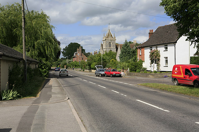
Winterbourne Gunner is a small village situated in the county of Wiltshire, England. It lies approximately 4 miles northeast of Salisbury, near the eastern edge of Salisbury Plain. With a population of around 600 residents, it is a close-knit and rural community.

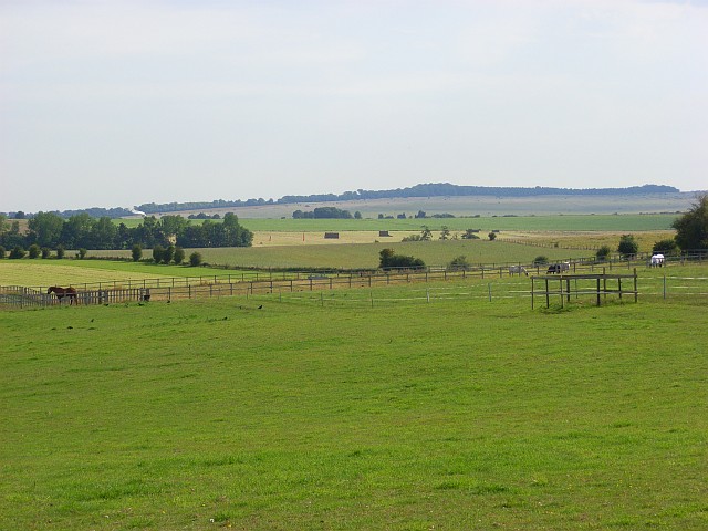
The village is surrounded by picturesque countryside, characterized by rolling hills, fields, and woodlands. It offers breathtaking views of the Wiltshire landscape and provides residents with a peaceful and idyllic setting to call home.

Winterbourne Gunner has a rich history, with evidence of human habitation dating back to the Iron Age. The area has been inhabited continuously since then, and remnants of Roman and Saxon settlements can still be found in the vicinity. The village itself developed during the medieval period and has retained much of its historic charm.

A prominent feature of Winterbourne Gunner is its parish church, St. Michael and All Angels. This impressive Grade I listed building dates back to the 13th century, with additions and renovations made over the centuries. It serves as a focal point for the community, hosting regular services and community events.

Despite its small size, Winterbourne Gunner benefits from a close proximity to Salisbury, which provides access to essential amenities such as schools, shops, and healthcare facilities. The village also offers a sense of tranquility and a close connection to nature, making it an attractive place to live for those seeking a peaceful rural lifestyle.

If you have any feedback on the listing, please let us know in the comments section below.

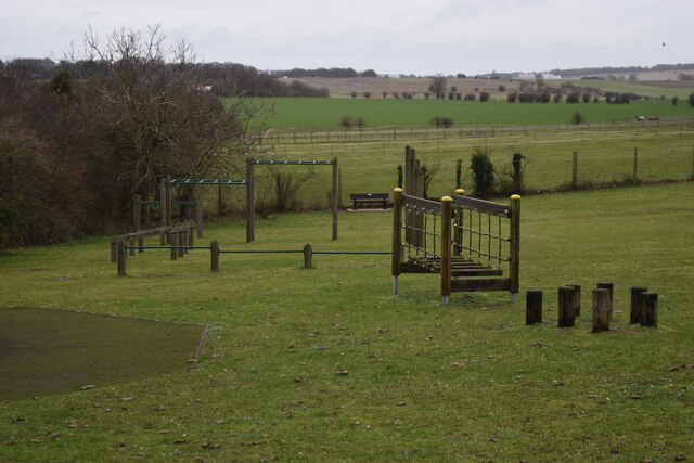
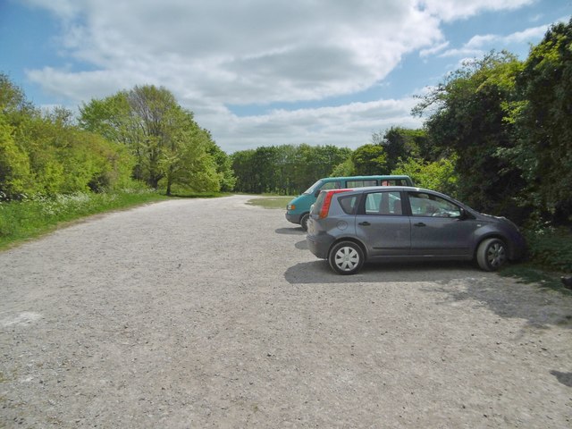
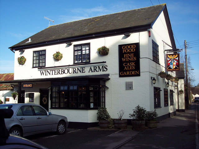
Winterbourne Gunner Images

Images are sourced within 2km of 51.115438/-1.7423541 or Grid Reference SU1835. Thanks to Geograph Open Source API. All images are credited.

Recreation ground at East Gomeldon
Paddocks, Gomeldon The view from the end of the public road in East Gomeldon. Paddocks and hay meadows occupy the area outside of the Porton Down perimeter. There are also hay meadows within the Porton Down MOD area.
Paddocks, Gomeldon
The view from the end of the public road in East Gomeldon. Paddocks and hay meadows occupy the area outside of the Porton Down perimeter. There are also hay meadows within the Porton Down MOD area.
Porton Ford This ford on the River Bourne is found at Porton.
Porton Ford
This ford on the River Bourne is found at Porton.
Gomeldon Ford This ford on the River Bourne is found at West Gomeldon. A video of the ford can be seen at:
<span class="nowrap"><a title="https://youtu.be/FMbQizsOM8w" rel="nofollow ugc noopener" href="https://youtu.be/FMbQizsOM8w">Link</a><img style="margin-left:2px;" alt="External link" title="External link - shift click to open in new window" src="https://s1.geograph.org.uk/img/external.png" width="10" height="10"/></span>
Gomeldon Ford
This ford on the River Bourne is found at West Gomeldon. A video of the ford can be seen at: LinkExternal link
Winterbourne Dauntsey Ford This ford is found on the River Bourne at Winterbourne Dauntsey.
Winterbourne Dauntsey Ford
This ford is found on the River Bourne at Winterbourne Dauntsey.
Ford at Winterbourne Earls This ford on the River Bourne is found at the end of Tanners Lane at Winterbourne Earls.
Ford at Winterbourne Earls
This ford on the River Bourne is found at the end of Tanners Lane at Winterbourne Earls.
Winterbourne Earls Ford This ford on the River Bourne is found at Winterbourne Earls. The footpath shown on the linked image is no longer there or more likely covered with shingle:
<a title="https://www.geograph.org.uk/photo/189949" href="https://www.geograph.org.uk/photo/189949">Link</a>
Winterbourne Earls Ford
This ford on the River Bourne is found at Winterbourne Earls. The footpath shown on the linked image is no longer there or more likely covered with shingle: Link
Winterbourne Dauntsey Church St. Michael and All Angels.
Winterbourne Dauntsey Church
St. Michael and All Angels.
Ordnance Survey Flush Bracket S8371 This can be found on the wall of a building of a private dwelling in Winterbourne Gunner.
For more detail see : <span class="nowrap"><a title="http://www.bench-marks.org.uk/bm19260" rel="nofollow ugc noopener" href="http://www.bench-marks.org.uk/bm19260">Link</a><img style="margin-left:2px;" alt="External link" title="External link - shift click to open in new window" src="https://s1.geograph.org.uk/img/external.png" width="10" height="10"/></span>
Ordnance Survey Flush Bracket S8371
This can be found on the wall of a building of a private dwelling in Winterbourne Gunner. For more detail see : LinkExternal link
Figsbury, warning notice Overlooking tranquil-looking farmland, on the boundary of the Salisbury Plain Training Area.
Figsbury, warning notice
Overlooking tranquil-looking farmland, on the boundary of the Salisbury Plain Training Area.
Figsbury, car park For visitors to the nearby National Trust Figsbury Ring.
Figsbury, car park
For visitors to the nearby National Trust Figsbury Ring.
Figsbury, gate & marker At the entrance to the National Trust's Figsbury Ring.
Figsbury, gate & marker
At the entrance to the National Trust's Figsbury Ring.
Figsbury, outer ditch Stone Age henge enclosing a hill fort; outer ditch, seen here, with embankment, and inner ditch: <span class="nowrap"><a title="http://www.heritagegateway.org.uk/Gateway/Results_Single.aspx?uid=1005647&resourceID=5" rel="nofollow ugc noopener" href="http://www.heritagegateway.org.uk/Gateway/Results_Single.aspx?uid=1005647&resourceID=5">Link</a><img style="margin-left:2px;" alt="External link" title="External link - shift click to open in new window" src="https://s1.geograph.org.uk/img/external.png" width="10" height="10"/></span>
Figsbury, outer ditch
Stone Age henge enclosing a hill fort; outer ditch, seen here, with embankment, and inner ditch: LinkExternal link
Figsbury, cowslips On the outer embankment of the Iron Age henge.
Figsbury, cowslips
On the outer embankment of the Iron Age henge.
Figsbury, path Heading towards the inner plateau of the Iron Age hill fort and henge: <span class="nowrap"><a title="http://www.heritagegateway.org.uk/Gateway/Results_Single.aspx?uid=1005647&resourceID=5" rel="nofollow ugc noopener" href="http://www.heritagegateway.org.uk/Gateway/Results_Single.aspx?uid=1005647&resourceID=5">Link</a><img style="margin-left:2px;" alt="External link" title="External link - shift click to open in new window" src="https://s1.geograph.org.uk/img/external.png" width="10" height="10"/></span>
Figsbury, path
Heading towards the inner plateau of the Iron Age hill fort and henge: LinkExternal link
Figsbury, outer embankment Figsbury Ring is an Iron Age henge and hill fort: outer ditch and embankment, and inner ditch. <span class="nowrap"><a title="http://www.heritagegateway.org.uk/Gateway/Results_Single.aspx?uid=1005647&resourceID=5" rel="nofollow ugc noopener" href="http://www.heritagegateway.org.uk/Gateway/Results_Single.aspx?uid=1005647&resourceID=5">Link</a><img style="margin-left:2px;" alt="External link" title="External link - shift click to open in new window" src="https://s1.geograph.org.uk/img/external.png" width="10" height="10"/></span>
Figsbury, outer embankment
Figsbury Ring is an Iron Age henge and hill fort: outer ditch and embankment, and inner ditch. LinkExternal link
Figsbury, inner ditch Figsbury Ring is an Iron Age henge and hill fort; the henge would have been on the flat area to the left. <span class="nowrap"><a title="http://www.heritagegateway.org.uk/Gateway/Results_Single.aspx?uid=1005647&resourceID=5" rel="nofollow ugc noopener" href="http://www.heritagegateway.org.uk/Gateway/Results_Single.aspx?uid=1005647&resourceID=5">Link</a><img style="margin-left:2px;" alt="External link" title="External link - shift click to open in new window" src="https://s1.geograph.org.uk/img/external.png" width="10" height="10"/></span>
Figsbury, inner ditch
Figsbury Ring is an Iron Age henge and hill fort; the henge would have been on the flat area to the left. LinkExternal link
Figsbury, ash tree One of two venerable ash trees growing in the inner ditch of the Iron Age henge and hill fort.
Figsbury, ash tree
One of two venerable ash trees growing in the inner ditch of the Iron Age henge and hill fort.
Show me another place!

Winterbourne Gunner is located at Grid Ref: SU1835 (Lat: 51.115438, Lng: -1.7423541)

Unitary Authority: Wiltshire

Police Authority: Wiltshire

What 3 Words

///bands.iteration.wing. Near Allington, Wiltshire

Related Wikis

Winterbourne Gunner

Winterbourne Gunner is a village and former civil parish, now in the parish of Winterbourne, in Wiltshire, England, about 4 miles (6 km) northeast of Salisbury...

Defence CBRN Centre

The Defence Chemical, Biological, Radiological and Nuclear Centre (the Defence CBRN Centre or DCBRNC for short) is a United Kingdom military facility at...

Winterbourne Dauntsey

Winterbourne Dauntsey is a village in Wiltshire, England, in the Bourne valley on the A338 road about 3.5 miles (6 km) northeast of Salisbury. The village...

Gomeldon

Gomeldon is a small village in the valley of the River Bourne in Wiltshire, England, in the civil parish of Idmiston. It lies about 5 miles (8 km) north...

Porton Meadows

Porton Meadows (grid reference SU185362) is a 17.6 hectare biological Site of Special Scientific Interest in Wiltshire, England, notified in 1988. ��2...

Winterbourne Earls

Winterbourne Earls is a village in Wiltshire, England. The village is in the Bourne valley on the A338 road, about 3.4 miles (5 km) northeast of Salisbury...

Winterbourne, Wiltshire

Winterbourne is a civil parish in south east Wiltshire, England, about 3.5 miles (6 km) northeast of Salisbury. The parish encompasses the contiguous...

Hurdcott House

Hurdcott House is a 19th-century country house in Winterbourne Earls, Wiltshire, England, in the Bourne valley about 3 miles (5 km) north-east of Salisbury...

Nearby Amenities

Located within 500m of 51.115438,-1.7423541
Odbl: clean
Lat/Long: 51.1138866/-1.7488128
Odbl: clean
Lat/Long: 51.1157833/-1.7447327
Marsh Motors
Shop: car
Lat/Long: 51.1144954/-1.7482522
Winterbourne Gunner
Place: village
Wikidata: Q9375269
Lat/Long: 51.1158927/-1.7440731
Post Box
Post Box Type: lamp
Ref: SP4 107
Royal Cypher: EIIR
Royal Cypher Wikidata: Q33102113
Lat/Long: 51.1157964/-1.7446241
Barrier: kissing_gate
Lat/Long: 51.1158935/-1.7488108
Barrier: kissing_gate
Lat/Long: 51.1156766/-1.7483697
Barrier: kissing_gate
Lat/Long: 51.1149474/-1.7431514
Barrier: kissing_gate
Lat/Long: 51.1139595/-1.7444277
Barrier: kissing_gate
Lat/Long: 51.1192449/-1.7409939
Barrier: kissing_gate
Lat/Long: 51.1162899/-1.7438017
The data included in this document is from www.openstreetmap.org. The data is made available under ODbL.

Have you been to Winterbourne Gunner?

Leave your review of Winterbourne Gunner below (or comments, questions and feedback).