Winson
Settlement in Gloucestershire Cotswold
England
Winson
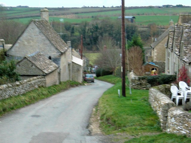
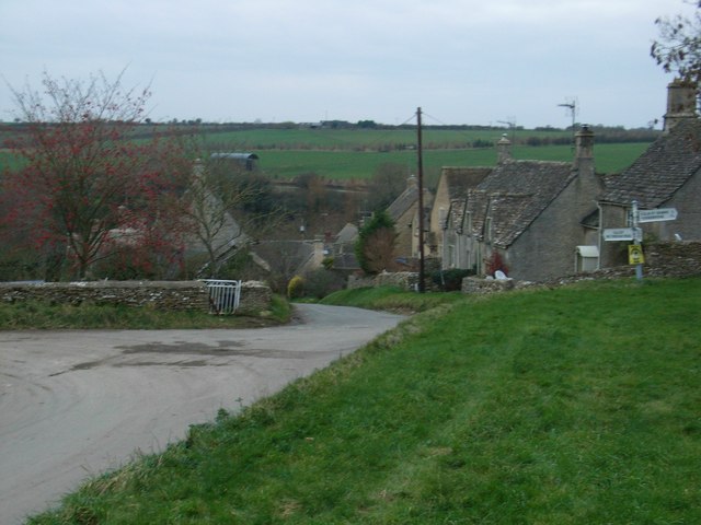
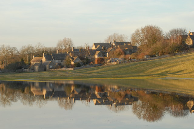
Winson is a small village situated in the county of Gloucestershire, England. It is located in the Cotswolds, a picturesque area known for its rolling hills, charming villages, and beautiful landscapes. The village is nestled in the Windrush Valley, surrounded by lush green fields and meandering streams.
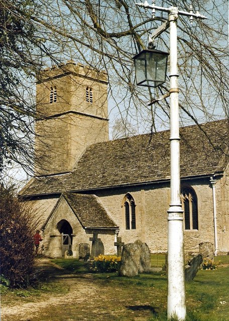
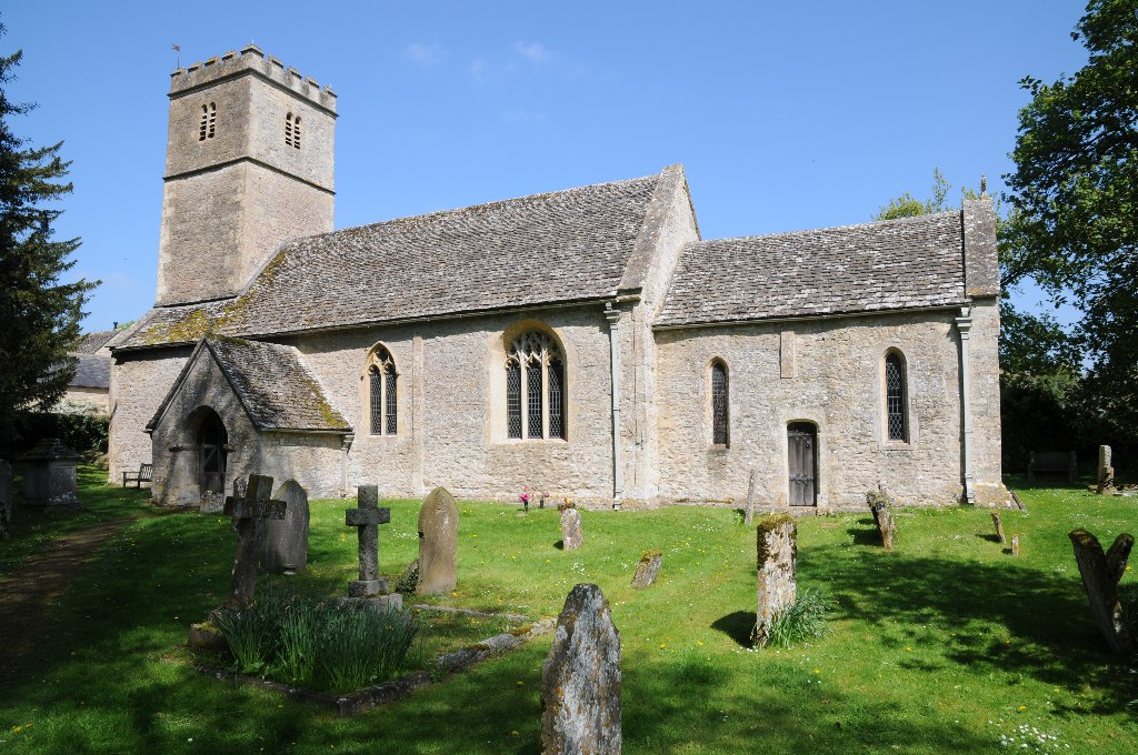
With a population of around 200 residents, Winson has a close-knit community that exudes a friendly and welcoming atmosphere. The village is characterized by traditional stone cottages, some of which date back to the 17th century, giving it a timeless and quaint feel. The local parish church, St. Michael's, is a notable landmark and has a long history, dating back to the 12th century.
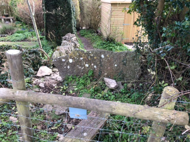
Despite its small size, Winson boasts several amenities for its residents and visitors. The village has a well-maintained playground and a village hall that serves as a hub for community events and gatherings. Additionally, there are several walking trails and footpaths that offer breathtaking views of the surrounding countryside, making it a popular destination for hikers and nature enthusiasts.
Winson's location in the Cotswolds provides easy access to other nearby attractions. The market towns of Cirencester and Tetbury are a short drive away, offering a range of shops, restaurants, and cultural events. The village also benefits from being close to the Cotswold Water Park, a renowned leisure destination with a variety of water sports, fishing lakes, and nature reserves.
Overall, Winson is a charming and idyllic village, perfect for those seeking a tranquil escape in the heart of the Cotswolds.
If you have any feedback on the listing, please let us know in the comments section below.
Winson Images
Images are sourced within 2km of 51.777437/-1.8709387 or Grid Reference SP0908. Thanks to Geograph Open Source API. All images are credited.
![A circular walk around Bibury and Ablington [12] The footpath from Arlington Corner meet the minor road at Ablington.
The walk starts at Arlington Corner and follows a footpath to Ablington, where the River Coln is crossed, and then a byway northeast to Saltway Barn. Another byway, the historic Salt Way, is then followed southeast before a right turn onto a bridleway which runs south past Hale Barn to Bibury. The River Coln is recrossed at Bibury Mill and a footpath is then followed back to the starting point. Just over 5 miles.](https://s2.geograph.org.uk/geophotos/07/48/93/7489318_31443d2d.jpg)
![A circular walk around Bibury and Ablington [13] After passing through Ablington Village, the walk now follows a restricted byway which leads northeast to Saltway Barn.
The walk starts at Arlington Corner and follows a footpath to Ablington, where the River Coln is crossed, and then a byway northeast to Saltway Barn. Another byway, the historic Salt Way, is then followed southeast before a right turn onto a bridleway which runs south past Hale Barn to Bibury. The River Coln is recrossed at Bibury Mill and a footpath is then followed back to the starting point. Just over 5 miles.](https://s2.geograph.org.uk/geophotos/07/48/93/7489326_08bc7578.jpg)
![A circular walk around Bibury and Ablington [14] The track, a restricted byway, runs along the field edge on its way to Saltway Barn.
The walk starts at Arlington Corner and follows a footpath to Ablington, where the River Coln is crossed, and then a byway northeast to Saltway Barn. Another byway, the historic Salt Way, is then followed southeast before a right turn onto a bridleway which runs south past Hale Barn to Bibury. The River Coln is recrossed at Bibury Mill and a footpath is then followed back to the starting point. Just over 5 miles.](https://s0.geograph.org.uk/geophotos/07/48/93/7489328_a152267d.jpg)
![A circular walk around Bibury and Ablington [15] The track continues northeast towards Saltway Barn. Gore Hill Covert is seen in the distance.
The walk starts at Arlington Corner and follows a footpath to Ablington, where the River Coln is crossed, and then a byway northeast to Saltway Barn. Another byway, the historic Salt Way, is then followed southeast before a right turn onto a bridleway which runs south past Hale Barn to Bibury. The River Coln is recrossed at Bibury Mill and a footpath is then followed back to the starting point. Just over 5 miles.](https://s1.geograph.org.uk/geophotos/07/48/93/7489329_d99739a6.jpg)
![A circular walk around Bibury and Ablington [16] Gore Hill Covert is seen alongside the track.
The walk starts at Arlington Corner and follows a footpath to Ablington, where the River Coln is crossed, and then a byway northeast to Saltway Barn. Another byway, the historic Salt Way, is then followed southeast before a right turn onto a bridleway which runs south past Hale Barn to Bibury. The River Coln is recrossed at Bibury Mill and a footpath is then followed back to the starting point. Just over 5 miles.](https://s3.geograph.org.uk/geophotos/07/49/06/7490635_0dfffd14.jpg)
![Ablington houses [1] Bridge House was formerly two houses, now one. Built in the mid or late 18th century with 20th century rear alterations. Constructed of limestone rubble stone with ashlar chimneys under a stone slate roof. Listed, grade II, with details at: <span class="nowrap"><a title="https://historicengland.org.uk/listing/the-list/list-entry/1341831" rel="nofollow ugc noopener" href="https://historicengland.org.uk/listing/the-list/list-entry/1341831">Link</a><img style="margin-left:2px;" alt="External link" title="External link - shift click to open in new window" src="https://s1.geograph.org.uk/img/external.png" width="10" height="10"/></span>
The hamlet of Ablington is located in Gloucestershire astride the River Coln some 6¼ miles northeast of Cirencester and about 1 mile upstream from Bibury. The name &#039;Ablington&#039; is derived from the &#039;estate called after Eadbald&#039; (personal name Ēadbald + ing + tūn) and has been recorded as Eadbaldingtun, Ablinton and Ablyngton.](https://s1.geograph.org.uk/geophotos/07/50/22/7502217_56aa5a1d.jpg)
![Ablington features [1] This late 18th century bridge of two round arches carries the road over the River Coln. Constructed of coursed limestone rubble stone with dressed copings and piers. Listed, grade II, with details at: <span class="nowrap"><a title="https://historicengland.org.uk/listing/the-list/list-entry/1088387" rel="nofollow ugc noopener" href="https://historicengland.org.uk/listing/the-list/list-entry/1088387">Link</a><img style="margin-left:2px;" alt="External link" title="External link - shift click to open in new window" src="https://s1.geograph.org.uk/img/external.png" width="10" height="10"/></span>
The hamlet of Ablington is located in Gloucestershire astride the River Coln some 6¼ miles northeast of Cirencester and about 1 mile upstream from Bibury. The name &#039;Ablington&#039; is derived from the &#039;estate called after Eadbald&#039; (personal name Ēadbald + ing + tūn) and has been recorded as Eadbaldingtun, Ablinton and Ablyngton.](https://s2.geograph.org.uk/geophotos/07/50/22/7502218_93cce947.jpg)
![Ablington features [2] Looking downstream from the bridge at <a href="https://www.geograph.org.uk/photo/7502218">SP1007 : Ablington features [1]</a> is seen this second bridge which carries a gravel driveway to Ablington Manor over the River Coln. Built in the early 19th century with two segmental arches with keystones and constructed of coursed and dressed limestone. Listed, grade II, with details at: <span class="nowrap"><a title="https://historicengland.org.uk/listing/the-list/list-entry/1088392" rel="nofollow ugc noopener" href="https://historicengland.org.uk/listing/the-list/list-entry/1088392">Link</a><img style="margin-left:2px;" alt="External link" title="External link - shift click to open in new window" src="https://s1.geograph.org.uk/img/external.png" width="10" height="10"/></span>
The hamlet of Ablington is located in Gloucestershire astride the River Coln some 6¼ miles northeast of Cirencester and about 1 mile upstream from Bibury. The name &#039;Ablington&#039; is derived from the &#039;estate called after Eadbald&#039; (personal name Ēadbald + ing + tūn) and has been recorded as Eadbaldingtun, Ablinton and Ablyngton.](https://s0.geograph.org.uk/geophotos/07/50/22/7502220_2c90699b.jpg)
![Ablington houses [2] Numbers 1 and 2 Mill Cottages are a former corn mill, now two houses. Built in the early to mid 18th century and extensively altered in the mid 20th century when converted to houses. Constructed of limestone rubble stone under a stone slate roof. The main mill block now number 2 with the wing to the north forming number 1. Listed, grade II, with details at: <span class="nowrap"><a title="https://historicengland.org.uk/listing/the-list/list-entry/1341832" rel="nofollow ugc noopener" href="https://historicengland.org.uk/listing/the-list/list-entry/1341832">Link</a><img style="margin-left:2px;" alt="External link" title="External link - shift click to open in new window" src="https://s1.geograph.org.uk/img/external.png" width="10" height="10"/></span>
The hamlet of Ablington is located in Gloucestershire astride the River Coln some 6¼ miles northeast of Cirencester and about 1 mile upstream from Bibury. The name &#039;Ablington&#039; is derived from the &#039;estate called after Eadbald&#039; (personal name Ēadbald + ing + tūn) and has been recorded as Eadbaldingtun, Ablinton and Ablyngton.](https://s2.geograph.org.uk/geophotos/07/50/22/7502230_0908c1cf.jpg)
![Ablington houses [3] Mill House, on the left, and Elm Tree Cottage are two attached houses. Mill House was built in the early 19th century, Elm Tree Cottage in the later 19th century with a late 20th century addition. Constructed of coursed limestone rubble stone under stone slate and concrete tile roofs. Listed, grade II, with details at: <span class="nowrap"><a title="https://historicengland.org.uk/listing/the-list/list-entry/1088388" rel="nofollow ugc noopener" href="https://historicengland.org.uk/listing/the-list/list-entry/1088388">Link</a><img style="margin-left:2px;" alt="External link" title="External link - shift click to open in new window" src="https://s1.geograph.org.uk/img/external.png" width="10" height="10"/></span>
The hamlet of Ablington is located in Gloucestershire astride the River Coln some 6¼ miles northeast of Cirencester and about 1 mile upstream from Bibury. The name &#039;Ablington&#039; is derived from the &#039;estate called after Eadbald&#039; (personal name Ēadbald + ing + tūn) and has been recorded as Eadbaldingtun, Ablinton and Ablyngton.](https://s1.geograph.org.uk/geophotos/07/50/22/7502241_f54b098c.jpg)

![Ablington houses [4] Beyond the gates is a glimpse of Ablington Manor, a large house dated 1590. There have been additions in the early to mid 17th century; alterations and additions circa 1780; internal alterations in the late 19th and early 20th centuries. Constructed of rendered limestone rubble stone with ashlar dressings under a stone slate roof. There is a gabled service wing to the left with a small circular domed cupola. Inside the dining room is panelled, probably early 17th century, with a Jacobean style plasterwork ceiling. Originally the house was a 3-room range with two wings added to form a courtyard which was later in-filled. The manor was the home of J. Arthur Gibbs, author of &#039;A Cotswold Village&#039;. Listed, grade I, with details at: <span class="nowrap"><a title="https://historicengland.org.uk/listing/the-list/list-entry/1341833" rel="nofollow ugc noopener" href="https://historicengland.org.uk/listing/the-list/list-entry/1341833">Link</a><img style="margin-left:2px;" alt="External link" title="External link - shift click to open in new window" src="https://s1.geograph.org.uk/img/external.png" width="10" height="10"/></span>
The boundary wall and gate piers are 18th century, restored in the early 20th century. Constructed of limestone rubble stone with ashlar piers and dressed coping. (See also <a href="https://www.geograph.org.uk/photo/7502253">SP1007 : Ablington houses [5]</a>) Listed, grade II, with details at: <span class="nowrap"><a title="https://historicengland.org.uk/listing/the-list/list-entry/1088391" rel="nofollow ugc noopener" href="https://historicengland.org.uk/listing/the-list/list-entry/1088391">Link</a><img style="margin-left:2px;" alt="External link" title="External link - shift click to open in new window" src="https://s1.geograph.org.uk/img/external.png" width="10" height="10"/></span>
The hamlet of Ablington is located in Gloucestershire astride the River Coln some 6¼ miles northeast of Cirencester and about 1 mile upstream from Bibury. The name &#039;Ablington&#039; is derived from the &#039;estate called after Eadbald&#039; (personal name Ēadbald + ing + tūn) and has been recorded as Eadbaldingtun, Ablinton and Ablyngton.](https://s0.geograph.org.uk/geophotos/07/50/22/7502252_289ac67d.jpg)
![Ablington houses [5] The boundary wall and gate piers to Ablington Manor are 18th century, restored in the early 20th century. Constructed of limestone rubble stone with ashlar piers and dressed coping. (See also <a href="https://www.geograph.org.uk/photo/7502252">SP1007 : Ablington houses [4]</a>) Listed, grade II, with details at: <span class="nowrap"><a title="https://historicengland.org.uk/listing/the-list/list-entry/1088391" rel="nofollow ugc noopener" href="https://historicengland.org.uk/listing/the-list/list-entry/1088391">Link</a><img style="margin-left:2px;" alt="External link" title="External link - shift click to open in new window" src="https://s1.geograph.org.uk/img/external.png" width="10" height="10"/></span>
The hamlet of Ablington is located in Gloucestershire astride the River Coln some 6¼ miles northeast of Cirencester and about 1 mile upstream from Bibury. The name &#039;Ablington&#039; is derived from the &#039;estate called after Eadbald&#039; (personal name Ēadbald + ing + tūn) and has been recorded as Eadbaldingtun, Ablinton and Ablyngton.](https://s1.geograph.org.uk/geophotos/07/50/22/7502253_ac1a46d1.jpg)
Winson is located at Grid Ref: SP0908 (Lat: 51.777437, Lng: -1.8709387)
Administrative County: Gloucestershire
District: Cotswold
Police Authority: Gloucestershire
What 3 Words
///response.gradually.nosedive. Near Northleach, Gloucestershire
Nearby Locations
Related Wikis


Nearby Amenities
Located within 500m of 51.777437,-1.8709387Have you been to Winson?
Leave your review of Winson below (or comments, questions and feedback).