Windydoors

Settlement in Selkirkshire

Scotland

Windydoors

Summit, Bowshank Hill
Summit, Bowshank Hill Credit: Richard Webb

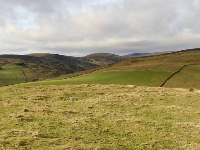
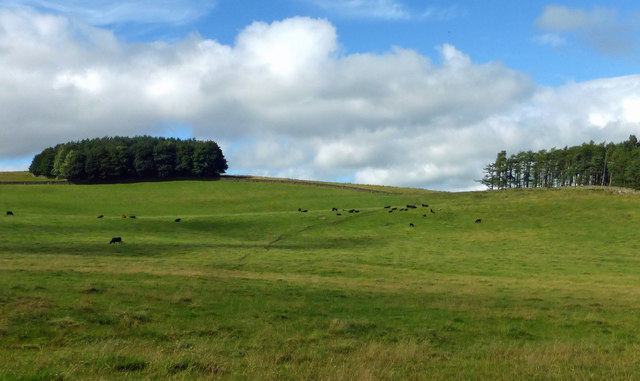
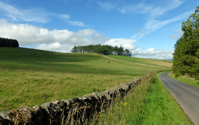
Windydoors is a small village located in Selkirkshire, a historic county in the Scottish Borders region of Scotland. Situated amidst the picturesque landscape of rolling hills and verdant valleys, Windydoors offers a tranquil and idyllic setting for residents and visitors alike.

The village is characterized by its charming rural atmosphere, with traditional stone-built houses and cottages dotting the landscape. Its population is relatively small, comprising a tight-knit community that exudes warmth and friendliness.

Windydoors benefits from its location, as it is surrounded by beautiful natural attractions. The nearby Ettrick Forest provides ample opportunities for outdoor activities such as hiking, cycling, and wildlife spotting. The renowned River Ettrick also flows through the area, offering scenic spots for fishing and leisurely walks along its banks.

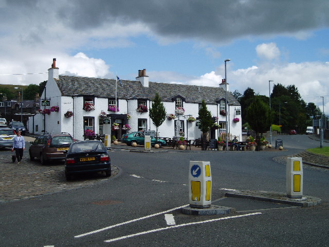
Despite its small size, Windydoors has a few amenities to cater to the needs of its residents. There is a local convenience store that provides essential supplies, and a charming village pub where locals gather to socialize and unwind. Additionally, the village is well-connected to larger towns in the region, with regular bus services and good road links.

The community in Windydoors is known for its strong sense of community spirit, with various events and gatherings organized throughout the year. These include summer fairs, community markets, and festive celebrations that bring residents together.

In summary, Windydoors is a picturesque village in Selkirkshire, Scotland, offering a serene rural lifestyle amidst stunning natural beauty. With its close-knit community and proximity to outdoor attractions, it is a perfect destination for those seeking a peaceful retreat.

If you have any feedback on the listing, please let us know in the comments section below.

Windydoors Images

Images are sourced within 2km of 55.641192/-2.90711 or Grid Reference NT4339. Thanks to Geograph Open Source API. All images are credited.

Summit, Bowshank Hill
Bowland Farmland Grazing land on the Bowland Estate with Peat Wood on the far left.
Bowland Farmland
Grazing land on the Bowland Estate with Peat Wood on the far left.
Bowland Estate Farmland A late-summer view of grazing land on the Bowland Estate.
Bowland Estate Farmland
A late-summer view of grazing land on the Bowland Estate.
The Caddon Water This tributary of the Tweed rises in the Moorfoot Hills and its waters feed the Stantling Crag Reservoir 1km downstream from here. The mast on Meigle Hill is just visible on the distant skyline to the left of Knowes Hill, and a drystane sheepfold is in the foreground.
The Caddon Water
This tributary of the Tweed rises in the Moorfoot Hills and its waters feed the Stantling Crag Reservoir 1km downstream from here. The mast on Meigle Hill is just visible on the distant skyline to the left of Knowes Hill, and a drystane sheepfold is in the foreground.
Fields by the Caddon Water Note the contrast between the improved pasture land and the ground closer to the burn. There are heaps in the fields gathered during stone-clearing operations.
Fields by the Caddon Water
Note the contrast between the improved pasture land and the ground closer to the burn. There are heaps in the fields gathered during stone-clearing operations.
Valley of the Caddon Water A view up the valley from the gate by the plantation near the Glentanner Burn.
Valley of the Caddon Water
A view up the valley from the gate by the plantation near the Glentanner Burn.
New fence, Crumside Hill Not yet mapped and it's electric.
New fence, Crumside Hill
Not yet mapped and it's electric.
Glentanner Burn Moorland with scrubby woodland in the foreground, but there is some good grazing just over a dyke (and electric fence).
Glentanner Burn
Moorland with scrubby woodland in the foreground, but there is some good grazing just over a dyke (and electric fence).
Caddon Water The glen is more wooded than the maps suggest; some birches had been recently felled for firewood.
Caddon Water
The glen is more wooded than the maps suggest; some birches had been recently felled for firewood.
Hill road passing Bowland Estate Heading for Ferniehurst Farm below Bowshank Hill.
Hill road passing Bowland Estate
Heading for Ferniehurst Farm below Bowshank Hill.
Scrubby woodland Willow scrub on the slopes of Crumside Hill.
Scrubby woodland
Willow scrub on the slopes of Crumside Hill.
Water intake Sign tells of drinking water at this intake off the Glentanner Burn.
Water intake
Sign tells of drinking water at this intake off the Glentanner Burn.
Road, Caddon Water A road down the Caddon Water towards Windy Doors.
Road, Caddon Water
A road down the Caddon Water towards Windy Doors.
Birch wood, Caddon Water There has been some cutting for firewood here. The Ordnance Survey have missed off this woodland, but this area is in need of a resurvey.
Birch wood, Caddon Water
There has been some cutting for firewood here. The Ordnance Survey have missed off this woodland, but this area is in need of a resurvey.
Glentanner burn. Just upstream of the bridge carrying the track up the Caddon Water.
Glentanner burn.
Just upstream of the bridge carrying the track up the Caddon Water.
Track near Glentanner burn. Looking down the valley of the Glentanner burn.  In the distance is the Stantling Craig Reservoir.
Track near Glentanner burn.
Looking down the valley of the Glentanner burn. In the distance is the Stantling Craig Reservoir.
Quarry, Bowshank Hill A small quarry supplying stones for farm tracks.
Quarry, Bowshank Hill
A small quarry supplying stones for farm tracks.
Gate, Bowshank Hill The square provides a mix of forestry and rough grazing for sheep.
Gate, Bowshank Hill
The square provides a mix of forestry and rough grazing for sheep.
Show me another place!

Windydoors is located at Grid Ref: NT4339 (Lat: 55.641192, Lng: -2.90711)

Unitary Authority: The Scottish Borders

Police Authority: The Lothians and Scottish Borders

What 3 Words

///reception.nicer.taxi. Near Galashiels, Scottish Borders

Related Wikis

Bowshank

Bowshank is a village in the Scottish Borders area of Scotland, close to the A7, beside the Gala Water. Nearby are Bow Castle Broch, as well as Buckholm...

Bowland railway station

Bowland railway station (Bowland Bridge between May 1849 and July 1862) was a railway station in the village of Bowland, near Galashiels, Scotland. Located...

Clovenfords railway station

Clovenfords railway station served the village of Clovenfords, Scottish Borders, Scotland from 1866 to 1962 on the Peebles Railway. == History == The station...

Clovenfords

Clovenfords is a village in the Scottish Borders area of Scotland, 1 mile (2 kilometres) north of the hamlet of Caddonfoot and 4 miles (6 kilometres) west...

Nearby Amenities

Located within 500m of 55.641192,-2.90711
The data included in this document is from www.openstreetmap.org. The data is made available under ODbL.

Have you been to Windydoors?

Leave your review of Windydoors below (or comments, questions and feedback).