Stantling Craig Reservoir

Lake, Pool, Pond, Freshwater Marsh in Selkirkshire

Scotland

Stantling Craig Reservoir

Summit, Bowshank Hill
Summit, Bowshank Hill Credit: Richard Webb

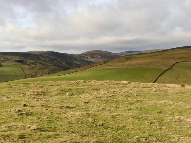
Stantling Craig Reservoir is a picturesque freshwater marsh located in Selkirkshire, Scotland. Spanning over a vast area, this natural marvel is often referred to as a lake due to its significant size. Nestled amidst the rolling hills and lush greenery, the reservoir serves as a popular recreational spot for both locals and tourists alike.

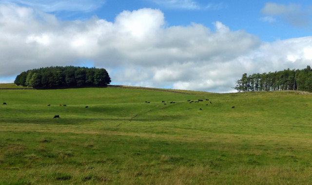
The reservoir is surrounded by a diverse range of flora and fauna, making it a haven for nature enthusiasts and birdwatchers. The tranquil waters are home to various species of fish, including brown trout, pike, and perch, providing an excellent opportunity for fishing enthusiasts to try their luck. Additionally, the reservoir attracts a wide array of water birds, such as ducks, swans, and herons, adding to the natural beauty of the area.

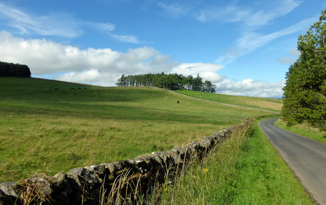
Boating and kayaking are popular activities on Stantling Craig Reservoir, offering visitors a chance to explore the calm waters and take in the stunning surroundings. The reservoir is also a great spot for picnicking, with several designated areas equipped with benches and tables. Hiking trails surround the reservoir, allowing visitors to embark on scenic walks and enjoy breathtaking views of the surrounding countryside.

Stantling Craig Reservoir is easily accessible, with ample parking available for visitors. The tranquil ambiance and stunning natural beauty make it an ideal destination for those seeking a peaceful retreat or a day of outdoor adventure. Whether it's fishing, boating, birdwatching, or simply enjoying the serenity of nature, this reservoir offers something for everyone to appreciate and enjoy.

If you have any feedback on the listing, please let us know in the comments section below.

Stantling Craig Reservoir Images

Images are sourced within 2km of 55.645013/-2.9068488 or Grid Reference NT4339. Thanks to Geograph Open Source API. All images are credited.

Summit, Bowshank Hill
Bowland Farmland Grazing land on the Bowland Estate with Peat Wood on the far left.
Bowland Farmland
Grazing land on the Bowland Estate with Peat Wood on the far left.
Bowland Estate Farmland A late-summer view of grazing land on the Bowland Estate.
Bowland Estate Farmland
A late-summer view of grazing land on the Bowland Estate.
The Caddon Water This tributary of the Tweed rises in the Moorfoot Hills and its waters feed the Stantling Crag Reservoir 1km downstream from here. The mast on Meigle Hill is just visible on the distant skyline to the left of Knowes Hill, and a drystane sheepfold is in the foreground.
The Caddon Water
This tributary of the Tweed rises in the Moorfoot Hills and its waters feed the Stantling Crag Reservoir 1km downstream from here. The mast on Meigle Hill is just visible on the distant skyline to the left of Knowes Hill, and a drystane sheepfold is in the foreground.
Fields by the Caddon Water Note the contrast between the improved pasture land and the ground closer to the burn. There are heaps in the fields gathered during stone-clearing operations.
Fields by the Caddon Water
Note the contrast between the improved pasture land and the ground closer to the burn. There are heaps in the fields gathered during stone-clearing operations.
Valley of the Caddon Water A view up the valley from the gate by the plantation near the Glentanner Burn.
Valley of the Caddon Water
A view up the valley from the gate by the plantation near the Glentanner Burn.
An oddity in Burial Ground Wood, Bowland This 9m diameter filled-in circular drystone wall is located on a mound at the southwest edge of Burial Ground Wood on the Bowland Estate. It may have some association with the nearby Rutherford Pyramid <a href="https://www.geograph.org.uk/photo/3247539">NT4440 : The Rutherford Pyramid on the Bowland Estate</a>.
An oddity in Burial Ground Wood, Bowland
This 9m diameter filled-in circular drystone wall is located on a mound at the southwest edge of Burial Ground Wood on the Bowland Estate. It may have some association with the nearby Rutherford Pyramid NT4440 : The Rutherford Pyramid on the Bowland Estate.
The Rutherford Pyramid on the Bowland Estate This 3.1m high monument is situated in Burial Ground Wood to the northeast of Bowland House. A granite stone is inscribed:-

HERE REST
TWO GENERATIONS OF
RUTHERFORDS
LAIRDS OF BOWLAND
1697 – 1752
W.R. 1912
The Rutherford Pyramid on the Bowland Estate
This 3.1m high monument is situated in Burial Ground Wood to the northeast of Bowland House. A granite stone is inscribed:- HERE REST TWO GENERATIONS OF RUTHERFORDS LAIRDS OF BOWLAND 1697 – 1752 W.R. 1912
Burial Ground Wood on the Bowland Estate For a closer view of the circular stone structure at the top of the mound, see <a href="https://www.geograph.org.uk/photo/3247534">NT4440 : An oddity in Burial Ground Wood, Bowland</a>.
Burial Ground Wood on the Bowland Estate
For a closer view of the circular stone structure at the top of the mound, see NT4440 : An oddity in Burial Ground Wood, Bowland.
New fence, Crumside Hill Not yet mapped and it's electric.
New fence, Crumside Hill
Not yet mapped and it's electric.
Glentanner Burn Moorland with scrubby woodland in the foreground, but there is some good grazing just over a dyke (and electric fence).
Glentanner Burn
Moorland with scrubby woodland in the foreground, but there is some good grazing just over a dyke (and electric fence).
Caddon Water The glen is more wooded than the maps suggest; some birches had been recently felled for firewood.
Caddon Water
The glen is more wooded than the maps suggest; some birches had been recently felled for firewood.
Interesting structures on the hillside There are several of these structures. I'm not sure what they were for. Storage? There are several ruined houses and sheep stells nearby. They are close to the cairn shown on the OS map at this location.
Interesting structures on the hillside
There are several of these structures. I'm not sure what they were for. Storage? There are several ruined houses and sheep stells nearby. They are close to the cairn shown on the OS map at this location.
Hill road passing Bowland Estate Heading for Ferniehurst Farm below Bowshank Hill.
Hill road passing Bowland Estate
Heading for Ferniehurst Farm below Bowshank Hill.
Scrubby woodland Willow scrub on the slopes of Crumside Hill.
Scrubby woodland
Willow scrub on the slopes of Crumside Hill.
Water intake Sign tells of drinking water at this intake off the Glentanner Burn.
Water intake
Sign tells of drinking water at this intake off the Glentanner Burn.
Road, Caddon Water A road down the Caddon Water towards Windy Doors.
Road, Caddon Water
A road down the Caddon Water towards Windy Doors.
Birch wood, Caddon Water There has been some cutting for firewood here. The Ordnance Survey have missed off this woodland, but this area is in need of a resurvey.
Birch wood, Caddon Water
There has been some cutting for firewood here. The Ordnance Survey have missed off this woodland, but this area is in need of a resurvey.
Show me another place!

Stantling Craig Reservoir is located at Grid Ref: NT4339 (Lat: 55.645013, Lng: -2.9068488)

Unitary Authority: The Scottish Borders

Police Authority: The Lothians and Scottish Borders

What 3 Words

///snuggle.billiard.duties. Near Galashiels, Scottish Borders

Related Wikis

Bowshank

Bowshank is a village in the Scottish Borders area of Scotland, close to the A7, beside the Gala Water. Nearby are Bow Castle Broch, as well as Buckholm...

Bowland railway station

Bowland railway station (Bowland Bridge between May 1849 and July 1862) was a railway station in the village of Bowland, near Galashiels, Scotland. Located...

Clovenfords railway station

Clovenfords railway station served the village of Clovenfords, Scottish Borders, Scotland from 1866 to 1962 on the Peebles Railway. == History == The station...

Clovenfords

Clovenfords is a village in the Scottish Borders area of Scotland, 1 mile (2 kilometres) north of the hamlet of Caddonfoot and 4 miles (6 kilometres) west...

Torwoodlee Broch

Torwoodlee Broch is the remains of an iron-age broch located near the town of Galashiels in the Scottish Borders. == Description == Torwoodlee Broch...

Thornielee railway station

Thornielee railway station served the smallholding of Thornielee, Scottish Borders, Scotland from 1866 to 1950 on the Peebles Railway. == History == The...

Bow Castle Broch

Bow Castle is the remains of an iron-age broch near the Gala Water, in the Scottish Borders area of Scotland, in the parish of Stow. It is a scheduled...

Angling Club Cottage Platform railway station

Angling Club Cottage Platform served the Edinburgh Angling Club in Selkirk, Scottish Borders, Scotland from 1898 to the late 1940s. == History == The station...

Nearby Amenities

Located within 500m of 55.645013,-2.9068488
Barrier: cattle_grid
Lat/Long: 55.6492403/-2.9069015
Power: pole
Lat/Long: 55.6491618/-2.9042091
Power: pole
Lat/Long: 55.6489435/-2.9044687
Power: pole
Lat/Long: 55.6488373/-2.9051126
Power: pole
Lat/Long: 55.6490397/-2.9057616
Power: pole
Lat/Long: 55.649337/-2.9066091
The data included in this document is from www.openstreetmap.org. The data is made available under ODbL.

Have you been to Stantling Craig Reservoir?

Leave your review of Stantling Craig Reservoir below (or comments, questions and feedback).