Windhill

Settlement in Yorkshire

England

Windhill

View down Victoria Road, Saltaire Saltaire is a Victorian model village on the outskirts of Bradford, by the River Aire and the Leeds and Liverpool Canal The village takes its name from Titus Salt, a Victorian textile magnate and philanthropist who built a mill and a village to house his workers.

In December 2001, Saltaire was designated a World Heritage Site by UNESCO (<span class="nowrap"><a title="http://www.saltairevillage.info/acrobat/Saltaire_Streetplan_Nemine_Juvante_Publications.pdf" rel="nofollow ugc noopener" href="http://www.saltairevillage.info/acrobat/Saltaire_Streetplan_Nemine_Juvante_Publications.pdf">Link</a><img style="margin-left:2px;" alt="External link" title="External link - shift click to open in new window" src="https://s1.geograph.org.uk/img/external.png" width="10" height="10"/></span>  for a site plan of Saltaire showing the overall layout and the boundaries of the UNESCO World Heritage Site). The vast majority of buildings in the village have been individually designated as listed buildings by English Heritage.
View down Victoria Road, Saltaire Credit: David Martin

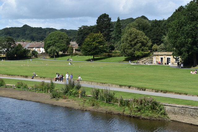
Windhill is a small village located in the county of Yorkshire in Northern England. Situated about 3 miles northwest of the city of Bradford, it falls within the metropolitan borough of Bradford. The village is nestled within the hilly landscape of Aireborough, offering picturesque views of the surrounding countryside.

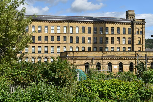
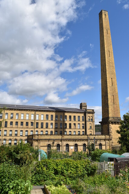
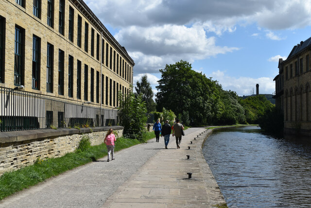
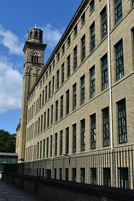
Historically, Windhill was an agricultural community, with farming being the primary occupation of its residents. However, with the advent of the Industrial Revolution, the village transformed into a textile manufacturing center. Mills and factories were built, and the village experienced rapid growth during the 19th century.

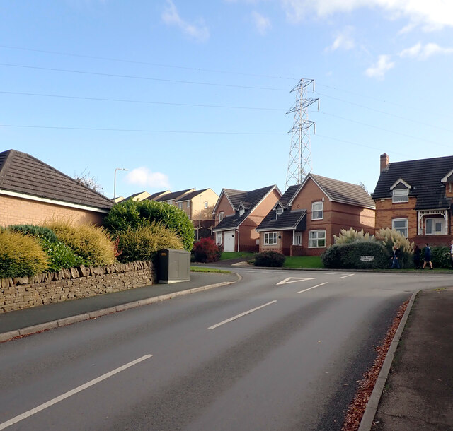
Today, Windhill is a residential area with a mix of old and new housing developments. The village retains some of its historical charm, with remnants of its industrial past still visible, such as converted mill buildings. The local amenities include a primary school, a few shops, and a pub, catering to the needs of its residents.

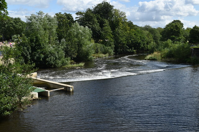
The village is well-connected to nearby towns and cities through a network of roads and public transport. Additionally, Windhill benefits from its proximity to natural attractions, such as the nearby Shipley Glen, which offers stunning walking trails and panoramic views of the Aire Valley.

Overall, Windhill provides a peaceful and scenic environment for its residents, combining a rich industrial heritage with modern-day conveniences.

If you have any feedback on the listing, please let us know in the comments section below.
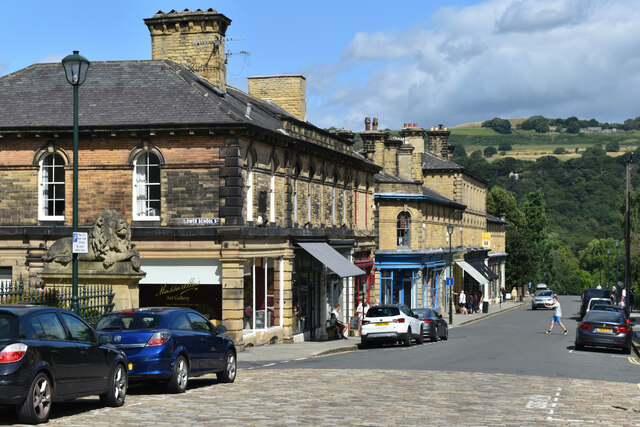
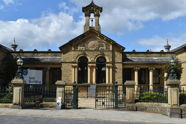
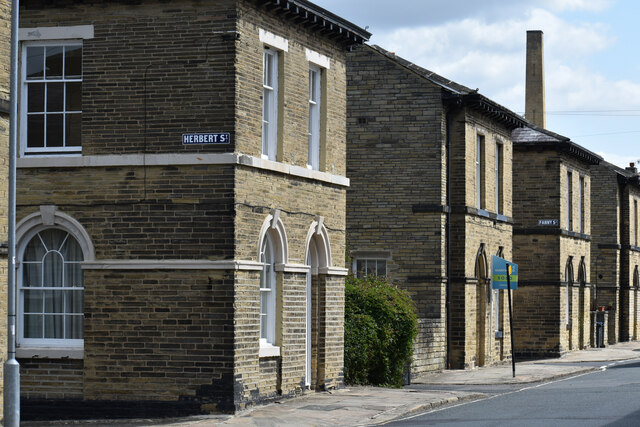
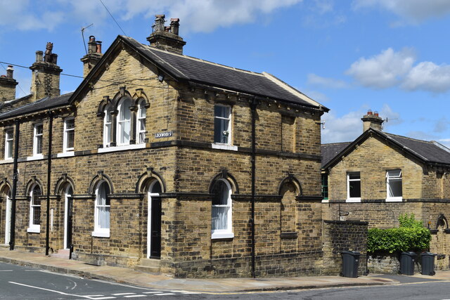
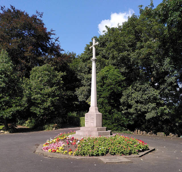
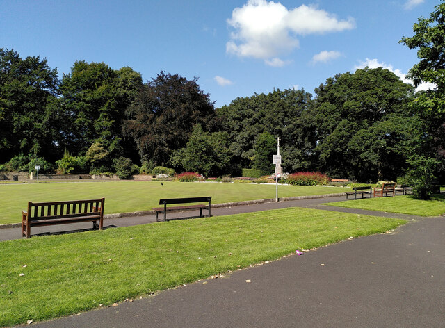
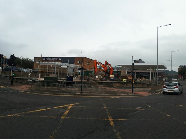
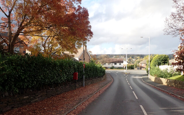
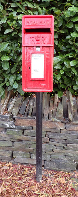
Windhill Images

Images are sourced within 2km of 53.830086/-1.7700264 or Grid Reference SE1537. Thanks to Geograph Open Source API. All images are credited.

View down Victoria Road, Saltaire Saltaire is a Victorian model village on the outskirts of Bradford, by the River Aire and the Leeds and Liverpool Canal The village takes its name from Titus Salt, a Victorian textile magnate and philanthropist who built a mill and a village to house his workers.

In December 2001, Saltaire was designated a World Heritage Site by UNESCO (<span class="nowrap"><a title="http://www.saltairevillage.info/acrobat/Saltaire_Streetplan_Nemine_Juvante_Publications.pdf" rel="nofollow ugc noopener" href="http://www.saltairevillage.info/acrobat/Saltaire_Streetplan_Nemine_Juvante_Publications.pdf">Link</a><img style="margin-left:2px;" alt="External link" title="External link - shift click to open in new window" src="https://s1.geograph.org.uk/img/external.png" width="10" height="10"/></span>  for a site plan of Saltaire showing the overall layout and the boundaries of the UNESCO World Heritage Site). The vast majority of buildings in the village have been individually designated as listed buildings by English Heritage.
View down Victoria Road, Saltaire
Saltaire is a Victorian model village on the outskirts of Bradford, by the River Aire and the Leeds and Liverpool Canal The village takes its name from Titus Salt, a Victorian textile magnate and philanthropist who built a mill and a village to house his workers. In December 2001, Saltaire was designated a World Heritage Site by UNESCO (LinkExternal link for a site plan of Saltaire showing the overall layout and the boundaries of the UNESCO World Heritage Site). The vast majority of buildings in the village have been individually designated as listed buildings by English Heritage.
The Salt Building, Saltaire Originally the site of the factory school, and now a part of Shipley College.
The Salt Building, Saltaire
Originally the site of the factory school, and now a part of Shipley College.
Houses in Caroline Street, Saltaire Saltaire is a Victorian model village on the outskirts of Bradford, by the River Aire and the Leeds and Liverpool Canal The village takes its name from Titus Salt, a Victorian textile magnate and philanthropist who built a mill and a village to house his workers.

In December 2001, Saltaire was designated a World Heritage Site by UNESCO (<span class="nowrap"><a title="http://www.saltairevillage.info/acrobat/Saltaire_Streetplan_Nemine_Juvante_Publications.pdf" rel="nofollow ugc noopener" href="http://www.saltairevillage.info/acrobat/Saltaire_Streetplan_Nemine_Juvante_Publications.pdf">Link</a><img style="margin-left:2px;" alt="External link" title="External link - shift click to open in new window" src="https://s1.geograph.org.uk/img/external.png" width="10" height="10"/></span>  for a site plan of Saltaire showing the overall layout and the boundaries of the UNESCO World Heritage Site). The vast majority of buildings in the village have been individually designated as listed buildings by English Heritage.
Houses in Caroline Street, Saltaire
Saltaire is a Victorian model village on the outskirts of Bradford, by the River Aire and the Leeds and Liverpool Canal The village takes its name from Titus Salt, a Victorian textile magnate and philanthropist who built a mill and a village to house his workers. In December 2001, Saltaire was designated a World Heritage Site by UNESCO (LinkExternal link for a site plan of Saltaire showing the overall layout and the boundaries of the UNESCO World Heritage Site). The vast majority of buildings in the village have been individually designated as listed buildings by English Heritage.
House on the corner of Lockwood Street, Saltaire Saltaire is a Victorian model village on the outskirts of Bradford, by the River Aire and the Leeds and Liverpool Canal The village takes its name from Titus Salt, a Victorian textile magnate and philanthropist who built a mill and a village to house his workers.

In December 2001, Saltaire was designated a World Heritage Site by UNESCO (<span class="nowrap"><a title="http://www.saltairevillage.info/acrobat/Saltaire_Streetplan_Nemine_Juvante_Publications.pdf" rel="nofollow ugc noopener" href="http://www.saltairevillage.info/acrobat/Saltaire_Streetplan_Nemine_Juvante_Publications.pdf">Link</a><img style="margin-left:2px;" alt="External link" title="External link - shift click to open in new window" src="https://s1.geograph.org.uk/img/external.png" width="10" height="10"/></span>  for a site plan of Saltaire showing the overall layout and the boundaries of the UNESCO World Heritage Site). The vast majority of buildings in the village have been individually designated as listed buildings by English Heritage.
House on the corner of Lockwood Street, Saltaire
Saltaire is a Victorian model village on the outskirts of Bradford, by the River Aire and the Leeds and Liverpool Canal The village takes its name from Titus Salt, a Victorian textile magnate and philanthropist who built a mill and a village to house his workers. In December 2001, Saltaire was designated a World Heritage Site by UNESCO (LinkExternal link for a site plan of Saltaire showing the overall layout and the boundaries of the UNESCO World Heritage Site). The vast majority of buildings in the village have been individually designated as listed buildings by English Heritage.
Salt's Mill seen across allotments from Caroline Street The shadow of the mill chimney can be seen on the further building.
Salt's Mill seen across allotments from Caroline Street
The shadow of the mill chimney can be seen on the further building.
Salt's Mill and chimney seen across allotments from Caroline Street Saltaire is a Victorian model village on the outskirts of Bradford, by the River Aire and the Leeds and Liverpool Canal The village takes its name from Titus Salt, a Victorian textile magnate and philanthropist who built a mill and a village to house his workers.

In December 2001, Saltaire was designated a World Heritage Site by UNESCO (<span class="nowrap"><a title="http://www.saltairevillage.info/acrobat/Saltaire_Streetplan_Nemine_Juvante_Publications.pdf" rel="nofollow ugc noopener" href="http://www.saltairevillage.info/acrobat/Saltaire_Streetplan_Nemine_Juvante_Publications.pdf">Link</a><img style="margin-left:2px;" alt="External link" title="External link - shift click to open in new window" src="https://s1.geograph.org.uk/img/external.png" width="10" height="10"/></span>  for a site plan of Saltaire showing the overall layout and the boundaries of the UNESCO World Heritage Site). The vast majority of buildings in the village have been individually designated as listed buildings by English Heritage.
Salt's Mill and chimney seen across allotments from Caroline Street
Saltaire is a Victorian model village on the outskirts of Bradford, by the River Aire and the Leeds and Liverpool Canal The village takes its name from Titus Salt, a Victorian textile magnate and philanthropist who built a mill and a village to house his workers. In December 2001, Saltaire was designated a World Heritage Site by UNESCO (LinkExternal link for a site plan of Saltaire showing the overall layout and the boundaries of the UNESCO World Heritage Site). The vast majority of buildings in the village have been individually designated as listed buildings by English Heritage.
Roberts Park, beside the River Aire at Saltaire
Saltaire United Reformed Church Saltaire is a Victorian model village on the outskirts of Bradford, by the River Aire and the Leeds and Liverpool Canal The village takes its name from Titus Salt, a Victorian textile magnate and philanthropist who built a mill and a village to house his workers.

In December 2001, Saltaire was designated a World Heritage Site by UNESCO (<span class="nowrap"><a title="http://www.saltairevillage.info/acrobat/Saltaire_Streetplan_Nemine_Juvante_Publications.pdf" rel="nofollow ugc noopener" href="http://www.saltairevillage.info/acrobat/Saltaire_Streetplan_Nemine_Juvante_Publications.pdf">Link</a><img style="margin-left:2px;" alt="External link" title="External link - shift click to open in new window" src="https://s1.geograph.org.uk/img/external.png" width="10" height="10"/></span>  for a site plan of Saltaire showing the overall layout and the boundaries of the UNESCO World Heritage Site). The vast majority of buildings in the village have been individually designated as listed buildings by English Heritage.
Saltaire United Reformed Church
Saltaire is a Victorian model village on the outskirts of Bradford, by the River Aire and the Leeds and Liverpool Canal The village takes its name from Titus Salt, a Victorian textile magnate and philanthropist who built a mill and a village to house his workers. In December 2001, Saltaire was designated a World Heritage Site by UNESCO (LinkExternal link for a site plan of Saltaire showing the overall layout and the boundaries of the UNESCO World Heritage Site). The vast majority of buildings in the village have been individually designated as listed buildings by English Heritage.
Weir on the River Aire at Saltaire
Leeds and Liverpool Canal towpath beside the New Mill, Saltaire Saltaire is a Victorian model village on the outskirts of Bradford, by the River Aire and the Leeds and Liverpool Canal The village takes its name from Titus Salt, a Victorian textile magnate and philanthropist who built a mill and a village to house his workers.

In December 2001, Saltaire was designated a World Heritage Site by UNESCO (<span class="nowrap"><a title="http://www.saltairevillage.info/acrobat/Saltaire_Streetplan_Nemine_Juvante_Publications.pdf" rel="nofollow ugc noopener" href="http://www.saltairevillage.info/acrobat/Saltaire_Streetplan_Nemine_Juvante_Publications.pdf">Link</a><img style="margin-left:2px;" alt="External link" title="External link - shift click to open in new window" src="https://s1.geograph.org.uk/img/external.png" width="10" height="10"/></span>  for a site plan of Saltaire showing the overall layout and the boundaries of the UNESCO World Heritage Site). The vast majority of buildings in the village have been individually designated as listed buildings by English Heritage.
Leeds and Liverpool Canal towpath beside the New Mill, Saltaire
Saltaire is a Victorian model village on the outskirts of Bradford, by the River Aire and the Leeds and Liverpool Canal The village takes its name from Titus Salt, a Victorian textile magnate and philanthropist who built a mill and a village to house his workers. In December 2001, Saltaire was designated a World Heritage Site by UNESCO (LinkExternal link for a site plan of Saltaire showing the overall layout and the boundaries of the UNESCO World Heritage Site). The vast majority of buildings in the village have been individually designated as listed buildings by English Heritage.
The New Mill, Saltaire Saltaire is a Victorian model village on the outskirts of Bradford, by the River Aire and the Leeds and Liverpool Canal The village takes its name from Titus Salt, a Victorian textile magnate and philanthropist who built a mill and a village to house his workers.

In December 2001, Saltaire was designated a World Heritage Site by UNESCO (<span class="nowrap"><a title="http://www.saltairevillage.info/acrobat/Saltaire_Streetplan_Nemine_Juvante_Publications.pdf" rel="nofollow ugc noopener" href="http://www.saltairevillage.info/acrobat/Saltaire_Streetplan_Nemine_Juvante_Publications.pdf">Link</a><img style="margin-left:2px;" alt="External link" title="External link - shift click to open in new window" src="https://s1.geograph.org.uk/img/external.png" width="10" height="10"/></span>  for a site plan of Saltaire showing the overall layout and the boundaries of the UNESCO World Heritage Site). The vast majority of buildings in the village have been individually designated as listed buildings by English Heritage.
The New Mill, Saltaire
Saltaire is a Victorian model village on the outskirts of Bradford, by the River Aire and the Leeds and Liverpool Canal The village takes its name from Titus Salt, a Victorian textile magnate and philanthropist who built a mill and a village to house his workers. In December 2001, Saltaire was designated a World Heritage Site by UNESCO (LinkExternal link for a site plan of Saltaire showing the overall layout and the boundaries of the UNESCO World Heritage Site). The vast majority of buildings in the village have been individually designated as listed buildings by English Heritage.
Construction, Otley Road (A6038), Shipley
War memorial, Crowgill Park, Shipley
Crowgill Park, Shipley Part of the bowling green and the war memorial can be seen.
Crowgill Park, Shipley
Part of the bowling green and the war memorial can be seen.
Construction site on Otley Road This was snapped from a passing bus, but it seems another contributor took a clearer photo from a different angle the week before <a href="https://www.geograph.org.uk/photo/6946197">SE1437 : Construction, Otley Road (A6038), Shipley</a> as well as the demolition of the previous buildings at the start of the year <a href="https://www.geograph.org.uk/photo/6742695">SE1437 : Demolition site, Otley Road (A6038), Shipley</a>. 
 It looks like a new filling station being built, judging by the canopy.
Construction site on Otley Road
This was snapped from a passing bus, but it seems another contributor took a clearer photo from a different angle the week before SE1437 : Construction, Otley Road (A6038), Shipley as well as the demolition of the previous buildings at the start of the year SE1437 : Demolition site, Otley Road (A6038), Shipley. It looks like a new filling station being built, judging by the canopy.
Cote Farm Lane, Thackley, Bradford A close-up of the post box can be seen in <a href="https://www.geograph.org.uk/photo/7002171">SE1638 : Post box, Cote Farm Lane, Thackley, Bradford</a>.
Cote Farm Lane, Thackley, Bradford
A close-up of the post box can be seen in SE1638 : Post box, Cote Farm Lane, Thackley, Bradford.
Post box, Cote Farm Lane, Thackley, Bradford This post box can be seen in context in <a href="https://www.geograph.org.uk/photo/7002169">SE1638 : Cote Farm Lane, Thackley, Bradford</a>
Post box, Cote Farm Lane, Thackley, Bradford
This post box can be seen in context in SE1638 : Cote Farm Lane, Thackley, Bradford
Cote Farm Lane, Thackley, Bradford
Show me another place!

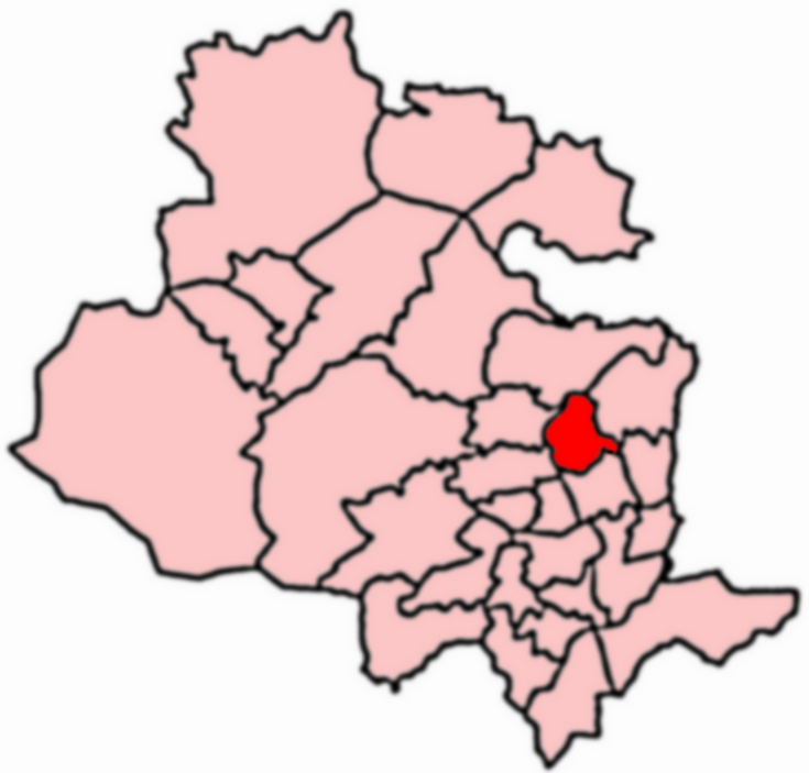
Windhill is located at Grid Ref: SE1537 (Lat: 53.830086, Lng: -1.7700264)

Division: West Riding

Unitary Authority: Bradford

Police Authority: West Yorkshire

What 3 Words

///reds.scouts.verse. Near Shipley, West Yorkshire

Related Wikis

Shipley railway station

Shipley railway station serves the market town of Shipley in West Yorkshire, England. It is 2+3⁄4 miles (4.4 km) north of Bradford Forster Square and 10...

Shipley and Windhill railway station

Shipley and Windhill railway station was a railway station in Shipley, West Yorkshire, England between 1875 and 1931. During the 1860s, two small railway...

Shipley, West Yorkshire

Shipley is a historic market town and civil parish in the City of Bradford, West Yorkshire, England, by the River Aire and the Leeds and Liverpool Canal...

Windhill and Wrose

Windhill and Wrose (population 14,541 - 2001 UK census) is a ward within the City of Bradford Metropolitan District Council in the county of West Yorkshire...

Nearby Amenities

Located within 500m of 53.830086,-1.7700264
Traffic Signals
Lat/Long: 53.8301396/-1.7769513
Shipley
Public Transport: stop_position
Railway: stop
Train: yes
Lat/Long: 53.8334026/-1.7739775
Shipley
Public Transport: stop_position
Railway: stop
Train: yes
Lat/Long: 53.8330248/-1.7730893
Traffic Signals
Source: survey
Lat/Long: 53.8342096/-1.768109
Traffic Signals
Source: survey
Lat/Long: 53.8340703/-1.768004
Pub
The New Inn
Addr City: Shipley
Addr Housenumber: 23
Addr Postcode: BD18 2JR
Addr Street: Crag Road
Addr Village: Windhill
Fhrs Id: 327468
Source: survey
Lat/Long: 53.8332969/-1.7692709
Traffic Signals
Lat/Long: 53.8298059/-1.7764833
Barrier: stile
Source: survey
Lat/Long: 53.8315366/-1.7642112
Source: landsat
Lat/Long: 53.8292826/-1.7650299
Source: landsat
Lat/Long: 53.8301225/-1.764589
Source: landsat
Lat/Long: 53.8307423/-1.7639586
Source: landsat
Lat/Long: 53.8313901/-1.7630277
Source: landsat
Lat/Long: 53.8291123/-1.7647647
Source: landsat
Lat/Long: 53.8298431/-1.7643268
Source: landsat
Lat/Long: 53.8305538/-1.7637487
Source: landsat
Lat/Long: 53.8308919/-1.7626502
Source: landsat
Lat/Long: 53.829097/-1.7639586
Source: landsat
Lat/Long: 53.8290512/-1.7633089
Source: landsat
Lat/Long: 53.8303873/-1.7632514
Source: landsat
Lat/Long: 53.8295624/-1.7655262
Source: landsat
Lat/Long: 53.8301055/-1.7653679
Source: landsat
Lat/Long: 53.8302639/-1.7652906
Source: landsat
Lat/Long: 53.8314713/-1.7649136
Source: landsat
Lat/Long: 53.8319988/-1.7641266
Source: landsat
Lat/Long: 53.8300023/-1.7628067
Source: landsat
Lat/Long: 53.8296124/-1.7631299
Post Box
Operator: Royal Mail
Post Box Type: lamp
Royal Cypher: EIIR
Royal Cypher Wikidata: Q33102113
Source: survey
Lat/Long: 53.8284954/-1.7683316
Telephone
Booth: KX100
Covered: booth
Payment Coins: yes
Source: survey
Lat/Long: 53.829079/-1.7687127
Bus Stop
450 26408
Bus: yes
Public Transport: platform
Source: survey
Lat/Long: 53.8317429/-1.7700067
Bus Stop
450 17104
Bus: yes
Public Transport: platform
Source: survey
Lat/Long: 53.8320195/-1.7700399
Bus Stop
Crag Road Carr Road
Bus: yes
Local Ref: 45017119
Naptan AtcoCode: 450017119
Naptan Bearing: NE
Naptan CommonName: Crag Road Carr Road
Naptan Crossing: Carr Road
Naptan Indicator: Stop 45017119
Naptan Landmark: Public Library
Naptan PlusbusZoneRef: LEEDS
Naptan ShortCommonName: Carr Road
Naptan Street: Crag Road
Public Transport: platform
Shelter: yes
Source: naptan_import;survey
Lat/Long: 53.8339644/-1.7685072
Speed Camera
Source: survey
Lat/Long: 53.8342612/-1.7705987
Bus Stop
Crag Road Carr Lane
Bus: yes
Local Ref: 45017120
Naptan AtcoCode: 450017120
Naptan Bearing: SW
Naptan CommonName: Crag Road Carr Lane
Naptan Crossing: Carr Lane
Naptan Indicator: Stop 45017120
Naptan Landmark: Public Library
Naptan PlusbusZoneRef: LEEDS
Naptan ShortCommonName: Carr Road
Naptan Street: Crag Road
Public Transport: platform
Source: naptan_import;survey
Lat/Long: 53.8338576/-1.7683997
Post Box
Operator: Royal Mail
Operator Wikidata: Q638098
Post Box Type: pillar
Royal Cypher: GVIR
Royal Cypher Wikidata: Q33102169
Source: survey
Lat/Long: 53.833754/-1.7678288
Turning Circle
Lat/Long: 53.8286321/-1.7662198
Turning Circle
Lat/Long: 53.8285787/-1.7657537
Turning Circle
Lat/Long: 53.8268143/-1.7651239
Barrier: entrance
Foot: yes
Lat/Long: 53.8328465/-1.7731548
Barrier: entrance
Foot: yes
Lat/Long: 53.8328705/-1.7734998
Turning Circle
Lat/Long: 53.8303594/-1.7669222
Turning Circle
Lat/Long: 53.8284452/-1.7670808
Turning Circle
Lat/Long: 53.8279754/-1.7667872
Turning Circle
Lat/Long: 53.8293139/-1.7667973
Turning Circle
Lat/Long: 53.8305187/-1.7694651
Turning Circle
Lat/Long: 53.8306648/-1.7714116
Turning Circle
Lat/Long: 53.8310765/-1.7711078
Traffic Signals
Crossing: traffic_signals
Crossing Ref: pelican
Kerb: flush
Tactile Paving: yes
Lat/Long: 53.8316288/-1.7757118
Barrier: entrance
Foot: yes
Lat/Long: 53.83294/-1.7739281
Turning Circle
Source: Bing
Lat/Long: 53.8332969/-1.7734163
Bus Stop
Owlet Road Hollin Road
Bus: yes
Local Ref: 45016699
Naptan AtcoCode: 450016699
Naptan Bearing: SE
Naptan CommonName: Owlet Road Hollin Road
Naptan Crossing: Hollin Road
Naptan Indicator: Stop 45016699
Naptan Landmark: Owlet Social Club
Naptan PlusbusZoneRef: LEEDS
Naptan ShortCommonName: Hollin Road
Naptan Street: Owlet Road
Naptan Verified: no
Public Transport: platform
Source: naptan_import
Lat/Long: 53.8271994/-1.7672162
Bus Stop
Owlet Road Hollin Road
Bus: yes
Local Ref: 45016700
Naptan AtcoCode: 450016700
Naptan Bearing: NW
Naptan CommonName: Owlet Road Hollin Road
Naptan Crossing: Hollin Road
Naptan Indicator: Stop 45016700
Naptan Landmark: Hollin Croft
Naptan Notes: S4 Trueform conversion site & 3P ttc was S4 & size 2
Naptan PlusbusZoneRef: LEEDS
Naptan ShortCommonName: Hollin Road
Naptan Street: Owlet Road
Naptan Verified: no
Public Transport: platform
Source: naptan_import
Lat/Long: 53.8273257/-1.7674434
Bus Stop
Owlet Road Pratt Lane
Bus: yes
Local Ref: 45017101
Naptan AtcoCode: 450017101
Naptan Bearing: N
Naptan CommonName: Owlet Road Pratt Lane
Naptan Crossing: Pratt Lane
Naptan Indicator: Stop 45017101
Naptan Notes: S4 Trueform conversion site & 3P ttc was S4 & size 2
Naptan PlusbusZoneRef: LEEDS
Naptan ShortCommonName: Pratt Lane
Naptan Street: Owlet Road
Naptan Verified: no
Public Transport: platform
Source: naptan_import
Lat/Long: 53.8287927/-1.7684381
Bus Stop
Owlet Road Prospect Avenue
Local Ref: 45017102
Naptan AtcoCode: 450017102
Naptan Bearing: SE
Naptan CommonName: Owlet Road Prospect Avenue
Naptan Crossing: Prospect Avenue
Naptan Indicator: Stop 45017102
Naptan Notes: S4 Trueform Conversion Site & 3P was S4 & size 2
Naptan PlusbusZoneRef: LEEDS
Naptan ShortCommonName: Prospect Avenue
Naptan Street: Owlet Road
Naptan Verified: no
Source: naptan_import
Lat/Long: 53.8303511/-1.7702072
Bus Stop
Owlet Road Shipley
Local Ref: 45017103
Naptan AtcoCode: 450017103
Naptan Bearing: N
Naptan CommonName: Owlet Road Shipley
Naptan Crossing: Nr-Opp Prospect Avenue
Naptan Indicator: Stop 45017103
Naptan PlusbusZoneRef: LEEDS
Naptan ShortCommonName: Prospect Avenue
Naptan Street: Owlet Road
Naptan Verified: no
Source: naptan_import
Lat/Long: 53.8306574/-1.7706005
Bus Stop
Owlet Road Shipley
Bus: yes
Local Ref: 45017104
Naptan AtcoCode: 450017104
Naptan Bearing: N
Naptan CommonName: Owlet Road Shipley
Naptan Crossing: Adj Prospect Avenue
Naptan Indicator: Stop 45017104
Naptan PlusbusZoneRef: LEEDS
Naptan ShortCommonName: Cemetery
Naptan Street: Owlet Road
Naptan Verified: no
Public Transport: platform
Source: naptan_import
Lat/Long: 53.8315646/-1.7702613
Bus Stop
Carr Lane Hall Lane
Bus: yes
Local Ref: 45017105
Naptan AtcoCode: 450017105
Naptan Bearing: NW
Naptan CommonName: Carr Lane Hall Lane
Naptan Crossing: Hall Lane
Naptan Indicator: Stop 45017105
Naptan PlusbusZoneRef: LEEDS
Naptan ShortCommonName: Hall Lane
Naptan Street: Carr Lane
Naptan Verified: no
Public Transport: platform
Ref: 450 17105
Source: naptan_import
Lat/Long: 53.8336712/-1.7673627
Bus Stop
Carr Lane Hall Lane
Bus: yes
Local Ref: 45017106
Naptan AtcoCode: 450017106
Naptan Bearing: SE
Naptan CommonName: Carr Lane Hall Lane
Naptan Crossing: Hall Lane
Naptan Indicator: Stop 45017106
Naptan PlusbusZoneRef: LEEDS
Naptan ShortCommonName: Hall Lane
Naptan Street: Carr Lane
Naptan Verified: no
Public Transport: platform
Ref: 450 17106
Source: naptan_import
Lat/Long: 53.8334371/-1.7668063
Bus Stop
Carr Lane Park Road
Bus: yes
Local Ref: 45017107
Naptan AtcoCode: 450017107
Naptan Bearing: SE
Naptan CommonName: Carr Lane Park Road
Naptan Crossing: Park Road
Naptan Indicator: Stop 45017107
Naptan Landmark: Windhill Conservative Club
Naptan PlusbusZoneRef: LEEDS
Naptan ShortCommonName: Park Road
Naptan Street: Carr Lane
Naptan Verified: no
Public Transport: platform
Ref: 450 17107
Source: naptan_import
Lat/Long: 53.8324815/-1.7656675
Bus Stop
Carr Lane Oakfield Terrace
Bus: yes
Local Ref: 45017108
Naptan AtcoCode: 450017108
Naptan Bearing: NW
Naptan CommonName: Carr Lane Oakfield Terrace
Naptan Crossing: Oakfield Terrace
Naptan Indicator: Stop 45017108
Naptan Notes: New TF shelter and 3P case fitted awaiting survey
Naptan PlusbusZoneRef: LEEDS
Naptan ShortCommonName: Oakfield Terrace
Naptan Street: Carr Lane
Naptan Verified: no
Public Transport: platform
Ref: 450 17108
Source: naptan_import
Lat/Long: 53.8323017/-1.7656533
Bus Stop
Carr Lane Prospect Mount
Bus: yes
Local Ref: 45017109
Naptan AtcoCode: 450017109
Naptan Bearing: S
Naptan CommonName: Carr Lane Prospect Mount
Naptan Crossing: Prospect Mount
Naptan Indicator: Stop 45017109
Naptan PlusbusZoneRef: LEEDS
Naptan ShortCommonName: Prospect Mount
Naptan Street: Carr Lane
Public Transport: platform
Source: naptan_import
Lat/Long: 53.8302966/-1.765315
Bus Stop
Carr Lane Prospect Mount
Bus: yes
Local Ref: 45017110
Naptan AtcoCode: 450017110
Naptan Bearing: N
Naptan CommonName: Carr Lane Prospect Mount
Naptan Crossing: Prospect Mount
Naptan Indicator: Stop 45017110
Naptan PlusbusZoneRef: LEEDS
Naptan ShortCommonName: Prospect Mount
Naptan Street: Carr Lane
Public Transport: platform
Source: naptan_import
Lat/Long: 53.8301892/-1.7655131
Bus Stop
Carr Lane Hollin Lane
Bus: yes
Local Ref: 45017111
Naptan AtcoCode: 450017111
Naptan Bearing: NW
Naptan CommonName: Carr Lane Hollin Lane
Naptan Crossing: Hollin Lane
Naptan Indicator: Stop 45017111
Naptan PlusbusZoneRef: LEEDS
Naptan ShortCommonName: Hollin Lane
Naptan Street: Carr Lane
Naptan Verified: no
Public Transport: platform
Ref: 450 17111
Source: survey
Lat/Long: 53.8286693/-1.765081
Bus Stop
Crag Road Rochester Street
Bus: yes
Local Ref: 45017112
Naptan AtcoCode: 450017112
Naptan Bearing: SE
Naptan CommonName: Crag Road Rochester Street
Naptan Crossing: Rochester Street
Naptan Indicator: Stop 45017112
Naptan Landmark: Unknown
Naptan PlusbusZoneRef: LEEDS
Naptan ShortCommonName: Rochester Street
Naptan Street: Crag Road
Naptan Verified: no
Public Transport: platform
Source: naptan_import
Lat/Long: 53.8266029/-1.7701517
Bus Stop
Crag Road Poplar Road
Bus: yes
Local Ref: 45017113
Naptan AtcoCode: 450017113
Naptan Bearing: NW
Naptan CommonName: Crag Road Poplar Road
Naptan Crossing: Poplar Road
Naptan Indicator: Stop 45017113
Naptan Notes: TTC was size 2 now 3P
Naptan PlusbusZoneRef: LEEDS
Naptan ShortCommonName: Poplar Road
Naptan Street: Crag Road
Naptan Verified: no
Public Transport: platform
Source: naptan_import
Lat/Long: 53.8265312/-1.7702736
Bus Stop
Crag Road Fair Bank
Local Ref: 45017114
Naptan AtcoCode: 450017114
Naptan Bearing: NW
Naptan CommonName: Crag Road Fair Bank
Naptan Crossing: Fair Bank
Naptan Indicator: Stop 45017114
Naptan Landmark: High Crags Primary School
Naptan Notes: S4 Trueform Conversion Site & 3P was S4 & size 2
Naptan PlusbusZoneRef: LEEDS
Naptan ShortCommonName: Fair Bank
Naptan Street: Crag Road
Naptan Verified: no
Source: naptan_import
Lat/Long: 53.8281254/-1.7720121
Bus Stop
Crag Road Marion Drive
Local Ref: 45017115
Naptan AtcoCode: 450017115
Naptan Bearing: N
Naptan CommonName: Crag Road Marion Drive
Naptan Crossing: Marion Drive
Naptan Indicator: Stop 45017115
Naptan PlusbusZoneRef: LEEDS
Naptan ShortCommonName: Marion Drive
Naptan Street: Crag Road
Naptan Verified: no
Source: naptan_import
Lat/Long: 53.8292056/-1.7728419
Bus Stop
Briggate Valley Road
Local Ref: 45017117
Naptan AtcoCode: 450017117
Naptan Bearing: SW
Naptan CommonName: Briggate Valley Road
Naptan Crossing: Valley Road
Naptan Indicator: Stop 45017117
Naptan PlusbusZoneRef: LEEDS
Naptan ShortCommonName: Valley Road
Naptan Street: Briggate
Naptan Verified: no
Source: naptan_import
Lat/Long: 53.828893/-1.7738919
Bus Stop
Crag Road Owlet Road
Bus: yes
Local Ref: 45017118
Naptan AtcoCode: 450017118
Naptan Bearing: SW
Naptan CommonName: Crag Road Owlet Road
Naptan Crossing: Owlet Road
Naptan Indicator: Stop 45017118
Naptan Landmark: Church
Naptan PlusbusZoneRef: LEEDS
Naptan ShortCommonName: Owlet Road
Naptan Street: Crag Road
Naptan Verified: no
Public Transport: platform
Source: naptan_import
Lat/Long: 53.8328766/-1.7701326
Bus Stop
Valley Road Argyle Street
Bus: yes
Layby: yes
Local Ref: 45016519
Naptan AtcoCode: 450016519
Naptan Bearing: N
Naptan CommonName: Valley Road Argyle Street
Naptan Crossing: Argyle Street
Naptan Indicator: Stop 45016519
Naptan PlusbusZoneRef: LEEDS
Naptan ShortCommonName: Argyle Street
Naptan Street: Valley Road
Public Transport: platform
Shelter: no
Source: naptan_import
Timetable: yes
Lat/Long: 53.8277957/-1.7737699
Bus Stop
Valley Road Argyle Street
Bus: yes
Local Ref: 45016520
Naptan AtcoCode: 450016520
Naptan Bearing: S
Naptan CommonName: Valley Road Argyle Street
Naptan Crossing: Argyle Street
Naptan Indicator: Stop 45016520
Naptan PlusbusZoneRef: LEEDS
Naptan ShortCommonName: Argyle Street
Naptan Street: Valley Road
Naptan Verified: no
Public Transport: platform
Shelter: no
Source: naptan_import
Timetable: yes
Lat/Long: 53.8278273/-1.7735439
Bus Stop
Valley Road Wharncliffe Road
Bench: no
Bin: no
Bus: yes
Lit: no
Local Ref: 45016521
Naptan AtcoCode: 450016521
Naptan Bearing: NW
Naptan CommonName: Valley Road Wharncliffe Road
Naptan Crossing: Wharncliffe Road
Naptan Indicator: Stop 45016521
Naptan PlusbusZoneRef: LEEDS
Naptan ShortCommonName: Wharncliffe Road
Naptan Street: Valley Road
Naptan Verified: no
Public Transport: platform
Shelter: no
Source: naptan_import
Tactile Paving: no
Timetable: yes
Lat/Long: 53.8261765/-1.7729538
Bus Stop
Otley Road Valley Road
Local Ref: 45018635
Naptan AtcoCode: 450018635
Naptan Bearing: SW
Naptan CommonName: Otley Road Valley Road
Naptan Crossing: Valley Road
Naptan Indicator: Stop 45018635
Naptan PlusbusZoneRef: LEEDS
Naptan ShortCommonName: Valley Road
Naptan Street: Otley Road
Naptan Verified: no
Source: naptan_import
Lat/Long: 53.8297441/-1.77723
Bus Stop
Leeds Road Carnegie Drive
Bench: yes
Bin: yes
Bus: yes
Local Ref: 45024058
Naptan AtcoCode: 450024058
Naptan Bearing: E
Naptan CommonName: Leeds Road Carnegie Drive
Naptan Crossing: Carnegie Drive
Naptan Indicator: Stop 45024058
Naptan PlusbusZoneRef: LEEDS
Naptan ShortCommonName: Carnegie Drive
Naptan Street: Leeds Road
Naptan Verified: no
Public Transport: platform
Shelter: yes
Source: naptan_import
Lat/Long: 53.8344671/-1.7709601
Bus Stop
Leeds Road Carnegie Drive
Bus: yes
Local Ref: 45024059
Naptan AtcoCode: 450024059
Naptan Bearing: NW
Naptan CommonName: Leeds Road Carnegie Drive
Naptan Crossing: Carnegie Drive
Naptan Indicator: Stop 45024059
Naptan Landmark: Garage
Naptan PlusbusZoneRef: LEEDS
Naptan ShortCommonName: Carnegie Drive
Naptan Street: Leeds Road
Public Transport: platform
Shelter: no
Source: naptan_import
Lat/Long: 53.8342436/-1.7705657
Bus Stop
Owlet Road Fairbank
Bus: yes
Local Ref: 45025892
Naptan AtcoCode: 450025892
Naptan Bearing: S
Naptan CommonName: Owlet Road Fairbank
Naptan Crossing: Fairbank
Naptan Indicator: Stop 45025892
Naptan PlusbusZoneRef: LEEDS
Naptan ShortCommonName: Pratt Lane
Naptan Street: Owlet Road
Naptan Verified: no
Public Transport: platform
Source: naptan_import
Lat/Long: 53.8284863/-1.7680447
Bus Stop
Owlet Road Shipley
Bus: yes
Local Ref: 45026408
Naptan AtcoCode: 450026408
Naptan Bearing: N
Naptan CommonName: Owlet Road Shipley
Naptan Crossing: Adj-Opp Prospect Avenue
Naptan Indicator: Stop 45026408
Naptan PlusbusZoneRef: LEEDS
Naptan ShortCommonName: Windhill Cemetery
Naptan Street: Owlet Road
Naptan Verified: no
Public Transport: platform
Source: naptan_import
Lat/Long: 53.8313306/-1.770141
Bus Stop
Carr Lane Hollin Lane
Bus: yes
Naptan AtcoCode: 450028906
Naptan Bearing: SE
Naptan CommonName: Carr Lane Hollin Lane
Naptan Crossing: Hollin Lane
Naptan Landmark: Unknown
Naptan ShortCommonName: Carr Ln Hollin Ln
Naptan Street: Carr Lane
Naptan Verified: no
Public Transport: platform
Ref: 450 28906
Source: naptan_import
Lat/Long: 53.8284881/-1.7644757
Bus Stop
Owlet Road Shipley
Bus: yes
Local Ref: 45050505
Naptan AtcoCode: 450050505
Naptan Bearing: S
Naptan BusStopType: CUS
Naptan CommonName: Owlet Road Shipley
Naptan Indicator: Stop 45050505
Naptan PlusbusZoneRef: LEEDS
Naptan ShortCommonName: Owlet Road
Naptan Street: Owlet Road
Naptan Verified: no
Public Transport: platform
Source: naptan_import
Lat/Long: 53.8315281/-1.7700032
Bus Stop
Briggate Shipley
Bus: yes
Local Ref: 45050507
Naptan AtcoCode: 450050507
Naptan Bearing: NE
Naptan BusStopType: CUS
Naptan CommonName: Briggate Shipley
Naptan Indicator: Stop 45050507
Naptan PlusbusZoneRef: LEEDS
Naptan ShortCommonName: Valley Road
Naptan Street: Briggate
Naptan Verified: no
Public Transport: platform
Source: naptan_import
Lat/Long: 53.828965/-1.7739523
Bus Stop
Crag Road Shipley
Bus: yes
Local Ref: 45050508
Naptan AtcoCode: 450050508
Naptan Bearing: NE
Naptan BusStopType: CUS
Naptan CommonName: Crag Road Shipley
Naptan Indicator: Stop 45050508
Naptan PlusbusZoneRef: LEEDS
Naptan ShortCommonName: Owlet Road
Naptan Street: Crag Road
Naptan Verified: no
Public Transport: platform
Source: naptan_import
Lat/Long: 53.8329487/-1.7702385
Shipley
Naptan AtcoCode: 9100SHPY
Network: National Rail
Network Website: https://www.nationalrail.co.uk/stations/shy/
Network Wikidata: Q26334
Operator: Northern Rail
Operator Website: https://www.northernrailway.co.uk/stations/shipley-yorks
Operator Wikidata: Q85789775
Public Transport: station
Railway: station
Ref Crs: SHY
Wikidata: Q4762414
Wikipedia: en:Shipley railway station
Lat/Long: 53.8335128/-1.7736115
Elevator
Source: survey
Lat/Long: 53.8332874/-1.7730521
Elevator
Source: survey
Lat/Long: 53.8331558/-1.7727173
Parking
Parking: surface
Lat/Long: 53.8281237/-1.7745208
Grit Bin
Lat/Long: 53.829505/-1.7761958
Parking
Lat/Long: 53.8326645/-1.7762154
Door: automatic
Entrance: yes
Source: survey
Lat/Long: 53.8331454/-1.7733689
Aspect 88
Source: survey
Tourism: apartment
Lat/Long: 53.833049/-1.7750702
Shop: vacant
Source: survey
Lat/Long: 53.8332105/-1.7751238
Restaurant
Rajpoot Restaurant
Addr City: Shipley
Addr Housenumber: 73
Addr Postcode: BD18 2BJ
Addr Street: Otley Road
Cuisine: indian
Fhrs Id: 327753
Source: survey
Lat/Long: 53.8329446/-1.77573
Restaurant
Shimla Spice
Addr City: Shipley
Addr Housenumber: 69
Addr Postcode: BD18 2BJ
Addr Street: Otley Road
Cuisine: indian
Fhrs Id: 325288
Source: survey
Lat/Long: 53.8330205/-1.7757515
Bicycle Parking
Access: customers
Bicycle Parking: lockers
Capacity: 5
Fee: no
Source: survey
Lat/Long: 53.8329117/-1.773681
Railway: switch
Lat/Long: 53.8311936/-1.7747253
Railway: switch
Lat/Long: 53.8321154/-1.7740354
Shipley
Public Transport: stop_position
Railway: stop
Train: yes
Lat/Long: 53.8330408/-1.7731415
Railway: switch
Lat/Long: 53.8308826/-1.7748363
Crossing
Crossing Island: yes
Tactile Paving: yes
Lat/Long: 53.8318184/-1.7755817
Envy Tanning Lounge
Beauty: tanning
Shop: beauty
Lat/Long: 53.8322344/-1.7766305
Cafe
Shipley Youth Cafe
Lat/Long: 53.8323167/-1.7766399
Parking
Lat/Long: 53.8328322/-1.765259
Place Of Worship
Windhill Parish Hall
Lat/Long: 53.8330569/-1.7692527
Owlet Family Centre
Building: yes
Lat/Long: 53.8318225/-1.7683354
Post Box
Post Box Type: pillar
Royal Cypher: GVIR
Royal Cypher Wikidata: Q33102169
Lat/Long: 53.8258907/-1.7726793
The Corner Shop
Addr City: Shipley
Addr Housenumber: 39-43
Addr Postcode: BD18 2AW
Addr Street: Wharncliffe Road
Fhrs Id: 327905
Shop: convenience
Source Addr: FHRS Open Data
Lat/Long: 53.825889/-1.7727712
Fast Food
Pizza Valley
Addr City: Shipley
Addr Housenumber: 45
Addr Postcode: BD18 2AW
Addr Street: Wharncliffe Road
Cuisine: pizza
Fhrs Id: 327906
Source Addr: FHRS Open Data
Lat/Long: 53.8259776/-1.7728375
Barrier: yes
Lat/Long: 53.8286983/-1.7706575
Post Box
Operator: Royal Mail
Operator Wikidata: Q638098
Post Box Type: wall
Royal Cypher: VR
Royal Cypher Wikidata: Q33102356
Source: survey
Lat/Long: 53.8325174/-1.7657117
Bicycle Parking
Bicycle Parking: stands
Capacity: 5
Covered: yes
Lat/Long: 53.8329021/-1.773607
Bicycle Parking
Bicycle Parking: stands
Capacity: 2
Check Date Capacity: 2023-11-26
Covered: no
Lat/Long: 53.8331515/-1.7734894
Crossing
Lat/Long: 53.8324078/-1.7655837
Crossing
Lat/Long: 53.8325792/-1.7657698
Crossing
Lat/Long: 53.833228/-1.7665691
Crossing
Lat/Long: 53.8329991/-1.766281
Crossing
Lat/Long: 53.8335632/-1.7669823
Crossing
Lat/Long: 53.8337906/-1.7673766
Source: landsat
Lat/Long: 53.8296483/-1.7630127
Shipley South Junction
Alt Name: Bradford Junction
Railway: junction
Lat/Long: 53.8322731/-1.7738651
Barrier: bollard
Lat/Long: 53.8298078/-1.7738007
Grit Bin
Material: plastic
Seasonal: no
Lat/Long: 53.8328851/-1.7735514
Vending Machine
Vending: public_transport_tickets
Lat/Long: 53.8329286/-1.77353
Bench
Backrest: yes
Colour: red
Material: metal
Lat/Long: 53.8329956/-1.7733567
Bench
Backrest: yes
Colour: red
Material: metal
Lat/Long: 53.8331498/-1.7732328
Waste Basket
Lat/Long: 53.8329354/-1.7734525
Waste Basket
Lat/Long: 53.8329577/-1.7735617
Door: automatic
Entrance: yes
Lat/Long: 53.832989/-1.7733879
Door: automatic
Entrance: yes
Lat/Long: 53.8330225/-1.7733559
Shop: ticket
Lat/Long: 53.8330893/-1.7733733
Parking
Parking: surface
Lat/Long: 53.8287349/-1.7747813
Bench
Backrest: yes
Lat/Long: 53.8341935/-1.7730016
Barrier: bollard
Lat/Long: 53.8297183/-1.7738482
Barrier: bollard
Lat/Long: 53.8289731/-1.7736109
Barrier: bollard
Lat/Long: 53.8289475/-1.7735913
Barrier: block
Bicycle: yes
Foot: yes
Motor Vehicle: no
Lat/Long: 53.8335903/-1.7703979
Man Made: tower
Tower Type: communication
Lat/Long: 53.831947/-1.7749659
Car Wash
Pit Stop
Automated: no
Self Service: no
Lat/Long: 53.8269763/-1.7735517
The Salvation Army
Addr Unit: Unit 2
Brand: The Salvation Army
Brand Wikidata: Q188307
Operator: Salvation Army
Shop: charity
Website: https://www.salvationarmydonationcentre.org/stores/shipley-donation-centre
Lat/Long: 53.8331426/-1.7750993
Crossing
Crossing: unmarked
Crossing Island: yes
Lat/Long: 53.8273782/-1.7734097
Speed Camera
Maxspeed: 30 mph
Lat/Long: 53.8275173/-1.7733854
Crossing
Crossing: traffic_signals
Crossing Island: yes
Tactile Paving: yes
Lat/Long: 53.8316851/-1.7759184
Addr Housenumber: 67-83
Addr Street: Valley Road Lower
Lat/Long: 53.8279998/-1.7741789
Waste Basket
Waste: trash
Lat/Long: 53.834055/-1.7735419
Vending Machine
Costa Express
Brand: Costa Express
Brand Wikidata: Q113556385
Vending: coffee
Lat/Long: 53.8326821/-1.7756517
Atm
Lat/Long: 53.832512/-1.7758357
Car Wash
Lat/Long: 53.8319569/-1.7759931
Bench
Lat/Long: 53.8295507/-1.7772777
Bench
Lat/Long: 53.8287795/-1.7740675
Bench
Lat/Long: 53.8296316/-1.7733671
Waste Basket
Lat/Long: 53.831878/-1.7762777
Source: landsat
Lat/Long: 53.8298431/-1.7643268
Source: landsat
Lat/Long: 53.8300958/-1.7631607
Source: landsat
Lat/Long: 53.8300023/-1.7628067
Source: landsat
Lat/Long: 53.8275603/-1.7650678
Source: landsat
Lat/Long: 53.8270747/-1.7645959
Camera Mount: pole
Camera Type: fixed
Man Made: surveillance
Surveillance Type: camera
Lat/Long: 53.8340803/-1.7730364
Information: route_marker
Tourism: information
Lat/Long: 53.8341017/-1.7693675
The data included in this document is from www.openstreetmap.org. The data is made available under ODbL.

Have you been to Windhill?

Leave your review of Windhill below (or comments, questions and feedback).