Brandy Carr

Settlement in Yorkshire

England

Brandy Carr

St Paul's church, Alverthorpe The church was built in 1823-25 and is grade II listed (list entry 1273436). It dominates the village from a hilltop site; in front of it is the church primary school.
St Paul's church, Alverthorpe Credit: Stephen Craven

Brandy Carr is a small village located in the county of West Yorkshire, England. Situated approximately 5 miles southeast of the city of Wakefield, Brandy Carr is nestled amidst the picturesque countryside that characterizes the region. The village is part of the City of Wakefield Metropolitan District, and its postal code is WF2.

Historically, Brandy Carr was an agricultural settlement, surrounded by farmlands and fields. Over the years, the village has experienced some residential development, resulting in a mix of traditional and modern housing. The population of Brandy Carr is relatively small, with a close-knit community feel.

Despite its size, Brandy Carr benefits from its proximity to larger urban areas. Wakefield offers a range of amenities, including shops, supermarkets, and leisure facilities, which are easily accessible to residents of Brandy Carr. Additionally, the village enjoys good transportation links, with several bus routes passing through and connecting it to nearby towns and cities.

The countryside surrounding Brandy Carr provides ample opportunities for outdoor activities. The area is known for its beautiful landscapes, with rolling hills, green meadows, and charming woodlands. Residents and visitors can explore the local trails, enjoy leisurely walks, or engage in various recreational activities.

In terms of education, Brandy Carr falls under the jurisdiction of the Wakefield local education authority. There are several primary and secondary schools located within a short distance of the village, ensuring that children have access to quality education.

Overall, Brandy Carr offers a peaceful and idyllic setting, perfect for those who appreciate the tranquility of rural living while still benefiting from nearby urban conveniences.

If you have any feedback on the listing, please let us know in the comments section below.
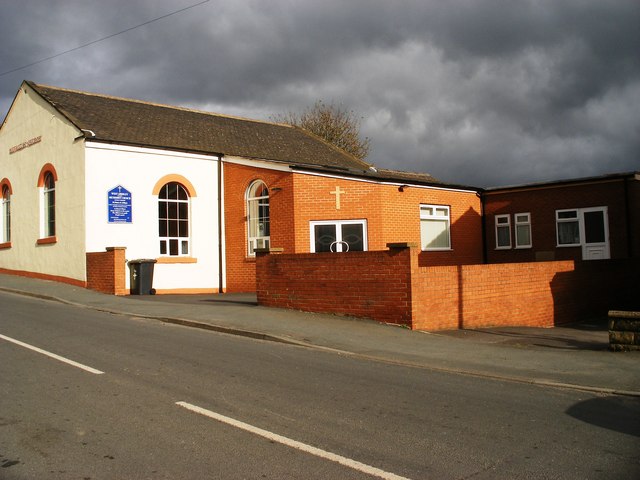
Brandy Carr Images

Images are sourced within 2km of 53.706855/-1.538973 or Grid Reference SE3023. Thanks to Geograph Open Source API. All images are credited.

St Paul's church, Alverthorpe The church was built in 1823-25 and is grade II listed (list entry 1273436). It dominates the village from a hilltop site; in front of it is the church primary school.
St Paul's church, Alverthorpe
The church was built in 1823-25 and is grade II listed (list entry 1273436). It dominates the village from a hilltop site; in front of it is the church primary school.
East end, St Paul's Church, Alverthorpe The church has an extensive graveyard.
East end, St Paul's Church, Alverthorpe
The church has an extensive graveyard.
Commonwealth war grave in Alverthorpe churchyard [4] The inscription reads '2363 Private / W. Murray / King's Own Yorkshire L. I. /1st April 1920'.
Commonwealth war grave in Alverthorpe churchyard [4]
The inscription reads '2363 Private / W. Murray / King's Own Yorkshire L. I. /1st April 1920'.
Commonwealth war grave in Alverthorpe churchyard [5] The inscription reads '2203694 Aircraftman 2nd Cl. / J. Crane / Royal Air Force / 14th January 1943 Age 42 / In loving memory / of one who did his duty well / a loving husband and father / ever remembered'.
Commonwealth war grave in Alverthorpe churchyard [5]
The inscription reads '2203694 Aircraftman 2nd Cl. / J. Crane / Royal Air Force / 14th January 1943 Age 42 / In loving memory / of one who did his duty well / a loving husband and father / ever remembered'.
Commonwealth war grave in Alverthorpe churchyard [6] The inscription reads '1595185 Sergeant / A. Harnell / Air Gunner / Royal Air Force / 10th April 1944 Age 19 / In loving memory of our dear son Albert / killed in an air crash / in our memory always'.
Commonwealth war grave in Alverthorpe churchyard [6]
The inscription reads '1595185 Sergeant / A. Harnell / Air Gunner / Royal Air Force / 10th April 1944 Age 19 / In loving memory of our dear son Albert / killed in an air crash / in our memory always'.
Commonwealth war grave in Alverthorpe churchyard [7] The inscription reads '12059 Gunner / D. Bedford / Royal Field Artillery / 1st September 1918 Age 33 / Thy will be done'.
Commonwealth war grave in Alverthorpe churchyard [7]
The inscription reads '12059 Gunner / D. Bedford / Royal Field Artillery / 1st September 1918 Age 33 / Thy will be done'.
Commonwealth war grave in Alverthorpe churchyard [8] The inscription reads ' 1633264 Ldg. Aircraftman / E. Archer / Royal Air Force / 10th July 1944 Age 23 / Deep in our heart / is a memory kept / of one we loved / and will never forget'.
Commonwealth war grave in Alverthorpe churchyard [8]
The inscription reads ' 1633264 Ldg. Aircraftman / E. Archer / Royal Air Force / 10th July 1944 Age 23 / Deep in our heart / is a memory kept / of one we loved / and will never forget'.
Commonwealth war grave in Alverthorpe churchyard [9] The inscription reads '631565 Aircraftman 1st Cl. / D. Lilley / Wireless operator Air gunner / Royal Air Force / 1st May 1940 Age 19 / He gave his life / that we may live / Treasured memories / of a dear son'.
Commonwealth war grave in Alverthorpe churchyard [9]
The inscription reads '631565 Aircraftman 1st Cl. / D. Lilley / Wireless operator Air gunner / Royal Air Force / 1st May 1940 Age 19 / He gave his life / that we may live / Treasured memories / of a dear son'.
Commonwealth war grave in Alverthorpe churchyard [10] The inscription reads '4582 Private / W. Burnley / King's Own Yorkshire L.I. / 9th June 1915 Age 27 / R.I.P.'
Commonwealth war grave in Alverthorpe churchyard [10]
The inscription reads '4582 Private / W. Burnley / King's Own Yorkshire L.I. / 9th June 1915 Age 27 / R.I.P.'
St Paul's Walk, Alverthorpe, Wakefield A residential cul-de-sac, named after the nearby parish church.
St Paul's Walk, Alverthorpe, Wakefield
A residential cul-de-sac, named after the nearby parish church.
Marion Avenue from Childs Road, Alverthorpe Wakefield Council built this small housing estate in the 1920s.
Marion Avenue from Childs Road, Alverthorpe
Wakefield Council built this small housing estate in the 1920s.
Canning Avenue stepping down the hillside Wakefield Council built this small housing estate in the 1920s.
Canning Avenue stepping down the hillside
Wakefield Council built this small housing estate in the 1920s.
Never the twain shall meet, Alverthorpe In the foreground, the end of Childs Road, part of a small estate built by Wakefield Council in the 1920s. In the background, houses on Harewood Drive, part of a private infill development built in the 1990s. There is no direct connection between the two roads.
Never the twain shall meet, Alverthorpe
In the foreground, the end of Childs Road, part of a small estate built by Wakefield Council in the 1920s. In the background, houses on Harewood Drive, part of a private infill development built in the 1990s. There is no direct connection between the two roads.
Steps on the north side of Batley Road, Alverthorpe To accommodate the hillside, the houses on this side of the road have been built above a bank, with their own access road.
Steps on the north side of Batley Road, Alverthorpe
To accommodate the hillside, the houses on this side of the road have been built above a bank, with their own access road.
Construction site, off Billingham Close More houses on a little infill site, Alverthorpe. Frank Billingham was one of the seven miners killed underground near here in the Lofthouse Colliery disaster in 1973. <a href="https://www.geograph.org.uk/photo/993615">SE3022 : Lofthouse Colliery Disaster Memorial - Batley Road</a>
Construction site, off Billingham Close
More houses on a little infill site, Alverthorpe. Frank Billingham was one of the seven miners killed underground near here in the Lofthouse Colliery disaster in 1973. SE3022 : Lofthouse Colliery Disaster Memorial - Batley Road
Path from Charles Cotton Close, Alverthorpe Heading up to the Batley Road, alongside the former Crown pub [currently being converted to semi-detached houses]. Charles Cotton was one of the seven miners killed underground near here in the Lofthouse Colliery disaster in 1973. <a href="https://www.geograph.org.uk/photo/993615">SE3022 : Lofthouse Colliery Disaster Memorial - Batley Road</a>
Path from Charles Cotton Close, Alverthorpe
Heading up to the Batley Road, alongside the former Crown pub [currently being converted to semi-detached houses]. Charles Cotton was one of the seven miners killed underground near here in the Lofthouse Colliery disaster in 1973. SE3022 : Lofthouse Colliery Disaster Memorial - Batley Road
Flats on Alan Haigh Close, Alverthorpe Alan Haigh was one of the seven miners killed underground near here in the Lofthouse Colliery disaster in 1973. <a href="https://www.geograph.org.uk/photo/993615">SE3022 : Lofthouse Colliery Disaster Memorial - Batley Road</a>
Flats on Alan Haigh Close, Alverthorpe
Alan Haigh was one of the seven miners killed underground near here in the Lofthouse Colliery disaster in 1973. SE3022 : Lofthouse Colliery Disaster Memorial - Batley Road
Replacements for Wrenthorpe Road's lopped trees It will be some time before these saplings are as tall as <a href="https://www.geograph.org.uk/photo/6765001">SE3122 : Lopped trees on Wrenthorpe Road</a>, if ever.
Replacements for Wrenthorpe Road's lopped trees
It will be some time before these saplings are as tall as SE3122 : Lopped trees on Wrenthorpe Road, if ever.
Show me another place!

Brandy Carr is located at Grid Ref: SE3023 (Lat: 53.706855, Lng: -1.538973)

Division: West Riding

Unitary Authority: Wakefield

Police Authority: West Yorkshire

What 3 Words

///bother.rushed.rams. Near Lofthouse, West Yorkshire

Related Wikis

Nearby Amenities

Located within 500m of 53.706855,-1.538973
Note: FIXME
Lat/Long: 53.7041849/-1.5434353
Post Box
Operator: Royal Mail
Post Box Type: lamp
Ref: WF2 189
Lat/Long: 53.7062453/-1.5392228
Power: pole
Lat/Long: 53.7051269/-1.5424045
Power: pole
Lat/Long: 53.7049739/-1.5413893
Power: pole
Lat/Long: 53.7043785/-1.5355706
Power: pole
Lat/Long: 53.7052966/-1.5434244
Power: pole
Lat/Long: 53.7043896/-1.5380429
Power: pole
Lat/Long: 53.7041921/-1.5369101
Power: pole
Lat/Long: 53.7051161/-1.5379106
Power: pole
Lat/Long: 53.70459/-1.5391615
Power: pole
Lat/Long: 53.7025982/-1.5400492
Power: pole
Lat/Long: 53.7057977/-1.5382514
Power: pole
Lat/Long: 53.7055804/-1.5448298
Power: pole
Lat/Long: 53.7031372/-1.5393265
Power: pole
Lat/Long: 53.7064828/-1.5386156
Power: pole
Lat/Long: 53.7046845/-1.5334086
Power: pole
Lat/Long: 53.7037702/-1.5384511
Power: pole
Lat/Long: 53.7057724/-1.5461317
Power: pole
Lat/Long: 53.7047764/-1.5402613
Power: pole
Lat/Long: 53.7044449/-1.5375523
Brandy Carr Hill
Natural: peak
Source: OS_OpenData_StreetView
Lat/Long: 53.7058342/-1.5379503
The data included in this document is from www.openstreetmap.org. The data is made available under ODbL.

Have you been to Brandy Carr?

Leave your review of Brandy Carr below (or comments, questions and feedback).