Brandy Hole

Settlement in Essex Rochford

England

Brandy Hole

Arable field off Lower Road, Hullbridge
Arable field off Lower Road, Hullbridge Credit: Roger Jones

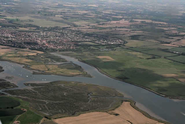
Brandy Hole is a small coastal settlement located in Essex, England. Situated on the northern bank of the River Crouch, it lies approximately 5 miles east of the town of South Woodham Ferrers. The origins of the name "Brandy Hole" are unclear, but it is believed to have derived from the area's historical association with smuggling activities during the 18th and 19th centuries.

The village is primarily known for its picturesque views and serene atmosphere. Surrounded by beautiful marshlands and a thriving wildlife habitat, Brandy Hole attracts nature enthusiasts and birdwatchers. The nearby Brandy Hole Yacht Club is a popular destination for sailing enthusiasts who navigate the river and explore the surrounding creeks and estuaries.

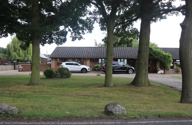
In terms of amenities, Brandy Hole is a relatively quiet settlement with limited facilities. However, nearby towns offer a wider range of services including shops, schools, and medical facilities. The rural nature of the area makes it an ideal location for those seeking tranquility and a slower pace of life.

Brandy Hole is well-connected to other parts of Essex and beyond. The nearby South Woodham Ferrers railway station provides direct links to London Liverpool Street, making it a viable option for commuters. Additionally, the A130 road is easily accessible, allowing for convenient travel by car.

Overall, Brandy Hole offers a peaceful and scenic retreat for those looking to escape the hustle and bustle of urban life. With its rich history, stunning natural surroundings, and proximity to larger towns, it remains a charming destination for residents and visitors alike.

If you have any feedback on the listing, please let us know in the comments section below.

Brandy Hole Images

Images are sourced within 2km of 51.630667/0.632084 or Grid Reference TQ8295. Thanks to Geograph Open Source API. All images are credited.

Arable field off Lower Road, Hullbridge
Lake in Saltcoats Park
Marshy ground Greener and wetter than when I last photographed this area behind the dam <a href="https://www.geograph.org.uk/photo/2600225">TQ8297 : Dry Marsh</a>
Marshy ground
Greener and wetter than when I last photographed this area behind the dam TQ8297 : Dry Marsh
Low tide in Hawbush Creek
Marshland between the Crouch and the southern edge of South Woodham Ferrers
View across the River Crouch to Kendal Park
Land reclamation on River Crouch east of Hullbridge: aerial 2022
The River Crouch from the air Fambridge Yacht Haven can be seen to the right of the centre of the photo. South Woodham Ferrers is at the bottom. Cold Norton is in the distance.
The River Crouch from the air
Fambridge Yacht Haven can be seen to the right of the centre of the photo. South Woodham Ferrers is at the bottom. Cold Norton is in the distance.
Fambridge Yacht Haven from the air On Stow Creek off the River Crouch near South Woodham Ferrers.

See also <a href="https://www.geograph.org.uk/photo/4670686">TQ8496 : Fambridge Yacht Haven from the air</a>.
Fambridge Yacht Haven from the air
On Stow Creek off the River Crouch near South Woodham Ferrers. See also TQ8496 : Fambridge Yacht Haven from the air.
Fambridge Yacht Haven from the air On Stow Creek off the River Crouch near South Woodham Ferrers.

See also <a href="https://www.geograph.org.uk/photo/4670680">TQ8396 : Fambridge Yacht Haven from the air</a>.
Fambridge Yacht Haven from the air
On Stow Creek off the River Crouch near South Woodham Ferrers. See also TQ8396 : Fambridge Yacht Haven from the air.
The Dome Village To quote their web site: 'The Dome Village is a semi retirement residential park home estate'.
The Dome Village
To quote their web site: 'The Dome Village is a semi retirement residential park home estate'.
River Crouch, South Woodham Ferrers and land to the east: aerial 2017
Mud near the River Crouch
Looking to Cracknell's Farm, Hullbridge
Lower Road, Hullbridge
The entrance to La Vallee Farm Shop, Hullbridge
Large bungalow on Lower Road, Hullbridge
Show me another place!

Brandy Hole is located at Grid Ref: TQ8295 (Lat: 51.630667, Lng: 0.632084)

Administrative County: Essex

District: Rochford

Police Authority: Essex

What 3 Words

///entitles.comical.firm. Near Cold Norton, Essex

Nearby Locations

Brandy Hole Hullbridge

Related Wikis

Brandy Hole

Brandy Hole is the name of a large area of saltmarsh and saltings on the River Crouch in Rochford District in the County of Essex, England. It is located...
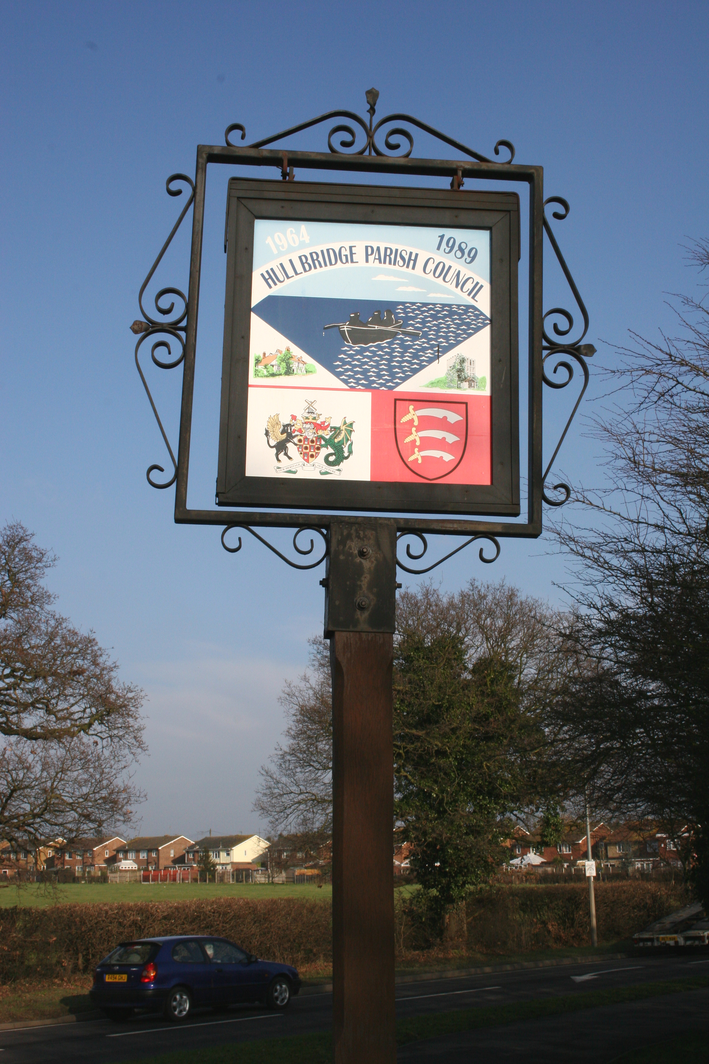
Hullbridge

Hullbridge is a village and civil parish in the Rochford district of Essex in England. Bordered to the north by the River Crouch, as well a distance from...
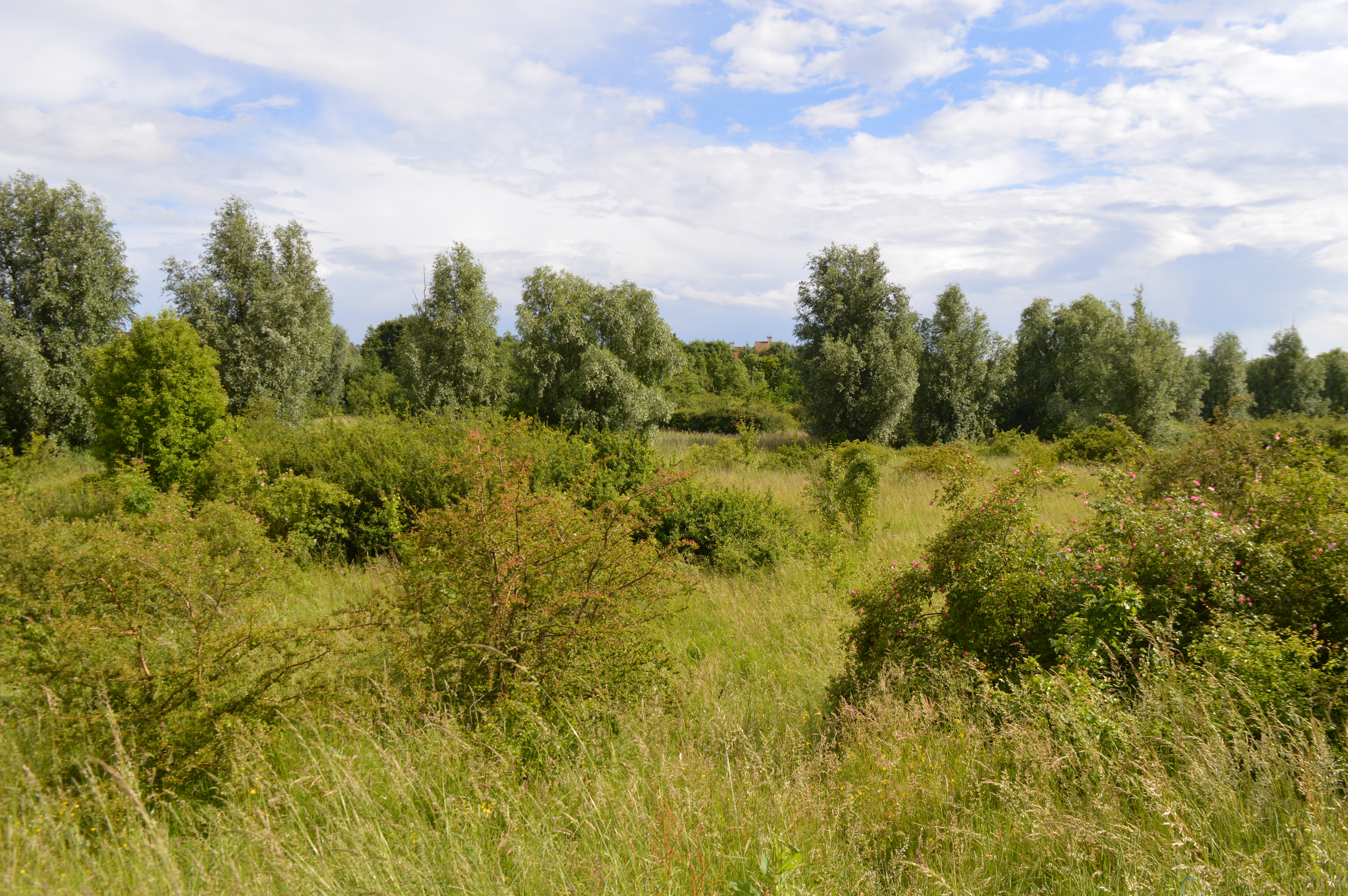
Kendal Park

Kendal Park or Hullbridge Foreshore is a 2.8 hectare Local Nature Reserve in Hullbridge in Essex. It is owned by Rochford District Council and managed...

Fenn Washland

Fenn Washland is a 4.9 hectare Local Nature Reserve in South Woodham Ferrers in Essex, England. It is owned by Essex County Council and managed by the...

Hullbridge Sports F.C.

Hullbridge Sports Football Club is a football club based in Hullbridge, Essex, England. They are currently members of the Essex Senior League and play...

William de Ferrers School

William de Ferrers School is a co-educational British secondary school in the town of South Woodham Ferrers, in the English county of Essex. It is an academy...

South Woodham Ferrers

South Woodham Ferrers is a town and civil parish in the borough of Chelmsford, in the English county of Essex. It is approximately 35 miles (56 km) east...

South Woodham Ferrers railway station

South Woodham Ferrers railway station is on the Crouch Valley Line in the East of England, serving the town of South Woodham Ferrers, Essex. It is 34 miles...

Nearby Amenities

Located within 500m of 51.630667,0.632084
Source: PGS
Lat/Long: 51.6293084/0.6380816
Source: PGS
Lat/Long: 51.6297879/0.6381675
Source: PGS
Lat/Long: 51.6302008/0.6356998
Source: PGS
Lat/Long: 51.6303873/0.635614
Source: PGS
Lat/Long: 51.6307736/0.635378
Created By: dmgroom_coastlines
Source: PGS
Lat/Long: 51.6312389/0.6347618
Created By: dmgroom_coastlines
Source: PGS
Lat/Long: 51.6314296/0.6346268
Created By: dmgroom_coastlines
Source: PGS
Lat/Long: 51.6314768/0.634499
Created By: dmgroom_coastlines
Source: PGS
Lat/Long: 51.6315104/0.6340614
Created By: dmgroom_coastlines
Source: PGS
Lat/Long: 51.6314294/0.6332204
Created By: dmgroom_coastlines
Source: PGS
Lat/Long: 51.6313862/0.6328158
Source: PGS
Lat/Long: 51.6312773/0.6317828
Source: PGS
Lat/Long: 51.631224/0.6308129
Source: PGS
Lat/Long: 51.6314744/0.6303237
Source: PGS
Lat/Long: 51.6313999/0.628032
Source: PGS
Lat/Long: 51.6312507/0.6276029
Source: PGS
Lat/Long: 51.6312933/0.6272939
Source: PGS
Lat/Long: 51.6314638/0.6271909
Source: PGS
Lat/Long: 51.6314798/0.6257747
Source: PGS
Lat/Long: 51.6313839/0.6253198
Source: PGS
Lat/Long: 51.6333517/0.6263487
Source: PGS
Lat/Long: 51.6334908/0.6271721
Source: PGS
Lat/Long: 51.6332143/0.6289085
Source: PGS
Lat/Long: 51.6327463/0.6301868
Source: PGS
Lat/Long: 51.6328551/0.6310686
Source: PGS
Lat/Long: 51.6325365/0.6318696
Source: PGS
Lat/Long: 51.6325138/0.632423
Source: PGS
Lat/Long: 51.6326098/0.6327345
Source: PGS
Lat/Long: 51.6330862/0.6336373
Source: PGS
Lat/Long: 51.6332858/0.6340745
Source: PGS
Lat/Long: 51.6333178/0.6347011
Source: PGS
Lat/Long: 51.6333178/0.6351903
Source: PGS
Lat/Long: 51.6334758/0.6362724
Source: PGS
Lat/Long: 51.6334225/0.6370771
Source: PGS
Lat/Long: 51.6336889/0.6372273
Source: PGS
Lat/Long: 51.6333893/0.6376028
Brandy Hole Yatch Club
Leisure: marina
Lat/Long: 51.6313609/0.6344676
Seamark Buoy Lateral Category: starboard
Seamark Buoy Lateral Colour: green
Seamark Buoy Lateral Shape: conical
Seamark Buoy Lateral System: iala-a
Seamark Name: Kingsman
Seamark Type: buoy_lateral
Lat/Long: 51.632/0.6321667
Seamark Buoy Lateral Category: port
Seamark Buoy Lateral Colour: red
Seamark Buoy Lateral Shape: can
Seamark Buoy Lateral System: iala-a
Seamark Name: Hawbush
Seamark Type: buoy_lateral
Lat/Long: 51.6326667/0.6273333
Turning Circle
Lat/Long: 51.6299789/0.62574
Halycon Park
Alt Name: Private Property
Place: neighbourhood
Lat/Long: 51.6301051/0.6261164
The data included in this document is from www.openstreetmap.org. The data is made available under ODbL.

Have you been to Brandy Hole?

Leave your review of Brandy Hole below (or comments, questions and feedback).