Wickhambreaux

Settlement in Kent Canterbury

England

Wickhambreaux

Stodmarsh Court Farm Farm near Stodmarsh.
Stodmarsh Court Farm Credit: Wayland Smith

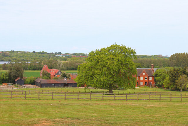
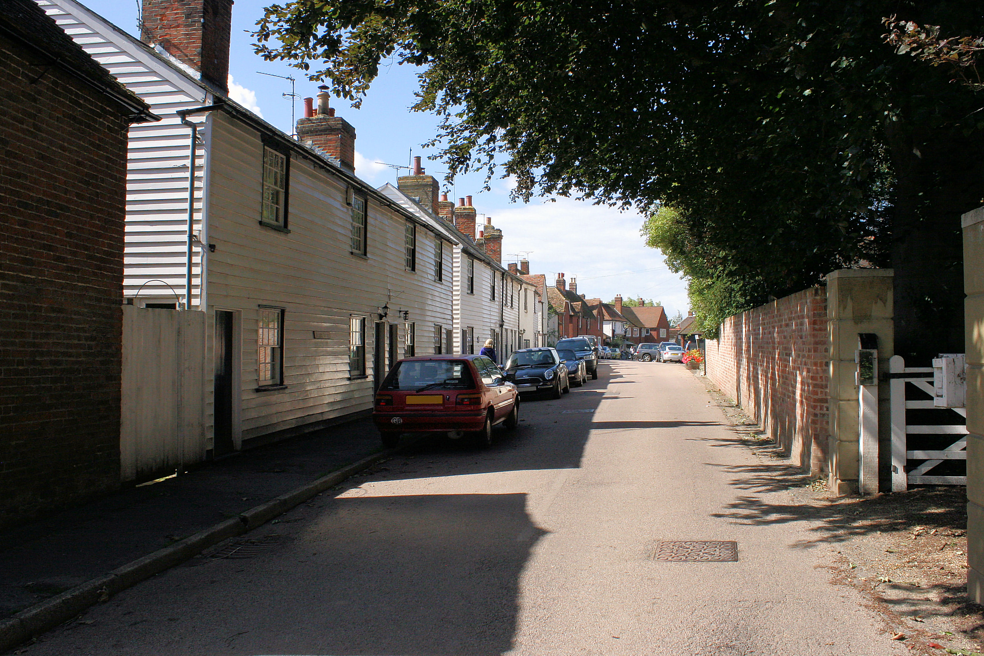
Wickhambreaux is a small village located in the county of Kent, England. Situated approximately six miles east of Canterbury, the village lies in the valley of the River Little Stour. With a population of around 300 residents, Wickhambreaux encapsulates the quintessential charm of a traditional English village.

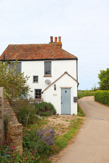
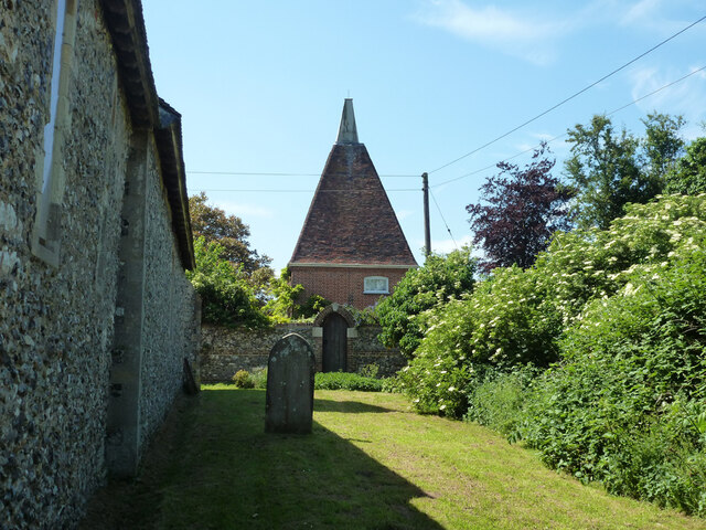
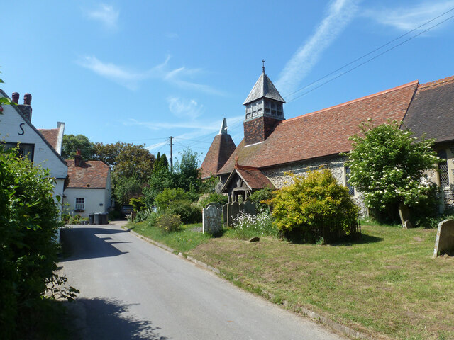
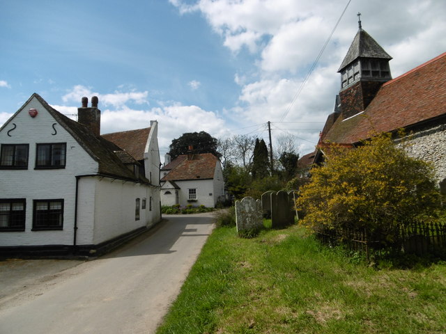
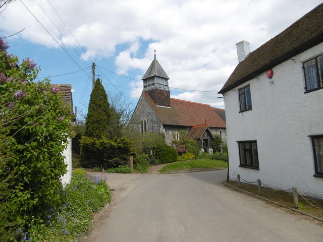
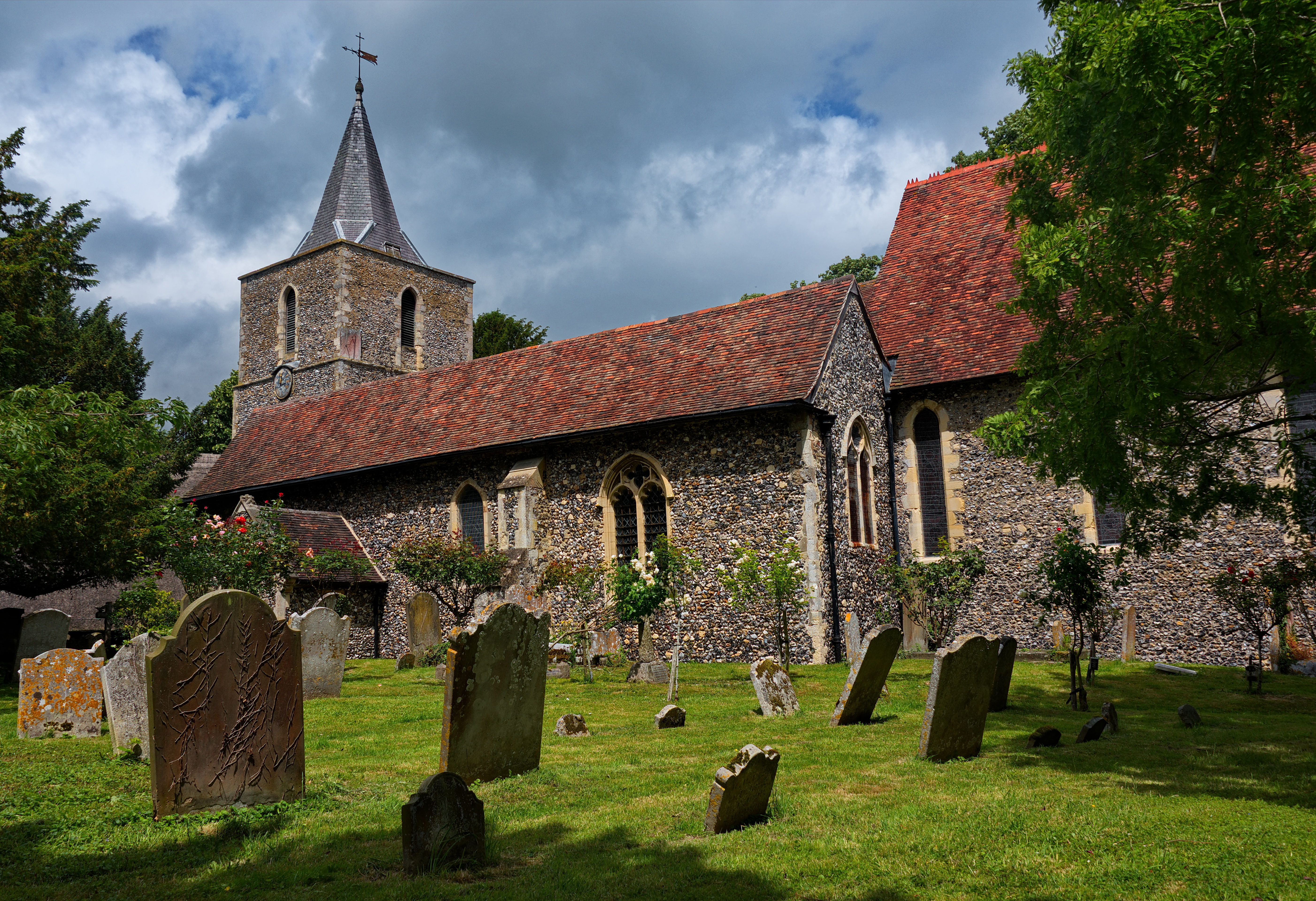
The village is known for its picturesque setting, surrounded by beautiful countryside and farmland. It boasts a range of historic buildings, including a medieval church dedicated to St. Andrew, which dates back to the 13th century. The church features notable architectural elements such as a Norman doorway and a 14th-century tower.

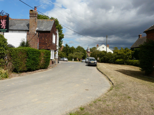
Wickhambreaux is also home to a traditional village pub, The Rose Inn, which has served locals and visitors for centuries. This welcoming establishment offers a selection of delicious food and beverages, making it a popular spot for both residents and tourists.

The village hosts various community events throughout the year, including a summer fete and a Christmas market. These gatherings provide opportunities for villagers to connect and celebrate together, fostering a strong sense of community spirit.

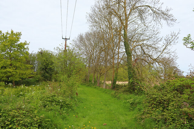
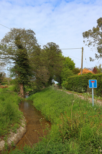
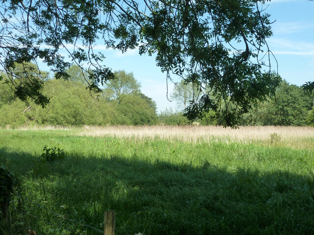
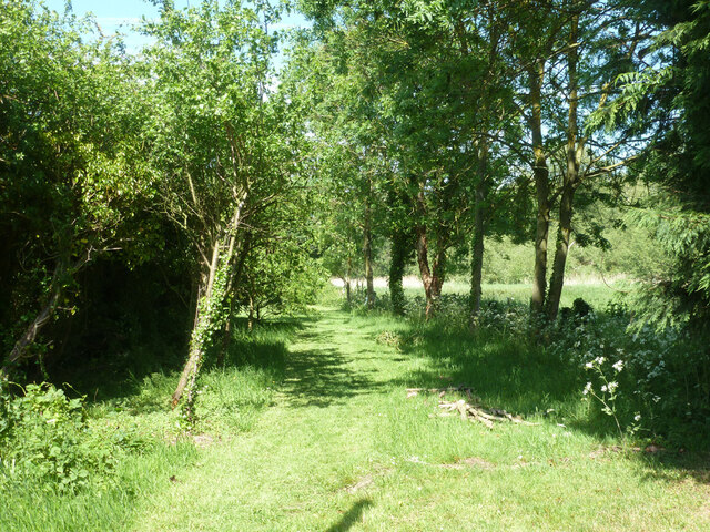
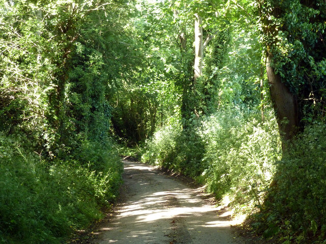
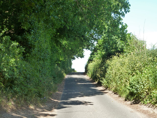
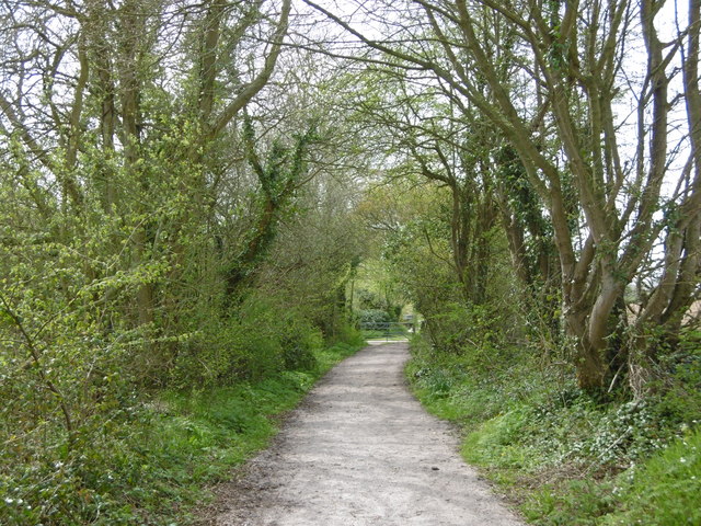
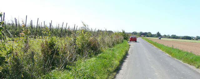
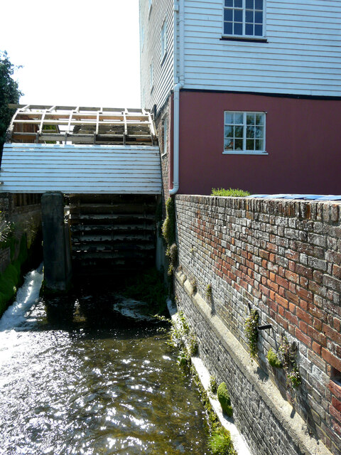
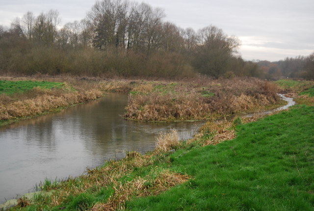
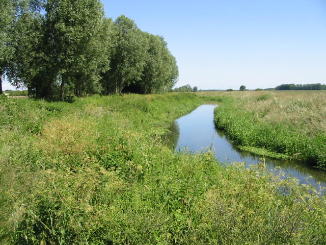
Surrounded by the beautiful Kentish countryside, Wickhambreaux offers numerous opportunities for outdoor activities. The nearby River Little Stour is a popular spot for fishing and boating enthusiasts, while the surrounding fields and footpaths provide excellent options for walking, hiking, and exploring the natural beauty of the area.

In summary, Wickhambreaux is a charming and historic village that offers a tranquil escape from the hustle and bustle of city life. Its idyllic setting, rich history, and strong community spirit make it a truly special place to visit or call home.

If you have any feedback on the listing, please let us know in the comments section below.

Wickhambreaux Images

Images are sourced within 2km of 51.285459/1.181544 or Grid Reference TR2158. Thanks to Geograph Open Source API. All images are credited.

Stodmarsh Court Farm Farm near Stodmarsh.
Stodmarsh Court Farm
Farm near Stodmarsh.
Lambkin Wall House in Stodmarsh.
Lambkin Wall
House in Stodmarsh.
Near Stodmarsh Church Power lines and trees.
Near Stodmarsh Church
Power lines and trees.
Stream near Stodmarsh Stream at the road junction for Stodmarsh.
Stream near Stodmarsh
Stream at the road junction for Stodmarsh.
Field east of churchyard, Stodmarsh
Track east of churchyard, Stodmarsh It seems to give access to a small field beyond the churchyard.
Track east of churchyard, Stodmarsh
It seems to give access to a small field beyond the churchyard.
Converted oast house, Stodmarsh Looking from behind the church.
Converted oast house, Stodmarsh
Looking from behind the church.
Stodmarsh Road, Stodmarsh
Burnt House Hill (lane) Heading towards Stodmarsh.
Burnt House Hill (lane)
Heading towards Stodmarsh.
Hollybush Lane Towards Grove or Stodmarsh.
Hollybush Lane
Towards Grove or Stodmarsh.
Stodmarsh Road Stodmarsh Road leads here into the village of Stodmarsh. St Mary's Church is on the right. It has a late Norman nave and a chancel of the 13th century. The church was heavily restored in the late 1880s.
Stodmarsh Road
Stodmarsh Road leads here into the village of Stodmarsh. St Mary's Church is on the right. It has a late Norman nave and a chancel of the 13th century. The church was heavily restored in the late 1880s.
St Mary's Churchyard, Stodmarsh Stodmarsh Road leads here into the village of Stodmarsh. St Mary's Church is on the right. It has a late Norman nave and a chancel of the 13th century. The church was heavily restored in the late 1880s. For the view looking back to here see <a title="https://www.geograph.org.uk/photo/4934219" href="https://www.geograph.org.uk/photo/4934219">Link</a>
St Mary's Churchyard, Stodmarsh
Stodmarsh Road leads here into the village of Stodmarsh. St Mary's Church is on the right. It has a late Norman nave and a chancel of the 13th century. The church was heavily restored in the late 1880s. For the view looking back to here see Link
The centre of Stodmarsh St Mary's Church has a late Norman nave and a chancel of the 13th century. The church was heavily restored in the late 1880s.
The centre of Stodmarsh
St Mary's Church has a late Norman nave and a chancel of the 13th century. The church was heavily restored in the late 1880s.
A path on Stodmarsh National Nature Reserve The earliest recorded use of the land which now makes up the National Nature Reserve of Stodmarsh was by Augustinian monks during medieval times. The monks dug ditches to bring the mineral-rich river floodwater onto the meadows to flood them and make the grass more productive. The marsh was used for grazing mares in foal and at this time was known as Stud-marsh.

In the early 18th century a flood defence barrier, the Lampen Wall, was constructed by Flemish engineers to prevent excessive flooding in the Grove Ferry area. This more efficient drainage of the valley was reversed by the opening of Chislet Colliery at the start of the 20th century. The land subsided due to the underground working and became waterlogged.

By the 1930s small lagoons had formed in the meadows. Reed beds then developed, spreading from the river banks to cover the wetter areas. The marsh was then used for wildfowling. The land was notified as a Site of Special Scientific Interest in 1951 and became a National Nature Reserve in 1968.

The main car park near Stodmarsh is just beyond the gate ahead.
A path on Stodmarsh National Nature Reserve
The earliest recorded use of the land which now makes up the National Nature Reserve of Stodmarsh was by Augustinian monks during medieval times. The monks dug ditches to bring the mineral-rich river floodwater onto the meadows to flood them and make the grass more productive. The marsh was used for grazing mares in foal and at this time was known as Stud-marsh. In the early 18th century a flood defence barrier, the Lampen Wall, was constructed by Flemish engineers to prevent excessive flooding in the Grove Ferry area. This more efficient drainage of the valley was reversed by the opening of Chislet Colliery at the start of the 20th century. The land subsided due to the underground working and became waterlogged. By the 1930s small lagoons had formed in the meadows. Reed beds then developed, spreading from the river banks to cover the wetter areas. The marsh was then used for wildfowling. The land was notified as a Site of Special Scientific Interest in 1951 and became a National Nature Reserve in 1968. The main car park near Stodmarsh is just beyond the gate ahead.
Barn & outbuildings at Sawkinge Farm
Looking northeast along Stodmarsh Road A typical village scene with the Red Lion public house on the left and part of St Mary’s church in the distance. The village green (beside which a silver car is parked) and the grass verge have suffered the ravages of a prolonged dry spell.
Looking northeast along Stodmarsh Road
A typical village scene with the Red Lion public house on the left and part of St Mary’s church in the distance. The village green (beside which a silver car is parked) and the grass verge have suffered the ravages of a prolonged dry spell.
Established orchard The view of <a href="https://www.geograph.org.uk/photo/6185399">TR2257 : Establishing a new orchard</a> was taken before the trees had been planted.
Established orchard
The view of TR2257 : Establishing a new orchard was taken before the trees had been planted.
Wickham Mill Repairs are being undertaken to the boards over the waterwheel with a framework in place to attach new boards to. 

The watermill is a grade II listed early 19th century building with four storeys and attics in the gable end. The ground floor is of red brick, faced with weatherboarding above. There are gable ends east and west and the roof is tiled. In the west gable end is a small projection of one window to which a hoist was once fixed. The windows have modern casements. There is an overshot waterwheel <span class="nowrap"><a title="https://britishlistedbuildings.co.uk/101336608-wickham-mill-wickhambreaux#.YRgJyIySncc" rel="nofollow ugc noopener" href="https://britishlistedbuildings.co.uk/101336608-wickham-mill-wickhambreaux#.YRgJyIySncc">Link</a><img style="margin-left:2px;" alt="External link" title="External link - shift click to open in new window" src="https://s1.geograph.org.uk/img/external.png" width="10" height="10"/></span>
Wickham Mill
Repairs are being undertaken to the boards over the waterwheel with a framework in place to attach new boards to. The watermill is a grade II listed early 19th century building with four storeys and attics in the gable end. The ground floor is of red brick, faced with weatherboarding above. There are gable ends east and west and the roof is tiled. In the west gable end is a small projection of one window to which a hoist was once fixed. The windows have modern casements. There is an overshot waterwheel LinkExternal link
Show me another place!

Wickhambreaux is located at Grid Ref: TR2158 (Lat: 51.285459, Lng: 1.181544)

Administrative County: Kent

District: Canterbury

Police Authority: Kent

What 3 Words

///unloaded.trusts.overtime. Near Littlebourne, Kent

Nearby Locations

Wickhambreaux

Related Wikis

Wickhambreaux

Wickhambreaux ( WIK-əm-brew) is a village and civil parish in the Canterbury district, in the county of Kent, England. The village is just off the A257...

St Vincent of Saragossa Church, Littlebourne

St Vincent of Saragossa's Church is the Church of England parish church of Littlebourne, Kent, England. The parish is part of the Benefice of Littlebourne...

Littlebourne

Littlebourne is a village and civil parish 4 miles (6.4 km) east of Canterbury in Kent, South East England. == History == The significant Howletts Anglo...

Wingham River

The River Wingham is a tributary of the Little Stour in Kent, England. The river runs from its source near Ash, west, through Wingham to the Little Stour...

Stodmarsh

Stodmarsh is a small village in the civil parish of Wickhambreaux, in the Canterbury district, in east Kent, England. It is 5 miles to the east of Canterbury...

Ickham and Well

Ickham and Well is a mostly rural civil parish east of Canterbury in Kent, South East England. The parish covers the villages of Ickham and Bramling just...

Preston Marshes

Preston Marshes is a 43.4-hectare (107-acre) biological Site of Special Scientific Interest east of Canterbury in Kent.This site in the valley of the River...

Bramling

Bramling is a hamlet five miles (8 km) east of Canterbury in Kent, England. It lies on the A257 road between Littlebourne and Wingham. The local public...

Nearby Amenities

Located within 500m of 51.285459,1.181544
Wickhambreaux
Place: village
Source: survey
Wikidata: Q3092462
Lat/Long: 51.2850598/1.1839708
Telephone
Booth: K6
Covered: booth
Listed Status: Grade II
Payment Coins: no
Payment Credit Cards: yes
Payment Debit Cards: yes
Phone: +44 1227 721212
Lat/Long: 51.2837554/1.1828212
Townhall
Wickhambreaux Village Hall
Lat/Long: 51.2843718/1.1845815
Post Box
Collection Times: Mo-Fr 09:00; Sa 07:00
Operator: Royal Mail
Operator Wikidata: Q638098
Post Box Mounting: metal_post
Post Box Type: lamp
Postal Code: CT3
Ref: CT3 163
Royal Cypher: EIIR
Royal Cypher Wikidata: Q33102113
Source: survey
Lat/Long: 51.2836814/1.1826238
Bus Stop
Rose
Flag: no
Naptan AtcoCode: 2400A073230A
Naptan Bearing: S
Naptan BusStopType: CUS
Naptan CommonName: Rose
Naptan Indicator: o/s
Naptan Landmark: Green
Naptan NaptanCode: kntgjajm
Naptan Street: Wickham Road
Naptan Verified: no
Public Transport: platform
Source: naptan_import
Lat/Long: 51.2844302/1.1834591
Power: pole
Lat/Long: 51.2812496/1.1808692
Power: pole
Lat/Long: 51.2831353/1.185091
Power: pole
Lat/Long: 51.2818166/1.1822264
Power: pole
Lat/Long: 51.2838043/1.1865193
Power: pole
Lat/Long: 51.2838983/1.1856959
Power: pole
Lat/Long: 51.2823535/1.18353
Power: pole
Lat/Long: 51.2829353/1.1830619
Power: pole
Lat/Long: 51.2839204/1.1875989
Power: pole
Lat/Long: 51.2847122/1.1880522
Barrier: stile
Foot: yes
Lat/Long: 51.2840359/1.1864859
Fruit Vending Machine
Description: Fresh fruit vending machine during summer months.
Payment Contactless: yes
Payment Credit Cards: yes
Payment Debit Cards: yes
Shop: farm
Lat/Long: 51.2882654/1.1844193
The data included in this document is from www.openstreetmap.org. The data is made available under ODbL.

Have you been to Wickhambreaux?

Leave your review of Wickhambreaux below (or comments, questions and feedback).