Brancaster Staithe

Settlement in Norfolk King's Lynn and West Norfolk

England

Brancaster Staithe

Arable field on Deepdale Marsh The rest of this segment of reclaimed land is now grazing marsh.
Arable field on Deepdale Marsh Credit: Hugh Venables

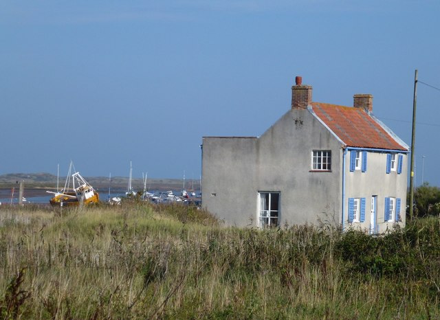
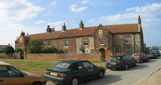
Brancaster Staithe is a picturesque coastal village located on the north coast of Norfolk, England. Situated within the Norfolk Coast Area of Outstanding Natural Beauty, it is a popular destination for tourists seeking natural beauty, tranquility, and outdoor activities.

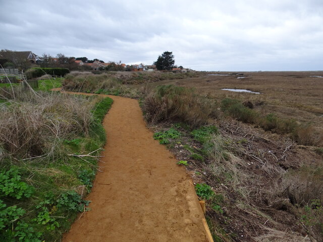
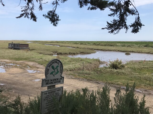
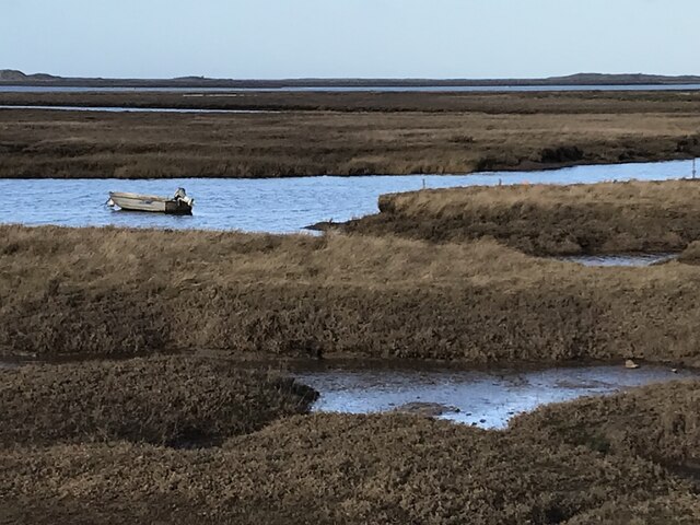
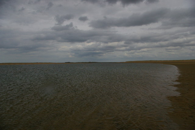
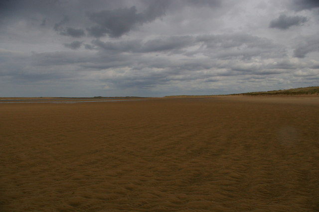
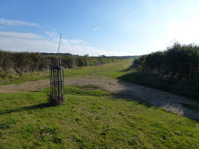
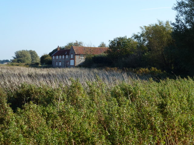
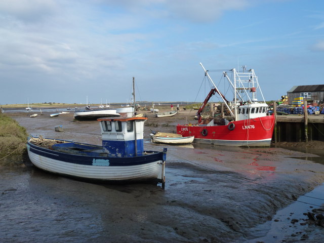
The village is nestled on the banks of the tidal inlet known as Brancaster Staithe, which leads into the vast expanse of marshes and mudflats of the North Norfolk coastline. It offers stunning views of the coastline and is a haven for birdwatchers, as it serves as a significant breeding ground for various seabirds and waders.

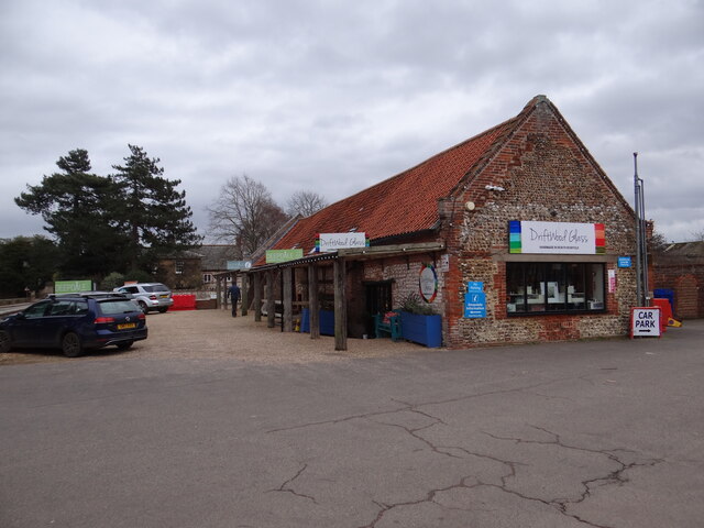
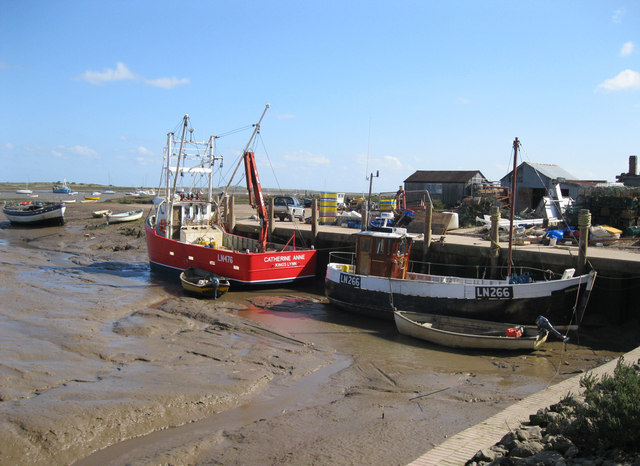
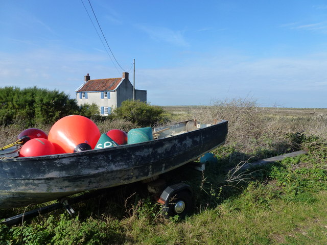
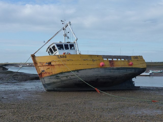
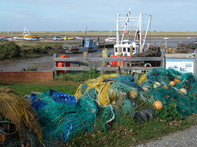
Brancaster Staithe is known for its thriving harbor, which is home to a small fishing fleet. Visitors can witness the hustle and bustle of fishermen unloading their catch or take a leisurely stroll along the quay, enjoying the sight of colorful fishing boats bobbing on the water.

The village is also a hub for water sports enthusiasts, with sailing and windsurfing being particularly popular activities. The harbor provides an excellent base for exploring the surrounding creeks and waterways, with boat trips and kayak rentals readily available.

Aside from its natural attractions, Brancaster Staithe offers a range of amenities for visitors. There are several charming pubs and restaurants serving delicious seafood and local fare, as well as a well-stocked village shop for provisions.

Overall, Brancaster Staithe is a captivating destination that seamlessly combines natural beauty, maritime heritage, and outdoor adventure, making it a must-visit location for anyone exploring the Norfolk coast.

If you have any feedback on the listing, please let us know in the comments section below.

Brancaster Staithe Images

Images are sourced within 2km of 52.964825/0.675035 or Grid Reference TF7944. Thanks to Geograph Open Source API. All images are credited.

Arable field on Deepdale Marsh The rest of this segment of reclaimed land is now grazing marsh.
Arable field on Deepdale Marsh
The rest of this segment of reclaimed land is now grazing marsh.
Deepdale Camping and Rooms Nice place to spend a reasonably priced self-catering weekend with close friends in dormitory accommodation in the roof space, or park your tent/van round the back.  Free parking included and a shop next door!
<span class="nowrap"><a title="https://www.deepdalebackpackers.co.uk" rel="nofollow ugc noopener" href="https://www.deepdalebackpackers.co.uk">Link</a><img style="margin-left:2px;" alt="External link" title="External link - shift click to open in new window" src="https://s1.geograph.org.uk/img/external.png" width="10" height="10"/></span>
Deepdale Camping and Rooms
Nice place to spend a reasonably priced self-catering weekend with close friends in dormitory accommodation in the roof space, or park your tent/van round the back. Free parking included and a shop next door! LinkExternal link
Pleasant path Just about the most perfect surface for a footpath. Clean, well-defined, flat, firm but not too soft nor too hard, no mud, no puddles, no dog poop, no litter!
Pleasant path
Just about the most perfect surface for a footpath. Clean, well-defined, flat, firm but not too soft nor too hard, no mud, no puddles, no dog poop, no litter!
St Mary's Burnham Deepdale Taken from outside Dalegate Market <span class="nowrap"><a title="https://www.dalegatemarket.co.uk/" rel="nofollow ugc noopener" href="https://www.dalegatemarket.co.uk/">Link</a><img style="margin-left:2px;" alt="External link" title="External link - shift click to open in new window" src="https://s1.geograph.org.uk/img/external.png" width="10" height="10"/></span> . The OS symbol for a church with a tower seems inappropriate in these parts, where round-towered churches, as here, are common. The tower at St Mary's is thought to be Norman <span class="nowrap"><a title="http://www.saxonshorebenefice.co.uk/burnhamd.htm" rel="nofollow ugc noopener" href="http://www.saxonshorebenefice.co.uk/burnhamd.htm">Link</a><img style="margin-left:2px;" alt="External link" title="External link - shift click to open in new window" src="https://s1.geograph.org.uk/img/external.png" width="10" height="10"/></span> .
St Mary's Burnham Deepdale
Taken from outside Dalegate Market LinkExternal link . The OS symbol for a church with a tower seems inappropriate in these parts, where round-towered churches, as here, are common. The tower at St Mary's is thought to be Norman LinkExternal link .
The Manor of Brancaster - National Trust
Saltmarsh and creeks, Brancaster Staithe A view from the car park of the White Horse
Saltmarsh and creeks, Brancaster Staithe
A view from the car park of the White Horse
Signpost in the garden of the White Horse, Brancaster Staithe The garden and car park abut the saltmarshes at this popular North Norfolk hostelry.
Signpost in the garden of the White Horse, Brancaster Staithe
The garden and car park abut the saltmarshes at this popular North Norfolk hostelry.
St Mary's church, Burnham Deepdale The church has an eleventh century tower but most of the external detailing of the body of the church dates to the nineteenth century <span class="nowrap"><a title="https://historicengland.org.uk/listing/the-list/list-entry/1237969?section=official-list-entry" rel="nofollow ugc noopener" href="https://historicengland.org.uk/listing/the-list/list-entry/1237969?section=official-list-entry">Link</a><img style="margin-left:2px;" alt="External link" title="External link - shift click to open in new window" src="https://s1.geograph.org.uk/img/external.png" width="10" height="10"/></span>
St Mary's church, Burnham Deepdale
The church has an eleventh century tower but most of the external detailing of the body of the church dates to the nineteenth century LinkExternal link
Brancaster Beach looking east
Brancaster Staithe Quay The quay was renovated in 2007 and is used regularly by fishing vessels.
Brancaster Staithe Quay
The quay was renovated in 2007 and is used regularly by fishing vessels.
Green Common Lane, Brancaster
Creek Farm near Brancaster There are hundreds of acres of salt marsh to the north of this house
Creek Farm near Brancaster
There are hundreds of acres of salt marsh to the north of this house
House near the marsh at Brancaster Staithe
Buoys in a boat at Brancaster Staithe
High and dry at Brancaster Staithe Fishing boat LN86 waiting for the next tide
High and dry at Brancaster Staithe
Fishing boat LN86 waiting for the next tide
Fishing boats at low tide, Brancaster Staithe Fishing boats and the new steel and concrete quay built in 2007 to replace the timber one.
Fishing boats at low tide, Brancaster Staithe
Fishing boats and the new steel and concrete quay built in 2007 to replace the timber one.
All the colours of the rainbow at Brancaster Staithe Fishing nets and boats near the quay in this tiny fishing harbour
All the colours of the rainbow at Brancaster Staithe
Fishing nets and boats near the quay in this tiny fishing harbour
Show me another place!

Brancaster Staithe is located at Grid Ref: TF7944 (Lat: 52.964825, Lng: 0.675035)

Administrative County: Norfolk

District: King's Lynn and West Norfolk

Police Authority: Norfolk

What 3 Words

///goodnight.preoccupied.fattest. Near Hunstanton, Norfolk

Nearby Locations

Brancaster Staithe

Related Wikis

Brancaster Staithe

Brancaster Staithe is a village on the north coast of the English county of Norfolk. Brancaster Staithe merges with Burnham Deepdale, forming one village...

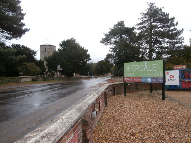
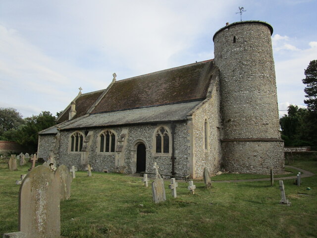
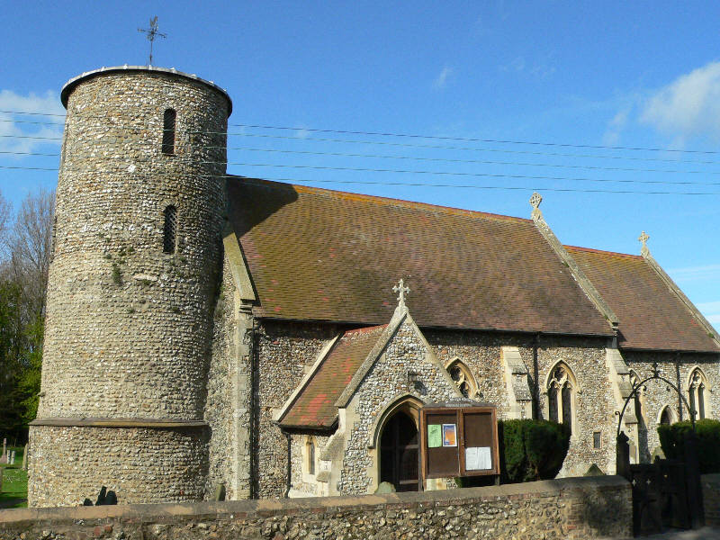
St Mary's Church, Burnham Deepdale

St Mary's Church is a round-tower church in Burnham Deepdale, Norfolk, England. Its round tower and some other parts of the building date from the 11th...

Branodunum

Branodunum was an ancient Roman fort to the east of the modern English village of Brancaster in Norfolk. Its Roman name derives from the local Celtic language...

Brancaster

Brancaster is a village and civil parish on the north coast of the English county of Norfolk. The civil parish of Brancaster comprises Brancaster itself...

Royal West Norfolk Golf Club

Royal West Norfolk Golf Club is a golf club in Brancaster, Norfolk, England, about 7 miles (11 km) east of Hunstanton, between Brancaster Bay and the salt...

Scolt Head Island

Scolt Head Island is an offshore barrier island between Brancaster and Wells-next-the-Sea in north Norfolk. It is in the parish of Burnham Norton and is...

Burnham Norton

Burnham Norton is a village and civil parish in the English county of Norfolk, one of the Burnhams, an adjacent group in the northernmost part of Norfolk...

Burnham Deepdale

Burnham Deepdale is a village and former civil parish, now in the parish of Brancaster, in the King's Lynn and West Norfolk district, on the north coast...

Nearby Amenities

Located within 500m of 52.964825,0.675035
Bus Stop
Jolly Sailors, opp
Bench: yes
Bus: yes
Naptan AtcoCode: 2900B4310
Naptan Bearing: E
Naptan CommonName: Jolly Sailors
Naptan Indicator: opp
Naptan Landmark: public house
Naptan Locality: Brancaster Staithe
Naptan NaptanCode: nfoagdmt
Naptan ShortCommonName: Jolly Sailors
Naptan Street: A149
Naptan Verified: no
Public Transport: platform
Shelter: yes
Source: naptan_import
Lat/Long: 52.9660688/0.6692615
Bus Stop
White Horse, adj
Naptan AtcoCode: 2900B4314
Naptan Bearing: E
Naptan CommonName: White Horse
Naptan Indicator: adj
Naptan Landmark: public house
Naptan Locality: Brancaster Staithe
Naptan NaptanCode: nfoagdpd
Naptan ShortCommonName: White Horse
Naptan Street: A149
Naptan Verified: no
Source: naptan_import
Lat/Long: 52.9659676/0.678951
Bus Stop
White Horse, opp
Naptan AtcoCode: 2900B4315
Naptan Bearing: W
Naptan CommonName: White Horse
Naptan Indicator: opp
Naptan Landmark: public house
Naptan Locality: Brancaster Staithe
Naptan NaptanCode: nfoagdpg
Naptan ShortCommonName: White Horse
Naptan Street: A149
Naptan Verified: no
Source: naptan_import
Lat/Long: 52.965876/0.6794219
Bus Stop
Jolly Sailors, adj
Bus: yes
Naptan AtcoCode: 2900B436
Naptan Bearing: W
Naptan CommonName: Jolly Sailors
Naptan Indicator: adj
Naptan Landmark: public house
Naptan Locality: Brancaster Staithe
Naptan NaptanCode: nfoagdpm
Naptan ShortCommonName: Jolly Sailors
Naptan Street: A149
Naptan Verified: no
Public Transport: platform
Source: naptan_import
Lat/Long: 52.9660183/0.6683052
Post Box
Ref: PE31 156
Lat/Long: 52.9659329/0.6741582
Brancaster Staithe
Place: village
Website: https://www.brancasterstaithe.co.uk/
Wikidata: Q13870412
Wikipedia: en:Brancaster Staithe
Lat/Long: 52.966142/0.6703572
Pub
The White Horse
Addr City: King's Lynn
Addr Postcode: PE31 8BY
Addr Street: Main Road
Addr Village: Brancaster Staithe
Cuisine: seafood
Fhrs Id: 123786
Internet Access: wlan
Website: https://www.whitehorsebrancaster.co.uk/
Wheelchair: limited
Lat/Long: 52.9660852/0.6789542
The Fish Shed
Addr City: King's Lynn
Addr Housename: Fremington
Addr Postcode: PE31 8BX
Addr Street: Main Road
Addr Village: Brancaster Staithe
Fhrs Id: 145203
Shop: seafood
Source Addr: FHRS Open Data
Lat/Long: 52.9656563/0.678179
Give Way
Direction: backward
Lat/Long: 52.9660109/0.6692226
Give Way
Lat/Long: 52.9657735/0.6799901
Crossing
Crossing: unmarked
Tactile Paving: yes
Lat/Long: 52.9656682/0.6799815
The data included in this document is from www.openstreetmap.org. The data is made available under ODbL.

Have you been to Brancaster Staithe?

Leave your review of Brancaster Staithe below (or comments, questions and feedback).