Brancaster

Settlement in Norfolk King's Lynn and West Norfolk

England

Brancaster

Looking towards the sea from Titchwell From the main road, outside the Titchwell Manor Hotel.
Looking towards the sea from Titchwell Credit: Christopher Hilton

Brancaster is a picturesque village located on the North Norfolk coast in England. Situated approximately 23 miles northwest of Norwich, it falls within the county of Norfolk. With a population of around 1,000 residents, Brancaster offers a peaceful and idyllic setting for both visitors and locals alike.

The village is renowned for its stunning coastline, which boasts a long sandy beach that stretches for miles. As part of the Norfolk Coast Area of Outstanding Natural Beauty, Brancaster attracts nature enthusiasts, bird watchers, and beach lovers throughout the year. The beach is popular for its wide range of activities, including swimming, sailing, kiteboarding, and windsurfing.

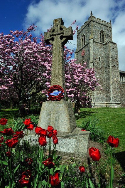
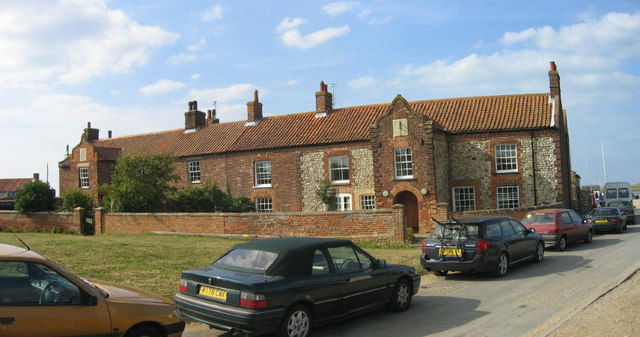
Brancaster is also home to a thriving local community, and amenities within the village include a village hall, church, pub, and a few small shops. The village is well-connected to nearby towns and cities, with regular bus services and road access to Norwich, King's Lynn, and other surrounding areas.

Historically, Brancaster has significance, as it was once a Roman port and a prosperous trading center during the medieval period. The remnants of these ancient times can still be seen in the form of Brancaster Castle, a ruined manor house that dates back to the 15th century.

Overall, Brancaster offers a charming and tranquil escape for those seeking natural beauty, outdoor activities, and a close-knit community atmosphere.

If you have any feedback on the listing, please let us know in the comments section below.

Brancaster Images

Images are sourced within 2km of 52.962871/0.636969 or Grid Reference TF7743. Thanks to Geograph Open Source API. All images are credited.

Looking towards the sea from Titchwell From the main road, outside the Titchwell Manor Hotel.
Looking towards the sea from Titchwell
From the main road, outside the Titchwell Manor Hotel.
Looking towards the sea from Titchwell From the main road, outside the Titchwell Manor Hotel.
Looking towards the sea from Titchwell
From the main road, outside the Titchwell Manor Hotel.
Cottages south of main road in Titchwell Taken looking east from the back car park of the Titchwell Manor hotel/restaurant.
Cottages south of main road in Titchwell
Taken looking east from the back car park of the Titchwell Manor hotel/restaurant.
Brancaster across the marshes
Royal West Norfolk Golf Club: war memorial gates The gate records members and other associates of the club killed in the two World Wars.  At the head of those killed in the Second World War is H.R.H. the Duke of Kent.
Royal West Norfolk Golf Club: war memorial gates
The gate records members and other associates of the club killed in the two World Wars. At the head of those killed in the Second World War is H.R.H. the Duke of Kent.
Brancaster Beach, and the clubhouse of the Royal West Norfolk Golf Club
Marsh Road, between the Royal West Norfolk Golf Club and the marshes
Brancaster Beach The Royal West Norfolk Golf Club clubhouse in the distance.
Brancaster Beach
The Royal West Norfolk Golf Club clubhouse in the distance.
Brancaster Beach Looking towards the ship wreck SS Vina.

The camera location was fixed using a Nikon GP-1 GPS unit attached to the camera. This is embedded in the EXIF data.
Brancaster Beach
Looking towards the ship wreck SS Vina. The camera location was fixed using a Nikon GP-1 GPS unit attached to the camera. This is embedded in the EXIF data.
War Memorial, St Mary's Church, Brancaster
St. Mary's Church - Titchwell Viewed from the main road ( A149 ) on a June evening.
St. Mary's Church - Titchwell
Viewed from the main road ( A149 ) on a June evening.
Titchwell Manor Hotel Built in the late Nineteenth Century with modern extensions.
Titchwell Manor Hotel
Built in the late Nineteenth Century with modern extensions.
Royal West Norfolk Golf Club House, Brancaster Looking inland towards the club house - <span class="nowrap"><a title="http://www.rwngc.org/" rel="nofollow ugc noopener" href="http://www.rwngc.org/">Link</a><img style="margin-left:2px;" alt="External link" title="External link - shift click to open in new window" src="https://s1.geograph.org.uk/img/external.png" width="10" height="10"/></span>
Royal West Norfolk Golf Club House, Brancaster
Looking inland towards the club house - LinkExternal link
Royal West Norfolk Golf Club House, Brancaster A panorama of photographs showing the club house looking north - <span class="nowrap"><a title="http://www.rwngc.org/" rel="nofollow ugc noopener" href="http://www.rwngc.org/">Link</a><img style="margin-left:2px;" alt="External link" title="External link - shift click to open in new window" src="https://s1.geograph.org.uk/img/external.png" width="10" height="10"/></span>
Royal West Norfolk Golf Club House, Brancaster
A panorama of photographs showing the club house looking north - LinkExternal link
Royal West Norfolk Golf Club House, Brancaster
Kite Landboarding, Brancaster beach There are miles of beach here, so as not to get in anyones way.
Kite Landboarding, Brancaster beach
There are miles of beach here, so as not to get in anyones way.
Western Brancaster Beach
Little egret, Brancaster beach As I approached it flew off down the beach and then its yellow feet became visible <span class="nowrap"><a title="http://www.rspb.org.uk/wildlife/birdguide/name/l/littleegret/index.aspx" rel="nofollow ugc noopener" href="http://www.rspb.org.uk/wildlife/birdguide/name/l/littleegret/index.aspx">Link</a><img style="margin-left:2px;" alt="External link" title="External link - shift click to open in new window" src="https://s1.geograph.org.uk/img/external.png" width="10" height="10"/></span> .
Little egret, Brancaster beach
As I approached it flew off down the beach and then its yellow feet became visible LinkExternal link .
Show me another place!

Brancaster is located at Grid Ref: TF7743 (Lat: 52.962871, Lng: 0.636969)

Administrative County: Norfolk

District: King's Lynn and West Norfolk

Police Authority: Norfolk

What 3 Words

///gobblers.surnames.savers. Near Hunstanton, Norfolk

Nearby Locations

Brancaster

Related Wikis

Brancaster

Brancaster is a village and civil parish on the north coast of the English county of Norfolk. The civil parish of Brancaster comprises Brancaster itself...

Branodunum

Branodunum was an ancient Roman fort to the east of the modern English village of Brancaster in Norfolk. Its Roman name derives from the local Celtic language...

Titchwell

Titchwell is a village and civil parish in Norfolk, England. It is situated on the north Norfolk coast some 2 km (1.2 mi) west of the village of Brancaster...

Royal West Norfolk Golf Club

Royal West Norfolk Golf Club is a golf club in Brancaster, Norfolk, England, about 7 miles (11 km) east of Hunstanton, between Brancaster Bay and the salt...

Titchwell Marsh

Titchwell Marsh is an English nature reserve owned and managed by the Royal Society for the Protection of Birds (RSPB). Located on the north coast of the...

Brancaster Staithe

Brancaster Staithe is a village on the north coast of the English county of Norfolk. Brancaster Staithe merges with Burnham Deepdale, forming one village...

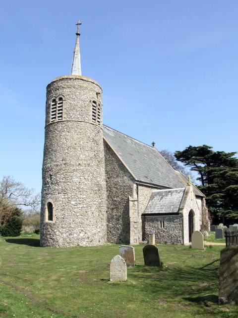
St Mary's Church, Burnham Deepdale

St Mary's Church is a round-tower church in Burnham Deepdale, Norfolk, England. Its round tower and some other parts of the building date from the 11th...

Thornham, Norfolk

Thornham is a village and civil parish in the English county of Norfolk. It is situated on the north Norfolk coast some 7 kilometres (4.3 mi) north-east...

Nearby Amenities

Located within 500m of 52.962871,0.636969
Brancaster
Place: village
Postal Code: PE31
Wikidata: Q2923674
Wikipedia: en:Brancaster
Lat/Long: 52.9634407/0.6395494
Bus Stop
Ship, adj
Bench: yes
Bin: no
Bus: yes
Naptan AtcoCode: 2900B431
Naptan Bearing: W
Naptan CommonName: Ship
Naptan Indicator: adj
Naptan Landmark: London Street
Naptan Locality: Brancaster
Naptan NaptanCode: nfoagdmp
Naptan Street: A149
Naptan Verified: no
Public Transport: platform
Shelter: yes
Source: naptan_import
Tactile Paving: no
Lat/Long: 52.9631069/0.6392344
Bus Stop
Ship, opp
Bench: no
Bin: no
Bus: yes
Naptan AtcoCode: 2900B437
Naptan Bearing: E
Naptan CommonName: Ship
Naptan Indicator: opp
Naptan Landmark: London Street
Naptan Locality: Brancaster
Naptan NaptanCode: nfoagdpt
Naptan Street: A149
Naptan Verified: no
Public Transport: platform
Shelter: no
Source: naptan_import
Lat/Long: 52.9632484/0.6394578
Crossing
Crossing: unmarked
Lat/Long: 52.96001/0.6371858
Power: pole
Lat/Long: 52.9602045/0.6384301
Power: pole
Lat/Long: 52.9589475/0.638752
Power: pole
Transformer: distribution
Lat/Long: 52.9593708/0.6379446
Power: pole
Lat/Long: 52.961266/0.6424749
Power: pole
Lat/Long: 52.9611448/0.6405678
Power: pole
Lat/Long: 52.9610349/0.6389371
Location Transition: yes
Power: pole
Lat/Long: 52.9609315/0.6374082
Location Transition: yes
Power: pole
Lat/Long: 52.9607716/0.6348735
Power: pole
Lat/Long: 52.9606682/0.6330952
Power: pole
Lat/Long: 52.9605422/0.6313679
Entrance: main
Lat/Long: 52.9630927/0.6374632
Post Office
Brancaster Post Office
Addr City: King's Lynn
Addr Housename: Simms Reeves Institute
Addr Housenumber: 71
Addr Postcode: PE31 8AA
Addr Street: Main Road
Addr Village: Brancaster
Brand: Post Office
Brand Wikidata: Q1783168
Contact Website: https://www.postoffice.co.uk/branch-finder/0581313/brancaster
Fixme: Check precise location in building
Opening Hours: Mo, Tu, Th, Fr 09:00-12:30; We 09:00-12:00; Sa-Su closed
Ref Pol Id: 247
Source Addr: pol_branch_list_2018-02
Source Opening Hours: pol_branch_list_2018-02
Lat/Long: 52.9630036/0.6436184
Give Way
Lat/Long: 52.9629558/0.6369912
Give Way
Lat/Long: 52.962885/0.636854
Brancaster
Colour: brown
Man Made: village_sign
Material: wood
Old Name: Branodunum
Lat/Long: 52.9627911/0.6366371
Post Box
Brand: Royal Mail
Brand Wikidata: Q638098
Collection Times: Mo-Fr 09:00; Sa 07:00
Operator: Royal Mail
Operator Wikidata: Q638098
Post Box Type: lamp
Ref: PE31 171
Royal Cypher: EIIR
Royal Cypher Wikidata: Q33102113
Source: survey
Survey Date: 2019-09-16
Lat/Long: 52.96251/0.6369026
Bench
Backrest: yes
Colour: rose
Inscription: In memory of / James Petchey / 1945 - 2011 / "Big Jim"
Material: plastic
Lat/Long: 52.9632265/0.6368329
Post Box
Brand: Royal Mail
Brand Wikidata: Q638098
Collection Times: Mo-Fr 08:00,15:45; Sa 08:00
Operator: Royal Mail
Operator Wikidata: Q638098
Post Box Type: wall
Ref: HST129
Royal Cypher: GR
Royal Cypher Wikidata: Q33102273
Lat/Long: 52.9649075/0.6368476
Waste Basket
Waste: dog_excrement
Lat/Long: 52.9649874/0.6368288
Give Way
Lat/Long: 52.9647954/0.6367346
Post Box
Collection Times: Mo-Fr 16:00; Sa 12:00
Operator: Royal Mail
Post Box Type: wall
Ref: PE31 328
Royal Cypher: GVIR
Lat/Long: 52.9628511/0.6433206
Defibrillator
Access: yes
Defibrillator Location: outside Brancaster Village Hall
Emergency: defibrillator
Indoor: no
Ref GB The Circuit: C1926D39-6ECE-4569-A11B-AE9300BADEDC
Lat/Long: 52.9629523/0.6435414
Leisure: playground
Lat/Long: 52.9635512/0.6438043
The data included in this document is from www.openstreetmap.org. The data is made available under ODbL.

Have you been to Brancaster?

Leave your review of Brancaster below (or comments, questions and feedback).