Brampton Abbotts

Settlement in Herefordshire

England

Brampton Abbotts

Oak Road, post-coronation A rainy May evening a couple of days after the coronation of King Charles III.
Oak Road, post-coronation Credit: Jonathan Billinger

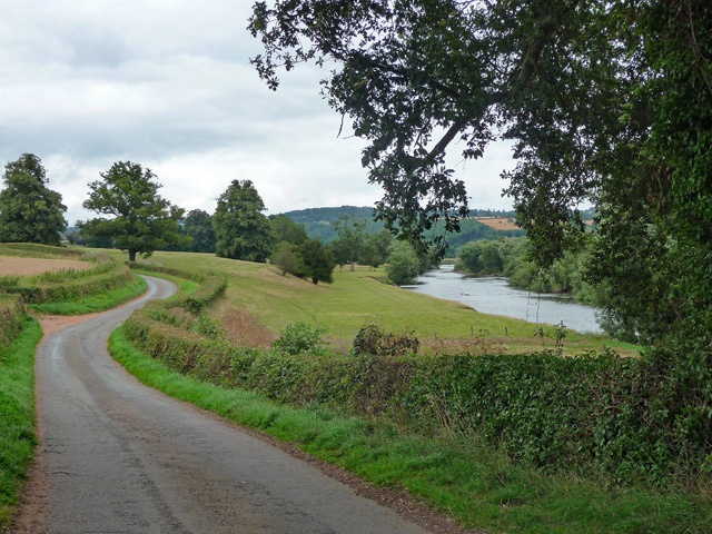
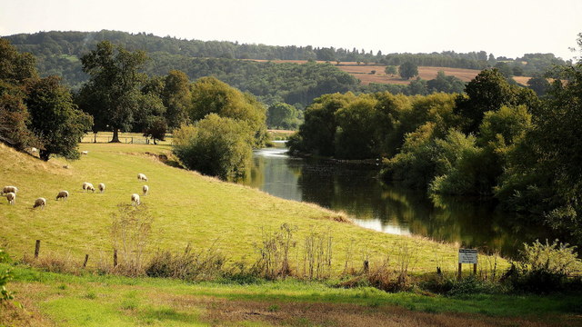
Brampton Abbotts is a small village located in the county of Herefordshire, England. Situated on the eastern bank of the River Wye, it is nestled amidst picturesque countryside and offers residents and visitors a tranquil escape from the hustle and bustle of urban life. The village is approximately 4 miles northeast of the market town of Ross-on-Wye.

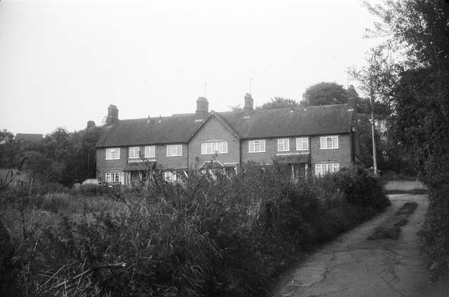
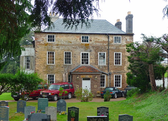
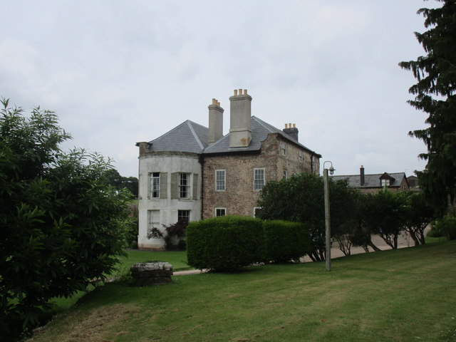
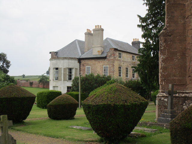
Historically, Brampton Abbotts was part of the ecclesiastical parish of Ross, and the name derives from its association with the nearby Llanthony Priory. The village is characterized by its charming collection of traditional stone houses, many of which date back several centuries. These buildings add to the village's overall charm and provide a glimpse into its rich history.

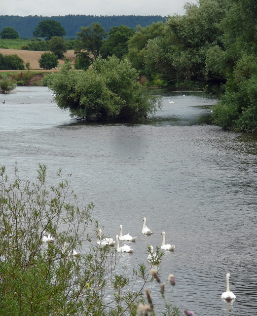
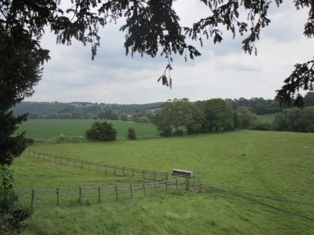
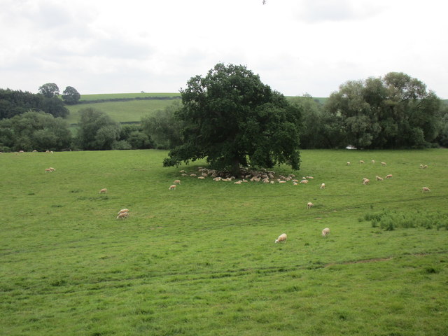
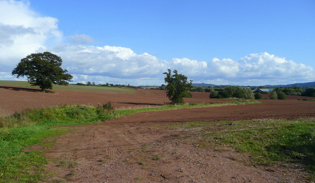
The surrounding area offers plenty of opportunities for outdoor activities, with the River Wye being a popular spot for fishing, boating, and riverside walks. The Wye Valley, designated an Area of Outstanding Natural Beauty, is a short distance away and provides breathtaking views of rolling hills and woodlands.

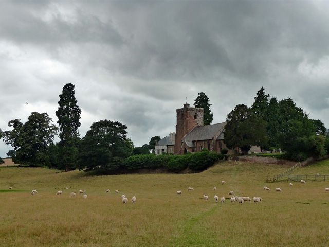
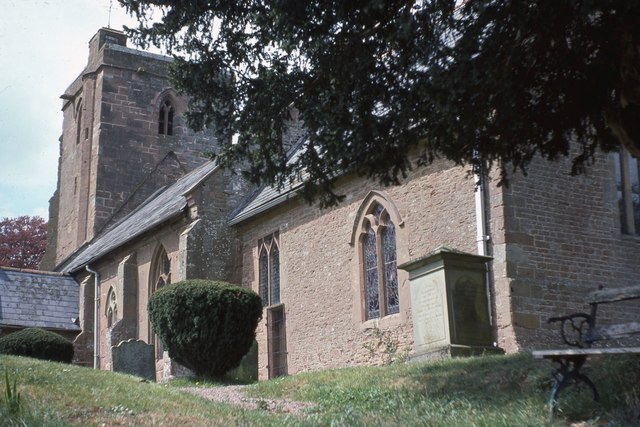
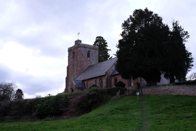
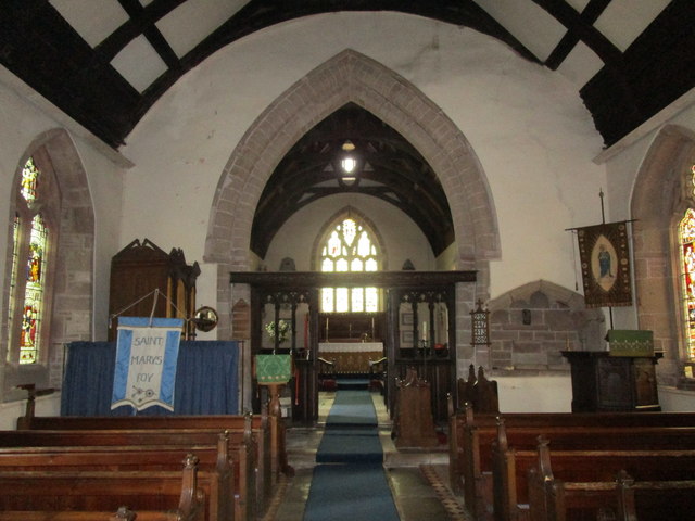
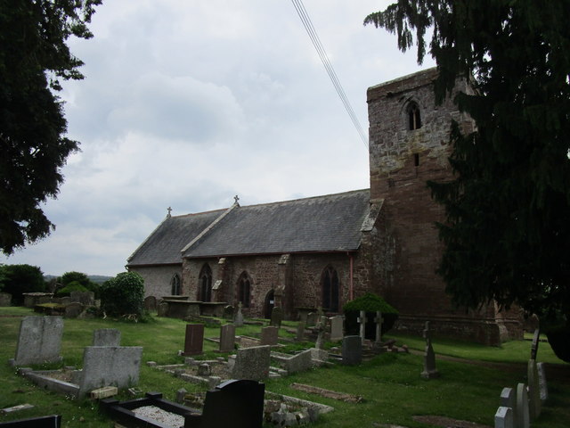
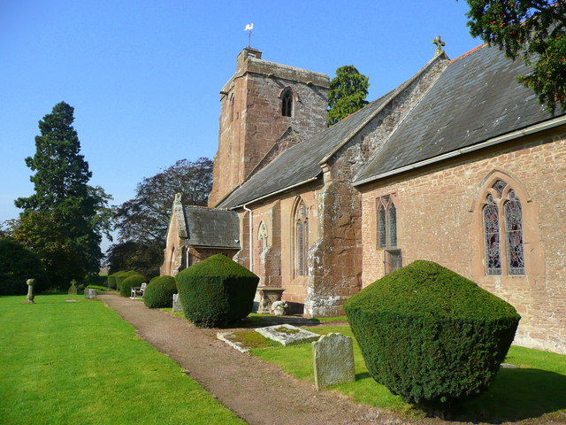
Community life in Brampton Abbotts is vibrant, with a close-knit community that organizes various events throughout the year, including village fairs and social gatherings. The village is home to a small church, St. Michael and All Angels, which holds regular services and is a prominent feature in the village's landscape.

Overall, Brampton Abbotts is a charming and peaceful village that offers a perfect blend of rural beauty, historical significance, and community spirit. It remains a hidden gem in Herefordshire, attracting those seeking a slower pace of life and a connection with nature.

If you have any feedback on the listing, please let us know in the comments section below.

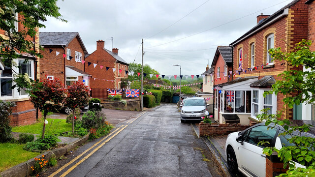
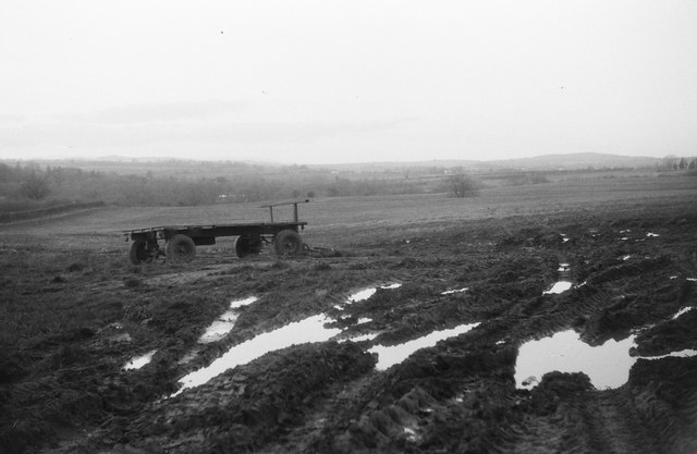
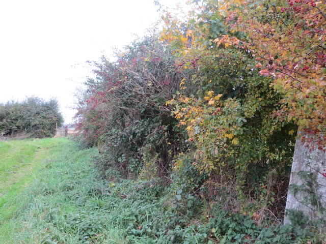
Brampton Abbotts Images

Images are sourced within 2km of 51.936045/-2.577902 or Grid Reference SO6026. Thanks to Geograph Open Source API. All images are credited.

Oak Road, post-coronation A rainy May evening a couple of days after the coronation of King Charles III.
Oak Road, post-coronation
A rainy May evening a couple of days after the coronation of King Charles III.
Farm cart A farm trailer parked in a field at Brampton Abbots near Ross on Wye. Taken with a 1950s Braun Paxette camera.
Farm cart
A farm trailer parked in a field at Brampton Abbots near Ross on Wye. Taken with a 1950s Braun Paxette camera.
Houses and abandoned allotments The overgrown area in the left foreground was formerly used as allotments, now abandoned and earmarked for a housing development. Shot on film using a Braun Paxette.
Houses and abandoned allotments
The overgrown area in the left foreground was formerly used as allotments, now abandoned and earmarked for a housing development. Shot on film using a Braun Paxette.
Field edge view from Brampton Abbotts Triangulation Pillar Looking north-westward.
Field edge view from Brampton Abbotts Triangulation Pillar
Looking north-westward.
St Mary, Foy Bucolically sited by the Wye. Mostly C13th/C14th but as usual touched by many later hands.
St Mary, Foy
Bucolically sited by the Wye. Mostly C13th/C14th but as usual touched by many later hands.
Former vicarage, Foy Rubble-faced, built c1730, the porch a clumsy Victorian addition. The bow round the corner was added c1800. Grade II listed.
Former vicarage, Foy
Rubble-faced, built c1730, the porch a clumsy Victorian addition. The bow round the corner was added c1800. Grade II listed.
Country road near Foy The road meanders to Foy which sits in a large loop of the Wye.
Country road near Foy
The road meanders to Foy which sits in a large loop of the Wye.
River Wye near Baysham There doesn't appear to be a definitive name for a group of swans - a flock, a bevy, a game ... ?
River Wye near Baysham
There doesn't appear to be a definitive name for a group of swans - a flock, a bevy, a game ... ?
Foye Court The former Rectory <span class="nowrap"><a title="https://historicengland.org.uk/listing/the-list/list-entry/1166408" rel="nofollow ugc noopener" href="https://historicengland.org.uk/listing/the-list/list-entry/1166408">Link</a><img style="margin-left:2px;" alt="External link" title="External link - shift click to open in new window" src="https://s1.geograph.org.uk/img/external.png" width="10" height="10"/></span>
Foye Court
The former Rectory LinkExternal link
The Wye near Foy A late summer view from the lane utilising telephoto to highlight the pastoral scene by the river.
In the distance is the high ground around Perrystone Hill.
The Wye near Foy
A late summer view from the lane utilising telephoto to highlight the pastoral scene by the river. In the distance is the high ground around Perrystone Hill.
St Mary's Church - Foy on Wye, Herefordshire This is the parish church of St Mary on the right bank of the Wye in the scattered 'cut in half' parish of Foy. The building dates from the 13th and 14th centuries and has a 14th century door. The east window of 1675 is a copy of the one at Sellack. There are memorials here to members of the Abrahall family. The village, for some reason, used to be known as Eton Tregoz and is truly cut in half. The only way of passing between the two is a footbridge of 1876, rebuilt in 1919 and drivers have a journey to Ross if they want to cross to the other half of the parish. Source: Herefordshire Village Book – Herefordshire Federation of Women's Institutes/Countryside Books. Time photo taken not available.
St Mary's Church - Foy on Wye, Herefordshire
This is the parish church of St Mary on the right bank of the Wye in the scattered 'cut in half' parish of Foy. The building dates from the 13th and 14th centuries and has a 14th century door. The east window of 1675 is a copy of the one at Sellack. There are memorials here to members of the Abrahall family. The village, for some reason, used to be known as Eton Tregoz and is truly cut in half. The only way of passing between the two is a footbridge of 1876, rebuilt in 1919 and drivers have a journey to Ross if they want to cross to the other half of the parish. Source: Herefordshire Village Book – Herefordshire Federation of Women's Institutes/Countryside Books. Time photo taken not available.
St Mary's church, Foy The village of Foy gives its name to the peninsula of land formed by an enormous meander in the River Wye. Foy consists of two or three farms, a rather grand house and thins church. The church is aligned north east - south west, which is unusual with most churches facing east; this is probably due to the local topography and the course of the nearby River Wye. More about the church's history can be found at <span class="nowrap"><a title="http://www.stmarysfoy.co.uk/history.html#church" rel="nofollow ugc noopener" href="http://www.stmarysfoy.co.uk/history.html#church">Link</a><img style="margin-left:2px;" alt="External link" title="External link - shift click to open in new window" src="https://s1.geograph.org.uk/img/external.png" width="10" height="10"/></span>
St Mary's church, Foy
The village of Foy gives its name to the peninsula of land formed by an enormous meander in the River Wye. Foy consists of two or three farms, a rather grand house and thins church. The church is aligned north east - south west, which is unusual with most churches facing east; this is probably due to the local topography and the course of the nearby River Wye. More about the church's history can be found at LinkExternal link
Church of St. Mary, Foy, interior looking east Largely thirteenth century though quite heavily restored <span class="nowrap"><a title="https://historicengland.org.uk/listing/the-list/list-entry/1157820" rel="nofollow ugc noopener" href="https://historicengland.org.uk/listing/the-list/list-entry/1157820">Link</a><img style="margin-left:2px;" alt="External link" title="External link - shift click to open in new window" src="https://s1.geograph.org.uk/img/external.png" width="10" height="10"/></span>
Church of St. Mary, Foy, interior looking east
Largely thirteenth century though quite heavily restored LinkExternal link
Footpath to the River Wye The footpath can just be made out crossing the grass field from the lower right hand corner of the photograph.
Footpath to the River Wye
The footpath can just be made out crossing the grass field from the lower right hand corner of the photograph.
Sheep in the shade It's not particularly hot or sunny but the sheep have mostly taken to the shade.
In a field between St. Mary's church, Foy and the River Wye.
Sheep in the shade
It's not particularly hot or sunny but the sheep have mostly taken to the shade. In a field between St. Mary's church, Foy and the River Wye.
The east end of St. Mary's church, Foy Largely a rebuilding of 1673. Money was bequeathed in 1640 under the will of John Abrahall for this to be done. No doubt the religious strife of the period prevented its execution until over 30 years later. <span class="nowrap"><a title="https://historicengland.org.uk/listing/the-list/list-entry/1157820" rel="nofollow ugc noopener" href="https://historicengland.org.uk/listing/the-list/list-entry/1157820">Link</a><img style="margin-left:2px;" alt="External link" title="External link - shift click to open in new window" src="https://s1.geograph.org.uk/img/external.png" width="10" height="10"/></span>
The east end of St. Mary's church, Foy
Largely a rebuilding of 1673. Money was bequeathed in 1640 under the will of John Abrahall for this to be done. No doubt the religious strife of the period prevented its execution until over 30 years later. LinkExternal link
Foye Court The former Rectory. <span class="nowrap"><a title="https://historicengland.org.uk/listing/the-list/list-entry/1166408" rel="nofollow ugc noopener" href="https://historicengland.org.uk/listing/the-list/list-entry/1166408">Link</a><img style="margin-left:2px;" alt="External link" title="External link - shift click to open in new window" src="https://s1.geograph.org.uk/img/external.png" width="10" height="10"/></span>
Foye Court
The former Rectory. LinkExternal link
St. Mary's church, Foy Largely dating to the thirteenth and fourteenth centuries <span class="nowrap"><a title="https://historicengland.org.uk/listing/the-list/list-entry/1157820" rel="nofollow ugc noopener" href="https://historicengland.org.uk/listing/the-list/list-entry/1157820">Link</a><img style="margin-left:2px;" alt="External link" title="External link - shift click to open in new window" src="https://s1.geograph.org.uk/img/external.png" width="10" height="10"/></span>
St. Mary's church, Foy
Largely dating to the thirteenth and fourteenth centuries LinkExternal link
Show me another place!

Brampton Abbotts is located at Grid Ref: SO6026 (Lat: 51.936045, Lng: -2.577902)

Unitary Authority: County of Herefordshire

Police Authority: West Mercia

What 3 Words

///shunning.perplexed.hamper. Near Ross on Wye, Herefordshire

Related Wikis

Brampton Abbotts

Brampton Abbotts is a village and civil parish in Herefordshire, England. It is located 2 km north of Ross-on-Wye and 16 km south east of Hereford. The...

Ross Spur Services

Ross Spur Services is a southbound-only service area on the A449 at the end of the M50 motorway. Formerly operated by BP, it is now owned by Euro Garages...

John Kyrle High School

John Kyrle High School is a secondary school with academy status situated in Ross-on-Wye, Herefordshire, England. It is named after the philanthropist...
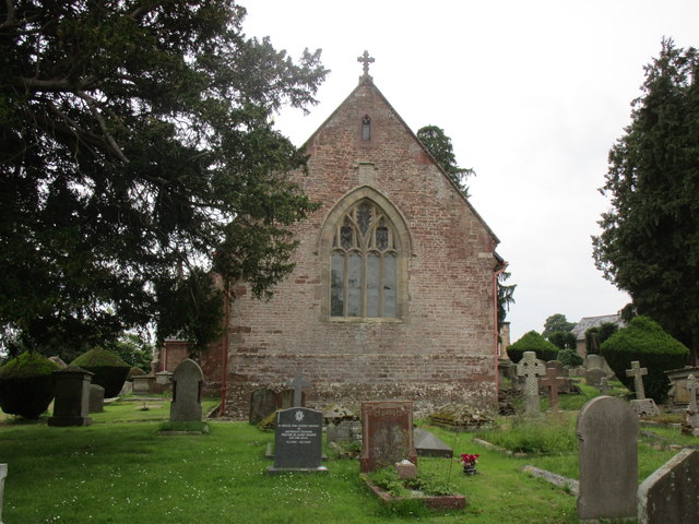
Foy, Herefordshire

Foy is a hamlet and civil parish in Herefordshire, England. By road, it is 7 kilometres (4 miles) north of Ross-on-Wye, 23 kilometres (14 miles) south...

Nearby Amenities

Located within 500m of 51.936045,-2.577902
Post Box
Collection Times: Mo-Fr 09:00; Sa 08:00
Post Box Type: wall
Ref: HR9 400
Royal Cypher: GR
Royal Cypher Wikidata: Q33102273
Lat/Long: 51.9370582/-2.5827047
Brampton Abbotts
Place: hamlet
Wikidata: Q3784152
Lat/Long: 51.9358472/-2.5808687
Bus Stop
Bus Shelter
Naptan AtcoCode: 2090A119900
Naptan Bearing: S
Naptan CommonName: Bus Shelter
Naptan Indicator: adj
Naptan Landmark: Oak House Nursery School
Naptan NaptanCode: heradtgt
Naptan Street: Ross Road
Naptan Verified: no
Source: naptan_import
Lat/Long: 51.9359854/-2.5778757
Bus Stop
Bus Shelter
Naptan AtcoCode: 2090A18486
Naptan Bearing: N
Naptan BusStopType: CUS
Naptan CommonName: Bus Shelter
Naptan Indicator: opp
Naptan Landmark: Village Hall
Naptan NaptanCode: heragtjm
Naptan Street: Ross Road
Naptan Verified: no
Source: naptan_import
Lat/Long: 51.9357532/-2.5781355
Barrier: stile
Material: wood
Stile: stepover
Lat/Long: 51.9397637/-2.5788492
Barrier: kissing_gate
Source: survey
Lat/Long: 51.9344485/-2.5817005
Barrier: stile
Source: survey
Lat/Long: 51.934996/-2.5844587
Barrier: stile
Source: survey
Lat/Long: 51.9351537/-2.5835525
Post Box
Collection Times: Mo-Fr 16:30; Sa 09:00
Post Box Type: lamp
Ref: HR9 509
Royal Cypher: EIIR
Royal Cypher Wikidata: Q33102113
Lat/Long: 51.9353412/-2.5781331
Barrier: stile
Lat/Long: 51.9354809/-2.5816455
Barrier: stile
Lat/Long: 51.9357298/-2.5804772
Barrier: stile
Lat/Long: 51.9369542/-2.577829
Barrier: stile
Lat/Long: 51.9371272/-2.582568
Barrier: stile
Lat/Long: 51.9372035/-2.5798171
Barrier: stile
Lat/Long: 51.9384646/-2.5774666
Power: pole
Lat/Long: 51.9322238/-2.5803577
Power: pole
Lat/Long: 51.9329428/-2.5801558
Power: pole
Lat/Long: 51.933662/-2.5799477
Power: pole
Lat/Long: 51.9343743/-2.579747
Power: pole
Lat/Long: 51.9350333/-2.5795952
Green Close
Power: pole
Transformer: distribution
Voltage Primary: 11000
Lat/Long: 51.9352541/-2.5785933
Power: pole
Lat/Long: 51.9353216/-2.5773826
Power: pole
Lat/Long: 51.9353577/-2.5762505
Power: pole
Lat/Long: 51.9354087/-2.5751631
Power: pole
Lat/Long: 51.9354786/-2.5737661
Brampton Abbotts Church
Location Transition: yes
Power: pole
Transformer: distribution
Voltage Primary: 11000
Lat/Long: 51.9356019/-2.5822647
Brampton Abbotts
Power: pole
Transformer: distribution
Voltage Primary: 11000
Lat/Long: 51.9358096/-2.5793592
Power: pole
Lat/Long: 51.9358811/-2.5816713
Location Transition: yes
Power: pole
Lat/Long: 51.9360597/-2.5790245
Power: pole
Lat/Long: 51.9360964/-2.5728905
Power: pole
Lat/Long: 51.9361519/-2.5810663
Power: pole
Lat/Long: 51.9364521/-2.580479
Power: pole
Lat/Long: 51.9365892/-2.572156
Power: pole
Lat/Long: 51.9367122/-2.5799498
Location Transition: yes
Power: pole
Lat/Long: 51.9368057/-2.5797697
Brampton Abbotts North
Power: pole
Transformer: distribution
Voltage Primary: 11000
Lat/Long: 51.9375081/-2.5797556
Entrance: yes
Lat/Long: 51.9347273/-2.5818409
Barrier: stile
Material: wood
Stile: stepover
Lat/Long: 51.9387516/-2.5797507
Telephone
Defibrillator
Booth: K6
Colour: red
Defibrillator Location: inside red phone box, Ross Road, Brampton Abbotts
Emergency: defibrillator
Man Made: telephone_box
Ref GB The Circuit: 3DD6ED2F-062F-4194-814E-7871A40618AE
Lat/Long: 51.9353248/-2.5781342
New House Brampton Abbotts
Power: pole
Transformer: distribution
Voltage Primary: 11000
Lat/Long: 51.937297/-2.5729398
New House Cottages
Power: pole
Transformer: distribution
Voltage Primary: 11000
Lat/Long: 51.9366768/-2.5711079
Power: pole
Lat/Long: 51.9368893/-2.5717302
Brampton Abbotts South
Power: pole
Transformer: distribution
Voltage Primary: 11000
Lat/Long: 51.9337481/-2.5770852
Power: pole
Lat/Long: 51.9345278/-2.577222
Power: pole
Lat/Long: 51.9373242/-2.5710945
The data included in this document is from www.openstreetmap.org. The data is made available under ODbL.

Have you been to Brampton Abbotts?

Leave your review of Brampton Abbotts below (or comments, questions and feedback).