Whitelackington

Settlement in Somerset South Somerset

England

Whitelackington

Ilminster This market town takes its name from the River Ile and the Minster church, St Mary's.
Ilminster Credit: Liz Martin

Whitelackington is a small village located in the county of Somerset, England. Situated approximately 5 miles east of the town of Ilminster, Whitelackington is nestled amidst the picturesque rolling hills and lush green countryside that Somerset is renowned for.

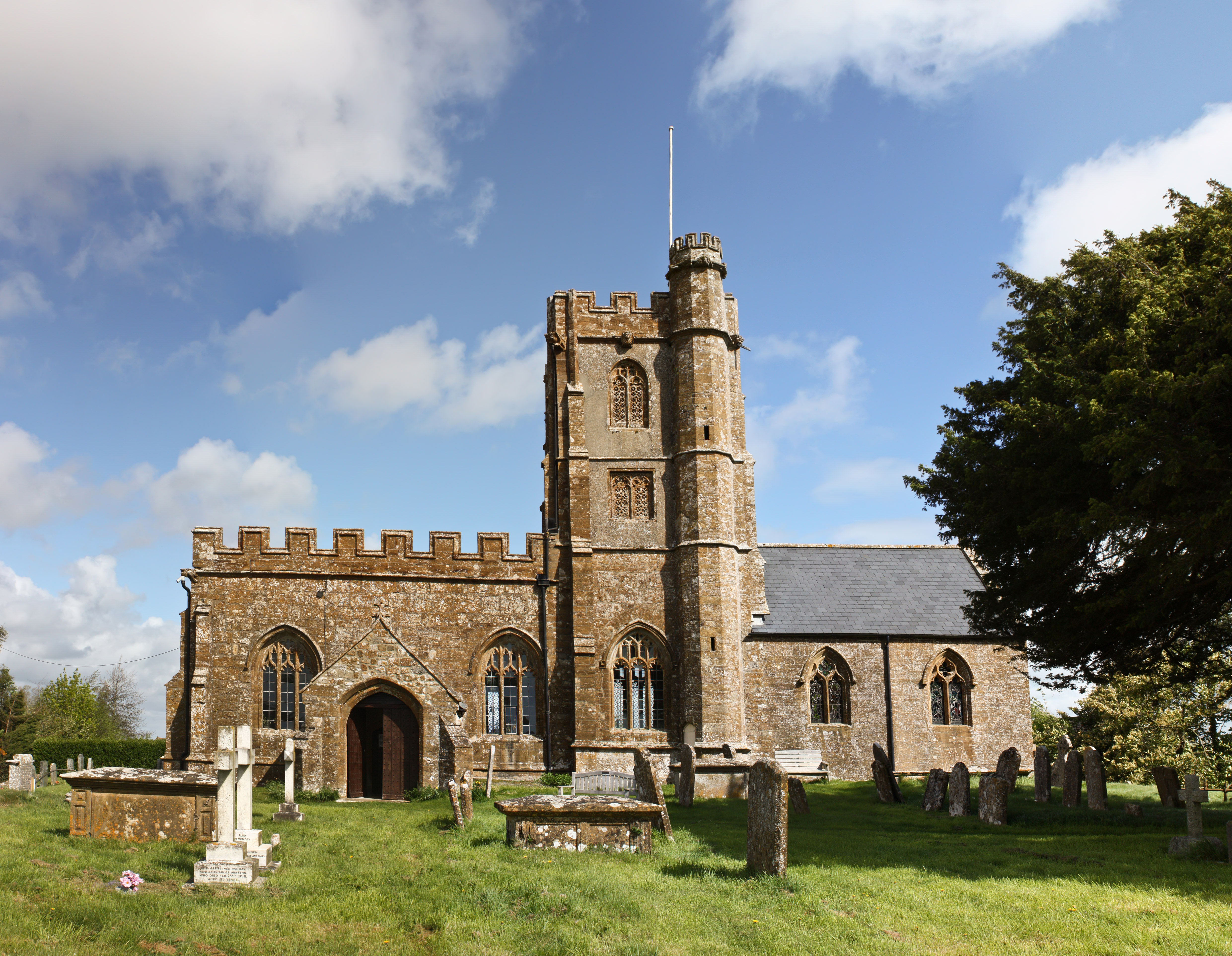
The village, with a population of around 200 residents, is characterized by its traditional English charm and rural beauty. It boasts a collection of well-preserved historic buildings, including a charming 15th-century church dedicated to St. Mary the Virgin. The church is a notable local landmark, with its impressive tower and intricate stained glass windows.

Whitelackington is surrounded by fertile agricultural land, and farming has played a significant role in the village's economy for centuries. The fields are predominantly used for grazing livestock and cultivating crops, contributing to the area's picturesque landscape. The village is also home to a number of small, family-run businesses that cater to both locals and visitors.

Nature enthusiasts will find plenty to explore in the vicinity of Whitelackington, with numerous footpaths and bridleways crisscrossing the countryside. These pathways offer breathtaking views of the surrounding area, making it a popular destination for walkers, cyclists, and horse riders.

Despite its small size, Whitelackington benefits from a strong sense of community. The village hosts various events throughout the year, including a summer fete and a Christmas market, bringing residents together and fostering a friendly atmosphere.

In summary, Whitelackington is a quintessentially English village, offering a peaceful retreat in the heart of Somerset's countryside. With its historic charm, rural landscapes, and strong community spirit, it is a hidden gem that captures the essence of traditional village life.

If you have any feedback on the listing, please let us know in the comments section below.

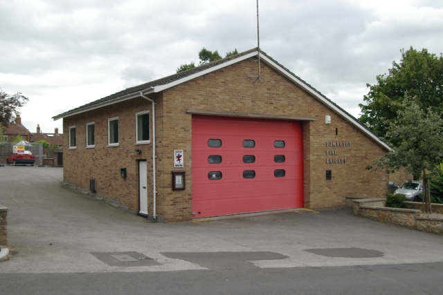
Whitelackington Images

Images are sourced within 2km of 50.934386/-2.883977 or Grid Reference ST3715. Thanks to Geograph Open Source API. All images are credited.

Ilminster This market town takes its name from the River Ile and the Minster church, St Mary's.
Ilminster
This market town takes its name from the River Ile and the Minster church, St Mary's.
Whitelackington Village Hall
Whitelackington
Village Hall
Dillington House Present house dates back to the 16th Century.  Now a regional centre for adult education and the arts.
Dillington House
Present house dates back to the 16th Century. Now a regional centre for adult education and the arts.
Track in Autumn
Track in Autumn
St John and All Saints church, Kingstone The medieval church <span class="nowrap"><a title="http://webapp1.somerset.gov.uk/her/details.asp?prn=56710" rel="nofollow ugc noopener" href="http://webapp1.somerset.gov.uk/her/details.asp?prn=56710">Link</a><img style="margin-left:2px;" alt="External link" title="External link - shift click to open in new window" src="https://s1.geograph.org.uk/img/external.png" width="10" height="10"/></span> from the south.
St John and All Saints church, Kingstone
The medieval church LinkExternal link from the south.
Townsend Farm, Ilminster Seen from the slopes of Pretwood Hill.
Townsend Farm, Ilminster
Seen from the slopes of Pretwood Hill.
Cottages at Knott Oak Seen from the slopes of Pretwood Hill, looking northeast.
Cottages at Knott Oak
Seen from the slopes of Pretwood Hill, looking northeast.
Wake Hill, Kingstone Early C19 house - "in a later form of 'cottage ornee' (<span class="nowrap"><a title="http://webapp1.somerset.gov.uk/her/details.asp?prn=57246" rel="nofollow ugc noopener" href="http://webapp1.somerset.gov.uk/her/details.asp?prn=57246">Link</a><img style="margin-left:2px;" alt="External link" title="External link - shift click to open in new window" src="https://s1.geograph.org.uk/img/external.png" width="10" height="10"/></span> )
Wake Hill, Kingstone
Early C19 house - "in a later form of 'cottage ornee' (LinkExternal link )
Old Toll House, Kingstone <span class="nowrap"><a title="http://webapp1.somerset.gov.uk/her/details.asp?prn=57243" rel="nofollow ugc noopener" href="http://webapp1.somerset.gov.uk/her/details.asp?prn=57243">Link</a><img style="margin-left:2px;" alt="External link" title="External link - shift click to open in new window" src="https://s1.geograph.org.uk/img/external.png" width="10" height="10"/></span> . George V postbox TA19 19 is on the wall. See also <a href="https://www.geograph.org.uk/photo/3715963">ST3713 : Old Toll House, Kingstone</a>.
Old Toll House, Kingstone
LinkExternal link . George V postbox TA19 19 is on the wall. See also ST3713 : Old Toll House, Kingstone.
Barn conversion, Kingstone Farmhouse The pre-conversion photo, taken in 1986, at <span class="nowrap"><a title="http://webapp1.somerset.gov.uk/her/details.asp?prn=56718" rel="nofollow ugc noopener" href="http://webapp1.somerset.gov.uk/her/details.asp?prn=56718">Link</a><img style="margin-left:2px;" alt="External link" title="External link - shift click to open in new window" src="https://s1.geograph.org.uk/img/external.png" width="10" height="10"/></span> makes an interesting comparison. Listed and described at <span class="nowrap"><a title="https://historicengland.org.uk/listing/the-list/list-entry/1056989" rel="nofollow ugc noopener" href="https://historicengland.org.uk/listing/the-list/list-entry/1056989">Link</a><img style="margin-left:2px;" alt="External link" title="External link - shift click to open in new window" src="https://s1.geograph.org.uk/img/external.png" width="10" height="10"/></span>  .
Barn conversion, Kingstone Farmhouse
The pre-conversion photo, taken in 1986, at LinkExternal link makes an interesting comparison. Listed and described at LinkExternal link .
Ilminster fire station Ilminster fire station, Blackdown View, Ilminster, Somerset.
Ilminster fire station
Ilminster fire station, Blackdown View, Ilminster, Somerset.
Lane to Allowenshay Trees line one side of the lane as it leaves Boyton Hill.
Lane to Allowenshay
Trees line one side of the lane as it leaves Boyton Hill.
Lane junction near Kingstone Longforward Lane, to the right, leads from Kingstone to Seavington St Mary. Park Lane, to the left, runs along the edge of the landscape park centred on Dillington House, which extends across much of Whitelackington parish.
Lane junction near Kingstone
Longforward Lane, to the right, leads from Kingstone to Seavington St Mary. Park Lane, to the left, runs along the edge of the landscape park centred on Dillington House, which extends across much of Whitelackington parish.
Park Lane On the right is Putcombe Copse, which was the site of a C16 deerpark, part of Whitelackington Park. The lane leads to Kingstone.
Park Lane
On the right is Putcombe Copse, which was the site of a C16 deerpark, part of Whitelackington Park. The lane leads to Kingstone.
Hurcott Copse Between the camera and the wooded slopes the A303 lies hidden. In the foreground, Park Lane meets the former main road from Ilminster to Yeovil, now downgraded to unclassified.
Hurcott Copse
Between the camera and the wooded slopes the A303 lies hidden. In the foreground, Park Lane meets the former main road from Ilminster to Yeovil, now downgraded to unclassified.
St Mary's Church, Whitelackington The church is very close to the manor house, and consequently difficult to photograph from the south. <span class="nowrap"><a title="http://webapp1.somerset.gov.uk/her/details.asp?prn=53358" rel="nofollow ugc noopener" href="http://webapp1.somerset.gov.uk/her/details.asp?prn=53358">Link</a><img style="margin-left:2px;" alt="External link" title="External link - shift click to open in new window" src="https://s1.geograph.org.uk/img/external.png" width="10" height="10"/></span>
St Mary's Church, Whitelackington
The church is very close to the manor house, and consequently difficult to photograph from the south. LinkExternal link
Dillington Park A view from the long drive that approaches Dillington House from Whitelackington.
Dillington Park
A view from the long drive that approaches Dillington House from Whitelackington.
Dillington Park Farm The farm lies in the landscape park of Dillington House. A workshop among the buildings houses a firm of cabinet makers. See also <a href="https://www.geograph.org.uk/photo/1307455">ST3715 : Fishing lake, Dillington</a>.
Dillington Park Farm
The farm lies in the landscape park of Dillington House. A workshop among the buildings houses a firm of cabinet makers. See also ST3715 : Fishing lake, Dillington.
Show me another place!

Whitelackington is located at Grid Ref: ST3715 (Lat: 50.934386, Lng: -2.883977)

Administrative County: Somerset

District: South Somerset

Police Authority: Avon and Somerset

What 3 Words

///reunion.encourage.exclusive. Near Ilminster, Somerset

Related Wikis

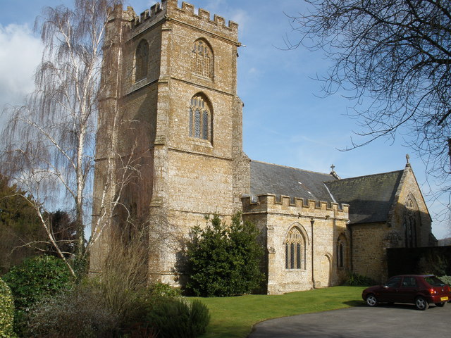
Church of St Mary the Virgin, Whitelackington

The Anglican Church of St Mary the Virgin in Whitelackington, Somerset, England was built in the 14th and 15th centuries. It is a Grade II* listed building...

Whitelackington

Whitelackington is a village and civil parish on the A303 one mile north east of Ilminster, in Somerset, England. The parish includes Dillington Park and...

Dillington House

Dillington House is a residential adult education college near Ilminster in the parish of Whitelackington, Somerset, England. The present house, which...

Church of St John the Evangelist and All Saints, Kingstone

The Anglican Church of St John the Evangelist and All Saints in Kingstone, Somerset, England was built in the 14th century. It is a Grade II* listed building...

Nearby Amenities

Located within 500m of 50.934386,-2.883977
Passing Place
Lat/Long: 50.9359963/-2.8893303
Whitelackington
Place: village
Wikidata: Q2583625
Wikipedia: en:Whitelackington
Lat/Long: 50.935792/-2.8846032
Barrier: bollard
Lat/Long: 50.9346307/-2.8850814
Give Way
Direction: backward
Lat/Long: 50.9344642/-2.8838856
Historic: memorial
Lat/Long: 50.9341628/-2.8842708
Passing Place
Lat/Long: 50.9359927/-2.887501
Booth: K6
Removed Amenity: telephone
Lat/Long: 50.9366448/-2.8837567
Post Box
Collection Times: Mo-Fr 11:00; Sa 10:30
Drive Through: no
Operator: Royal Mail
Operator Wikidata: Q638098
Ref: TA19 22
Lat/Long: 50.9366279/-2.8837774
Give Way
Direction: backward
Lat/Long: 50.9345466/-2.8848801
Give Way
Direction: forward
Lat/Long: 50.9379175/-2.8850049
Defibrillator
Access: yes
Defibrillator Location: outside Whitelackington Village Hall on North side of building
Emergency: defibrillator
Indoor: no
Lat/Long: 50.9365595/-2.8835758
The data included in this document is from www.openstreetmap.org. The data is made available under ODbL.

Have you been to Whitelackington?

Leave your review of Whitelackington below (or comments, questions and feedback).