Whiteknights

Settlement in Berkshire

England

Whiteknights

Duke Street bridge This photo was taken as part of a personal project to try and recreate 'Firsts' for the grid squares that I visit. In this case the first image submitted was by Brendan and Ruth McCartney 16 years ago. See <a href="https://www.geograph.org.uk/photo/183">SU7173 : Duke Street Bridge, River Kennet, Reading</a>.
Duke Street bridge Credit: Mr Ignavy

Whiteknights is a charming village located in the county of Berkshire, England. Situated just two miles from the bustling town of Reading, Whiteknights offers residents a peaceful and idyllic setting, surrounded by lush greenery and picturesque landscapes.

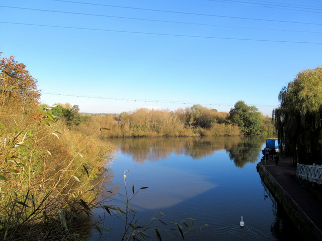
The village is renowned for its stunning Whiteknights Park, a 130-hectare public space that was once part of the historic Whiteknights Estate. The park boasts beautiful gardens, woodlands, and lakes, providing an ideal spot for leisurely walks, picnics, and various outdoor activities. Additionally, the park is home to the University of Reading, which adds a vibrant and intellectual atmosphere to the area.

Whiteknights is a well-connected village, with excellent transport links to both Reading and London. The nearby M4 motorway provides easy access to London, while Reading Station offers frequent train services to various destinations across the country.

In terms of amenities, Whiteknights offers a range of local shops, cafes, and restaurants, catering to the needs of its residents. The village also benefits from several highly regarded schools, making it an attractive location for families.

Overall, Whiteknights is a delightful village that combines the tranquility of rural living with the convenience of nearby urban centers. With its stunning park, excellent transport links, and abundance of amenities, Whiteknights offers a high quality of life for its residents.

If you have any feedback on the listing, please let us know in the comments section below.
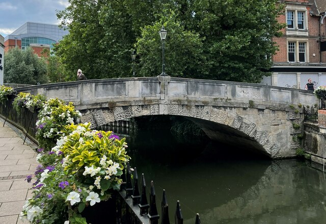
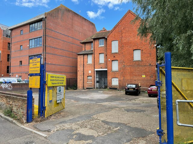
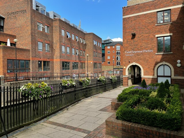
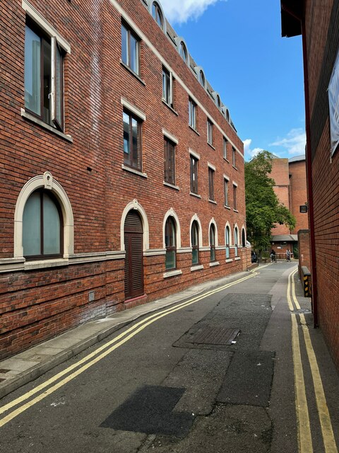
Whiteknights Images

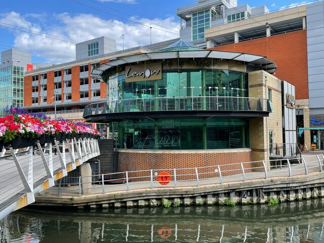
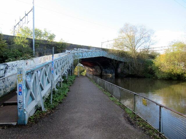
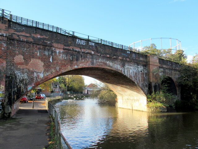
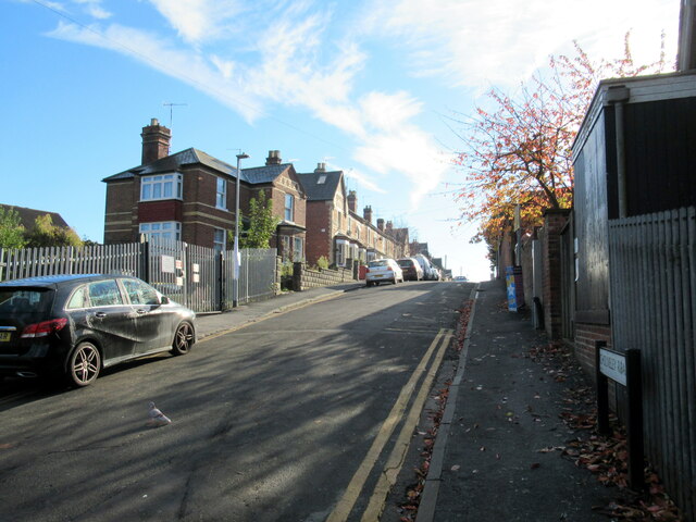
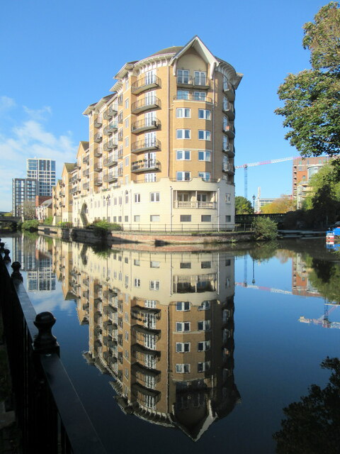
Images are sourced within 2km of 51.442298/-0.9510535 or Grid Reference SU7372. Thanks to Geograph Open Source API. All images are credited.

Duke Street bridge This photo was taken as part of a personal project to try and recreate 'Firsts' for the grid squares that I visit. In this case the first image submitted was by Brendan and Ruth McCartney 16 years ago. See <a href="https://www.geograph.org.uk/photo/183">SU7173 : Duke Street Bridge, River Kennet, Reading</a>.
Duke Street bridge
This photo was taken as part of a personal project to try and recreate 'Firsts' for the grid squares that I visit. In this case the first image submitted was by Brendan and Ruth McCartney 16 years ago. See SU7173 : Duke Street Bridge, River Kennet, Reading.
Horrse & Barge car park
Dukesbridge Court
Dukesbridge Court
Looking down Star Lane
Redundant Ready Bike stands
Buildings on London Road The modern building is known as Central Point.
Buildings on London Road
The modern building is known as Central Point.
Black History Mural Looking good after 21 years, see also <a href="https://www.geograph.org.uk/photo/605875">SU7173 : Black History Mural, Reading</a>.
Black History Mural
Looking good after 21 years, see also SU7173 : Black History Mural, Reading.
Lemoni by the Kennet When I first took a photo here it was occupied by Chili's, <a href="https://www.geograph.org.uk/photo/780249">SU7173 : Chili's restaurant by the Kennet</a>.
Lemoni by the Kennet
When I first took a photo here it was occupied by Chili's, SU7173 : Chili's restaurant by the Kennet.
Mask machine - The Oracle I wonder how long this will stay here.
Mask machine - The Oracle
I wonder how long this will stay here.
The playing fields of St. John's school
St. John's school playing fields
Up the river to Oxford, over the bridge to Bristol signpost at mouth of River Kennet
The River Kennet joins the Thames at Reading
Footbridge and railway bridge over the Kennet at Reading
Railway bridge over the Kennet at Reading
Cholmeley Road, New Town Reading
Reflections in the River Kennet, Reading
Show me another place!

Whiteknights is located at Grid Ref: SU7372 (Lat: 51.442298, Lng: -0.9510535)

Unitary Authority: Reading

Police Authority: Thames Valley

What 3 Words

///regard.trail.same. Near Earley, Berkshire

Related Wikis

ICMA Centre

The International Capital Market Association Centre (or ICMA Centre) is a department of the Henley Business School within the University of Reading, based...

University of Reading

The University of Reading is a public research university in Reading, Berkshire, England. It was founded in 1892 as University College, Reading, a University...

Cole Museum of Zoology

The Cole Museum of Zoology is a university museum, part of the School of Biological Sciences at the University of Reading. It is located on the ground...

Ure Museum of Greek Archaeology

The Ure Museum of Greek Archaeology is a museum of ancient Mediterranean archaeology, primarily that of ancient Greek civilisation but with smaller collections...

Nearby Amenities

Located within 500m of 51.442298,-0.9510535
Traffic Signals
Source: Bing
Traffic Signals Direction: forward
Lat/Long: 51.4424498/-0.9543282
Crossing
Crossing: unmarked
Crossing Island: yes
Kerb: lowered
Sloped Curb: yes
Source: seen on journey
Tactile Paving: no
Lat/Long: 51.4427313/-0.9545051
Traffic Calming: table
Lat/Long: 51.4393204/-0.9554582
Crossing
Crossing: zebra
Crossing Island: no
Tactile Paving: yes
Lat/Long: 51.4462328/-0.950959
Traffic Calming: cushion
Lat/Long: 51.4460311/-0.950993
Post Box
Collection Times: Mo-Fr 16:00, Sa 10:45
Post Box Type: pillar
Ref: RG2 13
Royal Cypher: EIIR
Royal Cypher Wikidata: Q33102113
Lat/Long: 51.442787/-0.9553101
Pub
The Queen's Head
Addr City: Reading
Addr Housenumber: 54
Addr Postcode: RG2 7AZ
Addr Street: Christchurch Road
Loc Name: The Nob
Lat/Long: 51.4430577/-0.9565033
Post Box
Collection Times: Mo-Fr 12:00, Sa 07:00
Ref: RG2 116D
Royal Cypher: EIIR
Royal Cypher Wikidata: Q33102113
Lat/Long: 51.4386284/-0.9507582
Crossing
Crossing: uncontrolled
Crossing Ref: zebra
Kerb: lowered
Source: Bing
Lat/Long: 51.4400741/-0.9481919
Mini Roundabout
Direction: clockwise
Lat/Long: 51.4420039/-0.947459
Crossing
Crossing: marked
Crossing Markings: yes
Lat/Long: 51.440252/-0.9483561
Crossing
Crossing: marked
Crossing Island: no
Crossing Markings: yes
Tactile Paving: yes
Lat/Long: 51.4419498/-0.9485383
Recycling
Location: overground
Recycling Cardboard: yes
Recycling Paper: yes
Recycling Type: container
Lat/Long: 51.4416639/-0.9464575
Recycling
Recycling Cans: yes
Recycling Cardboard: yes
Recycling Magazines: yes
Recycling Paper: yes
Recycling Plastic Bottles: yes
Lat/Long: 51.4395977/-0.9461443
Entrance: yes
Lat/Long: 51.4408959/-0.9462999
B
Entrance: yes
Lat/Long: 51.4415456/-0.946765
Crossing
Crossing: uncontrolled
Crossing Ref: zebra
Kerb: lowered
Source: Bing
Lat/Long: 51.4419384/-0.9472267
Bus Stop
Wellington Avenue
Bench: yes
Bin: no
Lit: yes
Naptan AtcoCode: 039027730002
Naptan NaptanCode: rdgdtjg
Public Transport: platform
Route Ref: 9;144
Shelter: no
Source: survey
Tactile Paving: yes
Wheelchair: yes
Lat/Long: 51.4387057/-0.9505937
Bus Stop
Wellington Avenue
Bench: yes
Bin: yes
Lit: yes
Public Transport: platform
Shelter: yes
Source: survey
Tactile Paving: yes
Wheelchair: yes
Lat/Long: 51.4394843/-0.9511777
Bus Stop
Chancellors Way
Bench: no
Bin: no
Lit: yes
Naptan AtcoCode: 039025500002
Naptan NaptanCode: rdgajgm
Public Transport: platform
Shelter: no
Source: survey
Tactile Paving: yes
Wheelchair: yes
Lat/Long: 51.4402529/-0.9518049
Bus Stop
Chancellors Way
Bench: yes
Bin: yes
Lit: yes
Public Transport: platform
Shelter: yes
Source: survey
Tactile Paving: yes
Wheelchair: yes
Lat/Long: 51.4407248/-0.9525335
Bus Stop
Christchurch Green
Bench: yes
Bin: yes
Lit: yes
Naptan AtcoCode: 039025570003
Naptan NaptanCode: rdgajtg
Public Transport: platform
Shelter: yes
Source: survey
Tactile Paving: yes
Lat/Long: 51.4424114/-0.9540452
Bus Stop
Christchurch Green
Bench: yes
Bin: yes
Lit: yes
Naptan AtcoCode: 039025570002
Naptan NaptanCode: rdgajtd
Public Transport: platform
Shelter: yes
Source: survey
Tactile Paving: yes
Lat/Long: 51.4430927/-0.9547466
Bus Stop
Christchurch Green
Bench: yes
Bin: yes
Bus: yes
Lit: yes
Naptan AtcoCode: 039025570001
Naptan NaptanCode: rdgajta
Public Transport: platform
Route Ref: 20;21;73
Shelter: yes
Source: survey
Tactile Paving: no
Wheelchair: limited
Lat/Long: 51.4430155/-0.9560886
Bus Stop
UoR Whiteknights House
Bench: yes
Bin: yes
Bus: yes
Lit: yes
Public Transport: platform
Shelter: yes
Source: survey
Tactile Paving: no
Lat/Long: 51.4410517/-0.947788
Bus Stop
Wellington Avenue
Bench: no
Naptan AtcoCode: 039027730003
Naptan NaptanCode: rdgdtjm
Shelter: no
Source: survey
Lat/Long: 51.4392915/-0.9490136
Bus Stop
Christchurch Green
Bench: no
Bin: no
Lit: yes
Naptan AtcoCode: 039025570004
Naptan NaptanCode: rdgajtj
Shelter: no
Source: survey
Tactile Paving: no
Lat/Long: 51.4429531/-0.9540538
Bus Stop
St Josephs Convent
Bench: no
Bin: yes
Lit: yes
Naptan AtcoCode: 039027310003
Naptan NaptanCode: rdgdmpw
Shelter: no
Source: survey
Tactile Paving: no
Lat/Long: 51.4459094/-0.9510797
Bus Stop
St Josephs Convent
Bench: no
Bin: yes
Lit: yes
Naptan AtcoCode: 039027310002
Naptan NaptanCode: rdgdmpt
Shelter: no
Source: survey
Tactile Paving: no
Lat/Long: 51.4460473/-0.9509341
Bus Stop
St Josephs Convent
Naptan AtcoCode: 039027310001
Naptan NaptanCode: rdgdmpm
Source: survey
Lat/Long: 51.4456766/-0.9505795
Bus Stop
Windsor Hall
Naptan AtcoCode: 039028070001
Naptan NaptanCode: rdgdwjp
Source: survey
Lat/Long: 51.4455118/-0.9481889
Bus Stop
Windsor Hall
Naptan AtcoCode: 039028070002
Naptan NaptanCode: rdgdwjt
Source: survey
Lat/Long: 51.4457373/-0.9470973
Bench
Backrest: yes
Check Date: 2021-07-11
Lat/Long: 51.4456734/-0.9509843
Bus Stop
Reading University
Bus: yes
Naptan AtcoCode: 039027900001
Naptan NaptanCode: rdgagta
Public Transport: platform
Shelter: yes
Source: survey
Lat/Long: 51.4402496/-0.9484891
Bicycle Parking
Bicycle Parking: stands
Capacity: 40
Check Date: 2023-10-20
Covered: no
Lat/Long: 51.4418346/-0.9448339
Bicycle Parking
Bicycle Parking: stands
Capacity: 4
Covered: no
Lat/Long: 51.4412743/-0.9551892
Addr Street: Northcourt Avenue
Lat/Long: 51.4402181/-0.9539574
Bicycle Parking
Lat/Long: 51.4413257/-0.9545469
Entrance: yes
Lat/Long: 51.4413336/-0.9544223
Bench
Backrest: yes
Colour: brown
Lat/Long: 51.4412812/-0.9545532
Bicycle Parking
Bicycle Parking: stands
Capacity: 62
Covered: no
Lat/Long: 51.4397617/-0.9458023
Bicycle Parking
Bicycle Parking: stands
Capacity: 20
Covered: no
Lat/Long: 51.4400387/-0.9468101
Bicycle Parking
Bicycle Parking: stands
Capacity: 28
Covered: no
Lat/Long: 51.4398932/-0.9462817
Bicycle Parking
Bicycle Parking: stands
Capacity: 6
Check Date Capacity: 2021-07-10
Covered: no
Lat/Long: 51.442742/-0.9551226
Bicycle Parking
Bicycle Parking: stands
Capacity: 24
Covered: yes
Lat/Long: 51.4402843/-0.9453149
Bicycle Parking
Bicycle Parking: stands
Capacity: 24
Covered: yes
Lat/Long: 51.4400169/-0.9454706
Bicycle Parking
Bicycle Parking: stands
Capacity: 44
Covered: yes
Lat/Long: 51.4399667/-0.9451301
Cinema
Reading Film Theatre
Email: rft@reading.ac.uk
Phone: +44 118 378 7151
Website: https://www.readingfilmtheatre.co.uk/
Wikidata: Q40473855
Lat/Long: 51.4413054/-0.9445099
Recycling
Recycling Glass: yes
Recycling Glass Bottles: yes
Recycling Type: container
Lat/Long: 51.4392551/-0.9490746
Waste Basket
Lat/Long: 51.4408116/-0.9459408
Bicycle Parking
Bicycle Parking: stands
Capacity: 20
Covered: yes
Lat/Long: 51.441765/-0.9456566
Bicycle Parking
Bicycle Parking: stands
Capacity: 24
Check Date: 2023-10-20
Covered: yes
Lat/Long: 51.4419303/-0.9469332
Bicycle Parking
Bicycle Parking: stands
Capacity: 20
Covered: yes
Lat/Long: 51.4423757/-0.9527773
Bicycle Parking
Bicycle Parking: stands
Capacity: 60
Covered: no
Lat/Long: 51.4423823/-0.9526842
Bicycle Parking
Bicycle Parking: stands
Capacity: 22
Covered: no
Lat/Long: 51.441691/-0.9467626
Bicycle Parking
Bicycle Parking: stands
Capacity: 12
Check Date Capacity: 2023-10-20
Covered: no
Lat/Long: 51.4416169/-0.9464123
Post Box
Collection Times: Mo-Fr 16:00, Sa 09:00
Operator: Royal Mail
Operator Wikidata: Q638098
Post Box Type: pillar
Ref: RG6 575D
Royal Cypher: EIIR
Royal Cypher Wikidata: Q33102113
Lat/Long: 51.4409008/-0.94708
Bicycle Parking
Bicycle Parking: stands
Capacity: 10
Lat/Long: 51.444544/-0.945623
Bicycle Parking
Bicycle Parking: stands
Capacity: 12
Lat/Long: 51.44438/-0.945975
Bicycle Parking
Bicycle Parking: stands
Capacity: 8
Lat/Long: 51.4441/-0.9474705
Bicycle Parking
Bicycle Parking: stands
Capacity: 8
Covered: yes
Lat/Long: 51.4408763/-0.9470989
Post Box
Brand: Royal Mail
Brand Wikidata: Q638098
Collection Times: Mo-Fr 09:00; Sa 07:00
Operator: Royal Mail
Operator Wikidata: Q638098
Post Box Type: wall
Ref: RG1 138D
Royal Cypher: EIIR
Royal Cypher Wikidata: Q33102113
Lat/Long: 51.4455447/-0.9478539
Cafe
Dol.che Vita
Addr Housename: Palmer Building
Diet Vegan: yes
Diet Vegetarian: yes
Fhrs Id: 282563
Source: http://www.fmd.reading.ac.uk/Events_and_catering/Places_to_eat/
Lat/Long: 51.4411761/-0.9440889
Access: private
Barrier: lift_gate
Lat/Long: 51.4385058/-0.9503575
Bar
Park Bar
Lat/Long: 51.4442349/-0.9469748
Park Wash
Shop: laundry
Lat/Long: 51.4440632/-0.9474482
Crossing
Crossing: marked
Crossing Island: no
Crossing Markings: yes
Crossing Ref: zebra
Kerb: lowered
Source: Bing
Tactile Paving: yes
Lat/Long: 51.4406934/-0.9479413
Barrier: bollard
Lat/Long: 51.4455219/-0.9476567
The Mount
Place: locality
Source: OS OpenData StreetView
Lat/Long: 51.4447834/-0.9541528
Traffic Signals
Source: Bing
Traffic Signals Direction: backward
Lat/Long: 51.4428234/-0.9543158
Barrier: kerb
Kerb: lowered
Tactile Paving: no
Lat/Long: 51.442829/-0.9545393
Crossing
Crossing: uncontrolled
Crossing Island: no
Kerb: lowered
Sloped Curb: yes
Source: seen on journey
Tactile Paving: no
Lat/Long: 51.4428398/-0.9544524
Crossing
Crossing: uncontrolled
Crossing Island: no
Kerb: lowered
Sloped Curb: yes
Source: seen on journey
Tactile Paving: no
Lat/Long: 51.442803/-0.9543576
Traffic Signals
Source: Bing
Traffic Signals Direction: forward
Lat/Long: 51.4428653/-0.9544698
Barrier: kerb
Kerb: lowered
Tactile Paving: no
Lat/Long: 51.4427472/-0.9543614
Barrier: kerb
Kerb: lowered
Tactile Paving: yes
Lat/Long: 51.4428408/-0.9549998
Crossing
Button Operated: yes
Crossing: traffic_signals
Crossing Ref: pelican
Kerb: lowered
Sloped Curb: yes
Source: Bing
Tactile Paving: yes
Traffic Signals Sound: no
Traffic Signals Vibration: yes
Lat/Long: 51.4425671/-0.9543848
Traffic Signals
Source: Bing
Traffic Signals Direction: forward
Lat/Long: 51.4427815/-0.9551409
Crossing
Button Operated: yes
Crossing: traffic_signals
Crossing Ref: pelican
Kerb: lowered
Sloped Curb: yes
Source: Bing
Tactile Paving: yes
Traffic Signals Sound: no
Traffic Signals Vibration: yes
Lat/Long: 51.4427954/-0.9551957
Traffic Signals
Source: Bing
Traffic Signals Direction: forward
Lat/Long: 51.442825/-0.9550723
Crossing
Button Operated: yes
Crossing: traffic_signals
Crossing Ref: pelican
Kerb: lowered
Sloped Curb: yes
Source: Bing
Tactile Paving: yes
Traffic Signals Sound: no
Traffic Signals Vibration: yes
Lat/Long: 51.4424828/-0.9543885
Barrier: kerb
Kerb: lowered
Tactile Paving: no
Lat/Long: 51.4426666/-0.9549584
Traffic Signals
Source: Bing
Traffic Signals Direction: forward
Lat/Long: 51.4425916/-0.9544335
Crossing
Button Operated: yes
Crossing: traffic_signals
Crossing Ref: pelican
Kerb: lowered
Sloped Curb: yes
Source: Bing
Tactile Paving: yes
Traffic Signals Sound: no
Traffic Signals Vibration: yes
Lat/Long: 51.4428114/-0.9550201
Barrier: kerb
Kerb: lowered
Tactile Paving: yes
Lat/Long: 51.4427633/-0.955217
Crossing
Crossing: unmarked
Crossing Island: no
Kerb: lowered
Sloped Curb: yes
Tactile Paving: no
Lat/Long: 51.4426524/-0.9549139
Barrier: kerb
Kerb: lowered
Tactile Paving: no
Lat/Long: 51.442639/-0.954865
Barrier: kerb
Kerb: lowered
Tactile Paving: yes
Lat/Long: 51.4424495/-0.9544347
Traffic Signals
Source: Bing
Traffic Signals Direction: forward
Lat/Long: 51.4389222/-0.9507418
Crossing
Button Operated: yes
Crossing: traffic_signals
Crossing Island: no
Crossing Ref: pelican
Kerb: lowered
Sloped Curb: yes
Tactile Paving: yes
Traffic Signals Sound: yes
Traffic Signals Vibration: yes
Lat/Long: 51.4389544/-0.9507549
Crossing
Button Operated: yes
Crossing: traffic_signals
Crossing Island: yes
Crossing Ref: pelican
Kerb: lowered
Sloped Curb: yes
Tactile Paving: yes
Traffic Signals Sound: yes
Traffic Signals Vibration: yes
Lat/Long: 51.4391851/-0.9508495
Crossing
Button Operated: yes
Crossing: traffic_signals
Crossing Island: yes
Crossing Ref: pelican
Kerb: lowered
Sloped Curb: yes
Tactile Paving: yes
Traffic Signals Sound: yes
Traffic Signals Vibration: yes
Lat/Long: 51.4390672/-0.9509525
Traffic Signals
Source: Bing
Traffic Signals Direction: backward
Lat/Long: 51.4392117/-0.9508731
Traffic Signals
Source: Bing
Traffic Signals Direction: backward
Lat/Long: 51.4390851/-0.9506275
Traffic Signals
Source: Bing
Traffic Signals Direction: forward
Lat/Long: 51.4390592/-0.9509937
Crossing
Button Operated: yes
Crossing: traffic_signals
Crossing Island: yes
Crossing Ref: pelican
Kerb: lowered
Sloped Curb: yes
Tactile Paving: yes
Traffic Signals Sound: yes
Traffic Signals Vibration: yes
Lat/Long: 51.4390841/-0.9506441
Traffic Calming: table
Lat/Long: 51.4451601/-0.9539831
Entrance: yes
Lat/Long: 51.4420925/-0.9478844
Entrance: yes
Lat/Long: 51.4407661/-0.9469236
Access: permissive
Entrance: main
Lat/Long: 51.4411473/-0.9442657
Entrance: yes
Lat/Long: 51.4394619/-0.9467972
Entrance: yes
Lat/Long: 51.4408399/-0.9462707
Access: permissive
Entrance: main
Lat/Long: 51.4414896/-0.947463
Access: private
Entrance: yes
Lat/Long: 51.4417326/-0.9476114
Entrance: yes
Lat/Long: 51.4419653/-0.9443674
Post Office
Central Mail Service
Brand: Postal Services
Operator: Univresity of Reading
Url: https://www.reading.ac.uk/fmd/campus-services/fmd-cs-postal-services.aspx
Lat/Long: 51.4404529/-0.9471192
Entrance: yes
Lat/Long: 51.4417134/-0.946821
The Ure Museum of Greek Archaeology
Fee: no
Operator: University of Reading
Tourism: museum
Wikidata: Q7900347
Wikipedia: en:Ure Museum of Greek Archaeology
Lat/Long: 51.4412092/-0.9453854
Access: permissive
Entrance: main
Lat/Long: 51.4409953/-0.9460033
Cafe
The Breakfast Box
Addr City: Reading
Addr Housename: Edith Morley Building
Addr Postcode: RG6 6UR
Cuisine: coffee_shop;breakfast;sandwich
Fhrs Id: 282572
Outdoor Seating: yes
Lat/Long: 51.4408061/-0.9462369
Entrance: yes
Lat/Long: 51.4413426/-0.9455209
Entrance: yes
Lat/Long: 51.4413872/-0.9451761
Entrance: yes
Lat/Long: 51.4421661/-0.946389
Entrance: yes
Lat/Long: 51.4418328/-0.9461088
Entrance: yes
Lat/Long: 51.4424966/-0.9461722
Entrance: emergency
Lat/Long: 51.4413489/-0.947556
Entrance: yes
Lat/Long: 51.4404707/-0.9470257
Access: permissive
Entrance: main
Lat/Long: 51.4400955/-0.94536
Entrance: yes
Lat/Long: 51.440266/-0.9494275
Crossing
Crossing: marked
Lat/Long: 51.4404865/-0.9510862
Barrier: kerb
Kerb: raised
Tactile Paving: no
Lat/Long: 51.4417005/-0.9532759
Crossing
Crossing: unmarked
Kerb: lowered
Sloped Curb: yes
Tactile Paving: no
Lat/Long: 51.4416662/-0.9532437
Crossing
Crossing: unmarked
Kerb: lowered
Sloped Curb: yes
Tactile Paving: no
Lat/Long: 51.4416146/-0.9531945
Barrier: kerb
Kerb: raised
Tactile Paving: no
Lat/Long: 51.4415546/-0.9531434
Barrier: yes
Lat/Long: 51.4425023/-0.9476913
Crossing
Crossing: marked
Crossing Markings: yes
Lat/Long: 51.4419068/-0.9476859
Crossing: uncontrolled
Lat/Long: 51.4397426/-0.9484425
Crossing: uncontrolled
Lat/Long: 51.4397777/-0.9485954
Millstones
Historic: ruins
Historic Civilization: modern
Lat/Long: 51.4403184/-0.9506698
Telephone
Booth: KX100
Check Date: 2021-07-10
Covered: booth
Lat/Long: 51.4429443/-0.9546652
Entrance: yes
Lat/Long: 51.440051/-0.9469238
Cafe
HBS Cafe
Addr Housename: Henley Business School
Addr Postcode: RG6 6BY
Fhrs Id: 715016
Opening Hours: Mo-Fr 08:30-16:00
Lat/Long: 51.4418622/-0.9461829
Covered: no
Leisure: picnic_table
Lat/Long: 51.4407678/-0.9463544
Bicycle Parking
Covered: yes
Lat/Long: 51.4407635/-0.9465391
Cafe
Library Café
Lat/Long: 51.4401775/-0.9452436
Entrance: main
Wheelchair: yes
Lat/Long: 51.4396184/-0.9490237
Bicycle Parking
Bicycle Parking: stands
Capacity: 22
Covered: no
Lat/Long: 51.4402577/-0.9489393
Bicycle Parking
Bicycle Parking: stands
Capacity: 48
Covered: no
Lat/Long: 51.4401835/-0.9489509
Recycling
Recycling Cans: yes
Recycling Cardboard: yes
Recycling Paper: yes
Recycling Plastic: yes
Recycling Type: container
Lat/Long: 51.4402235/-0.9490408
Bicycle Parking
Bicycle Parking: stands
Capacity: 30
Covered: no
Lat/Long: 51.4396786/-0.9492586
Bicycle Parking
Bicycle Parking: stands
Capacity: 22
Covered: yes
Lat/Long: 51.4396226/-0.9487463
Recycling
Operator: Thames Valley Air Ambulance
Recycling Clothes: yes
Recycling Shoes: yes
Recycling Type: container
Lat/Long: 51.4392524/-0.9491591
Recycling
Operator: Cystic Fibrosis Trust
Recycling Clothes: yes
Recycling Shoes: yes
Recycling Type: container
Lat/Long: 51.4392574/-0.9489875
Vending Machine
Vending: parking_tickets
Lat/Long: 51.439208/-0.9485347
Dinamix Hair & Beauty
Shop: beauty
Lat/Long: 51.4425154/-0.9551273
Top Gear Tyres
Opening Hours: Mo-Fr 08:30-17:30; Sa 08:30-13:00
Shop: car_repair
Website: http://topgear-tyres.co.uk/
Lat/Long: 51.4425915/-0.9561311
Disused Shop: yes
Lat/Long: 51.4429033/-0.9560506
Fast Food
Domino's
Addr City: Reading
Addr Country: GB
Addr Housenumber: 64
Addr Postcode: RG2 7AZ
Addr Street: Christchurch Road
Brand: Domino's
Brand Wikidata: Q839466
Brand Wikipedia: en:Domino's Pizza
Contact Website: https://www.dominos.co.uk/pizza-near-me/reading/64-christchurch-road
Cuisine: pizza
Takeaway: yes
Lat/Long: 51.4428097/-0.9557743
Adams
Office: estate_agent
Lat/Long: 51.4427894/-0.9557013
Pharmacy
Lloyds Pharmacy
Brand: Lloyds Pharmacy
Brand Wikidata: Q6662870
Healthcare: pharmacy
Lat/Long: 51.442771/-0.9556349
Costcutter
Brand: Costcutter
Brand Wikidata: Q5175072
Shop: convenience
Lat/Long: 51.442752/-0.9555663
Todays Local
Shop: convenience
Lat/Long: 51.442722/-0.9554582
Bank
NatWest
Brand: NatWest
Brand Wikidata: Q2740021
Lat/Long: 51.442694/-0.955357
Cintra Estates
Office: estate_agent
Lat/Long: 51.4426738/-0.9552841
Cafe
Cafe Metro
Lat/Long: 51.4426541/-0.9552131
Fast Food
Greggs
Addr City: Reading
Addr Country: GB
Addr Housenumber: 82
Addr Postcode: RG2 7AZ
Addr Street: Christchurch Road
Brand: Greggs
Brand Wikidata: Q3403981
Brand Wikipedia: en:Greggs
Contact Website: https://www.greggs.co.uk/shop-finder?shop-code=1016
Cuisine: sandwich;bakery
Fhrs Id: 280457
Takeaway: yes
Lat/Long: 51.4426345/-0.9551424
Barbers
Female: yes
Male: yes
Shop: hairdresser
Lat/Long: 51.4426149/-0.9550716
Restaurant
Sizzling Spice
Addr City: Reading
Addr Housenumber: 62
Addr Street: Christchurch Road
Cuisine: indian
Lat/Long: 51.4428479/-0.9558424
Crossing
Crossing: unmarked
Kerb: lowered
Sloped Curb: yes
Tactile Paving: yes
Lat/Long: 51.440416/-0.9520434
Traffic Calming: hump
Lat/Long: 51.4456396/-0.9504881
Direction: ESE
Generator Method: photovoltaic
Generator Output Electricity: yes
Generator Solar Modules: 155
Generator Source: solar
Generator Type: solar_photovoltaic_panel
Location: roof
Power: generator
Lat/Long: 51.441111/-0.9460241
Direction: SSW
Generator Method: photovoltaic
Generator Output Electricity: yes
Generator Solar Modules: 160
Generator Source: solar
Generator Type: solar_photovoltaic_panel
Location: roof
Power: generator
Lat/Long: 51.4412473/-0.9455722
Direction: SSW
Generator Method: photovoltaic
Generator Output Electricity: yes
Generator Solar Modules: 168
Generator Source: solar
Generator Type: solar_photovoltaic_panel
Location: roof
Power: generator
Lat/Long: 51.4407131/-0.9459557
Post Box
Collection Times: Mo-Fr 09:00; Sa 07:00
Operator: Royal Mail
Post Box Type: pillar
Ref: RG2 446D
Royal Cypher: GVIR
Royal Cypher Wikidata: Q33102169
Lat/Long: 51.4404352/-0.9545043
Post Box
Brand: Royal Mail
Brand Wikidata: Q638098
Collection Times: Mo-Fr 09:00; Sa 07:00
Operator: Royal Mail
Operator Wikidata: Q638098
Post Box Type: wall
Ref: RG1 352D
Royal Cypher: EIIR
Royal Cypher Wikidata: Q33102113
Lat/Long: 51.4444915/-0.9535575
Direction: 255
Generator Method: photovoltaic
Generator Output Electricity: yes
Generator Solar Modules: 20
Generator Source: solar
Generator Type: solar_photovoltaic_panel
Location: roof
Power: generator
Lat/Long: 51.4467517/-0.9506274
Direction: 160
Generator Method: photovoltaic
Generator Output Electricity: yes
Generator Solar Modules: 16
Generator Source: solar
Generator Type: solar_photovoltaic_panel
Location: roof
Power: generator
Lat/Long: 51.4467013/-0.9522651
Traffic Calming: island
Lat/Long: 51.4455327/-0.9511563
Direction: 240
Generator Method: photovoltaic
Generator Output Electricity: yes
Generator Solar Modules: 7
Generator Source: solar
Generator Type: solar_photovoltaic_panel
Location: roof
Power: generator
Lat/Long: 51.4459265/-0.9551256
Direction: 145
Generator Method: photovoltaic
Generator Output Electricity: yes
Generator Solar Modules: 6
Generator Source: solar
Generator Type: solar_photovoltaic_panel
Location: roof
Power: generator
Lat/Long: 51.4463098/-0.9542148
Direction: 70
Generator Method: photovoltaic
Generator Output Electricity: yes
Generator Solar Modules: 6
Generator Source: solar
Generator Type: solar_photovoltaic_panel
Location: roof
Power: generator
Lat/Long: 51.4462516/-0.9541338
Direction: 85
Generator Method: photovoltaic
Generator Output Electricity: yes
Generator Solar Modules: 7
Generator Source: solar
Generator Type: solar_photovoltaic_panel
Location: roof
Power: generator
Lat/Long: 51.4461289/-0.9542006
Direction: 85
Generator Method: photovoltaic
Generator Output Electricity: yes
Generator Solar Modules: 6
Generator Source: solar
Generator Type: solar_photovoltaic_panel
Location: roof
Power: generator
Lat/Long: 51.4460502/-0.9542226
Direction: 240
Generator Method: photovoltaic
Generator Output Electricity: yes
Generator Solar Modules: 16
Generator Source: solar
Generator Type: solar_photovoltaic_panel
Location: roof
Power: generator
Lat/Long: 51.4446526/-0.956641
Direction: 240
Generator Method: photovoltaic
Generator Output Electricity: yes
Generator Solar Modules: 12
Generator Source: solar
Generator Type: solar_photovoltaic_panel
Location: roof
Power: generator
Lat/Long: 51.4447226/-0.956687
Direction: 240
Generator Method: photovoltaic
Generator Output Electricity: yes
Generator Solar Modules: 12
Generator Source: solar
Generator Type: solar_photovoltaic_panel
Location: roof
Power: generator
Lat/Long: 51.4447929/-0.9567414
Fixme: solar panel?
Lat/Long: 51.4431917/-0.9543143
Direction: 150
Generator Method: photovoltaic
Generator Output Electricity: yes
Generator Solar Modules: 8
Generator Source: solar
Generator Type: solar_photovoltaic_panel
Location: roof
Power: generator
Lat/Long: 51.443862/-0.954926
Direction: 150
Generator Method: photovoltaic
Generator Output Electricity: yes
Generator Solar Modules: 17
Generator Source: solar
Generator Type: solar_photovoltaic_panel
Location: roof
Power: generator
Lat/Long: 51.4440653/-0.9542414
Direction: 165
Generator Method: photovoltaic
Generator Output Electricity: yes
Generator Solar Modules: 24
Generator Source: solar
Generator Type: solar_photovoltaic_panel
Location: roof
Power: generator
Lat/Long: 51.4430548/-0.9520643
Fixme: solar panel?
Lat/Long: 51.4387655/-0.9516236
Direction: 145
Generator Method: photovoltaic
Generator Output Electricity: yes
Generator Solar Modules: 10
Generator Source: solar
Generator Type: solar_photovoltaic_panel
Location: roof
Power: generator
Lat/Long: 51.4389739/-0.9531755
Fixme: solar panel?
Lat/Long: 51.4387655/-0.9529489
Fixme: solar panel?
Lat/Long: 51.4388614/-0.9530708
Direction: 145
Generator Method: photovoltaic
Generator Output Electricity: yes
Generator Solar Modules: 107
Generator Source: solar
Generator Type: solar_photovoltaic_panel
Location: roof
Power: generator
Lat/Long: 51.4405663/-0.9541928
Direction: 120
Generator Method: photovoltaic
Generator Output Electricity: yes
Generator Solar Modules: 14
Generator Source: solar
Generator Type: solar_photovoltaic_panel
Location: roof
Power: generator
Lat/Long: 51.4423795/-0.9561101
Direction: 90
Generator Method: photovoltaic
Generator Output Electricity: yes
Generator Solar Modules: 12
Generator Source: solar
Generator Type: solar_photovoltaic_panel
Location: roof
Power: generator
Lat/Long: 51.4425714/-0.9565623
Direction: 270
Generator Method: photovoltaic
Generator Output Electricity: yes
Generator Solar Modules: 12
Generator Source: solar
Generator Type: solar_photovoltaic_panel
Location: roof
Power: generator
Lat/Long: 51.4425737/-0.9566213
Direction: 80
Generator Method: photovoltaic
Generator Output Electricity: yes
Generator Solar Modules: 6
Generator Source: solar
Generator Type: solar_photovoltaic_panel
Location: roof
Power: generator
Lat/Long: 51.4381338/-0.950796
Fixme: solar panel?
Lat/Long: 51.4380597/-0.9508135
Direction: S
Generator Method: photovoltaic
Generator Output Electricity: yes
Generator Solar Modules: 160
Generator Source: solar
Generator Type: solar_photovoltaic_panel
Location: roof
Power: generator
Lat/Long: 51.4421723/-0.947763
Access: private
Barrier: lift_gate
Lat/Long: 51.4385287/-0.9499641
Height: 24
Man Made: chimney
Lat/Long: 51.4395842/-0.9493304
Height: 24
Man Made: chimney
Lat/Long: 51.4394918/-0.949009
Height: 24
Man Made: chimney
Lat/Long: 51.4395342/-0.9487974
Entrance: yes
Lat/Long: 51.4402128/-0.9490983
Defibrillator
Defibrillator Location: Inside vestibule, between picnic benches and Edith Morley student support
Emergency: defibrillator
Indoor: yes
Level: 0
Lat/Long: 51.4409029/-0.9463092
Entrance: yes
Lat/Long: 51.442104/-0.9466114
Defibrillator
Access: private
Defibrillator Location: With reception of Henley Business School
Emergency: defibrillator
Indoor: yes
Lat/Long: 51.4420842/-0.9465735
Restaurant
Eat at St Patricks
Access: private
Addr Housename: St Patrick's Hall
Addr Postcode: RG2 7HB
Cuisine: breakfast;diner;lunch
Fhrs Id: 280524
Lat/Long: 51.4401687/-0.9556844
Restaurant
Park Eat
Access: private
Fhrs Id: 280850
Lat/Long: 51.4442484/-0.9474362
Restaurant
Wantage Dining
Access: private
Addr City: Reading
Addr Housename: Wantage Hall
Addr Postcode: RG1 5JG
Addr Street: Upper Redlands Road
Cuisine: breakfast;lunch;diner
Fhrs Id: 280563
Opening Hours: Sa-Su off
Lat/Long: 51.4453349/-0.955685
The data included in this document is from www.openstreetmap.org. The data is made available under ODbL.

Have you been to Whiteknights?

Leave your review of Whiteknights below (or comments, questions and feedback).