Dillington

Settlement in Somerset South Somerset

England

Dillington

Ilminster This market town takes its name from the River Ile and the Minster church, St Mary's.
Ilminster Credit: Liz Martin

Dillington is a small village located in Somerset, England. It is situated approximately 4 miles east of Ilminster and 12 miles southwest of Yeovil. Nestled in the heart of the picturesque countryside, Dillington offers a peaceful and idyllic setting for its residents.

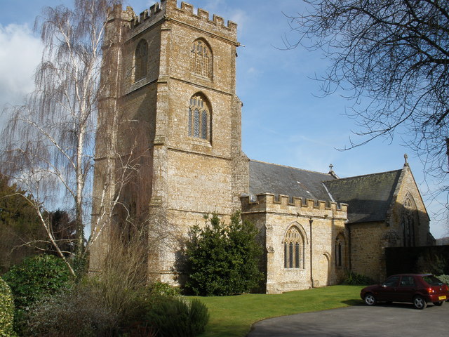
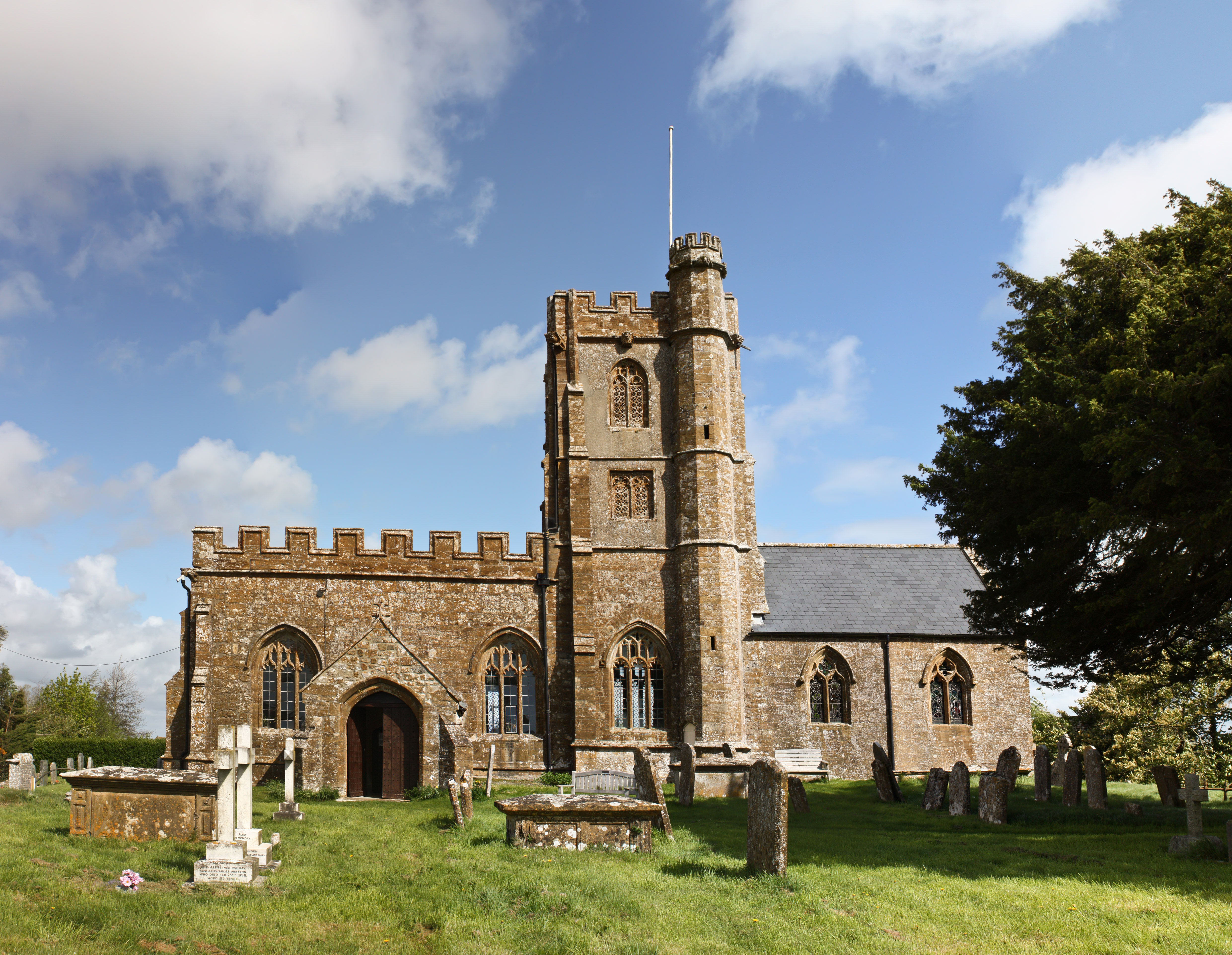
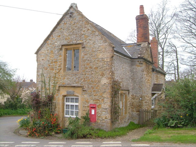
The village is known for its charming and traditional architecture, with many of its buildings dating back to the 17th and 18th centuries. The centerpiece of the village is the beautiful St. Mary's Church, a Grade II listed building that adds to the village's historical appeal.

Dillington is surrounded by rolling green hills and tranquil farmland, making it a popular destination for nature enthusiasts and hikers. The village is also close to several nature reserves, including the Blackdown Hills Area of Outstanding Natural Beauty, which offers stunning panoramic views and a variety of wildlife.

Despite its small size, Dillington boasts a strong sense of community. The village has a local pub, The Dillington Arms, where residents and visitors can enjoy a drink and sample traditional British cuisine. Additionally, the village hall hosts various events and activities throughout the year, bringing the community together.

For those seeking a taste of city life, Dillington is conveniently located near larger towns such as Taunton and Yeovil, offering a range of amenities including shopping centers, restaurants, and entertainment options.

Overall, Dillington offers a peaceful and picturesque lifestyle, surrounded by natural beauty and steeped in history. Whether you're looking for a tranquil retreat or a close-knit community, Dillington provides a charming and welcoming place to call home.

If you have any feedback on the listing, please let us know in the comments section below.

Dillington Images

Images are sourced within 2km of 50.933512/-2.890109 or Grid Reference ST3715. Thanks to Geograph Open Source API. All images are credited.

Ilminster This market town takes its name from the River Ile and the Minster church, St Mary's.
Ilminster
This market town takes its name from the River Ile and the Minster church, St Mary's.
Whitelackington Village Hall
Whitelackington
Village Hall
Dillington House Present house dates back to the 16th Century.  Now a regional centre for adult education and the arts.
Dillington House
Present house dates back to the 16th Century. Now a regional centre for adult education and the arts.
Track in Autumn
Track in Autumn
Pretwood Hill Trees newly in leaf on the permissive path along the crest of Pretwood Hill, overlooking Ilminster.
Pretwood Hill
Trees newly in leaf on the permissive path along the crest of Pretwood Hill, overlooking Ilminster.
St John and All Saints church, Kingstone The medieval church <span class="nowrap"><a title="http://webapp1.somerset.gov.uk/her/details.asp?prn=56710" rel="nofollow ugc noopener" href="http://webapp1.somerset.gov.uk/her/details.asp?prn=56710">Link</a><img style="margin-left:2px;" alt="External link" title="External link - shift click to open in new window" src="https://s1.geograph.org.uk/img/external.png" width="10" height="10"/></span> from the south.
St John and All Saints church, Kingstone
The medieval church LinkExternal link from the south.
Market House , Ilminster The cross roads at the heart of Ilminster viewed through the ham stone Market House - <span class="nowrap"><a title="http://webapp1.somerset.gov.uk/her/details.asp?prn=58067" rel="nofollow ugc noopener" href="http://webapp1.somerset.gov.uk/her/details.asp?prn=58067">Link</a><img style="margin-left:2px;" alt="External link" title="External link - shift click to open in new window" src="https://s1.geograph.org.uk/img/external.png" width="10" height="10"/></span>
Market House , Ilminster
The cross roads at the heart of Ilminster viewed through the ham stone Market House - LinkExternal link
Ilminster Library On Ditton Road, south of the town centre. The tablet in the gable reads "The Reading Room, 1889".
Ilminster Library
On Ditton Road, south of the town centre. The tablet in the gable reads "The Reading Room, 1889".
Townsend Farm, Ilminster Seen from the slopes of Pretwood Hill.
Townsend Farm, Ilminster
Seen from the slopes of Pretwood Hill.
Cottages at Knott Oak Seen from the slopes of Pretwood Hill, looking northeast.
Cottages at Knott Oak
Seen from the slopes of Pretwood Hill, looking northeast.
Wake Hill, Kingstone Early C19 house - "in a later form of 'cottage ornee' (<span class="nowrap"><a title="http://webapp1.somerset.gov.uk/her/details.asp?prn=57246" rel="nofollow ugc noopener" href="http://webapp1.somerset.gov.uk/her/details.asp?prn=57246">Link</a><img style="margin-left:2px;" alt="External link" title="External link - shift click to open in new window" src="https://s1.geograph.org.uk/img/external.png" width="10" height="10"/></span> )
Wake Hill, Kingstone
Early C19 house - "in a later form of 'cottage ornee' (LinkExternal link )
Old Toll House, Kingstone <span class="nowrap"><a title="http://webapp1.somerset.gov.uk/her/details.asp?prn=57243" rel="nofollow ugc noopener" href="http://webapp1.somerset.gov.uk/her/details.asp?prn=57243">Link</a><img style="margin-left:2px;" alt="External link" title="External link - shift click to open in new window" src="https://s1.geograph.org.uk/img/external.png" width="10" height="10"/></span> . George V postbox TA19 19 is on the wall. See also <a href="https://www.geograph.org.uk/photo/3715963">ST3713 : Old Toll House, Kingstone</a>.
Old Toll House, Kingstone
LinkExternal link . George V postbox TA19 19 is on the wall. See also ST3713 : Old Toll House, Kingstone.
Barn conversion, Kingstone Farmhouse The pre-conversion photo, taken in 1986, at <span class="nowrap"><a title="http://webapp1.somerset.gov.uk/her/details.asp?prn=56718" rel="nofollow ugc noopener" href="http://webapp1.somerset.gov.uk/her/details.asp?prn=56718">Link</a><img style="margin-left:2px;" alt="External link" title="External link - shift click to open in new window" src="https://s1.geograph.org.uk/img/external.png" width="10" height="10"/></span> makes an interesting comparison. Listed and described at <span class="nowrap"><a title="https://historicengland.org.uk/listing/the-list/list-entry/1056989" rel="nofollow ugc noopener" href="https://historicengland.org.uk/listing/the-list/list-entry/1056989">Link</a><img style="margin-left:2px;" alt="External link" title="External link - shift click to open in new window" src="https://s1.geograph.org.uk/img/external.png" width="10" height="10"/></span>  .
Barn conversion, Kingstone Farmhouse
The pre-conversion photo, taken in 1986, at LinkExternal link makes an interesting comparison. Listed and described at LinkExternal link .
Kingstone church from the south Looking across a field of brassica, past a little stand of trees in its midst, from the footpath to Dowlish Wake.
Kingstone church from the south
Looking across a field of brassica, past a little stand of trees in its midst, from the footpath to Dowlish Wake.
Ilminster fire station Ilminster fire station, Blackdown View, Ilminster, Somerset.
Ilminster fire station
Ilminster fire station, Blackdown View, Ilminster, Somerset.
Lane to Allowenshay Trees line one side of the lane as it leaves Boyton Hill.
Lane to Allowenshay
Trees line one side of the lane as it leaves Boyton Hill.
Lane junction near Kingstone Longforward Lane, to the right, leads from Kingstone to Seavington St Mary. Park Lane, to the left, runs along the edge of the landscape park centred on Dillington House, which extends across much of Whitelackington parish.
Lane junction near Kingstone
Longforward Lane, to the right, leads from Kingstone to Seavington St Mary. Park Lane, to the left, runs along the edge of the landscape park centred on Dillington House, which extends across much of Whitelackington parish.
Park Lane On the right is Putcombe Copse, which was the site of a C16 deerpark, part of Whitelackington Park. The lane leads to Kingstone.
Park Lane
On the right is Putcombe Copse, which was the site of a C16 deerpark, part of Whitelackington Park. The lane leads to Kingstone.
Show me another place!

Dillington is located at Grid Ref: ST3715 (Lat: 50.933512, Lng: -2.890109)

Administrative County: Somerset

District: South Somerset

Police Authority: Avon and Somerset

What 3 Words

///ally.sourced.expansion. Near Ilminster, Somerset

Related Wikis

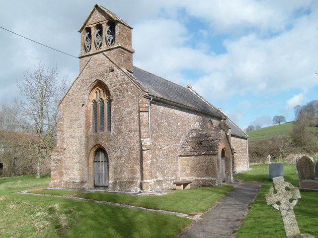
Church of St Mary the Virgin, Whitelackington

The Anglican Church of St Mary the Virgin in Whitelackington, Somerset, England was built in the 14th and 15th centuries. It is a Grade II* listed building...

Dillington House

Dillington House is a residential adult education college near Ilminster in the parish of Whitelackington, Somerset, England. The present house, which...

Whitelackington

Whitelackington is a village and civil parish on the A303 one mile north east of Ilminster, in Somerset, England. The parish includes Dillington Park and...

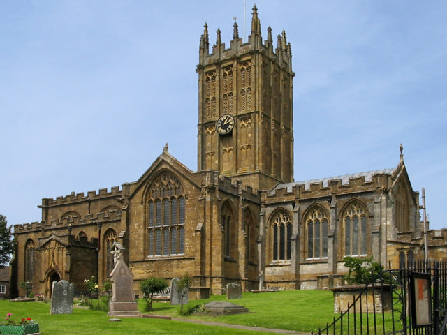
St Mary's Church, Ilminster

The Church of St Mary in Ilminster, Somerset, England, dates from the 15th century and has been designated as a Grade I listed building. == History... ==

Church of St John the Evangelist and All Saints, Kingstone

The Anglican Church of St John the Evangelist and All Saints in Kingstone, Somerset, England was built in the 14th century. It is a Grade II* listed building...

Ilminster

Ilminster is a minster town and civil parish in the South Somerset district of Somerset, England, with a population of 5,808. Bypassed in 1988, the town...

Kingstone, Somerset

Kingstone is a village and civil parish in Somerset, England, situated near Ilminster, 5 miles (8.0 km) north east of Chard in the South Somerset district...

Church of St Mary Magdalene, Stocklinch

The Church of St Mary Magdalen in Stocklinch, Somerset, England, dates from the 13th century. It is recorded in the National Heritage List for England...

Nearby Amenities

Located within 500m of 50.933512,-2.890109
Passing Place
Lat/Long: 50.9359963/-2.8893303
Whitelackington
Place: village
Wikidata: Q2583625
Wikipedia: en:Whitelackington
Lat/Long: 50.935792/-2.8846032
Barrier: bollard
Lat/Long: 50.9346307/-2.8850814
Give Way
Direction: backward
Lat/Long: 50.9344642/-2.8838856
Historic: memorial
Lat/Long: 50.9341628/-2.8842708
Passing Place
Lat/Long: 50.9359927/-2.887501
Give Way
Direction: backward
Lat/Long: 50.9345466/-2.8848801
Dillington
Place: hamlet
Lat/Long: 50.9346905/-2.8917995
The data included in this document is from www.openstreetmap.org. The data is made available under ODbL.

Have you been to Dillington?

Leave your review of Dillington below (or comments, questions and feedback).