Bramling

Settlement in Kent Canterbury

England

Bramling

Established orchard The view of <a href="https://www.geograph.org.uk/photo/6185399">TR2257 : Establishing a new orchard</a> was taken before the trees had been planted.
Established orchard Credit: John Baker

Bramling is a small village located in the county of Kent, England. Situated about 3 miles south of the historic city of Canterbury, Bramling is nestled within the picturesque countryside of the region. The village falls within the civil parish of Ickham and Well, and is part of the administrative district of Canterbury.

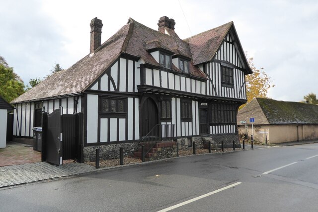
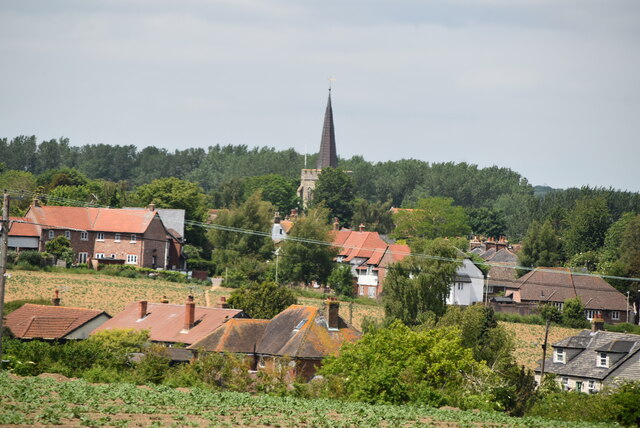
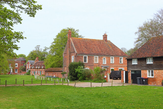
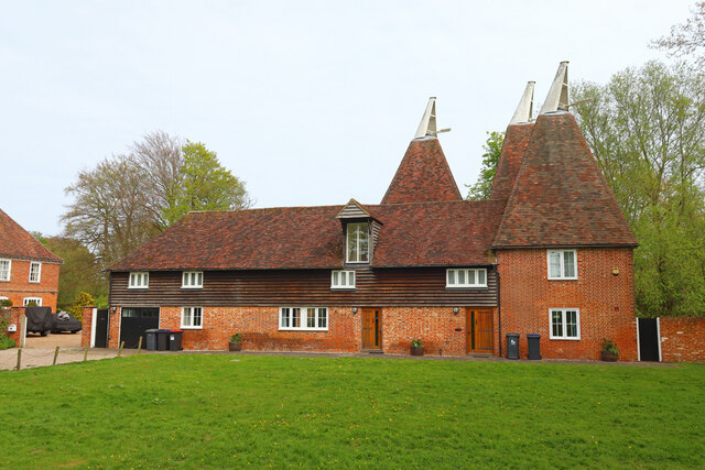
Bramling is known for its charming rural setting, with idyllic landscapes and rolling hills surrounding the area. The village itself is characterized by its quaint cottages and traditional architecture, giving it a timeless appeal. The local community is close-knit, with a friendly and welcoming atmosphere.

Despite its small size, Bramling benefits from its proximity to Canterbury, which offers a wide range of amenities and services. Residents of Bramling can easily access various shops, restaurants, and leisure facilities in the city, while still enjoying the tranquility of the countryside.

The village is also conveniently located for those commuting to Canterbury or other nearby towns, with good transport links including bus routes and road connections. This makes Bramling an attractive place to live for those seeking a peaceful rural lifestyle while still having access to urban conveniences.

In terms of recreational activities, Bramling and its surrounding area offer numerous opportunities for outdoor pursuits. The village is surrounded by beautiful walking and cycling routes, allowing residents to explore the stunning natural landscapes of Kent.

Overall, Bramling is a charming village that offers a peaceful and picturesque setting, making it an attractive place to live for those seeking a rural retreat within easy reach of urban amenities.

If you have any feedback on the listing, please let us know in the comments section below.
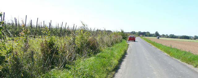
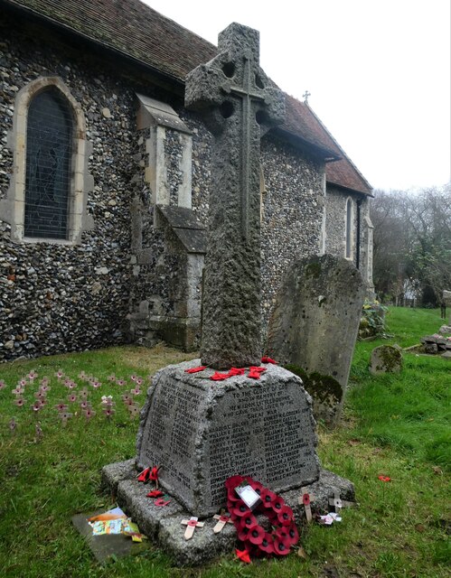
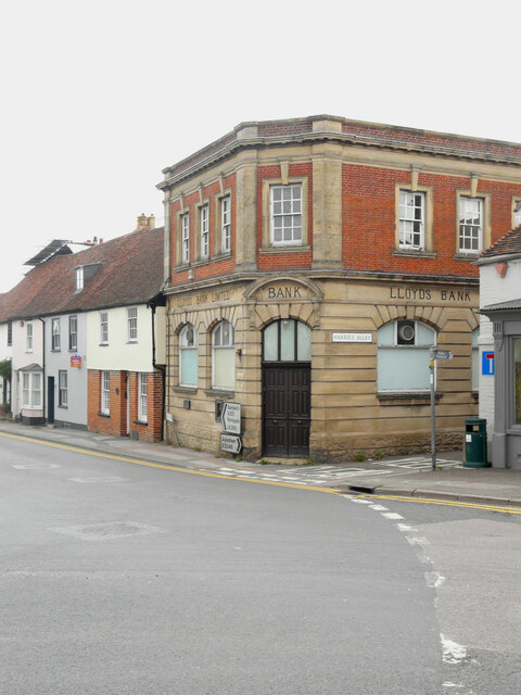
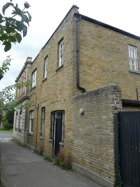
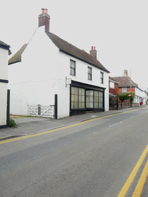
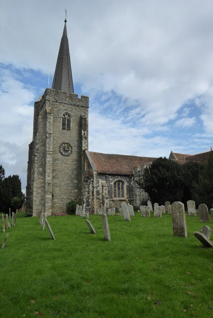
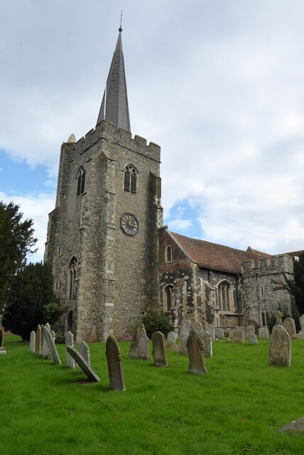
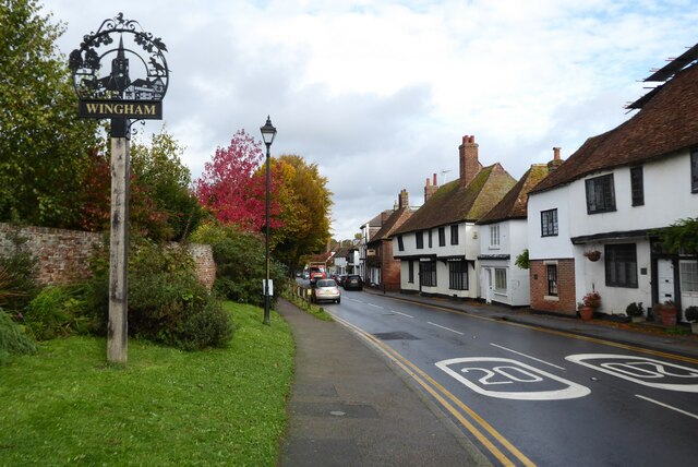
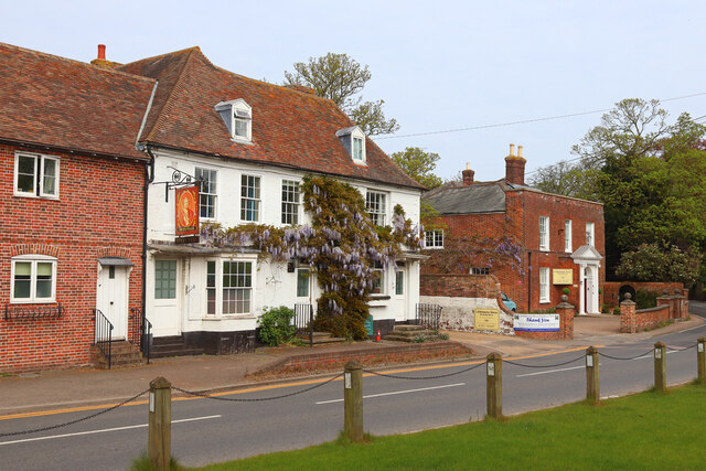
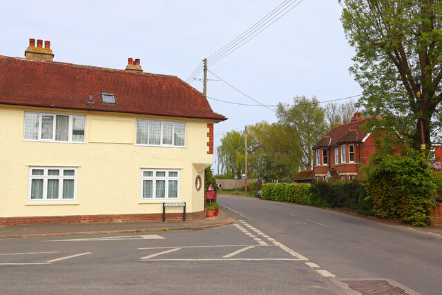
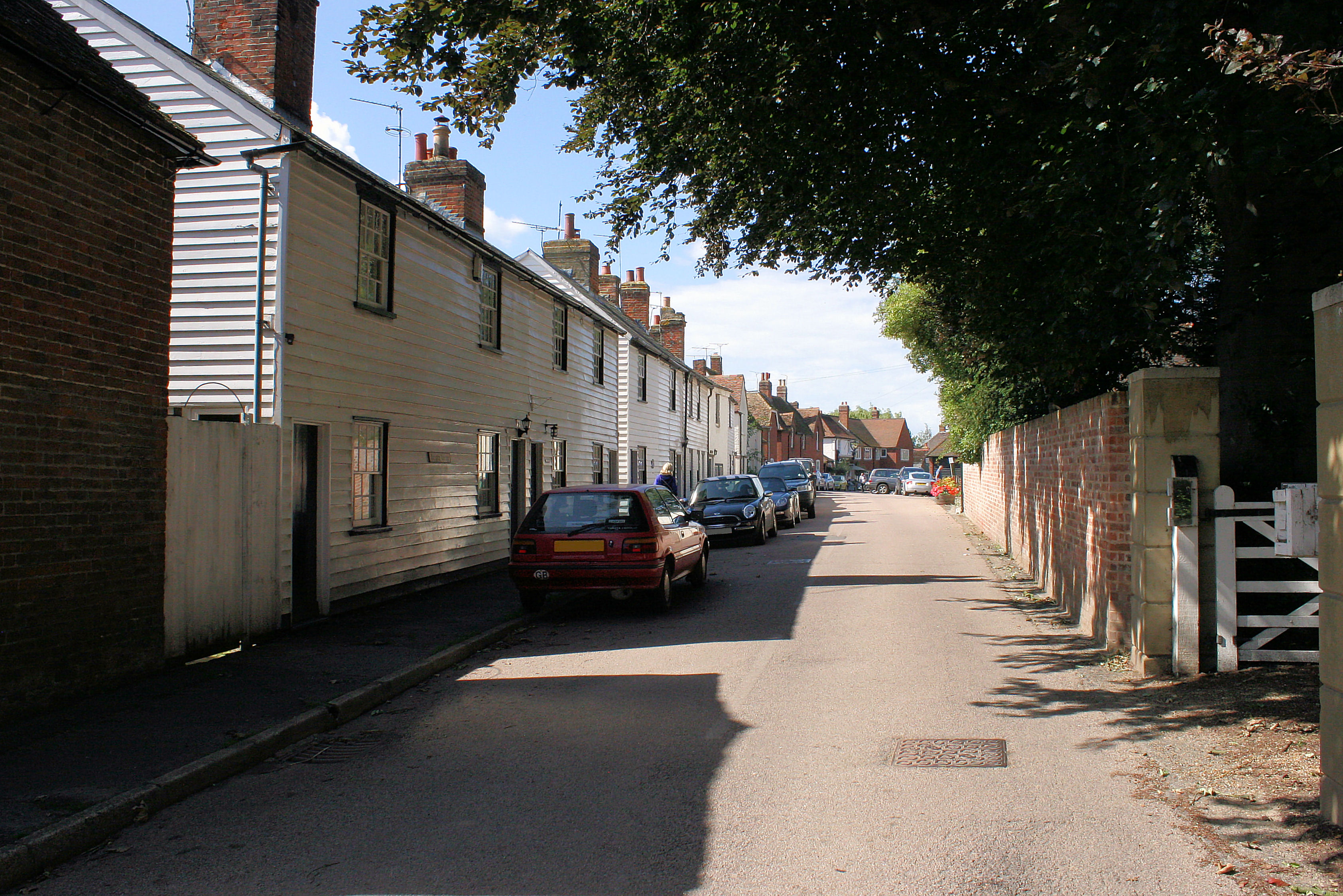
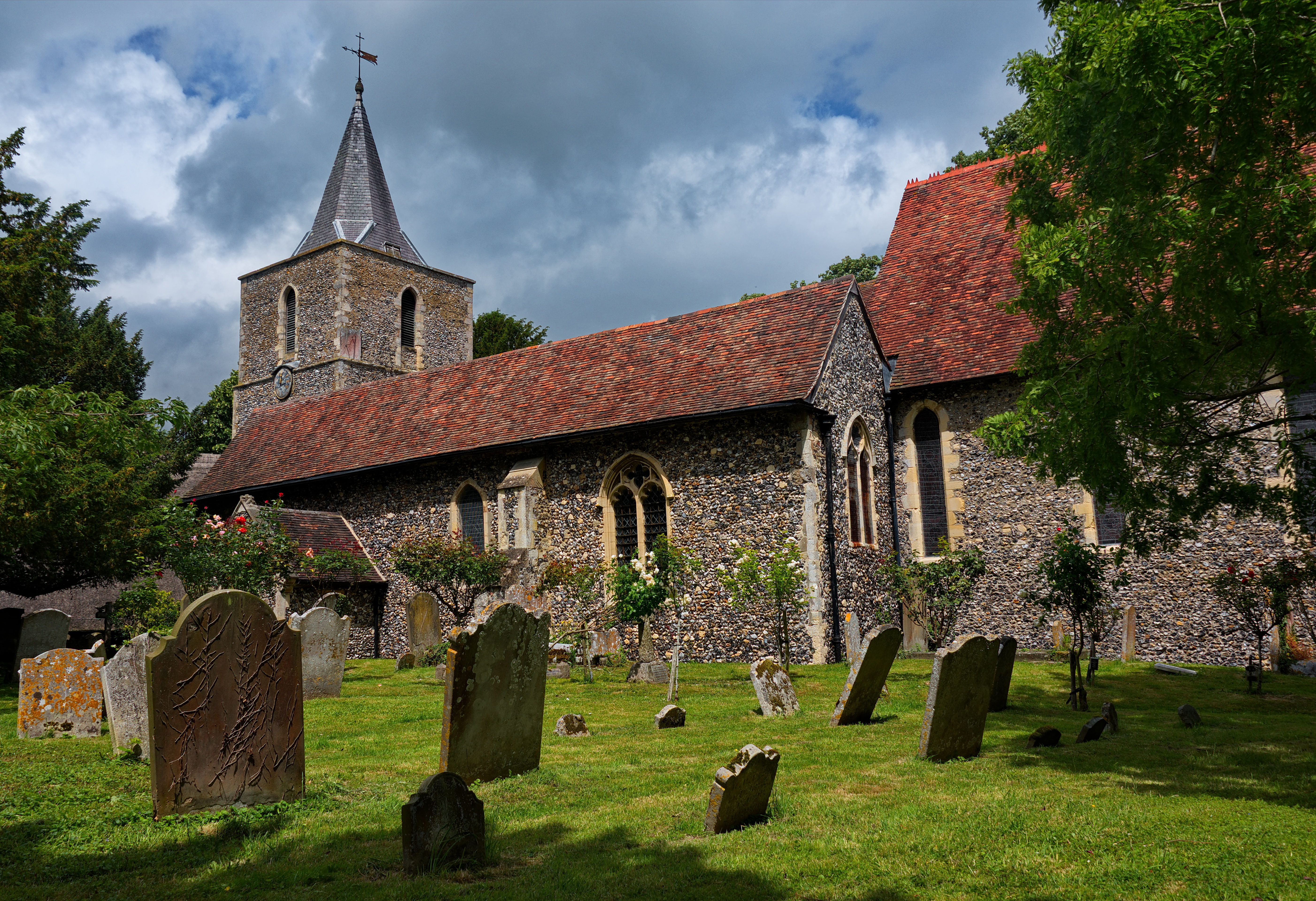
Bramling Images

Images are sourced within 2km of 51.265005/1.18945 or Grid Reference TR2256. Thanks to Geograph Open Source API. All images are credited.

Established orchard The view of <a href="https://www.geograph.org.uk/photo/6185399">TR2257 : Establishing a new orchard</a> was taken before the trees had been planted.
Established orchard
The view of TR2257 : Establishing a new orchard was taken before the trees had been planted.
Stained glass window, St. Vincent's Church, Littlebourne At the east end of the south aisle. The church of St Vincent of Saragossa dates from the 13th century and is thought to have been founded by the monks of St Augustine's Abbey in Canterbury. It is a Grade I listed building.
Stained glass window, St. Vincent's Church, Littlebourne
At the east end of the south aisle. The church of St Vincent of Saragossa dates from the 13th century and is thought to have been founded by the monks of St Augustine's Abbey in Canterbury. It is a Grade I listed building.
War memorial, St. Vincent's Church, Littlebourne The church of St Vincent of Saragossa dates from the 13th century and is thought to have been founded by the monks of St Augustine's Abbey in Canterbury. It is a Grade I listed building.
War memorial, St. Vincent's Church, Littlebourne
The church of St Vincent of Saragossa dates from the 13th century and is thought to have been founded by the monks of St Augustine's Abbey in Canterbury. It is a Grade I listed building.
Copperfields, Canterbury Road The house was built in a <a href="https://www.geograph.org.uk/photo/6524473">TR2357 : Field, Canterbury Road</a>.
Copperfields, Canterbury Road
The house was built in a TR2357 : Field, Canterbury Road.
Lloyds Bank Plc, High Street Planning permission has been approved by Dover District Council under application number DOV/21/01938for a “change of use and conversion to 4 self-contained flats, insertion of 3 roof lights, 3 extraction fans, cycle stores, alterations to windows/doors, replacement access gates, erection of 1.8m high fence and gate (existing single storey rear extension to be demolished)”.

The rear of the bank is located in <a href="https://www.geograph.org.uk/photo/7305987">TR2457 : Harris’s Alley</a>.
Lloyds Bank Plc, High Street
Planning permission has been approved by Dover District Council under application number DOV/21/01938for a “change of use and conversion to 4 self-contained flats, insertion of 3 roof lights, 3 extraction fans, cycle stores, alterations to windows/doors, replacement access gates, erection of 1.8m high fence and gate (existing single storey rear extension to be demolished)”. The rear of the bank is located in TR2457 : Harris’s Alley.
Harris’s Alley The view shows the back of <a href="https://www.geograph.org.uk/photo/7305976">TR2457 : Lloyds Bank Plc, High Street</a>, where the gate and the single storey extension are to be removed/demolished.
Harris’s Alley
The view shows the back of TR2457 : Lloyds Bank Plc, High Street, where the gate and the single storey extension are to be removed/demolished.
Chez Lucky, 30, Adisham  Road The premises appear to be permanently closed.
Chez Lucky, 30, Adisham Road
The premises appear to be permanently closed.
St Mary's Church, Wingham St Mary's church, Wingham is Grade I listed, see: <span class="nowrap"><a title="https://historicengland.org.uk/listing/the-list/list-entry/1070091?section=official-list-entry" rel="nofollow ugc noopener" href="https://historicengland.org.uk/listing/the-list/list-entry/1070091?section=official-list-entry">Link</a><img style="margin-left:2px;" alt="External link" title="External link - shift click to open in new window" src="https://s1.geograph.org.uk/img/external.png" width="10" height="10"/></span>
St Mary's Church, Wingham
St Mary's church, Wingham is Grade I listed, see: LinkExternal link
The village of Wingham The A257 entering the village of Wingham.
The village of Wingham
The A257 entering the village of Wingham.
Canon Cottage and Old Canonry  This pair of timber-framed cottages are Grade I listed and may date back to the late 13th century.
Canon Cottage and Old Canonry
This pair of timber-framed cottages are Grade I listed and may date back to the late 13th century.
East window, Wingham Church The Stained glass east window in St Mary's church, Wingham.
East window, Wingham Church
The Stained glass east window in St Mary's church, Wingham.
Reredos in St Mary's Church, Wingham The 15th-century reredos in St Mary's church, Wingham, which was brought from Troyes in France. The upper section depicts the Passion of Christ, the lower half shows the Last Supper and the Adoration of the Kings.
Reredos in St Mary's Church, Wingham
The 15th-century reredos in St Mary's church, Wingham, which was brought from Troyes in France. The upper section depicts the Passion of Christ, the lower half shows the Last Supper and the Adoration of the Kings.
Wingham Church spire Christians have been worshipping on this site since shortly after St. Augustine's mission to England in 597 AD. The building we see today, though, is essentially medieval, with major work from the late 13th century (chancel), early 15th (tower and south porch) and mid-16th (nave), with some Georgian and Victorian alterations.
The church’s size and prominence stem from its status as a College of Canons, founded by Archbishop Peckham in 1286 (The fine timber-framed buildings opposite the church were originally canons’ houses.) By Elizabethan times the building was in poor repair; in consequence, the old north aisle was pulled down and the south aisle rebuilt. The story goes that money collected for restoration by George Ffogarde, a Canterbury brewer, was embezzled - hence pillars made of chestnut rather than the traditional stone. 
Some fine monuments embellish the church, including one in the north chapel, now the vestry, to Sir Thomas Palmer (1624) and the remarkable Oxenden memorial (1682) in the form of a highly decorated obelisk. In the chancel, misericords with interesting wood-carvings survive from the early 14th century. Far plainer, but much more modern, is a plaque to General Miller, the Wingham-born hero of Peru's struggle for independence from Spain. 
Grade I listed. <span class="nowrap"><a title="http://www.britishlistedbuildings.co.uk/en-178359-church-of-st-mary-wingham-kent" rel="nofollow ugc noopener" href="http://www.britishlistedbuildings.co.uk/en-178359-church-of-st-mary-wingham-kent">Link</a><img style="margin-left:2px;" alt="External link" title="External link - shift click to open in new window" src="https://s1.geograph.org.uk/img/external.png" width="10" height="10"/></span>
Wingham Church spire
Christians have been worshipping on this site since shortly after St. Augustine's mission to England in 597 AD. The building we see today, though, is essentially medieval, with major work from the late 13th century (chancel), early 15th (tower and south porch) and mid-16th (nave), with some Georgian and Victorian alterations. The church’s size and prominence stem from its status as a College of Canons, founded by Archbishop Peckham in 1286 (The fine timber-framed buildings opposite the church were originally canons’ houses.) By Elizabethan times the building was in poor repair; in consequence, the old north aisle was pulled down and the south aisle rebuilt. The story goes that money collected for restoration by George Ffogarde, a Canterbury brewer, was embezzled - hence pillars made of chestnut rather than the traditional stone. Some fine monuments embellish the church, including one in the north chapel, now the vestry, to Sir Thomas Palmer (1624) and the remarkable Oxenden memorial (1682) in the form of a highly decorated obelisk. In the chancel, misericords with interesting wood-carvings survive from the early 14th century. Far plainer, but much more modern, is a plaque to General Miller, the Wingham-born hero of Peru's struggle for independence from Spain. Grade I listed. LinkExternal link
Littlebourne House Green in Littlebourne.
Littlebourne House
Green in Littlebourne.
The Oast Holiday accommodation in Littlebourne.
The Oast
Holiday accommodation in Littlebourne.
King William King William Day Centre, in Littlebourne.
King William
King William Day Centre, in Littlebourne.
Nargate Street / Church Road Road Junction in Littlebourne.
Nargate Street / Church Road
Road Junction in Littlebourne.
Show me another place!

Bramling is located at Grid Ref: TR2256 (Lat: 51.265005, Lng: 1.18945)

Administrative County: Kent

District: Canterbury

Police Authority: Kent

What 3 Words

///chainsaw.however.diverting. Near Littlebourne, Kent

Nearby Locations

Bramling

Related Wikis

Bramling

Bramling is a hamlet five miles (8 km) east of Canterbury in Kent, England. It lies on the A257 road between Littlebourne and Wingham. The local public...

Ickham and Well

Ickham and Well is a mostly rural civil parish east of Canterbury in Kent, South East England. The parish covers the villages of Ickham and Bramling just...

Wingham (Canterbury Road) railway station

Wingham (Canterbury Road) railway station was a terminus on the East Kent Light Railway. It opened in 1925 (named Wingham) and the last passenger train...

St Mary's Church, Wingham

St Mary's Church, Wingham, is an Anglican parish church in Wingham, Kent. It is recorded in the National Heritage List for England as a designated Grade...

Wingham Town railway station

Wingham Town railway station was a railway station on the East Kent Light Railway, which served the village of Wingham. It opened in 1920 and closed to...

St Vincent of Saragossa Church, Littlebourne

St Vincent of Saragossa's Church is the Church of England parish church of Littlebourne, Kent, England. The parish is part of the Benefice of Littlebourne...

Littlebourne

Littlebourne is a village and civil parish 4 miles (6.4 km) east of Canterbury in Kent, South East England. == History == The significant Howletts Anglo...

Wingham, Kent

Wingham is a village and civil parish in the Dover District of Kent, England. The village lies along the ancient coastal road, now the A257, from Richborough...

Nearby Amenities

Located within 500m of 51.265005,1.18945
Bramling
Is In: Kent,England,UK
Place: village
Wikidata: Q3019704
Lat/Long: 51.2660988/1.1916077
Post Box
Brand: Royal Mail
Brand Wikidata: Q638098
Operator: Royal Mail
Operator Wikidata: Q638098
Post Box Mounting: metal_post
Post Box Type: lamp
Postal Code: CT3
Ref: CT3 137
Royal Cypher: EIIR
Royal Cypher Wikidata: Q33102113
Source: survey
Source Ref: http://www.dracos.co.uk/play/locating-postboxes/?pc1=CT3
Lat/Long: 51.2661907/1.1922328
Bus Stop
The Haywain
Bench: no
Bin: yes
Bus: yes
Flag: no
Naptan AtcoCode: 2400A039830A
Naptan Bearing: W
Naptan BusStopType: CUS
Naptan CommonName: The Haywain
Naptan Indicator: o/s
Naptan Landmark: Bramling Rd
Naptan NaptanCode: kntdptaw
Naptan Street: A257
Naptan Verified: yes
Public Transport: platform
Ref: kntdptaw
Shelter: no
Source: naptan_import
Source Date: 2018-04-11T15:13:00
Lat/Long: 51.2661529/1.1921915
Bus Stop
The Haywain
Bench: no
Bin: no
Bus: yes
Naptan AtcoCode: 240096800
Naptan Bearing: SE
Naptan CommonName: The Haywain
Naptan Indicator: opp
Naptan Landmark: The Haywain
Naptan NaptanCode: kntgmdpm
Naptan Street: A257 Canterbury Road
Naptan Verified: no
Public Transport: platform
Ref: kntgmdpm
Shelter: no
Source: naptan_import
Source Date: 2018-04-11T15:19:00
Lat/Long: 51.2667521/1.1903405
Power: pole
Lat/Long: 51.2677442/1.1923955
Power: pole
Lat/Long: 51.2681961/1.1913079
Power: pole
Lat/Long: 51.2686781/1.1902625
Power: pole
Lat/Long: 51.2668003/1.1944521
Power: pole
Lat/Long: 51.2661372/1.1920644
Power: pole
Lat/Long: 51.2673074/1.1933452
Power: pole
Lat/Long: 51.2690912/1.1894307
Power: pole
Lat/Long: 51.2668013/1.1958321
Power: pole
Lat/Long: 51.265843/1.193626
Power: pole
Lat/Long: 51.2663473/1.1940538
Generator Method: photovoltaic
Generator Output Electricity: yes
Generator Source: solar
Generator Type: solar_photovoltaic_panel
Location: surface
Power: generator
Lat/Long: 51.2664774/1.1919026
Generator Method: photovoltaic
Generator Output Electricity: yes
Generator Source: solar
Generator Type: solar_photovoltaic_panel
Location: roof
Power: generator
Lat/Long: 51.2664707/1.1919522
Generator Method: photovoltaic
Generator Output Electricity: yes
Generator Source: solar
Generator Type: solar_photovoltaic_panel
Location: roof
Power: generator
Lat/Long: 51.266469/1.1920045
Generator Method: photovoltaic
Generator Output Electricity: yes
Generator Source: solar
Generator Type: solar_photovoltaic_panel
Location: roof
Power: generator
Lat/Long: 51.2664715/1.1920448
Generator Method: photovoltaic
Generator Output Electricity: yes
Generator Source: solar
Generator Type: solar_photovoltaic_panel
Location: roof
Power: generator
Lat/Long: 51.2665202/1.1921118
The data included in this document is from www.openstreetmap.org. The data is made available under ODbL.

Have you been to Bramling?

Leave your review of Bramling below (or comments, questions and feedback).