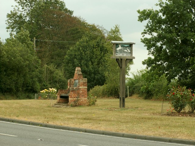
Whiteash Green

Settlement in Essex Braintree

England

Whiteash Green

A1124 Hedingham Road Or it might be Halstead Road, the name changes somewhere around here. Looking from Halstead towards Sible Hedingham.
A1124 Hedingham Road Credit: Robin Webster

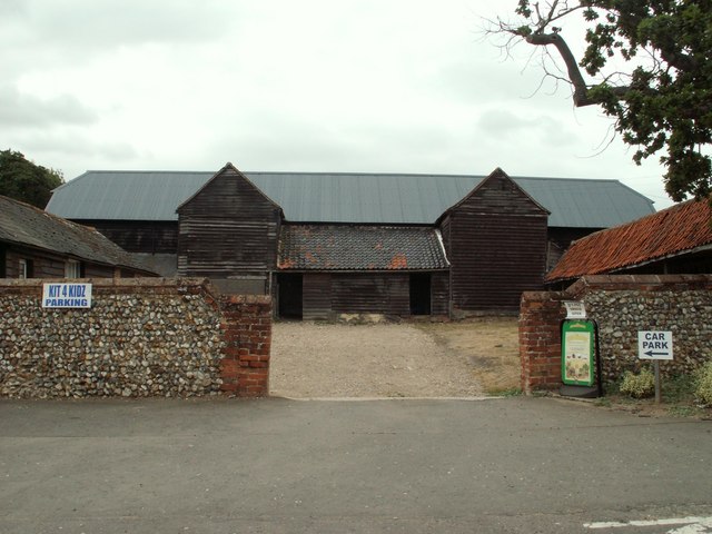
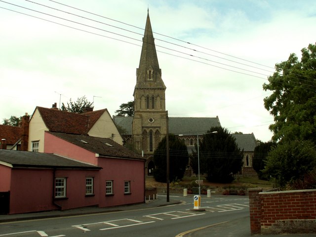
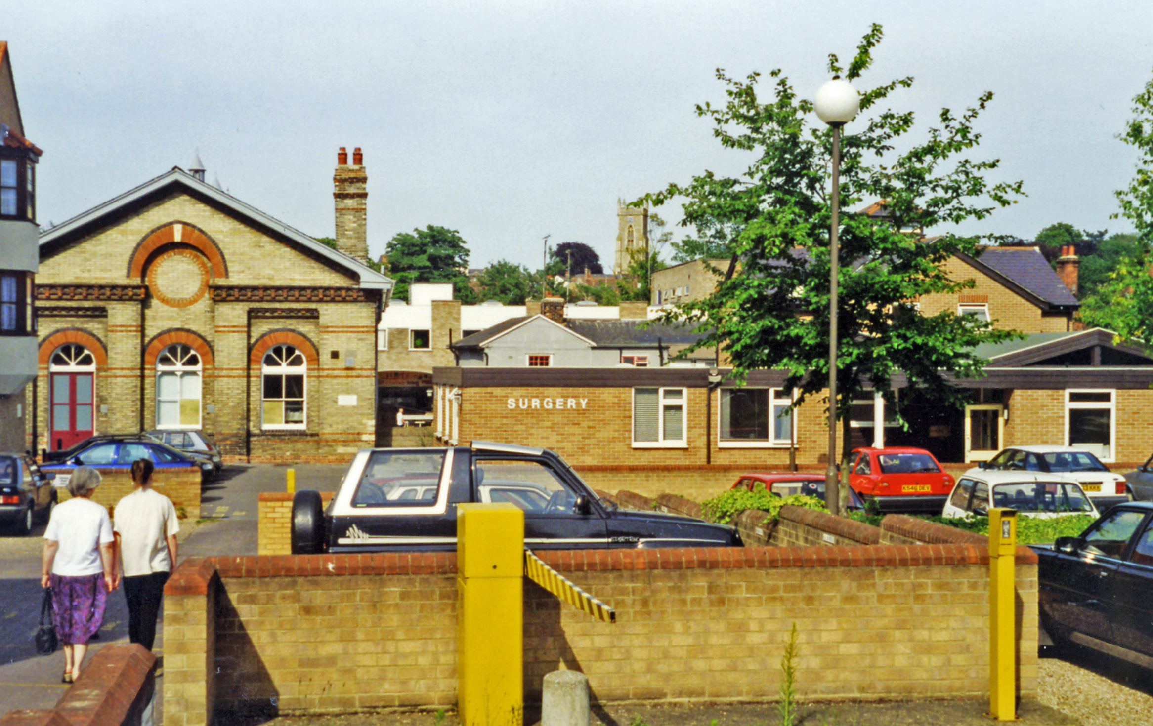
Whiteash Green is a small village located in the county of Essex, England. Situated within the Uttlesford district, it is nestled in the picturesque countryside, offering residents and visitors a peaceful and idyllic setting. The village is surrounded by rolling green hills, meandering rivers, and lush woodlands, making it an ideal location for nature enthusiasts and outdoor lovers.

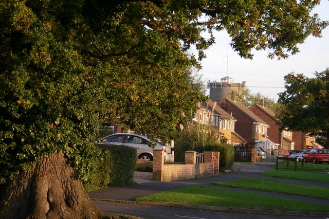
With a population of around 300 residents, Whiteash Green maintains a close-knit community feel. The village is characterized by its charming cottages, many of which date back several centuries, adding to its historical charm. The architecture reflects a mix of traditional and modern styles, creating a unique blend of old and new.

Whiteash Green is well-connected to nearby towns and cities. The village is conveniently located near major road networks, providing easy access to neighboring areas. The nearest town, Saffron Walden, is just a short drive away and offers a range of amenities, including shops, restaurants, and leisure facilities.

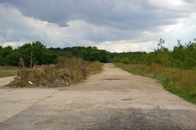
In terms of recreational activities, Whiteash Green benefits from its surrounding natural beauty. The village is surrounded by numerous walking and cycling trails, allowing residents and visitors to explore the stunning countryside. Additionally, there are several parks and green spaces within the village, providing opportunities for relaxation and outdoor leisure activities.

Overall, Whiteash Green offers a tranquil and picturesque setting for those seeking a peaceful village lifestyle, while still being within easy reach of urban amenities and transport links.

If you have any feedback on the listing, please let us know in the comments section below.

Whiteash Green Images

Images are sourced within 2km of 51.945551/0.60596227 or Grid Reference TL7930. Thanks to Geograph Open Source API. All images are credited.

A1124 Hedingham Road Or it might be Halstead Road, the name changes somewhere around here. Looking from Halstead towards Sible Hedingham.
A1124 Hedingham Road
Or it might be Halstead Road, the name changes somewhere around here. Looking from Halstead towards Sible Hedingham.
A1124 Halstead Road by Sparrows Farm Towards Sible Hedingham.
A1124 Halstead Road by Sparrows Farm
Towards Sible Hedingham.
Blocked gateway off Russell's Road, Halstead
Hedgerow oak near Hobbs Wood
Old Barn at Whitehouse Farm near Halstead, Essex
Village Sign at White Ash Green, Essex White Ash Green lies on the road between Halstead and Gosfield.
Village Sign at White Ash Green, Essex
White Ash Green lies on the road between Halstead and Gosfield.
Gosfield Airfield This is the crossing point of the Perimeter track and the end of a runway on the former Gosfield Airfield. Gosfield operated from 1943 initially as a fighter station using P47s, later the base was returned to its intended use as a bomber field operating A20s. Late on in the war C47 Dakotas operated Horsa gliders from the base. Today there is a community woodland, industrial units and the Consumers Association <a href="https://www.geograph.org.uk/photo/221160">TL7731 : Speed Test Centre</a> on the base. To go to the next field in an alphabetical tour of Essex WW2 airfields click on <a href="https://www.geograph.org.uk/photo/221175">TL5923 : Great Dunmow Airfield</a>. Much information was gleaned from Graham Smith’s book “Essex Airfields In The Second World War”. <span class="nowrap"><a title="https://books.google.co.uk/books/about/Essex_Airfields_in_the_Second_World_War.html?id=u3atAAAACAAJ&redir_esc=y" rel="nofollow ugc noopener" href="https://books.google.co.uk/books/about/Essex_Airfields_in_the_Second_World_War.html?id=u3atAAAACAAJ&redir_esc=y">Link</a><img style="margin-left:2px;" alt="External link" title="External link - shift click to open in new window" src="https://s1.geograph.org.uk/img/external.png" width="10" height="10"/></span>
Gosfield Airfield
This is the crossing point of the Perimeter track and the end of a runway on the former Gosfield Airfield. Gosfield operated from 1943 initially as a fighter station using P47s, later the base was returned to its intended use as a bomber field operating A20s. Late on in the war C47 Dakotas operated Horsa gliders from the base. Today there is a community woodland, industrial units and the Consumers Association TL7731 : Speed Test Centre on the base. To go to the next field in an alphabetical tour of Essex WW2 airfields click on TL5923 : Great Dunmow Airfield. Much information was gleaned from Graham Smith’s book “Essex Airfields In The Second World War”. LinkExternal link
C A's Test Track This runway on the former <a href="https://www.geograph.org.uk/photo/221155">TL7830 : Gosfield Airfield</a> is where the Consumers Association do the research to obtain data for their vehicle tests.
C A's Test Track
This runway on the former TL7830 : Gosfield Airfield is where the Consumers Association do the research to obtain data for their vehicle tests.
Gosfield Perimeter Track This is the perimeter track of the former <a href="https://www.geograph.org.uk/photo/221155">TL7830 : Gosfield Airfield</a> the trees on the right are part of the Gosfield Community Woodland Scheme <span class="nowrap"><a title="http://www.gosfield.org.uk/visit.htm#Community%20Woodland" rel="nofollow ugc noopener" href="http://www.gosfield.org.uk/visit.htm#Community%20Woodland">Link</a><img style="margin-left:2px;" alt="External link" title="External link - shift click to open in new window" src="https://s1.geograph.org.uk/img/external.png" width="10" height="10"/></span>
Gosfield Perimeter Track
This is the perimeter track of the former TL7830 : Gosfield Airfield the trees on the right are part of the Gosfield Community Woodland Scheme LinkExternal link
Speed Test Centre This is the Gate to the <a href="https://www.geograph.org.uk/photo/221157">TL7831 : C A's Test Track</a> on the former <a href="https://www.geograph.org.uk/photo/221155">TL7830 : Gosfield Airfield</a>
Speed Test Centre
This is the Gate to the TL7831 : C A's Test Track on the former TL7830 : Gosfield Airfield
Colne valley Canada geese grazing the meadows beside the infant River Colne with the old Colne Valley Railway alignment in the background.
Colne valley
Canada geese grazing the meadows beside the infant River Colne with the old Colne Valley Railway alignment in the background.
The information board at Broak's Wood This reserve also includes Shardlow's Wood.
The information board at Broak's Wood
This reserve also includes Shardlow's Wood.
Whiteash Green This is an unnamed lane at the junction with another unnamed lane some distance away from Whiteash Green, yet, nonetheless, in <a href="https://www.geograph.org.uk/gridref/TL7931">TL7931</a>...!
Whiteash Green
This is an unnamed lane at the junction with another unnamed lane some distance away from Whiteash Green, yet, nonetheless, in TL7931...!
Holy Trinity church, Halstead, Essex The church in this picture was designed by George Gilbert Scott & Moffatt and built in 1843-4. It stands at the southern end of Halstead. The main road in the picture is A.131 and the turning to the left, in front of the church, is the road to Gosfield.
Holy Trinity church, Halstead, Essex
The church in this picture was designed by George Gilbert Scott & Moffatt and built in 1843-4. It stands at the southern end of Halstead. The main road in the picture is A.131 and the turning to the left, in front of the church, is the road to Gosfield.
Water tower - Halstead Dominating this km square, the water tower stands between Oak road and Conies road.
Water tower - Halstead
Dominating this km square, the water tower stands between Oak road and Conies road.
Holy Trinity - Halstead The area in this view was hit by a V2 rocket during WW II.
Holy Trinity - Halstead
The area in this view was hit by a V2 rocket during WW II.
Footpath to Halstead This footpath has been laid over the course of the old Colne Valley Railway.
Footpath to Halstead
This footpath has been laid over the course of the old Colne Valley Railway.
The Bull Hotel, Halstead
Show me another place!

Whiteash Green is located at Grid Ref: TL7930 (Lat: 51.945551, Lng: 0.60596227)

Administrative County: Essex

District: Braintree

Police Authority: Essex

What 3 Words

///lines.initiated.infinite. Near Gosfield, Essex

Related Wikis

Gosfield School

Gosfield School is an English co-educational independent school in Gosfield, in the Braintree district of Essex. It was founded in 1929. == Setting... ==

Whiteash Green

White Ash Green is a hamlet in the civil parish of Greenstead Green and Halstead Rural, in the Braintree district of Essex, England. It is a little over...

Gosfield Sandpits

Gosfield Sandpits is an 8.3 hectare Local Nature Reserve in Gosfield, north of Braintree in Essex. It is owned by Gosfield Parish Council, and managed...

Holy Trinity Church, Halstead

Holy Trinity Church is a redundant Anglican church in the town of Halstead, Essex, England. It is recorded in the National Heritage List for England as...

Halstead Town F.C.

Halstead Town Football Club is a football club based in Halstead, Essex, England. They are currently members of the Essex Senior League and play at Rosemary...

Halstead railway station

Halstead railway station was located in Halstead, Essex. It was 56 miles 34 chains (90.81 km) from London Liverpool Street via Marks Tey. It closed in...

RAF Gosfield

Royal Air Force Gosfield or more simply RAF Gosfield is a former Royal Air Force station in Essex, England. The airfield is located approximately 5 miles...

Gosfield

Gosfield is a village in the Braintree district of Essex, England. It is located around two miles west of the town of Halstead. Places of note include...

Nearby Amenities

Located within 500m of 51.945551,0.60596227
Bus Stop
Whiteash Green
Naptan AtcoCode: 150024012011
Naptan Bearing: NE
Naptan CommonName: Whiteash Green
Naptan Indicator: Adj
Naptan Landmark: Whiteash Green
Naptan NaptanCode: esxdjgja
Naptan Street: Halstead Road
Naptan Verified: no
Public Transport: platform
Source: naptan_import
Lat/Long: 51.9476039/0.6098922
Bus Stop
Russells Road
Naptan AtcoCode: 150024012012
Naptan Bearing: SW
Naptan CommonName: Russells Road
Naptan Crossing: Russells Road
Naptan Indicator: Adj
Naptan Landmark: Russells Road
Naptan NaptanCode: esxdjmdm
Naptan Street: Halstead Road
Naptan Verified: no
Public Transport: platform
Source: naptan_import
Lat/Long: 51.9453121/0.6053643
Bus Stop
School
Naptan AtcoCode: 150024012013
Naptan Bearing: W
Naptan CommonName: School
Naptan Indicator: Opp
Naptan Landmark: School
Naptan NaptanCode: esxdjgjd
Naptan Street: Halstead Road
Naptan Verified: no
Public Transport: platform
Source: naptan_import
Lat/Long: 51.9440507/0.6009983
Bus Stop
School
Naptan AtcoCode: 150024012014
Naptan Bearing: E
Naptan CommonName: School
Naptan Indicator: o/s
Naptan Landmark: School
Naptan NaptanCode: esxdjgjg
Naptan Street: Halstead Road
Naptan Verified: no
Public Transport: platform
Source: naptan_import
Lat/Long: 51.9439956/0.599831
Whiteash Green
Naptan AtcoCode: 150024012Y11
Naptan Bearing: SW
Naptan BusStopType: CUS
Naptan CommonName: Whiteash Green
Naptan Indicator: Opp
Naptan Landmark: Whiteash Green
Naptan NaptanCode: esxgpwtg
Naptan Street: Halstead Road
Naptan Verified: no
Public Transport: platform
Source: naptan_import
Lat/Long: 51.9475577/0.6099477
Russells Road
Naptan AtcoCode: 150024012Y12
Naptan Bearing: NE
Naptan BusStopType: CUS
Naptan CommonName: Russells Road
Naptan Crossing: Russells Road
Naptan Indicator: Opp
Naptan Landmark: Russells Road
Naptan NaptanCode: esxgptam
Naptan Street: Halstead Road
Naptan Verified: no
Public Transport: platform
Source: naptan_import
Lat/Long: 51.9453669/0.6053238
The data included in this document is from www.openstreetmap.org. The data is made available under ODbL.

Have you been to Whiteash Green?

Leave your review of Whiteash Green below (or comments, questions and feedback).