Bramfield

Settlement in Hertfordshire East Hertfordshire

England

Bramfield

Tattle Hill, Broadoak End By Oakfield Plantation on the right
Tattle Hill, Broadoak End Credit: David Howard

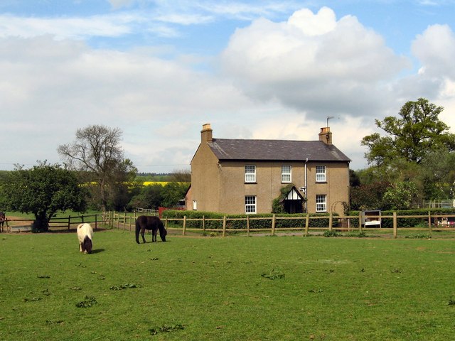
Bramfield is a small village located in the county of Hertfordshire, England. Situated approximately 40 miles north of London, Bramfield is nestled in the beautiful countryside and is surrounded by fields and farmland. The village is part of the East Hertfordshire district and lies close to the larger town of Hertford.

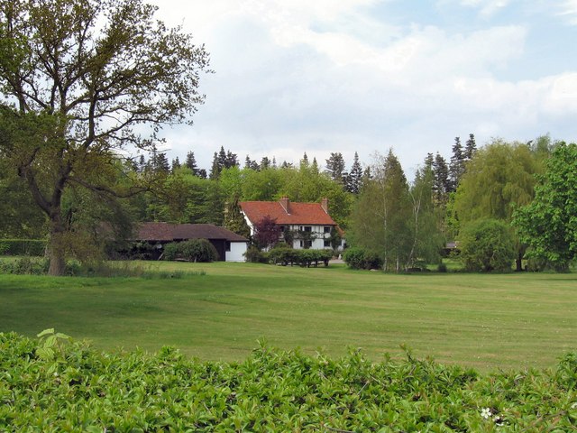
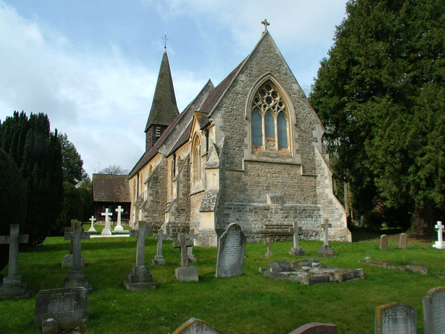
Bramfield is a quintessential English village with a population of around 500 residents. It boasts a charming and picturesque atmosphere, characterized by traditional cottages and historic buildings. The heart of the village is centered around St. Andrew's Church, a 13th-century parish church that adds to the village's quaint appeal.

Despite its small size, Bramfield offers a range of amenities to its residents. The village is home to a local pub, The Bull Inn, where locals and visitors can enjoy a pint and a meal in a cozy and friendly setting. There is also a village hall that serves as a hub for various community events and gatherings.

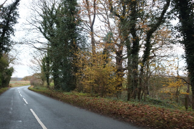
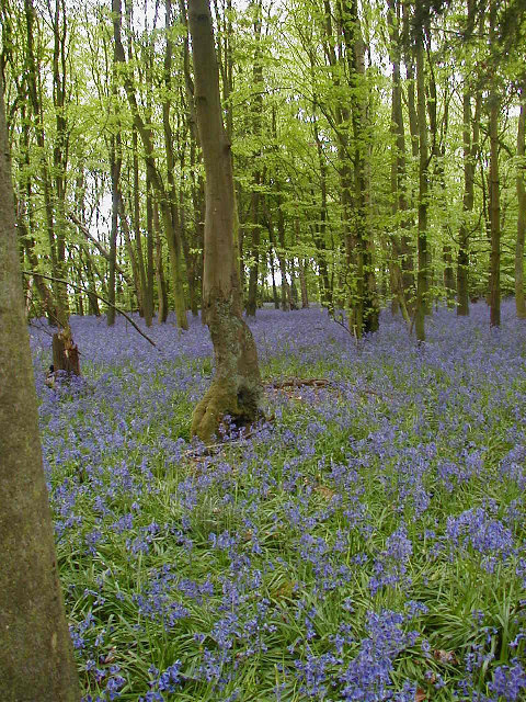
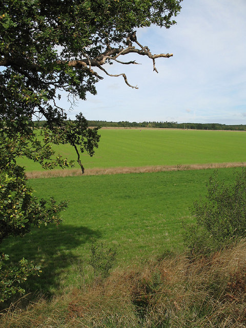
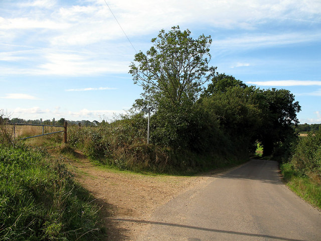
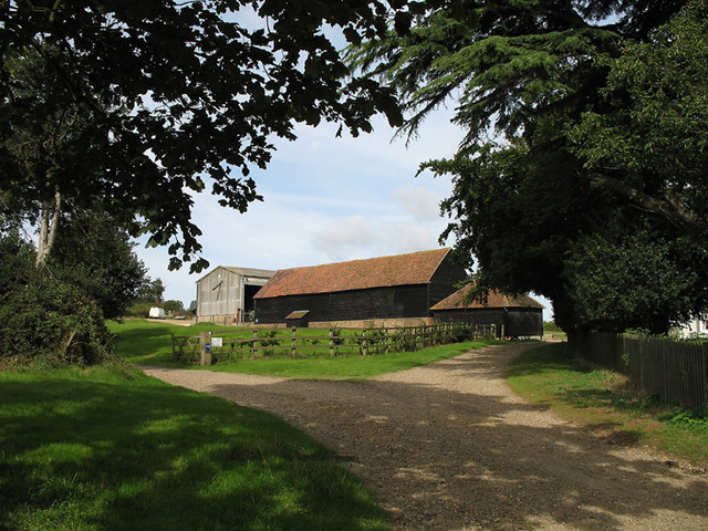
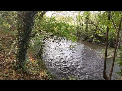
Surrounded by idyllic countryside, Bramfield offers plenty of opportunities for outdoor activities. The village is located close to several nature reserves and country parks, providing access to beautiful walking trails and scenic landscapes. Additionally, the nearby River Mimram is a popular spot for fishing enthusiasts.

Overall, Bramfield is a tranquil and picturesque village that provides a peaceful and traditional English living experience. With its charming architecture, community spirit, and access to nature, Bramfield offers a delightful retreat from the bustling city life.

If you have any feedback on the listing, please let us know in the comments section below.

Bramfield Images

Images are sourced within 2km of 51.823073/-0.125597 or Grid Reference TL2915. Thanks to Geograph Open Source API. All images are credited.

Tattle Hill, Broadoak End By Oakfield Plantation on the right
Tattle Hill, Broadoak End
By Oakfield Plantation on the right
Main Road, Bramfield
Looking towards Priest Wood, Bramfield
Main Road, Bramfield
Vicarage Way, Waterford Crossing the River Beane
Vicarage Way, Waterford
Crossing the River Beane
High Road, Waterford
Bramfield Village Looking north from the village church.
Bramfield Village
Looking north from the village church.
Bluebells in Row Wood
Bramfield Shelter Built 2 June 1953 to commemorate Queen Elizabeth's Coronation it was originally the village well house.
Bramfield Shelter
Built 2 June 1953 to commemorate Queen Elizabeth's Coronation it was originally the village well house.
Bramfield Village Post Office A rare sight these days, a working, village post office and store.
Bramfield Village Post Office
A rare sight these days, a working, village post office and store.
Bacon's Farm On the other side of the farmhouse there live a flock of chickens.
The eggs are sold from an honesty-box by the gate.
Bacon's Farm
On the other side of the farmhouse there live a flock of chickens. The eggs are sold from an honesty-box by the gate.
Bramfieldbury This house may be on the site of the dwelling-house said to have been built by Robert Ware, bursar of St. Albans, at Bramfield. It is generally called Bramfieldbury or Nancy Bury.
Bramfieldbury
This house may be on the site of the dwelling-house said to have been built by Robert Ware, bursar of St. Albans, at Bramfield. It is generally called Bramfieldbury or Nancy Bury.
Greenhill This house stands just to the south of Bramfield Woods.
It is the only house in this grid-square apart from the Lodge-house at the end of the drive.
Greenhill
This house stands just to the south of Bramfield Woods. It is the only house in this grid-square apart from the Lodge-house at the end of the drive.
Westend Farmland Farmland to the south of Bramfield.  The oak tree in the foreground has fully developed acorns.  Beyond the near boundary, the field has a new crop, possibly winter wheat, growing.   The small dot near the centre of the photo is a pair of joggers on the bridleway that cuts diagonally across the field.
Westend Farmland
Farmland to the south of Bramfield. The oak tree in the foreground has fully developed acorns. Beyond the near boundary, the field has a new crop, possibly winter wheat, growing. The small dot near the centre of the photo is a pair of joggers on the bridleway that cuts diagonally across the field.
Bridleway and road near Westend Farm On the road between Bramfield and the B1000.  The road hugs the east side of the shallow valley.   On the left is a bridleway to Goldings Plantation.
Bridleway and road near Westend Farm
On the road between Bramfield and the B1000. The road hugs the east side of the shallow valley. On the left is a bridleway to Goldings Plantation.
Great Gobions Farm Entrance to the farm.  The track to the right is a public bridleway.
Great Gobions Farm
Entrance to the farm. The track to the right is a public bridleway.
Conservation Walks Marker Post marking the route and showing a map of a local conservation walk.  The section it is indicating does not appear as a footpath on the OS map.
Conservation Walks Marker
Post marking the route and showing a map of a local conservation walk. The section it is indicating does not appear as a footpath on the OS map.
Veteran Hornbeam Pollard along old green lane Veteran trees like this provide a really important wildlife habitat.
Veteran Hornbeam Pollard along old green lane
Veteran trees like this provide a really important wildlife habitat.
Show me another place!

Bramfield is located at Grid Ref: TL2915 (Lat: 51.823073, Lng: -0.125597)

Administrative County: Hertfordshire

District: East Hertfordshire

Police Authority: Hertfordshire

What 3 Words

///blame.period.cared. Near Datchworth, Hertfordshire

Related Wikis

Bramfield, Hertfordshire

Bramfield is a village and civil parish in the East Hertfordshire district, in the county of Hertfordshire, England. Nearby settlements include Hertford...

Waterford, Hertfordshire

Waterford is a village in the East Hertfordshire district of Hertfordshire, England. It is located on the A119 road, around 2.5 km (1.6 miles) north of...
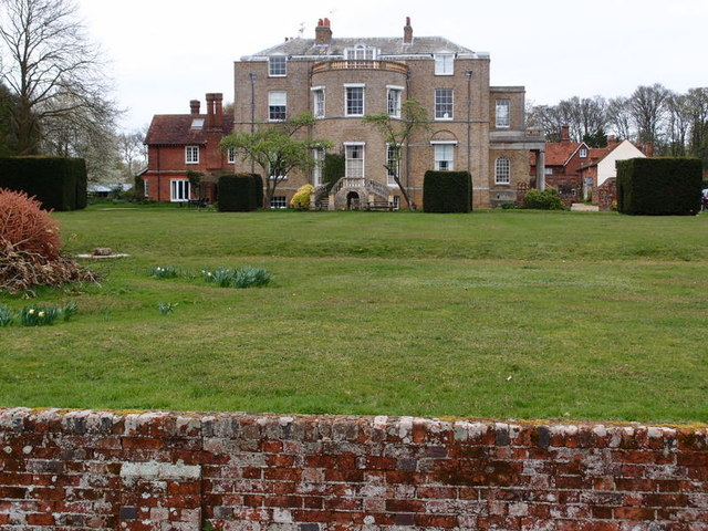
Marden Hill

Marden Hill is a Grade II* listed country house close to the village of Tewin, Hertfordshire.The house, originally Jacobean but substantially rebuilt in...

Stapleford railway station

Stapleford railway station was a station on the Hertford Loop Line, and was situated in the village of Stapleford, Hertfordshire, England. == History... ==

Related Videos

Walks in Ware - Waterford Heath South

Walks in Ware are a series of videos to keep fit and stay healthy. Waterford Heath is an amazing place teaming with life the flora ...

Walk 220: Stapleford North Loop

For this walk we explored the countryside between a couple of existing routes in our collection in order to create a new loop.

Waterford - The Ultimate 12k

Our club run from Sunday 25th July, where run leader Chris lead us on a beautiful trail run around Waterford. Why don't you join ...

Walks in Ware - Waterford Marsh

Walks in Ware are a seris of videos to keep fit and stay well. Walks in Ware - Waterford Marsh is a walk along the river Bean ...

Nearby Amenities

Located within 500m of 51.823073,-0.125597
Bramfield
Created By: Potlatch 0.6a
Place: village
Lat/Long: 51.8247274/-0.1260695
Bus Stop
St Andrew's Church
Bus: yes
Naptan AtcoCode: 210021300440
Naptan Bearing: S
Naptan CommonName: St Andrew's Church
Naptan Crossing: Well Green
Naptan Indicator: opp
Naptan Landmark: Well Green
Naptan NaptanCode: hrtdwdjp
Naptan ShortCommonName: NA
Naptan Street: Main Road
Naptan Verified: no
Public Transport: platform
Source: naptan_import
Lat/Long: 51.8244625/-0.1265001
St Andrew's Church
Local Ref: NR
Naptan AtcoCode: 210021312680
Naptan Bearing: N
Naptan BusStopType: CUS
Naptan CommonName: St Andrew's Church
Naptan Crossing: Bury Lane
Naptan Indicator: nr
Naptan Landmark: Bury Lane
Naptan NaptanCode: hrtgtdtg
Naptan ShortCommonName: NA
Naptan Street: Main Road
Naptan Verified: no
Source: naptan_import
Lat/Long: 51.8244653/-0.1266741
Bench
Backrest: yes
Source: GPS
Lat/Long: 51.8239025/-0.1282391
The King's House B&B
Tourism: guest_house
Website: https://www.thekingshousebramfield.com/
Lat/Long: 51.8223408/-0.1251063
Leisure: picnic_table
Source: GPS, observation
Lat/Long: 51.8244972/-0.1283216
Leisure: picnic_table
Source: GPS, observation
Lat/Long: 51.8245125/-0.1283222
Post Box
Brand: Royal Mail
Brand Wikidata: Q638098
Collection Times: Mo-Fr 17:00; Sa 10:30
Operator: Royal Mail
Operator Wikidata: Q638098
Post Box Type: lamp
Ref: SG14 36
Royal Cypher: EIIR
Royal Cypher Wikidata: Q33102113
Lat/Long: 51.8245223/-0.126525
Power: pole
Lat/Long: 51.8205718/-0.1313558
Power: pole
Lat/Long: 51.821288/-0.1306772
Power: pole
Lat/Long: 51.8222148/-0.1297438
Power: pole
Lat/Long: 51.8233852/-0.1277
Power: pole
Lat/Long: 51.8237035/-0.1264755
Power: pole
Lat/Long: 51.8230818/-0.1288828
Power: pole
Lat/Long: 51.8237499/-0.1300952
Power: pole
Lat/Long: 51.8245904/-0.1308623
Barrier: cycle_barrier
Lat/Long: 51.8254424/-0.1268233
Defibrillator
Booth: K6
Covered: booth
Defibrillator Location: inside old red phone box in front of St Andrews Church, Bramfield
Disused Amenity: telephone
Emergency: defibrillator
Listed Status: Grade II
Man Made: telephone_box
Ref GB The Circuit: 3CFB01B8-1802-4004-AF14-AF1A00FEFDFC
Lat/Long: 51.8244073/-0.1264716
Public Bookcase
Note: shelf inside bus shelter
Public Bookcase Type: shelf
Lat/Long: 51.8244593/-0.1264797
Bench
Lat/Long: 51.8245695/-0.1264858
Recycling
Recycling Type: centre
Lat/Long: 51.8246159/-0.1281449
The data included in this document is from www.openstreetmap.org. The data is made available under ODbL.

Have you been to Bramfield?

Leave your review of Bramfield below (or comments, questions and feedback).