Whatmore

Settlement in Shropshire

England

Whatmore

Bora The southern part of Boraston viewed from close to Aston Bank.
Bora Credit: Bob Embleton

Whatmore is a small village located in the county of Shropshire, England. Situated approximately five miles west of the town of Ellesmere, it is nestled in the picturesque countryside of the Welsh Marches. The village is part of the civil parish of Welshampton and Lyneal.

With a population of around 200 residents, Whatmore is a close-knit community that offers a tranquil and peaceful environment for its inhabitants. The village is characterized by its charming cottages and traditional architecture, which adds to its rustic charm. The surrounding landscape is dominated by rolling hills, lush meadows, and scenic woodlands, providing ample opportunities for outdoor activities such as hiking, cycling, and birdwatching.

Despite its small size, Whatmore has a strong sense of community spirit, with various community events and activities organized throughout the year. The village boasts a local pub, The Oak Inn, which serves as a popular meeting place for locals and visitors alike. Additionally, the nearby town of Ellesmere offers a wider range of amenities including shops, restaurants, and schools.

Whatmore's location also provides easy access to several notable attractions in the area. The nearby Ellesmere Lake, known as The Mere, is a popular destination for boating and fishing enthusiasts. The historic town of Shrewsbury, with its medieval architecture and charming streets, is just a short drive away.

Overall, Whatmore offers a delightful blend of rural living, natural beauty, and a strong sense of community, making it an idyllic place to reside or visit in Shropshire.

If you have any feedback on the listing, please let us know in the comments section below.
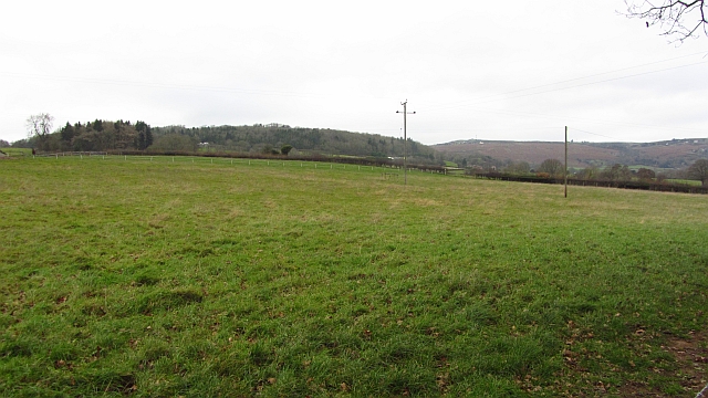
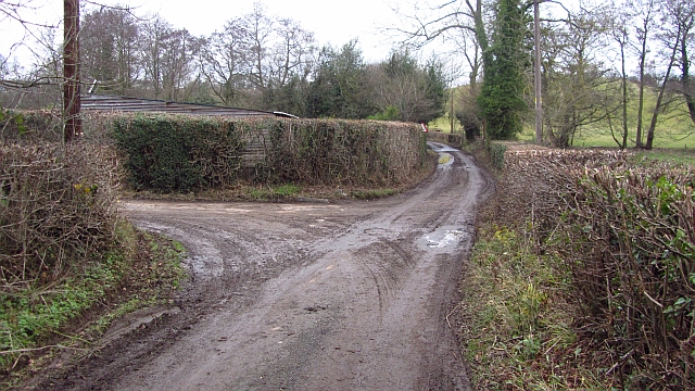
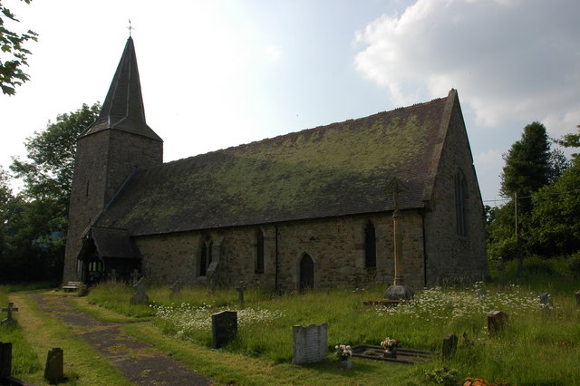
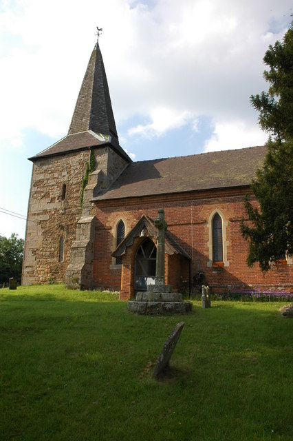
Whatmore Images

Images are sourced within 2km of 52.34143/-2.5725625 or Grid Reference SO6171. Thanks to Geograph Open Source API. All images are credited.

Bora The southern part of Boraston viewed from close to Aston Bank.
Bora
The southern part of Boraston viewed from close to Aston Bank.
The churchyard, Boraston
The village of Boraston A telephone box and timber-framed black and white cottage in the village of Boraston.
The village of Boraston
A telephone box and timber-framed black and white cottage in the village of Boraston.
Boraston church Boraston church dates from the 13th century and was renewed and enlarged in 1884-1887 by Henry Curzon.  The church has no dedication. It is Grade II listed.

Historic England description
Church. C13, renewed and enlarged 1884-1887 by Henry Curzon. Stone rubble with ashlar dressing to nave, ashlar to chancel and lower stage of tower, upper stage of tower weatherboarded. Plain-tile roofs, with shingled broach spire. PLAN: chancel with north vestry, nave, tower with south porch. EXTERIOR: chancel with late C19 hipped apsidal east end with projecting raised gable-end with verge rafters on carved brackets, and east window of twin lancets surmounted by vesica. Lancets in Early English style to canted walls and south wall. Late C19 vestry with hipped tiled roof with door and 3-light mullion window, both with plain chamfered jambs with rounded tops. Ashlar ridge chimney with octagonal shaft. Nave: north wall with 3 restored cusped lancets and blocked plain Norman north doorway. South wall with restored cusped lancet to right and 2 C19 flat-headed windows with cusped ogee tracery. Vestiges of blocked Norman south doorway. Tower: lower stage with pointed arched south doorway with hoodmould over. Large cinquefoil window to west and lancet to north in Early English style. Upper stage of weatherboarded timber frame jettied off ashlar corbels. Timber bell-openings on each face with ogee lintels and louvres on cusped projecting mullions. Shingle covered broach spire with sprocket eaves. South porch set in angle of tower and nave. Steep tiled gabled roof with bargeboards, shingled apex to truss with carved tie beam with projecting cross set on bracket, cusped ogee arch set under tie, oak timber-framed side walls on high ashlar plinth. INTERIOR: 2-bay chancel consisting of single bay and apsidal bay. c1884 pulpit, chancel screen and lectern. 4-bay nave roof with 4 trusses of twin swept raking struts and one vertical strut all set below collar, chamfered tie beam with plain stepped chamfer stops. Restored single-purlin roof with scissor-trussed rafters. c1700 font has bowl with raised spirals with vestiges of earlier carving now eroded. 
Source: <span class="nowrap"><a title="https://www.historicengland.org.uk/listing/the-list/list-entry/1383416" rel="nofollow ugc noopener" href="https://www.historicengland.org.uk/listing/the-list/list-entry/1383416">Link</a><img style="margin-left:2px;" alt="External link" title="External link - shift click to open in new window" src="https://s1.geograph.org.uk/img/external.png" width="10" height="10"/></span>
Boraston church
Boraston church dates from the 13th century and was renewed and enlarged in 1884-1887 by Henry Curzon. The church has no dedication. It is Grade II listed. Historic England description Church. C13, renewed and enlarged 1884-1887 by Henry Curzon. Stone rubble with ashlar dressing to nave, ashlar to chancel and lower stage of tower, upper stage of tower weatherboarded. Plain-tile roofs, with shingled broach spire. PLAN: chancel with north vestry, nave, tower with south porch. EXTERIOR: chancel with late C19 hipped apsidal east end with projecting raised gable-end with verge rafters on carved brackets, and east window of twin lancets surmounted by vesica. Lancets in Early English style to canted walls and south wall. Late C19 vestry with hipped tiled roof with door and 3-light mullion window, both with plain chamfered jambs with rounded tops. Ashlar ridge chimney with octagonal shaft. Nave: north wall with 3 restored cusped lancets and blocked plain Norman north doorway. South wall with restored cusped lancet to right and 2 C19 flat-headed windows with cusped ogee tracery. Vestiges of blocked Norman south doorway. Tower: lower stage with pointed arched south doorway with hoodmould over. Large cinquefoil window to west and lancet to north in Early English style. Upper stage of weatherboarded timber frame jettied off ashlar corbels. Timber bell-openings on each face with ogee lintels and louvres on cusped projecting mullions. Shingle covered broach spire with sprocket eaves. South porch set in angle of tower and nave. Steep tiled gabled roof with bargeboards, shingled apex to truss with carved tie beam with projecting cross set on bracket, cusped ogee arch set under tie, oak timber-framed side walls on high ashlar plinth. INTERIOR: 2-bay chancel consisting of single bay and apsidal bay. c1884 pulpit, chancel screen and lectern. 4-bay nave roof with 4 trusses of twin swept raking struts and one vertical strut all set below collar, chamfered tie beam with plain stepped chamfer stops. Restored single-purlin roof with scissor-trussed rafters. c1700 font has bowl with raised spirals with vestiges of earlier carving now eroded. Source: LinkExternal link
Traditional red-brick farm buildings, Boraston Traditional red-brick farm buildings at Boraston Court.
Traditional red-brick farm buildings, Boraston
Traditional red-brick farm buildings at Boraston Court.
Traditional red-brick farm buildings, Boraston Traditional red-brick farm buildings at Boraston Court.
Traditional red-brick farm buildings, Boraston
Traditional red-brick farm buildings at Boraston Court.
Farm entrance at Boraston Entrance to traditional red-brick farm buildings at Boraston Court.
Farm entrance at Boraston
Entrance to traditional red-brick farm buildings at Boraston Court.
Victorian letterbox A disused Victorian letterbox in an old red-brick farm building in Boraston.
Victorian letterbox
A disused Victorian letterbox in an old red-brick farm building in Boraston.
Old barn at Boraston An old red-brick hay barn with regular ventilation holes.
Old barn at Boraston
An old red-brick hay barn with regular ventilation holes.
Bridleway to Nash Court Farm A public bridleway from a T-junction to the west of Boraston to Nash Court Farm.
Bridleway to Nash Court Farm
A public bridleway from a T-junction to the west of Boraston to Nash Court Farm.
Road junction near Nash Road junction near Nash mid-way between Tenbury Wells and Clee Hill.
Road junction near Nash
Road junction near Nash mid-way between Tenbury Wells and Clee Hill.
Woodland near Milson A small wood on one of the steep small hills that are a distinctive feature of the Teme Valley downstream of Tenbury.
Woodland near Milson
A small wood on one of the steep small hills that are a distinctive feature of the Teme Valley downstream of Tenbury.
A rough field  near Boraston Hilly country with watercourses cutting deep valleys as they descend off Clee Hill down to the Teme.
A rough field near Boraston
Hilly country with watercourses cutting deep valleys as they descend off Clee Hill down to the Teme.
Field entrance Grassland north of Boraston.
Field entrance
Grassland north of Boraston.
Near Shear Field under Clee Hill on the southern side of Clee Hill near Coreley.
Near Shear
Field under Clee Hill on the southern side of Clee Hill near Coreley.
A maze of muddy lanes Thank goodness I was not on the bike today as the mix of mud and thorns from recently cut hedges would prove most trying. In drier times and when the birds are nesting so flail cutting is banned, this is great cycling country in a maze of hilly, tiny lanes, often with grass growing down the centre strip.  Some Clee Hill lanes have been decommissioned and are no longer maintained by Shropshire County Council (I don't know if Worcestershire did this as well).
View towards a ford near Coreley.
A maze of muddy lanes
Thank goodness I was not on the bike today as the mix of mud and thorns from recently cut hedges would prove most trying. In drier times and when the birds are nesting so flail cutting is banned, this is great cycling country in a maze of hilly, tiny lanes, often with grass growing down the centre strip. Some Clee Hill lanes have been decommissioned and are no longer maintained by Shropshire County Council (I don't know if Worcestershire did this as well). View towards a ford near Coreley.
Snow on a green lane in Coreley Looking down the green lane which used to be a through route to the Trapnell but is now a dead end due to a landowner forcing through its closure!  Taken on a snowy walk with more snow just about to fall.
Snow on a green lane in Coreley
Looking down the green lane which used to be a through route to the Trapnell but is now a dead end due to a landowner forcing through its closure! Taken on a snowy walk with more snow just about to fall.
Lodge at entrance to Nash Court From B4214 north
Lodge at entrance to Nash Court
From B4214 north
Show me another place!

Whatmore is located at Grid Ref: SO6171 (Lat: 52.34143, Lng: -2.5725625)

Unitary Authority: Shropshire

Police Authority: West Mercia

What 3 Words

///rags.headrest.losses. Near Tenbury Wells, Worcestershire

Nearby Locations

Whatmore

Related Wikis

Nash, south Shropshire

Nash is a small village and civil parish located in Shropshire, England, situated south east of Ludlow and north of Tenbury Wells. The parish had a population...

Boraston

Boraston is a small village and civil parish in Shropshire, England. It is situated in the West Midlands, approximately 0.8 mi (1.3 km) north of Worcestershire...

Coreley

Coreley is a small, dispersed village and civil parish in south Shropshire, England, near to Clee Hill Village. It is situated approximately 30 miles...

Knighton on Teme

Knighton on Teme is a village and civil parish once in the hundred of Doddingtree and now in the Malvern Hills District of the county of Worcestershire...

Nearby Amenities

Located within 500m of 52.34143,-2.5725625
Power: pole
Lat/Long: 52.3432806/-2.5664342
Power: pole
Lat/Long: 52.343533/-2.5682151
Power: pole
Lat/Long: 52.3437821/-2.5697655
Power: pole
Lat/Long: 52.344041/-2.5714096
Power: pole
Lat/Long: 52.3444801/-2.5742072
Power: pole
Lat/Long: 52.3447554/-2.5760096
Ford: yes
Lat/Long: 52.3445916/-2.5752671
Generator Method: wind_turbine
Generator Source: wind
Power: generator
Source: bing
Lat/Long: 52.3419025/-2.5721285
The data included in this document is from www.openstreetmap.org. The data is made available under ODbL.

Have you been to Whatmore?

Leave your review of Whatmore below (or comments, questions and feedback).