Bramdean

Settlement in Hampshire Winchester

England

Bramdean

A272 Petersfield Road heading west Towards Winchester.
A272 Petersfield Road heading west Credit: Robin Webster

Bramdean is a small village located in the county of Hampshire, England. Situated approximately 10 miles east of Winchester, it falls within the South Downs National Park, known for its picturesque landscapes and rolling hills. The village itself is nestled in a valley, surrounded by lush green fields and woodland areas.

With a population of around 400 residents, Bramdean has a close-knit community and a peaceful, rural atmosphere. The village is characterized by its charming thatched cottages, historic buildings, and traditional English gardens. It maintains a strong sense of its agricultural heritage, with several working farms still operating in the area.

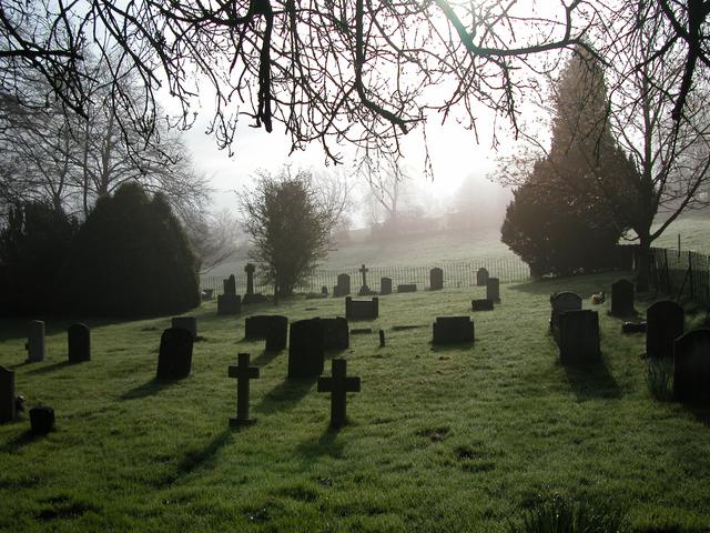
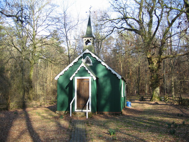
Bramdean is home to the Church of St. Simon and St. Jude, a beautiful medieval church dating back to the 12th century. The church features a striking tower and stained glass windows, attracting visitors interested in its architectural and historical significance.

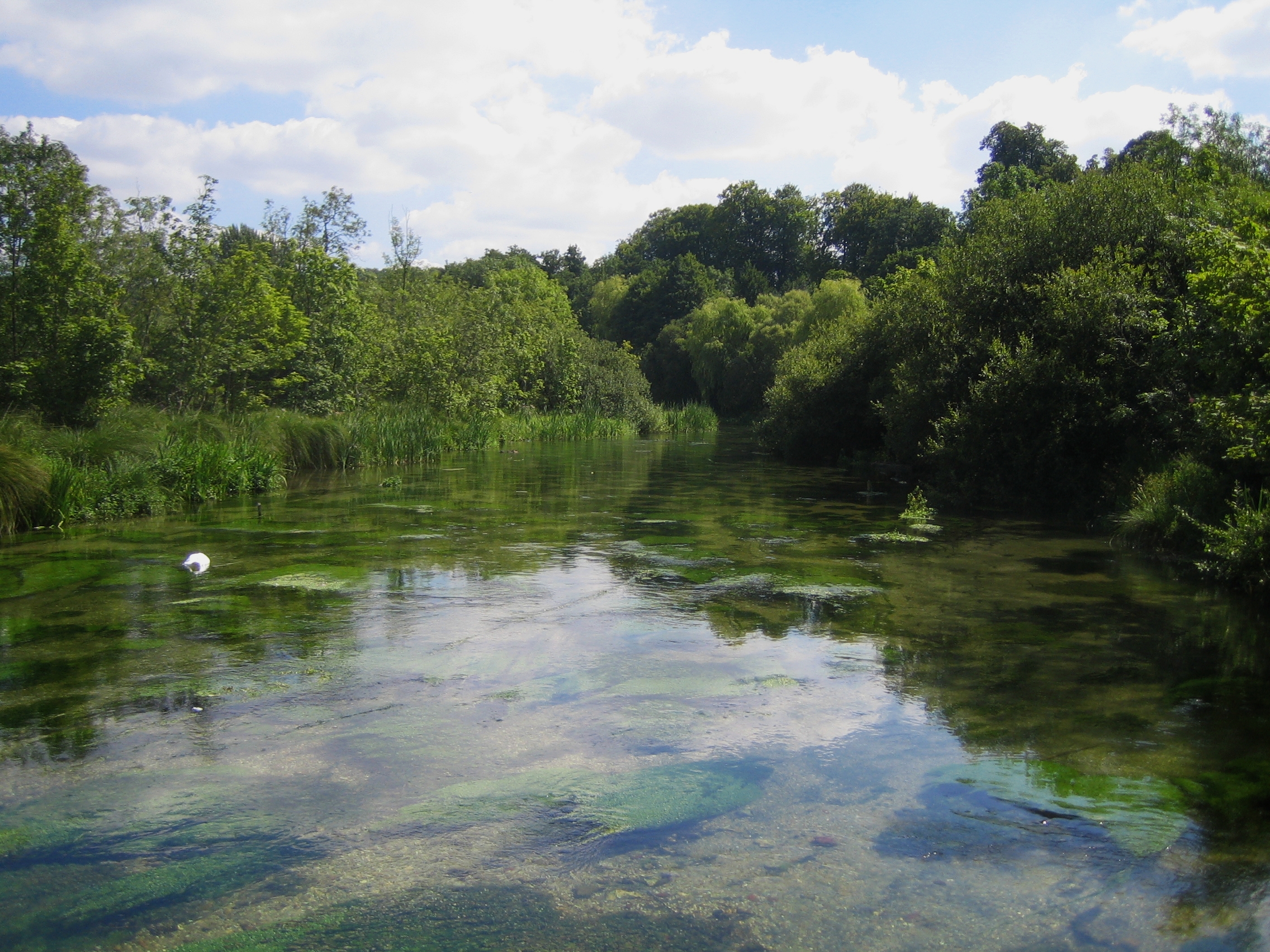
For nature enthusiasts, Bramdean offers numerous opportunities for outdoor activities. The village is surrounded by stunning countryside, with various walking and cycling trails that allow visitors to explore the natural beauty of the South Downs. Additionally, the nearby Itchen Valley Country Park provides a perfect spot for picnicking, birdwatching, and fishing.

While Bramdean maintains its rural charm, it is conveniently located near larger towns and cities. Winchester, with its rich history and cultural attractions, is within easy reach, offering a range of amenities including shops, restaurants, and entertainment venues.

In summary, Bramdean is a tranquil village in Hampshire, offering a peaceful retreat in the heart of the South Downs National Park. Its natural beauty, historic architecture, and strong sense of community make it a delightful place to visit or reside.

If you have any feedback on the listing, please let us know in the comments section below.

Bramdean Images

Images are sourced within 2km of 51.049236/-1.124146 or Grid Reference SU6128. Thanks to Geograph Open Source API. All images are credited.

A272 Petersfield Road heading west Towards Winchester.
A272 Petersfield Road heading west
Towards Winchester.
Gardens, Hinton Ampner Cannas planted in a hexagonal bed in the Yew Garden at the National Trust owned Hinton Ampner.
Gardens, Hinton Ampner
Cannas planted in a hexagonal bed in the Yew Garden at the National Trust owned Hinton Ampner.
Gardens, Hinton Ampner Agapanthus planted by the steps out of the Yew Garden at the National Trust owned Hinton Ampner.
Gardens, Hinton Ampner
Agapanthus planted by the steps out of the Yew Garden at the National Trust owned Hinton Ampner.
Hinton Ampner The south front of the house at Agapanthus at the National Trust owned Hinton Ampner, seen above a border below the main terrace.
Hinton Ampner
The south front of the house at Agapanthus at the National Trust owned Hinton Ampner, seen above a border below the main terrace.
Hinton Ampner The south front of the house at Agapanthus at the National Trust owned Hinton Ampner, seen across the Sunken Garden.
Hinton Ampner
The south front of the house at Agapanthus at the National Trust owned Hinton Ampner, seen across the Sunken Garden.
Hinton Ampner The south front of the house at Agapanthus at the National Trust owned Hinton Ampner, seen across the Sunken Garden.
Hinton Ampner
The south front of the house at Agapanthus at the National Trust owned Hinton Ampner, seen across the Sunken Garden.
Hinton Ampner The south front of the house at Agapanthus at the National Trust owned Hinton Ampner, seen above a border along the lawn below the Main Terrace.
Hinton Ampner
The south front of the house at Agapanthus at the National Trust owned Hinton Ampner, seen above a border along the lawn below the Main Terrace.
Hinton Ampner The gable of a building at the western end of the house at the National Trust owned Hinton Ampner, seen above a border along the lawn below the Main Terrace.
Hinton Ampner
The gable of a building at the western end of the house at the National Trust owned Hinton Ampner, seen above a border along the lawn below the Main Terrace.
All Saints' Church, Hinton Ampner Church with Saxon origins, largely rebuilt in the 13th Century and restored in the 19th Century.  Grade II* listed - see <span class="nowrap"><a title="www.historicengland.org.uk/listing/the-list/list-entry/1155865" rel="nofollow ugc noopener" href="http://www.historicengland.org.uk/listing/the-list/list-entry/1155865">Link</a><img style="margin-left:2px;" alt="External link" title="External link - shift click to open in new window" src="https://s1.geograph.org.uk/img/external.png" width="10" height="10"/></span>.
All Saints' Church, Hinton Ampner
Church with Saxon origins, largely rebuilt in the 13th Century and restored in the 19th Century. Grade II* listed - see LinkExternal link.
House View The view of the front of the house at the National Trust owned Hinton Ampner.
House View
The view of the front of the house at the National Trust owned Hinton Ampner.
House Front The front of the house at the National Trust owned Hinton Ampner.
House Front
The front of the house at the National Trust owned Hinton Ampner.
The Autumn Border The Autumn Border alongside the main drive into the National Trust owned Hinton Ampner.
The Autumn Border
The Autumn Border alongside the main drive into the National Trust owned Hinton Ampner.
The Walled Garden Greenhouses in the Walled Garden at the National Trust owned Hinton Ampner.
The Walled Garden
Greenhouses in the Walled Garden at the National Trust owned Hinton Ampner.
Inside Hinton Ampner The view inside at the National Trust owned Hinton Ampner.
Inside Hinton Ampner
The view inside at the National Trust owned Hinton Ampner.
Hinton Ampner Dining The view inside the house at the National Trust owned Hinton Ampner.
Hinton Ampner Dining
The view inside the house at the National Trust owned Hinton Ampner.
All Saints parish church The view in the grounds of the National Trust owned Hinton Ampner.
All Saints parish church
The view in the grounds of the National Trust owned Hinton Ampner.
All Saints Interior The view inside the church at the National Trust owned Hinton Ampner.
All Saints Interior
The view inside the church at the National Trust owned Hinton Ampner.
Show me another place!

Bramdean is located at Grid Ref: SU6128 (Lat: 51.049236, Lng: -1.124146)

Administrative County: Hampshire

District: Winchester

Police Authority: Hampshire

What 3 Words

///comedians.this.trooper. Near New Alresford, Hampshire

Nearby Locations

Bramdean

Related Wikis

Bramdean and Hinton Ampner

Bramdean and Hinton Ampner is a civil parish in the English county of Hampshire, forming part of the area administered as the City of Winchester. Its main...

Bramdean

Bramdean is a village and former civil parish, now in the parish of Bramdean and Hinton Ampner, in the Winchester district, in the county of Hampshire...

Itchen Way

The Itchen Way is a 31.80-mile (51.18 km) long-distance footpath following the River Itchen in Hampshire, England, from its source near Hinton Ampner House...
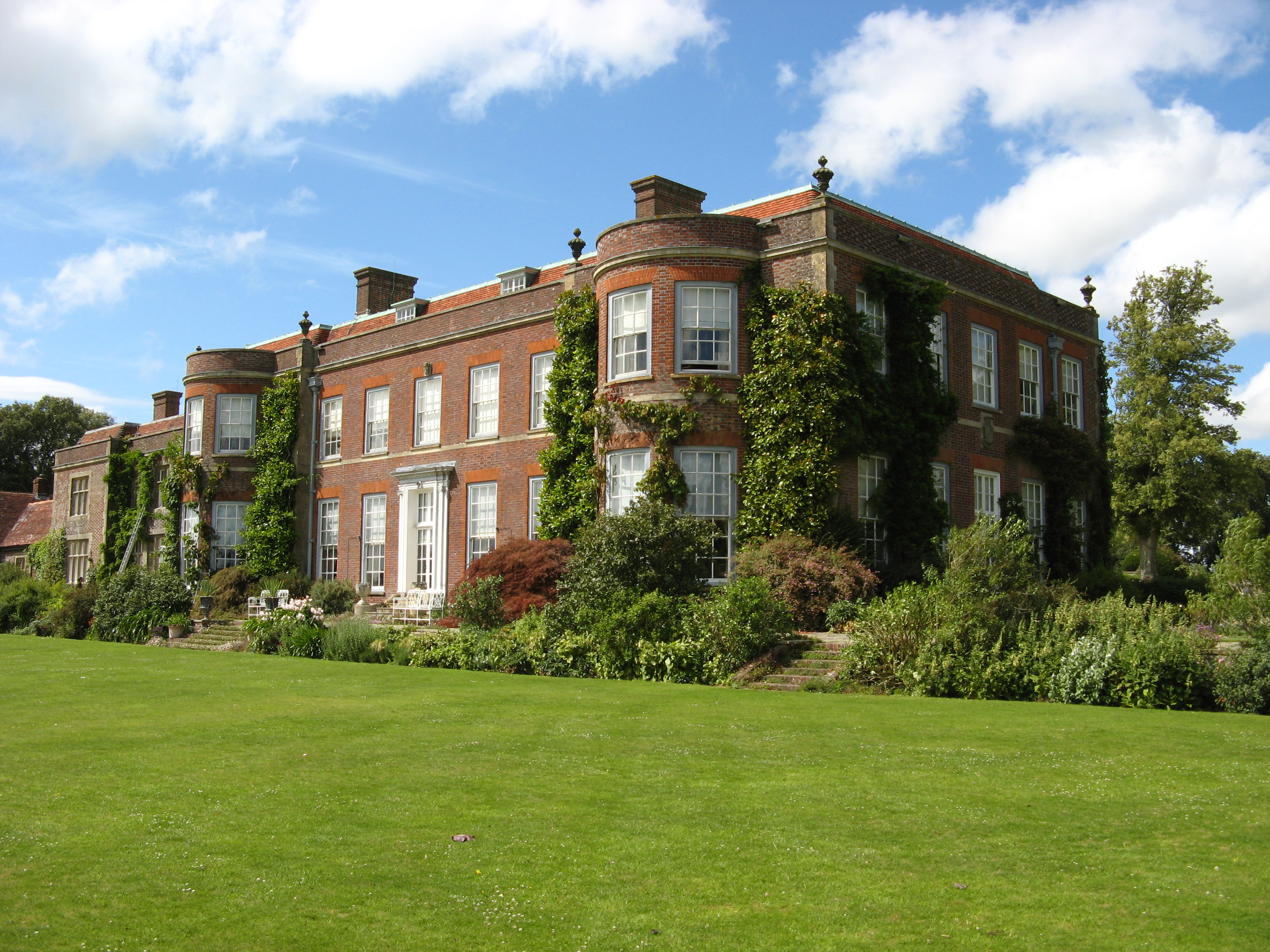
Hinton Ampner

Hinton Ampner is a village and country house estate with gardens and former civil parish, now in the parish of Bramdean and Hinton Ampner, in the Winchester...
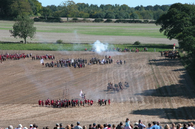
Battle of Cheriton

The Battle of Cheriton of 29 March 1644 was an important Parliamentarian victory during the First English Civil War. Sir William Waller's "Army of the...

Bramdean Common

Bramdean Common is near Winchester, Hampshire, England.Bramdean means "the valley where brooms grow" - broom being the gorse bush originally prevalent...
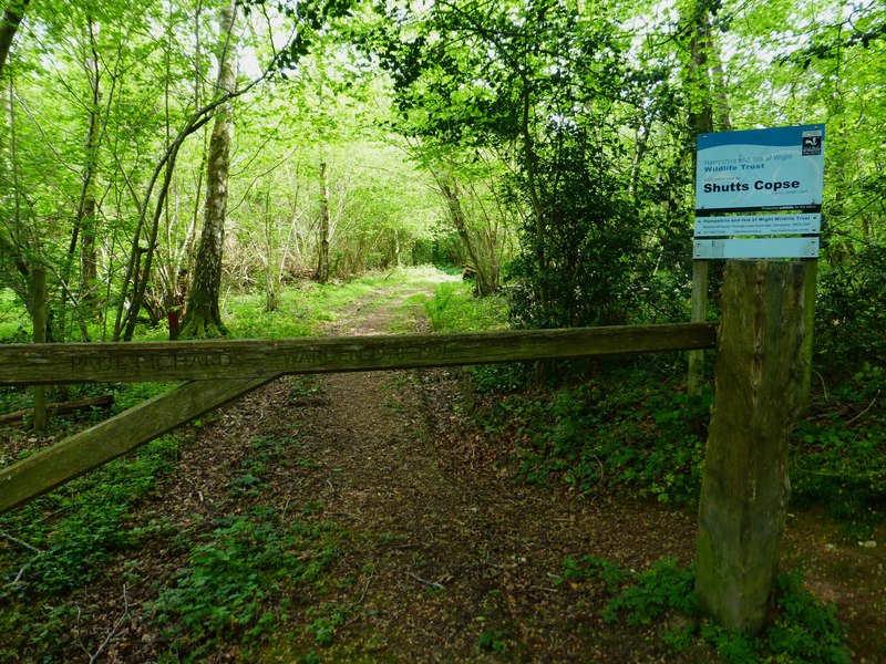
Shutts Copse

Shutts Copse is a 5-hectare (12-acre) nature reserve north of West Meon in Hampshire. It is managed by the Hampshire and Isle of Wight Wildlife Trust...

Cheriton, Hampshire

Cheriton is a village and civil parish near Alresford in Hampshire, England. The settlement is close to the site of the 1644 Battle of Cheriton, fought...

Related Videos

Portsmouth | Trại hè tiếng Anh ở Anh | Oxford Elites Group #traihe #shorts #hoctienganh

Hinton Ampner House And Garden. Trại hè tiếng Anh tại Anh của Oxford Elites Group đem tới những trải nghiệm tuyệt vời #traihe ...

I had too much coffee! Autumn Walk at Hinton Ampner National Trust - Last Country Walk in 2020

I was so glad we went for a walk at National Trust's Hinton Ampner and didn't let the terriblely bad weather stopped us. I really ...

THE SOUTH DOWNS NATIONAL PARK......a cinematic adventure through ancient woodlands!

Filmed in the stunning South Downs National Park, take a short journey through Queen Elizabeth Country park and it's ancient ...

Nearby Amenities

Located within 500m of 51.049236,-1.124146
Created By: osmeditor2
Lat/Long: 51.044784/-1.1242222
Created By: osmeditor2
Lat/Long: 51.0471825/-1.1304331
Barrier: stile
Lat/Long: 51.0470973/-1.1258449
Barrier: stile
Lat/Long: 51.0471641/-1.126509
Barrier: stile
Lat/Long: 51.047218/-1.1275104
Barrier: stile
Lat/Long: 51.0495404/-1.1269298
Barrier: stile
Lat/Long: 51.0508505/-1.1262483
Barrier: stile
Lat/Long: 51.0532343/-1.1244769
Bramdean
Is In: Hampshire, England, UK
Place: village
Wikidata: Q4956146
Wikipedia: en:Bramdean
Lat/Long: 51.0477273/-1.125843
Barrier: stile
Lat/Long: 51.0450702/-1.1266066
Bus Stop
The Fox Inn Ph
Naptan AtcoCode: 1900HA110731
Naptan Bearing: NW
Naptan CommonName: The Fox Inn Ph
Naptan NaptanCode: hamdwtjp
Naptan Street: A272 Winchester Road
Naptan Verified: no
Source: naptan_import
Lat/Long: 51.047186/-1.1248385
Bus Stop
The Fox Inn Ph
Naptan AtcoCode: 1900HA110732
Naptan Bearing: SE
Naptan CommonName: The Fox Inn Ph
Naptan Crossing: Wood Lane
Naptan NaptanCode: hamdwtjw
Naptan Street: A272 Winchester Road
Naptan Verified: no
Source: naptan_import
Lat/Long: 51.0472842/-1.1247511
Fuel
Bramdean Garage
Brand: Murco
Brand Wikidata: Q16998281
Brand Wikipedia: en:Murco Petroleum
Operator: Murco
Lat/Long: 51.0482235/-1.1264715
Post Box
Collection Plate: CP7
Collection Times: Mo-Fr 16:30; Sa 09:15
Last Checked: 2021-01-02
Operator: Royal Mail
Post Box Type: lamp
Ref: SO24 119
Royal Cypher: EIIR
Royal Cypher Wikidata: Q33102113
Source: survey
Lat/Long: 51.0491819/-1.1243185
Barrier: stile
Lat/Long: 51.0471626/-1.1303878
Barrier: kissing_gate
Lat/Long: 51.0469187/-1.1245631
Barrier: stile
Lat/Long: 51.0471169/-1.1259222
Barrier: stile
Lat/Long: 51.0449497/-1.1262356
Turning Circle
Lat/Long: 51.0492381/-1.1288789
Defibrillator
Access: yes
Booth: KX100
Covered: booth
Defibrillator Location: inside old phone box by Bramdean and Hinton Ampner Village Hall
Disused Amenity: telephone
Emergency: defibrillator
Indoor: no
Man Made: telephone_box
Source: survey
Lat/Long: 51.0491947/-1.1243362
Advertising: board
Source: survey
Lat/Long: 51.0491937/-1.1243051
Clock
Display: sundial
Lat/Long: 51.0494511/-1.1277986
Crossing
Lat/Long: 51.0487422/-1.1222853
The data included in this document is from www.openstreetmap.org. The data is made available under ODbL.

Have you been to Bramdean?

Leave your review of Bramdean below (or comments, questions and feedback).