Albrighton

Settlement in Shropshire

England

Albrighton

View northwards from a lay-by beside the Shrewsbury to Ellesmere road A view towards Ellesmere near Pim Hill. 

The tree caught my eye - the one that looks like a Grand National jockey and his horse about to leap a fence.
View northwards from a lay-by beside the Shrewsbury to Ellesmere road Credit: Jeremy Bolwell

Albrighton is a picturesque village located in the county of Shropshire, England. Situated approximately 8 miles west of Wolverhampton, it is nestled in the heart of the beautiful Shropshire countryside. With a population of around 4,000 residents, Albrighton has managed to retain its traditional charm and character.

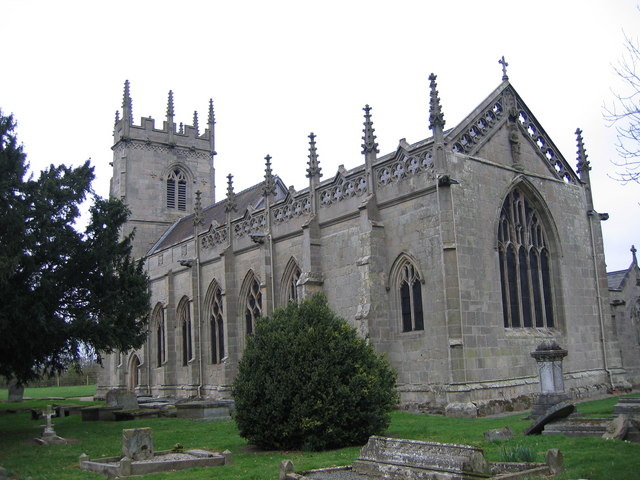
The village boasts a rich history, with records dating back to the Domesday Book of 1086. Its historic roots can be seen in the architecture of many of its buildings, including St. Mary Magdalene Church, which dates back to the 12th century, and the Tudor-style cottages that line its streets.

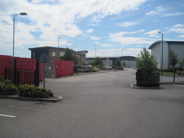
Albrighton is known for its vibrant community spirit and offers a range of amenities for its residents and visitors. The village features a variety of independent shops, including quaint boutiques, charming cafes, and traditional pubs. The Albrighton Moat and Gardens, a local attraction, is a beautifully landscaped area where visitors can enjoy a leisurely stroll or a picnic.

The village also benefits from excellent transport links, with a train station connecting it to nearby cities such as Birmingham and Shrewsbury. This accessibility makes Albrighton an attractive place for commuters looking for a tranquil place to call home.

Surrounded by lush green fields and rolling hills, Albrighton offers ample opportunities for outdoor activities. The nearby countryside provides scenic walking trails, cycling routes, and equestrian paths, allowing residents to enjoy the natural beauty of the area.

Overall, Albrighton is a charming village that seamlessly combines its historic past with modern amenities, making it a delightful place to live or visit for those seeking a tranquil retreat in the heart of the Shropshire countryside.

If you have any feedback on the listing, please let us know in the comments section below.

Albrighton Images

Images are sourced within 2km of 52.759569/-2.746826 or Grid Reference SJ4918. Thanks to Geograph Open Source API. All images are credited.

View northwards from a lay-by beside the Shrewsbury to Ellesmere road A view towards Ellesmere near Pim Hill. 

The tree caught my eye - the one that looks like a Grand National jockey and his horse about to leap a fence.
View northwards from a lay-by beside the Shrewsbury to Ellesmere road
A view towards Ellesmere near Pim Hill. The tree caught my eye - the one that looks like a Grand National jockey and his horse about to leap a fence.
On the Shrewsbury to Ellesmere road near Pim Hill Is it just me, or does this tree resemble a human form? I see a jockey complete with hat and his mount's neck curving in front of him.
On the Shrewsbury to Ellesmere road near Pim Hill
Is it just me, or does this tree resemble a human form? I see a jockey complete with hat and his mount's neck curving in front of him.
Massive jockey and horse about to leap the Shrewsbury to Ellesmere road near Pim Hill Well OK it is just a bit like that as the rear of the horse is missing, but that's what I see.

Van for scale.
Massive jockey and horse about to leap the Shrewsbury to Ellesmere road near Pim Hill
Well OK it is just a bit like that as the rear of the horse is missing, but that's what I see. Van for scale.
Scene on the Shrewsbury to Ellesmere road The jockey and his mount are about to leap the road here.
Scene on the Shrewsbury to Ellesmere road
The jockey and his mount are about to leap the road here.
Gate by Plex Lane
Gate by Plex Lane
Battlefield Church St. Mary Magdalene, built on orders of Henry IV after victory in the Battle of Shrewsbury in 1406 over the Marcher Lords.
Battlefield Church
St. Mary Magdalene, built on orders of Henry IV after victory in the Battle of Shrewsbury in 1406 over the Marcher Lords.
St. Mary Magdalene The church constructed in 1406 in commemoration of King Henry IV's victory in the Battle of Shrewsbury in 1403. The tower was added between 1478 and 1520 by Adam Grafton.
St. Mary Magdalene
The church constructed in 1406 in commemoration of King Henry IV's victory in the Battle of Shrewsbury in 1403. The tower was added between 1478 and 1520 by Adam Grafton.
St. Mary Magdalene The church is isolated and surrounded by open fields North of the suburbs of Shrewsbury.
St. Mary Magdalene
The church is isolated and surrounded by open fields North of the suburbs of Shrewsbury.
Battlefield Church St. Mary Magdalene, is no longer used for regular services but it is still consecrated and is cared for by the Churches Conservation Trust charity.
Battlefield Church
St. Mary Magdalene, is no longer used for regular services but it is still consecrated and is cared for by the Churches Conservation Trust charity.
Private Lane Private lane adjacent St. Mary Magdalene, leading to the Field House, Battlefield.
Private Lane
Private lane adjacent St. Mary Magdalene, leading to the Field House, Battlefield.
Battlefield Gate Gateway to footpath to 1403 Battlefield Visitor Centre at Battlefield Farm.
Battlefield Gate
Gateway to footpath to 1403 Battlefield Visitor Centre at Battlefield Farm.
Battle Field Fields fronting Battlefield Farm, opposite the Battlefield church.
Battle Field
Fields fronting Battlefield Farm, opposite the Battlefield church.
Battlefield Farm Viewed across fields to the fore of St. Mary Magdalene church.
Battlefield Farm
Viewed across fields to the fore of St. Mary Magdalene church.
Board Walk Footpath away from the rear of St. Mary Magdalene's towards the 1403 Battlefield site and several fish ponds.
Board Walk
Footpath away from the rear of St. Mary Magdalene's towards the 1403 Battlefield site and several fish ponds.
Battle Path Footpath away from the rear of St. Mary Magdalene church leading to the 1403 Shrewsbury Battle site.
Battle Path
Footpath away from the rear of St. Mary Magdalene church leading to the 1403 Shrewsbury Battle site.
St. Mary Magdalene Battlefield church fell into disrepair during the 18th Century and required a lot of restoration work completed between 1861 and 1862 by S. Pountney Smith.
St. Mary Magdalene
Battlefield church fell into disrepair during the 18th Century and required a lot of restoration work completed between 1861 and 1862 by S. Pountney Smith.
Stafford Drive, Battlefield Industrial Estate From the DVLA car park. This is new development off the roundabout on Knight's Way opposite Hussey Road
Stafford Drive, Battlefield Industrial Estate
From the DVLA car park. This is new development off the roundabout on Knight's Way opposite Hussey Road
Cattle and Battlefield Church Viewed from Battlefield Farm
Cattle and Battlefield Church
Viewed from Battlefield Farm
Show me another place!

Albrighton is located at Grid Ref: SJ4918 (Lat: 52.759569, Lng: -2.746826)

Unitary Authority: Shropshire

Police Authority: West Mercia

What 3 Words

///prank.judge.troll. Near Astley, Shropshire

Related Wikis

Albrighton, Pimhill

Albrighton is a small village in the civil parish of Pimhill, in Shropshire, England. It is situated on the A528 Shrewsbury-Ellesmere road and is roughly...

Albrighton Hall, Shrewsbury

Albrighton Hall near Shrewsbury, Shropshire, is a house which is Grade II* listed on the National Heritage List for England. It was built in 1630 for the...

Preston Gubbals

Preston Gubbalds is a small village and former civil parish, now in the parish of Pimhill, in the Shropshire district, in the ceremonial county of Shropshire...

St Martin's Church, Preston Gubbals

St Martin's Church is a redundant Anglican church in the village of Preston Gubbals, Shropshire, England. It is recorded in the National Heritage List...

A5124 road

The A5124 is a road in Shropshire, England, that forms part of the northern section of the Shrewsbury by-pass. It is known locally as the Battlefield Link...

Battlefield Heritage Park

Battlefield Heritage Park is a country park situated north of Shrewsbury in Shropshire, in the area known as Battlefield. It marks the supposed site of...

St Mary Magdalene's Church, Battlefield

St Mary Magdalene's Church is in the village of Battlefield, Shropshire, England, dedicated to Jesus' companion Mary Magdalene. It was built on the site...

Upper Battlefield, Shropshire

Upper Battlefield is a small village in Shropshire, England. It lies on the A49 just north of Battlefield. The Welsh Marches railway line runs through...

Nearby Amenities

Located within 500m of 52.759569,-2.746826
Removed Amenity: telephone
Lat/Long: 52.7606657/-2.7471827
Albrighton
Place: village
Lat/Long: 52.7590249/-2.7462999
Barrier: yes
Lat/Long: 52.761833/-2.7473686
The data included in this document is from www.openstreetmap.org. The data is made available under ODbL.

Have you been to Albrighton?

Leave your review of Albrighton below (or comments, questions and feedback).