Weston

Settlement in Hertfordshire North Hertfordshire

England

Weston

Fishing lake near Weston Private fishing lake in the woods south of Weston at TL263296
Fishing lake near Weston Credit: Paul Dixon

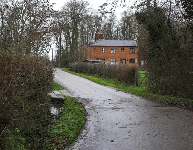
Weston is a small village located in the county of Hertfordshire, England. Situated approximately 6 miles northwest of the town of Hitchin, it is nestled in the picturesque countryside of rural Hertfordshire. With a population of around 700 residents, Weston offers a tranquil and close-knit community atmosphere.

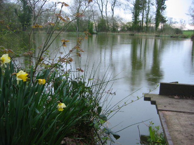
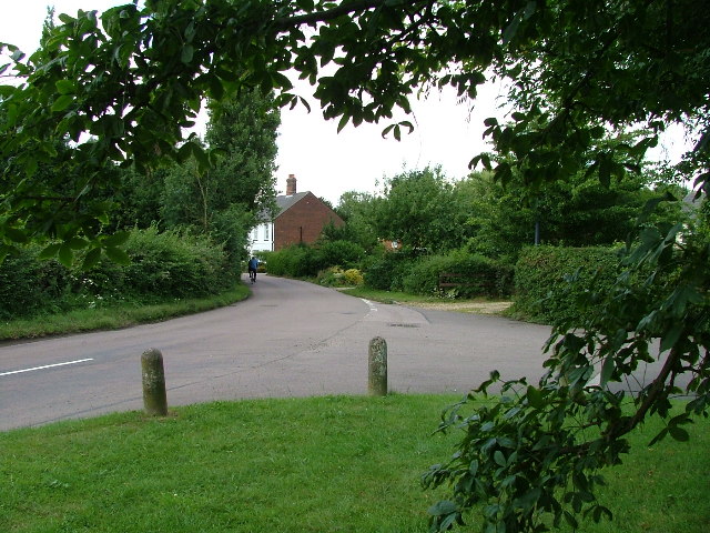
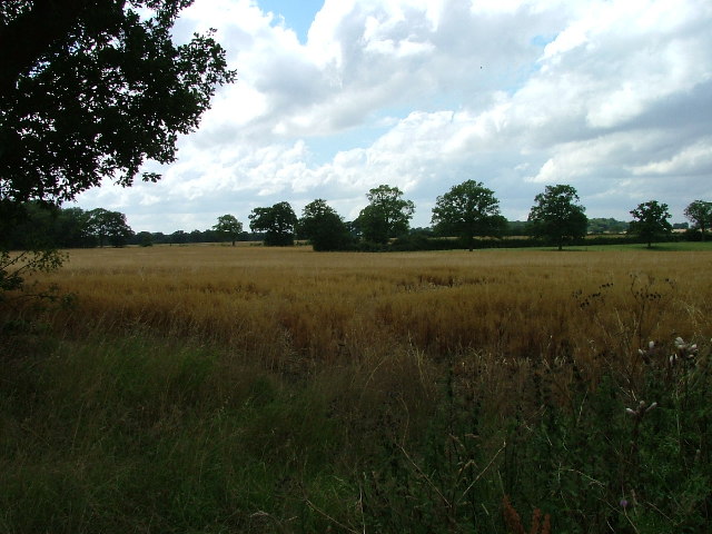
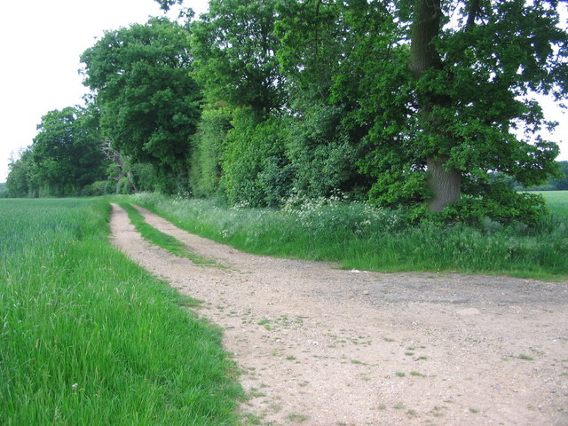
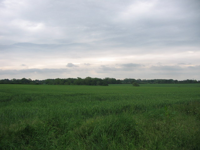
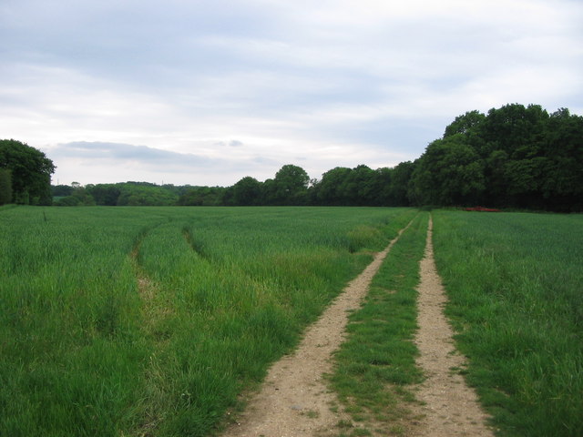
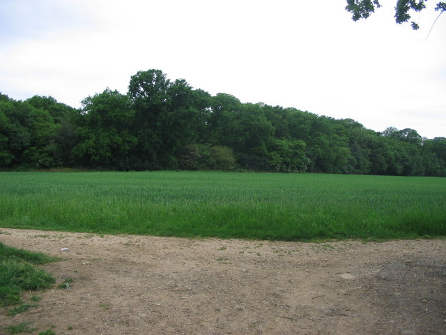
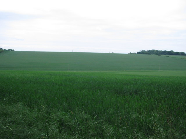
The village is surrounded by lush green fields and rolling hills, providing stunning views of the surrounding countryside. Its rural location makes it an ideal retreat for those seeking a peaceful and idyllic setting away from the hustle and bustle of city life.

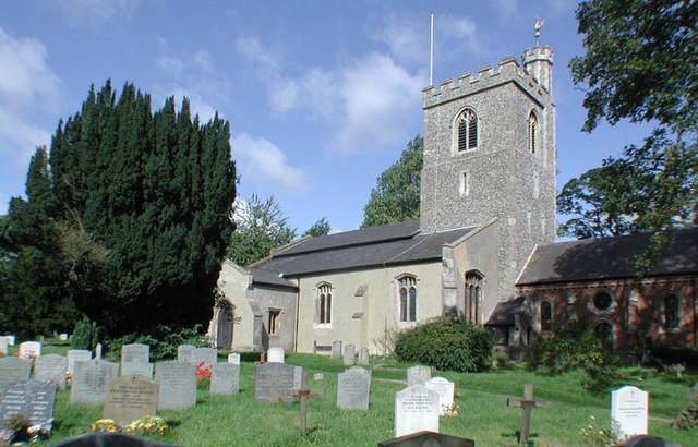
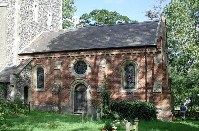
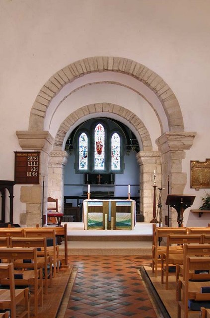
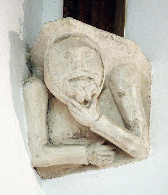
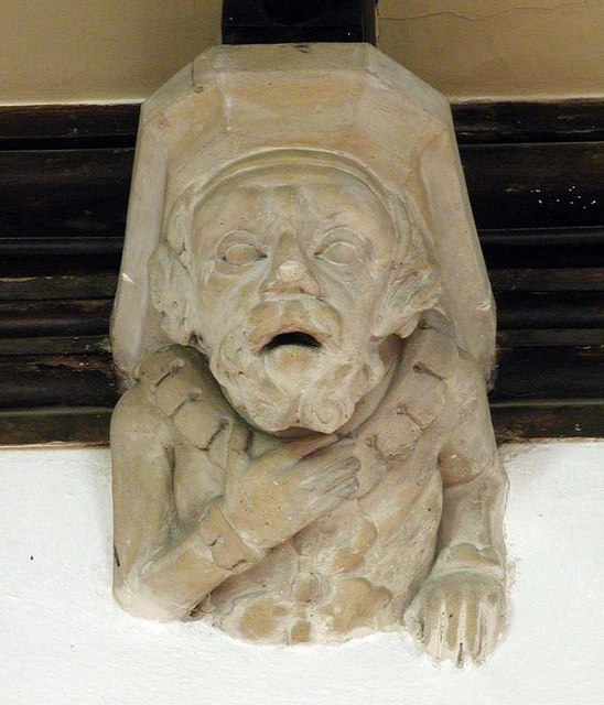
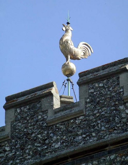
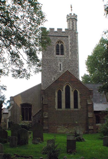
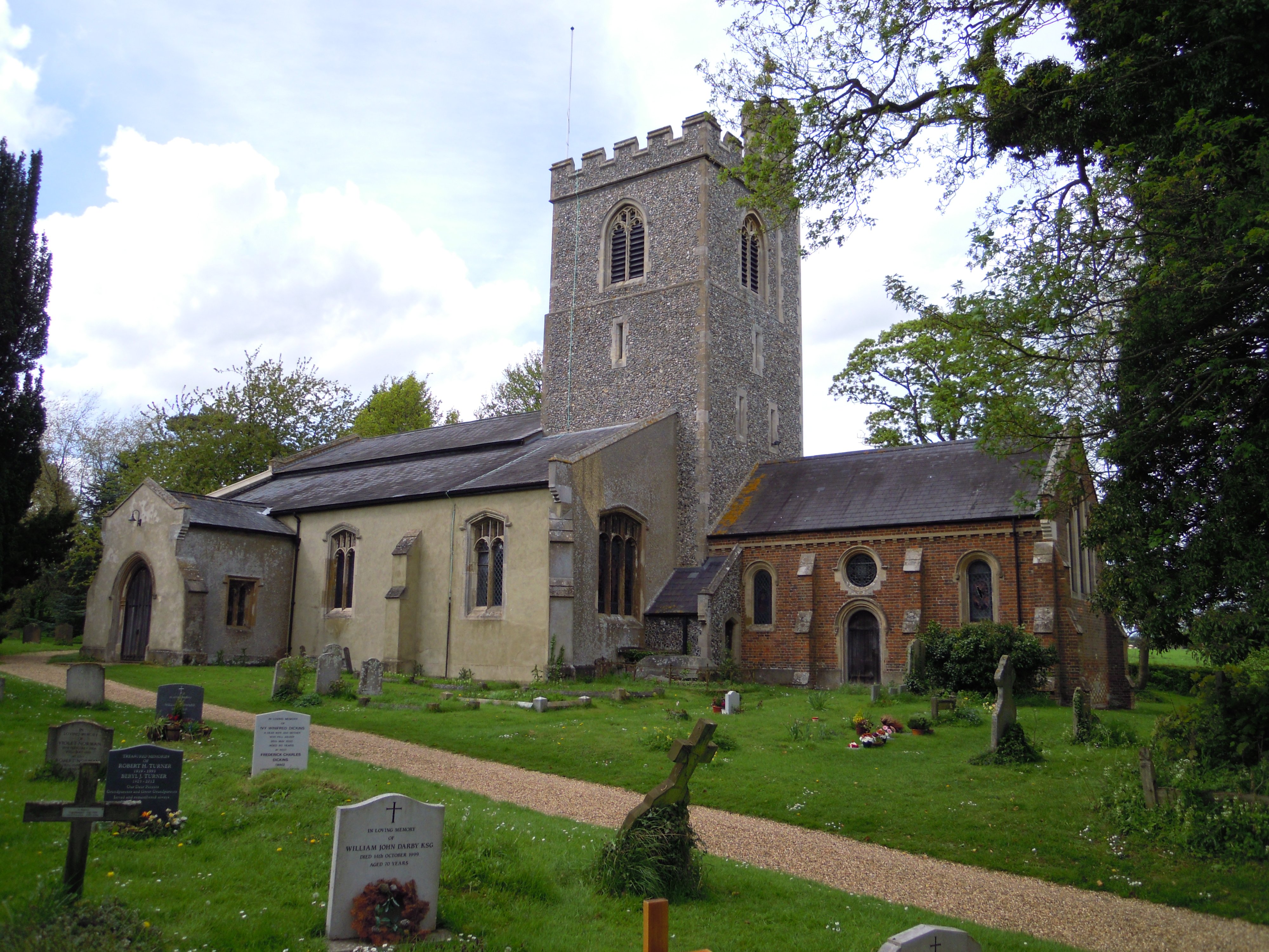
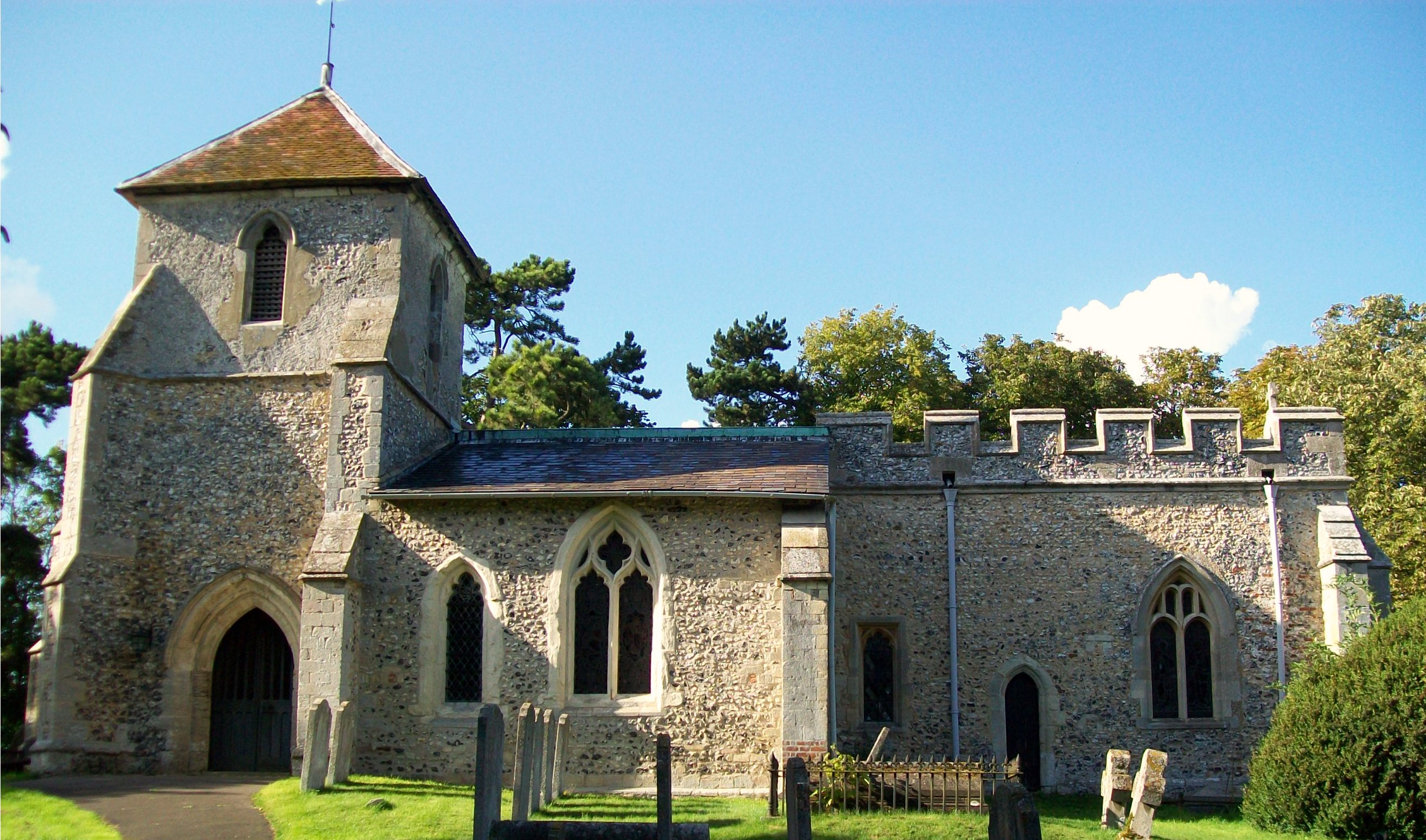
Despite its small size, Weston boasts a rich history that can be traced back to the Domesday Book of 1086. The village features several historical landmarks, including St. Mary's Church, a beautiful Grade II listed building that dates back to the 13th century. The church's unique architecture and well-preserved interior make it a popular attraction for history enthusiasts.

In terms of amenities, Weston offers a range of facilities to cater to the needs of its residents. These include a village hall, a primary school, a local pub, and a post office. The village is also well-connected to nearby towns and cities, with regular bus services and convenient access to major road networks.

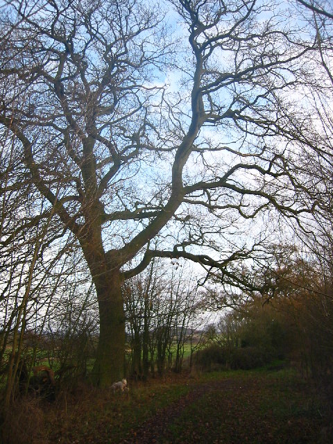
For outdoor enthusiasts, Weston provides ample opportunities for exploring the surrounding countryside. The area is crisscrossed with footpaths and bridleways, making it ideal for walking, cycling, and horse riding. The nearby Weston Hills Nature Reserve offers further opportunities for nature lovers, with its diverse range of flora and fauna.

In summary, Weston is a charming village in Hertfordshire that offers a peaceful and picturesque setting, rich history, and a welcoming community spirit.

If you have any feedback on the listing, please let us know in the comments section below.

Weston Images

Images are sourced within 2km of 51.955065/-0.16990747 or Grid Reference TL2530. Thanks to Geograph Open Source API. All images are credited.

Fishing lake near Weston Private fishing lake in the woods south of Weston at TL263296
Fishing lake near Weston
Private fishing lake in the woods south of Weston at TL263296
Damask Green A lovely spot.
Damask Green
A lovely spot.
Fields opposite Tile Kiln Farm Typical farmland in this area.
Fields opposite Tile Kiln Farm
Typical farmland in this area.
Oak tree on Lolleywood Lane An oak tree sheds the last of its leaves on the Lolleywood Lane bridleway
Oak tree on Lolleywood Lane
An oak tree sheds the last of its leaves on the Lolleywood Lane bridleway
Cottages at Warren's Green Warrens Green is made up of 4 or 5 cottages. This is an example.
Cottages at Warren's Green
Warrens Green is made up of 4 or 5 cottages. This is an example.
Holy Trinity, Weston, Herts
Holy Trinity, Weston, Herts - Font
Holy Trinity, Weston, Herts - East end
Holy Trinity, Weston, Herts - Corbel
Holy Trinity, Weston, Herts - Weathervane
Holy Trinity, Weston, Herts
Bridlepath Junction near How Wood looking NNW Not the centre of the square but it would seem that it would be a favourite spot.
Bridlepath Junction near How Wood looking NNW
Not the centre of the square but it would seem that it would be a favourite spot.
Bridlepath Junction near How Wood looking ENE (outside square) Not in the centre but it would seem to be a favourite place. This shot is looking outside the square instead.
Bridlepath Junction near How Wood looking ENE (outside square)
Not in the centre but it would seem to be a favourite place. This shot is looking outside the square instead.
Bridlepath Junction near How Wood looking SSW Not the centre but thought to be a favourite spot.
Bridlepath Junction near How Wood looking SSW
Not the centre but thought to be a favourite spot.
Bridlepath Junction near How Wood looking WSW this is not the centre but it is thought to be a favourite spot. This snap is looking at How Wood.
Bridlepath Junction near How Wood looking WSW
this is not the centre but it is thought to be a favourite spot. This snap is looking at How Wood.
Centre of Square in How Wood due North. North point of How Wood, facing North.
Centre of Square in How Wood due North.
North point of How Wood, facing North.
Show me another place!

Weston is located at Grid Ref: TL2530 (Lat: 51.955065, Lng: -0.16990747)

Administrative County: Hertfordshire

District: North Hertfordshire

Police Authority: Hertfordshire

What 3 Words

///fails.gent.tests. Near Baldock, Hertfordshire

Nearby Locations

Weston

Related Wikis

Weston, Hertfordshire

Weston is a village and civil parish in the North Hertfordshire district of Hertfordshire, England. It is located around 4 miles north of Stevenage, 2...

Lannock Mill, Weston

Lannock Mill is a Grade II listed tower mill at Weston, Hertfordshire, England which is derelict. == History == Lannock Mill was built in 1860. A windmill...

Holy Trinity Church, Weston

Holy Trinity Church is the parish church for the village of Weston in Hertfordshire. The church building stands to the south-east of the village on high...

Clothall

Clothall is a village and civil parish in the county of Hertfordshire, England, with a population of 358. It is situated 2.25 miles (3.62 km) south-east...
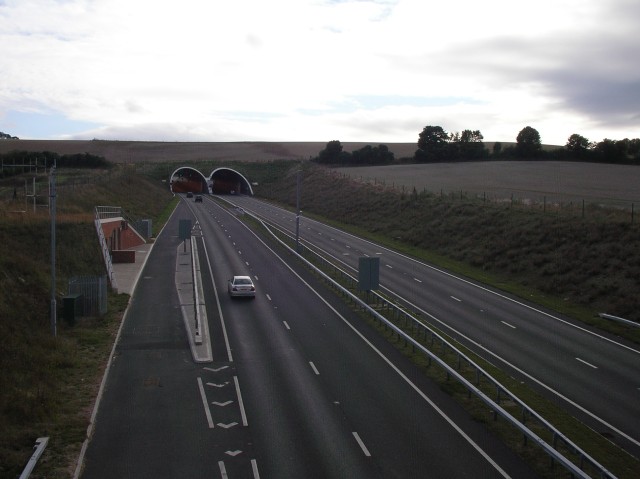
Weston Hills Tunnel

The Weston Hills Tunnel is a 230m twin road tunnel under the Weston Hills near Baldock in Hertfordshire. It was constructed as part of the A505 Baldock...

Great Ashby

Great Ashby is a civil parish in Stevenage in the North Hertfordshire district, in the county of Hertfordshire, England. The name Great Ashby was coined...

The Traveller Movement

The Traveller Movement (TM) is a charity based in the United Kingdom that supports the Gypsy, Roma and Traveller (GRT) community and challenge discrimination...

Letchworth Garden City Eagles F.C.

Letchworth Garden City Eagles Football Club is a football club based in Letchworth, England. They are currently members of the Spartan South Midlands League...

Nearby Amenities

Located within 500m of 51.955065,-0.16990747
Weston
Created By: Potlatch 0.4a
Place: village
Wikidata: Q1613163
Lat/Long: 51.9566473/-0.1678811
Barrier: kissing_gate
Source: GPS, observation
Lat/Long: 51.9544106/-0.1690733
Barrier: kissing_gate
Foot: yes
Lat/Long: 51.9537997/-0.1631485
Barrier: kissing_gate
Source: GPS, observation
Lat/Long: 51.9510925/-0.1700134
Barrier: kissing_gate
Source: GPS
Lat/Long: 51.953756/-0.1631104
Barrier: kissing_gate
Source: GPS, observation
Lat/Long: 51.9543477/-0.1634909
Barrier: stile
Source: GPS, observation
Lat/Long: 51.954598/-0.1637327
Barrier: kissing_gate
Source: GPS, observation
Lat/Long: 51.9554622/-0.1638146
Barrier: kissing_gate
Foot: yes
Source: GPS, observation
Lat/Long: 51.9575774/-0.1649346
Barrier: stile
Lat/Long: 51.9581038/-0.1735396
Barrier: stile
Lat/Long: 51.9583161/-0.1718774
Barrier: stile
Lat/Long: 51.9589161/-0.170949
Bus Stop
Red Lion PH
Naptan AtcoCode: 210021102355
Naptan Bearing: S
Naptan CommonName: Red Lion PH
Naptan Crossing: Red Lion PH
Naptan Indicator: opp
Naptan Landmark: Red Lion PH
Naptan NaptanCode: hrtgjwaw
Naptan ShortCommonName: NA
Naptan Street: Damask Green Road
Route Ref: 23;391
Shelter: yes
Source: naptan_import
Lat/Long: 51.9548227/-0.1698977
Red Lion PH
Local Ref: NR
Naptan AtcoCode: 210021102400
Naptan Bearing: NE
Naptan BusStopType: CUS
Naptan CommonName: Red Lion PH
Naptan Crossing: Hitchin Road
Naptan Indicator: nr
Naptan Landmark: Hitchin Road
Naptan NaptanCode: hrtgtatm
Naptan ShortCommonName: NA
Naptan Street: Post Office Row
Naptan Verified: no
Source: naptan_import
Lat/Long: 51.9550103/-0.1703993
Bench
Lat/Long: 51.9555627/-0.1691263
Bench
Lat/Long: 51.9556106/-0.1692561
Old Phone: +44 1462 790313 NC
Removed Amenity: telephone
Lat/Long: 51.9549855/-0.1699873
Bench
Lat/Long: 51.9539901/-0.170444
Barrier: kissing_gate
Lat/Long: 51.9542848/-0.1657417
Bench
Backrest: yes
Material: wood
Seats: 3
Lat/Long: 51.9552449/-0.1696679
Historic: monument
Note: Weston village sign
Lat/Long: 51.955496/-0.1692633
Post Office
Weston Post Office
Addr Country: GB
Addr Postcode: SG4 7AU
Brand: Post Office
Brand Wikidata: Q1783168
Contact Website: https://www.postoffice.co.uk/branch-finder/0971294/weston
Ref Pol Id: 1173
Lat/Long: 51.954923/-0.1704548
Post Box
Collection Times: Mo-Fr 16:15; Sa 09:15
Post Box Type: wall
Ref: SG4 88
Royal Cypher: EIIR
Royal Cypher Wikidata: Q33102113
Lat/Long: 51.95491/-0.170483
Post Box
Collection Times: Mo-Fr 16:00; Sa 08:15
Post Box Design: type_m
Post Box Type: lamp
Ref: SG4 93
Royal Cypher: EIIR
Royal Cypher Wikidata: Q33102113
Lat/Long: 51.95665/-0.164669
Power: pole
Lat/Long: 51.9540518/-0.1735094
Power: pole
Lat/Long: 51.9544967/-0.1748356
Power: pole
Lat/Long: 51.9531064/-0.171597
Power: pole
Lat/Long: 51.9549527/-0.1761567
Power: pole
Lat/Long: 51.9536055/-0.1721951
Power: pole
Lat/Long: 51.9529525/-0.1648646
Bench
Backrest: yes
Check Date: 2021-01-10
Material: wood
Seats: 3
Lat/Long: 51.9514523/-0.1705594
Bicycle Parking
Access: customers
Bicycle Parking: stands
Capacity: 6
Covered: no
Cyclestreets Id: 106200
Lat/Long: 51.9523484/-0.1706086
Waste Basket
Lat/Long: 51.95144/-0.1705389
Leisure: picnic_table
Source: observation, GPS
Lat/Long: 51.9545296/-0.1653575
Bench
Backrest: yes
Material: wood
Source: observation, GPS
Lat/Long: 51.9544217/-0.165613
Townhall
Weston Village Hall
Addr City: Hitchin
Addr Housename: Weston Village Hall
Addr Housenumber: 16
Addr Postcode: SG4 7AA
Addr Street: Maiden Street
Addr Suburb: Weston
Townhall Type: village
Lat/Long: 51.9559621/-0.1675443
Bench
Lat/Long: 51.9537647/-0.1631868
Leisure: outdoor_seating
Operator: The Cricketers
Lat/Long: 51.9524342/-0.1708635
Leisure: outdoor_seating
Operator: The Cricketers
Lat/Long: 51.9521943/-0.1710914
Weston
Board Type: information
Information: board
Tourism: information
Lat/Long: 51.9553384/-0.1696364
The data included in this document is from www.openstreetmap.org. The data is made available under ODbL.

Have you been to Weston?

Leave your review of Weston below (or comments, questions and feedback).