Western Park

Settlement in Leicestershire

England

Western Park

The Shoemaker in New Parks, Leicester The Shoemakers is a public house on Cokayne Road, in the New Parks area of Leicester. It opened in January 1958.
The Shoemaker in New Parks, Leicester Credit: Mat Fascione

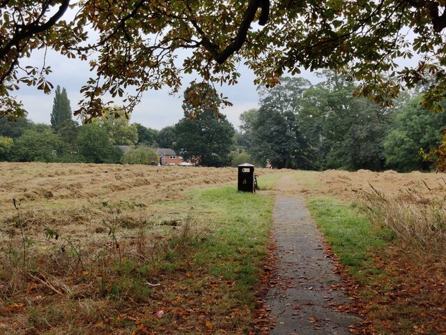
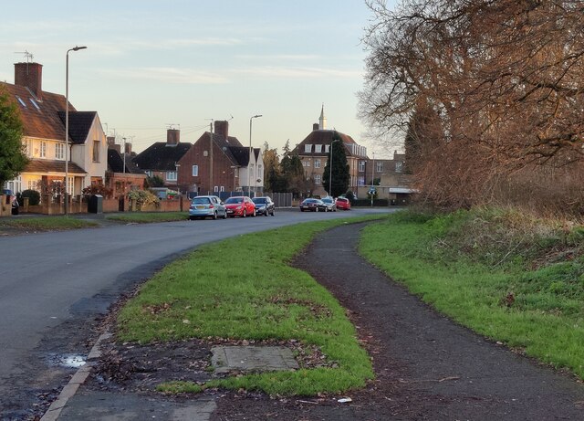
Western Park is a large public park located in the city of Leicester, in the county of Leicestershire, England. This picturesque park covers an area of around 78 hectares and is a popular recreational space for both local residents and tourists alike.

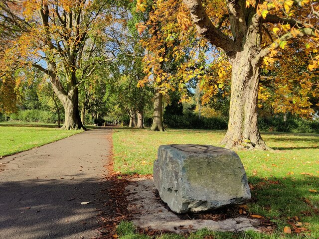
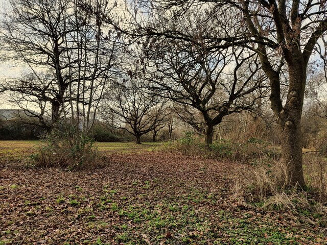
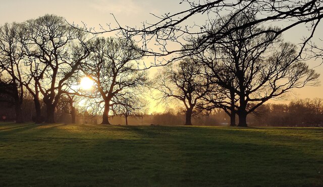
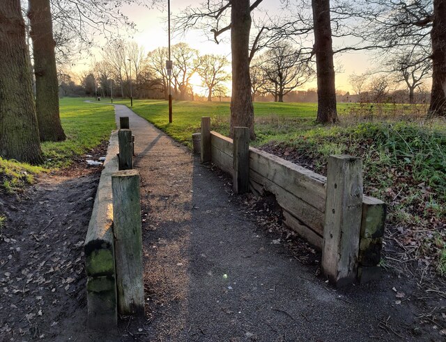
The park's landscape is characterized by rolling hills, woodlands, and open spaces, providing visitors with a tranquil and natural environment. It is home to a variety of flora and fauna, including wildflowers, mature trees, and several species of birds and small mammals. A network of paths and trails crisscrosses the park, offering visitors the opportunity to explore its different areas.

Western Park features a range of amenities to cater to the diverse needs of its visitors. There are well-maintained sports facilities, including tennis courts, a bowling green, and a cricket pitch, providing opportunities for outdoor activities and team sports. Additionally, the park has a children's play area, equipped with various play equipment, ensuring that younger visitors can have fun and enjoy themselves.

For those seeking a peaceful retreat, there are several picnic areas and benches scattered throughout the park, allowing visitors to relax and take in the scenic surroundings. Western Park also hosts regular events and activities, such as outdoor concerts and community festivals, enhancing its appeal as a vibrant community space.

Overall, Western Park in Leicestershire offers a delightful mix of natural beauty, recreational opportunities, and community engagement, making it a cherished destination for individuals of all ages.

If you have any feedback on the listing, please let us know in the comments section below.

Western Park Images

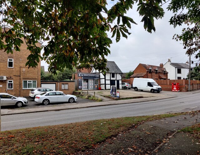
Images are sourced within 2km of 52.635657/-1.180597 or Grid Reference SK5504. Thanks to Geograph Open Source API. All images are credited.

The Shoemaker in New Parks, Leicester The Shoemakers is a public house on Cokayne Road, in the New Parks area of Leicester. It opened in January 1958.
The Shoemaker in New Parks, Leicester
The Shoemakers is a public house on Cokayne Road, in the New Parks area of Leicester. It opened in January 1958.
Harrow Road
Harrow Road
Somerset Drive
Somerset Drive
St Paul's Worship Centre
Town House
Town House
St Aidan New Parks This modern Church of England church is on St Oswalds Road New Parks and is the parish church for Kirby Frith, Braunstone Frith and New Parks.
St Aidan New Parks
This modern Church of England church is on St Oswalds Road New Parks and is the parish church for Kirby Frith, Braunstone Frith and New Parks.
St Aidan New Parks sign This modern Church of England church is on St Oswalds Road New Parks and is the parish church for Kirby Frith, Braunstine Frith and New Parks.
St Aidan New Parks sign
This modern Church of England church is on St Oswalds Road New Parks and is the parish church for Kirby Frith, Braunstine Frith and New Parks.
Swans at the Upper Lake (Reservoir), Braunstone Park This flood storage reservoir was constructed in the early 1970's to reduce the risk of flooding from the Braunstone Brook. It is located on the southern edge of Braunstone Park.
Swans at the Upper Lake (Reservoir), Braunstone Park
This flood storage reservoir was constructed in the early 1970's to reduce the risk of flooding from the Braunstone Brook. It is located on the southern edge of Braunstone Park.
St. Peter's Church at Braunstone A church dating back to the 12th century, restored in the 19th century.
St. Peter's Church at Braunstone
A church dating back to the 12th century, restored in the 19th century.
Path through Church Field in Braunstone An area of open public space next to St Peters Church in Braunstone.
Path through Church Field in Braunstone
An area of open public space next to St Peters Church in Braunstone.
Bidford Convenience Store Along Braunstone Lane in the Braunstone suburb of Leicester.
Bidford Convenience Store
Along Braunstone Lane in the Braunstone suburb of Leicester.
Path through Braunstone Park
Woodland on Cort Crescent
Kirby Frith Nature Area Next to Cherry Hills Road in the Kirby Frith area of Leicester.
Kirby Frith Nature Area
Next to Cherry Hills Road in the Kirby Frith area of Leicester.
Winter sunset over Braunstone Park
Gooding Avenue in Braunstone
Path at Braunstone Park This path is next to Gooding Avenue.
Path at Braunstone Park
This path is next to Gooding Avenue.
Show me another place!

Western Park is located at Grid Ref: SK5504 (Lat: 52.635657, Lng: -1.180597)

Unitary Authority: Leicester

Police Authority: Leicestershire

What 3 Words

///slot.kicks.hoping. Near Glenfield, Leicestershire

Related Wikis

Western Park, Leicester

Western Park is a park and surrounding suburb located in West End of Leicester. It is also a ward of the City of Leicester whose population at the 2011...

Western Park Open Air School

The Western Park Open Air School, situated in Western Park, was the first open air school in Leicester, for children with respiratory problems. It opened...

New College Leicester

New College Leicester (formed in 1999/2000 in a merger between New Parks Community College, Alderman Newton's School, and Wycliffe Community College) is...

Dane Hills

Dane Hills is a large area on the western side of the English city of Leicester. It consists of the smaller areas of Newfoundpool, Western Park, and New...

Nearby Amenities

Located within 500m of 52.635657,-1.180597
Traffic Signals
Lat/Long: 52.6313024/-1.1811056
Bus Stop
Braunstone Leisure Centre
Bus: yes
Naptan AtcoCode: 269045007
Naptan NaptanCode: lecdjgtw
Public Transport: platform
Route Ref: 18,13a,48,153,158,X1
Shelter: yes
Lat/Long: 52.6319601/-1.1780252
Post Box
Ref: LE3 632
Lat/Long: 52.6336273/-1.1832726
Barrier: bollard
Bicycle: yes
Foot: yes
Lat/Long: 52.6329807/-1.1821381
Barrier: bollard
Bicycle: yes
Foot: yes
Lat/Long: 52.6328761/-1.1795018
Barrier: cycle_barrier
Lat/Long: 52.6325865/-1.179174
Barrier: bollard
Bicycle: yes
Foot: yes
Lat/Long: 52.634087/-1.1864377
Barrier: bollard
Bicycle: yes
Foot: yes
Lat/Long: 52.6337381/-1.1865268
Barrier: bollard
Bicycle: yes
Foot: yes
Lat/Long: 52.6332492/-1.1864857
Park Rise Stores
Shop: convenience
Lat/Long: 52.6331028/-1.1853367
Barrier: bollard
Bicycle: yes
Foot: yes
Lat/Long: 52.6322351/-1.1787814
Barrier: bollard
Bicycle: yes
Foot: yes
Lat/Long: 52.6394463/-1.1770485
Man Made: tower
Lat/Long: 52.6358186/-1.1838876
Barrier: bollard
Foot: yes
Lat/Long: 52.6344772/-1.1813378
Barrier: bollard
Bicycle: yes
Foot: yes
Lat/Long: 52.6316324/-1.1784133
Crossing
Crossing: uncontrolled
Lat/Long: 52.6314278/-1.1794464
Crossing
Lat/Long: 52.6312783/-1.1802132
Crossing: traffic_signals
Crossing Ref: toucan
Lat/Long: 52.6317706/-1.1783299
Traffic Calming: cushion
Lat/Long: 52.6318718/-1.1767337
Car Wash
ABC
Lat/Long: 52.6315472/-1.1816828
Neal's Warehouse
Fixme: Former business at this site?
Shop: doityourself
Lat/Long: 52.6317067/-1.1805455
Bus Stop
Braunstone Leisure Centre
Bus: yes
Naptan AtcoCode: 269045000
Naptan NaptanCode: lecdapgj
Public Transport: platform
Shelter: yes
Lat/Long: 52.6316266/-1.1785821
Street Lamp
Lamp Type: electric
Ref: 82;S208
Lat/Long: 52.6325228/-1.1760276
Street Lamp
Lamp Type: electric
Lat/Long: 52.6316125/-1.178744
Street Lamp
Lamp Type: electric
Ref: 72
Lat/Long: 52.633245/-1.1749581
Kerb: lowered
Tactile Paving: no
Lat/Long: 52.6321696/-1.1768355
Street Lamp
Lamp Type: electric
Ref: 88
Lat/Long: 52.6315359/-1.1790905
Kerb: lowered
Tactile Paving: no
Lat/Long: 52.632106/-1.1770657
Barrier: kerb
Kerb: flush
Tactile Paving: yes
Lat/Long: 52.6314434/-1.1793685
Street Lamp
Lamp Type: electric
Ref: 84
Lat/Long: 52.6320907/-1.1771071
Kerb: lowered
Tactile Paving: no
Lat/Long: 52.6320326/-1.177271
Street Lamp
Lamp Type: electric
Ref: 90
Lat/Long: 52.6313528/-1.1798942
Kerb: lowered
Tactile Paving: no
Lat/Long: 52.6318844/-1.1776723
Street Lamp
Lamp Type: electric
Ref: 86
Lat/Long: 52.6317861/-1.1779901
Street Lamp
Lamp Type: electric
Ref: 87
Lat/Long: 52.6316918/-1.178363
Street Lamp
Lamp Type: electric
Ref: 80
Lat/Long: 52.6328035/-1.1752072
Waste Basket
Lat/Long: 52.6316475/-1.178466
Brand: National Grid
Brand Wikidata: Q1465461
Operator: National Grid Electricity Distribution Plc
Operator Old: Western Power Distribution
Operator Wikidata: Q7988183
Owner: National Grid Electricity Distribution (East Midlands) Plc
Owner Wikidata: Q114348127
Power: substation
Lat/Long: 52.6324835/-1.1759238
Bench
Backrest: yes
Lat/Long: 52.6316429/-1.1784945
Barrier: bollard
Lat/Long: 52.6312637/-1.1803187
Barrier: kerb
Kerb: flush
Tactile Paving: yes
Lat/Long: 52.6313925/-1.1796313
Generator Method: photovoltaic
Generator Output Electricity: yes
Generator Source: solar
Generator Type: solar_photovoltaic_panel
Location: roof
Power: generator
Lat/Long: 52.6315107/-1.1779717
Generator Method: photovoltaic
Generator Output Electricity: yes
Generator Source: solar
Generator Type: solar_photovoltaic_panel
Location: rii
Power: generator
Lat/Long: 52.6367501/-1.1877082
Generator Method: photovoltaic
Generator Output Electricity: yes
Generator Source: solar
Generator Type: solar_photovoltaic_panel
Location: rii
Power: generator
Lat/Long: 52.636252/-1.1869545
Generator Method: photovoltaic
Generator Output Electricity: yes
Generator Source: solar
Generator Type: solar_photovoltaic_panel
Location: rii
Power: generator
Lat/Long: 52.6329009/-1.184516
Generator Method: photovoltaic
Generator Output Electricity: yes
Generator Source: solar
Generator Type: solar_photovoltaic_panel
Location: rii
Power: generator
Lat/Long: 52.6335154/-1.1839702
Generator Method: photovoltaic
Generator Output Electricity: yes
Generator Source: solar
Generator Type: solar_photovoltaic_panel
Location: rii
Power: generator
Lat/Long: 52.633443/-1.184103
Generator Method: photovoltaic
Generator Output Electricity: yes
Generator Source: solar
Generator Type: solar_photovoltaic_panel
Location: rii
Power: generator
Lat/Long: 52.6333608/-1.1845898
Generator Method: photovoltaic
Generator Output Electricity: yes
Generator Source: solar
Generator Type: solar_photovoltaic_panel
Location: rii
Power: generator
Lat/Long: 52.6336497/-1.1844624
Generator Method: photovoltaic
Generator Output Electricity: yes
Generator Source: solar
Generator Type: solar_photovoltaic_panel
Location: rii
Power: generator
Lat/Long: 52.6334495/-1.1831025
Generator Method: photovoltaic
Generator Output Electricity: yes
Generator Source: solar
Generator Type: solar_photovoltaic_panel
Location: rii
Power: generator
Lat/Long: 52.6333632/-1.1830006
Generator Method: photovoltaic
Generator Output Electricity: yes
Generator Source: solar
Generator Type: solar_photovoltaic_panel
Location: rii
Power: generator
Lat/Long: 52.6351065/-1.1858799
Generator Method: photovoltaic
Generator Output Electricity: yes
Generator Source: solar
Generator Type: solar_photovoltaic_panel
Location: rii
Power: generator
Lat/Long: 52.6354435/-1.1860999
Generator Method: photovoltaic
Generator Output Electricity: yes
Generator Source: solar
Generator Type: solar_photovoltaic_panel
Location: rii
Power: generator
Lat/Long: 52.6347386/-1.1869474
Generator Method: photovoltaic
Generator Output Electricity: yes
Generator Source: solar
Generator Type: solar_photovoltaic_panel
Location: rii
Power: generator
Lat/Long: 52.6343756/-1.1874168
Barrier: lift_gate
Lat/Long: 52.632007/-1.1800009
Traffic Signals
Traffic Signals: signal
Traffic Signals Direction: forward
Lat/Long: 52.6314006/-1.1807621
Crossing
Crossing: marked
Lat/Long: 52.6314029/-1.1807174
Traffic Signals
Traffic Signals: signal
Traffic Signals Direction: forward
Lat/Long: 52.6313165/-1.1808425
Entrance: main
Lat/Long: 52.6320723/-1.1787668
Barrier: bollard
Bicycle: yes
Foot: yes
Lat/Long: 52.6318805/-1.1782687
Communication Mobile Phone: yes
Man Made: mast
Tower Type: communication
Lat/Long: 52.6324837/-1.1788065
Bench
Backrest: yes
Material: wood
Lat/Long: 52.6357073/-1.1779452
Bench
Backrest: yes
Material: wood
Lat/Long: 52.6354094/-1.177119
Waste Basket
Lat/Long: 52.6354111/-1.1770815
Bench
Backrest: no
Material: metal
Lat/Long: 52.6330719/-1.177752
The data included in this document is from www.openstreetmap.org. The data is made available under ODbL.

Have you been to Western Park?

Leave your review of Western Park below (or comments, questions and feedback).