Brafield-on-the-Green

Settlement in Northamptonshire

England

Brafield-on-the-Green

A428 Little Houghton by-pass
A428 Little Houghton by-pass Credit: Colin Pyle

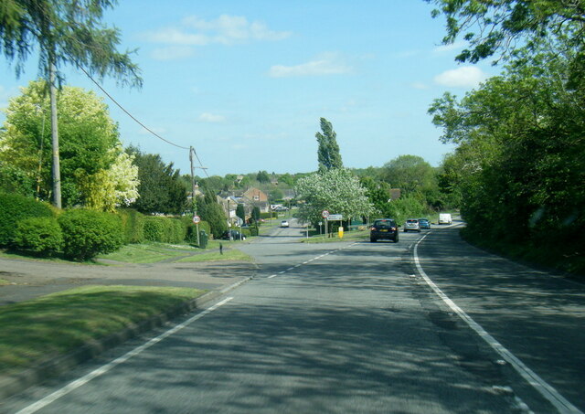
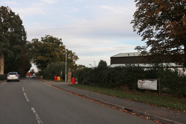
Brafield-on-the-Green is a small village located in the county of Northamptonshire, England. Situated approximately 5 miles northeast of Northampton, it is nestled in a rural setting surrounded by open countryside.

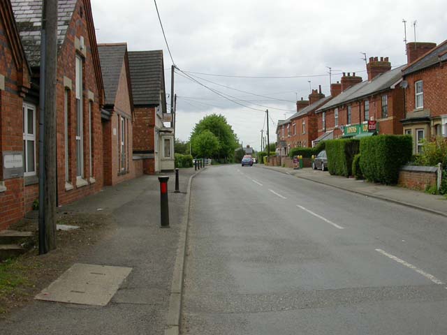
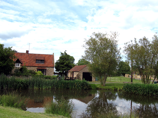
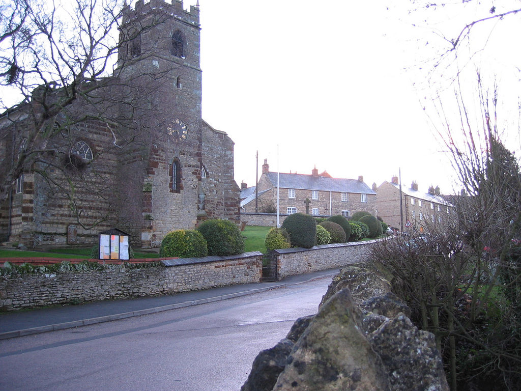
The village has a rich history dating back to the Anglo-Saxon period, with evidence of settlement found in the area. Today, it retains its traditional charm with a mix of historic and modern dwellings. The architecture is predominantly comprised of stone cottages and period houses, giving the village a picturesque and timeless feel.

Despite its small size, Brafield-on-the-Green offers a range of amenities to its residents. The village is home to a local pub, The Green Man, which serves as a focal point for social gatherings. Additionally, there is a primary school, providing education for the younger population.

The village is also known for its strong sense of community. Various events and activities are organized throughout the year, including a summer fete and a Christmas fair, fostering a close-knit atmosphere among the residents.

For outdoor enthusiasts, there are many opportunities to explore the surrounding countryside. The village is located near the River Nene, offering scenic walks and fishing spots. The nearby Pitsford Reservoir provides opportunities for water sports and birdwatching.

Overall, Brafield-on-the-Green is a tranquil village that combines a rich history with a vibrant community spirit. Its idyllic setting and proximity to nature make it an attractive place to live for those seeking a peaceful and picturesque lifestyle.

If you have any feedback on the listing, please let us know in the comments section below.

Brafield-on-the-Green Images

Images are sourced within 2km of 52.220642/-0.80032014 or Grid Reference SP8258. Thanks to Geograph Open Source API. All images are credited.

A428 Little Houghton by-pass
A428 near Brafield-on-the-Green
A428 Bedford Road at Denton
Bedford Road, Brafield-on-the-Green
Brafield-on-the-Green Working Mens Club
Bedford Road, Brafield-on-the-Green
Bedford Road, Little Houghton
Power lines on Brafield Road, Lower End
Bedford Road, Brafield-on-the-Green
Pylons in Cogenhoe
Pylons in Cogenhoe
Brafield Road entering Cogenhoe
Brafield Road, Cogenhoe The village hall is on the right.
Brafield Road, Cogenhoe
The village hall is on the right.
Cogenhoe and Whiston Village Hall
Station Road, Cogenhoe Taken from the junction of Station and Brafield Roads. The building on the left with a white bay window is the Working Men's Club and the Londis store on the right is the Post Office.
Station Road, Cogenhoe
Taken from the junction of Station and Brafield Roads. The building on the left with a white bay window is the Working Men's Club and the Londis store on the right is the Post Office.
Station Road Looking east into Cogenhoe from the edge of the village.
Station Road
Looking east into Cogenhoe from the edge of the village.
The Village of Little Houghton The church tower can be seen on the right. Regarding the water in the middle distance, a lot of work has been done to construct pits that reduce flooding in the valley.
The Village of Little Houghton
The church tower can be seen on the right. Regarding the water in the middle distance, a lot of work has been done to construct pits that reduce flooding in the valley.
Church of St Mary the Virgin, Little Houghton C13th with C19th remodelling.
Church of St Mary the Virgin, Little Houghton
C13th with C19th remodelling.
Bedford Road, Little Houghton Next to the white gates on the right is the Parish Hall. Behind that is the Post Office. The next house, which juts out towards the road, is called 'The Old Post Office'.
Bedford Road, Little Houghton
Next to the white gates on the right is the Parish Hall. Behind that is the Post Office. The next house, which juts out towards the road, is called 'The Old Post Office'.
Show me another place!

Brafield-on-the-Green is located at Grid Ref: SP8258 (Lat: 52.220642, Lng: -0.80032014)

Unitary Authority: West Northamptonshire

Police Authority: Northamptonshire

What 3 Words

///flags.chew.submit. Near Cogenhoe, Northamptonshire

Related Wikis

Brafield-on-the-Green

Brafield-on-the-Green is a civil parish and small village in West Northamptonshire. The villages name means 'Hill-top open country'. == Location == Brafield...

Cogenhoe United F.C.

Cogenhoe United Football Club is a football club based in Cogenhoe, near Northampton, Northamptonshire, England. They are currently members of the United...

Cogenhoe

Cogenhoe (locally KUUK-noh, ) is a village and former civil parish, now in the parish of Cogenhoe and Whiston, in the West Northamptonshire district,...

Little Houghton, Northamptonshire

Little Houghton is a village and civil parish in Northamptonshire, England, located about 2 miles (3.2 km) east of Northampton. At the time of the 2001...

Denton, Northamptonshire

Denton is a small village and civil parish on the A428 road about 6 miles (10 km) south-east of Northampton. It has a pub, the Red Lion, a village hall...

Billing railway station

Billing railway station is a former railway station in Northamptonshire on the former Northampton and Peterborough Railway which connected Peterborough...

Northampton International Raceway

Northampton Shaleway also known as Brafield, is used for BriSCA F1 Stock Cars, BriSCA Formula 2 Stock Cars, V8 Hotstox, and various other forms of oval...

Great Houghton, Northamptonshire

Great Houghton is a village near Northampton in West Northamptonshire. The population of the civil parish at the 2011 census was 642. It lies on the edge...

Nearby Amenities

Located within 500m of 52.220642,-0.80032014
Brafield-on-the-Green
Place: village
Lat/Long: 52.2216807/-0.7970185
Post Office
Brafield Stores
Addr City: Northampton
Addr Country: GB
Addr Housenumber: 31
Addr Postcode: NN7 1BD
Addr Street: Bedford Road
Addr Village: Brafield on the Green
Fhrs Authority: West Northamptonshire
Fhrs Id: 1540882
Fhrs Local Authority Id: FR/000001070
Ref Pol Id: 9694
Source: OS OpenData StreetView
Lat/Long: 52.2206574/-0.7995583
Crossing
Crossing Island: yes
Lat/Long: 52.2212899/-0.803592
Man Made: water_tower
Source: Bing
Lat/Long: 52.2188447/-0.8015672
Crossing
Crossing Island: yes
Lat/Long: 52.2209398/-0.8021706
Pub
Red Lion
Addr City: Northampton
Addr Country: GB
Addr Housenumber: 36
Addr Postcode: NN7 1BP
Addr Street: Bridle Path
Addr Village: Brafield on the Green
Fhrs Authority: West Northamptonshire
Fhrs Id: 1540957
Fhrs Local Authority Id: FR/000001440
Lat/Long: 52.2212786/-0.8003519
Crossing
Crossing: traffic_signals
Lat/Long: 52.2205958/-0.8000573
Post Box
Brand: Royal Mail
Brand Wikidata: Q638098
Brand Wikipedia: en:Royal Mail
Operator: Royal Mail
Operator Wikidata: Q638098
Ref: NN7 253
Royal Cypher: EIIR
Royal Cypher Wikidata: Q33102113
Lat/Long: 52.2207996/-0.8016373
Fuel
Ramco Filling Station And Convenience Store
Addr City: Northampton
Addr Country: GB
Addr Housenumber: 3
Addr Postcode: NN7 1BD
Addr Street: Bedford Road
Addr Village: Brafield on the Green
Fhrs Authority: West Northamptonshire
Fhrs Id: 1540789
Fhrs Local Authority Id: FR/000000429
Shop: convenience
Lat/Long: 52.2210087/-0.8016318
Pub
Brafield Working Mens Club
Addr City: Northampton
Addr Country: GB
Addr Housenumber: 35
Addr Postcode: NN7 1BD
Addr Street: Bedford Road
Addr Village: Brafield on the Green
Fhrs Authority: West Northamptonshire
Fhrs Id: 1541141
Fhrs Local Authority Id: FR/000002206
Lat/Long: 52.2205683/-0.7991347
Kindergarten
Acorn Day Nursery
Addr City: Northampton
Addr Country: GB
Addr Housenumber: 1
Addr Postcode: NN7 1BA
Addr Street: Church Lane
Addr Village: Brafield on the Green
Fhrs Authority: West Northamptonshire
Fhrs Id: 1541735
Fhrs Local Authority Id: FR/202200167
Lat/Long: 52.2233781/-0.7983274
Bus Stop
Red Lion PH (o/s)
Bin: yes
Bus: yes
Naptan AtcoCode: 300000039R
Naptan CommonName: Red Lion PH
Naptan Indicator: adj
Naptan Landmark: Red Lion PH
Naptan NaptanCode: nthadatg
Naptan Street: Bedford Road
Public Transport: platform
Shelter: yes
Lat/Long: 52.2208526/-0.8010632
Bus Stop
Red Lion PH (opp)
Bus: yes
Naptan AtcoCode: 300000039OR
Naptan CommonName: Red Lion PH
Naptan Indicator: opp
Naptan Landmark: Red Lion PH
Naptan NaptanCode: nthadatd
Naptan Street: Bedford Rd
Public Transport: platform
Shelter: yes
Lat/Long: 52.220478/-0.7996041
Bus Stop
Grove Road (opp)
Bus: yes
Naptan AtcoCode: 300000039B
Naptan CommonName: Grove Road
Naptan Indicator: opp
Naptan Landmark: Grove Road
Naptan NaptanCode: nthadapw
Naptan Street: Billing Road
Public Transport: platform
Lat/Long: 52.223337/-0.802753
Bus Stop
Grove Road (adj)
Bin: yes
Bus: yes
Naptan AtcoCode: 300000039BR
Naptan CommonName: Grove Road
Naptan Indicator: adj
Naptan Landmark: Grove Road
Naptan NaptanCode: nthadata
Naptan Street: Billing Road
Public Transport: platform
Shelter: yes
Lat/Long: 52.2232943/-0.8025491
Direction: 280
Generator Method: photovoltaic
Generator Output Electricity: yes
Generator Solar Modules: 10
Generator Source: solar
Generator Type: solar_photovoltaic_panel
Location: roof
Power: generator
Lat/Long: 52.2205431/-0.8012795
Direction: WNW
Generator Method: photovoltaic
Generator Output Electricity: yes
Generator Solar Modules: 4
Generator Source: solar
Generator Type: solar_photovoltaic_panel
Location: roof
Power: generator
Lat/Long: 52.2208904/-0.7994766
Direction: ESE
Generator Method: photovoltaic
Generator Output Electricity: yes
Generator Solar Modules: 3
Generator Source: solar
Generator Type: solar_photovoltaic_panel
Location: roof
Power: generator
Lat/Long: 52.2208797/-0.7994516
Direction: WNW
Generator Method: photovoltaic
Generator Output Electricity: yes
Generator Solar Modules: 3
Generator Source: solar
Generator Type: solar_photovoltaic_panel
Location: roof
Power: generator
Lat/Long: 52.2208769/-0.7994212
Direction: ESE
Generator Method: photovoltaic
Generator Output Electricity: yes
Generator Solar Modules: 4
Generator Source: solar
Generator Type: solar_photovoltaic_panel
Location: roof
Power: generator
Lat/Long: 52.2208697/-0.7993823
Marker: pedestal
Utility: gas
Lat/Long: 52.2192883/-0.7949682
Marker: pedestal
Utility: gas
Lat/Long: 52.2193645/-0.794786
Marker: post
Utility: gas
Lat/Long: 52.2193922/-0.7947409
Communication Mobile Phone: yes
Man Made: tower
Tower Construction: building
Tower Type: communication
Lat/Long: 52.2188819/-0.8014976
The data included in this document is from www.openstreetmap.org. The data is made available under ODbL.

Have you been to Brafield-on-the-Green?

Leave your review of Brafield-on-the-Green below (or comments, questions and feedback).