Braehoulland

Settlement in Shetland

Scotland

Braehoulland

Dore Holm This is the islet of Dore Holm off Tang Wick, Eshaness, Shetland. Papa Stour lies on the horizon.
Dore Holm Credit: Carroll Pierce

Braehoulland is a small settlement located in the Shetland Islands, an archipelago in Scotland, United Kingdom. Situated in the northernmost part of Shetland, Braehoulland is nestled on the west coast of the mainland, approximately 8 miles northwest of the town of Lerwick.

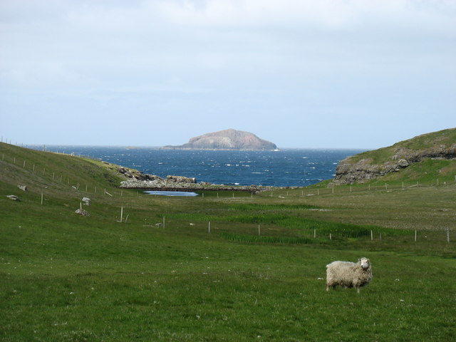
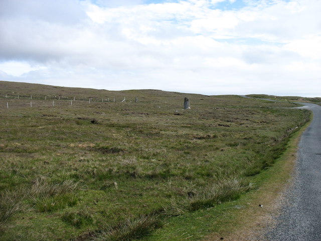
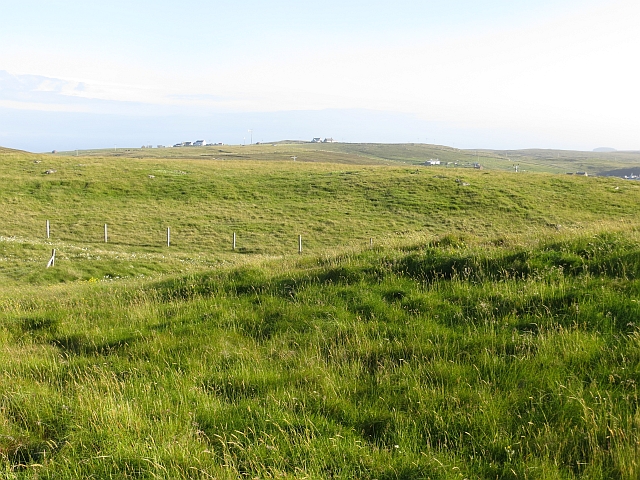
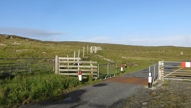
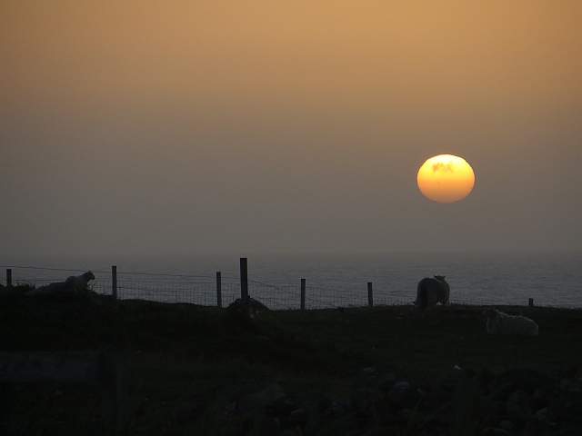
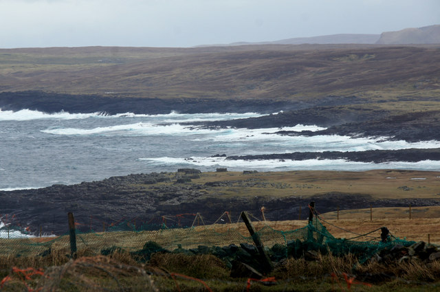
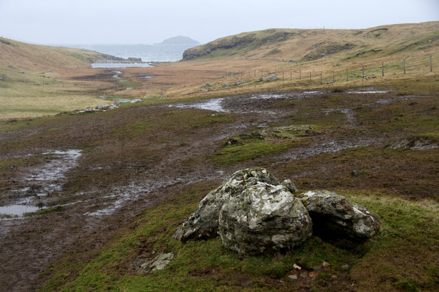
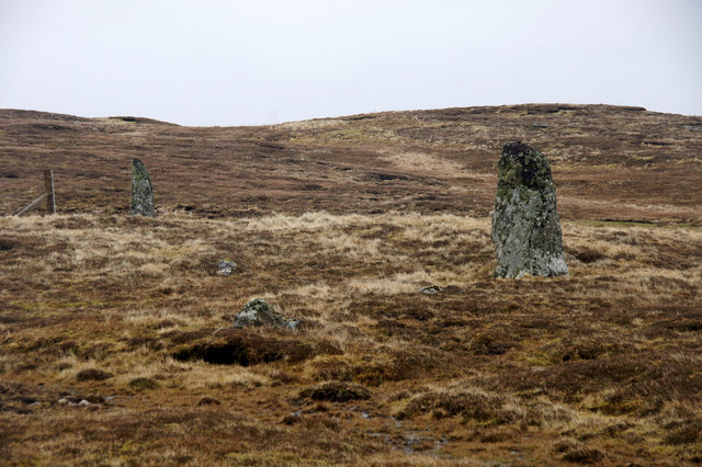
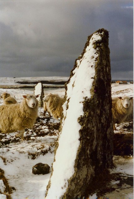
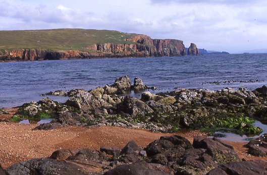
This picturesque village is renowned for its stunning coastal scenery and rugged landscapes. The area is characterized by rolling hills, steep cliffs, and pristine sandy beaches. Braehoulland offers breathtaking views over the North Atlantic Ocean, with nearby islands such as Muckle Roe and the Isle of Foula visible on clear days.

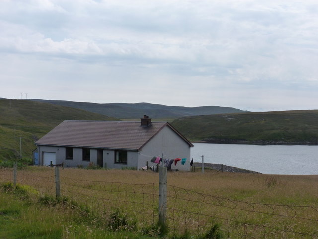
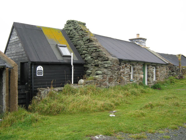
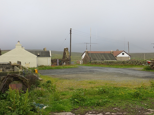
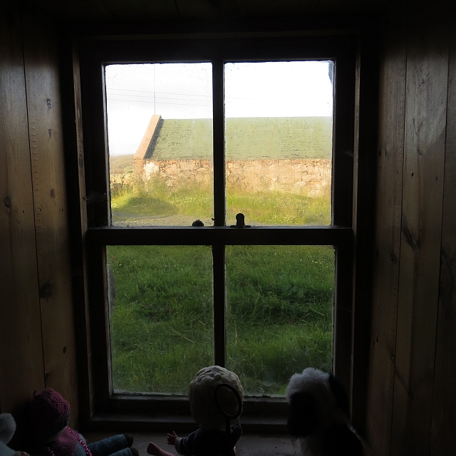
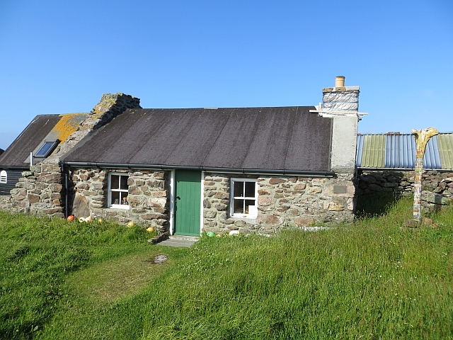
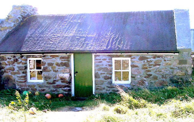
The settlement itself consists of a handful of traditional, stone-built houses, giving it a quaint and charming atmosphere. The local community is small and tight-knit, with residents engaging in a variety of activities such as fishing, crofting (small-scale farming), and crafts.

Nature enthusiasts flock to Braehoulland due to its rich wildlife. The surrounding waters are teeming with marine life, including seals, otters, and various seabirds such as puffins and gannets. Visitors can also explore the nearby Eshaness Cliffs, a designated nature reserve, which boasts dramatic geological formations and is home to many breeding seabird colonies.

Braehoulland is a haven for those seeking tranquility and natural beauty. Its remote location and untouched landscapes make it an ideal destination for hikers, birdwatchers, and anyone looking to escape the hustle and bustle of modern life.

If you have any feedback on the listing, please let us know in the comments section below.

Braehoulland Images

Images are sourced within 2km of 60.493964/-1.5650303 or Grid Reference HU2479. Thanks to Geograph Open Source API. All images are credited.

Dore Holm This is the islet of Dore Holm off Tang Wick, Eshaness, Shetland. Papa Stour lies on the horizon.
Dore Holm
This is the islet of Dore Holm off Tang Wick, Eshaness, Shetland. Papa Stour lies on the horizon.
Country near Hamnavoe In the distance, Muckle Ossa, 56m in <a href="https://www.geograph.org.uk/gridref/HU2185">HU2185</a>, is very prominent.
Country near Hamnavoe
In the distance, Muckle Ossa, 56m in HU2185, is very prominent.
One of the Giants' stones at Hamnavoe I don't wish to be unkind, but it seems to me that these must have been rather small giants.
One of the Giants' stones at Hamnavoe
I don't wish to be unkind, but it seems to me that these must have been rather small giants.
Eshaness: the post office This small bungalow, Urafirth, is the home of the postmistress and is thus home to the post office, open for two hours each on Monday and Saturday mornings and another two on Thursday afternoons. The office does not have a familiar glass screen but is simply a desk in one of the rooms.
Eshaness: the post office
This small bungalow, Urafirth, is the home of the postmistress and is thus home to the post office, open for two hours each on Monday and Saturday mornings and another two on Thursday afternoons. The office does not have a familiar glass screen but is simply a desk in one of the rooms.
Johnnie Notions' cottage This cottage is now a Shetland camping Böd.  In this remote corner of Shetland Johnnie Notions discovered a vaccination against Smallpox.  For more see:
<span class="nowrap"><a title="http://www.baysights.com/shetlandbooks/shetdocs/storyarch.htm" rel="nofollow ugc noopener" href="http://www.baysights.com/shetlandbooks/shetdocs/storyarch.htm">Link</a><img style="margin-left:2px;" alt="External link" title="External link - shift click to open in new window" src="https://s1.geograph.org.uk/img/external.png" width="10" height="10"/></span>
Johnnie Notions' cottage
This cottage is now a Shetland camping Böd. In this remote corner of Shetland Johnnie Notions discovered a vaccination against Smallpox. For more see: LinkExternal link
Hamnavoe A collection of houses and ruins at the road end. Rain was clearing as fast as it had arrived.
Hamnavoe
A collection of houses and ruins at the road end. Rain was clearing as fast as it had arrived.
Grassland, Hamnavoe The Esha Ness plateau.
Grassland, Hamnavoe
The Esha Ness plateau.
Cattle grid, Hamnavoe
Window, Johnny Notion's View through the thick walls of the restored croft house which is now operating as a camping böd - a simple bunkhouse.  There are four beds and you will need your own stove at this one. A lovely place.
Window, Johnny Notion's
View through the thick walls of the restored croft house which is now operating as a camping böd - a simple bunkhouse. There are four beds and you will need your own stove at this one. A lovely place.
Sunset, Hamnavoe The sun makes a short trip beneath the horizon.
Sunset, Hamnavoe
The sun makes a short trip beneath the horizon.
Johnny Notion's One of the simplest of the camping böds and a lovely place to stay.
Johnny Notion's
One of the simplest of the camping böds and a lovely place to stay.
The mouth of Hamna Voe from Leascole, Eshaness
View to Whal Wick from Hamnavoe, Eshaness Muckle Ossa in the distance.
View to Whal Wick from Hamnavoe, Eshaness
Muckle Ossa in the distance.
The Giant's Stones, Hamnavoe, Eshaness
Hamnavoe Bod,  near Esha Ness Not the Hamnavoe on West Burra. One can stay in this primitive Bod overnight.
Hamnavoe Bod, near Esha Ness
Not the Hamnavoe on West Burra. One can stay in this primitive Bod overnight.
Giants Stones Eshaness Giants stones and hungry sheep.
Giants Stones Eshaness
Giants stones and hungry sheep.
Old feeding trough, Hamnavoe
Brae Wick This is looking south-east from Braewick towards the red granite cliffs of The Neap
Brae Wick
This is looking south-east from Braewick towards the red granite cliffs of The Neap
Show me another place!

Braehoulland is located at Grid Ref: HU2479 (Lat: 60.493964, Lng: -1.5650303)

Unitary Authority: Shetland Islands

Police Authority: Highlands and Islands

What 3 Words

///dustbin.inferior.positives. Near Brae, Shetland Islands

Related Wikis

Braehoulland

Braehoulland is a hamlet on Mainland, in Shetland, Scotland. Braehoulland is situated within the parish of Northmaven. Eshaness Community Centre is located...

Esha Ness

Esha Ness, also spelled Eshaness, is a peninsula on the west coast of Northmavine, on the island of Mainland, Shetland, Scotland. Esha Ness Lighthouse...

Tangwick Haa

Tangwick Haa is an historic house and museum in Esha Ness, Northmavine, Shetland. The building has two stories in a rectangular layout and along with the...

Johnnie Notions

John Williamson (c. 1730 – c. 1803), more commonly known by the nickname Johnnie Notions (pronounced [ˌdʒoni ˈnoʃəns], JOH-nee-NOH-shəns) was a self-taught...

Nearby Amenities

Located within 500m of 60.493964,-1.5650303
Braewick Caravan Park
Tourism: caravan_site
Lat/Long: 60.4935035/-1.5586719
Passing Place
Lat/Long: 60.4939767/-1.5577817
Passing Place
Lat/Long: 60.4942761/-1.5674545
Passing Place
Lat/Long: 60.4933376/-1.5697738
Passing Place
Lat/Long: 60.4924129/-1.5710582
Passing Place
Lat/Long: 60.4966023/-1.5629179
Passing Place
Lat/Long: 60.4951967/-1.5623217
Post Box
Operator: Royal Mail
Operator Wikidata: Q638098
Ref: ZE2 91
Lat/Long: 60.4941431/-1.5658294
Restaurant
Braewick Cafe
Addr City: Shetland
Addr Postcode: ZE2 9RS
Fhrs Id: 1088434
Source Addr Postcode: FHRS Open Data
Lat/Long: 60.4935827/-1.5576849
Barrier: cattle_grid
Lat/Long: 60.4942179/-1.5649418
Passing Place
Lat/Long: 60.4942284/-1.5631113
Passing Place
Lat/Long: 60.4952258/-1.5677287
Passing Place
Lat/Long: 60.4969562/-1.5684292
Braewick
Place: hamlet
Lat/Long: 60.4938255/-1.5601534
Turning Circle
Lat/Long: 60.4922017/-1.5613253
Barrier: cattle_grid
Lat/Long: 60.4918139/-1.5607141
Turning Circle
Lat/Long: 60.4915542/-1.5604937
Power: pole
Lat/Long: 60.4903716/-1.5697336
Power: pole
Lat/Long: 60.4908564/-1.5692883
Power: pole
Lat/Long: 60.4913268/-1.5687975
Power: pole
Lat/Long: 60.4918182/-1.568312
Power: pole
Lat/Long: 60.4920732/-1.5671774
Power: pole
Lat/Long: 60.4926809/-1.5668824
Power: pole
Lat/Long: 60.4929966/-1.5667188
Power: pole
Lat/Long: 60.4936704/-1.5668073
Power: pole
Lat/Long: 60.4941063/-1.5668502
Power: pole
Lat/Long: 60.4944841/-1.5668824
Power: pole
Lat/Long: 60.4947549/-1.5677541
Barrier: cattle_grid
Lat/Long: 60.4921077/-1.5594759
Power: pole
Lat/Long: 60.4952436/-1.5669814
Power: pole
Lat/Long: 60.4959376/-1.5670557
Power: pole
Lat/Long: 60.4965395/-1.5671324
Power: pole
Lat/Long: 60.497217/-1.5671899
Power: pole
Lat/Long: 60.4975971/-1.5672498
Power: pole
Lat/Long: 60.4979051/-1.5672833
Power: pole
Lat/Long: 60.4981943/-1.5673073
Power: pole
Lat/Long: 60.4921047/-1.5661464
Power: pole
Lat/Long: 60.4921579/-1.5645455
Power: pole
Lat/Long: 60.4922122/-1.563165
Power: pole
Lat/Long: 60.4922452/-1.5622495
Power: pole
Lat/Long: 60.4973834/-1.5664206
Power: pole
Lat/Long: 60.4976289/-1.565215
Power: pole
Lat/Long: 60.4978709/-1.5640239
Power: pole
Lat/Long: 60.4980621/-1.5630581
Power: pole
Lat/Long: 60.4980101/-1.5677842
Power: pole
Lat/Long: 60.4923398/-1.5593313
Power: pole
Lat/Long: 60.492387/-1.558121
Power: pole
Lat/Long: 60.492439/-1.5565632
The data included in this document is from www.openstreetmap.org. The data is made available under ODbL.

Have you been to Braehoulland?

Leave your review of Braehoulland below (or comments, questions and feedback).