Braehead of Lunan

Settlement in Angus

Scotland

Braehead of Lunan

North End of Lunan Beach Tide was on its way in, and a very blustery day whipping up the surf. In the distance on the RHS are The Limekilns at Boddin.
North End of Lunan Beach Credit: Jacqueline Hamilton

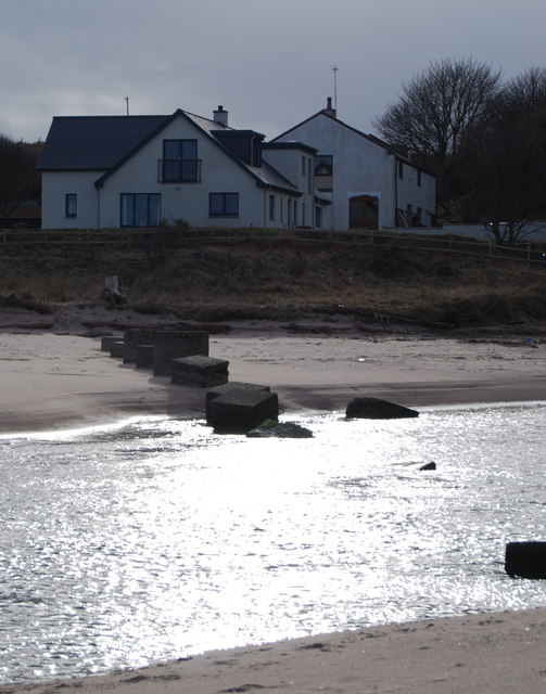
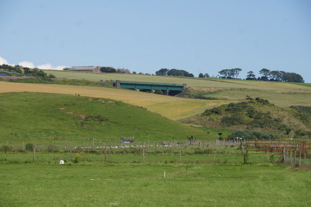
Braehead of Lunan is a small village located in the county of Angus, Scotland. Situated approximately 6 miles east of the town of Montrose, it is nestled in the picturesque Lunan Valley, surrounded by rolling hills and countryside.

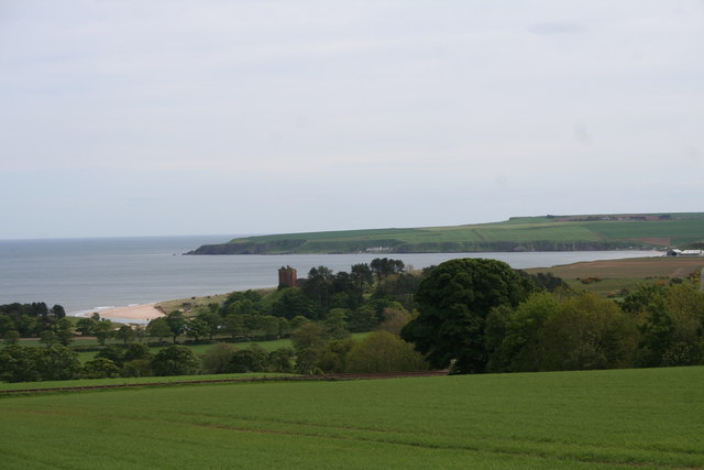
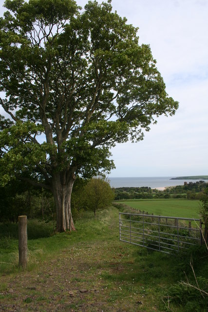
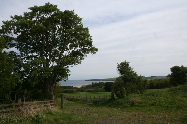
The village is known for its tranquil and rural atmosphere, making it an ideal destination for those seeking a peaceful retreat. The area is rich in natural beauty, with the Lunan Water, a small river, flowing through the village, providing stunning views and opportunities for fishing and leisurely walks along its banks.

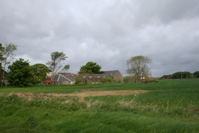
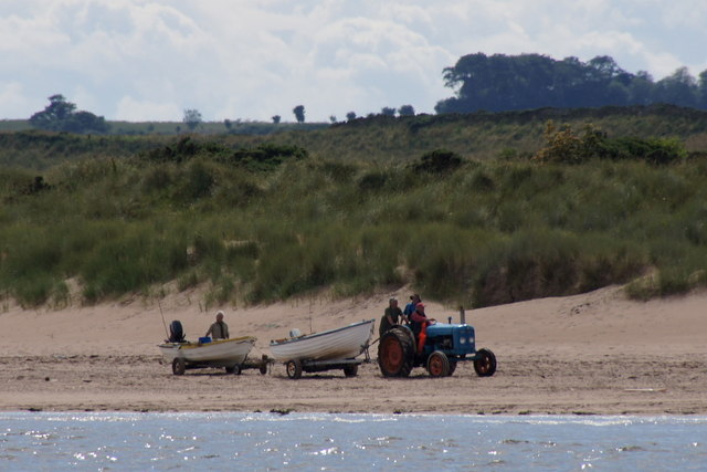
Historically, Braehead of Lunan has been an agricultural community, with farming being the primary occupation of its residents. The fertile lands surrounding the village have been cultivated for centuries, contributing to the area's agricultural heritage.

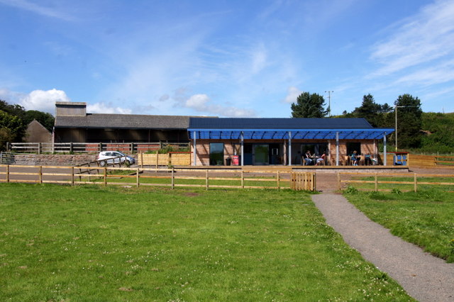
In terms of amenities, the village boasts a small primary school, providing education for local children. There are also a few local businesses, including a village shop, offering essential supplies to residents and visitors.

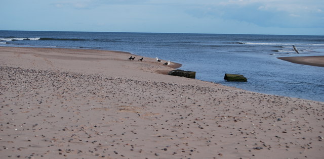
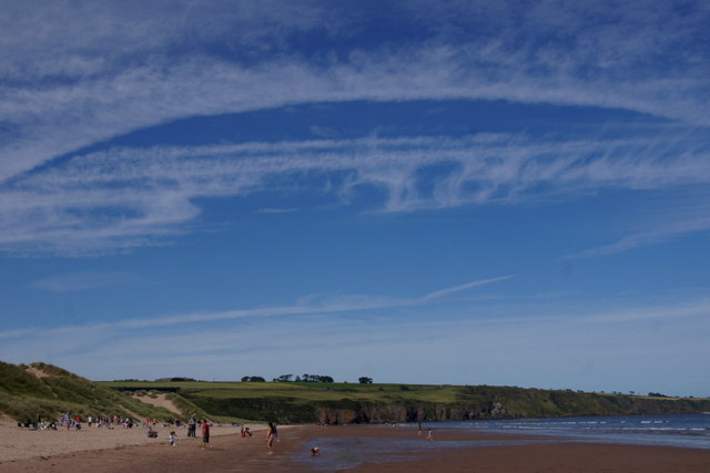
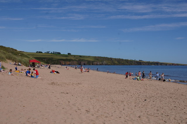
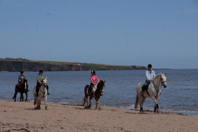
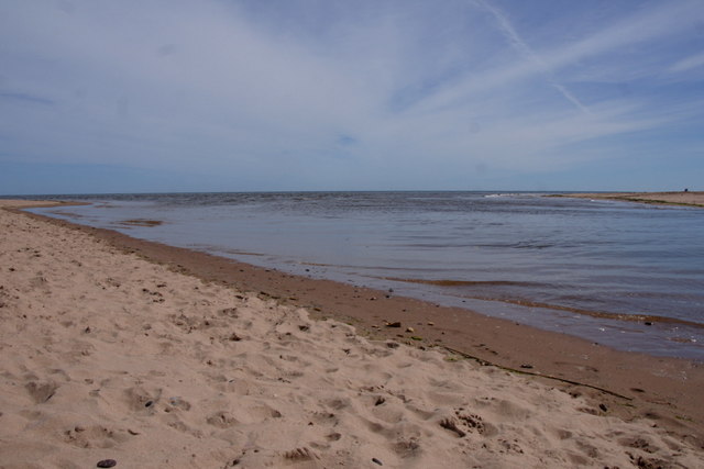
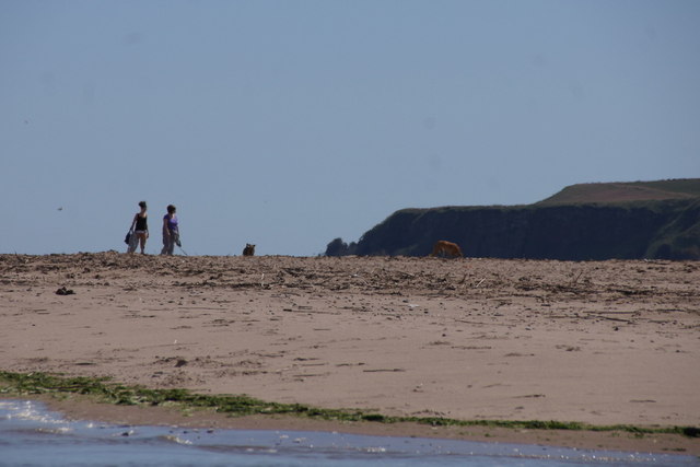
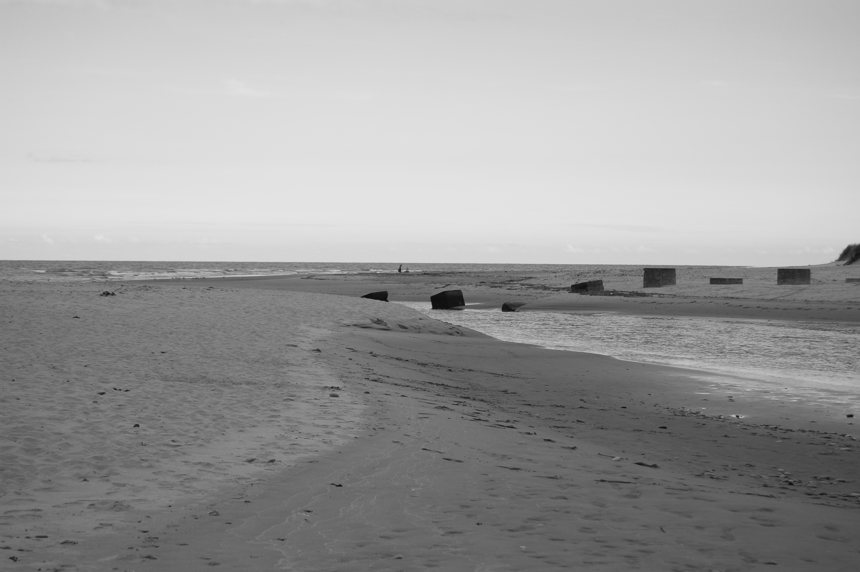
For those interested in exploring the surrounding area, there are several notable attractions nearby. The stunning Lunan Bay, with its beautiful sandy beach, is just a short drive away, offering opportunities for coastal walks, picnics, and beachcombing. Additionally, the nearby towns of Montrose and Arbroath provide further amenities, including shops, restaurants, and historical sites such as Montrose Basin and Arbroath Abbey.

Overall, Braehead of Lunan offers a peaceful and scenic retreat, perfect for those seeking a tranquil escape in the heart of Angus.

If you have any feedback on the listing, please let us know in the comments section below.

Braehead of Lunan Images

Images are sourced within 2km of 56.658688/-2.5235963 or Grid Reference NO6852. Thanks to Geograph Open Source API. All images are credited.

North End of Lunan Beach Tide was on its way in, and a very blustery day whipping up the surf. In the distance on the RHS are The Limekilns at Boddin.
North End of Lunan Beach
Tide was on its way in, and a very blustery day whipping up the surf. In the distance on the RHS are The Limekilns at Boddin.
House over the river From the northside of Lunan Water as it meets the sea at the southern end of the beach. 

Showing the wartime defences to prevent access from the beach.
House over the river
From the northside of Lunan Water as it meets the sea at the southern end of the beach. Showing the wartime defences to prevent access from the beach.
Lunan Water to the North Sea As the title with a couple of the remaining war time defences in the river.
Lunan Water to the North Sea
As the title with a couple of the remaining war time defences in the river.
Across Fields to Upper Dysart Farmland at Upper Dysart by Montrose.It was here that one of the first military airfields was established before the first world war moving to Bromfield in Montrose shortly after.
Across Fields to Upper Dysart
Farmland at Upper Dysart by Montrose.It was here that one of the first military airfields was established before the first world war moving to Bromfield in Montrose shortly after.
Gightyburn Farm A small farm by Rossie near Montrose.
Gightyburn Farm
A small farm by Rossie near Montrose.
Red Castle Lunan Bay and the ruin of Red Castle.
Red Castle
Lunan Bay and the ruin of Red Castle.
Track by Lunan A farm track by Lunan.
Track by Lunan
A farm track by Lunan.
Lunan Farmland Fields above Lunan bay.
Lunan Farmland
Fields above Lunan bay.
Lunan Bay cafe
Lunan Bay cafe
Lunan Bay Looking north towards Rickle Craig.
Lunan Bay
Looking north towards Rickle Craig.
Tractor hauling boats on the beach at Lunan Bay
Fields behind Lunan Bay Looking towards the railway bridge over Buckie Den.
Fields behind Lunan Bay
Looking towards the railway bridge over Buckie Den.
Lunan Bay beach  Looking north on the north end of the beach.
Lunan Bay beach
Looking north on the north end of the beach.
Horses on Lunan Bay beach Excersing horses on the beach would seem to be a regular occurrence as these were one of two groups seen during the day.
Horses on Lunan Bay beach
Excersing horses on the beach would seem to be a regular occurrence as these were one of two groups seen during the day.
Lunan Water entering the sea at Lunan Bay At high tide.
Lunan Water entering the sea at Lunan Bay
At high tide.
Walking on the southern part of Lunan Bay beach Access to the part of the Lunan Bay beach south of Lunan Water is more difficult so there are relatively few people to be seen on this part of the beach.
Walking on the southern part of Lunan Bay beach
Access to the part of the Lunan Bay beach south of Lunan Water is more difficult so there are relatively few people to be seen on this part of the beach.
Red Castle, Lunan Bay Originally built for King William the Lion in the 12th century, the castle has been in a ruinous state since the 16th century.
Red Castle, Lunan Bay
Originally built for King William the Lion in the 12th century, the castle has been in a ruinous state since the 16th century.
Show me another place!

Braehead of Lunan is located at Grid Ref: NO6852 (Lat: 56.658688, Lng: -2.5235963)

Unitary Authority: Angus

Police Authority: Tayside

What 3 Words

///puts.peroxide.hails. Near Montrose, Angus

Nearby Locations

Lunan Braehead of Lunan

Related Wikis

Arbikie distillery

Arbikie distillery is a scotch whisky, vodka and gin distillery in Inverkeilor, Angus, Scotland. == History == The distillery was built in 2013 on the...

Lunan, Angus

Lunan is a hamlet in Angus, Scotland, in the parish of the same name, 6 kilometres (3.7 mi) south of Montrose. The hamlet overlooks Lunan Bay, which is...

Lunan Bay railway station

Lunan Bay railway station served the village of Lunan, Angus, Scotland from 1883 to 1964 on the North British, Arbroath and Montrose Railway. == History... ==
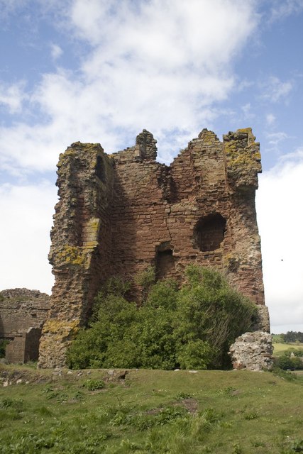
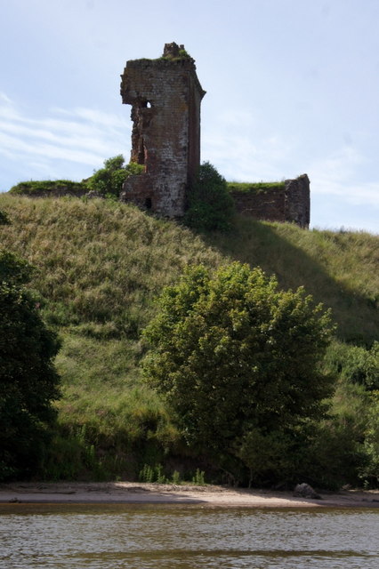
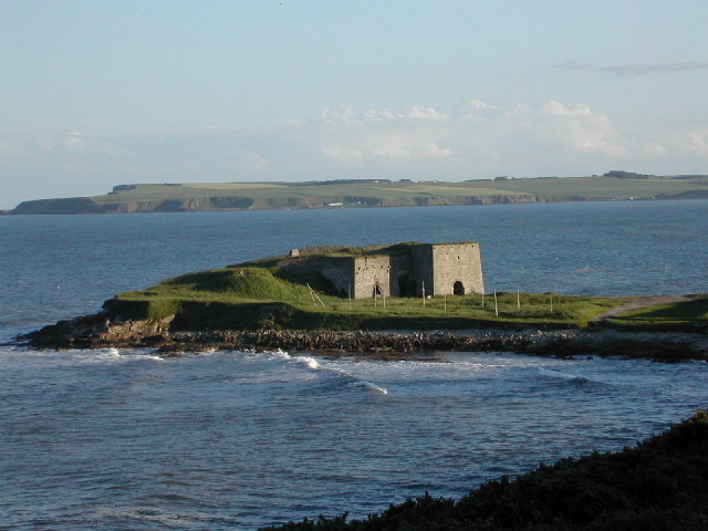
Red Castle, Angus

Red Castle of Lunan is a ruined fortified house on the coast of Angus, Scotland. It is about 4 miles (6.4 km) south-southwest of Montrose. == History... ==

Lunan Water

The Lunan Water is an easterly flowing river in Angus, Scotland, that discharges to the North Sea 11 kilometres (6.8 mi) north of the town of Arbroath...

Inverkeilor

Inverkeilor is a village and parish in Angus, Scotland. It lies near the North Sea coast, midway between Arbroath and Montrose. The A92 road now bypasses...

Inverkeilor railway station

Inverkeilor railway station served the village of Inverkeilor, Angus, Scotland from 1883 to 1930 on the North British, Arbroath and Montrose Railway....

Boddin, Angus

Boddin is a coastal village in Angus, Scotland, two miles south of Montrose. There are lime kilns at Boddin Point. == References ==

Nearby Amenities

Located within 500m of 56.658688,-2.5235963
Hawkhill
Place: hamlet
Lat/Long: 56.6550253/-2.5245819
Material: wood
Power: pole
Lat/Long: 56.6547287/-2.5247676
The data included in this document is from www.openstreetmap.org. The data is made available under ODbL.

Have you been to Braehead of Lunan?

Leave your review of Braehead of Lunan below (or comments, questions and feedback).