West Helmsdale

Settlement in Sutherland

Scotland

West Helmsdale

Navidale House Hotel Viewed from the cliff-top path below the hotel.
Navidale House Hotel Credit: sylvia duckworth

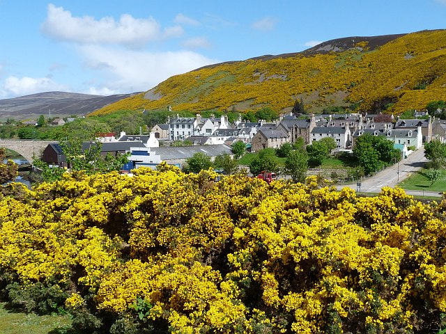
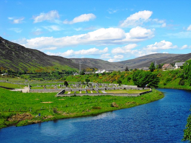
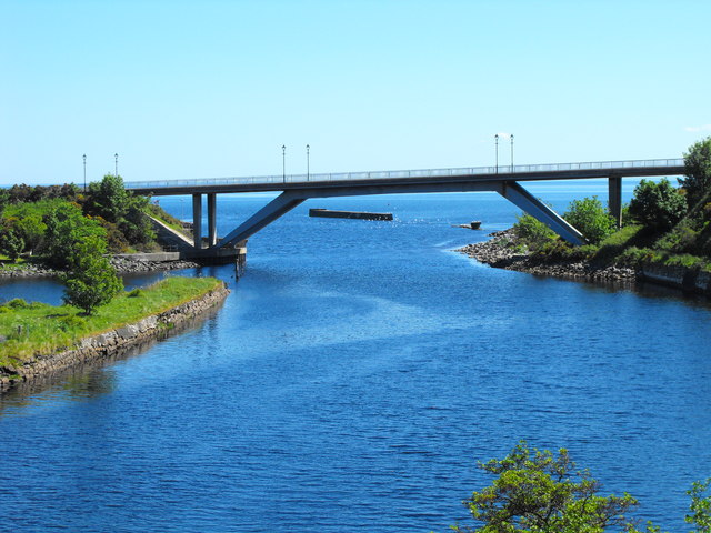
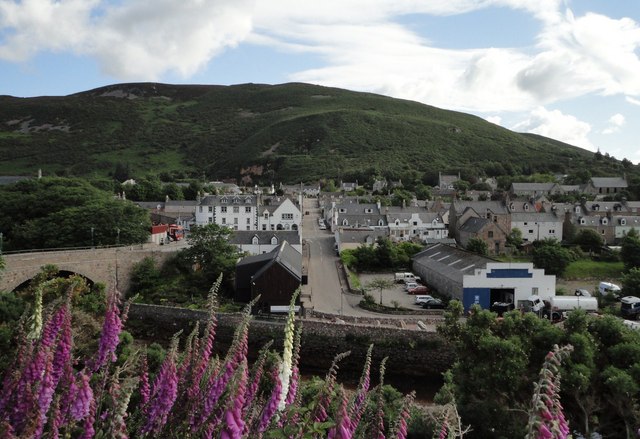
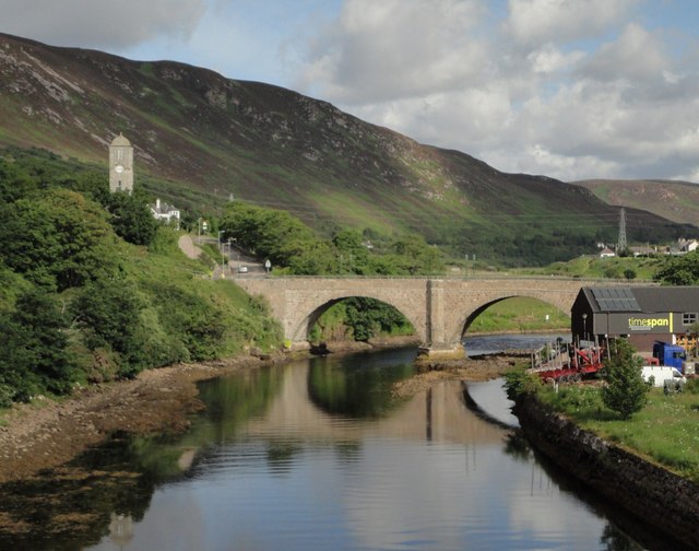
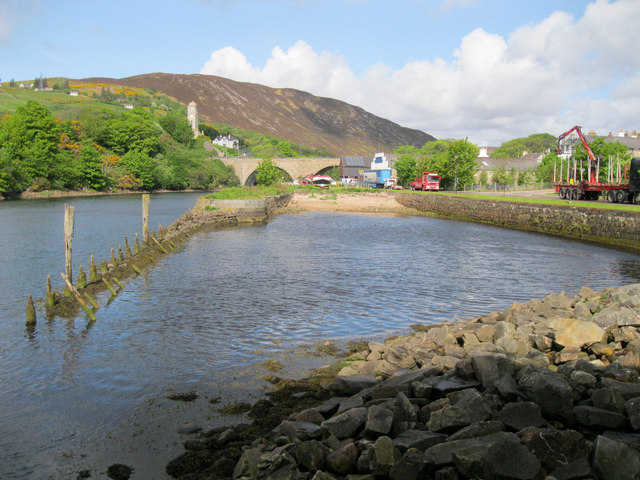
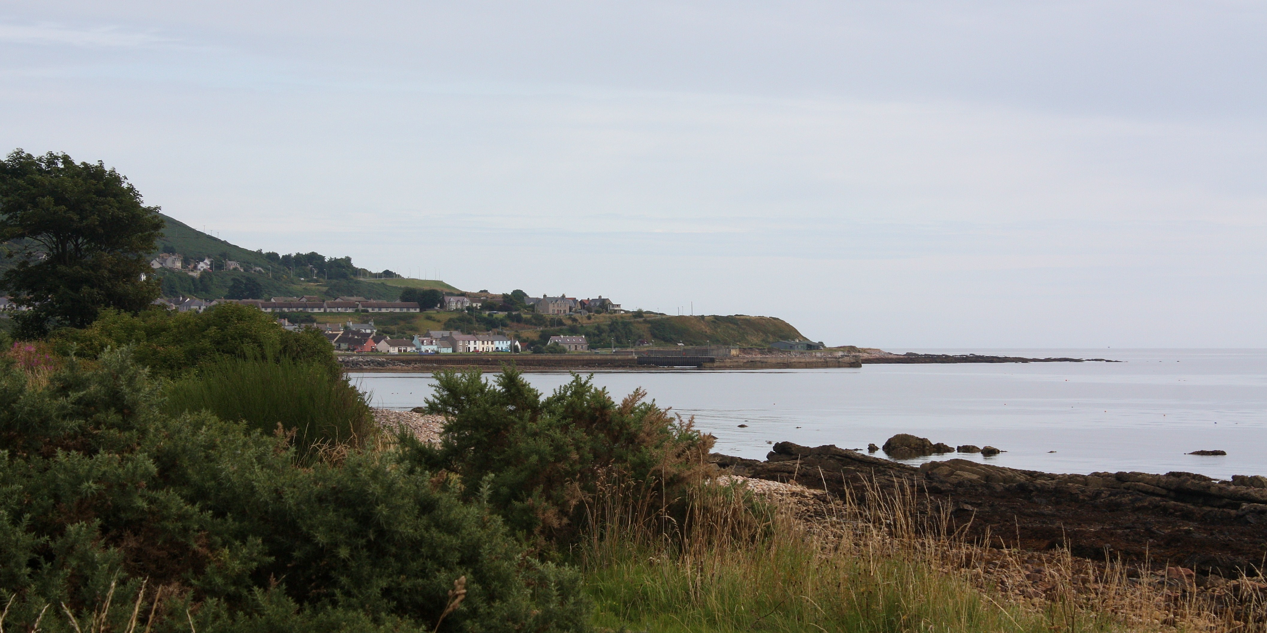
West Helmsdale is a small village located in the county of Sutherland, in the Highland region of Scotland. Situated on the eastern coast of the country, it lies along the banks of the River Helmsdale, which flows into the North Sea. The village is part of the larger settlement of Helmsdale, which is approximately 1 mile to the east.

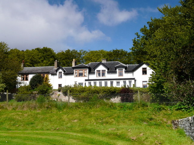
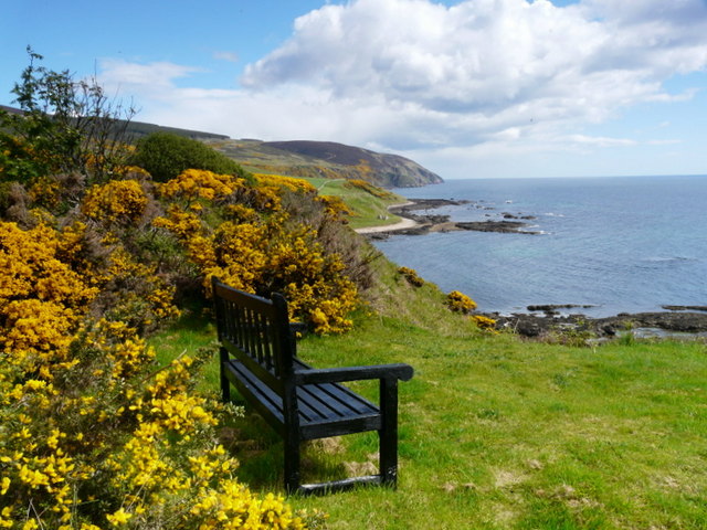
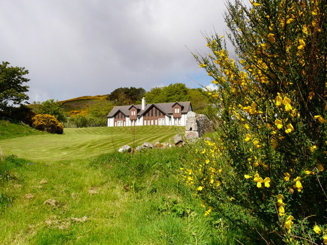
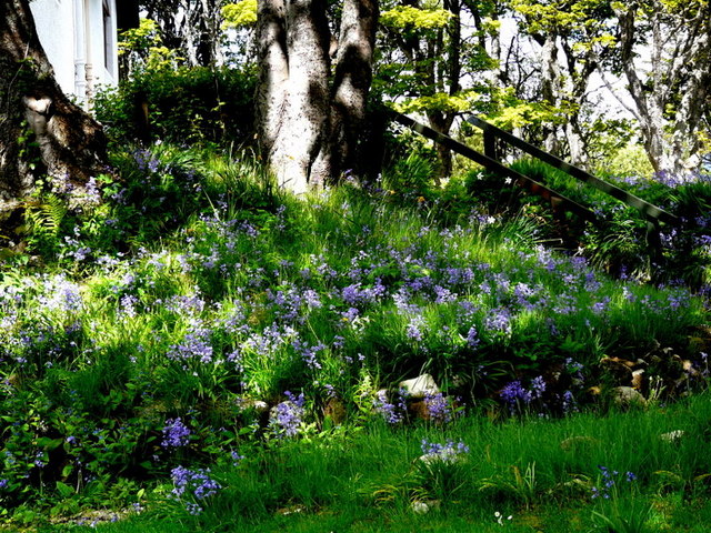
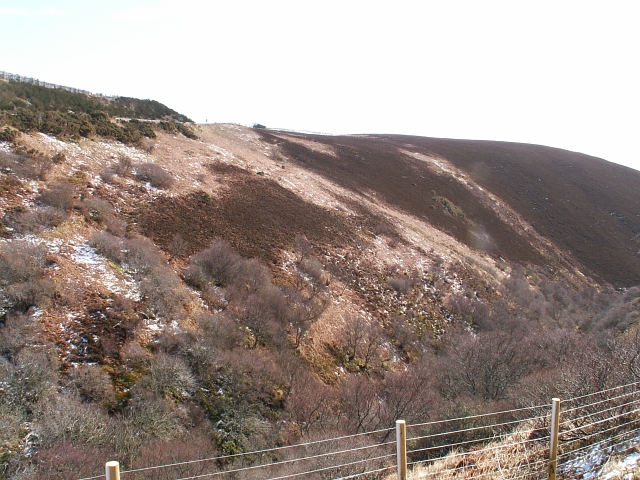
West Helmsdale boasts a picturesque setting, surrounded by stunning natural landscapes. The village is nestled between rolling hills and offers breathtaking views of the rugged Scottish countryside. The nearby Morven Hills and Sutherland Forest Park provide ample opportunities for outdoor activities such as hiking, birdwatching, and fishing.

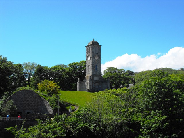
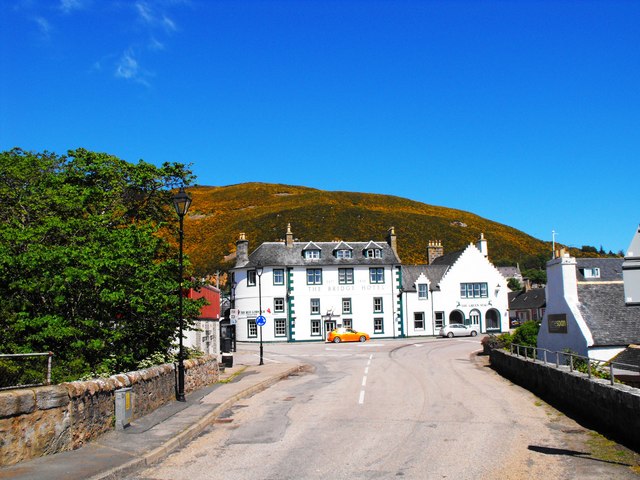
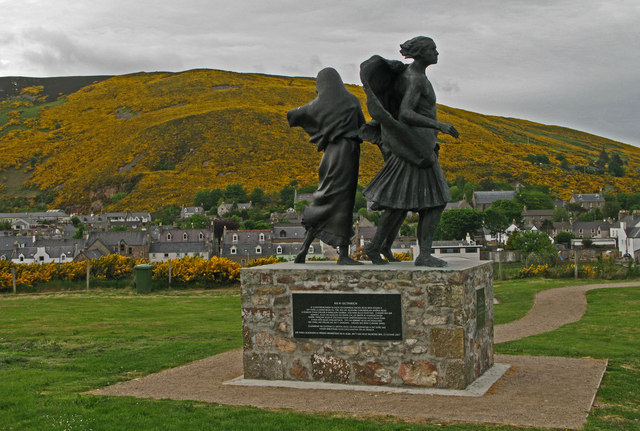
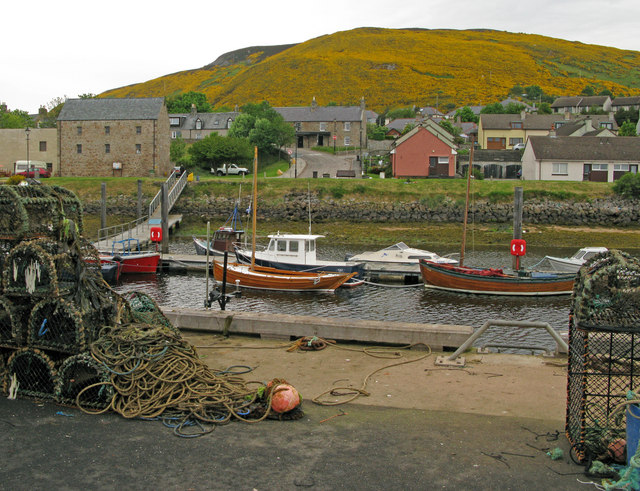
Despite its small size, West Helmsdale has a rich history. In the 19th century, the village was a thriving fishing community, known for its salmon fishing industry. Today, remnants of the fishing heritage can still be seen in the quaint harbor, which is a popular spot for leisure boats and yachts.

The village is home to a close-knit community, with a range of amenities to cater to residents and visitors alike. These include a few local shops, a post office, and a handful of restaurants and cafes. West Helmsdale also has a primary school, ensuring that the needs of families are met within the village.

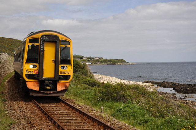
West Helmsdale is easily accessible by road, with the A9 passing through the nearby town of Helmsdale. The closest railway station is in Helmsdale, providing connections to major cities such as Inverness and Edinburgh. Overall, West Helmsdale offers a peaceful and idyllic setting for those seeking a tranquil escape in the Scottish Highlands.

If you have any feedback on the listing, please let us know in the comments section below.

West Helmsdale Images

Images are sourced within 2km of 58.117554/-3.6642272 or Grid Reference ND0215. Thanks to Geograph Open Source API. All images are credited.

Navidale House Hotel Viewed from the cliff-top path below the hotel.
Navidale House Hotel
Viewed from the cliff-top path below the hotel.
Cliff-top seat at Navidale House Hotel
Self-catering lodges at Navidale House Hotel
Bluebells at Navidale House Hotel
Gorse in profusion, Helmsdale With a gorse hedge by a picnic site and gorse covering the distant hills, the village of Helmsdale is surrounded by yellow on this May morning.
Gorse in profusion, Helmsdale
With a gorse hedge by a picnic site and gorse covering the distant hills, the village of Helmsdale is surrounded by yellow on this May morning.
Memorial Clock Tower Clock Tower at Helmsdale
Memorial Clock Tower
Clock Tower at Helmsdale
River Helmsdale from Telford's Bridge View upstream showing Helmsdale cemetery
River Helmsdale from Telford's Bridge
View upstream showing Helmsdale cemetery
Old Ice House Old double doored ice house at Helmsdale
Old Ice House
Old double doored ice house at Helmsdale
Bridge over River Helmsdale Picture shows the bridge carrying the A9 over the River Helmsdale and the helmsdale harbour breakwater beyond. Picture was taken from Telford's bridge.
Bridge over River Helmsdale
Picture shows the bridge carrying the A9 over the River Helmsdale and the helmsdale harbour breakwater beyond. Picture was taken from Telford's bridge.
The Bridge Hotel, Helmsdale Taken from Telford's Bridge
The Bridge Hotel, Helmsdale
Taken from Telford's Bridge
Inverness bound Inverness bound train just south of Helmsdale station.
Inverness bound
Inverness bound train just south of Helmsdale station.
View along Sittenham Road, Helmsdale With the Ice House and War Memorial on the left.
View along Sittenham Road, Helmsdale
With the Ice House and War Memorial on the left.
Lilleshall Street, Helmsdale The village is built on a grid system. Lilleshall Street leads to the River Helmsdale. Telford's bridge is on the left.
Lilleshall Street, Helmsdale
The village is built on a grid system. Lilleshall Street leads to the River Helmsdale. Telford's bridge is on the left.
Helmsdale Bridge Built in 1808 - 1809, to a design of Thomas Telford's.
Helmsdale Bridge
Built in 1808 - 1809, to a design of Thomas Telford's.
Monument marking the site of Helmsdale Castle The remains of the castle were removed when the new bridge was built. 
The plaque reads: 'Helmsdale Castle was built near here in 1488. The ruins were removed in 1970 to make way for the new road and bridge.'
The monument sits in the corner of what is now a car park. The new bridge is behind the monument.
Monument marking the site of Helmsdale Castle
The remains of the castle were removed when the new bridge was built. The plaque reads: 'Helmsdale Castle was built near here in 1488. The ruins were removed in 1970 to make way for the new road and bridge.' The monument sits in the corner of what is now a car park. The new bridge is behind the monument.
Helmsdale village with 'The Emigrants'. The small village of Helmsdale is home to this poignant bronze sculpture commemorating those who lost their homes and livelihoods during 'The Clearances'; Helmsdale itself was created as a resettlement location for some of those dispossessed.
Helmsdale village with 'The Emigrants'.
The small village of Helmsdale is home to this poignant bronze sculpture commemorating those who lost their homes and livelihoods during 'The Clearances'; Helmsdale itself was created as a resettlement location for some of those dispossessed.
Helmsdale The village of Helmsdale seen across the harbour with extensive areas of flowering gorse on the hillside rising to the north.
Helmsdale
The village of Helmsdale seen across the harbour with extensive areas of flowering gorse on the hillside rising to the north.
Helmsdale Old Harbour This is the original harbour, replaced by the 'new' one in 1892.
Helmsdale Old Harbour
This is the original harbour, replaced by the 'new' one in 1892.
Show me another place!

West Helmsdale is located at Grid Ref: ND0215 (Lat: 58.117554, Lng: -3.6642272)

Unitary Authority: Highland

Police Authority: Highlands and Islands

What 3 Words

///exams.reinvest.weekday. Near Brora, Highland

Related Wikis

River Helmsdale

The River Helmsdale (sometimes known as the River Ullie) (Scottish Gaelic: Ilidh / Abhainn Ilidh) is one of the major east-flowing rivers of Sutherland...

Helmsdale railway station

Helmsdale railway station is a railway station serving the village of Helmsdale in the Highland council area, northern Scotland. It is located on the Far...

Helmsdale

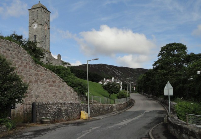
Helmsdale (Scots: Helmsdal, Scottish Gaelic: Bun Ilidh) is a village on the east coast of Sutherland, in the Highland council area of Scotland. The modern...

West Helmsdale

West Helmsdale is a small settlement lying on the right bank of the River Helmsdale, on the east coast of Sutherland, Scottish Highlands and is in the...

Gartymore

Gartymore (Scottish Gaelic: Gartaidh Mòr) is an area, lying on the east coast of Sutherland and located less than 0.5 miles south west of Helmsdale, close...

West Helmsdale railway station

West Helmsdale railway station served the settlement of West Helmsdale, in the historical county of Sutherland, from 1870 to 1871 on the Duke of Sutherland...

Portgower

Portgower is a former fishing village on the east coast of Scotland in Helmsdale, Sutherland, Scottish Highlands and is in the Scottish council area of...

Ord of Caithness

The Ord of Caithness is a granite mass on the east coast of the Highland council area of Scotland, on the boundary of the counties Sutherland and Caithness...

Nearby Amenities

Located within 500m of 58.117554,-3.6642272
Helmsdale
Name En: Helmsdale
Name Gd: Bun Ilidh
Naptan AtcoCode: 9100HELMSDL
Network: National Rail
Network Website: https://www.nationalrail.co.uk/stations/hms/
Network Wikidata: Q26334
Operator: ScotRail
Operator Website: https://www.scotrail.co.uk/plan-your-journey/stations-and-facilities/hms
Operator Wikidata: Q18356161
Public Transport: station
Railway: station
Ref Crs: HMS
Ref Nlc: 864700
Ref Stanox: 01016
Ref Tiploc: HELMSDL
Source: NPE
Train: yes
Uic Ref: 7086470
Wikidata: Q2412149
Wikipedia: en:Helmsdale railway station
Lat/Long: 58.1177286/-3.6591456
Railway: level_crossing
Lat/Long: 58.1209524/-3.6637289
Railway: switch
Lat/Long: 58.1199781/-3.662636
Railway: switch
Lat/Long: 58.1165193/-3.6580159
Design: barrel
Power: tower
Lat/Long: 58.1204357/-3.6636354
Bicycle Parking
Bicycle Parking: stands
Capacity: 6
Covered: no
Lat/Long: 58.117589/-3.6584365
Passing Place
Lat/Long: 58.1201186/-3.6624919
Belltower The Great War
Heritage Operator: Historic Environment Scotland
Heritage Website: https://portal.historicenvironment.scot/designation/LB7196
Historic: memorial
Listed Status: Category_C
Memorial: sculpture
Ref GB Hs: LB7196
Lat/Long: 58.1166533/-3.6564414
Design: barrel
Power: tower
Lat/Long: 58.11599/-3.669612
Design: barrel
Power: tower
Lat/Long: 58.1178995/-3.6670619
Design: barrel
Power: tower
Lat/Long: 58.1190953/-3.6654308
West Helmsdale
Place: hamlet
Wikidata: Q2360438
Wikipedia: en:West Helmsdale
Lat/Long: 58.1156728/-3.6683929
Railway: buffer_stop
Lat/Long: 58.1181336/-3.6595336
Railway: buffer_stop
Lat/Long: 58.1198265/-3.6623579
Railway: switch
Lat/Long: 58.1188575/-3.6607996
Railway: switch
Railway Local Operated: yes
Lat/Long: 58.1185244/-3.6603513
Land League Cairn
Historic: memorial
Inscription: IN MEMORY OF THE HIGHLAND HEROES OF THE LAND LEAGUE "They laid the foundations that we might build thereon" Gartymore 1881 - 1981
Material: stone
Memorial: cairn
Lat/Long: 58.1159275/-3.6664331
Power: pole
Lat/Long: 58.1135169/-3.6657295
Power: pole
Lat/Long: 58.1140561/-3.6647859
Power: pole
Lat/Long: 58.1146133/-3.6638207
Power: pole
Lat/Long: 58.1151165/-3.6629757
Power: pole
Lat/Long: 58.1152975/-3.6623172
Power: pole
Lat/Long: 58.1155506/-3.66144
Power: pole
Lat/Long: 58.1158159/-3.6605519
Power: pole
Lat/Long: 58.1160736/-3.659662
Power: pole
Lat/Long: 58.1164612/-3.6585596
Power: pole
Lat/Long: 58.1167777/-3.6588359
Power: pole
Lat/Long: 58.1170127/-3.6591427
Power: pole
Lat/Long: 58.1173245/-3.6599913
Power: pole
Lat/Long: 58.1177196/-3.6602119
Power: pole
Lat/Long: 58.1164536/-3.659096
Power: pole
Lat/Long: 58.1164612/-3.6605689
Power: pole
Lat/Long: 58.1164555/-3.6617387
Power: pole
Lat/Long: 58.1164499/-3.6629371
Power: pole
Lat/Long: 58.1164442/-3.6642862
Power: pole
Lat/Long: 58.116448/-3.6651581
Power: pole
Lat/Long: 58.1174998/-3.6662417
Power: pole
Lat/Long: 58.1179622/-3.6667405
Power: pole
Lat/Long: 58.1183914/-3.667198
Power: pole
Lat/Long: 58.1189515/-3.6678097
Power: pole
Lat/Long: 58.1193996/-3.6682834
Power: pole
Lat/Long: 58.1200259/-3.6681416
Power: pole
Lat/Long: 58.1205395/-3.6681793
Power: pole
Lat/Long: 58.121125/-3.6682206
Power: pole
Lat/Long: 58.1137112/-3.661039
Power: pole
Lat/Long: 58.1142665/-3.6606138
Power: pole
Lat/Long: 58.115053/-3.6599966
Power: pole
Lat/Long: 58.1156927/-3.6595104
Power: pole
Lat/Long: 58.1165162/-3.6588861
Passing Place
Lat/Long: 58.1188353/-3.6602821
Passing Place
Lat/Long: 58.1176938/-3.6580864
Passing Place
Lat/Long: 58.1183918/-3.6594869
Passing Place
Lat/Long: 58.1193287/-3.6611317
Passing Place
Lat/Long: 58.1206238/-3.6631546
The data included in this document is from www.openstreetmap.org. The data is made available under ODbL.

Have you been to West Helmsdale?

Leave your review of West Helmsdale below (or comments, questions and feedback).