Green, West

Settlement in Sussex Crawley

England

Green, West

The Hawth The Arts Centre in Crawley. Taken during the annual juggling convention held there (in 1999 in this case)
The Hawth Credit: Alan Simkins

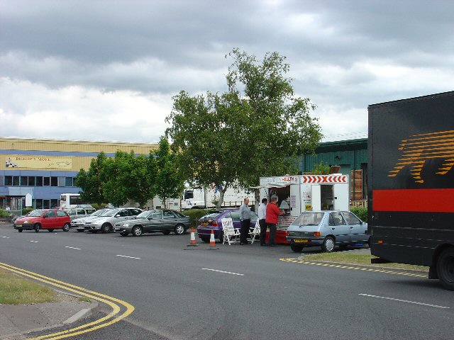
Green, West Sussex is a charming village located in the county of West Sussex, England. Situated amidst picturesque countryside, Green offers a tranquil and idyllic setting for its residents and visitors alike. With its population of around 500, the village exudes a close-knit community atmosphere.

Green is known for its rich history, dating back to the medieval period. The village is home to several historic buildings and landmarks, including a beautiful 12th-century church that stands as a testament to its past. The surrounding countryside provides ample opportunities for leisurely walks and outdoor activities, making it a popular destination for nature enthusiasts.

Despite its small size, Green boasts a number of amenities and services for its residents. The village has a well-stocked local grocery store, a cozy pub, and a primary school, ensuring that most everyday needs can be met within the community. For more extensive shopping or entertainment options, the nearby towns of Horsham and Crawley are easily accessible.

The village also benefits from excellent transportation links. The A24 road runs close by, providing convenient access to other parts of West Sussex and beyond. The nearest train station is just a short distance away, allowing for easy commuting to nearby towns and cities.

With its picturesque surroundings, rich history, and close-knit community spirit, Green, West Sussex offers a peaceful and charming place to live or visit.

If you have any feedback on the listing, please let us know in the comments section below.

Green, West Images

Images are sourced within 2km of 51.118917/-0.19921322 or Grid Reference TQ2637. Thanks to Geograph Open Source API. All images are credited.

The Hawth The Arts Centre in Crawley. Taken during the annual juggling convention held there (in 1999 in this case)
The Hawth
The Arts Centre in Crawley. Taken during the annual juggling convention held there (in 1999 in this case)
Crawley shops Always busy with a full range of shops.
Crawley shops
Always busy with a full range of shops.
Hawth Theatre Council-built and owned Theatre opened in 1988
Hawth Theatre
Council-built and owned Theatre opened in 1988
Holy Trinity School Opened in the late 1960s, the main Church of England Secondary School in North Sussex
Holy Trinity School
Opened in the late 1960s, the main Church of England Secondary School in North Sussex
Ifield Barn Theatre Converted Barn next to St Margaret's XIIIth Century church, now home to amateur theatre company
Ifield Barn Theatre
Converted Barn next to St Margaret's XIIIth Century church, now home to amateur theatre company
St Margaret's Church Thirteenth Century church in old Ifield Village, now  tucked into a corner of Crawley New Town
St Margaret's Church
Thirteenth Century church in old Ifield Village, now tucked into a corner of Crawley New Town
Ifield Community College One of Crawley's comprehensive schools. Originally opened as a combined Grammar and Secondary Modern school it was demolished in 2005 following the re-building of the school on the same campus.
Ifield Community College
One of Crawley's comprehensive schools. Originally opened as a combined Grammar and Secondary Modern school it was demolished in 2005 following the re-building of the school on the same campus.
Ifield Mill House Preserved working Water Mill
Ifield Mill House
Preserved working Water Mill
Ifield Mill Pond Pond connected to Ifield Water Mill
Ifield Mill Pond
Pond connected to Ifield Water Mill
Ifield Station Formerly Ifield Halt, now serves the west of Crawley New Town
Ifield Station
Formerly Ifield Halt, now serves the west of Crawley New Town
Crawley Signal Box 19th Century Signal Box on Horsham branch line. The box is now out of use following automation, although  it is subject to a preservation order, and is cared for by a local society.
Crawley Signal Box
19th Century Signal Box on Horsham branch line. The box is now out of use following automation, although it is subject to a preservation order, and is cared for by a local society.
St Wilfrid's RC School Catholic Comprehensive School, Crawley
St Wilfrid's RC School
Catholic Comprehensive School, Crawley
County Mall Shopping Centre Shopping Mall opened in 1992
County Mall Shopping Centre
Shopping Mall opened in 1992
Crawley College College of Further Education
Crawley College
College of Further Education
Crawley Station Crawley Station, with Overline House above. The station was relocated here in the late 1960s from a former site 500yds further west.
Crawley Station
Crawley Station, with Overline House above. The station was relocated here in the late 1960s from a former site 500yds further west.
Ye Olde Punche Bowle A 15th century building which has many previous uses, including as a branch of Natwest Bank. It is currently in use as a public house
Ye Olde Punche Bowle
A 15th century building which has many previous uses, including as a branch of Natwest Bank. It is currently in use as a public house
Crawley Hospital View from South
Crawley Hospital
View from South
Manor Royal Industrial Estate, Crawley, West Sussex - Lunch Time Manor Royal Industrial Estate dominates Grid square TQ2738. The industries are varied and include various types of light to medium weight engineering, pharmaceuticals, administrative head offices, storage, etc. The view here shows one of the many snack bars that are found at strategic points round the estate. Most of the larger premises include on-site catering for employees, but there are many small companies who don't.
Manor Royal Industrial Estate, Crawley, West Sussex - Lunch Time
Manor Royal Industrial Estate dominates Grid square TQ2738. The industries are varied and include various types of light to medium weight engineering, pharmaceuticals, administrative head offices, storage, etc. The view here shows one of the many snack bars that are found at strategic points round the estate. Most of the larger premises include on-site catering for employees, but there are many small companies who don't.
Show me another place!

Green, West is located at Grid Ref: TQ2637 (Lat: 51.118917, Lng: -0.19921322)

Administrative County: West Sussex

District: Crawley

Police Authority: Sussex

What 3 Words

///part.dare.sits. Near Langley Green, West Sussex

Related Wikis

Crawley Hospital

Crawley Hospital is a National Health Service hospital in Crawley, a town and borough in West Sussex, England. Since 2006 it has been part of the Sussex...

West Green, West Sussex

West Green is one of the 14 residential neighbourhoods in Crawley, a town and borough in West Sussex, England. Crawley was planned and laid out as a New...

The George Hotel, Crawley

The George Hotel, also known as the George Inn and now marketed as the Ramada Crawley Gatwick, is a hotel and former coaching inn on the High Street in...

Gossops Green

Gossops Green is one of 14 neighbourhoods within the town of Crawley in West Sussex, England. Gossops Green is located in the west of the town and is bordered...

Nearby Amenities

Located within 500m of 51.118917,-0.19921322
Crossing
Bicycle: yes
Crossing: traffic_signals
Crossing Island: no
Foot: yes
Lat/Long: 51.1216379/-0.1984534
Crossing
Crossing: uncontrolled
Crossing Island: yes
Kerb: lowered
Tactile Paving: yes
Lat/Long: 51.1192003/-0.1991341
Mini Roundabout
Direction: clockwise
Lat/Long: 51.1189207/-0.1991639
Crossing
Crossing: uncontrolled
Crossing Island: yes
Kerb: lowered
Tactile Paving: yes
Lat/Long: 51.1188336/-0.1990502
Turning Circle
Lat/Long: 51.1193668/-0.2013226
Noexit: yes
Lat/Long: 51.1213364/-0.1976467
Crawley Labour Supporters Club
Building: yes
Lat/Long: 51.1214172/-0.1962879
Crossing
Crossing: uncontrolled
Lat/Long: 51.1197062/-0.1928154
West Green
Is In: West Sussex, England, UK
Place: village
Wikidata: Q2602900
Lat/Long: 51.1176905/-0.1977785
Post Box
Collection Times: Mo-Fr 17:30; Sa 12:00
Operator: Royal Mail
Operator Wikidata: Q638098
Post Box Type: pillar
Ref: RH11 73
Royal Cypher: EIIR
Royal Cypher Wikidata: Q33102113
Source: gps; survey
Lat/Long: 51.1178289/-0.205226
Crossing
Button Operated: yes
Crossing: traffic_signals
Crossing Island: no
Crossing Ref: toucan
Kerb: flush
Tactile Paving: yes
Traffic Signals Sound: yes
Lat/Long: 51.1229523/-0.2001403
Post Box
Town Mead
Collection Times: Mo-Fr 17:30; Sa 12:15
Operator: Royal Mail
Operator Wikidata: Q638098
Post Box Type: pillar
Ref: RH11 76
Royal Cypher: EIIR
Royal Cypher Wikidata: Q33102113
Source: survey
Lat/Long: 51.1194235/-0.193389
Bus Stop
Ifield Drive
Bench: no
Bin: yes
Bus: yes
Bus Bay: no
Naptan AtcoCode: 4400CY0117
Naptan Bearing: NW
Naptan CommonName: Ifield Drive
Naptan Indicator: adj
Naptan Landmark: Ifield Drive
Naptan NaptanCode: wsxajtam
Naptan PlusbusZoneRef: CRAWLEY
Naptan ShortCommonName: Ifield Drive
Naptan Street: Ifield Avenue
Naptan Verified: no
Passenger Information Display: no
Public Transport: platform
Shelter: no
Source: naptan_import
Lat/Long: 51.1232866/-0.2006448
Bus Stop
Ifield Drive
Bench: yes
Bin: yes
Bus: yes
Bus Bay: yes
Naptan AtcoCode: 4400CY0118
Naptan Bearing: SE
Naptan CommonName: Ifield Drive
Naptan Indicator: opp
Naptan Landmark: Ifield Drive
Naptan NaptanCode: wsxajtap
Naptan PlusbusZoneRef: CRAWLEY
Naptan ShortCommonName: Ifield Drive
Naptan Street: Ifield Avenue
Naptan Verified: no
Passenger Information Display: no
Public Transport: platform
Shelter: yes
Source: naptan_import
Lat/Long: 51.123128/-0.2002411
Bus Stop
The Mardens
Bus: yes
Naptan AtcoCode: 4400CY0119
Naptan Bearing: NE
Naptan CommonName: The Mardens
Naptan Indicator: o/s School fields
Naptan Landmark: End of The Mardens
Naptan NaptanCode: wsxajtat
Naptan PlusbusZoneRef: CRAWLEY
Naptan Street: A23 Crawley Avenue
Naptan Verified: no
Public Transport: platform
Source: naptan_import
Lat/Long: 51.1201679/-0.2052862
Bus Stop
The Mardens
Bus: yes
Naptan AtcoCode: 4400CY0120
Naptan Bearing: SW
Naptan CommonName: The Mardens
Naptan Indicator: opp School fields (under underpass)
Naptan Landmark: End of The Mardens
Naptan NaptanCode: wsxajtaw
Naptan PlusbusZoneRef: CRAWLEY
Naptan Street: A23 Crawley Avenue
Naptan Verified: no
Public Transport: platform
Source: naptan_import
Lat/Long: 51.1198845/-0.2053302
Bus Stop
Ambulance Station
Bus: yes
Bus Bay: yes
Naptan AtcoCode: 4400CY0330
Naptan Bearing: E
Naptan CommonName: Ambulance Station
Naptan Indicator: o/s Amubulance Station
Naptan Landmark: Ewhurst Road
Naptan NaptanCode: wsxamgjp
Naptan PlusbusZoneRef: CRAWLEY
Naptan ShortCommonName: Ambulance Station
Naptan Street: Ifield Avenue
Naptan Verified: no
Public Transport: platform
Source: naptan_import
Lat/Long: 51.1211634/-0.1972117
Bus Stop
Ambulance Station
Bus: yes
Naptan AtcoCode: 4400CY0331
Naptan Bearing: W
Naptan CommonName: Ambulance Station
Naptan Indicator: opposite Ambulance Station
Naptan Landmark: Ewhurst Road
Naptan NaptanCode: wsxamgjt
Naptan PlusbusZoneRef: CRAWLEY
Naptan ShortCommonName: Ambulance Station
Naptan Street: Ifield Avenue
Naptan Verified: yes
Public Transport: platform
Shelter: yes
Source: naptan_import
Lat/Long: 51.121242/-0.1977353
Bus Stop
A23 Ambulance Station
Bus: yes
Naptan AtcoCode: 4400CY0332
Naptan Bearing: NE
Naptan CommonName: A23 Ambulance Station
Naptan Indicator: Towards Gatwick
Naptan Landmark: Ifield Avenue - ambulance station Rounda
Naptan NaptanCode: wsxamgjw
Naptan PlusbusZoneRef: CRAWLEY
Naptan ShortCommonName: A23 Ambulance Station
Naptan Street: A23
Naptan Verified: no
Public Transport: platform
Shelter: no
Source: naptan_import
Lat/Long: 51.1224546/-0.1979894
Bus Stop
Ewhurst Road
Addr City: Crawley
Addr Street: West Green Drive
Bench: yes
Bus: yes
Naptan AtcoCode: 4400CY0334
Naptan Bearing: SE
Naptan CommonName: Ewhurst Road
Naptan Indicator: opp
Naptan Landmark: Ewhurst Road
Naptan NaptanCode: wsxamgmd
Naptan PlusbusZoneRef: CRAWLEY
Naptan ShortCommonName: Ewhurst Road
Naptan Street: West Green Drive
Naptan Verified: no
Public Transport: platform
Shelter: yes
Source: naptan_import
Wheelchair: yes
Wheelchair Description: Step-free to stop opposite and shops via island refuges at roundabout.
Lat/Long: 51.1188107/-0.1988915
Bus Stop
Ewhurst Road
Addr City: Crawley
Addr Street: West Green Drive
Bench: no
Bus: yes
Naptan AtcoCode: 4400CY0335
Naptan Bearing: NW
Naptan CommonName: Ewhurst Road
Naptan Indicator: adj
Naptan Landmark: Ewhurst Road
Naptan NaptanCode: wsxamgmg
Naptan PlusbusZoneRef: CRAWLEY
Naptan ShortCommonName: Ewhurst Road
Naptan Street: West Green Drive
Naptan Verified: no
Note: name on stop "Apple Tree, West Green"
Public Transport: platform
Shelter: no
Source: naptan_import
Tactile Paving: no
Wheelchair: yes
Wheelchair Description: Step-free shops, and to stop opposite via island refuge at roundabout.
Lat/Long: 51.1185697/-0.1986436
Bus Stop
Crawley Hospital
Addr City: Crawley
Addr Street: West Green Drive
Bench: yes
Bus: yes
Naptan AtcoCode: 4400CY0336
Naptan Bearing: SE
Naptan CommonName: Crawley Hospital
Naptan Indicator: opp Crawley Hospital
Naptan Landmark: Town Barn Road
Naptan NaptanCode: wsxamgmj
Naptan PlusbusZoneRef: CRAWLEY
Naptan ShortCommonName: Crawley Hospital
Naptan Street: West Green Drive
Naptan Verified: no
Public Transport: platform
Shelter: yes
Source: naptan_import
Tactile Paving: no
Wheelchair: yes
Wheelchair Description: Step-free to Hospital and stop opposite via controlled crossing 50m south east.
Lat/Long: 51.1176339/-0.1964036
Bus Stop
Crawley Hospital
Addr City: Crawley
Addr Street: West Green Drive
Bus: yes
Naptan AtcoCode: 4400CY0337
Naptan Bearing: NW
Naptan CommonName: Crawley Hospital
Naptan Indicator: o/s Crawley Hospital
Naptan Landmark: Town Barn Road
Naptan NaptanCode: wsxamgmp
Naptan PlusbusZoneRef: CRAWLEY
Naptan ShortCommonName: Crawley Hospital
Naptan Street: West Green Drive
Naptan Verified: no
Public Transport: platform
Shelter: yes
Source: naptan_import
Wheelchair: yes
Wheelchair Description: Step-free to stop opposite via controlled crossing 50m to north west.
Lat/Long: 51.1170887/-0.1959876
Fishing
Shop: sports
Lat/Long: 51.119121/-0.200123
West Green Newsagent
Shop: newsagent
Lat/Long: 51.11916/-0.199418
Crawley Horticultural Soc'y
Building: yes
Lat/Long: 51.1211643/-0.1966312
Place Of Worship
Crawley Community Church
Denomination: evangelical
Religion: christian
Lat/Long: 51.1186235/-0.1978559
Noexit: yes
Lat/Long: 51.1227356/-0.2006602
T&N MOTs
Addr City: Crawley
Addr Postcode: RH11 7HA
Addr Street: Reynolds Road
Email: tn.mots@hotmail.com
Phone: +44 1293 270 530
Shop: car_repair
Lat/Long: 51.119831/-0.1999461
Addr City: Crawley
Addr Country: GB
Addr Housename: Warwick House
Addr Postcode: RH11 7HA
Addr Street: Reynolds Road
Lat/Long: 51.1196703/-0.2001556
Addr City: Crawley
Addr Country: GB
Addr Housenumber: 1
Addr Postcode: RH11 7HA
Addr Street: Reynolds Road
Lat/Long: 51.1185908/-0.2006542
Addr City: Crawley
Addr Country: GB
Addr Housenumber: 102
Addr Postcode: RH11 7JR
Addr Street: Deerswood Road
Lat/Long: 51.1201933/-0.1992095
Addr City: Crawley
Addr Country: GB
Addr Housenumber: 108
Addr Postcode: RH11 7JR
Addr Street: Deerswood Road
Lat/Long: 51.1201501/-0.1989345
Addr City: Crawley
Addr Country: GB
Addr Housenumber: 11-21
Addr Postcode: RH11 7EX
Addr Street: Ewhurst Road
Lat/Long: 51.1178931/-0.2011657
Addr City: Crawley
Addr Country: GB
Addr Housenumber: 110
Addr Postcode: RH11 7JR
Addr Street: Deerswood Road
Lat/Long: 51.1201126/-0.1984735
Addr City: Crawley
Addr Country: GB
Addr Housenumber: 116
Addr Postcode: RH11 7JR
Addr Street: Deerswood Road
Lat/Long: 51.1200765/-0.1982306
Addr City: Crawley
Addr Country: GB
Addr Housenumber: 16
Addr Postcode: RH11 7HA
Addr Street: Reynolds Road
Lat/Long: 51.118967/-0.2006088
Addr City: Crawley
Addr Country: GB
Addr Housenumber: 2
Addr Postcode: RH11 7JN
Addr Street: Deerswood Road
Lat/Long: 51.1180892/-0.2023896
Addr City: Crawley
Addr Country: GB
Addr Housenumber: 2
Addr Postcode: RH11 7HA
Addr Street: Reynolds Road
Lat/Long: 51.1187136/-0.2000192
Addr City: Crawley
Addr Country: GB
Addr Housenumber: 23
Addr Postcode: RH11 7EX
Addr Street: Ewhurst Road
Lat/Long: 51.1179153/-0.2009173
Addr City: Crawley
Addr Country: GB
Addr Housenumber: 28
Addr Postcode: RH11 7EY
Addr Street: Ewhurst Road
Lat/Long: 51.1180184/-0.2012672
Addr City: Crawley
Addr Country: GB
Addr Housenumber: 31
Addr Postcode: RH11 7JP
Addr Street: Deerswood Road
Lat/Long: 51.1197902/-0.2017046
Addr City: Crawley
Addr Country: GB
Addr Housenumber: 36
Addr Postcode: RH11 7EY
Addr Street: Ewhurst Road
Lat/Long: 51.1181496/-0.2009635
Addr City: Crawley
Addr Country: GB
Addr Housenumber: 37
Addr Postcode: RH11 7JP
Addr Street: Deerswood Road
Lat/Long: 51.1199684/-0.2017664
Addr City: Crawley
Addr Country: GB
Addr Housenumber: 40
Addr Postcode: RH11 7EY
Addr Street: Ewhurst Road
Lat/Long: 51.1182311/-0.2007258
Addr City: Crawley
Addr Country: GB
Addr Housenumber: 48
Addr Postcode: RH11 7EY
Addr Street: Ewhurst Road
Lat/Long: 51.1184456/-0.2003344
Addr City: Crawley
Addr Country: GB
Addr Housenumber: 50
Addr Postcode: RH11 7EY
Addr Street: Ewhurst Road
Lat/Long: 51.1184959/-0.2002729
Addr City: Crawley
Addr Country: GB
Addr Housenumber: 51
Addr Postcode: RH11 7HH
Addr Street: Ewhurst Road
Lat/Long: 51.1195799/-0.1985033
Addr City: Crawley
Addr Country: GB
Addr Housenumber: 6
Addr Postcode: RH11 7JQ
Addr Street: Ewhurst Road
Lat/Long: 51.1178529/-0.2023782
Addr City: Crawley
Addr Country: GB
Addr Housenumber: 67
Addr Postcode: RH11 7JP
Addr Street: Deerswood Road
Lat/Long: 51.1200649/-0.1996459
Addr City: Crawley
Addr Country: GB
Addr Housenumber: 68
Addr Postcode: RH11 7HE
Addr Street: Ewhurst Road
Lat/Long: 51.119375/-0.1991279
Addr City: Crawley
Addr Country: GB
Addr Housenumber: 7
Addr Postcode: RH11 7JH
Addr Street: Ewhurst Road
Lat/Long: 51.1177098/-0.2020813
Addr City: Crawley
Addr Country: GB
Addr Housenumber: 73
Addr Postcode: RH11 7JP
Addr Street: Deerswood Road
Lat/Long: 51.1200277/-0.1992906
Addr City: Crawley
Addr Country: GB
Addr Housenumber: 78
Addr Postcode: RH11 7HE
Addr Street: Reynolds Road
Lat/Long: 51.1195516/-0.1989497
Addr City: Crawley
Addr Country: GB
Addr Housenumber: 8A
Addr Postcode: RH11 7EY
Addr Street: Ewhurst Road
Lat/Long: 51.1179122/-0.2018363
Addr City: Crawley
Addr Country: GB
Addr Housenumber: 92
Addr Postcode: RH11 7JR
Addr Street: Deerswood Road
Lat/Long: 51.1203097/-0.1997773
Addr City: Crawley
Addr Country: GB
Addr Housenumber: 94
Addr Postcode: RH11 7JR
Addr Street: Deerswood Road
Lat/Long: 51.1202934/-0.1996703
Crossing
Crossing: traffic_signals
Crossing Ref: pelican
Kerb: lowered
Tactile Paving: yes
Lat/Long: 51.1172532/-0.196072
Crossing
Crossing: unmarked
Crossing Markings: no
Kerb: lowered
Tactile Paving: yes
Lat/Long: 51.1172667/-0.1967031
Bench
Backrest: yes
Lat/Long: 51.117389/-0.1964183
Crossing
Crossing: unmarked
Crossing Markings: no
Kerb: lowered
Tactile Paving: yes
Lat/Long: 51.1174645/-0.1964365
Fire Hydrant
Emergency: fire_hydrant
Fire Hydrant Position: sidewalk
Fire Hydrant Type: underground
Lat/Long: 51.1178527/-0.2022839
Fire Hydrant
Emergency: fire_hydrant
Fire Hydrant Position: sidewalk
Fire Hydrant Type: underground
Lat/Long: 51.1181347/-0.2007597
Crossing
Crossing: unmarked
Crossing Markings: no
Kerb: lowered
Tactile Paving: no
Lat/Long: 51.1183733/-0.1982263
Barrier: bollard
Foot: yes
Lat/Long: 51.1185762/-0.199828
Crossing
Crossing: unmarked
Crossing Markings: no
Kerb: lowered
Tactile Paving: yes
Lat/Long: 51.1186365/-0.199999
Recycling
Recycling Clothes: yes
Recycling Type: container
Lat/Long: 51.1186569/-0.1997424
Recycling
Recycling Cans: yes
Recycling Clothes: yes
Recycling Foil: yes
Recycling Glass: yes
Recycling Paper: yes
Recycling Type: container
Lat/Long: 51.1187591/-0.1986439
Crossing
Crossing: unmarked
Crossing Markings: no
Kerb: lowered
Tactile Paving: yes
Lat/Long: 51.1188262/-0.1995405
Toilets
Fee: no
Wheelchair: ramp: female only
Lat/Long: 51.1188491/-0.1987489
Bench
Backrest: yes
Seats: 3
Lat/Long: 51.1188699/-0.1989458
Pharmacy
Day Lewis Pharmacy
Addr City: Crawley
Addr Housenumber: 52
Addr Postcode: RH11 7HE
Addr Street: Ewhurst Road
Brand: Day Lewis Pharmacy
Brand Wikidata: Q62563772
Dispensing: yes
Healthcare: pharmacy
Phone: +44 1293 400848
Wheelchair: yes
Wheelchair Description: Step-free, slight ramp. No Hearing Loop.
Lat/Long: 51.1189077/-0.1997119
Fire Hydrant
Emergency: fire_hydrant
Fire Hydrant Diameter: 100
Fire Hydrant Position: sidewalk
Fire Hydrant Type: underground
Lat/Long: 51.1194623/-0.1990379
Crossing
Crossing: unmarked
Crossing Markings: no
Kerb: lowered
Tactile Paving: yes
Lat/Long: 51.1195468/-0.1987151
Barrier: cycle_barrier
Bicycle: no
Foot: yes
Lat/Long: 51.1196328/-0.200686
Crossing
Crossing: unmarked
Crossing Markings: no
Kerb: lowered
Tactile Paving: no
Wheelchair: yes
Lat/Long: 51.1198684/-0.202147
Post Box
Ref: RH11 70
Lat/Long: 51.1199631/-0.2019514
Fire Hydrant
Emergency: fire_hydrant
Fire Hydrant Diameter: 100
Fire Hydrant Position: lane
Fire Hydrant Type: underground
Lat/Long: 51.1200484/-0.1989102
Barrier: lift_gate
Lat/Long: 51.1158152/-0.1981555
Post Box
The Link
Collection Times: Mo-Fr 17:30; Sa 12:15
Operator: Royal Mail
Operator Wikidata: Q638098
Post Box Type: pillar
Ref: RH11 71
Royal Cypher: GVIR
Royal Cypher Wikidata: Q33102169
Source: survey
Lat/Long: 51.117625/-0.1929241
Telephone
Booth: KX100
Covered: booth
Operator: BT
Operator Wikidata: Q593786
Payment Coins: yes
Lat/Long: 51.1168485/-0.1941352
Post Box
West Green Parade
Brand: Royal Mail
Brand Wikidata: Q638098
Brand Wikipedia: en:Royal Mail
Collection Times: Mo-Fr 17:30; Sa 11:45
Operator: Royal Mail
Operator Wikidata: Q638098
Post Box Type: pillar
Ref: RH11 14
Royal Cypher: EIIR
Royal Cypher Wikidata: Q33102113
Source: survey
Lat/Long: 51.1191991/-0.199382
Post Box
Ifield Road
Collection Times: Mo-Fr 17:45; Sa 12:00
Operator: Royal Mail
Post Box Type: pillar
Ref: RH11 48
Royal Cypher: EIIR
Royal Cypher Wikidata: Q33102113
Source: survey
Lat/Long: 51.1159293/-0.2013464
Post Box
Crawley Hospital
Brand: Royal Mail
Brand Wikidata: Q638098
Brand Wikipedia: en:Royal Mail
Collection Times: Mo-Fr 17:30; Sa 12:00
Indoor: yes
Operator: Royal Mail
Operator Wikidata: Q638098
Post Box Type: pillar
Ref: RH10 176
Royal Cypher: EIIR
Royal Cypher Wikidata: Q33102113
Source: survey
Lat/Long: 51.1166246/-0.1978571
Addr City: Crawley
Addr Housenumber: 17
Addr Postcode: RH11 7EN
Addr Street: Meadowlands
Lat/Long: 51.1171177/-0.1995443
Addr City: Crawley
Addr Housenumber: 21
Addr Postcode: RH11 7EN
Addr Street: Meadowlands
Lat/Long: 51.1171894/-0.1994708
Newsagent
Addr City: Crawley
Addr Housenumber: 64
Addr Postcode: RH11 7HE
Addr Street: Ewhurst Road
Shop: convenience
Wheelchair: yes
Wheelchair Description: Step free, slight ramp
Lat/Long: 51.1192219/-0.199445
Toilets
Public Toilet
Addr City: Crawley
Addr Street: West Green Road
Toilets Wheelchair: yes
Wheelchair: yes
Wheelchair Description: Step free with railings. RADAR key?
Lat/Long: 51.1189096/-0.1987436
Fast Food
Golden City
Addr City: Crawley
Addr Housenumber: 54
Addr Postcode: RH11 7HE
Addr Street: Ewhurst Road
Phone: +44 1293 562888
Website: http://www.goldencitycrawley.co.uk
Wheelchair: yes
Wheelchair Description: Step free, slight ramp
Lat/Long: 51.1189929/-0.1996864
Fast Food
West Green Fish Bar
Addr City: Crawley
Addr Housenumber: 56
Addr Postcode: RH11 7HE
Addr Street: Ewhurst Road
Wheelchair: yes
Wheelchair Description: Step free, slight ramp
Lat/Long: 51.1190434/-0.1996435
Fast Food
Pop Inn Cafe
Addr City: Crawley
Addr Housenumber: 58
Addr Postcode: RH11 7HE
Addr Street: Ewhurst Road
Wheelchair: yes
Wheelchair Description: Step free, slight ramp
Lat/Long: 51.1191041/-0.1995738
Revive
Addr City: Crawley
Addr Housenumber: 60
Addr Postcode: RH11 7HE
Addr Street: Ewhurst Road
Phone: +44 1293 450178
Shop: hairdresser
Website: http://www.revivehair.co.uk
Wheelchair: yes
Wheelchair Description: Step free, slight ramp
Lat/Long: 51.1191445/-0.1995255
Archy's Food and Wine
Addr City: Crawley
Addr Housenumber: 62
Addr Postcode: RH11 7HE
Addr Street: Ewhurst Road
Shop: alcohol
Wheelchair: yes
Wheelchair Description: Step free, slight ramp
Lat/Long: 51.1191849/-0.1994933
Bicycle Parking
Bicycle Parking: stands
Capacity: 10
Covered: yes
Lat/Long: 51.1166322/-0.1982045
Turning Circle
Lat/Long: 51.1206352/-0.2047161
Hospital
Main Entrance
Healthcare: hospital
Lat/Long: 51.1168084/-0.1976982
Barrier: bollard
Lat/Long: 51.1210811/-0.2051983
Barrier: height_restrictor
Lat/Long: 51.1211004/-0.2051875
Barrier: bollard
Lat/Long: 51.1220307/-0.2040319
Addr City: Crawley
Addr Housenumber: 38
Addr Postcode: RH11 7EY
Addr Street: Ewhurst Road
Lat/Long: 51.1181755/-0.2008693
Addr City: Crawley
Addr Housenumber: 42
Addr Postcode: RH11 7EY
Addr Street: Ewhurst Road
Lat/Long: 51.1182606/-0.200648
Addr City: Crawley
Addr Housenumber: 44
Addr Postcode: RH11 7EY
Addr Street: Ewhurst Road
Lat/Long: 51.1183296/-0.2005085
Addr City: Crawley
Addr Housenumber: 46
Addr Postcode: RH11 7EY
Addr Street: Ewhurst Road
Lat/Long: 51.1183666/-0.2004401
Addr City: Crawley
Addr Country: GB
Addr Housenumber: 35
Addr Postcode: RH11 7JP
Addr Street: Deerswood Road
Lat/Long: 51.1199215/-0.2017544
Addr City: Crawley
Addr Country: GB
Addr Housenumber: 33
Addr Postcode: RH11 7JP
Addr Street: Deerswood Road
Lat/Long: 51.1198583/-0.2017343
Traffic Signals
Crossing: no
Traffic Signals Direction: forward
Lat/Long: 51.122784/-0.2001887
Traffic Signals
Crossing: no
Traffic Signals Direction: forward
Lat/Long: 51.1229859/-0.2001786
Noexit: yes
Lat/Long: 51.1231947/-0.2003107
Traffic Signals
Crossing: no
Lat/Long: 51.1227082/-0.1999721
Traffic Signals
Crossing: no
Traffic Signals Direction: backward
Lat/Long: 51.1227556/-0.1998974
Crossing
Bicycle: yes
Button Operated: yes
Crossing: traffic_signals
Crossing Island: no
Crossing Ref: toucan
Kerb: flush
Tactile Paving: yes
Traffic Signals Sound: yes
Lat/Long: 51.1228084/-0.2001373
Crossing
Bicycle: yes
Button Operated: yes
Crossing: traffic_signals
Crossing Island: no
Crossing Ref: toucan
Kerb: flush
Tactile Paving: yes
Traffic Signals Sound: yes
Traffic Signals Vibration: yes
Lat/Long: 51.1227955/-0.1999354
Crossing
Bicycle: yes
Button Operated: yes
Crossing: traffic_signals
Crossing Island: no
Crossing Ref: toucan
Kerb: flush
Tactile Paving: yes
Traffic Signals Sound: yes
Lat/Long: 51.1227296/-0.2000513
Crossing
Crossing: unmarked
Crossing Island: no
Crossing Markings: no
Kerb: lowered
Tactile Paving: yes
Lat/Long: 51.1225158/-0.2012005
The data included in this document is from www.openstreetmap.org. The data is made available under ODbL.

Have you been to Green, West?

Leave your review of Green, West below (or comments, questions and feedback).