Ewhurst Wood

Wood, Forest in Sussex Crawley

England

Ewhurst Wood

The Hawth The Arts Centre in Crawley. Taken during the annual juggling convention held there (in 1999 in this case)
The Hawth Credit: Alan Simkins

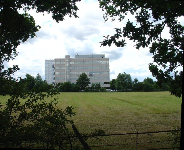
Ewhurst Wood is a picturesque woodland located in the county of Sussex, England. Spread over an area of approximately 150 acres, it is a part of the High Weald Area of Outstanding Natural Beauty. With its diverse ecosystem, Ewhurst Wood is a haven for nature enthusiasts and a popular destination for walkers, hikers, and birdwatchers.

The wood is predominantly made up of deciduous trees, including oak, beech, ash, and birch, interspersed with patches of coniferous trees such as pine and spruce. This mix of trees provides a rich habitat for a wide range of flora and fauna. Bluebells carpet the forest floor in the spring, creating a stunning display of vibrant colors.

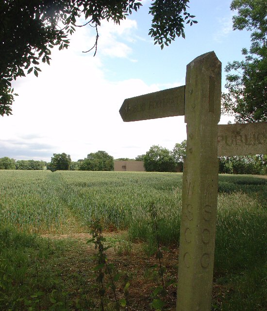
A network of well-maintained footpaths crisscrosses Ewhurst Wood, allowing visitors to explore its beauty at their own pace. The paths meander through ancient woodland, leading to hidden glades, bubbling streams, and serene ponds. The wood is also home to a variety of wildlife, including deer, foxes, badgers, and a multitude of bird species such as woodpeckers, owls, and warblers.

Ewhurst Wood offers visitors a peaceful and tranquil environment, making it an ideal place for both relaxation and recreation. It is a designated Site of Special Scientific Interest (SSSI) due to its ecological significance and is managed by a local conservation organization to preserve its natural heritage.

Throughout the year, Ewhurst Wood hosts various events and guided walks to educate visitors about its conservation efforts and the importance of preserving ancient woodlands. With its natural beauty and abundant wildlife, Ewhurst Wood truly encapsulates the essence of Sussex's enchanting countryside.

If you have any feedback on the listing, please let us know in the comments section below.

Ewhurst Wood Images

Images are sourced within 2km of 51.12319/-0.1975466 or Grid Reference TQ2637. Thanks to Geograph Open Source API. All images are credited.

The Hawth The Arts Centre in Crawley. Taken during the annual juggling convention held there (in 1999 in this case)
The Hawth
The Arts Centre in Crawley. Taken during the annual juggling convention held there (in 1999 in this case)
Crawley shops Always busy with a full range of shops.
Crawley shops
Always busy with a full range of shops.
Ifield Barn Theatre Converted Barn next to St Margaret's XIIIth Century church, now home to amateur theatre company
Ifield Barn Theatre
Converted Barn next to St Margaret's XIIIth Century church, now home to amateur theatre company
St Margaret's Church Thirteenth Century church in old Ifield Village, now  tucked into a corner of Crawley New Town
St Margaret's Church
Thirteenth Century church in old Ifield Village, now tucked into a corner of Crawley New Town
Ifield Community College One of Crawley's comprehensive schools. Originally opened as a combined Grammar and Secondary Modern school it was demolished in 2005 following the re-building of the school on the same campus.
Ifield Community College
One of Crawley's comprehensive schools. Originally opened as a combined Grammar and Secondary Modern school it was demolished in 2005 following the re-building of the school on the same campus.
Ifield Station Formerly Ifield Halt, now serves the west of Crawley New Town
Ifield Station
Formerly Ifield Halt, now serves the west of Crawley New Town
Crawley Signal Box 19th Century Signal Box on Horsham branch line. The box is now out of use following automation, although  it is subject to a preservation order, and is cared for by a local society.
Crawley Signal Box
19th Century Signal Box on Horsham branch line. The box is now out of use following automation, although it is subject to a preservation order, and is cared for by a local society.
St Wilfrid's RC School Catholic Comprehensive School, Crawley
St Wilfrid's RC School
Catholic Comprehensive School, Crawley
County Mall Shopping Centre Shopping Mall opened in 1992
County Mall Shopping Centre
Shopping Mall opened in 1992
Crawley College College of Further Education
Crawley College
College of Further Education
Crawley Station Crawley Station, with Overline House above. The station was relocated here in the late 1960s from a former site 500yds further west.
Crawley Station
Crawley Station, with Overline House above. The station was relocated here in the late 1960s from a former site 500yds further west.
Ye Olde Punche Bowle A 15th century building which has many previous uses, including as a branch of Natwest Bank. It is currently in use as a public house
Ye Olde Punche Bowle
A 15th century building which has many previous uses, including as a branch of Natwest Bank. It is currently in use as a public house
Crawley Hospital View from South
Crawley Hospital
View from South
Manor Royal Industrial Estate, Crawley, West Sussex - Lunch Time Manor Royal Industrial Estate dominates Grid square TQ2738. The industries are varied and include various types of light to medium weight engineering, pharmaceuticals, administrative head offices, storage, etc. The view here shows one of the many snack bars that are found at strategic points round the estate. Most of the larger premises include on-site catering for employees, but there are many small companies who don't.
Manor Royal Industrial Estate, Crawley, West Sussex - Lunch Time
Manor Royal Industrial Estate dominates Grid square TQ2738. The industries are varied and include various types of light to medium weight engineering, pharmaceuticals, administrative head offices, storage, etc. The view here shows one of the many snack bars that are found at strategic points round the estate. Most of the larger premises include on-site catering for employees, but there are many small companies who don't.
County Oak Retail Park, Crawley, West Sussex The largest of several small retail parks in Crawley that are situated away from the town centre. Carpets, Furniture, Consumer electronics and electrical items, Office supplies, motoring and cycling spares, pet supplies, and a motor vehicle tyre and exhaust replacement service are all represented.
County Oak Retail Park, Crawley, West Sussex
The largest of several small retail parks in Crawley that are situated away from the town centre. Carpets, Furniture, Consumer electronics and electrical items, Office supplies, motoring and cycling spares, pet supplies, and a motor vehicle tyre and exhaust replacement service are all represented.
Astral Towers, County Oak, Crawley, West Sussex The centre of Manor Royal industrial estate contains most of the light and medium industrial premises. Various clusters of administrative offices form satellites surrounding the main estate. One such satellite is at County Oak, just across the A23 trunk road from the main estate. A typical office block is Astral Towers.
Astral Towers, County Oak, Crawley, West Sussex
The centre of Manor Royal industrial estate contains most of the light and medium industrial premises. Various clusters of administrative offices form satellites surrounding the main estate. One such satellite is at County Oak, just across the A23 trunk road from the main estate. A typical office block is Astral Towers.
Pasture between Manor Royal Industrial Estate and Gatwick Airport, Near Crawley, West Sussex "The Atrium" office block in the background is on the extreme fringe of the Manor Royal Industrial Estate. The view has been taken from a public bridleway across a field, looking south. Most of this grid square is comprised of fields such as this. There are currently (2005) plans being discussed for a second runway for Gatwick Airport. One of the options would have the proposed runway in this area.
Pasture between Manor Royal Industrial Estate and Gatwick Airport, Near Crawley, West Sussex
"The Atrium" office block in the background is on the extreme fringe of the Manor Royal Industrial Estate. The view has been taken from a public bridleway across a field, looking south. Most of this grid square is comprised of fields such as this. There are currently (2005) plans being discussed for a second runway for Gatwick Airport. One of the options would have the proposed runway in this area.
Public Footpath across fields between County Oak and Rowley Farm, Near Crawley, West Sussex. One of several long standing public rights of way in this area. This path has been in use since long before the creation of the Manor Royal Industrial Estate, immediately behind the photographer and Gatwick Airport (1.5km N of here). The path cuts diagonally SW-NE across the fields, which are growing wheat. This area is currently (2005) being suggested as a possible location for a second runway for Gatwick International Airport.
Public Footpath across fields between County Oak and Rowley Farm, Near Crawley, West Sussex.
One of several long standing public rights of way in this area. This path has been in use since long before the creation of the Manor Royal Industrial Estate, immediately behind the photographer and Gatwick Airport (1.5km N of here). The path cuts diagonally SW-NE across the fields, which are growing wheat. This area is currently (2005) being suggested as a possible location for a second runway for Gatwick International Airport.
Show me another place!

Ewhurst Wood is located at Grid Ref: TQ2637 (Lat: 51.12319, Lng: -0.1975466)

Administrative County: West Sussex

District: Crawley

Police Authority: Sussex

What 3 Words

///rock.speak.bridge. Near Langley Green, West Sussex

Related Wikis

West Green, West Sussex

West Green is one of the 14 residential neighbourhoods in Crawley, a town and borough in West Sussex, England. Crawley was planned and laid out as a New...

Noor Mosque, Crawley

Noor mosque is an Ahmadi mosque in Crawley in the borough of West Sussex, England. The mosque was opened on 18 January 2014. == References ==

Ifield, West Sussex

Ifield is a former village and now one of 14 neighbourhoods within the town of Crawley in West Sussex, England. Ifield is in the west of the town and...
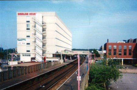
Crawley Hospital

Crawley Hospital is a National Health Service hospital in Crawley, a town and borough in West Sussex, England. Since 2006 it has been part of the Sussex...

Dyers Almshouses

The Dyers Almshouses are a group of 30 almshouses belonging to the Worshipful Company of Dyers, a London Livery Company. Built in three stages between...

Tree House, Crawley

Tree House, also known as The Tree, is a medieval timber-framed house on the High Street in Crawley, a town and borough in West Sussex, England. It is...
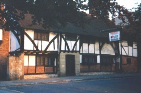
Old Punch Bowl

The Old Punch Bowl is a medieval timber-framed Wealden hall house on the High Street in Crawley, a town and borough in West Sussex, England. Built in...
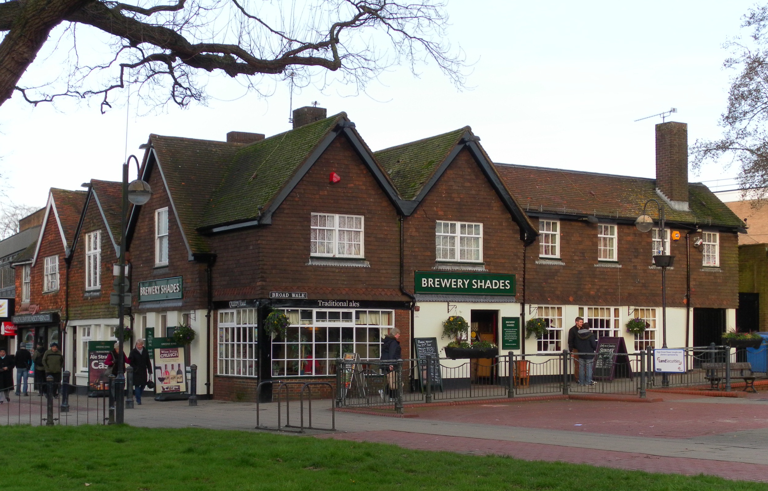
Brewery Shades

The Brewery Shades is a public house on the High Street in Crawley, a town and borough in West Sussex, England. The building, which stands on a corner...

Nearby Amenities

Located within 500m of 51.12319,-0.1975466
Crossing
Bicycle: yes
Crossing: traffic_signals
Crossing Island: no
Foot: yes
Lat/Long: 51.1216379/-0.1984534
Fuel
Sainsbury's
Brand: Sainsbury's
Brand Wikidata: Q152096
Brand Wikipedia: en:Sainsbury's
Opening Hours: Mo-Sa 05:00-23:59; Su 06:00-23:59
Website: https://stores.sainsburys.co.uk/0188/west-green-petrol-station
Lat/Long: 51.1227774/-0.1948598
Crossing
Crossing: uncontrolled
Crossing Island: yes
Kerb: lowered
Tactile Paving: yes
Lat/Long: 51.1192003/-0.1991341
Mini Roundabout
Direction: clockwise
Lat/Long: 51.1189207/-0.1991639
Crossing
Crossing: uncontrolled
Crossing Island: yes
Kerb: lowered
Tactile Paving: yes
Lat/Long: 51.1188336/-0.1990502
Turning Circle
Lat/Long: 51.1193668/-0.2013226
Noexit: yes
Lat/Long: 51.1253864/-0.2022276
Noexit: yes
Lat/Long: 51.1213364/-0.1976467
Crawley Labour Supporters Club
Building: yes
Lat/Long: 51.1214172/-0.1962879
Post Box
Brand: Royal Mail
Brand Wikidata: Q638098
Brand Wikipedia: en:Royal Mail
Collection Times: Mo-Fr 09:00; Sa 07:00
Operator: Royal Mail
Operator Wikidata: Q638098
Ref: RH11 83
Lat/Long: 51.124817/-0.1964864
Crossing
Button Operated: yes
Crossing: traffic_signals
Crossing Island: no
Crossing Ref: toucan
Kerb: flush
Tactile Paving: yes
Traffic Signals Sound: yes
Lat/Long: 51.1229523/-0.2001403
Entrance: yes
Lat/Long: 51.1229599/-0.1927712
Crossing
Lat/Long: 51.1230215/-0.1926628
Crossing
Lat/Long: 51.1234656/-0.1911518
Entrance: yes
Lat/Long: 51.1227003/-0.1909138
Recycling
Lat/Long: 51.1235782/-0.1926954
Bus Stop
Ifield Drive
Bench: no
Bin: yes
Bus: yes
Bus Bay: no
Naptan AtcoCode: 4400CY0117
Naptan Bearing: NW
Naptan CommonName: Ifield Drive
Naptan Indicator: adj
Naptan Landmark: Ifield Drive
Naptan NaptanCode: wsxajtam
Naptan PlusbusZoneRef: CRAWLEY
Naptan ShortCommonName: Ifield Drive
Naptan Street: Ifield Avenue
Naptan Verified: no
Passenger Information Display: no
Public Transport: platform
Shelter: no
Source: naptan_import
Lat/Long: 51.1232866/-0.2006448
Bus Stop
Ifield Drive
Bench: yes
Bin: yes
Bus: yes
Bus Bay: yes
Naptan AtcoCode: 4400CY0118
Naptan Bearing: SE
Naptan CommonName: Ifield Drive
Naptan Indicator: opp
Naptan Landmark: Ifield Drive
Naptan NaptanCode: wsxajtap
Naptan PlusbusZoneRef: CRAWLEY
Naptan ShortCommonName: Ifield Drive
Naptan Street: Ifield Avenue
Naptan Verified: no
Passenger Information Display: no
Public Transport: platform
Shelter: yes
Source: naptan_import
Lat/Long: 51.123128/-0.2002411
Bus Stop
Stagelands
Bench: no
Bus: yes
Bus Bay: no
Naptan AtcoCode: 4400CY0279
Naptan Bearing: S
Naptan CommonName: Stagelands
Naptan Indicator: outside number 32
Naptan Landmark: Hare Lane
Naptan NaptanCode: wsxamdjg
Naptan PlusbusZoneRef: CRAWLEY
Naptan ShortCommonName: Stagelands
Naptan Street: Stagelands
Naptan Verified: no
Public Transport: platform
Shelter: no
Source: naptan_import
Lat/Long: 51.1252901/-0.2012403
Bus Stop
Stagelands
Bus: yes
Naptan AtcoCode: 4400CY0280
Naptan Bearing: N
Naptan CommonName: Stagelands
Naptan Indicator: adj Hare Lane
Naptan Landmark: Hare Lane
Naptan NaptanCode: wsxamdjm
Naptan PlusbusZoneRef: CRAWLEY
Naptan ShortCommonName: Stagelands
Naptan Street: Stagelands
Naptan Verified: no
Public Transport: platform
Source: naptan_import
Lat/Long: 51.1257588/-0.2010732
Bus Stop
Langley Parade
Bus: yes
Local Ref: C
Naptan AtcoCode: 4400CY0282
Naptan Bearing: W
Naptan CommonName: Langley Parade
Naptan Indicator: o/s School
Naptan Landmark: Langley Drive
Naptan NaptanCode: wsxamdjt
Naptan PlusbusZoneRef: CRAWLEY
Naptan ShortCommonName: Langley Parade
Naptan Street: Langley Parade
Naptan Verified: no
Public Transport: platform
Source: naptan_import
Lat/Long: 51.1276416/-0.1980418
Bus Stop
Swallow Road
Bus: yes
Naptan AtcoCode: 4400CY0283
Naptan Bearing: NW
Naptan CommonName: Swallow Road
Naptan Indicator: adj Swallow Road
Naptan Landmark: Swallow Road
Naptan NaptanCode: wsxamdjw
Naptan PlusbusZoneRef: CRAWLEY
Naptan ShortCommonName: Swallow Road
Naptan Street: Langley Drive
Naptan Verified: no
Public Transport: platform
Source: naptan_import
Lat/Long: 51.1266519/-0.1958155
Bus Stop
Swallow Road
Bus: yes
Naptan AtcoCode: 4400CY0284
Naptan Bearing: E
Naptan CommonName: Swallow Road
Naptan Indicator: opposite Swallow Road
Naptan Landmark: Swallow Road
Naptan NaptanCode: wsxamdma
Naptan PlusbusZoneRef: CRAWLEY
Naptan ShortCommonName: Swallow Road
Naptan Street: Langley Drive
Naptan Verified: no
Public Transport: platform
Source: naptan_import
Lat/Long: 51.1265885/-0.194798
Bus Stop
Ambulance Station
Bus: yes
Bus Bay: yes
Naptan AtcoCode: 4400CY0330
Naptan Bearing: E
Naptan CommonName: Ambulance Station
Naptan Indicator: o/s Amubulance Station
Naptan Landmark: Ewhurst Road
Naptan NaptanCode: wsxamgjp
Naptan PlusbusZoneRef: CRAWLEY
Naptan ShortCommonName: Ambulance Station
Naptan Street: Ifield Avenue
Naptan Verified: no
Public Transport: platform
Source: naptan_import
Lat/Long: 51.1211634/-0.1972117
Bus Stop
Ambulance Station
Bus: yes
Naptan AtcoCode: 4400CY0331
Naptan Bearing: W
Naptan CommonName: Ambulance Station
Naptan Indicator: opposite Ambulance Station
Naptan Landmark: Ewhurst Road
Naptan NaptanCode: wsxamgjt
Naptan PlusbusZoneRef: CRAWLEY
Naptan ShortCommonName: Ambulance Station
Naptan Street: Ifield Avenue
Naptan Verified: yes
Public Transport: platform
Shelter: yes
Source: naptan_import
Lat/Long: 51.121242/-0.1977353
Bus Stop
A23 Ambulance Station
Bus: yes
Naptan AtcoCode: 4400CY0332
Naptan Bearing: NE
Naptan CommonName: A23 Ambulance Station
Naptan Indicator: Towards Gatwick
Naptan Landmark: Ifield Avenue - ambulance station Rounda
Naptan NaptanCode: wsxamgjw
Naptan PlusbusZoneRef: CRAWLEY
Naptan ShortCommonName: A23 Ambulance Station
Naptan Street: A23
Naptan Verified: no
Public Transport: platform
Shelter: no
Source: naptan_import
Lat/Long: 51.1224546/-0.1979894
Bus Stop
Ewhurst Road
Addr City: Crawley
Addr Street: West Green Drive
Bench: yes
Bus: yes
Naptan AtcoCode: 4400CY0334
Naptan Bearing: SE
Naptan CommonName: Ewhurst Road
Naptan Indicator: opp
Naptan Landmark: Ewhurst Road
Naptan NaptanCode: wsxamgmd
Naptan PlusbusZoneRef: CRAWLEY
Naptan ShortCommonName: Ewhurst Road
Naptan Street: West Green Drive
Naptan Verified: no
Public Transport: platform
Shelter: yes
Source: naptan_import
Wheelchair: yes
Wheelchair Description: Step-free to stop opposite and shops via island refuges at roundabout.
Lat/Long: 51.1188107/-0.1988915
Fishing
Shop: sports
Lat/Long: 51.119121/-0.200123
West Green Newsagent
Shop: newsagent
Lat/Long: 51.11916/-0.199418
Post Box
Brand: Royal Mail
Brand Wikidata: Q638098
Brand Wikipedia: en:Royal Mail
Collection Times: Mo-Fr 17:45; Sa 11:00
Note: inside store
Operator: Royal Mail
Operator Wikidata: Q638098
Post Box Type: pillar
Ref: RH11 15
Royal Cypher: EIIR
Royal Cypher Wikidata: Q33102113
Source: P174-0202
Lat/Long: 51.12282/-0.192827
Crawley Horticultural Soc'y
Building: yes
Lat/Long: 51.1211643/-0.1966312
Noexit: yes
Lat/Long: 51.1227356/-0.2006602
T&N MOTs
Addr City: Crawley
Addr Postcode: RH11 7HA
Addr Street: Reynolds Road
Email: tn.mots@hotmail.com
Phone: +44 1293 270 530
Shop: car_repair
Lat/Long: 51.119831/-0.1999461
Addr City: Crawley
Addr Country: GB
Addr Housename: Warwick House
Addr Postcode: RH11 7HA
Addr Street: Reynolds Road
Lat/Long: 51.1196703/-0.2001556
Addr City: Crawley
Addr Country: GB
Addr Housenumber: 102
Addr Postcode: RH11 7JR
Addr Street: Deerswood Road
Lat/Long: 51.1201933/-0.1992095
Addr City: Crawley
Addr Country: GB
Addr Housenumber: 108
Addr Postcode: RH11 7JR
Addr Street: Deerswood Road
Lat/Long: 51.1201501/-0.1989345
Addr City: Crawley
Addr Country: GB
Addr Housenumber: 110
Addr Postcode: RH11 7JR
Addr Street: Deerswood Road
Lat/Long: 51.1201126/-0.1984735
Addr City: Crawley
Addr Country: GB
Addr Housenumber: 116
Addr Postcode: RH11 7JR
Addr Street: Deerswood Road
Lat/Long: 51.1200765/-0.1982306
Addr City: Crawley
Addr Country: GB
Addr Housenumber: 31
Addr Postcode: RH11 7JP
Addr Street: Deerswood Road
Lat/Long: 51.1197902/-0.2017046
Addr City: Crawley
Addr Country: GB
Addr Housenumber: 37
Addr Postcode: RH11 7JP
Addr Street: Deerswood Road
Lat/Long: 51.1199684/-0.2017664
Addr City: Crawley
Addr Country: GB
Addr Housenumber: 51
Addr Postcode: RH11 7HH
Addr Street: Ewhurst Road
Lat/Long: 51.1195799/-0.1985033
Addr City: Crawley
Addr Country: GB
Addr Housenumber: 67
Addr Postcode: RH11 7JP
Addr Street: Deerswood Road
Lat/Long: 51.1200649/-0.1996459
Addr City: Crawley
Addr Country: GB
Addr Housenumber: 68
Addr Postcode: RH11 7HE
Addr Street: Ewhurst Road
Lat/Long: 51.119375/-0.1991279
Addr City: Crawley
Addr Country: GB
Addr Housenumber: 73
Addr Postcode: RH11 7JP
Addr Street: Deerswood Road
Lat/Long: 51.1200277/-0.1992906
Addr City: Crawley
Addr Country: GB
Addr Housenumber: 78
Addr Postcode: RH11 7HE
Addr Street: Reynolds Road
Lat/Long: 51.1195516/-0.1989497
Addr City: Crawley
Addr Country: GB
Addr Housenumber: 92
Addr Postcode: RH11 7JR
Addr Street: Deerswood Road
Lat/Long: 51.1203097/-0.1997773
Addr City: Crawley
Addr Country: GB
Addr Housenumber: 94
Addr Postcode: RH11 7JR
Addr Street: Deerswood Road
Lat/Long: 51.1202934/-0.1996703
Recycling
Recycling Cans: yes
Recycling Clothes: yes
Recycling Foil: yes
Recycling Glass: yes
Recycling Paper: yes
Recycling Type: container
Lat/Long: 51.1187591/-0.1986439
Toilets
Fee: no
Wheelchair: ramp: female only
Lat/Long: 51.1188491/-0.1987489
Bench
Backrest: yes
Seats: 3
Lat/Long: 51.1188699/-0.1989458
Pharmacy
Day Lewis Pharmacy
Addr City: Crawley
Addr Housenumber: 52
Addr Postcode: RH11 7HE
Addr Street: Ewhurst Road
Brand: Day Lewis Pharmacy
Brand Wikidata: Q62563772
Dispensing: yes
Healthcare: pharmacy
Phone: +44 1293 400848
Wheelchair: yes
Wheelchair Description: Step-free, slight ramp. No Hearing Loop.
Lat/Long: 51.1189077/-0.1997119
Fire Hydrant
Emergency: fire_hydrant
Fire Hydrant Diameter: 100
Fire Hydrant Position: sidewalk
Fire Hydrant Type: underground
Lat/Long: 51.1194623/-0.1990379
Crossing
Crossing: unmarked
Crossing Markings: no
Kerb: lowered
Tactile Paving: yes
Lat/Long: 51.1195468/-0.1987151
Barrier: cycle_barrier
Bicycle: no
Foot: yes
Lat/Long: 51.1196328/-0.200686
Crossing
Crossing: unmarked
Crossing Markings: no
Kerb: lowered
Tactile Paving: no
Wheelchair: yes
Lat/Long: 51.1198684/-0.202147
Post Box
Ref: RH11 70
Lat/Long: 51.1199631/-0.2019514
Fire Hydrant
Emergency: fire_hydrant
Fire Hydrant Diameter: 100
Fire Hydrant Position: lane
Fire Hydrant Type: underground
Lat/Long: 51.1200484/-0.1989102
Bench
Lat/Long: 51.1208981/-0.192583
Waste Basket
Lat/Long: 51.1213127/-0.1921776
Bench
Backrest: yes
Seats: 3
Source: gps
Lat/Long: 51.1214158/-0.19204
Post Box
West Green Parade
Brand: Royal Mail
Brand Wikidata: Q638098
Brand Wikipedia: en:Royal Mail
Collection Times: Mo-Fr 17:30; Sa 11:45
Operator: Royal Mail
Operator Wikidata: Q638098
Post Box Type: pillar
Ref: RH11 14
Royal Cypher: EIIR
Royal Cypher Wikidata: Q33102113
Source: survey
Lat/Long: 51.1191991/-0.199382
Atm
Brand: Sainsbury's Bank
Brand Wikidata: Q7400525
Brand Wikipedia: en:Sainsbury's Bank
Network: Link
Operator: Sainsbury's Bank
Operator Wikidata: Q7400525
Wheelchair: yes
Lat/Long: 51.122733/-0.1926195
Atm
Brand: Sainsbury's Bank
Brand Wikidata: Q7400525
Brand Wikipedia: en:Sainsbury's Bank
Network: Link
Operator: Sainsbury's Bank
Operator Wikidata: Q7400525
Wheelchair: yes
Lat/Long: 51.1227585/-0.1926342
Newsagent
Addr City: Crawley
Addr Housenumber: 64
Addr Postcode: RH11 7HE
Addr Street: Ewhurst Road
Shop: convenience
Wheelchair: yes
Wheelchair Description: Step free, slight ramp
Lat/Long: 51.1192219/-0.199445
Toilets
Public Toilet
Addr City: Crawley
Addr Street: West Green Road
Toilets Wheelchair: yes
Wheelchair: yes
Wheelchair Description: Step free with railings. RADAR key?
Lat/Long: 51.1189096/-0.1987436
Fast Food
Golden City
Addr City: Crawley
Addr Housenumber: 54
Addr Postcode: RH11 7HE
Addr Street: Ewhurst Road
Phone: +44 1293 562888
Website: http://www.goldencitycrawley.co.uk
Wheelchair: yes
Wheelchair Description: Step free, slight ramp
Lat/Long: 51.1189929/-0.1996864
Fast Food
West Green Fish Bar
Addr City: Crawley
Addr Housenumber: 56
Addr Postcode: RH11 7HE
Addr Street: Ewhurst Road
Wheelchair: yes
Wheelchair Description: Step free, slight ramp
Lat/Long: 51.1190434/-0.1996435
Fast Food
Pop Inn Cafe
Addr City: Crawley
Addr Housenumber: 58
Addr Postcode: RH11 7HE
Addr Street: Ewhurst Road
Wheelchair: yes
Wheelchair Description: Step free, slight ramp
Lat/Long: 51.1191041/-0.1995738
Revive
Addr City: Crawley
Addr Housenumber: 60
Addr Postcode: RH11 7HE
Addr Street: Ewhurst Road
Phone: +44 1293 450178
Shop: hairdresser
Website: http://www.revivehair.co.uk
Wheelchair: yes
Wheelchair Description: Step free, slight ramp
Lat/Long: 51.1191445/-0.1995255
Archy's Food and Wine
Addr City: Crawley
Addr Housenumber: 62
Addr Postcode: RH11 7HE
Addr Street: Ewhurst Road
Shop: alcohol
Wheelchair: yes
Wheelchair Description: Step free, slight ramp
Lat/Long: 51.1191849/-0.1994933
Noexit: yes
Lat/Long: 51.1240047/-0.1979972
Noexit: yes
Lat/Long: 51.1237415/-0.1984259
Washout Hydrant
Fire Hydrant
Emergency: fire_hydrant
Fire Hydrant Type: underground
Survey Date: 2018-11-11
Water Source: main
Lat/Long: 51.126352/-0.1932362
Barrier: cycle_barrier
Cycle Barrier: double
Lat/Long: 51.1223009/-0.1932577
Bench
Backrest: yes
Seats: 3
Source: gps
Lat/Long: 51.1220663/-0.1926631
Waste Basket
Source: gps
Lat/Long: 51.1217784/-0.1919228
Doctors
Leacroft Medical Practice
Addr Postcode: RH11 7TF
Addr Street: Langley Drive
Healthcare: doctor
Opening Hours: Mo-Fr 08:00-18:00
Phone: +44 1293 574 747
Website: https://www.leacroft.co.uk/
Lat/Long: 51.1274116/-0.1978032
Crossing
Crossing: unmarked
Crossing Island: no
Crossing Markings: no
Kerb: lowered
Tactile Paving: yes
Lat/Long: 51.1245667/-0.2024471
Crossing
Crossing: unmarked
Crossing Island: no
Crossing Markings: no
Kerb: flush
Tactile Paving: yes
Traffic Calming: table
Lat/Long: 51.1245234/-0.2021703
Post Box
Brand: Royal Mail
Brand Wikidata: Q638098
Brand Wikipedia: en:Royal Mail
Collection Times: Mo-Fr 09:00; Sa 07:00
Operator: Royal Mail
Operator Wikidata: Q638098
Post Box Type: lamp
Ref: RH11 84D
Royal Cypher: EIIR
Royal Cypher Wikidata: Q33102113
Lat/Long: 51.1257851/-0.2010436
The Range
Addr Housenumber: 1
Addr Postcode: RH10 8NF
Addr Street: Crawley Avenue
Brand: The Range
Brand Wikidata: Q7759409
Brand Wikipedia: en:The Range (retailer)
Internet Access: wlan
Opening Hours: Mo-Sa 08:00-20:00; Su 10:00-16:00
Operator: The Range
Payment Cash: yes
Phone: +44 1293 513185
Shop: houseware
Website: https://www.therange.co.uk/stores/crawley
Lat/Long: 51.1224682/-0.1910467
Crossing
Lat/Long: 51.1276282/-0.1982709
Noexit: yes
Lat/Long: 51.124653/-0.1997004
Noexit: yes
Lat/Long: 51.125133/-0.201956
Barrier: bollard
Lat/Long: 51.1220307/-0.2040319
Addr City: Crawley
Addr Country: GB
Addr Housenumber: 35
Addr Postcode: RH11 7JP
Addr Street: Deerswood Road
Lat/Long: 51.1199215/-0.2017544
Addr City: Crawley
Addr Country: GB
Addr Housenumber: 33
Addr Postcode: RH11 7JP
Addr Street: Deerswood Road
Lat/Long: 51.1198583/-0.2017343
Traffic Signals
Crossing: no
Traffic Signals Direction: forward
Lat/Long: 51.122784/-0.2001887
Traffic Signals
Crossing: no
Traffic Signals Direction: forward
Lat/Long: 51.1229859/-0.2001786
Noexit: yes
Lat/Long: 51.1231947/-0.2003107
Traffic Signals
Crossing: no
Lat/Long: 51.1227082/-0.1999721
Traffic Signals
Crossing: no
Traffic Signals Direction: backward
Lat/Long: 51.1227556/-0.1998974
Crossing
Bicycle: yes
Button Operated: yes
Crossing: traffic_signals
Crossing Island: no
Crossing Ref: toucan
Kerb: flush
Tactile Paving: yes
Traffic Signals Sound: yes
Lat/Long: 51.1228084/-0.2001373
Crossing
Bicycle: yes
Button Operated: yes
Crossing: traffic_signals
Crossing Island: no
Crossing Ref: toucan
Kerb: flush
Tactile Paving: yes
Traffic Signals Sound: yes
Traffic Signals Vibration: yes
Lat/Long: 51.1227955/-0.1999354
Crossing
Bicycle: yes
Button Operated: yes
Crossing: traffic_signals
Crossing Island: no
Crossing Ref: toucan
Kerb: flush
Tactile Paving: yes
Traffic Signals Sound: yes
Lat/Long: 51.1227296/-0.2000513
Pharmacy
Lloyds Pharmacy
Branch: paharmacy
Brand: Lloyds Pharmacy
Brand Wikidata: Q6662870
Brand Wikipedia: en:LloydsPharmacy
Dispensing: yes
Drive Through: no
Healthcare: pharmacy
Opening Hours: Mo-Sa 09:00-21:00; Su 10:00-16:00
Lat/Long: 51.1229935/-0.193417
Defibrillator
Access: yes
Defibrillator Location: Inside front door of Sainsbury's Store
Emergency: defibrillator
Indoor: yes
Lat/Long: 51.1230157/-0.1928684
Noexit: yes
Lat/Long: 51.1237784/-0.1994035
Noexit: yes
Lat/Long: 51.1237553/-0.1995409
Noexit: yes
Lat/Long: 51.1240852/-0.1997682
Crossing
Crossing: unmarked
Crossing Island: no
Crossing Markings: no
Kerb: lowered
Tactile Paving: no
Lat/Long: 51.1240974/-0.2002799
Noexit: yes
Lat/Long: 51.1251673/-0.1987812
Crossing
Crossing: unmarked
Crossing Island: no
Crossing Markings: no
Kerb: lowered
Tactile Paving: yes
Lat/Long: 51.1261478/-0.2004877
Crossing
Crossing: unmarked
Crossing Island: no
Crossing Markings: no
Kerb: lowered
Tactile Paving: no
Lat/Long: 51.1257597/-0.1995298
Crossing
Crossing: unmarked
Crossing Island: no
Crossing Markings: no
Kerb: lowered
Tactile Paving: no
Lat/Long: 51.1252241/-0.1979973
Crossing
Crossing: unmarked
Crossing Island: no
Crossing Markings: no
Kerb: lowered
Tactile Paving: no
Lat/Long: 51.1249169/-0.1971598
Noexit: yes
Lat/Long: 51.1247461/-0.1977442
Crossing
Crossing: unmarked
Crossing Island: no
Crossing Markings: no
Kerb: lowered
Tactile Paving: yes
Lat/Long: 51.1246332/-0.20041
Noexit: yes
Lat/Long: 51.1242254/-0.1977204
Crossing
Crossing: unmarked
Crossing Island: no
Crossing Markings: no
Kerb: lowered
Tactile Paving: yes
Lat/Long: 51.1225158/-0.2012005
Crossing
Crossing: unmarked
Crossing Island: no
Crossing Markings: no
Kerb: lowered
Tactile Paving: yes
Lat/Long: 51.1243483/-0.2020843
Crossing
Crossing: unmarked
Crossing Island: no
Crossing Markings: no
Kerb: lowered
Tactile Paving: yes
Lat/Long: 51.1238402/-0.2013152
Noexit: yes
Lat/Long: 51.1242662/-0.2013367
Entrance: main
Lat/Long: 51.1255785/-0.2000416
Entrance: main
Lat/Long: 51.1239931/-0.1978823
Entrance: main
Lat/Long: 51.1241769/-0.1976168
Crossing
Lat/Long: 51.1275732/-0.1988965
Entrance: yes
Lat/Long: 51.1248299/-0.1958958
Crossing
Lat/Long: 51.1273081/-0.1969858
Crossing
Crossing: unmarked
Crossing Island: yes
Crossing Markings: no
Kerb: lowered
Lat/Long: 51.1251516/-0.2034321
Entrance: yes
Lat/Long: 51.1266604/-0.2005325
Crossing
Lat/Long: 51.12591/-0.2019717
Crossing
Lat/Long: 51.1262874/-0.2024142
Crossing
Lat/Long: 51.1253863/-0.2030783
Entrance: yes
Lat/Long: 51.1254734/-0.201429
The data included in this document is from www.openstreetmap.org. The data is made available under ODbL.

Have you been to Ewhurst Wood?

Leave your review of Ewhurst Wood below (or comments, questions and feedback).