Bradley

Settlement in Gloucestershire Stroud

England

Bradley

Cut Mark: Wotton-under-Edge, Long Street, Carlton House Cut bench mark on the frontage of the house.  See <a title="https://www.geograph.org.uk/photo/7070432" href="https://www.geograph.org.uk/photo/7070432">Link</a> for a wider view and <span class="nowrap"><a title="https://www.bench-marks.org.uk/bm59141" rel="nofollow ugc noopener" href="https://www.bench-marks.org.uk/bm59141">Link</a><img style="margin-left:2px;" alt="External link" title="External link - shift click to open in new window" src="https://s1.geograph.org.uk/img/external.png" width="10" height="10"/></span> for details of the mark.
Cut Mark: Wotton-under-Edge, Long Street, Carlton House Credit: Brian Westlake

Bradley is a small village located in the county of Gloucestershire, in the southwest region of England. It is situated about 6 miles south of the larger town of Stroud. With a population of around 500 residents, Bradley is a tight-knit community that offers a peaceful and rural environment.

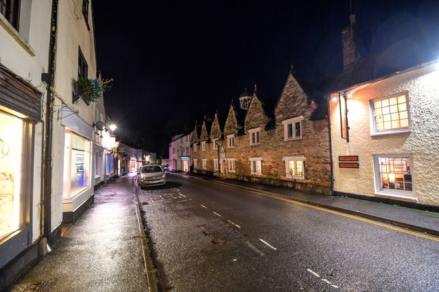
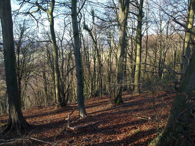
The village is characterized by its picturesque countryside surroundings, with rolling hills, lush green fields, and charming farmland. It is known for its natural beauty, providing residents and visitors with ample opportunities for outdoor activities such as hiking, cycling, and horseback riding.

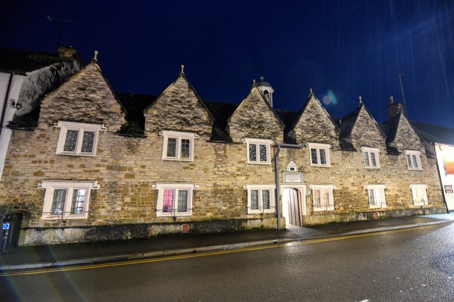
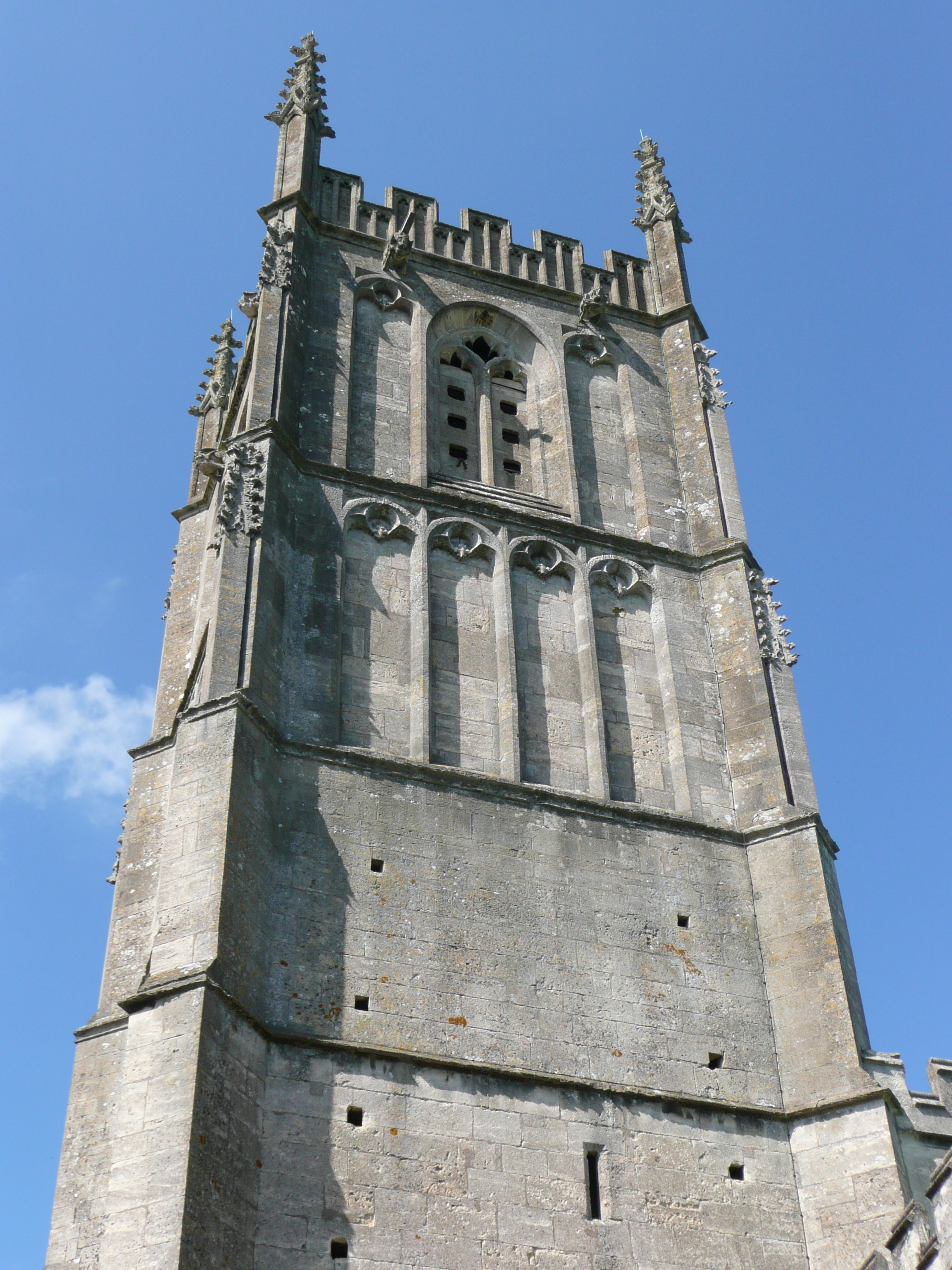
One of the notable landmarks in Bradley is the St. George's Church, which dates back to the 12th century. This historical building showcases beautiful architectural features and serves as a gathering place for religious services and community events.

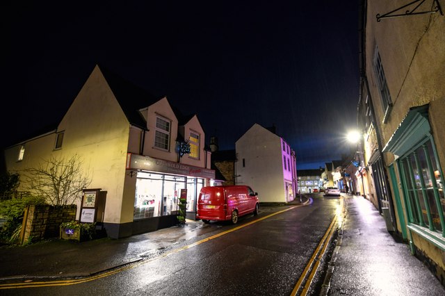
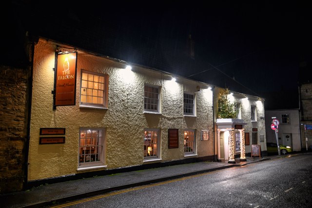
Despite its small size, Bradley offers some amenities to its residents. These include a local pub, which serves as a social hub for the village, and a small convenience store for basic supplies. For more extensive shopping needs, residents can easily access nearby towns and cities.

The village has a strong sense of community spirit, with various events and gatherings organized throughout the year. This includes a summer fete, Christmas celebrations, and other fundraisers that bring residents together.

Overall, Bradley, Gloucestershire, is a quintessential English village that offers a tranquil and close-knit community, surrounded by beautiful countryside and steeped in history.

If you have any feedback on the listing, please let us know in the comments section below.
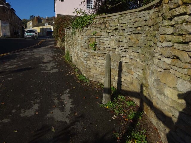
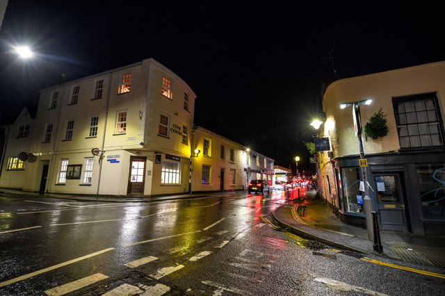
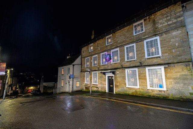
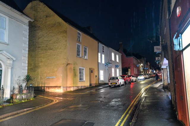
Bradley Images

Images are sourced within 2km of 51.64094/-2.367604 or Grid Reference ST7493. Thanks to Geograph Open Source API. All images are credited.

Cut Mark: Wotton-under-Edge, Long Street, Carlton House Cut bench mark on the frontage of the house.  See <a title="https://www.geograph.org.uk/photo/7070432" href="https://www.geograph.org.uk/photo/7070432">Link</a> for a wider view and <span class="nowrap"><a title="https://www.bench-marks.org.uk/bm59141" rel="nofollow ugc noopener" href="https://www.bench-marks.org.uk/bm59141">Link</a><img style="margin-left:2px;" alt="External link" title="External link - shift click to open in new window" src="https://s1.geograph.org.uk/img/external.png" width="10" height="10"/></span> for details of the mark.
Cut Mark: Wotton-under-Edge, Long Street, Carlton House
Cut bench mark on the frontage of the house. See Link for a wider view and LinkExternal link for details of the mark.
Carlton House, Long Street There is a cut bench mark on the frontage of the house.  See <a title="https://www.geograph.org.uk/photo/7070429" href="https://www.geograph.org.uk/photo/7070429">Link</a> for a wider view and <span class="nowrap"><a title="https://www.bench-marks.org.uk/bm59141" rel="nofollow ugc noopener" href="https://www.bench-marks.org.uk/bm59141">Link</a><img style="margin-left:2px;" alt="External link" title="External link - shift click to open in new window" src="https://s1.geograph.org.uk/img/external.png" width="10" height="10"/></span> for details of the mark.
Carlton House, Long Street
There is a cut bench mark on the frontage of the house. See Link for a wider view and LinkExternal link for details of the mark.
Cut Mark: Wotton-under-Edge, Orchard Street / Long Street Cut mark on the Orchard Street face of a building on the corner of Orchard Street and Long Street.  See <span class="nowrap"><a title="https://www.bench-marks.org.uk/bm102245" rel="nofollow ugc noopener" href="https://www.bench-marks.org.uk/bm102245">Link</a><img style="margin-left:2px;" alt="External link" title="External link - shift click to open in new window" src="https://s1.geograph.org.uk/img/external.png" width="10" height="10"/></span> for details of the mark.
Cut Mark: Wotton-under-Edge, Orchard Street / Long Street
Cut mark on the Orchard Street face of a building on the corner of Orchard Street and Long Street. See LinkExternal link for details of the mark.
Stone Stile, Wotton-under-Edge A stone slab from the stile, now a "Fallen Idle". On Gloucestershire bridleway CWE95 looking South, the view looking North is <a href="https://www.geograph.org.uk/photo/7127050">ST7594 : Stone Stile, Wotton-under-Edge</a>.
Stone Stile, Wotton-under-Edge
A stone slab from the stile, now a "Fallen Idle". On Gloucestershire bridleway CWE95 looking South, the view looking North is ST7594 : Stone Stile, Wotton-under-Edge.
Stone Stile, Wotton-under-Edge A stone slab from the stile, now a "Fallen Idle". On Gloucestershire bridleway CWE95 looking North, the view looking South is <a href="https://www.geograph.org.uk/photo/7127049">ST7594 : Stone Stile, Wotton-under-Edge</a>.
Stone Stile, Wotton-under-Edge
A stone slab from the stile, now a "Fallen Idle". On Gloucestershire bridleway CWE95 looking North, the view looking South is ST7594 : Stone Stile, Wotton-under-Edge.
Stone Stile, North Nibley At the junction of  Gloucestershire footpaths CNN48, CNN49 & CNN25 near Daisy Farm.
Stone Stile, North Nibley
At the junction of Gloucestershire footpaths CNN48, CNN49 & CNN25 near Daisy Farm.
Derelict buildings
Derelict buildings
Stone Stile, Wotton under Edge A gatepost and squeeze stile on Gloucestershire footpath CWE90 looking East. It would allow people to pass but not horses or cattle. Sheep might have been able to traverse. There was originally a gate at this point. The alternative view looking NW is <a href="https://www.geograph.org.uk/photo/7349021">ST7593 : Stone Stile, Wotton under Edge</a>.
Stone Stile, Wotton under Edge
A gatepost and squeeze stile on Gloucestershire footpath CWE90 looking East. It would allow people to pass but not horses or cattle. Sheep might have been able to traverse. There was originally a gate at this point. The alternative view looking NW is ST7593 : Stone Stile, Wotton under Edge.
Stone Stile, Wotton under Edge A gatepost and squeeze stile on Gloucestershire footpath CWE90 looking NW. It would allow people to pass but not horses or cattle. Sheep might have been able to traverse. There was originally a gate at this point. The alternative view looking East is <a href="https://www.geograph.org.uk/photo/7349020">ST7593 : Stone Stile, Wotton under Edge</a>.
Stone Stile, Wotton under Edge
A gatepost and squeeze stile on Gloucestershire footpath CWE90 looking NW. It would allow people to pass but not horses or cattle. Sheep might have been able to traverse. There was originally a gate at this point. The alternative view looking East is ST7593 : Stone Stile, Wotton under Edge.
Wotton-Under-Edge : Bear Street Looking along Bear Street from the road junction.
Wotton-Under-Edge : Bear Street
Looking along Bear Street from the road junction.
Wotton-Under-Edge: Ludgate Hill Looking along Ludgate Hill.
Wotton-Under-Edge: Ludgate Hill
Looking along Ludgate Hill.
Wotton-Under-Edge : Long Street Looking along Long Street.
Wotton-Under-Edge : Long Street
Looking along Long Street.
Wotton-Under-Edge : Church Street Looking along Church Street.
Wotton-Under-Edge : Church Street
Looking along Church Street.
Wotton-Under-Edge : School Road Looking along School Road from the junction at Church Street.
Wotton-Under-Edge : School Road
Looking along School Road from the junction at Church Street.
Wotton-Under-Edge : Roundabout A roundabout in the road with the war memorial and Edbrooke House in view.
Wotton-Under-Edge : Roundabout
A roundabout in the road with the war memorial and Edbrooke House in view.
Wotton-Under-Edge : Roundabout Almshouses. Part 1638 (dated) part 1712 and today a Grade II listed building.
Wotton-Under-Edge : Roundabout
Almshouses. Part 1638 (dated) part 1712 and today a Grade II listed building.
Wotton-Under-Edge : The Falcon Steakhouse The Falcon Steakhouse is a traditional Cotswold Steakhouse located in the picturesque town of Wotton-under-Edge.
Wotton-Under-Edge : The Falcon Steakhouse
The Falcon Steakhouse is a traditional Cotswold Steakhouse located in the picturesque town of Wotton-under-Edge.
Wotton-Under-Edge : Church Street Looking along Church Street.
Wotton-Under-Edge : Church Street
Looking along Church Street.
Show me another place!

Bradley is located at Grid Ref: ST7493 (Lat: 51.64094, Lng: -2.367604)

Administrative County: Gloucestershire

District: Stroud

Police Authority: Gloucestershire

What 3 Words

///moats.downsize.jotting. Near Kingswood, Gloucestershire

Related Wikis

Bradley, Gloucestershire

Bradley is a small village in the Stroud District, in the county of Gloucestershire, England.Also part of the village is the hamlet of Bradley Green, with...

Bournstream

Bournstream is a village located in Gloucestershire, England.

Wotton Hill

Wotton Hill (grid reference ST753942) is a hill on the edge of the Cotswold Hills in Gloucestershire, England, 0.5 miles (0.80 km) north of Wotton-under...

Wotton-under-Edge Town Hall

Wotton-under-Edge Town Hall is a municipal building in Market Street, Wotton-under-Edge, Gloucestershire, England. The structure, which operates as a community...

Katharine Lady Berkeley's School

Katharine Lady Berkeley's School is an academy school near Wotton-under-Edge, Gloucestershire, England, for ages 11 to 18. == History == The school was...

Wotton under Edge Friary

Wotton under Edge Friary was a friary of the Crutched Friars in Wotton-under-Edge, Gloucestershire, England. It was founded in 1347. == References ==

Wotton-under-Edge

Wotton-under-Edge is a market town and civil parish in the Stroud district of Gloucestershire, England. Near the southern fringe of the Cotswolds, the...

St Mary the Virgin, Wotton-under-Edge

One of the oldest churches in its area, St Mary's was consecrated on 19 August 1283 by Bishop of Worcester, Godfrey Giffard. It is believed that most of...

Nearby Amenities

Located within 500m of 51.64094,-2.367604
Post Box
Collection Times: Mo-Fr 09:00, Sa 07:00
Drive Through: no
Operator: Royal Mail
Post Box Type: lamp
Ref: GL12 12D
Royal Cypher: EIIR
Royal Cypher Wikidata: Q33102113
Lat/Long: 51.639615/-2.3611195
Barrier: kissing_gate
Bicycle: no
Horse: no
Motor Vehicle: no
Lat/Long: 51.642525/-2.3611863
Bus Stop
Bradley Green Turn
Bench: no
Bin: yes
Bus: yes
Naptan AtcoCode: 1600GLS041
Naptan Bearing: S
Naptan CommonName: Bradley Green Turn
Naptan Indicator: Opp
Naptan NaptanCode: gloapjpd
Naptan Street: Bradley Rd
Naptan Verified: no
Public Transport: platform
Shelter: no
Source: naptan_import
Tactile Paving: no
Lat/Long: 51.6407135/-2.361683
Bus Stop
Bradley Green Turn
Bench: yes
Bin: no
Bus: yes
Naptan AtcoCode: 1600GLS042
Naptan Bearing: N
Naptan CommonName: Bradley Green Turn
Naptan NaptanCode: gloapjmj
Naptan Street: Bradley Rd
Naptan Verified: no
Public Transport: platform
Shelter: yes
Source: naptan_import
Tactile Paving: no
Lat/Long: 51.6415726/-2.3621612
Bus Stop
Gloucester Row
Bus: yes
Naptan AtcoCode: 1600GLS043
Naptan Bearing: S
Naptan CommonName: Gloucester Row
Naptan Indicator: Opp
Naptan NaptanCode: gloapjmg
Naptan Street: Bradley Rd
Naptan Verified: no
Public Transport: platform
Source: naptan_import
Lat/Long: 51.6433608/-2.3620045
Bus Stop
Gloucester Row
Bus: yes
Naptan AtcoCode: 1600GLS044
Naptan Bearing: N
Naptan CommonName: Gloucester Row
Naptan NaptanCode: gloapjmd
Naptan Street: Bradley Rd
Naptan Verified: no
Public Transport: platform
Source: naptan_import
Lat/Long: 51.6433363/-2.3622783
Post Box
Check Date Collection Times: 2023-01-24
Collection Times: Mo-Fr 09:00, Sa 07:00
Operator: Royal Mail
Post Box Type: lamp
Ref: GL12 194
Royal Cypher: EIIR
Royal Cypher Wikidata: Q33102113
Lat/Long: 51.6414962/-2.3691129
Barrier: stile
Stile: stepover
Lat/Long: 51.6386477/-2.3662628
Barrier: kissing_gate
Lat/Long: 51.6386869/-2.3684802
Bradley Garage
Check Date Opening Hours: 2023-10-23
Opening Hours Signed: no
Shop: car_repair
Lat/Long: 51.639778/-2.3612318
Barrier: bollard
Bollard: fixed
Lat/Long: 51.6404409/-2.3626455
Post Box
Check Date Collection Times: 2022-02-23
Collection Times: Mo-Fr 09:00; Sa 07:00
Post Box Type: wall
Ref: GL12 9D
Royal Cypher: EIIR
Royal Cypher Wikidata: Q33102113
Lat/Long: 51.6411143/-2.3619922
Bradley Green
Place: hamlet
Lat/Long: 51.639416/-2.371037
Barrier: bollard
Bollard: removable
Lat/Long: 51.6409122/-2.3633156
Barrier: stile
Cycle Barrier: single
Stile: squeezer
Wheelchair: no
Lat/Long: 51.639097/-2.3615212
Material: wood
Power: pole
Lat/Long: 51.6393291/-2.3663817
Material: wood
Power: pole
Lat/Long: 51.6394752/-2.3651494
Material: wood
Power: pole
Lat/Long: 51.6397695/-2.3625868
Material: wood
Power: pole
Transformer: distribution
Lat/Long: 51.6399017/-2.3615664
Material: wood
Power: pole
Lat/Long: 51.6367449/-2.3660782
Material: wood
Power: pole
Lat/Long: 51.637402/-2.3661679
Material: wood
Power: pole
Transformer: distribution
Lat/Long: 51.6412851/-2.366627
Material: wood
Power: pole
Lat/Long: 51.6398883/-2.3664406
Material: wood
Power: pole
Lat/Long: 51.6386502/-2.3663019
Material: wood
Power: pole
Lat/Long: 51.6381045/-2.3662397
Power: pole
Lat/Long: 51.6449682/-2.3677259
Power: pole
Lat/Long: 51.6447027/-2.3682747
Power: pole
Lat/Long: 51.643551/-2.3684516
Power: pole
Lat/Long: 51.6432394/-2.36823
Power: pole
Lat/Long: 51.6443282/-2.369058
Power: pole
Lat/Long: 51.6438218/-2.3699687
Power: pole
Transformer: distribution
Lat/Long: 51.6432444/-2.3710267
Direction: 245
Tourism: viewpoint
Wheelchair: no
Lat/Long: 51.6399336/-2.361483
Noexit: yes
Lat/Long: 51.6403372/-2.3721738
Noexit: yes
Lat/Long: 51.6402815/-2.3715274
Noexit: yes
Lat/Long: 51.641028/-2.3722315
Shelter
Shelter Type: public_transport
Lat/Long: 51.6415451/-2.3621556
Waste Basket
Lat/Long: 51.6403608/-2.3626109
Waste Basket
Waste: dog_excrement;trash
Lat/Long: 51.6405837/-2.3615466
Barrier: entrance
Lat/Long: 51.6398257/-2.371458
Power: pole
Transformer: distribution
Lat/Long: 51.6383309/-2.373291
Noexit: yes
Lat/Long: 51.6417411/-2.3615441
Defibrillator
Access: yes
Defibrillator Location: immediately west of 46 Bradley Road, mounted in yellow cabinet on the garden wall, east of the postbox
Emergency: defibrillator
Indoor: no
Opening Hours: 24/7
Lat/Long: 51.6410513/-2.3619458
Camera Mount: pole
Camera Type: fixed
Man Made: surveillance
Operator: Bradley Farm
Surveillance: public
Surveillance Type: camera
Lat/Long: 51.6410461/-2.3719682
Camera Type: dome
Man Made: surveillance
Operator: Bradley Farm
Surveillance: public
Surveillance Type: camera
Lat/Long: 51.6412651/-2.3717455
Camera Mount: wall
Camera Type: fixed
Man Made: surveillance
Operator: Bradley Farm
Surveillance: public
Surveillance Type: camera
Lat/Long: 51.6409428/-2.3717967
Information: guidepost
Tourism: information
Lat/Long: 51.6413303/-2.37079
Noexit: yes
Lat/Long: 51.6415689/-2.3638
Barrier: height_restrictor
Lat/Long: 51.6387749/-2.3616976
Defibrillator
Access: yes
Defibrillator Location: Yellow box on the curved wall to the left of farm gate
Emergency: defibrillator
Opening Hours: 24/7
Ref GB The Circuit: 9471E89E-9F15-48E1-B46A-B11E0097147F
Wheelchair: limited
Lat/Long: 51.638803/-2.3618103
The data included in this document is from www.openstreetmap.org. The data is made available under ODbL.

Have you been to Bradley?

Leave your review of Bradley below (or comments, questions and feedback).