Burnside, West

Settlement in Kincardineshire

Scotland

Burnside, West

Path in Denlethen Wood Walking trail heading north inside Denlethen Wood.
Path in Denlethen Wood Credit: Scott Cormie

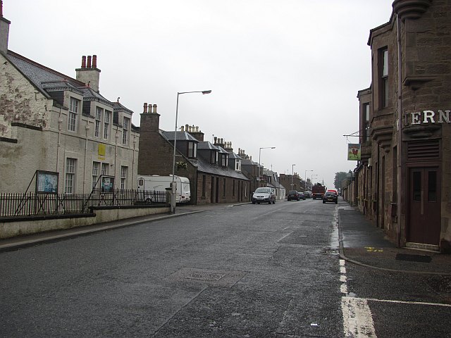
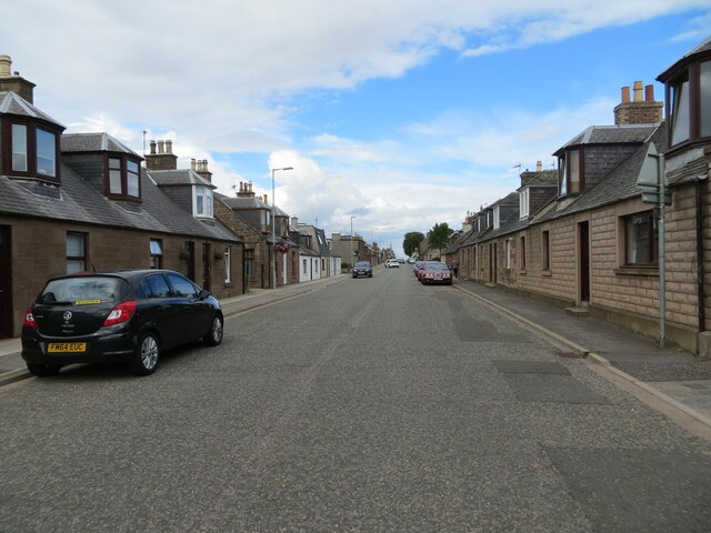
Burnside is a small village located in the region of Kincardineshire, in the west of Scotland. Situated near the coast, the village is nestled between the larger towns of Stonehaven and Portlethen. With a population of around 1,500, it offers a peaceful and close-knit community atmosphere.

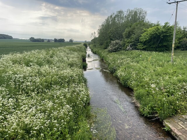
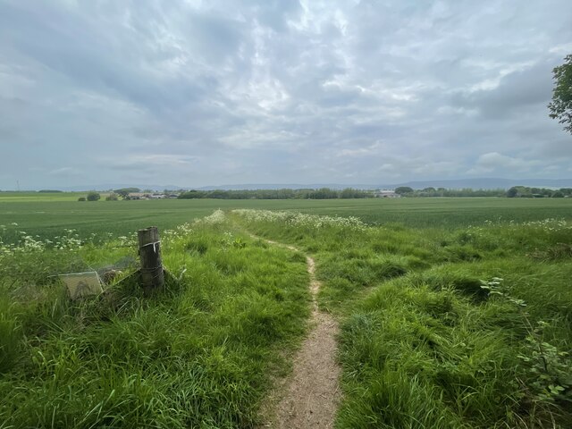
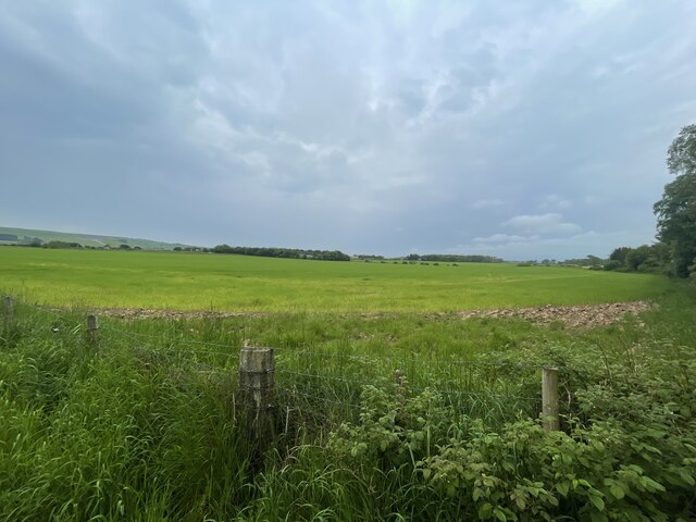
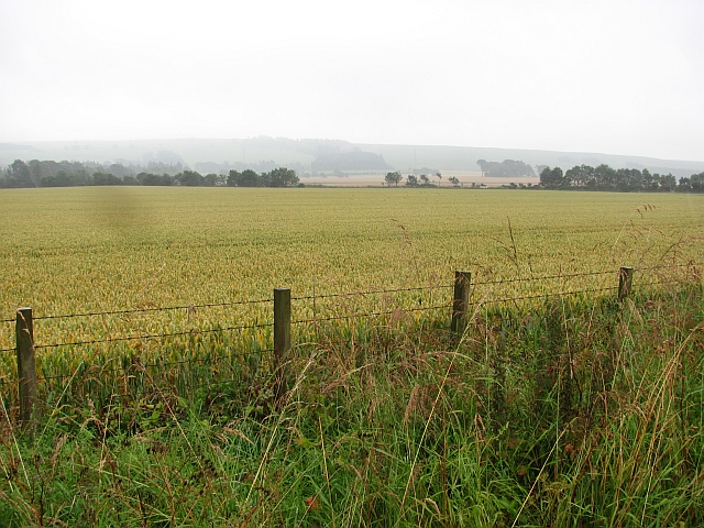
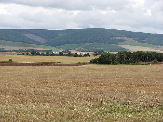
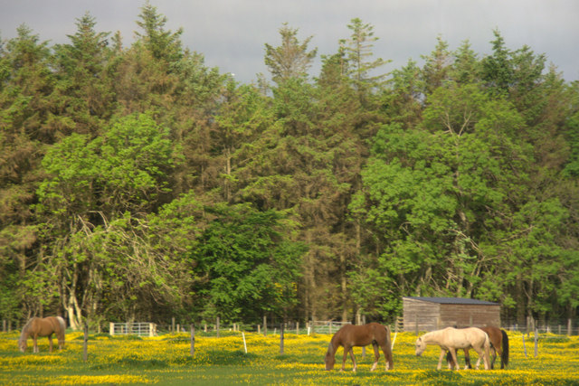
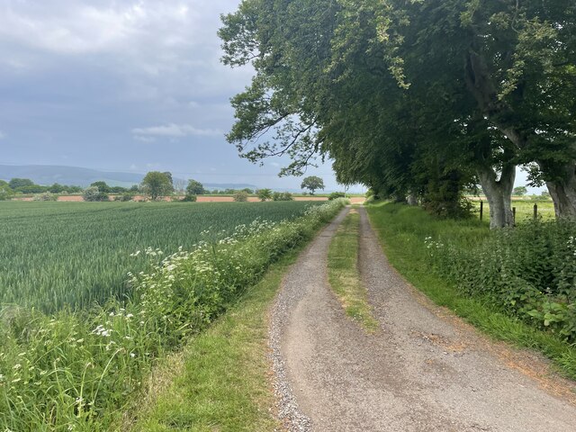
The village of Burnside is known for its picturesque countryside surroundings. Rolling hills, green fields, and stunning views of the North Sea make it an ideal location for outdoor enthusiasts and nature lovers. The nearby Dunnottar Castle, a medieval fortress perched on a cliff overlooking the sea, is a popular tourist attraction.

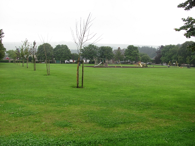
In terms of amenities, Burnside offers a range of facilities to cater to its residents' needs. The village has a primary school, providing education for local children, and there are also a few local shops and businesses serving the community. Additionally, nearby Stonehaven and Portlethen provide a wider range of services, including supermarkets, healthcare facilities, and recreational activities.

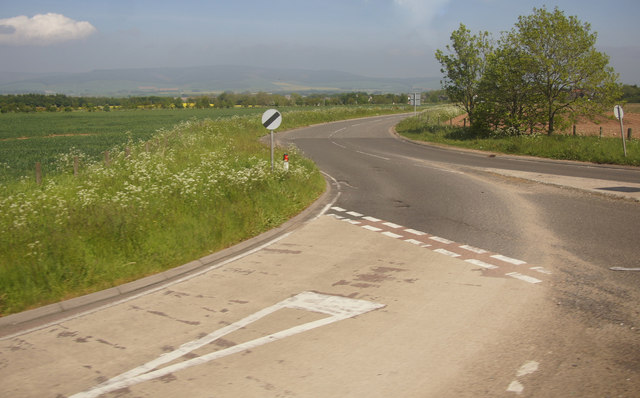
Transport links in Burnside are convenient, with regular bus services connecting the village to surrounding towns and cities. The nearest train station is in Stonehaven, providing further travel options for residents. The A90 road is easily accessible from the village, connecting it to Aberdeen, Scotland's third-largest city, which is approximately a 20-minute drive away.

Overall, Burnside, West, Kincardineshire is a charming village with a strong sense of community, stunning natural surroundings, and convenient access to nearby towns and amenities.

If you have any feedback on the listing, please let us know in the comments section below.

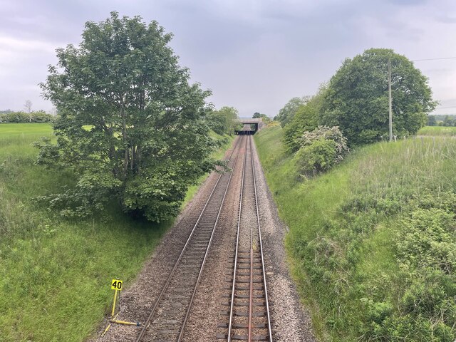
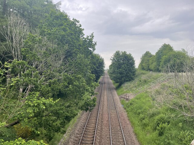
Burnside, West Images

Images are sourced within 2km of 56.82052/-2.4930877 or Grid Reference NO7070. Thanks to Geograph Open Source API. All images are credited.

Path in Denlethen Wood Walking trail heading north inside Denlethen Wood.
Path in Denlethen Wood
Walking trail heading north inside Denlethen Wood.
Luther Water Geocaching is a type of global treasure hunt of people looking for caches, or hidden stashes of objects. Geocaching may also be described as a series of hide-and-seek games, where hiders provide online clues for seekers. Seekers use global positioning system (GPS) devices to find hidden caches
Luther Water
Geocaching is a type of global treasure hunt of people looking for caches, or hidden stashes of objects. Geocaching may also be described as a series of hide-and-seek games, where hiders provide online clues for seekers. Seekers use global positioning system (GPS) devices to find hidden caches
Paths around Denlethen Woods
Paths around Denlethen Woods Geocaching is a type of global treasure hunt of people looking for caches, or hidden stashes of objects. Geocaching may also be described as a series of hide-and-seek games, where hiders provide online clues for seekers. Seekers use global positioning system (GPS) devices to find hidden caches
Paths around Denlethen Woods
Geocaching is a type of global treasure hunt of people looking for caches, or hidden stashes of objects. Geocaching may also be described as a series of hide-and-seek games, where hiders provide online clues for seekers. Seekers use global positioning system (GPS) devices to find hidden caches
Recreation Ground, Laurencekirk Park in Laurencekirk, Kincardineshire.
Recreation Ground, Laurencekirk
Park in Laurencekirk, Kincardineshire.
Pub sign, Laurencekirk Western Inn, Laurencekirk.
Pub sign, Laurencekirk
Western Inn, Laurencekirk.
Wheat field, Laurencekirk Mearns arable land.
Wheat field, Laurencekirk
Mearns arable land.
Stubble near Laurencekirk Looking over stubble and already ploughed land near Laurencekirk towards Strathfinella Hill
Stubble near Laurencekirk
Looking over stubble and already ploughed land near Laurencekirk towards Strathfinella Hill
High Street, Laurencekirk Northward view from outside The Western.
High Street, Laurencekirk
Northward view from outside The Western.
Horses in a field on the outskirts of Laurencekirk
Junction of the A90 and the A937 near Laurencekirk A dangerous junction, the last one along this section of the A90 where speeds are still restricted to 50 mph.
Junction of the A90 and the A937 near Laurencekirk
A dangerous junction, the last one along this section of the A90 where speeds are still restricted to 50 mph.
High Street (A937), Laurencekirk Looking north-eastward.
High Street (A937), Laurencekirk
Looking north-eastward.
Curving path in Denlethen Wood Trail curving westwards on the north side of Denlethen Wood.
Curving path in Denlethen Wood
Trail curving westwards on the north side of Denlethen Wood.
Firebreak in Denlethen Wood Looking west along a firebreak in Denlethen Wood.
Firebreak in Denlethen Wood
Looking west along a firebreak in Denlethen Wood.
Ordnance Survey Flush Bracket G4069 This bracket can be found on the wall of the former TA building in High Street, Laurencekirk.
The recorded details give a height of 87.6641 metres above sea level.
For more details see : <span class="nowrap"><a title="https://www.bench-marks.org.uk/bm440" rel="nofollow ugc noopener" href="https://www.bench-marks.org.uk/bm440">Link</a><img style="margin-left:2px;" alt="External link" title="External link - shift click to open in new window" src="https://s1.geograph.org.uk/img/external.png" width="10" height="10"/></span>
Ordnance Survey Flush Bracket G4069
This bracket can be found on the wall of the former TA building in High Street, Laurencekirk. The recorded details give a height of 87.6641 metres above sea level. For more details see : LinkExternal link
Paths around Denlethen Woods Geocaching is a type of global treasure hunt of people looking for caches, or hidden stashes of objects. Geocaching may also be described as a series of hide-and-seek games, where hiders provide online clues for seekers. Seekers use global positioning system (GPS) devices to find hidden caches
Paths around Denlethen Woods
Geocaching is a type of global treasure hunt of people looking for caches, or hidden stashes of objects. Geocaching may also be described as a series of hide-and-seek games, where hiders provide online clues for seekers. Seekers use global positioning system (GPS) devices to find hidden caches
Railway line towards Edinburgh Geocaching is a type of global treasure hunt of people looking for caches, or hidden stashes of objects. Geocaching may also be described as a series of hide-and-seek games, where hiders provide online clues for seekers. Seekers use global positioning system (GPS) devices to find hidden caches
Railway line towards Edinburgh
Geocaching is a type of global treasure hunt of people looking for caches, or hidden stashes of objects. Geocaching may also be described as a series of hide-and-seek games, where hiders provide online clues for seekers. Seekers use global positioning system (GPS) devices to find hidden caches
Railway towards Aberdeen Geocaching is a type of global treasure hunt of people looking for caches, or hidden stashes of objects. Geocaching may also be described as a series of hide-and-seek games, where hiders provide online clues for seekers. Seekers use global positioning system (GPS) devices to find hidden caches
Railway towards Aberdeen
Geocaching is a type of global treasure hunt of people looking for caches, or hidden stashes of objects. Geocaching may also be described as a series of hide-and-seek games, where hiders provide online clues for seekers. Seekers use global positioning system (GPS) devices to find hidden caches
Show me another place!

Burnside, West is located at Grid Ref: NO7070 (Lat: 56.82052, Lng: -2.4930877)

Unitary Authority: Aberdeenshire

Police Authority: North East

What 3 Words

///escape.conned.storeroom. Near Laurencekirk, Aberdeenshire

Related Wikis

Thornton Castle, Marykirk

Thornton Castle, Marykirk, Aberdeenshire is a fortress or fortified residence in Marykirk, Aberdeenshire. Parts of the house date from 1531.It was the...

Laurencekirk

Laurencekirk (, Scots: Lowrenkirk, Scottish Gaelic: Eaglais Labhrainn), locally known as Lournie, is a small town in the historic county of Kincardineshire...

Laurencekirk railway station

Laurencekirk railway station is a railway station serving the communities of Laurencekirk and The Mearns in Aberdeenshire, Scotland. The station was reopened...

Marykirk railway station

Marykirk railway station served the village of Marykirk, Kincardineshire, Scotland from 1849 to 1956 on the Aberdeen Railway. == History == The station...

Nearby Amenities

Located within 500m of 56.82052,-2.4930877
Noexit: yes
Lat/Long: 56.8176365/-2.4986351
Power: pole
Lat/Long: 56.8236919/-2.487659
Power: pole
Lat/Long: 56.8230116/-2.4884892
Power: pole
Lat/Long: 56.8223327/-2.4893247
Material: wood
Power: pole
Lat/Long: 56.8216876/-2.4901441
Material: wood
Power: pole
Lat/Long: 56.8210638/-2.4910037
Material: wood
Power: pole
Lat/Long: 56.8204356/-2.4918848
Material: wood
Power: pole
Lat/Long: 56.8201295/-2.4922791
Material: wood
Power: pole
Lat/Long: 56.8196693/-2.4929363
Material: wood
Power: pole
Lat/Long: 56.8189669/-2.4938603
Material: wood
Power: pole
Lat/Long: 56.8185038/-2.4944866
Material: wood
Power: pole
Lat/Long: 56.8180355/-2.4951303
Material: wood
Power: pole
Lat/Long: 56.8174777/-2.4959752
Material: wood
Power: pole
Lat/Long: 56.816842/-2.496922
Oatyhill
Place: isolated_dwelling
Lat/Long: 56.8189666/-2.4959558
Power: pole
Lat/Long: 56.8199886/-2.5004647
Power: pole
Lat/Long: 56.8198745/-2.4995337
Power: pole
Lat/Long: 56.8197557/-2.4985228
Material: wood
Power: pole
Lat/Long: 56.8196232/-2.4974445
Material: wood
Power: pole
Lat/Long: 56.8194906/-2.4963746
Material: wood
Power: pole
Lat/Long: 56.8193638/-2.4954016
Material: wood
Power: pole
Lat/Long: 56.8190526/-2.4947971
Material: wood
Power: pole
Lat/Long: 56.8189962/-2.4956522
Material: wood
Power: pole
Lat/Long: 56.8188313/-2.4957722
Material: wood
Power: pole
Lat/Long: 56.8186388/-2.4962293
Material: wood
Power: pole
Lat/Long: 56.8183633/-2.4969664
Material: wood
Power: pole
Lat/Long: 56.8181098/-2.4976172
Material: wood
Power: pole
Lat/Long: 56.8178573/-2.4982448
Material: wood
Power: pole
Lat/Long: 56.8175841/-2.4988935
The data included in this document is from www.openstreetmap.org. The data is made available under ODbL.

Have you been to Burnside, West?

Leave your review of Burnside, West below (or comments, questions and feedback).