West Bowling

Settlement in Yorkshire

England

West Bowling

Playground - Gleneagles Close
Playground - Gleneagles Close Credit: Betty Longbottom

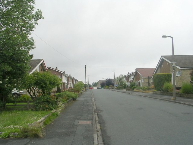
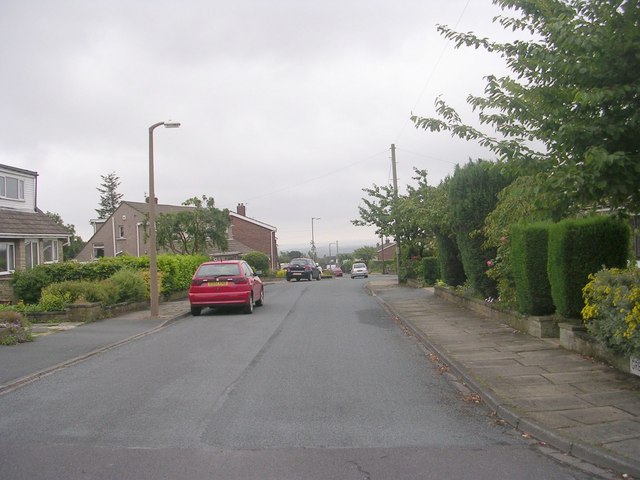
West Bowling is a suburb of the city of Bradford in West Yorkshire, England. It is located approximately 1.5 miles south-west of the city centre. The area is known for its diverse community and vibrant atmosphere.

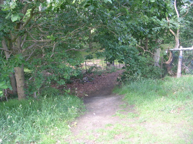
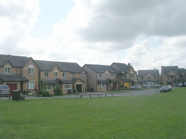
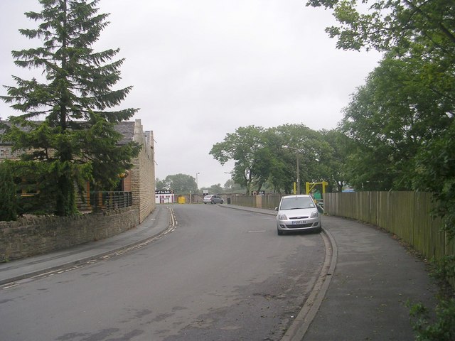
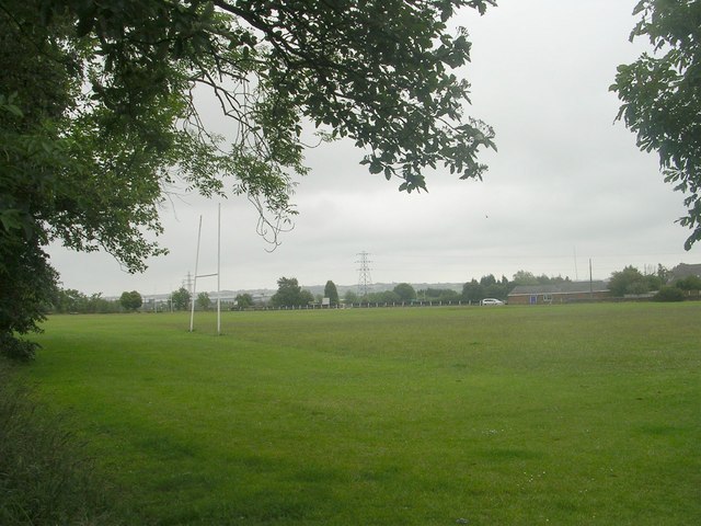
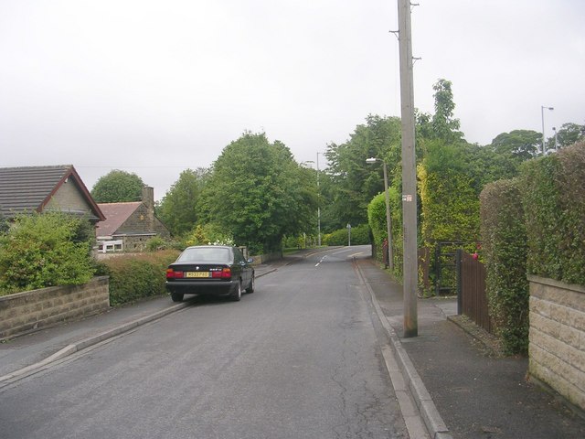
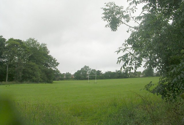
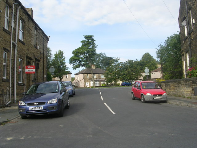
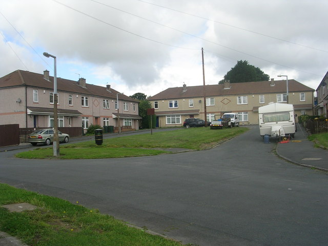
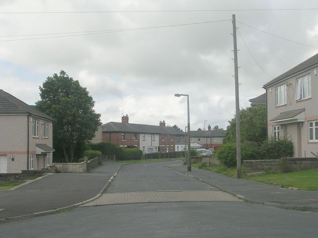
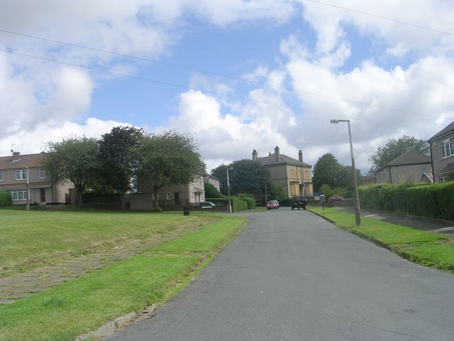
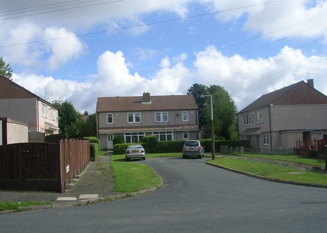
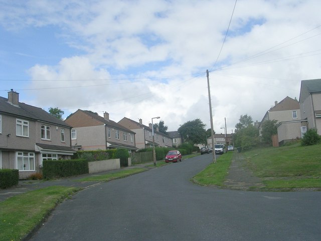
West Bowling has a mix of residential areas, shops, and green spaces. The housing stock consists mainly of terraced houses, with some newer developments also present. The area is well-connected to the rest of Bradford and the wider region, with good transport links including buses and a nearby train station.

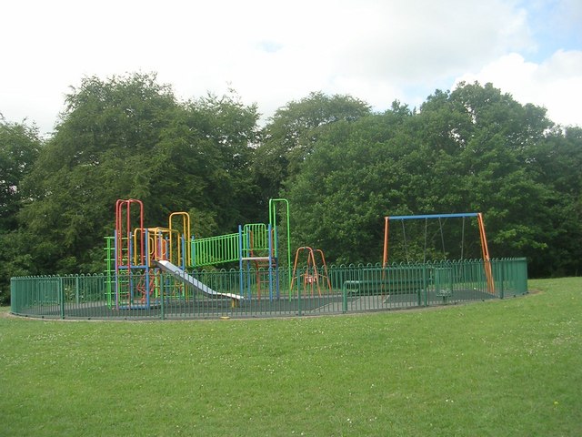
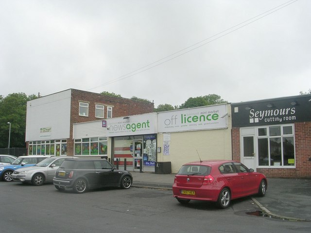
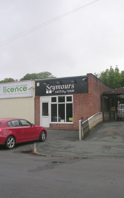
There are several schools in the area, providing education for children of all ages. West Bowling also has a range of amenities, including shops, restaurants, and leisure facilities, making it a convenient place to live.

The community in West Bowling is diverse, with residents from a variety of backgrounds and cultures. This diversity is reflected in the range of businesses and services in the area, creating a vibrant and inclusive community spirit.

Overall, West Bowling is a bustling and lively suburb of Bradford, offering a mix of housing options, amenities, and a strong sense of community.

If you have any feedback on the listing, please let us know in the comments section below.

West Bowling Images

Images are sourced within 2km of 53.776728/-1.7537022 or Grid Reference SE1631. Thanks to Geograph Open Source API. All images are credited.

Playground - Gleneagles Close
Footpath - near Gleneagles Close
Gleneagles Close - looking back
Stadium Road - off Cleckheaton Road
Recreation Ground - Cleckheaton Road
Belmont Gardens - looking towards Wesley Avenue
Belmont Mini-Market - Belmont Avenue
Seymours Cutting Room - Belmont Avenue
Wynford Way - viewed from Belmont Crescent
Electricity Substation No 1065 - Belmont Crescent
Greenville Drive - viewed from Belmont Crescent
Playing Fields - Cleckheaton Road
Triangle - White Lane
Elm Tree Gardens - Elmfield Drive
Dawson Avenue - Elmfield Drive
Thornfield Avenue - Elmfield Drive
Elm Tree Close - Elmfield Drive
Elmfield Drive - viewed from Thornfield Avenue
Show me another place!

West Bowling is located at Grid Ref: SE1631 (Lat: 53.776728, Lng: -1.7537022)

Division: West Riding

Unitary Authority: Bradford

Police Authority: West Yorkshire

What 3 Words

///tanks.chat.thigh. Near Bradford, West Yorkshire

Related Wikis

Birch Lane

Birch Lane was a rugby league ground in Bradford, England. It was the first long term home of Bradford Northern Rugby League Football Club, who played...

Bowling Junction railway station

Bowling Junction railway station is a closed station in the city of Bradford, West Yorkshire, England. It was situated on the Calder Valley line to the...

Dixons City Academy

Dixons City Academy is an academy in Bradford, West Yorkshire, England. The school was founded in 1990 as Dixons City Technology College which focused...

Manchester Road railway station (West Yorkshire)

Manchester Road railway station is a closed station in the city of Bradford, West Yorkshire, England. The station opened in 1878 but closed to passengers...

Related Videos

Exploring the Decaying Heart of Bradford!

Explore Bradford City Centre's decay. Witness the stark contrast between its past glory and current neglect. Join me as i navigate ...

BRADFORD - A walking tour of Bradford in 4k - January 2024

Come with me as I explore Bradford, the beautiful West Yorkshire city and see 10 places you should go and see for yourself.

Long Bank Holiday Weekend at City Park (Bradford) (4K)

Take a tour with me on a long Bank Holiday weekend at Bradford City Park. The Sun is shining and the kids are out to play by the ...

Nearby Amenities

Located within 500m of 53.776728,-1.7537022
Mini Roundabout
Direction: clockwise
Lat/Long: 53.7767156/-1.746399
Barrier: bollard
Lat/Long: 53.7753292/-1.7552808
Mini Roundabout
Direction: clockwise
Lat/Long: 53.7744518/-1.7552927
Mini Roundabout
Direction: clockwise
Lat/Long: 53.779088/-1.7543021
Turning Circle
Lat/Long: 53.7776418/-1.7507503
Barrier: bollard
Lat/Long: 53.7754962/-1.7552096
Crossing
Crossing: unmarked
Crossing Island: no
Tactile Paving: yes
Traffic Calming: table
Lat/Long: 53.7788359/-1.7570942
Crossing
Crossing: marked
Crossing Island: no
Crossing Markings: zebra
Crossing Ref: zebra
Tactile Paving: yes
Traffic Calming: table
Lat/Long: 53.7786764/-1.7586043
Akbar General Food Store
Shop: convenience
Lat/Long: 53.777625/-1.7586648
Lazeez
Addr City: Bradford
Addr Housenumber: 296
Addr Postcode: BD5 7BB
Addr Street: Bowling Old Lane
Fhrs Id: 327989
Shop: convenience
Source Addr: FHRS Open Data
Lat/Long: 53.7769943/-1.756018
Telephone
Booth: KX100
Covered: booth
Lat/Long: 53.7753809/-1.7552439
Traffic Signals
Crossing: no
Lat/Long: 53.7776061/-1.760643
Place Of Worship
Jamia Mosque Tabbligh-Ul-Islam
Religion: muslim
Lat/Long: 53.7762355/-1.7587549
Post Box
Operator: Royal Mail
Ref: BD5 334
Lat/Long: 53.7736206/-1.7552345
Atique Foodstore
Addr City: Bradford
Addr Housenumber: 2
Addr Postcode: BD5 8DR
Addr Street: Silverdale Road
Fhrs Id: 326320
Shop: convenience
Source Addr: FHRS Open Data
Lat/Long: 53.7741406/-1.7570255
Barrier: bollard
Lat/Long: 53.7729973/-1.7533445
Kindergarten
Community Nursery
Lat/Long: 53.7732166/-1.7525845
Barrier: bollard
Lat/Long: 53.7752105/-1.7496466
Crossing
Crossing: marked
Crossing Island: no
Crossing Markings: zebra
Crossing Ref: zebra
Tactile Paving: yes
Traffic Calming: table
Lat/Long: 53.7776643/-1.7541634
GameOn
Sport: snooker
Lat/Long: 53.7776354/-1.7537561
Makkah Market
Shop: supermarket
Lat/Long: 53.7765797/-1.7562331
Hazara Motors
Lat/Long: 53.7757271/-1.7560548
Kindergarten
First Steps Nursery
Lat/Long: 53.7746639/-1.7532876
Social Club
Little Horton Sociala Cycling Club
Lat/Long: 53.7758437/-1.7519384
Place Of Worship
The Light Of The World Gospel Hall Community Church
Religion: christian
Lat/Long: 53.780571/-1.7544477
Pub
The Newby Square
Lat/Long: 53.7808075/-1.7546241
Fast Food
Fish & Chips
Lat/Long: 53.7750655/-1.7597617
Pharmacy
Lat/Long: 53.775036/-1.7595234
Doctors
Lat/Long: 53.7751404/-1.7591352
Pub
West Bowling Social Club
Addr City: Bradford
Addr Housenumber: 106
Addr Postcode: BD5 8BL
Addr Street: Birch Lane
Fhrs Id: 326321
Source Addr: FHRS Open Data
Lat/Long: 53.7764132/-1.7521151
Bus Stop
Lat/Long: 53.7748315/-1.7604804
Bus Stop
Lat/Long: 53.7771896/-1.7606635
Barrier: bollard
Lat/Long: 53.7756306/-1.754461
Barrier: bollard
Lat/Long: 53.7745872/-1.7554749
Mini Roundabout
Direction: clockwise
Lat/Long: 53.7734054/-1.7510506
Turning Circle
Lat/Long: 53.7730042/-1.7494923
Turning Circle
Lat/Long: 53.7757094/-1.7495789
West Bowling
Place: suburb
Wikidata: Q78907362
Lat/Long: 53.7766727/-1.7531786
Bus Stop
Manchester Road Marsh Street
Local Ref: 45014587
Naptan AtcoCode: 450014587
Naptan Bearing: N
Naptan CommonName: Manchester Road Marsh Street
Naptan Crossing: Marsh Street
Naptan Indicator: Stop 45014587
Naptan Landmark: Admiral Nelson PH
Naptan PlusbusZoneRef: LEEDS
Naptan ShortCommonName: Marsh Street
Naptan Street: Manchester Road
Naptan Verified: no
Source: naptan_import
Lat/Long: 53.7751621/-1.7603725
Bus Stop
Manchester Road Burnett Avenue
Local Ref: 45014588
Naptan AtcoCode: 450014588
Naptan Bearing: N
Naptan CommonName: Manchester Road Burnett Avenue
Naptan Crossing: Burnett Avenue
Naptan Indicator: Stop 45014588
Naptan Landmark: Chapel of Rest
Naptan Notes: OSR taken place 160805
Naptan PlusbusZoneRef: LEEDS
Naptan ShortCommonName: Burnett Avenue
Naptan Street: Manchester Road
Naptan Verified: no
Source: naptan_import
Lat/Long: 53.777239/-1.7606945
Bus Stop
Manchester Road Donisthorpe Street
Local Ref: 45014599
Naptan AtcoCode: 450014599
Naptan Bearing: S
Naptan CommonName: Manchester Road Donisthorpe Street
Naptan Crossing: Donisthorpe Street
Naptan Indicator: Stop 45014599
Naptan Landmark: Funeral Directors
Naptan Notes: L/C 59B
Naptan PlusbusZoneRef: LEEDS
Naptan ShortCommonName: Donisthorpe Street
Naptan Street: Manchester Road
Naptan Verified: no
Source: naptan_import
Lat/Long: 53.7769412/-1.7601044
Bus Stop
Parkside Road Birch Lane
Local Ref: 45015818
Naptan AtcoCode: 450015818
Naptan Bearing: E
Naptan CommonName: Parkside Road Birch Lane
Naptan Crossing: Birch Lane
Naptan Indicator: Stop 45015818
Naptan Notes: OSR taken place 260905
Naptan PlusbusZoneRef: LEEDS
Naptan ShortCommonName: Birch Lane
Naptan Street: Parkside Road
Naptan Verified: no
Source: naptan_import
Lat/Long: 53.7736925/-1.7494104
Bus Stop
Parkside Road Woodroyd Terrace
Local Ref: 45015819
Naptan AtcoCode: 450015819
Naptan Bearing: W
Naptan CommonName: Parkside Road Woodroyd Terrace
Naptan Crossing: Woodroyd Terrace
Naptan Indicator: Stop 45015819
Naptan Notes: OSR taken place 260905
Naptan PlusbusZoneRef: LEEDS
Naptan ShortCommonName: Woodroyd Terrace
Naptan Street: Parkside Road
Naptan Verified: no
Source: naptan_import
Lat/Long: 53.773514/-1.7500032
Bus Stop
Parkside Road Hopbine Avenue
Local Ref: 45015820
Naptan AtcoCode: 450015820
Naptan Bearing: E
Naptan CommonName: Parkside Road Hopbine Avenue
Naptan Crossing: Hopbine Avenue
Naptan Indicator: Stop 45015820
Naptan Landmark: Youth Club
Naptan Notes: OSR taken place 260905
Naptan PlusbusZoneRef: LEEDS
Naptan ShortCommonName: Hopbine Avenue
Naptan Street: Parkside Road
Naptan Verified: no
Source: naptan_import
Lat/Long: 53.773448/-1.7528411
Bus Stop
Parkside Road Woodroyd Road
Local Ref: 45015821
Naptan AtcoCode: 450015821
Naptan Bearing: W
Naptan CommonName: Parkside Road Woodroyd Road
Naptan Crossing: Woodroyd Road
Naptan Indicator: Stop 45015821
Naptan Landmark: Kolos Bakery
Naptan Notes: OSR taken place 260905
Naptan PlusbusZoneRef: LEEDS
Naptan ShortCommonName: Woodroyd Road
Naptan Street: Parkside Road
Naptan Verified: no
Source: naptan_import
Lat/Long: 53.7734235/-1.7540551
Bus Stop
Newroyd Road Clipstone Street
Local Ref: 45015822
Naptan AtcoCode: 450015822
Naptan Bearing: S
Naptan CommonName: Newroyd Road Clipstone Street
Naptan Crossing: Clipston Street
Naptan Indicator: Stop 45015822
Naptan Notes: OSR taken place 160805
Naptan PlusbusZoneRef: LEEDS
Naptan ShortCommonName: Clipstone Street
Naptan Street: Newroyd Road
Naptan Verified: no
Source: naptan_import
Lat/Long: 53.7746394/-1.7552315
Bus Stop
Newroyd Road Clipsone Street
Local Ref: 45015823
Naptan AtcoCode: 450015823
Naptan Bearing: N
Naptan CommonName: Newroyd Road Clipsone Street
Naptan Crossing: Clipstone Street
Naptan Indicator: Stop 45015823
Naptan Notes: OSR taken place 160805
Naptan PlusbusZoneRef: LEEDS
Naptan ShortCommonName: Clipstone Street
Naptan Street: Newroyd Road
Naptan Verified: no
Source: naptan_import
Lat/Long: 53.7748553/-1.7553517
Bus Stop
Gaythorne Road Parsonage Road
Local Ref: 45015824
Naptan AtcoCode: 450015824
Naptan Bearing: N
Naptan CommonName: Gaythorne Road Parsonage Road
Naptan Crossing: Parsonage Road
Naptan Indicator: Stop 45015824
Naptan Notes: OSR taken place 160805
Naptan PlusbusZoneRef: LEEDS
Naptan ShortCommonName: Parsonage Road
Naptan Street: Gaythorne Road
Naptan Verified: no
Source: naptan_import
Lat/Long: 53.7760198/-1.7533874
Bus Stop
Gaythorne Road Round Street
Local Ref: 45015825
Naptan AtcoCode: 450015825
Naptan Bearing: N
Naptan CommonName: Gaythorne Road Round Street
Naptan Crossing: Round Street
Naptan Indicator: Stop 45015825
Naptan Landmark: The School
Naptan Notes: L/C 10
Naptan PlusbusZoneRef: LEEDS
Naptan ShortCommonName: Round Street
Naptan Street: Gaythorne Road
Naptan Verified: no
Source: naptan_import
Lat/Long: 53.7780082/-1.7543773
Bus Stop
Spring Mill Street St Stephens Road
Local Ref: 45015826
Naptan AtcoCode: 450015826
Naptan Bearing: S
Naptan CommonName: Spring Mill Street St Stephens Road
Naptan Crossing: St Stephens Road
Naptan Indicator: Stop 45015826
Naptan Notes: OSR taken place 160805L/C 20
Naptan PlusbusZoneRef: LEEDS
Naptan ShortCommonName: St. Stephens Road
Naptan Street: Spring Mill Street
Naptan Verified: no
Source: naptan_import
Lat/Long: 53.7793955/-1.7515162
Bus Stop
Spring Mill Street St Stephens Road
Local Ref: 45015827
Naptan AtcoCode: 450015827
Naptan Bearing: N
Naptan CommonName: Spring Mill Street St Stephens Road
Naptan Crossing: St Stephens Road
Naptan Indicator: Stop 45015827
Naptan Landmark: M K Textile
Naptan Notes: OSR taken place 160805
Naptan PlusbusZoneRef: LEEDS
Naptan ShortCommonName: St. Stephens Road
Naptan Street: Spring Mill Street
Naptan Verified: no
Source: naptan_import
Lat/Long: 53.779216/-1.751669
Bus Stop
Spring Mill Street Baird Street
Local Ref: 45015828
Naptan AtcoCode: 450015828
Naptan Bearing: N
Naptan CommonName: Spring Mill Street Baird Street
Naptan Crossing: Dalcross Street
Naptan Indicator: Stop 45015828
Naptan Notes: OSR taken place 280905L/C 17
Naptan PlusbusZoneRef: LEEDS
Naptan ShortCommonName: Dalcross Street
Naptan Street: Spring Mill Street
Naptan Verified: no
Source: naptan_import
Lat/Long: 53.7802593/-1.7519815
Bus Stop
Spring Mill Street Dalcross Street
Local Ref: 45015829
Naptan AtcoCode: 450015829
Naptan Bearing: S
Naptan CommonName: Spring Mill Street Dalcross Street
Naptan Crossing: Dalcross Street
Naptan Indicator: Stop 45015829
Naptan PlusbusZoneRef: LEEDS
Naptan ShortCommonName: Dalcross Street
Naptan Street: Spring Mill Street
Naptan Verified: no
Source: naptan_import
Lat/Long: 53.7804028/-1.7518138
Bus Stop
Gaythorne Road New Cross Street
Local Ref: 45023849
Naptan AtcoCode: 450023849
Naptan Bearing: S
Naptan CommonName: Gaythorne Road New Cross Street
Naptan Crossing: New Cross Street
Naptan Indicator: Stop 45023849
Naptan PlusbusZoneRef: LEEDS
Naptan ShortCommonName: New Cross Street
Naptan Street: Gaythorne Road
Naptan Verified: no
Source: naptan_import
Lat/Long: 53.7759294/-1.7531755
Bus Stop
St Stephens Road Bowling Old Lane
Local Ref: 45025721
Naptan AtcoCode: 450025721
Naptan Bearing: E
Naptan CommonName: St Stephens Road Bowling Old Lane
Naptan Crossing: Bowling Old Lane
Naptan Indicator: Stop 45025721
Naptan Landmark: School
Naptan PlusbusZoneRef: LEEDS
Naptan ShortCommonName: Bowling Old Lane
Naptan Street: St Stephen-s Road
Naptan Verified: no
Source: naptan_import
Lat/Long: 53.7790005/-1.7561318
Bus Stop
St Stephens Road Bowling Old Lane
Local Ref: 45025722
Naptan AtcoCode: 450025722
Naptan Bearing: W
Naptan CommonName: St Stephens Road Bowling Old Lane
Naptan Crossing: Bowling Old Lane
Naptan Indicator: Stop 45025722
Naptan Landmark: School
Naptan Notes: OSR taken place 160805L/C 10
Naptan PlusbusZoneRef: LEEDS
Naptan ShortCommonName: Bowling Old Lane
Naptan Street: St Stephen-s Road
Naptan Verified: no
Source: naptan_import
Lat/Long: 53.778831/-1.7567702
Bus Stop
Manchester Road Donisthorpe Street
Local Ref: 45024858
Naptan AtcoCode: 450024858
Naptan Bearing: S
Naptan CommonName: Manchester Road Donisthorpe Street
Naptan Crossing: Donisthorpe Street
Naptan Indicator: Stop 45024858
Naptan Landmark: Funeral Directors
Naptan Notes: OSR taken place 160805
Naptan PlusbusZoneRef: LEEDS
Naptan ShortCommonName: Donisthorpe Street
Naptan Street: Manchester Road
Naptan Verified: no
Source: naptan_import
Lat/Long: 53.7772926/-1.7605121
Gaythorne Road Newsagents
Local Ref: 45050346
Naptan AtcoCode: 450050346
Naptan Bearing: S
Naptan BusStopType: CUS
Naptan CommonName: Gaythorne Road Newsagents
Naptan Indicator: Stop 45050346
Naptan PlusbusZoneRef: LEEDS
Naptan ShortCommonName: Birch Lane
Naptan Street: Gaythorne Road
Naptan Verified: no
Source: naptan_import
Lat/Long: 53.7780078/-1.75418
Post Box
Operator: Royal Mail
Ref: BD5 309
Lat/Long: 53.7775853/-1.7542146
Post Box
Operator: Royal Mail
Ref: BD5 161
Lat/Long: 53.7797788/-1.7541717
Turning Circle
Lat/Long: 53.7792142/-1.7492688
Turning Circle
Lat/Long: 53.7802183/-1.7494534
Bowling Junction
Abandoned Railway: station
Railway: site
Wikidata: Q4951182
Wikipedia: en:Bowling Junction railway station
Lat/Long: 53.7748964/-1.7483926
Traffic Signals
Crossing: no
Lat/Long: 53.7774355/-1.7607758
Crossing
Button Operated: yes
Crossing: traffic_signals
Crossing Island: no
Kerb: flush
Tactile Paving: yes
Lat/Long: 53.7774924/-1.7608058
Crossing
Button Operated: yes
Crossing: traffic_signals
Crossing Island: no
Kerb: flush
Tactile Paving: yes
Lat/Long: 53.7775073/-1.7607134
Crossing
Button Operated: yes
Crossing: traffic_signals
Crossing Island: no
Crossing Ref: pelican
Kerb: flush
Tactile Paving: yes
Lat/Long: 53.77822/-1.760883
Crossing
Button Operated: yes
Crossing: traffic_signals
Crossing Island: no
Crossing Ref: pelican
Kerb: flush
Tactile Paving: yes
Lat/Long: 53.7782712/-1.7607635
Bowling Junction
Railway: junction
Lat/Long: 53.7758885/-1.7484106
Crossing
Button Operated: yes
Crossing: traffic_signals
Crossing Island: no
Tactile Paving: yes
Lat/Long: 53.7785198/-1.7606476
Crossing
Button Operated: yes
Crossing: traffic_signals
Crossing Island: no
Tactile Paving: yes
Lat/Long: 53.77841/-1.7606287
Crossing
Button Operated: yes
Crossing: traffic_signals
Crossing Island: no
Tactile Paving: yes
Lat/Long: 53.7775931/-1.7605126
Crossing
Button Operated: yes
Crossing: traffic_signals
Crossing Island: no
Tactile Paving: yes
Lat/Long: 53.7775538/-1.7606168
Barrier: bollard
Lat/Long: 53.7770181/-1.7606769
Crossing
Crossing: unmarked
Crossing Island: no
Tactile Paving: yes
Lat/Long: 53.7749509/-1.7599234
Crossing
Crossing: unmarked
Crossing Island: no
Tactile Paving: yes
Lat/Long: 53.7750384/-1.7598939
Cycleway: asl
Direction: forward
Lat/Long: 53.7784196/-1.7605765
Traffic Signals
Crossing: no
Traffic Signals Direction: forward
Lat/Long: 53.7784354/-1.7605001
Traffic Signals
Crossing: no
Lat/Long: 53.7781585/-1.7608729
Traffic Signals
Crossing: no
Lat/Long: 53.7776441/-1.7605403
Traffic Signals
Crossing: no
Lat/Long: 53.7774516/-1.7606851
Crossing
Button Operated: yes
Crossing: traffic_signals
Crossing Island: no
Tactile Paving: yes
Lat/Long: 53.7766936/-1.7601323
Crossing
Button Operated: yes
Crossing: traffic_signals
Crossing Island: no
Tactile Paving: yes
Lat/Long: 53.7766457/-1.7602379
Crossing
Button Operated: yes
Crossing: traffic_signals
Crossing Island: no
Tactile Paving: yes
Lat/Long: 53.7765748/-1.7603268
Traffic Signals
Crossing: no
Lat/Long: 53.776751/-1.7601514
Traffic Signals
Crossing: no
Lat/Long: 53.776518/-1.7603116
Traffic Signals
Crossing: no
Lat/Long: 53.7766971/-1.7602533
Crossing
Button Operated: yes
Crossing: traffic_signals
Crossing Island: no
Tactile Paving: yes
Lat/Long: 53.7746506/-1.76022
Crossing
Button Operated: yes
Crossing: traffic_signals
Crossing Island: no
Tactile Paving: yes
Lat/Long: 53.7746359/-1.7603539
Traffic Signals
Crossing: no
Lat/Long: 53.7746952/-1.7603311
Traffic Signals
Crossing: no
Lat/Long: 53.7747118/-1.7601943
Crossing
Crossing: unmarked
Crossing Island: no
Tactile Paving: yes
Traffic Calming: table
Lat/Long: 53.7786344/-1.7601253
Crossing
Crossing: unmarked
Crossing Island: no
Tactile Paving: yes
Traffic Calming: table
Lat/Long: 53.7790602/-1.7546125
Crossing
Crossing: marked
Crossing Island: no
Crossing Markings: zebra
Crossing Ref: zebra
Tactile Paving: yes
Traffic Calming: table
Lat/Long: 53.7787635/-1.7542688
Crossing
Crossing: unmarked
Crossing Island: no
Tactile Paving: yes
Traffic Calming: table
Lat/Long: 53.7784068/-1.7542653
Barrier: bollard
Lat/Long: 53.7786612/-1.754417
Crossing
Lat/Long: 53.7784685/-1.7543569
Crossing
Lat/Long: 53.7786317/-1.7543651
Crossing
Crossing: unmarked
Crossing Island: no
Tactile Paving: yes
Traffic Calming: table
Lat/Long: 53.7762939/-1.7511503
Crossing
Crossing: unmarked
Crossing Island: no
Tactile Paving: yes
Traffic Calming: table
Lat/Long: 53.7764923/-1.7502111
Crossing
Crossing: unmarked
Crossing Island: no
Tactile Paving: yes
Traffic Calming: table
Lat/Long: 53.7766361/-1.7487603
Crossing
Crossing: unmarked
Crossing Island: no
Tactile Paving: yes
Traffic Calming: table
Lat/Long: 53.7766685/-1.7471018
Crossing
Crossing: unmarked
Crossing Island: no
Tactile Paving: yes
Traffic Calming: table
Lat/Long: 53.7766267/-1.7463694
Crossing
Crossing: unmarked
Crossing Island: no
Tactile Paving: yes
Lat/Long: 53.7789602/-1.7503727
The data included in this document is from www.openstreetmap.org. The data is made available under ODbL.

Have you been to West Bowling?

Leave your review of West Bowling below (or comments, questions and feedback).