Ripleyville

Settlement in Yorkshire

England

Ripleyville

606 Business Park Business Park off Staithgate Lane.
606 Business Park Credit: JThomas

Ripleyville is a small village located in the county of Yorkshire, England. It is situated on the outskirts of the city of Bradford and is known for its picturesque surroundings and close-knit community. The village is home to a population of approximately 2,000 residents, many of whom have lived in Ripleyville for generations.

Ripleyville has a rich history, dating back to the 18th century when it was established as a farming community. Over the years, the village has grown and developed, with a range of amenities now available to residents, including a primary school, a village hall, and several local shops and businesses.

The village is surrounded by lush green countryside, making it a popular destination for nature lovers and outdoor enthusiasts. There are a number of walking and cycling routes in the area, as well as several parks and green spaces where residents can relax and enjoy the scenery.

Overall, Ripleyville is a charming and welcoming village, with a strong sense of community spirit and a peaceful, rural atmosphere. It is a popular place to live for those looking to escape the hustle and bustle of city life and enjoy a quieter, more relaxed pace of living.

If you have any feedback on the listing, please let us know in the comments section below.
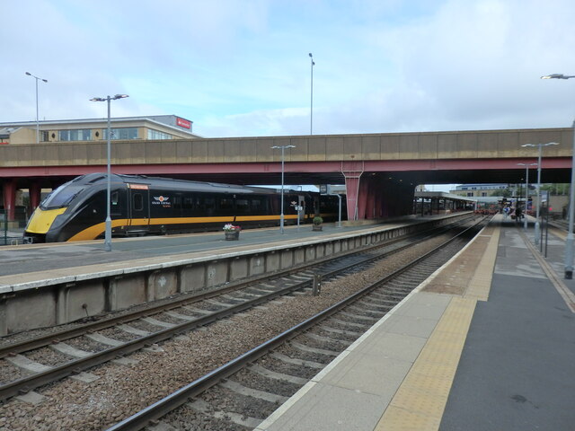
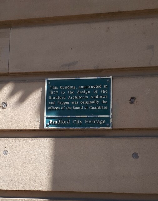
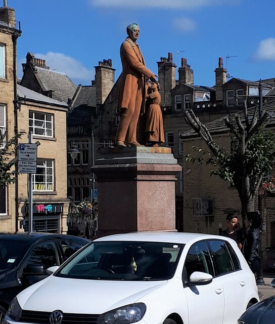
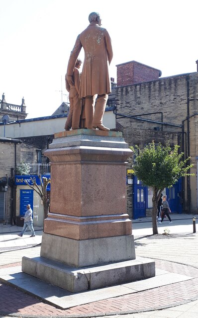
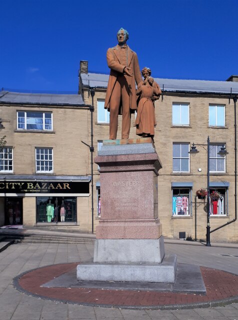
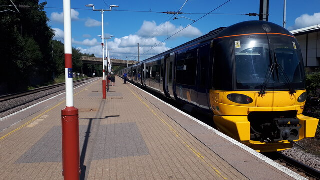
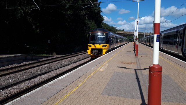
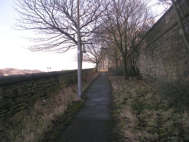
Ripleyville Images

Images are sourced within 2km of 53.783153/-1.745756 or Grid Reference SE1631. Thanks to Geograph Open Source API. All images are credited.

606 Business Park Business Park off Staithgate Lane.
606 Business Park
Business Park off Staithgate Lane.
Bradford Interchange Station Viewed from the end of Platform 3, with a Grand Central Class 180 Diesel Unit at Platform 1. This would form the 10.22am service to London Kings Cross
Bradford Interchange Station
Viewed from the end of Platform 3, with a Grand Central Class 180 Diesel Unit at Platform 1. This would form the 10.22am service to London Kings Cross
Polish Anna, Oastler Centre, Bradford This stencilled artwork, by the Bristol artist Stewy, was installed about April 2021, on the outside wall of the Oastler Centre. It is on the wall facing Northgate, very near the corner with John Street.
Polish Anna was a well known character around Bradford markets in the 1970's and 80's, when I lived in Bradford. I remember seeing her often, always with badges on her clothes, usually with a Morrisons carrier bag (faithfully reproduced here), a loud deep singing voice and with a stick. The story I heard was that she was a Pole who had been incarcerated in one of the Nazi concentration camps in WW2, and had been subjected to medical experiments by doctors there. My neighbour, who knew her better, said she was very kind to children, was very strong - when drunk it was known that 3 or 4 policemen were needed to control her.
The Bradford Telegraph and Argus ran some articles of people's memories of Anna - on Sept 22 2020 <span class="nowrap"><a title="https://www.thetelegraphandargus.co.uk/news/18736913.remarkable-images-bradfords-old-anna/" rel="nofollow ugc noopener" href="https://www.thetelegraphandargus.co.uk/news/18736913.remarkable-images-bradfords-old-anna/">Link</a><img style="margin-left:2px;" alt="External link" title="External link - shift click to open in new window" src="https://s1.geograph.org.uk/img/external.png" width="10" height="10"/></span> Oct 7 2020 <span class="nowrap"><a title="https://www.thetelegraphandargus.co.uk/news/18774268.readers-uncover-old-annas-story/" rel="nofollow ugc noopener" href="https://www.thetelegraphandargus.co.uk/news/18774268.readers-uncover-old-annas-story/">Link</a><img style="margin-left:2px;" alt="External link" title="External link - shift click to open in new window" src="https://s1.geograph.org.uk/img/external.png" width="10" height="10"/></span> 
See also this Telegraph and Argus article from Apr 2021 about the 4 artworks by Stewy in central Bradford <span class="nowrap"><a title="https://www.thetelegraphandargus.co.uk/news/19239397.polish-anna-among-bradford-icons-celebrated-street-art-project/" rel="nofollow ugc noopener" href="https://www.thetelegraphandargus.co.uk/news/19239397.polish-anna-among-bradford-icons-celebrated-street-art-project/">Link</a><img style="margin-left:2px;" alt="External link" title="External link - shift click to open in new window" src="https://s1.geograph.org.uk/img/external.png" width="10" height="10"/></span>
Polish Anna, Oastler Centre, Bradford
This stencilled artwork, by the Bristol artist Stewy, was installed about April 2021, on the outside wall of the Oastler Centre. It is on the wall facing Northgate, very near the corner with John Street. Polish Anna was a well known character around Bradford markets in the 1970's and 80's, when I lived in Bradford. I remember seeing her often, always with badges on her clothes, usually with a Morrisons carrier bag (faithfully reproduced here), a loud deep singing voice and with a stick. The story I heard was that she was a Pole who had been incarcerated in one of the Nazi concentration camps in WW2, and had been subjected to medical experiments by doctors there. My neighbour, who knew her better, said she was very kind to children, was very strong - when drunk it was known that 3 or 4 policemen were needed to control her. The Bradford Telegraph and Argus ran some articles of people's memories of Anna - on Sept 22 2020 LinkExternal link Oct 7 2020 LinkExternal link See also this Telegraph and Argus article from Apr 2021 about the 4 artworks by Stewy in central Bradford LinkExternal link
Former Bradford Register Office building, Manor Row When I lived in Bradford in the 1970's, I attended a wedding here on a very snowy winter's day. The weather had caused chaos in the city, many brides or grooms were delayed, and the timetable was abandoned, with couples being married whenever they were both there. As for myself, I was there in anorak and boots, having helped the groom's family to dig their car out from the snow and getting an invitation once it was moving. I hurriedly got my camera, which was lucky as I was the only person at the wedding with a camera so I became the official photographer.
The Register Office is now at Bradford City Hall, and this building appears to be empty.
See <a href="https://www.geograph.org.uk/photo/6946168">SE1633 : Plaque on the wall of the former Register Office, Manor Row</a>
Former Bradford Register Office building, Manor Row
When I lived in Bradford in the 1970's, I attended a wedding here on a very snowy winter's day. The weather had caused chaos in the city, many brides or grooms were delayed, and the timetable was abandoned, with couples being married whenever they were both there. As for myself, I was there in anorak and boots, having helped the groom's family to dig their car out from the snow and getting an invitation once it was moving. I hurriedly got my camera, which was lucky as I was the only person at the wedding with a camera so I became the official photographer. The Register Office is now at Bradford City Hall, and this building appears to be empty. See SE1633 : Plaque on the wall of the former Register Office, Manor Row
Plaque on the wall of the former Register Office, Manor Row The plaque tells us that the building was constructed in 1877 to the design of Bradford architects Andrews and Pepper and was originally the offices of the Board of Guardians. See <a href="https://www.geograph.org.uk/photo/6946164">SE1633 : Former Bradford Register Office building, Manor Row</a>.
Plaque on the wall of the former Register Office, Manor Row
The plaque tells us that the building was constructed in 1877 to the design of Bradford architects Andrews and Pepper and was originally the offices of the Board of Guardians. See SE1633 : Former Bradford Register Office building, Manor Row.
Statue of Richard Oastler, Oastler Square, Bradford Richard Oastler was an early campaigner for improved conditions in factories, his campaign led to the first Act of Parliament to limit the hours that could be worked by children. He is also one of my distant relatives, descended from my 6xgreat grandfather Sampson Oastler of Kirby Wiske in North Yorkshire.
See Wikipedia article <span class="nowrap"><a title="https://en.wikipedia.org/wiki/Richard_Oastler" rel="nofollow ugc noopener" href="https://en.wikipedia.org/wiki/Richard_Oastler">Link</a><img style="margin-left:2px;" alt="External link" title="External link - shift click to open in new window" src="https://s1.geograph.org.uk/img/external.png" width="10" height="10"/></span>
Statue of Richard Oastler, Oastler Square, Bradford
Richard Oastler was an early campaigner for improved conditions in factories, his campaign led to the first Act of Parliament to limit the hours that could be worked by children. He is also one of my distant relatives, descended from my 6xgreat grandfather Sampson Oastler of Kirby Wiske in North Yorkshire. See Wikipedia article LinkExternal link
Statue of Richard Oastler, Bradford See also <a href="https://www.geograph.org.uk/photo/6946175">SE1633 : Statue of Richard Oastler, Oastler Square, Bradford</a>
Statue of Richard Oastler, Bradford
Statue of Richard Oastler, Oastler Square, Bradford See also <a href="https://www.geograph.org.uk/photo/6946175">SE1633 : Statue of Richard Oastler, Oastler Square, Bradford</a>
Statue of Richard Oastler, Oastler Square, Bradford
The 12:00 train to Leeds, platform 1 Forster Square station My train to Leeds, one of 3 waiting at Platform 1. The bridge in the background carries Hamm Strasse over the railway lines.
See Wikipedia <span class="nowrap"><a title="https://en.wikipedia.org/wiki/Bradford_Forster_Square_railway_station" rel="nofollow ugc noopener" href="https://en.wikipedia.org/wiki/Bradford_Forster_Square_railway_station">Link</a><img style="margin-left:2px;" alt="External link" title="External link - shift click to open in new window" src="https://s1.geograph.org.uk/img/external.png" width="10" height="10"/></span>
The 12:00 train to Leeds, platform 1 Forster Square station
My train to Leeds, one of 3 waiting at Platform 1. The bridge in the background carries Hamm Strasse over the railway lines. See Wikipedia LinkExternal link
Forster Square Station, Bradford The 11:46 train to Ilkley leaving from platform 2, the 12:00 to Leeds waits at platform 1 on the right.
The bridge in the background carries Hamm Strasse over the railway lines.
See Wikipedia <span class="nowrap"><a title="https://en.wikipedia.org/wiki/Bradford_Forster_Square_railway_station" rel="nofollow ugc noopener" href="https://en.wikipedia.org/wiki/Bradford_Forster_Square_railway_station">Link</a><img style="margin-left:2px;" alt="External link" title="External link - shift click to open in new window" src="https://s1.geograph.org.uk/img/external.png" width="10" height="10"/></span>
Forster Square Station, Bradford
The 11:46 train to Ilkley leaving from platform 2, the 12:00 to Leeds waits at platform 1 on the right. The bridge in the background carries Hamm Strasse over the railway lines. See Wikipedia LinkExternal link
Hamm Strasse bridge from Forster Square station Seen from platform 1, the 12:00 train to Leeds waiting on the right.
Hamm Strasse bridge from Forster Square station
Seen from platform 1, the 12:00 train to Leeds waiting on the right.
Wakefield Road near Dudley Hill, Bradford Looking south towards Dudley Hill roundabout on the Bradford Outer Ring Road, which passes over Wakefield Road, which then becomes Tong Street at the other side of the underpass.
Wakefield Road near Dudley Hill, Bradford
Looking south towards Dudley Hill roundabout on the Bradford Outer Ring Road, which passes over Wakefield Road, which then becomes Tong Street at the other side of the underpass.
Pop-up Cycle Lane on Wakefield Road, Bradford
TLC Bus Depot, Spring Mill Street, Bradford A quite new depot to replace their old one on Linton Street, which was probably too small, requiring vehicles to be parked out on the street. <span class="nowrap"><a title="https://www.tlctravelltd.co.uk/latest/about/https://www.tlctravelltd.co.uk/latest/about/" rel="nofollow ugc noopener" href="https://www.tlctravelltd.co.uk/latest/about/https://www.tlctravelltd.co.uk/latest/about/">Link</a><img style="margin-left:2px;" alt="External link" title="External link - shift click to open in new window" src="https://s1.geograph.org.uk/img/external.png" width="10" height="10"/></span>
TLC Bus Depot, Spring Mill Street, Bradford
A quite new depot to replace their old one on Linton Street, which was probably too small, requiring vehicles to be parked out on the street. LinkExternal link
Old Go-Ahead London Bus Parked in the yard of the former Bradford City Transport, Ludlam Street Bus Depot.
Old Go-Ahead London Bus
Parked in the yard of the former Bradford City Transport, Ludlam Street Bus Depot.
Former Bus Depot, Mill Lane, Bradford The former Bradford City Transport Ludlam Street Depot, which became the West Yorkshire Transport Museum after closure. It has since been (and possibly still is) a car dealership.
Former Bus Depot, Mill Lane, Bradford
The former Bradford City Transport Ludlam Street Depot, which became the West Yorkshire Transport Museum after closure. It has since been (and possibly still is) a car dealership.
Manchester Road, Bradford, with a Pop-Up Cycle Lane When the guided busway was constructed in the middle of Manchester Road, each carriageway was reduced to 2 lanes. Hence the need to use part of the pavement for the cycle lane. Fortunately neither see much use.
Manchester Road, Bradford, with a Pop-Up Cycle Lane
When the guided busway was constructed in the middle of Manchester Road, each carriageway was reduced to 2 lanes. Hence the need to use part of the pavement for the cycle lane. Fortunately neither see much use.
Santander Regional Office, Bradford Built on part of the site of the original Interchange Bus Station, which was a huge unwelcoming structure. Viewed from the entrance to the current, much smaller and more welcoming, bus station.
Santander Regional Office, Bradford
Built on part of the site of the original Interchange Bus Station, which was a huge unwelcoming structure. Viewed from the entrance to the current, much smaller and more welcoming, bus station.
Show me another place!

Ripleyville is located at Grid Ref: SE1631 (Lat: 53.783153, Lng: -1.745756)

Division: West Riding

Unitary Authority: Bradford

Police Authority: West Yorkshire

What 3 Words

///fresh.guess.skips. Near Bradford, West Yorkshire

Related Wikis

Broomfields, Bradford

Broomfields is a historic district on the south eastern edge of Bradford, West Yorkshire, England. In 1840 it was still a mainly rural area with a population...

Ripley Ville

Ripley Ville or Ripleyville was an estate of model houses for the working classes in Broomfields in the West Bowling ward of the City of Bradford in West...

St Dunstans railway station

St Dunstans railway station is a closed station in the city of Bradford, West Yorkshire, England. The station was the location of a three-way junction...

Bradford Adolphus Street railway station

Bradford Adolphus Street railway station is a closed station in the city of Bradford, West Yorkshire, England. == History == When the Leeds, Bradford and...

Nearby Amenities

Located within 500m of 53.783153,-1.745756
Mini Roundabout
Direction: clockwise
Lat/Long: 53.7866452/-1.7444891
Mini Roundabout
Direction: clockwise
Lat/Long: 53.7858614/-1.7502688
Barrier: bollard
Bollard: fixed
Lat/Long: 53.780794/-1.7414065
Railway: signal_box
Lat/Long: 53.7857119/-1.7491523
Car Rental
Operator: Eurocar
Lat/Long: 53.7860135/-1.7505672
Post Box
Operator: Royal Mail
Post Box Type: meter
Ref: BD4 118
Lat/Long: 53.786505/-1.7453326
Telephone
Booth: KX100
Covered: booth
Lat/Long: 53.786788/-1.7446705
Pub
Bowling Hotel
Addr City: Bradford
Addr Housenumber: 112
Addr Postcode: BD4 7DF
Addr Street: Hall Lane
Fhrs Id: 324845
Source Addr: FHRS Open Data
Lat/Long: 53.7853965/-1.7443132
Pub
The Mill Lane
Lat/Long: 53.7864607/-1.7481209
Man Made: tower
Lat/Long: 53.7807634/-1.7468309
Historic Railway: level_crossing
Lat/Long: 53.7835405/-1.7435822
Bus Stop
Brassey Road / Ashby Street;Brassey Road Ashby Street
Local Ref: 45015805
Naptan AtcoCode: 450015805
Naptan Bearing: SE
Naptan CommonName: Brassey Road Ashby Street
Naptan Crossing: Ashby Street
Naptan Indicator: Stop 45015805
Naptan Notes: OSR taken place 120805
Naptan PlusbusZoneRef: LEEDS
Naptan ShortCommonName: Ashby Street
Naptan Street: Brassey Road
Naptan Verified: yes
Odbl: clean
Ref: 450 15805
Source: naptan_import
Towards: Bradford
Lat/Long: 53.7823967/-1.7394441
Bus Stop
Brassey Road / Ashby Street;Brassey Road Ashby Street
Local Ref: 45015806
Naptan AtcoCode: 450015806
Naptan Bearing: NW
Naptan CommonName: Brassey Road Ashby Street
Naptan Crossing: Ashby Street
Naptan Indicator: Stop 45015806
Naptan PlusbusZoneRef: LEEDS
Naptan ShortCommonName: Ashby Street
Naptan Street: Brassey Road
Naptan Verified: yes
Odbl: clean
Ref: 450 15806
Source: naptan_import
Towards: Odsal Top, West Bowling
Lat/Long: 53.7825056/-1.7397867
Bus Stop
Paley Road / Bowling Hall Road;Paley Road Bowling Hall Road
Bench: no
Bin: no
Lit: no
Local Ref: 45015803
Naptan AtcoCode: 450015803
Naptan Bearing: NE
Naptan CommonName: Paley Road Bowling Hall Road
Naptan Crossing: Bowling Hall Road
Naptan Indicator: Stop 45015803
Naptan Notes: OSR taken place 061005
Naptan PlusbusZoneRef: LEEDS
Naptan ShortCommonName: Bowling Hall Road
Naptan Street: Paley Road
Naptan Verified: yes
Odbl: clean
Ref: 450 15803
Shelter: no
Source: naptan_import
Tactile Paving: no
Towards: Bradford
Lat/Long: 53.7819662/-1.7423137
Fast Food
Paley Chinese Take Away
Addr Street: Paley Road
Cuisine: chinese
Lat/Long: 53.7829802/-1.7399603
St Dunstan's
Historic Railway: station
Note: Name from old 1921 OS map
Railway: site
Source: NLS-OS-1st_Series
Wikidata: Q7592985
Wikipedia: en:St Dunstans railway station
Lat/Long: 53.7851442/-1.7481753
Bus Stop
Paley Road Bowling Hall Road
Bench: no
Bin: no
Lit: no
Local Ref: 45015804
Naptan AtcoCode: 450015804
Naptan Bearing: SW
Naptan CommonName: Paley Road Bowling Hall Road
Naptan Crossing: Bowling Hall Road
Naptan Indicator: Stop 45015804
Naptan Notes: OSR taken place 061005
Naptan PlusbusZoneRef: LEEDS
Naptan ShortCommonName: Hall Lane
Naptan Street: Paley Road
Naptan Verified: yes
Ref: 450 15804
Shelter: no
Source: naptan_import
Tactile Paving: no
Towards: Odsal Top, West Bowling
Lat/Long: 53.781955/-1.7419703
Bus Stop
Spring Mill Street Tiley Square
Local Ref: 45015830
Naptan AtcoCode: 450015830
Naptan Bearing: W
Naptan CommonName: Spring Mill Street Tiley Square
Naptan Crossing: Tiley Square
Naptan Indicator: Stop 45015830
Naptan Notes: OSR taken place 160805
Naptan PlusbusZoneRef: LEEDS
Naptan ShortCommonName: Tiley Square
Naptan Street: Spring Mill Street
Naptan Verified: no
Source: naptan_import
Lat/Long: 53.7816714/-1.7524133
Bus Stop
Spring Mill Street Ripley Street
Local Ref: 45015831
Naptan AtcoCode: 450015831
Naptan Bearing: S
Naptan CommonName: Spring Mill Street Ripley Street
Naptan Crossing: Ripley Street
Naptan Indicator: Stop 45015831
Naptan Notes: OSR taken place 280905 size 1 case fitted
Naptan PlusbusZoneRef: LEEDS
Naptan ShortCommonName: Ripley Street
Naptan Street: Spring Mill Street
Naptan Verified: no
Source: naptan_import
Lat/Long: 53.7820486/-1.7522593
Bus Stop
Ripley Street Ripley Road
Local Ref: 45015832
Naptan AtcoCode: 450015832
Naptan Bearing: E
Naptan CommonName: Ripley Street Ripley Road
Naptan Crossing: Ripley Road
Naptan Indicator: Stop 45015832
Naptan Notes: OSR taken place 120805
Naptan PlusbusZoneRef: LEEDS
Naptan ShortCommonName: Ripley Road
Naptan Street: Ripley Street
Naptan Verified: no
Source: naptan_import
Lat/Long: 53.7827035/-1.7473686
Bus Stop
Ripley Street Ripley Road
Local Ref: 45015833
Naptan AtcoCode: 450015833
Naptan Bearing: W
Naptan CommonName: Ripley Street Ripley Road
Naptan Crossing: Ripley Road
Naptan Indicator: Stop 45015833
Naptan PlusbusZoneRef: LEEDS
Naptan ShortCommonName: Ripley Road
Naptan Street: Ripley Street
Naptan Verified: no
Source: naptan_import
Lat/Long: 53.7826149/-1.7479914
Bus Stop
Bolling Road Linton Street
Local Ref: 45015834
Naptan AtcoCode: 450015834
Naptan Bearing: N
Naptan CommonName: Bolling Road Linton Street
Naptan Crossing: Linton Street
Naptan Indicator: Stop 45015834
Naptan Notes: OSR taken place 120805
Naptan PlusbusZoneRef: LEEDS
Naptan ShortCommonName: Linton Street
Naptan Street: Bolling Road
Naptan Verified: no
Source: naptan_import
Lat/Long: 53.7839785/-1.7467538
Bus Stop
Bolling Road Linton Street
Local Ref: 45015835
Naptan AtcoCode: 450015835
Naptan Bearing: S
Naptan CommonName: Bolling Road Linton Street
Naptan Crossing: Linton Street
Naptan Indicator: Stop 45015835
Naptan Notes: OSR taken place 120805
Naptan PlusbusZoneRef: LEEDS
Naptan ShortCommonName: Linton Street
Naptan Street: Bolling Road
Naptan Verified: no
Source: naptan_import
Lat/Long: 53.7836904/-1.7465279
Bus Stop
Bolling Road Mill Lane
Local Ref: 45015836
Naptan AtcoCode: 450015836
Naptan Bearing: S
Naptan CommonName: Bolling Road Mill Lane
Naptan Crossing: Mill Lane
Naptan Indicator: Stop 45015836
Naptan Notes: OSR taken place 200705 size 2 fitted
Naptan PlusbusZoneRef: LEEDS
Naptan ShortCommonName: Mill Lane
Naptan Street: Bolling Road
Naptan Verified: no
Source: naptan_import
Lat/Long: 53.785541/-1.7460462
Bus Stop
Bolling Road Mill Lane
Local Ref: 45015837
Naptan AtcoCode: 450015837
Naptan Bearing: N
Naptan CommonName: Bolling Road Mill Lane
Naptan Crossing: Mill Lane
Naptan Indicator: Stop 45015837
Naptan Notes: OSR taken place 200705 Size 2 fitted
Naptan PlusbusZoneRef: LEEDS
Naptan ShortCommonName: Mill Lane
Naptan Street: Bolling Road
Naptan Verified: no
Source: naptan_import
Lat/Long: 53.7869176/-1.746721
Bus Stop
Bolling Road Caledonia Street
Local Ref: 45015838
Naptan AtcoCode: 450015838
Naptan Bearing: S
Naptan CommonName: Bolling Road Caledonia Street
Naptan Crossing: Caledonia Street
Naptan Indicator: Stop 45015838
Naptan Notes: OSR taken place size 1 case fitted 220705
Naptan PlusbusZoneRef: LEEDS
Naptan ShortCommonName: Caledonia Street
Naptan Street: Bolling Road
Naptan Verified: no
Source: naptan_import
Lat/Long: 53.7872678/-1.7465519
Post Box
Operator: Royal Mail
Ref: BD4 178
Lat/Long: 53.7804512/-1.741722
Turning Circle
Lat/Long: 53.7814694/-1.7516915
Turning Circle
Lat/Long: 53.7792142/-1.7492688
Turning Circle
Lat/Long: 53.7802183/-1.7494534
Turning Circle
Lat/Long: 53.7812/-1.7496477
Waste Basket
Lat/Long: 53.7801777/-1.7420867
Bench
Lat/Long: 53.7801507/-1.7420599
St Dunstan's North Junction
Historic Railway: junction
Railway: site
Lat/Long: 53.7854994/-1.7486102
St Dunstan's East Junction
Historic Railway: junction
Railway: site
Lat/Long: 53.7844969/-1.745869
Railway: switch
Lat/Long: 53.7863574/-1.7490002
Railway: switch
Lat/Long: 53.7863682/-1.7489509
Railway: switch
Lat/Long: 53.7846864/-1.7489133
Railway: switch
Lat/Long: 53.7871985/-1.7490477
St Dunstan's West Junction
Historic Railway: junction
Railway: site
Lat/Long: 53.7835539/-1.7481935
Railway: switch
Lat/Long: 53.7864509/-1.7490071
Railway: switch
Lat/Long: 53.7864501/-1.7489574
Railway: switch
Lat/Long: 53.7871856/-1.7489717
Railway: switch
Lat/Long: 53.7869884/-1.7489815
Railway: railway_crossing
Lat/Long: 53.7860072/-1.7489302
Mill Lane Junction
Railway: junction
Lat/Long: 53.7860638/-1.7489513
Generator Method: photovoltaic
Generator Output Electricity: yes
Generator Source: solar
Generator Type: solar_photovoltaic_panel
Power: generator
Lat/Long: 53.7846636/-1.7485763
Generator Method: photovoltaic
Generator Output Electricity: yes
Generator Source: solar
Generator Type: solar_photovoltaic_panel
Power: generator
Lat/Long: 53.7846705/-1.7483474
Generator Method: photovoltaic
Generator Output Electricity: yes
Generator Source: solar
Generator Type: solar_photovoltaic_panel
Power: generator
Lat/Long: 53.7840897/-1.7485249
Generator Method: photovoltaic
Generator Output Electricity: yes
Generator Source: solar
Generator Type: solar_photovoltaic_panel
Power: generator
Lat/Long: 53.7840318/-1.7485483
Generator Method: photovoltaic
Generator Output Electricity: yes
Generator Source: solar
Generator Type: solar_photovoltaic_panel
Power: generator
Lat/Long: 53.7840594/-1.7483078
The data included in this document is from www.openstreetmap.org. The data is made available under ODbL.

Have you been to Ripleyville?

Leave your review of Ripleyville below (or comments, questions and feedback).