Bay, West
Settlement in Dorset
England
Bay, West
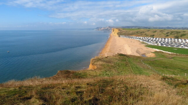
Bay is a small village situated in the West Dorset district of England. It is located on the coast, offering breathtaking views of the English Channel. With a population of just over 500 residents, Bay maintains a quaint and peaceful atmosphere, making it an ideal destination for those seeking tranquility.
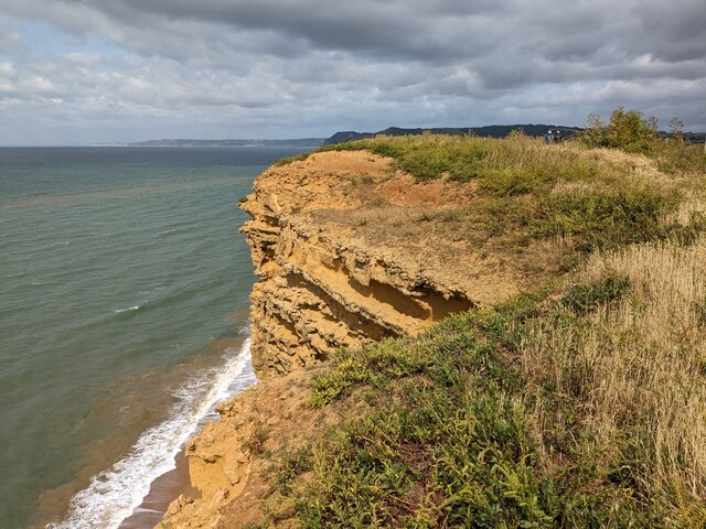
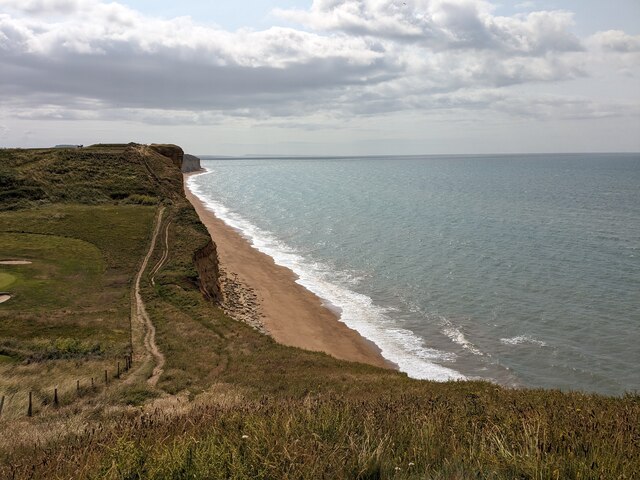
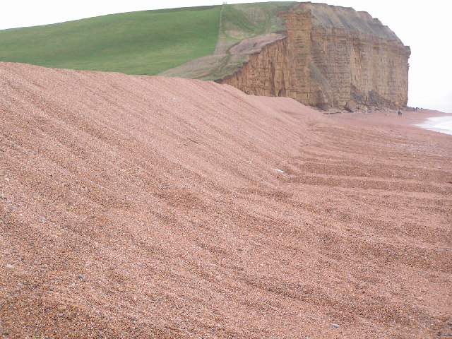
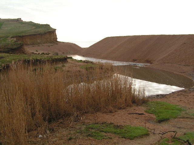
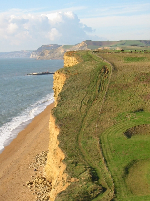
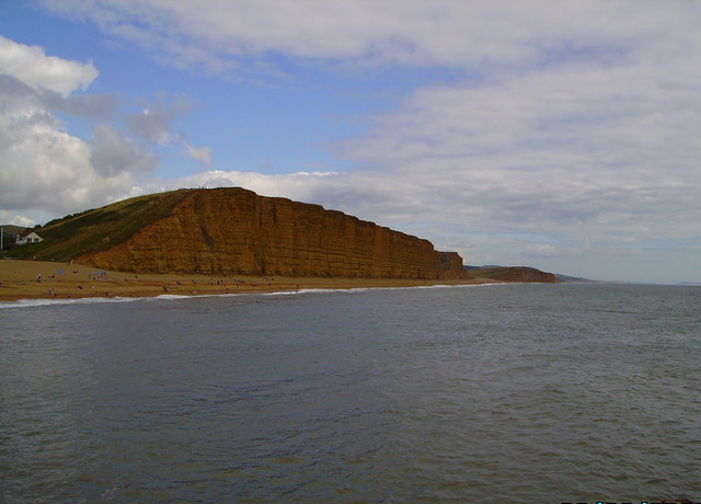
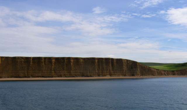
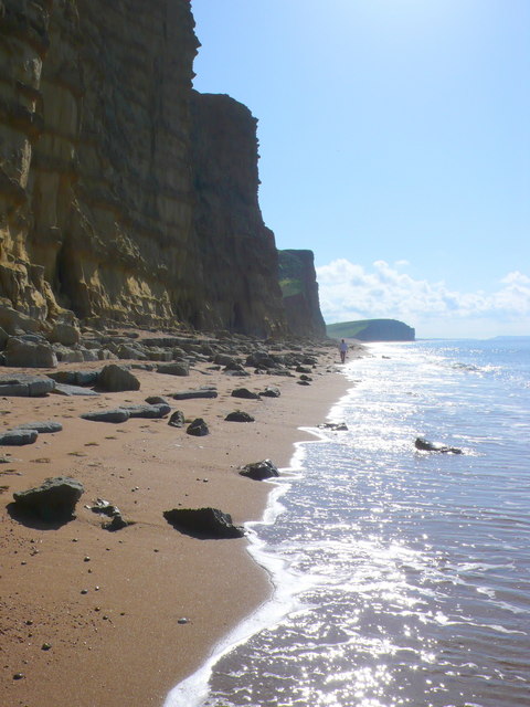
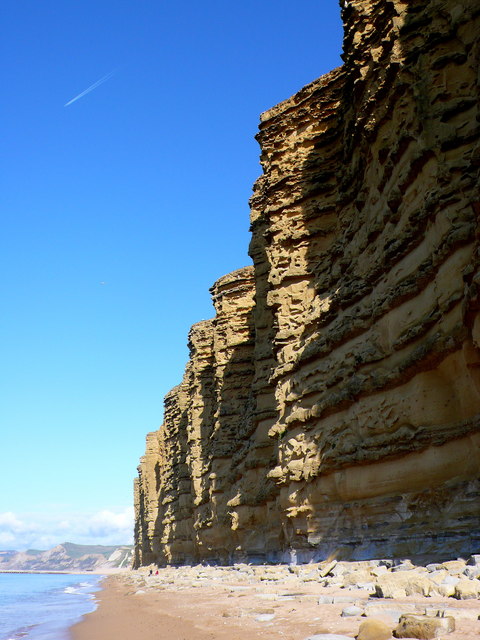
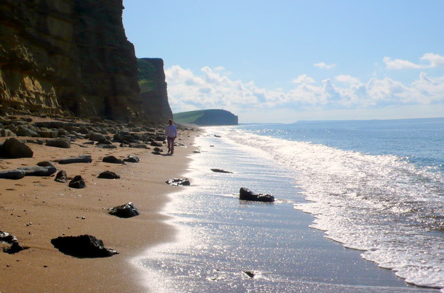
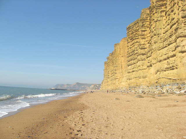
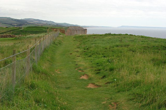
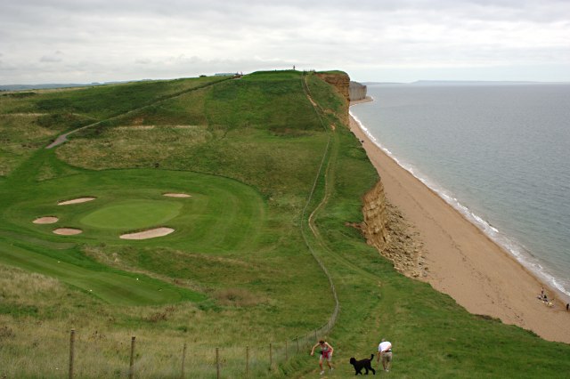
The village is surrounded by stunning natural beauty, with rolling hills and picturesque countryside. The rugged cliffs that line the coast provide a dramatic backdrop to the village, creating a sense of awe and wonder. The area is known for its rich biodiversity, with various species of birds and marine life making Bay their home.
Despite its small size, Bay offers a range of amenities and facilities to cater to both residents and visitors. The village has a local pub, serving traditional English cuisine and offering a warm and friendly atmosphere. Additionally, there are a few small shops and a post office, ensuring that basic needs are met within the community.
Bay is also a popular destination for outdoor enthusiasts, with numerous walking and hiking trails that showcase the natural beauty of the surrounding area. The nearby beach provides an opportunity for swimming, sunbathing, and enjoying various water sports. Visitors can also explore the nearby cliffs and caves, which are steeped in history and offer a glimpse into the area's rich heritage.
Overall, Bay in West Dorset is a hidden gem that combines natural beauty, tranquility, and a sense of community. It offers a peaceful retreat for both residents and visitors, allowing them to immerse themselves in the breathtaking scenery and unwind from the hustle and bustle of daily life.
If you have any feedback on the listing, please let us know in the comments section below.
Bay, West Images
Images are sourced within 2km of 50.711393/-2.7597026 or Grid Reference SY4690. Thanks to Geograph Open Source API. All images are credited.


Bay, West is located at Grid Ref: SY4690 (Lat: 50.711393, Lng: -2.7597026)
Unitary Authority: Dorset
Police Authority: Dorset
What 3 Words
///dormant.jaundice.solo. Near Bridport, Dorset
Nearby Locations
Related Wikis
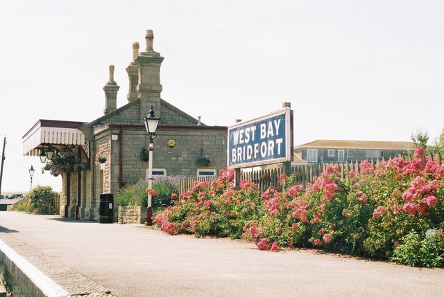
Bridport West Bay railway station
West Bay railway station was the terminus of the Bridport Railway in western Dorset, England. In 1879, the Great Western Railway, who held the operating...

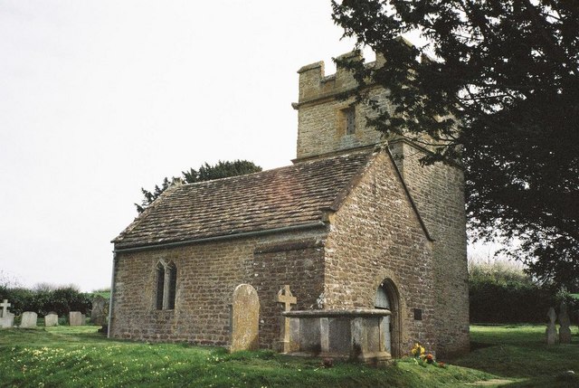
St John's Church, West Bay
St John's Church is a Church of England church in West Bay, Dorset, England. It was built in 1935–39 to the designs of William Henry Randoll Blacking and...

Riverside Restaurant
The Riverside Restaurant was a seafood restaurant in West Bay, England. The building is situated on a causeway and as such the dining area was on two levels...
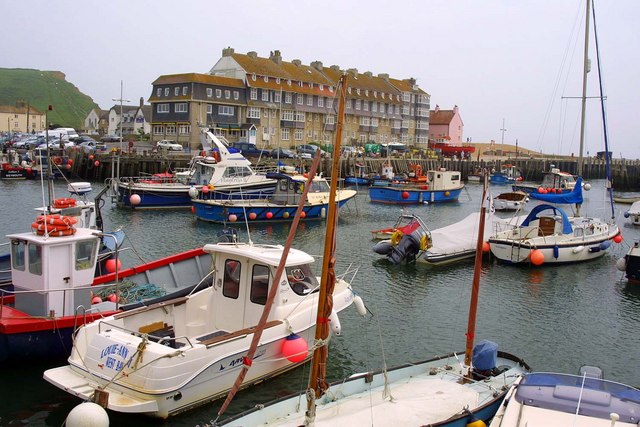
West Bay, Dorset
West Bay, originally known as Bridport Harbour, is a small harbour settlement and resort on the English Channel coast in Dorset, England, sited at the...
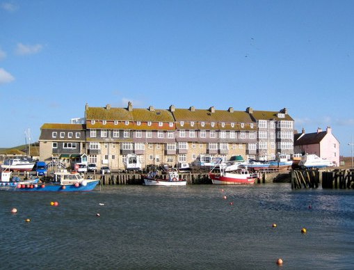
Pier Terrace, West Bay
The Pier Terrace in West Bay, Dorset, was designed by the English Arts and Crafts architect Edward Schroeder Prior in 1884–85. It is a Grade II listed...
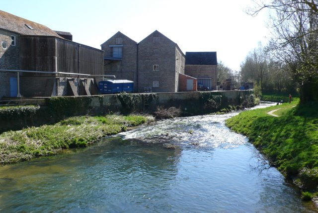
River Brit
The River Brit is a river in west Dorset in south-west England, which rises just to the north of Beaminster. It then flows south to Netherbury and Bridport...
River Asker
The River Asker is a small river in Dorset, England. It rises on the chalk slopes of Eggardon Hill, approximately five miles (8 km) east of Bridport. It...
Bothenhampton
Bothenhampton is a village and civil parish in southwest Dorset, England, just outside the town of Bridport. It is separated from the town only by the...
Nearby Amenities
Located within 500m of 50.711393,-2.7597026Have you been to Bay, West?
Leave your review of Bay, West below (or comments, questions and feedback).