West Barsham

Settlement in Norfolk North Norfolk

England

West Barsham

Barsham Tunnel Remains of what was Barsham Tunnel on the Wells to Wymondham railway line
Barsham Tunnel Credit: andrew watts

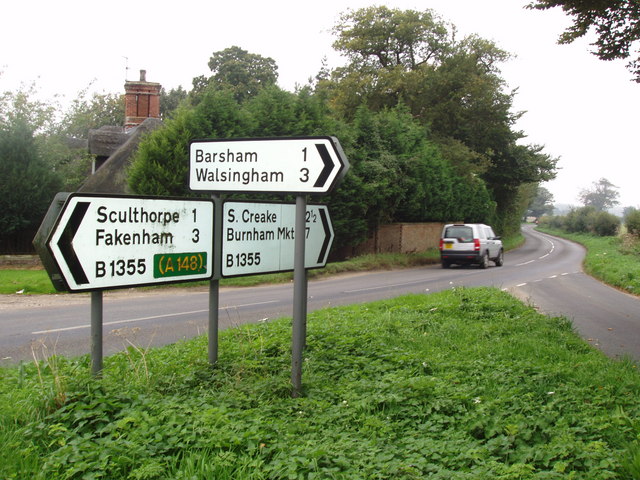
West Barsham is a small village located in the county of Norfolk, England. It is situated approximately 2 miles north of the market town of Fakenham and is part of the civil parish of Barsham. West Barsham has a population of around 100 residents.

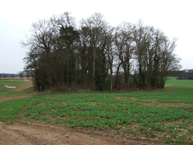
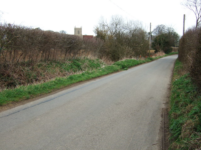
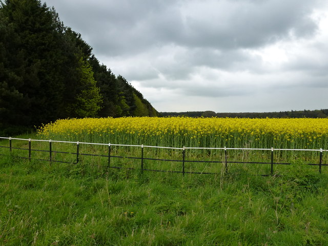
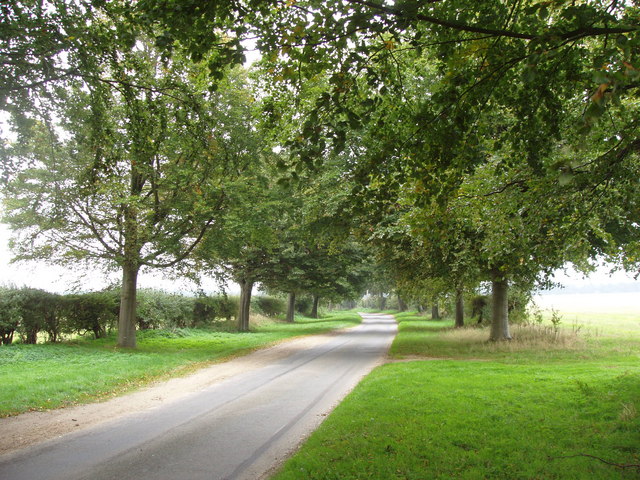
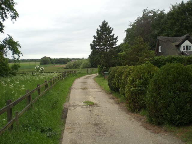
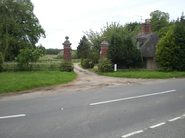
The village is characterized by its rural and picturesque setting, surrounded by open fields and farmland. It is known for its peaceful and tranquil atmosphere, making it an ideal destination for those seeking a quiet and idyllic retreat.

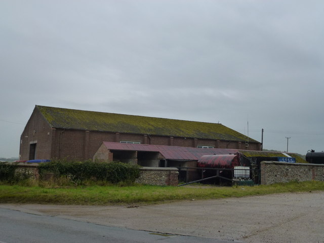
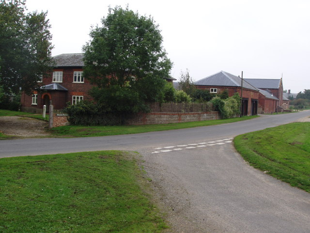
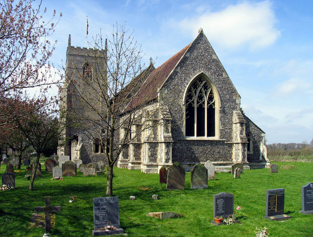
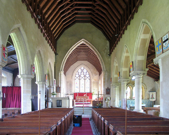
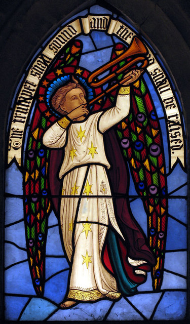
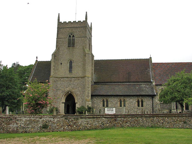
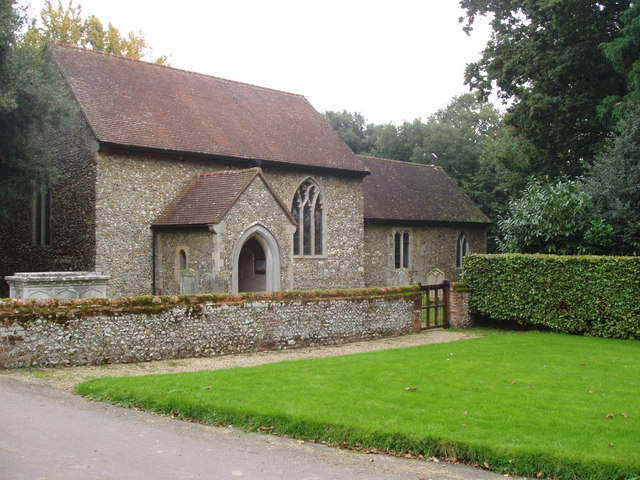
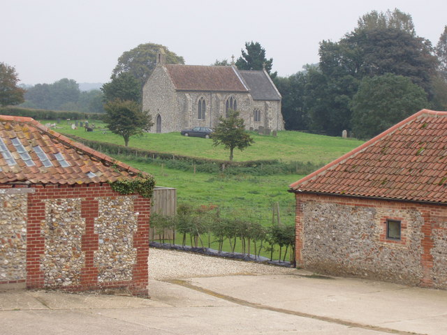
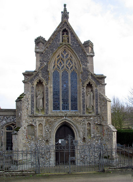
The architecture in West Barsham is predominantly traditional, with a mix of historic cottages and farmhouses. The village church, dedicated to St. Mary, is a notable landmark, dating back to the 14th century and featuring intricate stained glass windows and a picturesque churchyard.

Although primarily a residential area, West Barsham does not have any major amenities or services. Residents typically rely on nearby towns for shopping, healthcare, and educational facilities. However, the village benefits from its close proximity to Fakenham, where a wider range of amenities can be found.

The surrounding countryside offers ample opportunities for outdoor activities, such as walking, cycling, and birdwatching. The village is also conveniently located near the North Norfolk coast, providing easy access to popular coastal destinations like Wells-next-the-Sea and Holkham.

Overall, West Barsham is a charming and peaceful village, perfect for those seeking a rural lifestyle away from the hustle and bustle of city living.

If you have any feedback on the listing, please let us know in the comments section below.

West Barsham Images

Images are sourced within 2km of 52.866514/0.82819541 or Grid Reference TF9033. Thanks to Geograph Open Source API. All images are credited.

Barsham Tunnel Remains of what was Barsham Tunnel on the Wells to Wymondham railway line
Barsham Tunnel
Remains of what was Barsham Tunnel on the Wells to Wymondham railway line
Churchyard, All Saints' Church, East Barsham
Church of All Saints With its flock attending to the overgrown graveyard
Church of All Saints
With its flock attending to the overgrown graveyard
Claypit Clump near Cranmer Park Just north of the Norfolk village of Sculthorpe. There are hundreds of tree filled pits similar to this one all over the Norfolk countryside
Claypit Clump near Cranmer Park
Just north of the Norfolk village of Sculthorpe. There are hundreds of tree filled pits similar to this one all over the Norfolk countryside
Moor Lane in Sculthorpe, Norfolk The church tower of St Mary & All Saints' is visible over the hedge
Moor Lane in Sculthorpe, Norfolk
The church tower of St Mary & All Saints' is visible over the hedge
Rape and railings in Norfolk At the junction of Grove Road, West Barsham and the main road to Fakenham
Rape and railings in Norfolk
At the junction of Grove Road, West Barsham and the main road to Fakenham
Field Barn on Hand Lane near West Barsham A view from the end of Spring Lane looking over the B1105 on a damp Norfolk afternoon
Field Barn on Hand Lane near West Barsham
A view from the end of Spring Lane looking over the B1105 on a damp Norfolk afternoon
Sculthorpe War Memorials The memorials are in the church porch and easily missed.
The WW1 Memorial on the left bears ten names while the WW2 Memorial, on the right, bears six, plus one addition at the bottom for a casualty of the Korean War.
Sculthorpe War Memorials
The memorials are in the church porch and easily missed. The WW1 Memorial on the left bears ten names while the WW2 Memorial, on the right, bears six, plus one addition at the bottom for a casualty of the Korean War.
Roman Road Difficult to imagine that this isolated spot in rural North Norfolk may well have been a busy crossing place nearly 2,000 years ago. The track which crosses the B1335 (Fakenham to Burnham) is a Roman road
Roman Road
Difficult to imagine that this isolated spot in rural North Norfolk may well have been a busy crossing place nearly 2,000 years ago. The track which crosses the B1335 (Fakenham to Burnham) is a Roman road
Signposts Outside the gates of Cranmer Hall... and a clear indication which route to take for a history tour in this remote part of North Norfolk.  An interesting link to Walsingham (the religious shrine), Sculthorpe (the disused RAF WW2 air base) and Burnham Market.
Signposts
Outside the gates of Cranmer Hall... and a clear indication which route to take for a history tour in this remote part of North Norfolk. An interesting link to Walsingham (the religious shrine), Sculthorpe (the disused RAF WW2 air base) and Burnham Market.
Farm in North Norfolk This is Home Farm, close to the estate of Cranmer Hall.  The hall itself was built in 1720 for the Duke of Wellington's Engineer General.  Today the hall is made up of expensive holiday lets and there are holiday cottages in the grounds.
Farm in North Norfolk
This is Home Farm, close to the estate of Cranmer Hall. The hall itself was built in 1720 for the Duke of Wellington's Engineer General. Today the hall is made up of expensive holiday lets and there are holiday cottages in the grounds.
Avenue of trees This avenue of trees lead towards Cranmer Hall.
Avenue of trees
This avenue of trees lead towards Cranmer Hall.
All Saints, Sculthorpe, Norfolk
All Saints, Sculthorpe, Norfolk - East end
All Saints, Sculthorpe, Norfolk - Window
Down the drive Cranmer Hall
Down the drive
Cranmer Hall
Gates and Lodge, Cranmer Park In Sculthorpe CP
Gates and Lodge, Cranmer Park
In Sculthorpe CP
St Mary & All Saints' church in Sculthorpe St Mary & All Saints' church > <a title="https://www.geograph.org.uk/photo/2033209" href="https://www.geograph.org.uk/photo/2033209">Link</a> in Sculthorpe is one of those churches in Norfolk which have the tower on the south wall, rather than on their west end.  The tower dates from the early 13th century but much of the church as we see it today was rebuilt by Sir Roger Knollys after the Hundred Years War, in the 15th century.  In 1847 the chancel was rebuilt yet again and in 1860 the nave was restored and a south aisle added.  The church interior dates mainly from the C19 restoration but a few medieval features have survived such as the brass memorials > <a title="https://www.geograph.org.uk/photo/2033230" href="https://www.geograph.org.uk/photo/2033230">Link</a> and one of only four existing early Norman baptismal fonts > <a title="https://www.geograph.org.uk/photo/2033273" href="https://www.geograph.org.uk/photo/2033273">Link</a> with elaborately carved decorations on the square bowl.  St Mary & All Saints' houses an interesting collection of C19 stained glass > <a title="https://www.geograph.org.uk/photo/2033241" href="https://www.geograph.org.uk/photo/2033241">Link</a> - <a title="https://www.geograph.org.uk/photo/2033243" href="https://www.geograph.org.uk/photo/2033243">Link</a> - <a title="https://www.geograph.org.uk/photo/2033254" href="https://www.geograph.org.uk/photo/2033254">Link</a> and a grade II listed civic organ > <a title="https://www.geograph.org.uk/photo/2033264" href="https://www.geograph.org.uk/photo/2033264">Link</a> made by Johan Schnetzler of Schaffhausen (Switzerland).
St Mary & All Saints' church in Sculthorpe
St Mary & All Saints' church > Link in Sculthorpe is one of those churches in Norfolk which have the tower on the south wall, rather than on their west end. The tower dates from the early 13th century but much of the church as we see it today was rebuilt by Sir Roger Knollys after the Hundred Years War, in the 15th century. In 1847 the chancel was rebuilt yet again and in 1860 the nave was restored and a south aisle added. The church interior dates mainly from the C19 restoration but a few medieval features have survived such as the brass memorials > Link and one of only four existing early Norman baptismal fonts > Link with elaborately carved decorations on the square bowl. St Mary & All Saints' houses an interesting collection of C19 stained glass > Link - Link - Link and a grade II listed civic organ > Link made by Johan Schnetzler of Schaffhausen (Switzerland).
Show me another place!

West Barsham is located at Grid Ref: TF9033 (Lat: 52.866514, Lng: 0.82819541)

Administrative County: Norfolk

District: North Norfolk

Police Authority: Norfolk

What 3 Words

///starlight.mobile.private. Near Fakenham, Norfolk

Related Wikis

West Barsham

West Barsham is a village and former civil parish, now in the parish of Barsham, in the North Norfolk district, in the county of Norfolk, England. In 1931...

Barsham, Norfolk

Barsham is a civil parish in the English county of Norfolk, and includes the villages of East Barsham, North Barsham, West Barsham and Houghton St Giles...
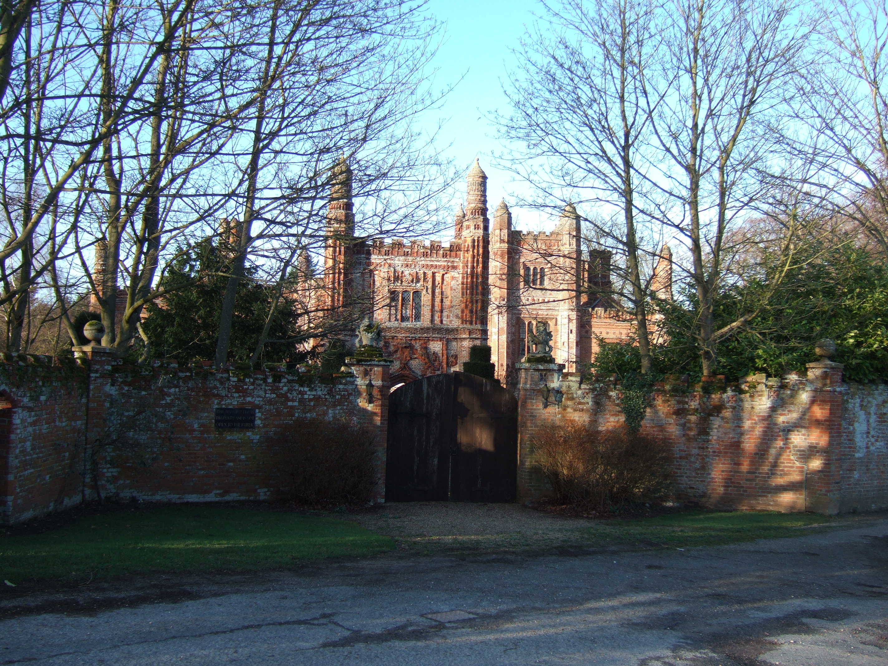
East Barsham Manor

East Barsham Manor is an important work of Tudor architecture, a leading and early example of a prodigy house, originally built in the 1520s. It is located...

East Barsham

East Barsham is a village and former civil parish, now in the parish of Barsham, in the North Norfolk district, in the English county of Norfolk. In 1931...

North Barsham

North Barsham is a village and former civil parish, now in the parish of Barsham, in the North Norfolk district, in the county of Norfolk, England. In...

Basilica of Our Lady of Walsingham

The Basilica of Our Lady of Walsingham, informally known as the Slipper Chapel or the Chapel of Saint Catherine of Alexandria, is a Catholic basilica in...

Houghton Saint Giles

Houghton Saint Giles is a village and former civil parish, now in the parish of Barsham, in the North Norfolk district, in the English county of Norfolk...
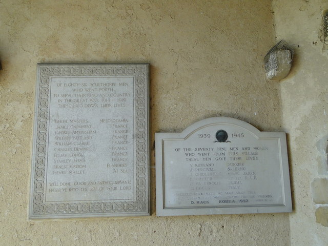
Sculthorpe, Norfolk

Sculthorpe is a village and civil parish in the English county of Norfolk. The village is some 4 km (2.5 mi) north-west of Fakenham and 5 km (3.1 mi) south...

Nearby Amenities

Located within 500m of 52.866514,0.82819541
West Barsham
Place: village
Wikidata: Q7984397
Lat/Long: 52.8680444/0.8273545
Entrance: main
Lat/Long: 52.8668081/0.8284117
Entrance: yes
Lat/Long: 52.8669063/0.828415
The data included in this document is from www.openstreetmap.org. The data is made available under ODbL.

Have you been to West Barsham?

Leave your review of West Barsham below (or comments, questions and feedback).