West Ashford

Settlement in Devon North Devon

England

West Ashford

Cutting on dismantled railway at Penhill The old railway line along the edge of the Taw estuary now carries the South West Coast Path and the Tarka Trail.  It is also very popular as a cycle path.
Cutting on dismantled railway at Penhill Credit: Tony Atkin

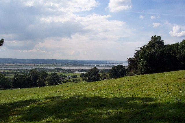
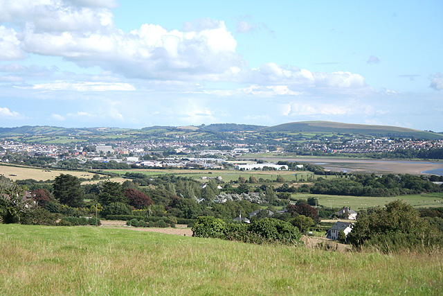
West Ashford is a small village located in the county of Devon, in the southwest of England. Situated on the edge of Dartmoor National Park, it is surrounded by stunning natural beauty and offers a peaceful and picturesque setting for residents and visitors alike.

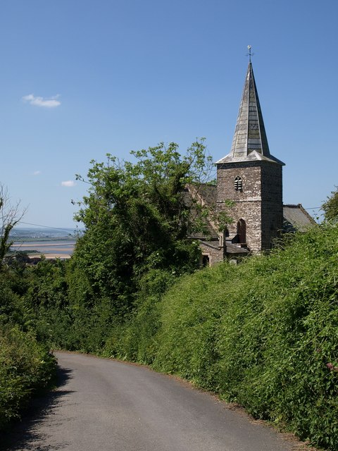
The village is home to a close-knit community, with a population of around 500 people. Its origins can be traced back to medieval times, as evidenced by the historic St. Mary's Church, which dates back to the 13th century. The church's striking architecture and beautiful stained glass windows are a testament to the village's rich history.

Despite its small size, West Ashford boasts several amenities to cater to the needs of its residents. These include a village hall, a primary school, a local pub, and a post office. The village also benefits from regular bus services, connecting it to nearby towns and cities.

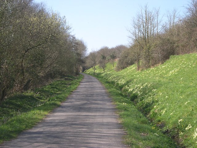
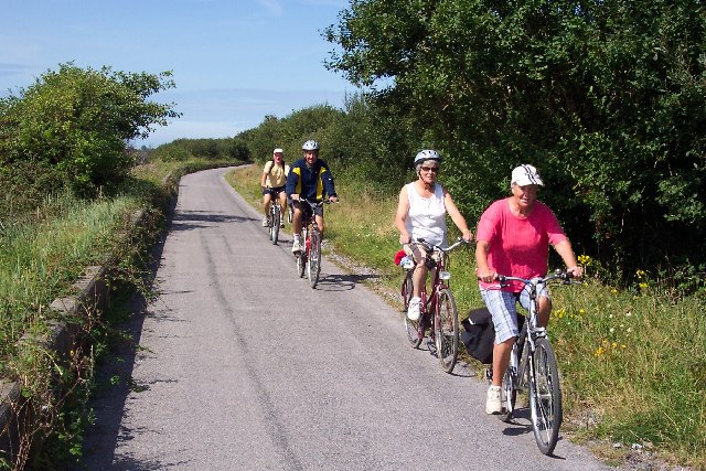
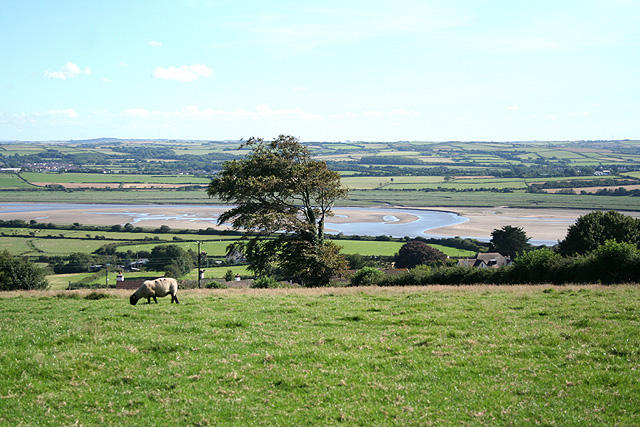
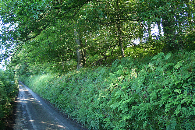
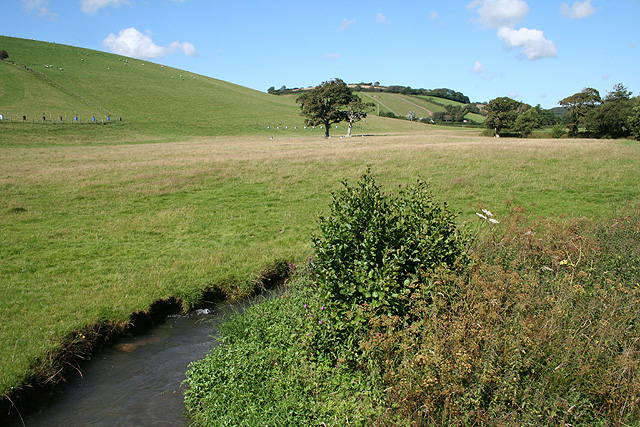
Nature enthusiasts are drawn to West Ashford due to its proximity to Dartmoor National Park. The park offers a range of outdoor activities, including hiking, cycling, and horseback riding, allowing visitors to explore its rugged landscapes, ancient woodlands, and stunning wildlife. The village itself is surrounded by rolling green fields and offers plenty of opportunities for walks and countryside strolls.

Overall, West Ashford offers a charming rural retreat, combining history, natural beauty, and a sense of community. It is an idyllic destination for those seeking a peaceful escape or a base to explore the stunning Devon countryside.

If you have any feedback on the listing, please let us know in the comments section below.
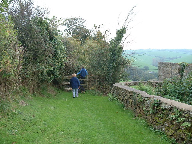
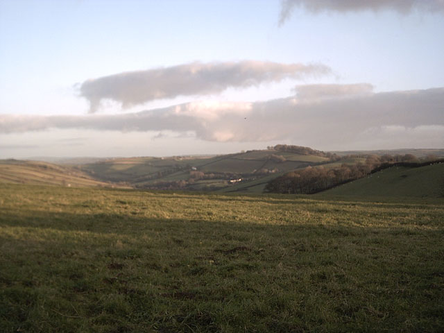
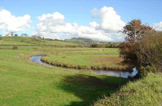
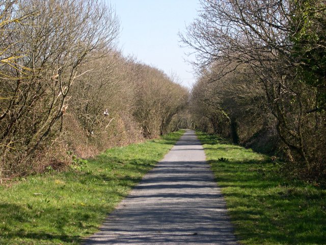
West Ashford Images

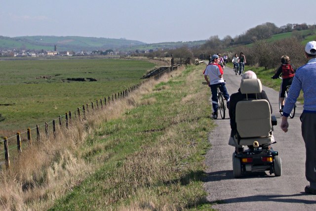
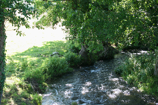
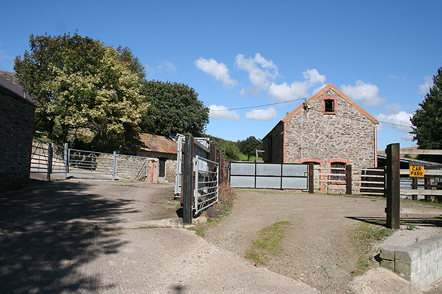
Images are sourced within 2km of 51.098405/-4.106416 or Grid Reference SS5235. Thanks to Geograph Open Source API. All images are credited.

Cutting on dismantled railway at Penhill The old railway line along the edge of the Taw estuary now carries the South West Coast Path and the Tarka Trail.  It is also very popular as a cycle path.
Cutting on dismantled railway at Penhill
The old railway line along the edge of the Taw estuary now carries the South West Coast Path and the Tarka Trail. It is also very popular as a cycle path.
Near Barnstaple, North Devon A view looking south west from Bradiford over the estuary of the River Taw.
Near Barnstaple, North Devon
A view looking south west from Bradiford over the estuary of the River Taw.
Anchored on the Taw The River Taw, taken from the Tarka Trail cycle path near Heanton Court.
Anchored on the Taw
The River Taw, taken from the Tarka Trail cycle path near Heanton Court.
Tarka Trail cycle path near Barnstaple The Tarka Trail cycle path looking towards Barnstaple from near Strand House. The cycle path uses the course of the old Ilfracombe to Barnstaple railway, which here also forms the sea wall.
Tarka Trail cycle path near Barnstaple
The Tarka Trail cycle path looking towards Barnstaple from near Strand House. The cycle path uses the course of the old Ilfracombe to Barnstaple railway, which here also forms the sea wall.
Cyclists on the Tarka Trail This photograph is a bit of a cheat. I wanted a picture of a big group of cyclists but the lady in the front came along well ahead of her friends. So I took two pictures and assembled them together. Unfortunately my cut and paste missed part of the shadow of the front bike wheel!
Cyclists on the Tarka Trail
This photograph is a bit of a cheat. I wanted a picture of a big group of cyclists but the lady in the front came along well ahead of her friends. So I took two pictures and assembled them together. Unfortunately my cut and paste missed part of the shadow of the front bike wheel!
Path to Pippacot Wood
Farmland near Springfield Cross Looking towards Shirwell Cross.
Farmland near Springfield Cross
Looking towards Shirwell Cross.
Bradiford Water Bird Reserve, Barnstaple Water meadows, scrapes and ponds just before confluence of Bradiford Water and River Taw. Situated at west end of Pottington Industrial Estate, Barnstaple. Image taken from the Tarka Trail (old trackbed of the Barnstaple to Ilfracombe Railway) looking east with Roborough (iron age fort) in far background.
Bradiford Water Bird Reserve, Barnstaple
Water meadows, scrapes and ponds just before confluence of Bradiford Water and River Taw. Situated at west end of Pottington Industrial Estate, Barnstaple. Image taken from the Tarka Trail (old trackbed of the Barnstaple to Ilfracombe Railway) looking east with Roborough (iron age fort) in far background.
Cycle Path past RAF Chivenor This path is a part of both the South West Coast Path and the Tarka Trail.  It is built on the course of an old railway line.
Cycle Path past RAF Chivenor
This path is a part of both the South West Coast Path and the Tarka Trail. It is built on the course of an old railway line.
A Path for Everybody For most of its length around the Taw estuary, the path which constitutes part of the Southwest Coast Path and the Tarka Trail is built along disused railway lines and surfaced as a cycle track making it suitable for anyone to use.
A Path for Everybody
For most of its length around the Taw estuary, the path which constitutes part of the Southwest Coast Path and the Tarka Trail is built along disused railway lines and surfaced as a cycle track making it suitable for anyone to use.
Misty morning on the River Taw Misty morning on the River Taw looking from the Tarka Trail.
Misty morning on the River Taw
Misty morning on the River Taw looking from the Tarka Trail.
Heanton Punchardon: towards the Taw estuary Looking south with Fremington Quay just visible on the far bank of the river – at SS515332
Heanton Punchardon: towards the Taw estuary
Looking south with Fremington Quay just visible on the far bank of the river – at SS515332
Heanton Punchardon: Knowl Water At Knowlwater Bridge, looking west, downstream. A lively tributary of the river Caen, itself a tributary of the Taw
Heanton Punchardon: Knowl Water
At Knowlwater Bridge, looking west, downstream. A lively tributary of the river Caen, itself a tributary of the Taw
Heanton Punchardon: Luscott Barton Outbuildings seen from the public footpath to Pippacott. Looking east
Heanton Punchardon: Luscott Barton
Outbuildings seen from the public footpath to Pippacott. Looking east
Heanton Punchardon: near West Ashford Barton View across a field near West Ashford with Barnstaple in the distance. Looking south east
Heanton Punchardon: near West Ashford Barton
View across a field near West Ashford with Barnstaple in the distance. Looking south east
Ashford: above the village Looking south from Horridge towards the Taw estuary
Ashford: above the village
Looking south from Horridge towards the Taw estuary
Marwood: lane south of Whitehall It leads to Springfield Cross. Looking south east
Marwood: lane south of Whitehall
It leads to Springfield Cross. Looking south east
Heanton Punchardon: Knowl Water valley Seen from Knowlwater Bridge on the Old Barnstaple Road
Heanton Punchardon: Knowl Water valley
Seen from Knowlwater Bridge on the Old Barnstaple Road
Show me another place!

West Ashford is located at Grid Ref: SS5235 (Lat: 51.098405, Lng: -4.106416)

Administrative County: Devon

District: North Devon

Police Authority: Devon and Cornwall

What 3 Words

///headings.neon.collide. Near Braunton, Devon

Related Wikis

Ashford, North Devon

Ashford is a village and civil parish in the North Devon district of Devon, England. According to the 2011 census it had a population of 267.This Ashford...

Braunton Road rail accident

The Braunton Road railway accident occurred on 1 January 1910 in England. The Lynton & Barnstaple Railway maintained an exemplary safety record throughout...

Pilton West

Pilton West is a rural civil parish of North Devon, Devon, England, immediately north-west of the suburb of Pilton in the town of Barnstaple. The parish...

Fremington railway station

Fremington railway station served the village of Fremington, Devon, England, from 1855 to 1965 on the Bideford Extension Railway. Located at Fremington...

Nearby Amenities

Located within 500m of 51.098405,-4.106416
Post Box
Operator: Royal Mail
Operator Wikidata: Q638098
Post Box Type: lamp
Ref: EX31 39
Royal Cypher: EIIR
Royal Cypher Wikidata: Q33102113
Lat/Long: 51.0941174/-4.1043179
Barrier: cycle_barrier
Lat/Long: 51.0942487/-4.1042896
Windy Cross
Place: locality
Lat/Long: 51.1006913/-4.1093581
West Ashford Barton
Place: hamlet
Lat/Long: 51.0984289/-4.1108197
West Ashford
Place: locality
Lat/Long: 51.0976076/-4.1019362
Horridge
Place: hamlet
Lat/Long: 51.0998448/-4.1016088
Power: pole
Lat/Long: 51.1007261/-4.1012183
Power: pole
Lat/Long: 51.1007194/-4.1027766
Power: pole
Lat/Long: 51.1007514/-4.1044986
Power: pole
Lat/Long: 51.1007581/-4.1064298
Power: pole
Lat/Long: 51.1007951/-4.1084334
Power: pole
Lat/Long: 51.1007901/-4.1103217
Generator Method: photovoltaic
Generator Output Electricity: yes
Generator Source: solar
Generator Type: solar_photovoltaic_panel
Location: roof
Power: generator
Lat/Long: 51.0985597/-4.0994177
Generator Method: photovoltaic
Generator Output Electricity: yes
Generator Source: solar
Generator Type: solar_photovoltaic_panel
Location: roof
Power: generator
Lat/Long: 51.0982572/-4.0999541
Generator Method: photovoltaic
Generator Output Electricity: yes
Generator Source: solar
Generator Type: solar_photovoltaic_panel
Location: roof
Power: generator
Lat/Long: 51.0946269/-4.1051147
Generator Method: photovoltaic
Generator Output Electricity: yes
Generator Source: solar
Generator Type: solar_photovoltaic_panel
Location: roof
Power: generator
Lat/Long: 51.0945039/-4.1050744
Generator Method: photovoltaic
Generator Output Electricity: yes
Generator Source: solar
Generator Type: solar_photovoltaic_panel
Location: roof
Power: generator
Lat/Long: 51.0944348/-4.1051147
The data included in this document is from www.openstreetmap.org. The data is made available under ODbL.

Have you been to West Ashford?

Leave your review of West Ashford below (or comments, questions and feedback).