Aith

Settlement in Shetland

Scotland

Aith

Aith Lifeboat and Lifeboat Station, Shetland Islands A view of the Severn Class Aith Lifeboat Charles Lidbury and Lifeboat Station in the background. Currently moored on the deep water jetty in St Magnus Bay. Aith Lifeboat station is the most northerly in the British Isles.
Aith Lifeboat and Lifeboat Station, Shetland Islands Credit: Mr S Mudgey

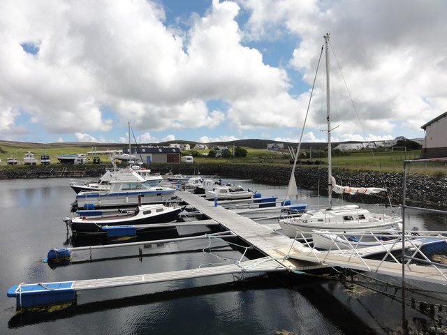
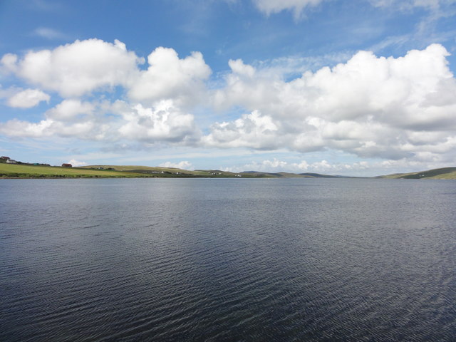
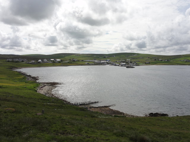
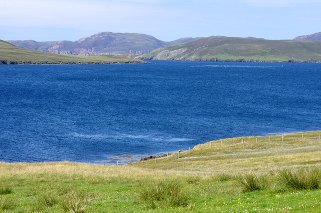
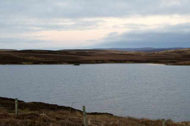
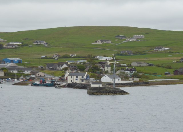
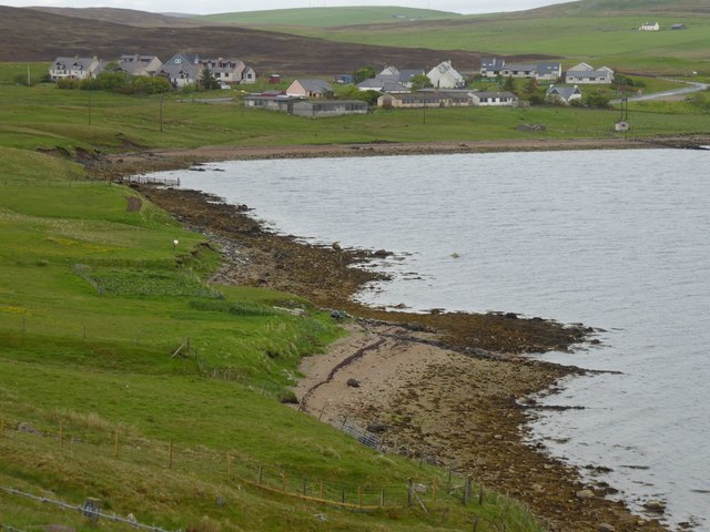
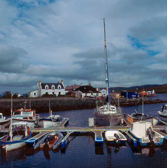
Aith is a small village located on the island of Shetland, Scotland. Situated on the west coast of the mainland, it is part of the parish of Sandsting and Aithsting. Aith is known for its picturesque setting, surrounded by beautiful rolling hills and stunning coastline.

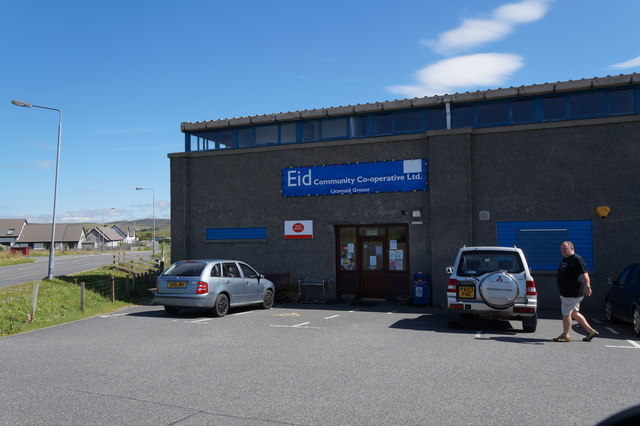
The village has a population of around 300 residents, making it a tight-knit community where everyone knows each other. It has basic amenities such as a primary school, post office, and a local shop, but for more extensive facilities, residents often travel to Lerwick, the capital of Shetland.

Aith is renowned for its natural beauty and is a popular destination for outdoor enthusiasts. The surrounding area offers opportunities for walking, hiking, and birdwatching, with the nearby Virdafjell Hill being a popular spot for panoramic views of the surrounding landscape.

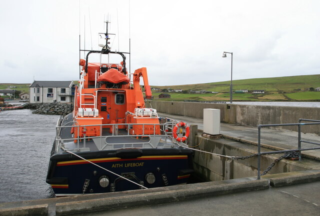
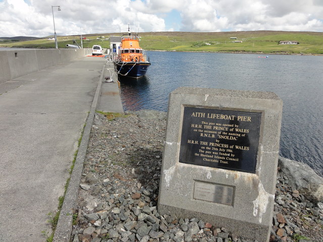
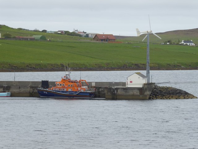
The village is also home to Aith Lifeboat Station, which provides essential search and rescue services to the local area. The lifeboat station plays a crucial role in ensuring the safety of those who venture out to sea.

Throughout the year, Aith hosts various cultural events and festivals, such as the Aith Agricultural Show, which showcases the local farming community and rural Shetland life. These events bring together locals and visitors, creating a vibrant atmosphere in the village.

Overall, Aith is a charming village that offers a peaceful and picturesque setting, perfect for those seeking a close-knit community and a connection with the stunning natural surroundings of Shetland.

If you have any feedback on the listing, please let us know in the comments section below.

Aith Images

Images are sourced within 2km of 60.285039/-1.383834 or Grid Reference HU3455. Thanks to Geograph Open Source API. All images are credited.

Aith Lifeboat and Lifeboat Station, Shetland Islands A view of the Severn Class Aith Lifeboat Charles Lidbury and Lifeboat Station in the background. Currently moored on the deep water jetty in St Magnus Bay. Aith Lifeboat station is the most northerly in the British Isles.
Aith Lifeboat and Lifeboat Station, Shetland Islands
A view of the Severn Class Aith Lifeboat Charles Lidbury and Lifeboat Station in the background. Currently moored on the deep water jetty in St Magnus Bay. Aith Lifeboat station is the most northerly in the British Isles.
Aith Marina The Marina at Aith
Aith Marina
The Marina at Aith
Aith Lifeboat Pier Aith Lifeboat Pier with a commemorative plaque reading that it was opened by HRH Princess of Wales.
Aith Lifeboat Pier
Aith Lifeboat Pier with a commemorative plaque reading that it was opened by HRH Princess of Wales.
Aith Voe View out over Aith Voe from the lifeboat station
Aith Voe
View out over Aith Voe from the lifeboat station
Aith Voe View across Aith Voe
Aith Voe
View across Aith Voe
Eid Community Co-operative Ltd, Aith Eid is the original Viking name for Aith and has been adopted as the name for the local community run shop.
Eid Community Co-operative Ltd, Aith
Eid is the original Viking name for Aith and has been adopted as the name for the local community run shop.
East-the-Voe, Aith Looking towards Muckle Roe.
East-the-Voe, Aith
Looking towards Muckle Roe.
The hoverfly Xylota segnis, East-the-voe, Aith Possibly a recent colonist, the larvae of this hoverfly feed in dead wood, and the species is now fairly widespread in areas with even just a few mature trees on Shetland Mainland.
The hoverfly Xylota segnis, East-the-voe, Aith
Possibly a recent colonist, the larvae of this hoverfly feed in dead wood, and the species is now fairly widespread in areas with even just a few mature trees on Shetland Mainland.
The hoverfly Eristalis pertinax, East-the-voe, Aith A common and widespread species in Shetland.
The hoverfly Eristalis pertinax, East-the-voe, Aith
A common and widespread species in Shetland.
A Polietes fly, East-the-Voe, Aith One of the houseflies (Muscidae).
A Polietes fly, East-the-Voe, Aith
One of the houseflies (Muscidae).
The hoverfly Rhingia campestris, East-the-voe, Aith A common species; covered in pollen and sitting on a Fuchsia flower.
The hoverfly Rhingia campestris, East-the-voe, Aith
A common species; covered in pollen and sitting on a Fuchsia flower.
Loch of North-house, near Twatt
Aith Lifeboat Station 'Operating for over 80 years, Aith is the most northerly lifeboat station providing protection off Shetland’s sometimes wild Atlantic coast.'  <span class="nowrap"><a title="https://rnli.org/find-my-nearest/lifeboat-stations/aith-lifeboat-station" rel="nofollow ugc noopener" href="https://rnli.org/find-my-nearest/lifeboat-stations/aith-lifeboat-station">Link</a><img style="margin-left:2px;" alt="External link" title="External link - shift click to open in new window" src="https://s1.geograph.org.uk/img/external.png" width="10" height="10"/></span>
At the head of Aith Voe.
Aith Lifeboat Station
'Operating for over 80 years, Aith is the most northerly lifeboat station providing protection off Shetland’s sometimes wild Atlantic coast.' LinkExternal link At the head of Aith Voe.
Wind turbine on the end of the pier At Aith. The lifeboat is absent.
Wind turbine on the end of the pier
At Aith. The lifeboat is absent.
Beach at Punds With Aith across the voe.
Beach at Punds
With Aith across the voe.
Michaelswood, Aith
Michaelswood, Aith
Tyrannosaurus in Michaelswood, Aith
Triceratops in Michaelswood, Aith
Show me another place!

Aith is located at Grid Ref: HU3455 (Lat: 60.285039, Lng: -1.383834)

Unitary Authority: Shetland Islands

Police Authority: Highlands and Islands

What 3 Words

///powering.coaching.energy. Near Aith, Shetland Islands

Related Wikis

Aith

Aith, (Shetland dialect: Eid, Old Norse: Eið, meaning Isthmus, cf Eday), is a village on the Northern coast of the West Shetland Mainland, Scotland at...

Braewick, Sandsting

Braewick is a settlement on the west Mainland of Shetland, Scotland. Braewick is on the western shore of Aith Voe and 1.2 mi (2 km) north of Aith itself...
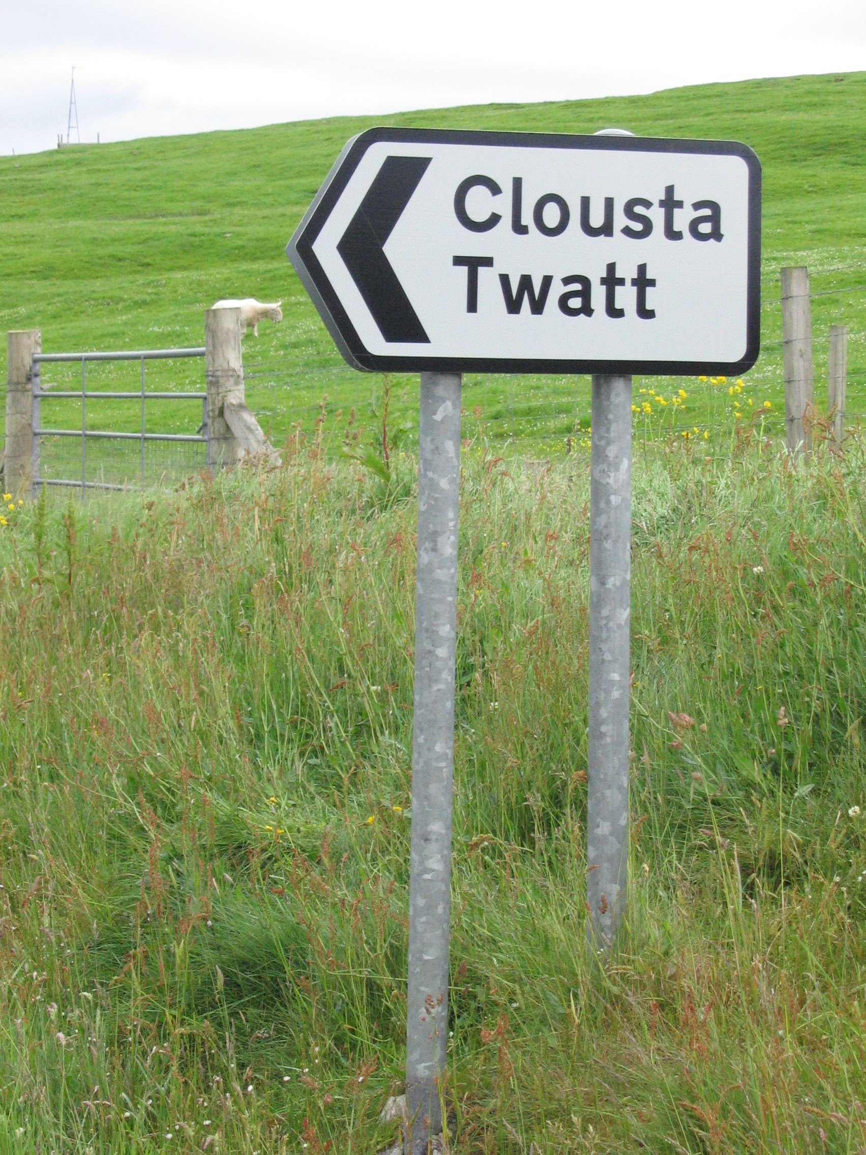
Twatt, Shetland

Twatt is a settlement in the Shetland Islands of Scotland. It is located on the Shetland Mainland on a minor road that leads from the A971 road to Clousta...

Clousta

Clousta is a hamlet on Mainaland, in the island's west, Shetland, Scotland. Approximately seventy people live here, many of whom are commuters, but local...

Bixter

Bixter is a village on the west side of the Shetland Islands, located more than 160 km (99 mi) off the north coast of mainland Scotland. Bixter is a group...

Park Hall, Shetland

Park Hall is a derelict laird's house situated west of the village of Bixter, in the parish of Sandsting on the Mainland of Shetland, Scotland. It has...

Westerfield, Shetland

Westerfield is a coastal community on Mainland, in Shetland, Scotland. The community is within the parish of Sandsting.It lies to the west of Tresta on...

Mainland, Shetland

The Mainland is the main island of Shetland, Scotland. The island contains Shetland's only burgh, Lerwick, and is the centre of Shetland's ferry and air...

Nearby Amenities

Located within 500m of 60.285039,-1.383834
Aith
Name Sco: Aid
Place: village
Lat/Long: 60.2843334/-1.3762487
Post Office
Aith Post Office
Addr City: Shetland
Addr Postcode: ZE2 9NB
Opening Hours: Mo,Tu,Th 10:00-16:00; Fr 09:00-16:00; Sa 10:00-14:00
Ref Pol Id: 1280
Source: OS OpenData StreetView
Lat/Long: 60.2837951/-1.3795768
Post Box
Note: Not listed by Royal Mail
Operator: Royal Mail
Ref: ZE2 unnumbered
Lat/Long: 60.2837847/-1.3797263
Entrance: yes
Lat/Long: 60.2852782/-1.3834459
Telephone
Booth: K6
Covered: booth
Man Made: telephone_box
Lat/Long: 60.2860335/-1.375864
Power: pole
Lat/Long: 60.2847742/-1.3750574
Power: pole
Lat/Long: 60.2889297/-1.3855527
Power: pole
Lat/Long: 60.2882917/-1.3855712
Power: pole
Lat/Long: 60.287671/-1.3855943
Power: pole
Lat/Long: 60.2870468/-1.3856359
Power: pole
Lat/Long: 60.2864169/-1.3856543
Power: pole
Lat/Long: 60.285945/-1.3856728
Power: pole
Lat/Long: 60.2854044/-1.3856913
Power: pole
Lat/Long: 60.2847653/-1.3856982
Power: pole
Lat/Long: 60.2841479/-1.3857214
Power: pole
Lat/Long: 60.2836439/-1.385756
Power: pole
Lat/Long: 60.2831376/-1.3857676
Power: pole
Lat/Long: 60.2826027/-1.3857884
Power: pole
Lat/Long: 60.2821102/-1.386031
Power: pole
Lat/Long: 60.2816061/-1.3862621
Power: pole
Lat/Long: 60.2809028/-1.3865948
Power: pole
Lat/Long: 60.2863997/-1.3846815
Power: pole
Lat/Long: 60.2863883/-1.3838243
Power: pole
Lat/Long: 60.2862886/-1.3836972
Power: pole
Lat/Long: 60.2869987/-1.3837295
Power: pole
Lat/Long: 60.2873767/-1.3837619
Power: pole
Lat/Long: 60.2875198/-1.3833945
Power: pole
Lat/Long: 60.2877935/-1.3827013
Power: pole
Lat/Long: 60.2878749/-1.383889
Power: pole
Lat/Long: 60.2883628/-1.3840161
Power: pole
Lat/Long: 60.2847859/-1.386879
Power: pole
Lat/Long: 60.284172/-1.3843396
Power: pole
Lat/Long: 60.2842075/-1.3829208
Power: pole
Lat/Long: 60.2842372/-1.3815089
Power: pole
Lat/Long: 60.2842659/-1.3800255
Power: pole
Lat/Long: 60.2837951/-1.3810768
Power: pole
Lat/Long: 60.2815592/-1.38702
Power: pole
Lat/Long: 60.2814423/-1.3885034
Power: pole
Lat/Long: 60.2818295/-1.3897974
Power: pole
Lat/Long: 60.2822648/-1.3901463
Power: pole
Lat/Long: 60.2826417/-1.3904537
Bus Stop
Aith
Fixme: Location unknown
Public Transport: platform
Lat/Long: 60.2844841/-1.3788311
The data included in this document is from www.openstreetmap.org. The data is made available under ODbL.

Have you been to Aith?

Leave your review of Aith below (or comments, questions and feedback).