Warkworth

Settlement in Northumberland

England

Warkworth

Weir on River Coquet between Warkworth and Amble The river remains tidal above this weir until another the other side of Warkworth.

Note the fish ladder, and if you look closely there are two herons ready to pounce.
Weir on River Coquet between Warkworth and Amble Credit: Chris Morgan

Warkworth is a charming village located in the county of Northumberland, England. Situated on the north bank of the River Coquet, it is nestled within the picturesque Northumberland Coast Area of Outstanding Natural Beauty.

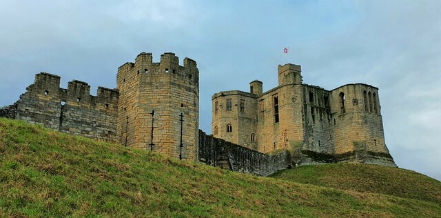
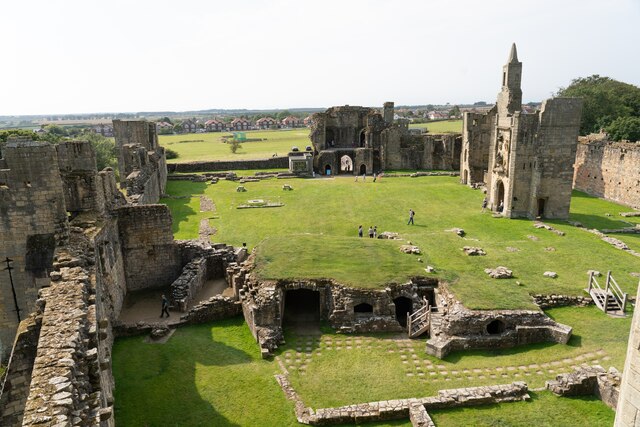
The village is famous for its stunning 12th-century castle, which stands proudly on a hilltop overlooking the village and offers breathtaking views of the surrounding countryside. The castle's impressive structure and its well-preserved keep make it a popular tourist attraction, drawing visitors from near and far.

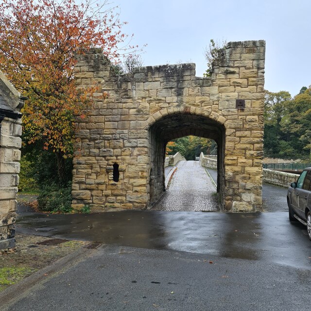
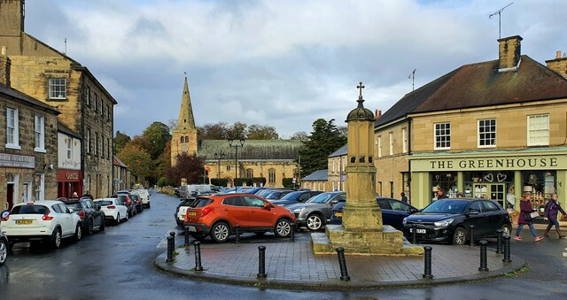
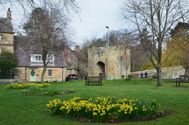
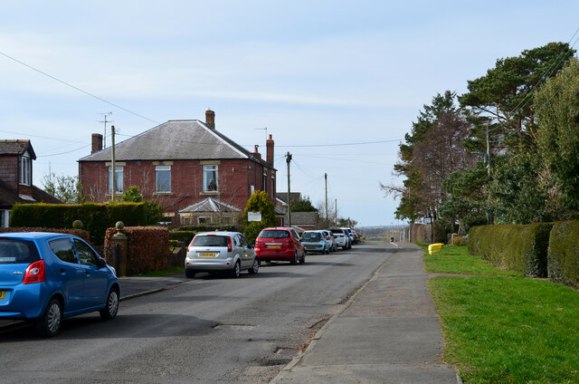
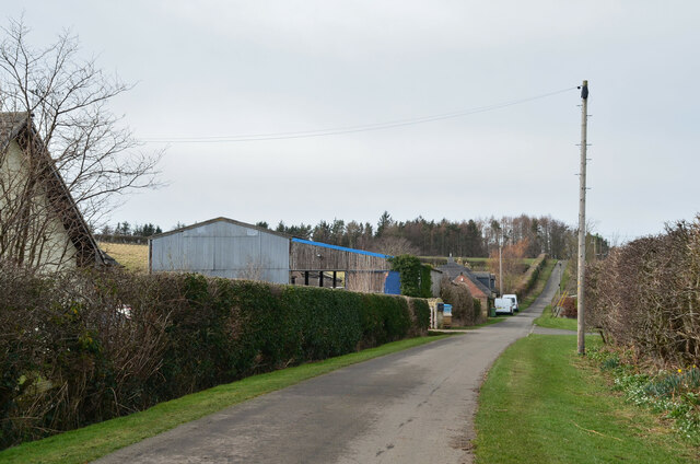
Warkworth boasts a rich history, with evidence of settlement dating back to the Iron Age. The village was an important center during medieval times, known for its bustling market and thriving fishing industry. Today, remnants of its past can still be seen in the form of narrow, winding streets and traditional stone-built houses.

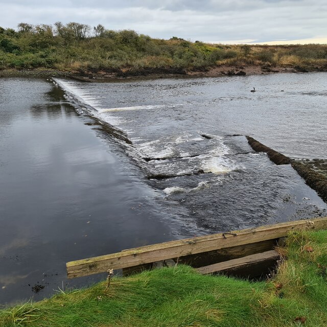
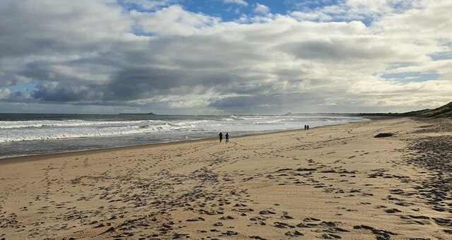
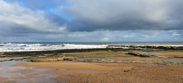
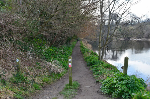
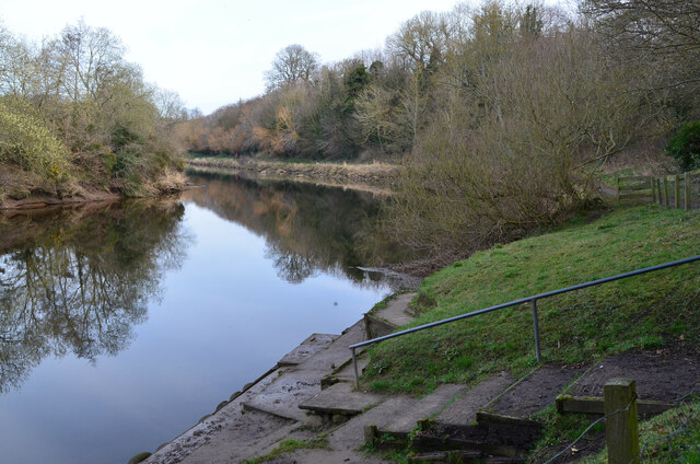
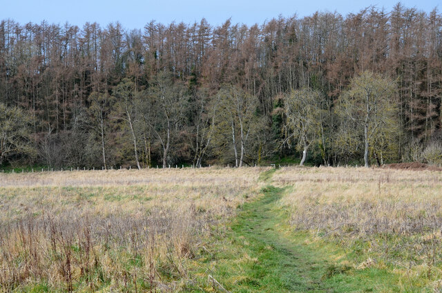
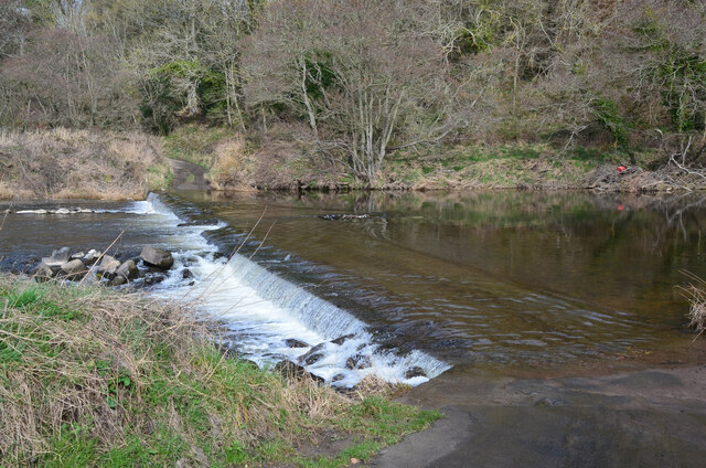
The tranquil atmosphere and idyllic surroundings make Warkworth a haven for nature enthusiasts and outdoor lovers. The nearby River Coquet provides opportunities for peaceful walks along its banks, while the stunning coastline offers sandy beaches and dramatic cliffs, perfect for long walks and bird-watching.

Warkworth is also home to a range of amenities, including cozy pubs, quaint tearooms, and independent shops, providing visitors with a taste of local hospitality and a chance to browse unique crafts and gifts.

With its historical charm, natural beauty, and warm community spirit, Warkworth truly offers a delightful escape for those seeking a peaceful retreat in the heart of Northumberland.

If you have any feedback on the listing, please let us know in the comments section below.

Warkworth Images

Images are sourced within 2km of 55.347763/-1.6119296 or Grid Reference NU2406. Thanks to Geograph Open Source API. All images are credited.

Weir on River Coquet between Warkworth and Amble The river remains tidal above this weir until another the other side of Warkworth.

Note the fish ladder, and if you look closely there are two herons ready to pounce.
Weir on River Coquet between Warkworth and Amble
The river remains tidal above this weir until another the other side of Warkworth. Note the fish ladder, and if you look closely there are two herons ready to pounce.
Defensive gateway to Warkworth bridge The bridge was probably built about 1380 and was still being used by all road traffic up and down the coast until the 1960s. There were traffic lights and long queues at busy times. 

A good description is on the Historic England website, see; <span class="nowrap"><a title="https://historicengland.org.uk/listing/the-list/list-entry/1020741" rel="nofollow ugc noopener" href="https://historicengland.org.uk/listing/the-list/list-entry/1020741">Link</a><img style="margin-left:2px;" alt="External link" title="External link - shift click to open in new window" src="https://s1.geograph.org.uk/img/external.png" width="10" height="10"/></span>
Defensive gateway to Warkworth bridge
The bridge was probably built about 1380 and was still being used by all road traffic up and down the coast until the 1960s. There were traffic lights and long queues at busy times. A good description is on the Historic England website, see; LinkExternal link
Warkworth, Northumberland The church of St Lawrence in Warkworth, dating from the 12th century.
Warkworth, Northumberland
The church of St Lawrence in Warkworth, dating from the 12th century.
Warkworth, Northumberland Warkworth Castle in Warkworth is a ruined medieval castle believed to date from at least the 12th century.
Warkworth, Northumberland
Warkworth Castle in Warkworth is a ruined medieval castle believed to date from at least the 12th century.
Birling, Northumberland Looking southeast along the beach at Birling.
Birling, Northumberland
Looking southeast along the beach at Birling.
Birling, Northumberland The coast line at Birling Carrs, Birling.
Birling, Northumberland
The coast line at Birling Carrs, Birling.
Warkworth castle and surrounding fields
Gateway to 14th century bridge, Warkworth The gateway at the south end of the medieval bridge spanning the River Coquet. In the foreground is a small park by the A1068 at the north end of the town.
Gateway to 14th century bridge, Warkworth
The gateway at the south end of the medieval bridge spanning the River Coquet. In the foreground is a small park by the A1068 at the north end of the town.
Riverside path, Warkworth The path on the south bank of the River Coquet which encloses the town in the last of its meanderings before reaching the sea at Warkworth Harbour, Amble.
Riverside path, Warkworth
The path on the south bank of the River Coquet which encloses the town in the last of its meanderings before reaching the sea at Warkworth Harbour, Amble.
Bend on the River Coquet, Warkworth The river swings northward in its final meander, within which the medieval town of Warkworth was built around its castle.
Bend on the River Coquet, Warkworth
The river swings northward in its final meander, within which the medieval town of Warkworth was built around its castle.
Fairy door near Warkworth There was a hermitage across the River Coquet, but here is evidence of a fairy dwelling in a tree by the track below Howlet Hall.
Fairy door near Warkworth
There was a hermitage across the River Coquet, but here is evidence of a fairy dwelling in a tree by the track below Howlet Hall.
Watershaugh Road, Heather Leazes A residential area to the SW of Warkworth. Compare with <a href="https://www.geograph.org.uk/photo/552831">NU2305 : The Grange Rest Home</a> taken by R J McNaughton in 2007.
Watershaugh Road, Heather Leazes
A residential area to the SW of Warkworth. Compare with NU2305 : The Grange Rest Home taken by R J McNaughton in 2007.
Path to river, Heather Leazes A path to the River Coquet from Heather Leazes.
Path to river, Heather Leazes
A path to the River Coquet from Heather Leazes.
The Coquet near Heather Leazes On the northern bank of the River Coquet upstream of the footbridge.
The Coquet near Heather Leazes
On the northern bank of the River Coquet upstream of the footbridge.
Footbridge over the River Coquet There are not many bridges over the meandering course of the Coquet. This one lies a short distance downstream of a ford on the minor road westwards from Heather Leazes.
Footbridge over the River Coquet
There are not many bridges over the meandering course of the Coquet. This one lies a short distance downstream of a ford on the minor road westwards from Heather Leazes.
Ford across the River Coquet I arrived here just too late to photograph a van crossing the water.
Ford across the River Coquet
I arrived here just too late to photograph a van crossing the water.
Track and road junction, Coquet Moor House The track cuts across SW to meet the Coquet on its meandering course, but does not cross - see <a href="https://www.geograph.org.uk/photo/3728733">NU2304 : Bridleway and Ford Near Morwick</a> taken by Paul Franks in 2013.
Track and road junction, Coquet Moor House
The track cuts across SW to meet the Coquet on its meandering course, but does not cross - see NU2304 : Bridleway and Ford Near Morwick taken by Paul Franks in 2013.
Minor road at Coquet Moor House Houses and farm buildings by the road heading west to Warkworth Moor.
Minor road at Coquet Moor House
Houses and farm buildings by the road heading west to Warkworth Moor.
Show me another place!

Warkworth is located at Grid Ref: NU2406 (Lat: 55.347763, Lng: -1.6119296)

Unitary Authority: Northumberland

Police Authority: Northumbria

What 3 Words

///mule.launcher.common. Near Warkworth, Northumberland

Related Wikis

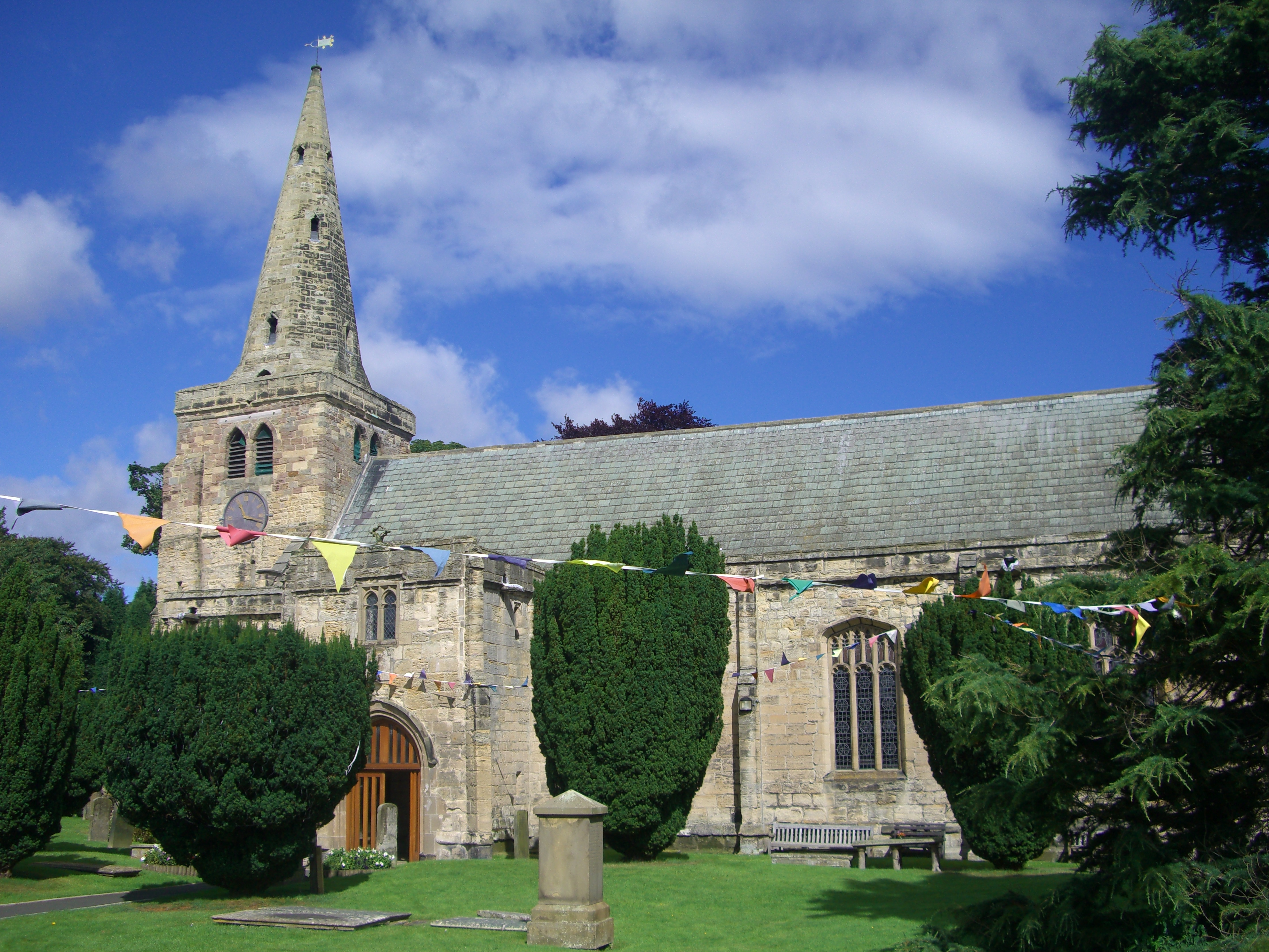
Church of St Lawrence, Warkworth

The Church of St Lawrence is situated in the village of Warkworth in Northumberland. It is a grade I listed building within the Diocese of Newcastle and...

Warkworth, Northumberland

Warkworth is a village in Northumberland, England. It is probably best known for its well-preserved medieval castle, church and hermitage. The population...

Warkworth Castle

Warkworth Castle is a ruined medieval castle in Warkworth in the English county of Northumberland. The village and castle occupy a loop of the River Coquet...
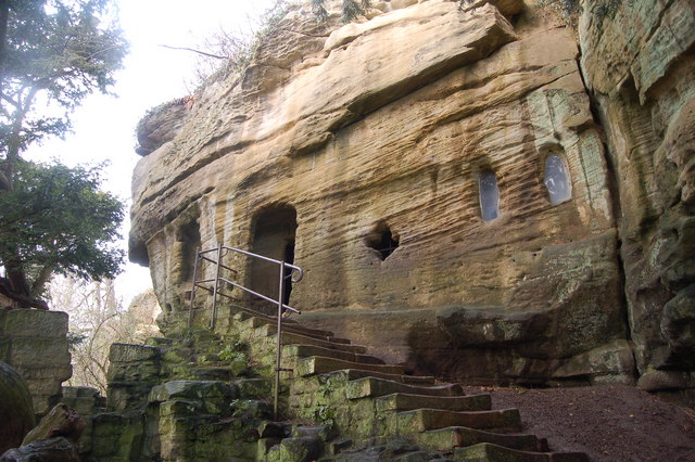
Warkworth Hermitage

Warkworth Hermitage is a chapel and priest's house built onto and within a cliff-face on the north bank of the River Coquet in Northumberland, England...

Related Videos

Warkworth Castle England Walking Tour | Stunning Medieval Castle Ruins

In this video, Margaret, a tour guide with Free Tours by Foot, takes you on a walking tour through the ruined medieval Warkworth ...

Walking around Warkworth Castle and River Coquet

A short stroll, taking in the colour and sunshine at the official end of British Summer Time.... More photo than video.

Bushwhacking trails around Warkworth, Northumberland with iWalksNE

The recent rain and sunny, warm weather has caused the vegetation to grow amazingly, making trails difficult to navigate. Top day ...

Nearby Amenities

Located within 500m of 55.347763,-1.6119296
Warkworth
Is In: Northumberland, UK
Place: village
Wikidata: Q1616632
Lat/Long: 55.3477629/-1.6103256
Check Date: 2021-06-02
Source: Bing;survey
Traffic Calming: hump
Lat/Long: 55.3463468/-1.6088204
Check Date: 2021-06-02
Source: Bing;survey
Traffic Calming: hump
Lat/Long: 55.3454402/-1.610554
Check Date: 2021-06-02
Source: Bing;survey
Traffic Calming: hump
Lat/Long: 55.3479661/-1.6084668
Post Box
Operator: Royal Mail
Operator Wikidata: Q638098
Ref: NE65 246
Source: survey
Lat/Long: 55.3504599/-1.614266
Bus Stop
Bench: no
Bus: yes
Public Transport: platform
Shelter: no
Lat/Long: 55.3501164/-1.6096397
Bus Stop
Bench: no
Bus: yes
Public Transport: platform
Shelter: no
Lat/Long: 55.3501013/-1.6095984
Telephone
Booth: K6
Covered: booth
Listed Status: Grade II
Operator: BT
Operator Wikidata: Q593786
Lat/Long: 55.3475093/-1.6119818
Helsay
Place: locality
Lat/Long: 55.3466104/-1.6059654
Drinking Water
Bottle Refill: yes
Description: water tap low above the ground, fast water flow rate, pressure can be regulated by pressing the top knob more or less intense, good suitable for filling big 2 litre bottles, nearby fashion shop confirmed that it is drinking water on 2022-08-25
Drinking Water Refill: yes
Lat/Long: 55.3475617/-1.6119971
Post Box
Operator: Royal Mail
Operator Wikidata: Q638098
Post Box Design: type_n
Post Box Type: lamp
Ref: NE65 115
Source: Bing;survey
Lat/Long: 55.3480308/-1.6121662
Warkworth War Memorial
Historic: memorial
Memorial: war_memorial
Lat/Long: 55.3486272/-1.6123912
Bus Stop
Warkworth, Market Place
Bus: yes
Departures Board: timetable
Naptan AtcoCode: 3100U246060
Naptan NaptanCode: nldamwjm
Public Transport: platform
Shelter: no
Source: survey
Lat/Long: 55.347854/-1.6119351
Bus Stop
Bench: no
Bus: yes
Covered: no
Public Transport: platform
Shelter: no
Source: survey
Lat/Long: 55.347764/-1.6118385
Check Date: 2021-06-02
Source: Bing;survey
Traffic Calming: hump
Lat/Long: 55.3460213/-1.6097654
Check Date: 2021-06-02
Source: Bing;survey
Traffic Calming: hump
Lat/Long: 55.3468125/-1.6085893
Check Date: 2021-06-02
Source: Bing;survey
Traffic Calming: hump
Lat/Long: 55.3474503/-1.6083753
Check Date: 2021-06-02
Source: Bing;survey
Traffic Calming: hump
Lat/Long: 55.3483858/-1.6087651
Check Date: 2021-06-02
Source: Bing;survey
Traffic Calming: hump
Lat/Long: 55.3489902/-1.6094613
Material: wood
Power: pole
Lat/Long: 55.3484329/-1.6060808
Material: wood
Power: pole
Lat/Long: 55.3484627/-1.614772
Material: wood
Power: pole
Lat/Long: 55.348587/-1.6070314
Material: wood
Power: pole
Lat/Long: 55.3487153/-1.6158644
Material: wood
Power: pole
Lat/Long: 55.3489478/-1.6169533
Material: wood
Power: pole
Lat/Long: 55.3492096/-1.6182677
Material: wood
Power: pole
Lat/Long: 55.3493007/-1.6075228
Material: wood
Power: pole
Lat/Long: 55.3498339/-1.6075688
Material: wood
Power: pole
Lat/Long: 55.3505298/-1.6076422
Material: wood
Power: pole
Lat/Long: 55.3510242/-1.608661
Material: wood
Power: pole
Lat/Long: 55.3512343/-1.6155612
Material: wood
Power: pole
Lat/Long: 55.3514754/-1.608294
Material: wood
Power: pole
Lat/Long: 55.3515266/-1.609718
Material: wood
Power: pole
Lat/Long: 55.351527/-1.6139516
Material: wood
Power: pole
Lat/Long: 55.351824/-1.6123827
Material: wood
Power: pole
Lat/Long: 55.3520935/-1.6108875
Entrance: main
Lat/Long: 55.348926/-1.612389
Recycling
Location: overground
Recycling Type: container
Lat/Long: 55.3504825/-1.6063928
Waste Basket
Check Date: 2024-04-05
Lat/Long: 55.3462151/-1.612068
Historic: market_cross
Lat/Long: 55.3480097/-1.6119595
Waste Basket
Source: GPS survey
Lat/Long: 55.3496055/-1.607008
Grit Bin
Source: GPS survey
Lat/Long: 55.3495247/-1.6076973
Waste Basket
Check Date: 2024-04-05
Source: GPS survey
Lat/Long: 55.3458736/-1.6123677
Bench
Backrest: yes
Source: GPS survey
Lat/Long: 55.3458683/-1.6123593
Bus Stop
Warkworth, Beal Bank Top
Bench: yes
Bin: yes
Bus: yes
Departures Board: timetable
Lit: yes
Naptan AtcoCode: 3100U248056
Naptan NaptanCode: nldagawa
Public Transport: platform
Shelter: yes
Source: GPS survey
Tactile Paving: no
Lat/Long: 55.3439428/-1.6098856
Bus Stop
Warkworth, Beal Bank Top
Bench: yes
Bin: no
Bus: yes
Departures Board: timetable
Lit: yes
Naptan AtcoCode: 3100U248055
Naptan NaptanCode: nldajwdw
Public Transport: platform
Shelter: yes
Source: GPS survey
Tactile Paving: no
Lat/Long: 55.3436242/-1.6095366
Fixme: continues
Lat/Long: 55.3504038/-1.6157144
Grit Bin
Source: GPS survey
Lat/Long: 55.3506135/-1.610008
Hiking: yes
Information: guidepost
Source: GPS survey
Tourism: information
Lat/Long: 55.3494541/-1.6104268
Bench
Lat/Long: 55.3495053/-1.6111291
Hiking: yes
Information: guidepost
Source: GPS survey
Tourism: information
Lat/Long: 55.3493049/-1.612891
Bench
Lat/Long: 55.3442709/-1.614601
Bench
Lat/Long: 55.3439603/-1.6160394
Bench
Backrest: yes
Lat/Long: 55.3456695/-1.6128118
Bench
Backrest: yes
Lat/Long: 55.3446622/-1.6137689
Bench
Backrest: yes
Lat/Long: 55.3476403/-1.6133279
Bench
Backrest: yes
Lat/Long: 55.3449833/-1.6132185
Bench
Backrest: yes
Lat/Long: 55.3453714/-1.6128746
Bench
Backrest: yes
Lat/Long: 55.3459266/-1.6128498
Entrance: yes
Lat/Long: 55.344866/-1.611898
Entrance: main
Lat/Long: 55.3448237/-1.6119164
Rivershield
Addr Housenumber: 5
Tourism: guest_house
Lat/Long: 55.3478102/-1.6127037
The data included in this document is from www.openstreetmap.org. The data is made available under ODbL.

Have you been to Warkworth?

Leave your review of Warkworth below (or comments, questions and feedback).