Wardley

Settlement in Durham

England

Wardley

The Strang Riding Centre Officially opened on July 26 1977 by Princess Anne, the Strang Riding Centre offers horse riding for children and adults with physical, learning and sensory disabilities.
The Strang Riding Centre Credit: Steve McShane

Wardley is a small village located in County Durham, in the northeast of England. It lies approximately 5 miles southwest of Gateshead and 8 miles south of Newcastle upon Tyne. The village is part of the Metropolitan Borough of Gateshead.

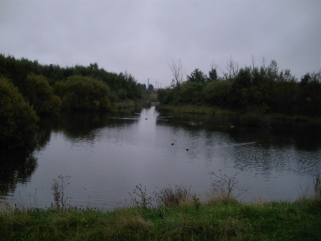
Wardley is a predominantly residential area with a population of around 2,000 people. It is known for its peaceful and picturesque surroundings, with rolling hills and green landscapes. The village benefits from its proximity to the River Tyne, which runs nearby and offers opportunities for recreational activities such as fishing and boating.

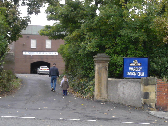
The village has a close-knit community and is well-served by various amenities. These include a primary school, a local convenience store, and a pub, providing essential services and fostering a sense of community spirit. The surrounding area offers ample opportunities for outdoor pursuits, such as walking and cycling, with numerous trails and paths to explore.

Wardley's location provides convenient access to nearby urban centers, including Gateshead and Newcastle upon Tyne. This allows residents to easily access a wide range of facilities, including shopping centers, restaurants, and cultural attractions.

Overall, Wardley offers a tranquil and scenic place to live, with the added benefit of being close to larger towns and cities. Its strong sense of community and numerous amenities make it an attractive place for residents seeking a peaceful and well-connected location in County Durham.

If you have any feedback on the listing, please let us know in the comments section below.
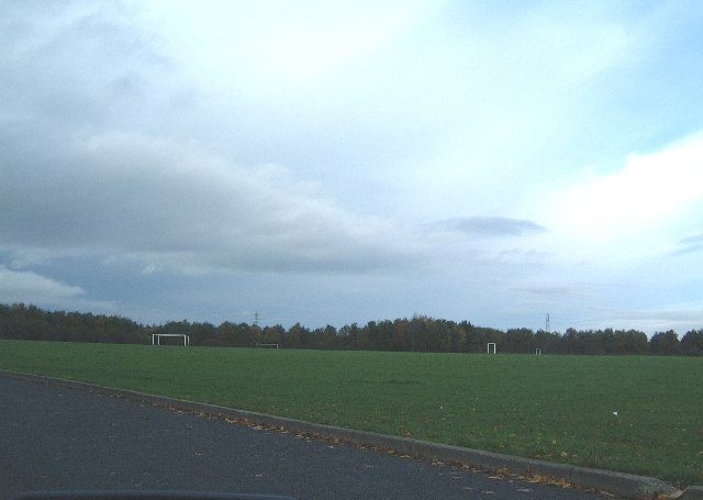
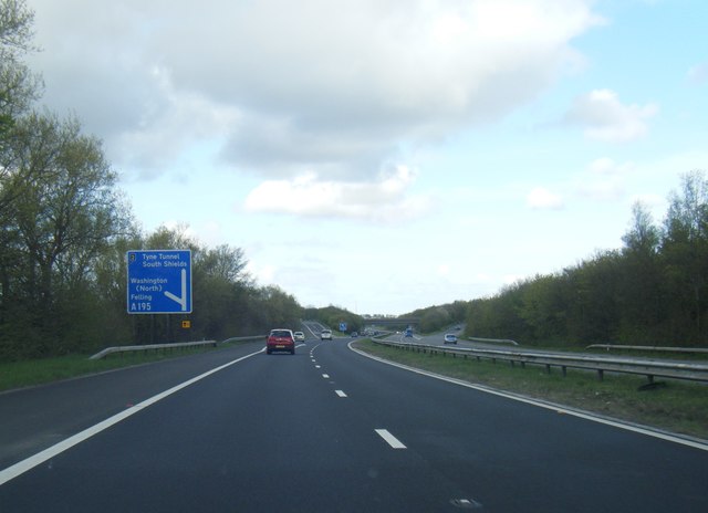
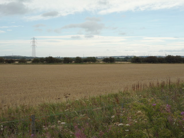
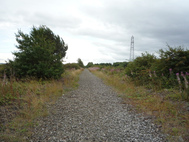
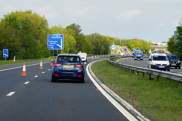
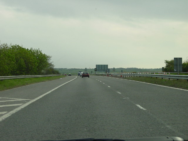
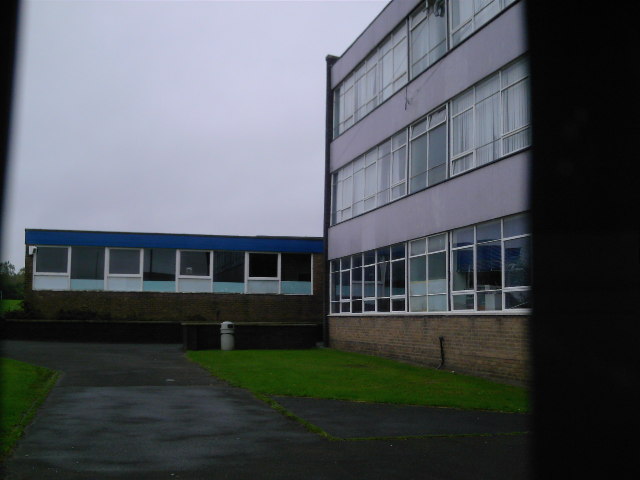
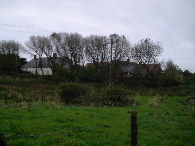
Wardley Images

Images are sourced within 2km of 54.94593/-1.5198439 or Grid Reference NZ3061. Thanks to Geograph Open Source API. All images are credited.

The Strang Riding Centre Officially opened on July 26 1977 by Princess Anne, the Strang Riding Centre offers horse riding for children and adults with physical, learning and sensory disabilities.
The Strang Riding Centre
Officially opened on July 26 1977 by Princess Anne, the Strang Riding Centre offers horse riding for children and adults with physical, learning and sensory disabilities.
Northern Playing Fields There's not much in this square - there is a main A195 road to Washington, the Washington Moat House golf course and here, the Northern Playing Fields.
Northern Playing Fields
There's not much in this square - there is a main A195 road to Washington, the Washington Moat House golf course and here, the Northern Playing Fields.
National Trail to East House
A194(M) near Whittle Burn
Bus stop and woodland beside Northumberland Way (A195)
Northumberland Way (A195) towards Washington Looking south east.
Northumberland Way (A195) towards Washington
Looking south east.
Cereal crop, Follingsby  View south east from the disused railway.
Cereal crop, Follingsby
View south east from the disused railway.
Course of disused railway, Follingsby  Tracks were still in place 2006 - <a href="https://www.geograph.org.uk/photo/223501">NZ3159 : Lines near Usworth Hall</a>
Course of disused railway, Follingsby
Tracks were still in place 2006 - NZ3159 : Lines near Usworth Hall
A194(M) approaching Junction 2 The A194(M) is a short (3½ miles) section of motorway which links junction 65 of the A1(M) to the A184 and A194 which both run east to join the A19 road to the Tyne Tunnel. 

The primary A194 road runs for 5 miles from the end of the A194(M) to South Shields. It is dual carriageway for most of its length.
A194(M) approaching Junction 2
The A194(M) is a short (3½ miles) section of motorway which links junction 65 of the A1(M) to the A184 and A194 which both run east to join the A19 road to the Tyne Tunnel. The primary A194 road runs for 5 miles from the end of the A194(M) to South Shields. It is dual carriageway for most of its length.
Pit stop for the Tyne Bridge and Red Arrows Collecting for Cystic Fibrosis, Great North Run 2022.
Pit stop for the Tyne Bridge and Red Arrows
Collecting for Cystic Fibrosis, Great North Run 2022.
A194(M) leaving White Mare Pool heading South
Follingsby Industrial Estate taken from the A194(M)
St James's RC Church This church was built at the same time as the school which surrounds it. However, the school was named St Joseph's.
St James's RC Church
This church was built at the same time as the school which surrounds it. However, the school was named St Joseph's.
Lake near Mill Lane/Monkton Lane This area was a quarry 20 years ago and has now been landscaped into a pleasant area of greenery and water.
Lake near Mill Lane/Monkton Lane
This area was a quarry 20 years ago and has now been landscaped into a pleasant area of greenery and water.
Wardley Legion Club A traditional club just off Sunderland Road. Children welcome.
Wardley Legion Club
A traditional club just off Sunderland Road. Children welcome.
Curious Block South of St Joseph's School I saw this in the middle of a field. It was the highest point around could it be something Trig-related?
Curious Block
South of St Joseph's School I saw this in the middle of a field. It was the highest point around could it be something Trig-related?
St Joseph's RC Comprehensive School This is the lower school block. The perimeter of the school field forms part of the border between South Tyneside and Gateshead.
St Joseph's RC Comprehensive School
This is the lower school block. The perimeter of the school field forms part of the border between South Tyneside and Gateshead.
Monkton Mill Farm Farmhouses on edge of reclaimed quarry.
Monkton Mill Farm
Farmhouses on edge of reclaimed quarry.
Show me another place!

Wardley is located at Grid Ref: NZ3061 (Lat: 54.94593, Lng: -1.5198439)

Unitary Authority: Gateshead

Police Authority: Northumbria

What 3 Words

///collapsed.upsetting.stability. Near Hebburn, Tyne & Wear

Related Wikis

Bill Quay

Bill Quay is a residential area in Gateshead, located around 4 miles (6.4 km) from Newcastle upon Tyne, 12 miles (19 km) from Sunderland, and 17 miles...

Wardley, Gateshead

Wardley is a residential area in Gateshead, located around 4 miles (6.4 km) from Newcastle upon Tyne, 10 miles (16 km) from Sunderland, and 15 miles (24...

Springwell railway station

Springwell railway station served Springwell Village, Tyne and Wear, England, from 1844 to 1871 on the Durham Coast Line. == History == The station opened...

Monkton Coke Works

Monkton Coke Works was a coking plant near Hebburn, Tyne and Wear, England. == History == The works were constructed in 1936, as the government's response...

Nearby Amenities

Located within 500m of 54.94593,-1.5198439
Traffic Signals
Traffic Signals: signal
Lat/Long: 54.9462762/-1.515172
Motorway Junction
Ref: 3
Lat/Long: 54.9455475/-1.5159643
Crossing
Crossing: unmarked
Crossing Island: no
Crossing Markings: no
Tactile Paving: yes
Lat/Long: 54.9464431/-1.5153028
Traffic Signals
Traffic Signals: signal
Lat/Long: 54.9464037/-1.5150215
Motorway Junction
Whitemare Pool Roundabout
Lat/Long: 54.9464075/-1.5205665
Traffic Calming: cushion
Lat/Long: 54.9472881/-1.5245832
Bus Stop
NEWCASTLE ROAD-WHITEMARE POOL-E/B
Bus: yes
Local Ref: E
Naptan AtcoCode: 410000016072
Naptan Bearing: E
Naptan CommonName: NEWCASTLE ROAD-WHITEMARE POOL-E/B
Naptan Indicator: E
Naptan Landmark: OUTSIDE LAVERICK GARDENS
Naptan NaptanCode: twrdjmjm
Naptan Street: NEWCASTLE ROAD
Naptan Verified: no
Public Transport: platform
Source: naptan_import
Wheelchair: yes
Lat/Long: 54.9457334/-1.5134156
Bus Stop
NEWCASTLE ROAD-WHITEMARE POOL-W/B
Bus: yes
Local Ref: W
Naptan AtcoCode: 410000016083
Naptan Bearing: W
Naptan CommonName: NEWCASTLE ROAD-WHITEMARE POOL-W/B
Naptan Indicator: W
Naptan Landmark: OUTSIDE FOLLONSBY TERRACE
Naptan NaptanCode: twrdjmta
Naptan Street: NEWCASTLE ROAD
Naptan Verified: no
Public Transport: platform
Source: naptan_import
Wheelchair: yes
Lat/Long: 54.9452504/-1.513999
Bus Stop
WARDLEY LANE-N/B
Local Ref: N
Naptan AtcoCode: 410000016237
Naptan Bearing: N
Naptan CommonName: WARDLEY LANE-N/B
Naptan Indicator: N
Naptan Landmark: OPPOSITE JULIAN ROAD JUNCTION
Naptan NaptanCode: twrdjwpg
Naptan Street: WARDLEY LANE
Naptan Verified: no
Source: naptan_import
Lat/Long: 54.9478775/-1.5238345
Bus Stop
WARDLEY
Local Ref: N
Naptan AtcoCode: 410000016238
Naptan Bearing: N
Naptan CommonName: WARDLEY
Naptan Indicator: N
Naptan Landmark: OUTSIDE WARDLY WELFARE GROUND
Naptan NaptanCode: twrdjwpj
Naptan Street: WARDLEY LANE
Naptan Verified: no
Source: naptan_import
Lat/Long: 54.9491085/-1.5237887
Bus Stop
WARDLEY LANE-S/B
Local Ref: S
Naptan AtcoCode: 410000016239
Naptan Bearing: S
Naptan CommonName: WARDLEY LANE-S/B
Naptan Indicator: S
Naptan Landmark: OUTSIDE ELLISON HOUSE
Naptan NaptanCode: twrdjwpm
Naptan Street: WARDLEY LANE
Naptan Verified: no
Source: naptan_import
Lat/Long: 54.9473563/-1.5238407
Bus Stop
LEAM LANE-STANTON CLOSE-NE/B
Local Ref: NE
Naptan AtcoCode: 410000016952
Naptan Bearing: NE
Naptan CommonName: LEAM LANE-STANTON CLOSE-NE/B
Naptan Indicator: NE
Naptan Landmark: OPPOSITE THE GREEN PUBLIC HOUSE
Naptan NaptanCode: twrdmdag
Naptan Street: LEAM LANE
Naptan Verified: no
Source: naptan_import
Lat/Long: 54.9453853/-1.5208197
Bus Stop
LEAM LANE-SLALEY CLOSE-NE/B
Local Ref: NE
Naptan AtcoCode: 410000016958
Naptan Bearing: NE
Naptan CommonName: LEAM LANE-SLALEY CLOSE-NE/B
Naptan Indicator: NE
Naptan Landmark: OPPOSITE GOLF COURSE
Naptan NaptanCode: twrjagaw
Naptan Street: LEAM LANE
Naptan Verified: no
Source: naptan_import
Lat/Long: 54.9434264/-1.5254326
Bus Stop
WARDLEY SUNDERLAND ROAD
Local Ref: W
Naptan AtcoCode: 410000016959
Naptan Bearing: W
Naptan CommonName: WARDLEY SUNDERLAND ROAD
Naptan Indicator: W
Naptan Landmark: OPPOSITE JOYCE CLOSE
Naptan NaptanCode: twrjagda
Naptan Street: SUNDERLAND ROAD
Naptan Verified: no
Source: naptan_import
Lat/Long: 54.947202/-1.5257628
Bus Stop
WARDLEY SUNDERLAND ROAD
Local Ref: E
Naptan AtcoCode: 410000016979
Naptan Bearing: E
Naptan CommonName: WARDLEY SUNDERLAND ROAD
Naptan Indicator: E
Naptan Landmark: OUTSIDE JOYCE CLOSE
Naptan NaptanCode: twrdmdgj
Naptan Street: SUNDERLAND ROAD
Naptan Verified: no
Source: naptan_import
Lat/Long: 54.9473175/-1.525418
Bus Stop
SUNDERLAND ROAD-WARDLEY DRIVE-E/B
Local Ref: S
Naptan AtcoCode: 410000016046
Naptan Bearing: S
Naptan CommonName: SUNDERLAND ROAD-WARDLEY DRIVE-E/B
Naptan Indicator: S
Naptan Landmark: OUTSIDE DARYL WAY
Naptan NaptanCode: twrdjgwt
Naptan Street: SUNDERLAND ROAD
Naptan Verified: no
Source: naptan_import
Lat/Long: 54.9469768/-1.5233143
Bus Stop
Leam Lane
Bench: no
Bin: no
Bus: yes
Departures Board: timetable
Local Ref: N
Naptan AtcoCode: 410000016047
Naptan Bearing: N
Naptan CommonName: LEAM LANE-WHITEMARE POOL-N/B
Naptan Indicator: N
Naptan Landmark: OUTSIDE WHITE MARE TRAVELODGE
Naptan NaptanCode: twrdjmad
Naptan Street: LEAM LANE
Naptan Verified: no
Public Transport: platform
Shelter: no
Source: naptan_import
Tactile Paving: no
Lat/Long: 54.9469273/-1.5150264
Bus Stop
LEAM LANE-WHITEMARE POOL-S/B
Bench: no
Bus: yes
Local Ref: S
Naptan AtcoCode: 410000016069
Naptan Bearing: S
Naptan CommonName: LEAM LANE-WHITEMARE POOL-S/B
Naptan Indicator: S
Naptan Landmark: OPPOSITE WHITE MARE TRAVELODGE
Naptan NaptanCode: twrdjmja
Naptan Street: LEAM LANE
Naptan Verified: no
Public Transport: platform
Shelter: no
Source: naptan_import
Tactile Paving: no
Lat/Long: 54.9467001/-1.5147153
Bus Stop
WARDLEY THE GREEN
Local Ref: W
Naptan AtcoCode: 410000016070
Naptan Bearing: W
Naptan CommonName: WARDLEY THE GREEN
Naptan Indicator: W
Naptan Landmark: OUTSIDE THE GREEN PUBLIC HOUSE
Naptan NaptanCode: twrdjmjd
Naptan Street: FELLING BY-PASS
Naptan Verified: no
Source: naptan_import
Lat/Long: 54.9459876/-1.5185956
Bus Stop
Felling Bypass
Bus: yes
Departures Board: timetable
Local Ref: W
Naptan AtcoCode: 410000016071
Naptan Bearing: W
Naptan CommonName: FELLING BYPASS-MONTROSE DRIVE-W/B
Naptan Indicator: W
Naptan Landmark: OUTSIDE WALK WAY LEADING TO MONTROSE DRIVE
Naptan NaptanCode: twrdjmjg
Naptan Street: FELLING BY-PASS
Naptan Verified: no
Public Transport: platform
Shelter: yes
Source: naptan_import
Lat/Long: 54.9466381/-1.5263634
Crossing
Crossing: unmarked
Crossing Island: no
Crossing Markings: no
Tactile Paving: yes
Lat/Long: 54.9460109/-1.5145033
Turning Circle
Lat/Long: 54.9482079/-1.5257773
Power: pole
Lat/Long: 54.9491502/-1.5186844
Power: pole
Lat/Long: 54.9500472/-1.5187715
Power: pole
Lat/Long: 54.9483047/-1.5181898
Power: pole
Lat/Long: 54.9479327/-1.5168721
Power: pole
Lat/Long: 54.9478727/-1.5160533
Power: pole
Lat/Long: 54.9484759/-1.5145711
Power: pole
Lat/Long: 54.9500177/-1.518546
Power: pole
Lat/Long: 54.9483762/-1.5180117
Power: pole
Lat/Long: 54.9484316/-1.5150434
Power: pole
Lat/Long: 54.948882/-1.5139986
Power: pole
Lat/Long: 54.9491522/-1.5184666
Power: pole
Lat/Long: 54.9480346/-1.5168293
Power: pole
Lat/Long: 54.9479694/-1.516123
Turning Circle
Lat/Long: 54.944216/-1.5265155
Turning Circle
Lat/Long: 54.9438092/-1.5256451
Noexit: yes
Lat/Long: 54.9457273/-1.52097
Traffic Signals
Traffic Signals: signal
Traffic Signals Direction: forward
Lat/Long: 54.9466848/-1.5240668
Fuel
Shell
Addr City: Gateshead
Addr Housename: Shell Whitemare Pool
Addr Postcode: NE10 8YB
Addr Street: Whitemare Pool
Brand: Shell
Brand Wikidata: Q110716465
Building: yes
Opening Hours: 24/7
Phone: +44 191 469 9610
Ref Navads: NVDS353_10019383
Website: https://find.shell.com/gb/fuel/10019383-shell-whitemare-pool
Wheelchair: yes
Lat/Long: 54.9477699/-1.5144432
Crossing
Crossing: unmarked
Crossing Island: no
Crossing Markings: no
Tactile Paving: yes
Lat/Long: 54.9453189/-1.5155906
Crossing
Crossing: unmarked
Crossing Island: no
Crossing Markings: no
Tactile Paving: yes
Lat/Long: 54.9454248/-1.5159806
Crossing
Crossing: unmarked
Crossing Island: no
Crossing Markings: no
Tactile Paving: yes
Lat/Long: 54.9462334/-1.5160247
Crossing
Crossing: unmarked
Crossing Island: no
Crossing Markings: no
Tactile Paving: yes
Lat/Long: 54.9454546/-1.514815
Traffic Calming: cushion
Lat/Long: 54.9472701/-1.525581
Fast Food
Subway
Addr City: Gateshead
Brand: Subway
Brand Wikidata: Q244457
Brand Wikipedia: en:Subway (restaurant)
Cuisine: sandwich
Takeaway: yes
Lat/Long: 54.9468982/-1.5156219
Post Box
Lat/Long: 54.9450602/-1.5147082
Fast Food
Burger King
Addr City: Gateshead
Addr Postcode: NE10 8YB
Addr Street: White Mare Pool
Brand: Burger King
Brand Wikidata: Q177054
Brand Wikipedia: en:Burger King
Contact Website: https://locations.burgerking.co.uk/gateshead/a194-white-mare-pool-wardley
Cuisine: burger
Fhrs Id: 1677823
Takeaway: yes
Lat/Long: 54.9469237/-1.5157693
Londis
Brand: Londis
Brand Wikidata: Q21008564
Shop: convenience
Lat/Long: 54.9461664/-1.5227062
Fuel
Jet
Addr Street: Felling Bypass
Lat/Long: 54.9461817/-1.5224898
Post Box
Operator: Royal Mail
Operator Wikidata: Q638098
Post Box Type: lamp
Ref: NE10 813
Lat/Long: 54.9471483/-1.523613
Traffic Signals
Traffic Signals: signal
Traffic Signals Direction: forward
Lat/Long: 54.9464672/-1.523792
Traffic Signals
Traffic Signals: signal
Traffic Signals Direction: forward
Lat/Long: 54.9465563/-1.5236633
Generator Method: photovoltaic
Generator Output Electricity: yes
Generator Source: solar
Generator Type: solar_photovoltaic_panel
Location: roof
Power: generator
Lat/Long: 54.9444693/-1.5251907
Generator Method: photovoltaic
Generator Output Electricity: yes
Generator Source: solar
Generator Type: solar_photovoltaic_panel
Location: roof
Power: generator
Lat/Long: 54.944514/-1.5247026
Generator Method: photovoltaic
Generator Output Electricity: yes
Generator Source: solar
Generator Type: solar_photovoltaic_panel
Location: roof
Power: generator
Lat/Long: 54.9451826/-1.5227687
Generator Method: photovoltaic
Generator Output Electricity: yes
Generator Source: solar
Generator Type: solar_photovoltaic_panel
Location: roof
Power: generator
Lat/Long: 54.9456294/-1.5226292
Generator Method: photovoltaic
Generator Output Electricity: yes
Generator Source: solar
Generator Type: solar_photovoltaic_panel
Location: roof
Power: generator
Lat/Long: 54.9457264/-1.5233078
Generator Method: photovoltaic
Generator Output Electricity: yes
Generator Source: solar
Generator Type: solar_photovoltaic_panel
Location: roof
Power: generator
Lat/Long: 54.9458635/-1.5217682
Generator Method: photovoltaic
Generator Output Electricity: yes
Generator Source: solar
Generator Type: solar_photovoltaic_panel
Location: roof
Power: generator
Lat/Long: 54.9458543/-1.5216449
Give Way
Direction: forward
Lat/Long: 54.9472041/-1.5269104
Crossing
Crossing: unmarked
Crossing Island: no
Tactile Paving: yes
Lat/Long: 54.9456472/-1.5202222
Crossing
Crossing: unmarked
Crossing Island: no
Crossing Markings: no
Tactile Paving: yes
Lat/Long: 54.9463824/-1.5150179
Railway: switch
Lat/Long: 54.9447734/-1.5165833
Railway: buffer_stop
Lat/Long: 54.9443601/-1.5160966
Railway: switch
Lat/Long: 54.9431368/-1.5152769
Traffic Calming: cushion
Lat/Long: 54.9472182/-1.5266201
Barrier: cycle_barrier
Foot: designated
Lat/Long: 54.947089/-1.5271677
Traffic Calming: hump
Lat/Long: 54.9447567/-1.5272513
Noexit: yes
Lat/Long: 54.9453052/-1.5215199
Traffic Signals
Traffic Signals: signal
Lat/Long: 54.9455634/-1.5149087
Traffic Signals
Traffic Signals: signal
Lat/Long: 54.9454497/-1.5147524
Traffic Signals
Traffic Signals: signal
Lat/Long: 54.9453796/-1.5159883
Traffic Signals
Traffic Signals: signal
Lat/Long: 54.9454632/-1.5157899
Traffic Signals
Traffic Signals: signal
Lat/Long: 54.946147/-1.5158764
Traffic Signals
Traffic Signals: signal
Lat/Long: 54.9462318/-1.5161056
Crossing
Crossing: unmarked
Crossing Island: no
Crossing Markings: no
Tactile Paving: yes
Lat/Long: 54.9452318/-1.5153914
Crossing
Crossing: unmarked
Crossing Island: no
Crossing Markings: no
Tactile Paving: yes
Lat/Long: 54.9457174/-1.5162652
Crossing
Crossing: unmarked
Crossing Island: no
Crossing Markings: no
Tactile Paving: yes
Lat/Long: 54.9451721/-1.5144872
The data included in this document is from www.openstreetmap.org. The data is made available under ODbL.

Have you been to Wardley?

Leave your review of Wardley below (or comments, questions and feedback).