Walton-on-the-Hill

Settlement in Staffordshire Stafford

England

Walton-on-the-Hill

Southern end of the bridleway The track from Walton on the Hill, which runs in a generally southeasterly direction, emerges here onto Sawpit Lane at Brocton.
Southern end of the bridleway Credit: Richard Law

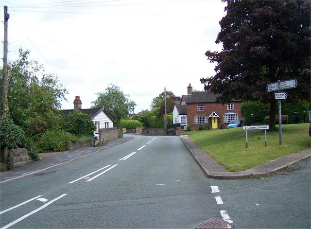
Walton-on-the-Hill is a quaint village located in Staffordshire, England. Situated on the outskirts of Stafford, the village offers a peaceful and idyllic setting for its residents. With a population of approximately 1,500 people, it maintains a close-knit community atmosphere.

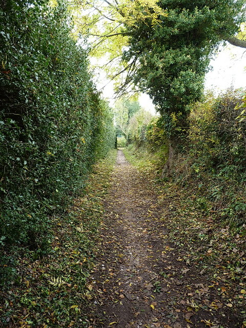
The village is known for its picturesque surroundings, with rolling hills and stunning countryside views. It is a popular destination for nature lovers and outdoor enthusiasts, who enjoy exploring the numerous walking and cycling routes in the area. The nearby Cannock Chase, an Area of Outstanding Natural Beauty, provides an excellent opportunity for outdoor activities such as hiking and wildlife spotting.

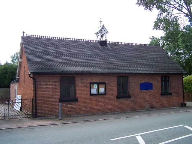
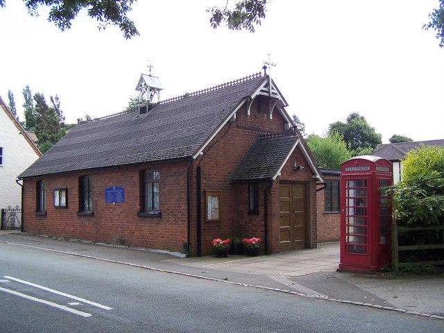
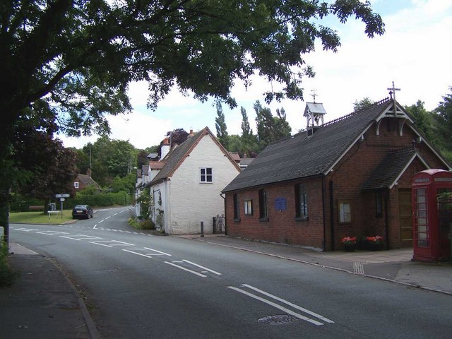
Walton-on-the-Hill has a rich history, with evidence of settlement dating back to the Roman era. The village is home to several historical landmarks, including the beautiful 12th-century St. Thomas and St. Andrew's Church. This charming church is a focal point of the village and attracts visitors with its stunning architecture and peaceful ambience.

In terms of amenities, Walton-on-the-Hill has a small selection of local shops, including a convenience store and a post office, catering to the needs of its residents. The village also has a primary school, providing education for the local children.

Overall, Walton-on-the-Hill is a delightful village that offers a tranquil and picturesque setting, making it an attractive place to reside for those seeking a peaceful countryside lifestyle.

If you have any feedback on the listing, please let us know in the comments section below.

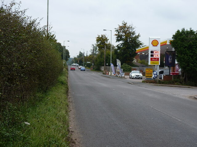
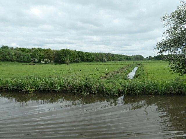
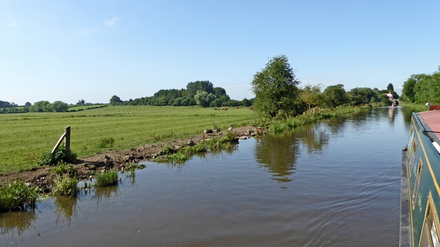
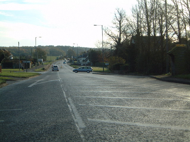
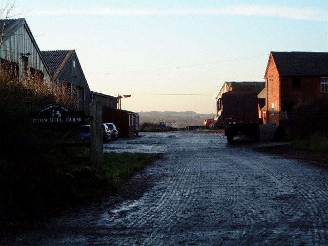
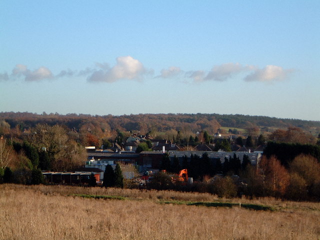
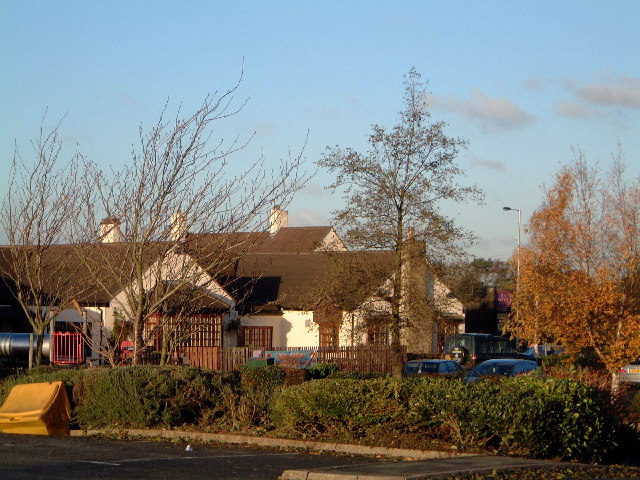
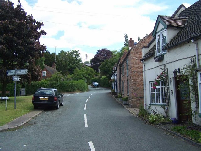
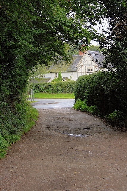
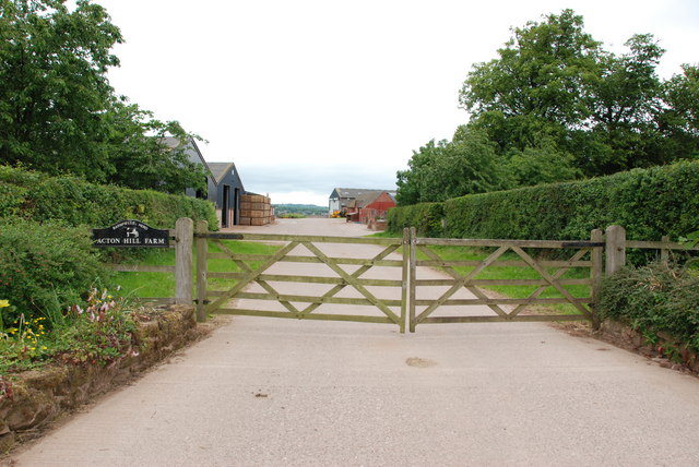
Walton-on-the-Hill Images

Images are sourced within 2km of 52.78528/-2.0650035 or Grid Reference SJ9520. Thanks to Geograph Open Source API. All images are credited.

Southern end of the bridleway The track from Walton on the Hill, which runs in a generally southeasterly direction, emerges here onto Sawpit Lane at Brocton.
Southern end of the bridleway
The track from Walton on the Hill, which runs in a generally southeasterly direction, emerges here onto Sawpit Lane at Brocton.
Dovecot at Brocton Hall In the grounds of Brocton Hall, which is now the golf club, this 18th century former dovecot was Grade II listed <span class="nowrap"><a title="https://britishlistedbuildings.co.uk/101116692-dovecote-at-brocton-hall-brocton#.Yle9wOjMI2w" rel="nofollow ugc noopener" href="https://britishlistedbuildings.co.uk/101116692-dovecote-at-brocton-hall-brocton#.Yle9wOjMI2w">Link</a><img style="margin-left:2px;" alt="External link" title="External link - shift click to open in new window" src="https://s1.geograph.org.uk/img/external.png" width="10" height="10"/></span> & <span class="nowrap"><a title="https://historicengland.org.uk/listing/the-list/list-entry/1116692" rel="nofollow ugc noopener" href="https://historicengland.org.uk/listing/the-list/list-entry/1116692">Link</a><img style="margin-left:2px;" alt="External link" title="External link - shift click to open in new window" src="https://s1.geograph.org.uk/img/external.png" width="10" height="10"/></span> in 1968.
Dovecot at Brocton Hall
In the grounds of Brocton Hall, which is now the golf club, this 18th century former dovecot was Grade II listed LinkExternal link & LinkExternal link in 1968.
Brocton Hall Originally the 18th century hall had a third floor, but this was lost to a fire around the start of WWII, and was never rebuilt. The hall is now the clubhouse of the golf club, and attracted a Grade II listing <span class="nowrap"><a title="https://britishlistedbuildings.co.uk/101116688-brocton-hall-brocton#.Yle__ujMI2w" rel="nofollow ugc noopener" href="https://britishlistedbuildings.co.uk/101116688-brocton-hall-brocton#.Yle__ujMI2w">Link</a><img style="margin-left:2px;" alt="External link" title="External link - shift click to open in new window" src="https://s1.geograph.org.uk/img/external.png" width="10" height="10"/></span> & <span class="nowrap"><a title="https://historicengland.org.uk/listing/the-list/list-entry/1116688" rel="nofollow ugc noopener" href="https://historicengland.org.uk/listing/the-list/list-entry/1116688">Link</a><img style="margin-left:2px;" alt="External link" title="External link - shift click to open in new window" src="https://s1.geograph.org.uk/img/external.png" width="10" height="10"/></span> in 1953.
Brocton Hall
Originally the 18th century hall had a third floor, but this was lost to a fire around the start of WWII, and was never rebuilt. The hall is now the clubhouse of the golf club, and attracted a Grade II listing LinkExternal link & LinkExternal link in 1953.
Ruins of a medieval building behind Brocton Hall Tucked away, attached to the wall of the large rear kitchen garden of <a href="https://www.geograph.org.uk/photo/7146661">SJ9619 : Brocton Hall</a>, these stone arches are the remains of an unknown building that once lay somewhere nearby. Despite the lack of detail, they were Grade II listed <span class="nowrap"><a title="https://britishlistedbuildings.co.uk/101116745-ruins-to-north-west-of-brocton-hall-brocton#.YlfBVujMI2w" rel="nofollow ugc noopener" href="https://britishlistedbuildings.co.uk/101116745-ruins-to-north-west-of-brocton-hall-brocton#.YlfBVujMI2w">Link</a><img style="margin-left:2px;" alt="External link" title="External link - shift click to open in new window" src="https://s1.geograph.org.uk/img/external.png" width="10" height="10"/></span> & <span class="nowrap"><a title="https://historicengland.org.uk/listing/the-list/list-entry/1116745" rel="nofollow ugc noopener" href="https://historicengland.org.uk/listing/the-list/list-entry/1116745">Link</a><img style="margin-left:2px;" alt="External link" title="External link - shift click to open in new window" src="https://s1.geograph.org.uk/img/external.png" width="10" height="10"/></span> in 1968.
Ruins of a medieval building behind Brocton Hall
Tucked away, attached to the wall of the large rear kitchen garden of SJ9619 : Brocton Hall, these stone arches are the remains of an unknown building that once lay somewhere nearby. Despite the lack of detail, they were Grade II listed LinkExternal link & LinkExternal link in 1968.
Filling station on the Cannock Road, A34, at Newtown Petrol at this point in time was for sale at £1.239 per litre, with diesel a few pence more than that.
Filling station on the Cannock Road, A34, at Newtown
Petrol at this point in time was for sale at £1.239 per litre, with diesel a few pence more than that.
Drain in a pasture field The field is criss-crossed with drains, which are also shown on the large-scale OS map surveyed in 1880.
Drain in a pasture field
The field is criss-crossed with drains, which are also shown on the large-scale OS map surveyed in 1880.
Canal and farmland south of Wildwood, Stafford This shows the Staffordshire and Worcestershire Canal, looking south-west towards Deptmore (Deepmore) Lock.
Canal and farmland south of Wildwood, Stafford
This shows the Staffordshire and Worcestershire Canal, looking south-west towards Deptmore (Deepmore) Lock.
Junction of A34 and Sawpit Lane and the way to Penkridge
Junction of A34 and Sawpit Lane
and the way to Penkridge
Acton Hill Farm Could view bag the hill in the distance as well???
Acton Hill Farm
Could view bag the hill in the distance as well???
Newtown from the 7 stars Industrial estate outside Newtown, as viewed from the carpark of the Seven Stars at Brocton
Newtown from the 7 stars
Industrial estate outside Newtown, as viewed from the carpark of the Seven Stars at Brocton
Seven Stars at Brocton Public house
Seven Stars at Brocton
Public house
The Green, Brocton
The Green, Brocton
Village Green, Brocton
All Saints, Brocton
All Saints, Brocton
All Saints, Brocton
All Saints, Brocton
The Green, Brocton
The Green, Brocton
Park Lane Looking up towards its junction with Walton Lane.
Park Lane
Looking up towards its junction with Walton Lane.
Acton Hill Farm
Acton Hill Farm
Show me another place!

Walton-on-the-Hill is located at Grid Ref: SJ9520 (Lat: 52.78528, Lng: -2.0650035)

Administrative County: Staffordshire

District: Stafford

Police Authority: Staffordshire

What 3 Words

///birdcage.manliness.digests. Near Stafford, Staffordshire

Related Wikis

Walton-on-the-Hill, Staffordshire

Walton-on-the-Hill is a village in the Borough of Stafford in Staffordshire, England. It is about 5 km east of the centre of Stafford, and lies on the...

Walton High School, Stafford

Walton High School is a large mixed secondary school and sixth form serving a community in the southern part of Stafford, England.There are approximately...

Berkswich

Berkswich ( BAHK-switch) is a civil parish in the borough of Stafford in Staffordshire, England. According to the 2001 census it had a population of 1...

Milford Hall

Milford Hall is a privately owned 18th-century English country house at Milford, near Stafford. It is the family seat of the Levett Haszard family and...

Milford, Staffordshire

Milford is a village in the county of Staffordshire, England. It lies at the edge of Cannock Chase, on the A513 road between Stafford and Rugeley. Just...

Milford and Brocton railway station

Milford and Brocton railway station served the villages of Milford and Brocton in Staffordshire, England from 1877 to 1950 on the Trent Valley line....

Brocton, Staffordshire

Brocton is a village and civil parish in the English county of Staffordshire. It is within the borough of Stafford. The village describes itself as the...

Baswich

Baswich is an estate on the south eastern side of Stafford, in the Stafford district, in the county of Staffordshire, England. Baswich amenities are a...

Nearby Amenities

Located within 500m of 52.78528,-2.0650035
Bus Stop
Oak Avenue
Bus: yes
Naptan AtcoCode: 3800C712400
Naptan Bearing: NE
Naptan CommonName: Oak Avenue
Naptan Indicator: Adj
Naptan Landmark: Oak Avenue
Naptan Street: Cedar Way
Naptan Verified: no
Public Transport: platform
Source: naptan_import
Lat/Long: 52.7844274/-2.0658322
Bus Stop
Walton Garage
Bus: yes
Naptan AtcoCode: 3800C729601
Naptan Bearing: E
Naptan CommonName: Walton Garage
Naptan Indicator: Opp
Naptan Landmark: Walton Garage
Naptan PlusbusZoneRef: STAFFRD
Naptan Street: Milford Rd
Naptan Verified: no
Public Transport: platform
Source: naptan_import
Lat/Long: 52.7882724/-2.0702568
Bus Stop
Old Croft Road
Bus: yes
Naptan AtcoCode: 3800C743001
Naptan Bearing: SE
Naptan CommonName: Old Croft Road
Naptan Indicator: Adj
Naptan Landmark: Old Croft Road
Naptan Street: Elm Avenue
Naptan Verified: no
Public Transport: platform
Source: naptan_import
Lat/Long: 52.7835992/-2.0678474
Bus Stop
Anson Drive
Bus: yes
Naptan AtcoCode: 3800C743801
Naptan Bearing: S
Naptan CommonName: Anson Drive
Naptan Indicator: Adj
Naptan Landmark: Anson Drive
Naptan PlusbusZoneRef: STAFFRD
Naptan Street: Old Croft Road
Naptan Verified: no
Public Transport: platform
Source: naptan_import
Lat/Long: 52.786323/-2.067985
Bus Stop
Meadowsweet Drive
Bus: yes
Naptan AtcoCode: 3800C745601
Naptan Bearing: E
Naptan CommonName: Meadowsweet Drive
Naptan Indicator: Adj
Naptan Landmark: Meadowsweet Dr
Naptan PlusbusZoneRef: STAFFRD
Naptan Street: Milford Rd
Naptan Verified: no
Public Transport: platform
Source: naptan_import
Lat/Long: 52.788697/-2.0667876
Bus Stop
The Crescent
Bus: yes
Naptan AtcoCode: 3800C745602
Naptan Bearing: W
Naptan CommonName: The Crescent
Naptan Indicator: Adj
Naptan Landmark: The Crescent
Naptan PlusbusZoneRef: STAFFRD
Naptan Street: Milford Road
Naptan Verified: no
Public Transport: platform
Source: naptan_import
Lat/Long: 52.7884085/-2.0682552
Bus Stop
Green Gore Lane
Bus: yes
Naptan AtcoCode: 3800C745801
Naptan Bearing: SE
Naptan CommonName: Green Gore Lane
Naptan Indicator: Adj
Naptan Landmark: Green Gore Ln
Naptan Street: Milford Rd
Naptan Verified: no
Public Transport: platform
Source: naptan_import
Lat/Long: 52.7879376/-2.0612312
Bus Stop
Kitlings Lane
Bus: yes
Naptan AtcoCode: 3800C745802
Naptan Bearing: NW
Naptan CommonName: Kitlings Lane
Naptan Indicator: Adj
Naptan Landmark: Kitlings Ln
Naptan Street: Milford Rd
Naptan Verified: no
Public Transport: platform
Source: naptan_import
Lat/Long: 52.7880443/-2.0620509
High School
Naptan AtcoCode: 3800C790400
Naptan Bearing: SE
Naptan BusStopType: CUS
Naptan CommonName: High School
Naptan Indicator: Opp
Naptan Landmark: Walton High Sch
Naptan PlusbusZoneRef: STAFFRD
Naptan Street: The Rise
Naptan Verified: no
Source: naptan_import
Lat/Long: 52.7876433/-2.070063
Bus Stop
High School
Bus: yes
Naptan AtcoCode: 3800C790401
Naptan Bearing: NW
Naptan CommonName: High School
Naptan Indicator: Adj
Naptan Landmark: Walton High School
Naptan PlusbusZoneRef: STAFFRD
Naptan Street: The Rise
Naptan Verified: no
Public Transport: platform
Source: naptan_import
Lat/Long: 52.7875444/-2.0700481
Bus Stop
School Lane
Bus: yes
Naptan AtcoCode: 3800C760001
Naptan Bearing: NW
Naptan CommonName: School Lane
Naptan Indicator: Adj
Naptan Landmark: School Lane
Naptan Street: The Village
Naptan Verified: no
Public Transport: platform
Source: naptan_import
Lat/Long: 52.7863108/-2.0659431
Noexit: yes
Lat/Long: 52.78882/-2.0684701
Bus Stop
Bus: yes
Public Transport: platform
Lat/Long: 52.7874126/-2.0699323
Cedar Way
Power: substation
Ref: 96/734
Lat/Long: 52.7829462/-2.0670186
Post Box
Post Box Type: pillar
Ref: ST17 388
Royal Cypher: GVIR
Royal Cypher Wikidata: Q33102169
Lat/Long: 52.7884119/-2.0636282
Post Box
Ref: ST17 186
Lat/Long: 52.7870957/-2.0682595
Walton Rise
Power: substation
Lat/Long: 52.7873896/-2.0679453
Stafford Chiropractic Clinic
Healthcare: clinic
Healthcare Speciality: chiropractic
Lat/Long: 52.78715/-2.0680827
Post Box
Ref: ST17 396
Lat/Long: 52.7828585/-2.066984
Crossing
Crossing: traffic_signals
Crossing Ref: pelican
Lat/Long: 52.788566/-2.0674422
Barrier: kissing_gate
Lat/Long: 52.7847327/-2.0599495
Barrier: kissing_gate
Lat/Long: 52.7850468/-2.0615043
Walton on the Hill
Place: village
Source: NLS - OS 1:25k 1st Series 1937-61
Wikidata: Q7966712
Lat/Long: 52.7867252/-2.0616266
Noexit: yes
Lat/Long: 52.788907/-2.0684633
Traffic Calming: island
Lat/Long: 52.7876791/-2.0593821
Traffic Signals
Traffic Signals: signal
Traffic Signals Direction: backward
Lat/Long: 52.7886277/-2.0669047
Noexit: yes
Lat/Long: 52.7889006/-2.064503
Information Board
Board Type: Historic
Information: board
Tourism: information
Lat/Long: 52.7857057/-2.0643633
Noexit: yes
Lat/Long: 52.7888009/-2.065383
Generator Method: photovoltaic
Generator Output Electricity: yes
Generator Source: solar
Generator Type: solar_photovoltaic_panel
Location: roof
Power: generator
Lat/Long: 52.7830745/-2.0682916
Generator Method: photovoltaic
Generator Output Electricity: yes
Generator Source: solar
Generator Type: solar_photovoltaic_panel
Location: roof
Power: generator
Lat/Long: 52.7829966/-2.0666125
Generator Method: photovoltaic
Generator Output Electricity: yes
Generator Source: solar
Generator Type: solar_photovoltaic_panel
Location: roof
Power: generator
Lat/Long: 52.7845945/-2.0660117
Generator Method: photovoltaic
Generator Output Electricity: yes
Generator Source: solar
Generator Type: solar_photovoltaic_panel
Location: roof
Power: generator
Lat/Long: 52.7869175/-2.0630989
Generator Method: photovoltaic
Generator Output Electricity: yes
Generator Source: solar
Generator Type: solar_photovoltaic_panel
Location: roof
Power: generator
Lat/Long: 52.7877967/-2.0684874
Traffic Calming: hump
Lat/Long: 52.7883382/-2.0614385
Traffic Calming: hump
Lat/Long: 52.7886366/-2.061145
Information: board
Tourism: information
Lat/Long: 52.7879994/-2.0612802
Public Bookcase
Booth: K6
Disused Amenity: telephone
Man Made: telephone_box
Public Bookcase Type: phone_box
Lat/Long: 52.7880326/-2.0615404
Information: board
Tourism: information
Lat/Long: 52.7880554/-2.0614421
Power: pole
Lat/Long: 52.787028/-2.0594909
Power: pole
Lat/Long: 52.7866776/-2.0605235
Power: pole
Lat/Long: 52.7872468/-2.0611679
Power: pole
Lat/Long: 52.785951/-2.0597206
Power: pole
Lat/Long: 52.7873424/-2.0586203
Power: pole
Lat/Long: 52.7848234/-2.0584507
Power: pole
Lat/Long: 52.7875959/-2.0600695
Street Lamp
Lat/Long: 52.7876144/-2.0601854
Noexit: yes
Lat/Long: 52.788664/-2.0633723
Noexit: yes
Lat/Long: 52.7887282/-2.0689462
Noexit: yes
Lat/Long: 52.7886255/-2.0687736
Traffic Signals
Traffic Signals: signal
Traffic Signals Direction: forward
Lat/Long: 52.7887131/-2.067211
Traffic Signals
Traffic Signals: signal
Traffic Signals Direction: forward
Lat/Long: 52.7885588/-2.0674982
Traffic Signals
Traffic Signals: signal
Traffic Signals Direction: backward
Lat/Long: 52.7884546/-2.0671129
Crossing
Crossing: unmarked
Crossing Island: no
Crossing Markings: no
Tactile Paving: yes
Lat/Long: 52.7884349/-2.0689524
The data included in this document is from www.openstreetmap.org. The data is made available under ODbL.

Have you been to Walton-on-the-Hill?

Leave your review of Walton-on-the-Hill below (or comments, questions and feedback).