Walton-on-Thames

Settlement in Surrey Elmbridge

England

Walton-on-Thames

Ambleside Avenue, Walton-on-Thames Mini-roundabout on Ambleside Avenue.
Ambleside Avenue, Walton-on-Thames Credit: Daniel Parks

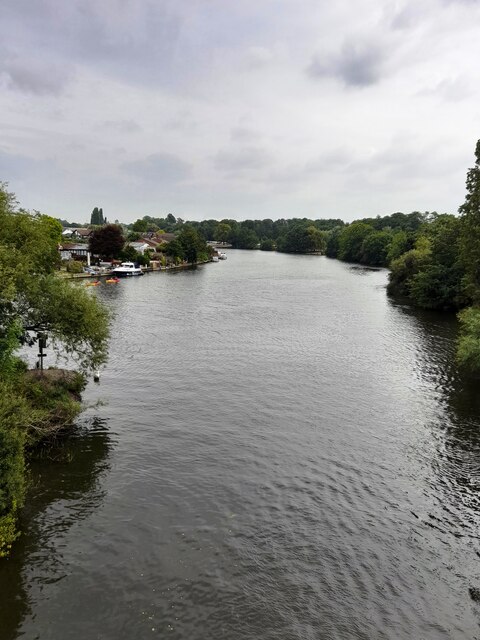
Walton-on-Thames is a picturesque town located in the county of Surrey, England. Situated on the southern bank of the River Thames, it lies approximately 15 miles southwest of central London. With its rich history and scenic surroundings, Walton-on-Thames attracts both locals and visitors alike.

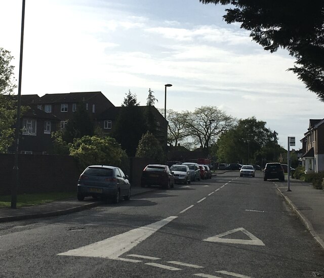
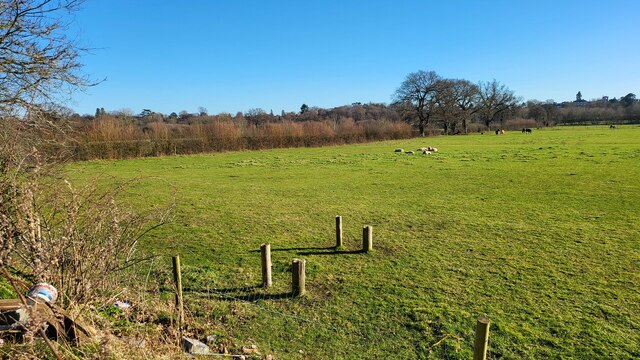
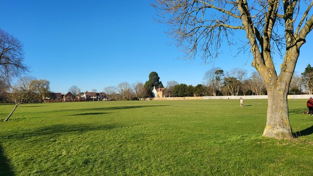
The town is known for its charming town center, which features a mix of historic buildings and modern amenities. The High Street is lined with a variety of shops, cafes, and restaurants, offering a vibrant atmosphere for residents and visitors to enjoy. Additionally, the town boasts several green spaces, including the popular Walton-on-Thames Park, where locals can relax, picnic, and partake in recreational activities.

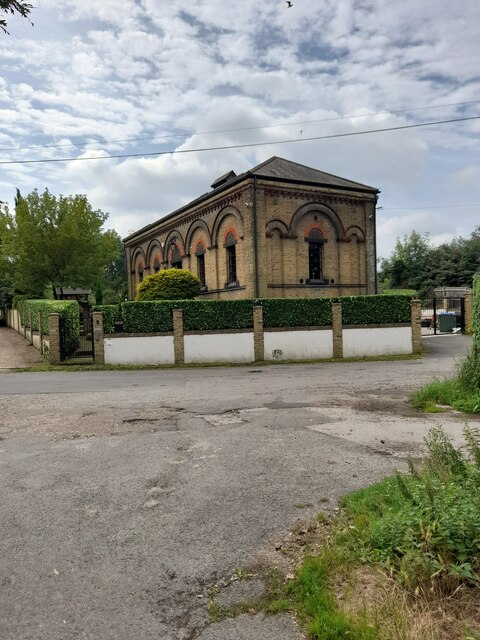
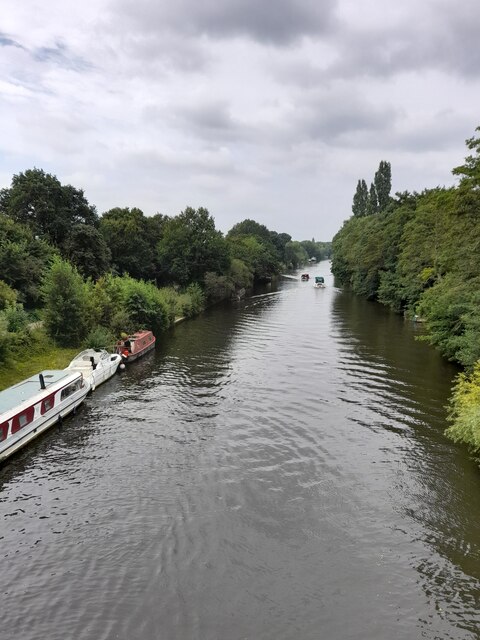
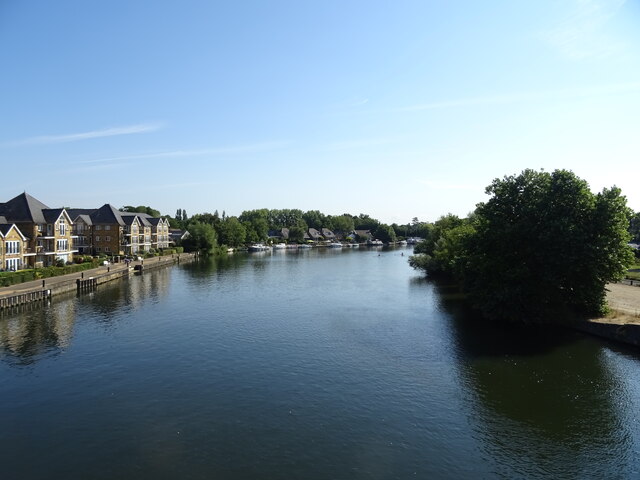
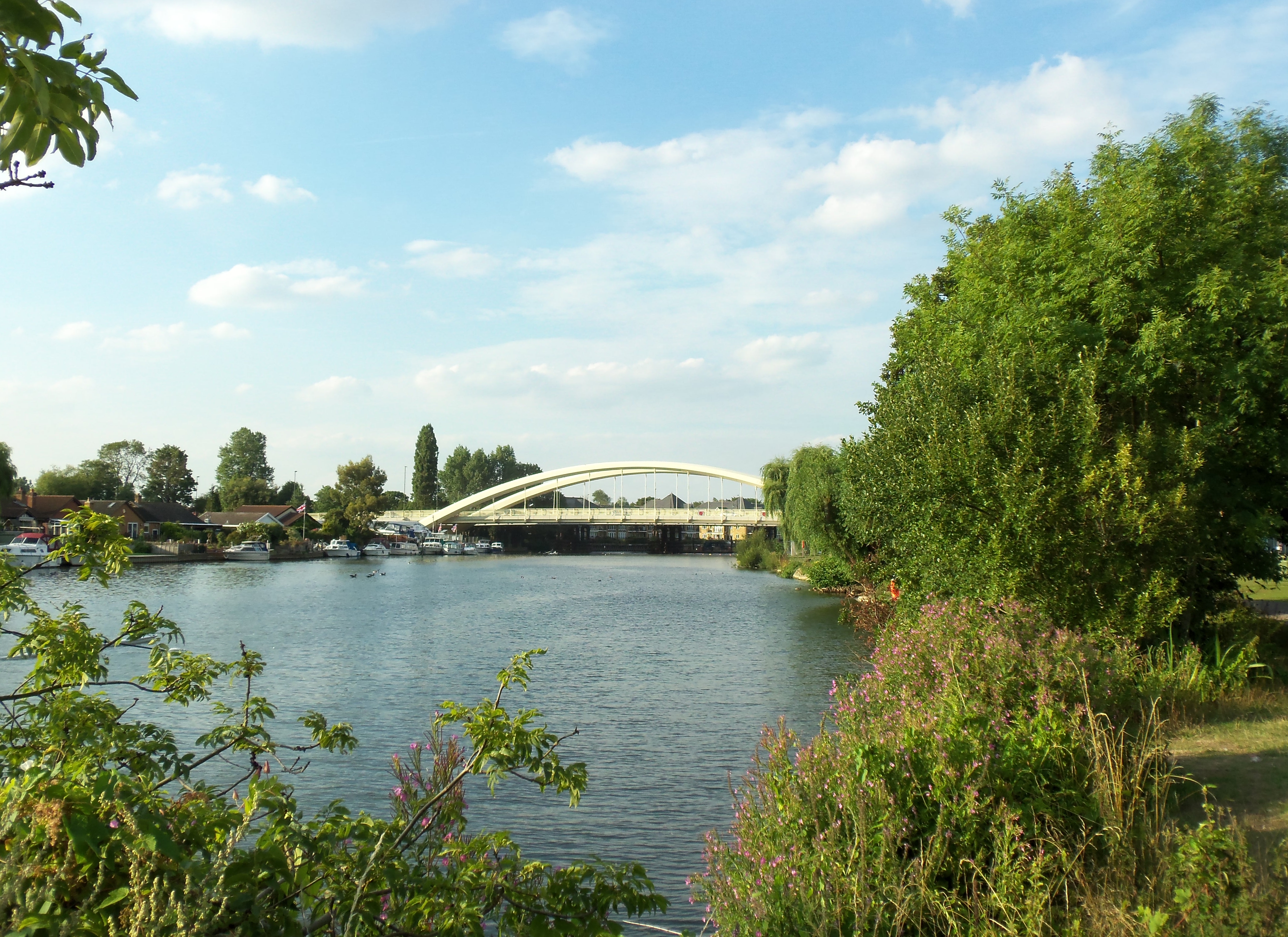
Walton-on-Thames is also home to numerous cultural and historical attractions. The River Thames, which flows through the town, provides opportunities for leisurely walks along its banks and boating activities. The historic Church of St. Mary stands proudly in the town center, showcasing stunning architecture and a rich history dating back to the 12th century. For art enthusiasts, The Walton Playhouse offers a range of theatrical performances throughout the year.

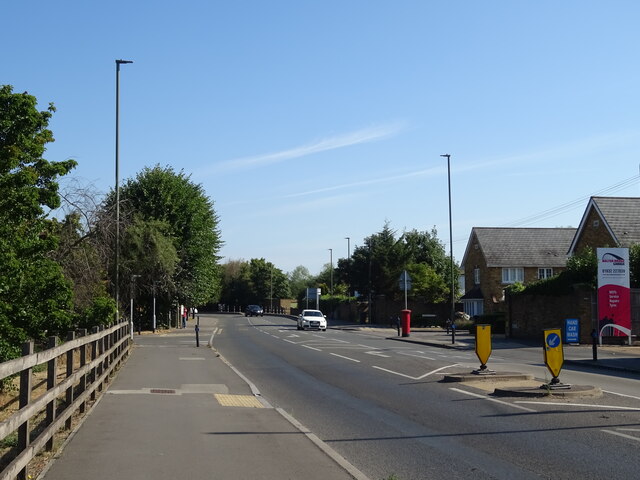
Transportation in Walton-on-Thames is well-served, with a direct train line to London Waterloo, making it an ideal location for commuters. The town also benefits from excellent road links, with the A3 and M25 motorway easily accessible.

Overall, Walton-on-Thames offers a unique blend of history, natural beauty, and modern amenities, making it an attractive place to live and visit in Surrey.

If you have any feedback on the listing, please let us know in the comments section below.

Walton-on-Thames Images

Images are sourced within 2km of 51.385012/-0.41838521 or Grid Reference TQ1066. Thanks to Geograph Open Source API. All images are credited.

Ambleside Avenue, Walton-on-Thames Mini-roundabout on Ambleside Avenue.
Ambleside Avenue, Walton-on-Thames
Mini-roundabout on Ambleside Avenue.
Desborough Water Works
River Thames
River Thames
River Thames
River Thames
Farmland next to Walton Lane Fields between the River Thames and Oatlands Park Hotel.
Farmland next to Walton Lane
Fields between the River Thames and Oatlands Park Hotel.
Bishop Duppas Recreation Ground Midium sized park of Lower Halliford.
Bishop Duppas Recreation Ground
Midium sized park of Lower Halliford.
Bus stop on Queens Road (A317)
Halliford School, Shepperton
Bus stop on Russell Road (B375)
Walton Bridge Garage
Walton Bridge Road (A244)
Roundabout on Walton Bridge Road (A244)
Flats beside the River Thames
River Thames, Walton Bridge
Walton Bridge Walton Bridge Road (A244) crossing the River Thames.
Walton Bridge
Walton Bridge Road (A244) crossing the River Thames.
Travelodge Walton-on-Thames Central Travelodge is the second largest budget hotel chain in the UK, with over 450 budget hotels.
Website: <span class="nowrap"><a title="http://www.travelodge.co.uk/" rel="nofollow ugc noopener" href="http://www.travelodge.co.uk/">Link</a><img style="margin-left:2px;" alt="External link" title="External link - shift click to open in new window" src="https://s1.geograph.org.uk/img/external.png" width="10" height="10"/></span> 
Wikipedia: <span class="nowrap"><a title="http://en.wikipedia.org/wiki/Travelodge_UK" rel="nofollow ugc noopener" href="http://en.wikipedia.org/wiki/Travelodge_UK">Link</a><img style="margin-left:2px;" alt="External link" title="External link - shift click to open in new window" src="https://s1.geograph.org.uk/img/external.png" width="10" height="10"/></span>
Travelodge Walton-on-Thames Central
Travelodge is the second largest budget hotel chain in the UK, with over 450 budget hotels. Website: LinkExternal link Wikipedia: LinkExternal link
The Regent, Walton-on-Thames See <a href="https://www.geograph.org.uk/photo/7257507">TQ1066 : Sign for the Regent, Walton-on-Thames</a> for sign.
The Regent, Walton-on-Thames
Show me another place!

Walton-on-Thames is located at Grid Ref: TQ1066 (Lat: 51.385012, Lng: -0.41838521)

Administrative County: Surrey

District: Elmbridge

Police Authority: Surrey

What 3 Words

///ideas.pitch.woke. Near Walton-on-Thames, Surrey

Nearby Locations

Walton-on-Thames

Related Wikis

Walton and Weybridge Urban District

Walton and Weybridge Urban District was a local government district in Surrey, England from 1933 to 1974. == Boundaries and background == The district...

Walton Studios

Walton Studios, previously named Hepworth Studios and Nettlefold Studios, was a film production studio in Walton-on-Thames in Surrey, England. Hepworth...

Walton-on-Thames

Walton-on-Thames, known locally as Walton, is a market town on the south bank of the Thames in northwest Surrey, England. It is in the Borough of Elmbridge...

No. 2 New Zealand General Hospital

The No. 2 New Zealand General Hospital was a World War I military hospital in Walton-on-Thames, England. The hospital opened in 1915 by requisitioning...

Related Videos

πŸ‡¬πŸ‡§ Holiday Inn Shepperton Hotel New Renovation Full Facility Report Breakfast Buffet Restaurant Bar

ihg #shepperton #holidayinn #heathrow #transit Welcome to a spooktacular stay at Holiday Inn Shepperton! In this video, we'll ...

Esher Walk πŸŒΏπŸ’š

https://www.google.com/search?client=ms-android-samsung-gn-rev1&source=android-browser&ei=PoMEYIKgKdKD8gKQ- ...

Nearby Amenities

Located within 500m of 51.385012,-0.41838521
Crossing
Crossing: traffic_signals
Crossing Ref: pelican
Kerb: lowered
Sloped Curb: yes
Lat/Long: 51.3843975/-0.4213502
Barrier: lift_gate
Lat/Long: 51.3836246/-0.4163301
Crossing
Crossing: unmarked
Kerb: lowered
Lat/Long: 51.3859125/-0.4203959
Barrier: lift_gate
Lat/Long: 51.3847712/-0.422643
Historic: memorial
Memorial: war_memorial
Lat/Long: 51.3840568/-0.4175261
Pub
The George
Lat/Long: 51.3870836/-0.4212786
Pub
The Bear
Lat/Long: 51.3870736/-0.4218566
site of former police station
Historic: building
Note: former police station demolished 2014; retirement homes being built March 2015
Lat/Long: 51.3840323/-0.4191757
School
Ashley CofE Primary School
Wikidata: Q66230824
Lat/Long: 51.3835591/-0.4179381
Bus Stop
Bridge Street
Naptan AtcoCode: 40004405044A
Naptan Bearing: W
Naptan CommonName: Bridge Street
Naptan Indicator: Just after
Naptan Landmark: Bridge Street
Naptan NaptanCode: suradwtp
Naptan Street: Bridge Street
Naptan Verified: no
Public Transport: platform
Source: naptan_import
Lat/Long: 51.3861582/-0.4247694
Bus Stop
Bridge Street
Naptan AtcoCode: 40004405044B
Naptan Bearing: E
Naptan CommonName: Bridge Street
Naptan Indicator: Just Before
Naptan Landmark: Bridge Street
Naptan NaptanCode: suradwtw
Naptan Street: Bridge Street
Naptan Verified: no
Public Transport: platform
Source: naptan_import
Lat/Long: 51.386284/-0.4246528
Bus Stop
The Bear
Local Ref: C
Naptan AtcoCode: 40004405045A
Naptan Bearing: E
Naptan CommonName: The Bear
Naptan Indicator: Stop C
Naptan Landmark: The Bear
Naptan NaptanCode: suragada
Naptan Street: Bridge Street
Naptan Verified: no
Public Transport: platform
Source: naptan_import
Lat/Long: 51.3869802/-0.4219352
Bus Stop
Hepworth Way
Naptan AtcoCode: 40004405046A
Naptan Bearing: W
Naptan CommonName: Hepworth Way
Naptan Indicator: W-bound
Naptan Landmark: Hepworth Way
Naptan NaptanCode: suragadg
Naptan Street: Hepworth Way
Naptan Verified: no
Public Transport: platform
Source: naptan_import
Lat/Long: 51.3856279/-0.422479
Bus Stop
Hepworth Way
Bus: yes
Local Ref: D
Naptan AtcoCode: 40004405046B
Naptan Bearing: E
Naptan CommonName: Hepworth Way
Naptan Indicator: Stop D
Naptan Landmark: Hepworth Way
Naptan NaptanCode: suragadj
Naptan Street: Hepworth Way
Public Transport: platform
Source: naptan_import
Lat/Long: 51.3857331/-0.4210927
Bus Stop
High Street
Local Ref: F
Naptan AtcoCode: 40004405047A
Naptan Bearing: SE
Naptan CommonName: High Street
Naptan Indicator: Stop F
Naptan Landmark: High Street
Naptan NaptanCode: suragadm
Naptan Street: High Street
Public Transport: platform
Source: naptan_import
Lat/Long: 51.3849299/-0.4182105
Bus Stop
High Street
Bus: yes
Local Ref: E
Naptan AtcoCode: 40004405047B
Naptan Bearing: NW
Naptan CommonName: High Street
Naptan Indicator: Stop E
Naptan Landmark: High Street
Naptan NaptanCode: suragadp
Naptan Street: High Street
Naptan Verified: no
Public Transport: platform
Source: naptan_import
Lat/Long: 51.3855541/-0.4191061
Bus Stop
Library
Local Ref: G
Naptan AtcoCode: 40004405048A
Naptan Bearing: SE
Naptan CommonName: Library
Naptan Indicator: Stop G
Naptan Landmark: Library
Naptan NaptanCode: suragadt
Naptan Street: Hersham Road
Naptan Verified: no
Public Transport: platform
Source: naptan_import
Lat/Long: 51.3837918/-0.4167418
Bus Stop
Library
Local Ref: H
Naptan AtcoCode: 40004405048B
Naptan Bearing: N
Naptan CommonName: Library
Naptan Indicator: Stop H
Naptan Landmark: Library
Naptan NaptanCode: suragadw
Naptan Street: Ashley Road
Naptan Verified: no
Public Transport: platform
Source: naptan_import
Lat/Long: 51.3835066/-0.4176693
Bus Stop
Church Street
Bus: yes
Local Ref: B
Naptan AtcoCode: 40004405087A
Naptan Bearing: SW
Naptan CommonName: Church Street
Naptan Indicator: Stop B
Naptan Landmark: Church Street
Naptan NaptanCode: suragjam
Naptan Street: Church Street
Naptan Verified: no
Public Transport: platform
Source: naptan_import
Lat/Long: 51.3866304/-0.4192256
Bus Stop
Church Street
Bus: yes
Local Ref: A
Naptan AtcoCode: 40004405087B
Naptan Bearing: NE
Naptan CommonName: Church Street
Naptan Indicator: Stop A
Naptan Landmark: Church Street
Naptan NaptanCode: suragjap
Naptan Street: Church Street
Naptan Verified: no
Public Transport: platform
Source: naptan_import
Lat/Long: 51.3866502/-0.4194132
Bus Stop
Annett Road
Naptan AtcoCode: 40004405088A
Naptan Bearing: SW
Naptan CommonName: Annett Road
Naptan Indicator: Opp
Naptan Landmark: Annett Road
Naptan NaptanCode: suragjat
Naptan Street: Terrace Road
Naptan Verified: no
Public Transport: platform
Source: naptan_import
Lat/Long: 51.3891455/-0.415817
Bus Stop
Sidney Road
Naptan AtcoCode: 40004405271B
Naptan Bearing: NW
Naptan CommonName: Sidney Road
Naptan Indicator: NW-bound
Naptan Landmark: Sidney Road / Montague Close
Naptan NaptanCode: surajatd
Naptan Street: Sidney Road
Naptan Verified: no
Public Transport: platform
Source: naptan_import
Lat/Long: 51.3874038/-0.4134783
Sainsbury's
Brand: Sainsbury's
Brand Wikidata: Q152096
Brand Wikipedia: en:Sainsbury's
Shop: supermarket
Website: https://stores.sainsburys.co.uk/2663/walton-on-thames
Lat/Long: 51.3848903/-0.4215905
M&S Simply Food
Addr City: Walton-on-Thames
Addr Housenumber: 20-32
Addr Postcode: KT12 2QS
Addr Street: Church Street
Brand: M&S Simply Food
Brand Wikidata: Q714491
Contact Website: https://www.marksandspencer.com/stores/walton-on-thames-foodhall-804
Note: This store was an Aldi but is now M&S food store. This store has a cafe.
Phone: +44 1932 504507
Shop: convenience
Wheelchair: yes
Lat/Long: 51.3868387/-0.4188047
Entrance: main
Lat/Long: 51.3866047/-0.4177484
Barrier: lift_gate
Lat/Long: 51.3847765/-0.4146208
Sport: cricket
Lat/Long: 51.3831462/-0.4124543
Toilets
Capacity: 1
Fee: yes
Lat/Long: 51.3834692/-0.4163749
Bench
Lat/Long: 51.3841059/-0.4173643
Entrance: yes
Lat/Long: 51.3837976/-0.4163774
Bicycle Parking
Capacity: 6
Lat/Long: 51.3843606/-0.4180795
Parking
Access: residents
Parking: underground
Lat/Long: 51.3846629/-0.4202111
Place Of Worship
Religion: christian
Lat/Long: 51.3816075/-0.4140648
Mini Roundabout
Direction: clockwise
Lat/Long: 51.3890082/-0.4161245
Crossing
Crossing Island: yes
Kerb: lowered
Sloped Curb: yes
Source: DigitalGlobe-Premium
Lat/Long: 51.3830075/-0.4174457
Traffic Calming: hump
Lat/Long: 51.3870082/-0.4157413
Traffic Calming: hump
Lat/Long: 51.3862776/-0.4167168
Barrier: lift_gate
Lat/Long: 51.3841086/-0.4162688
Walton-on-Thames
Is In: Surrey, England, UK
Place: town
Population: 22834
Wikidata: Q2003600
Wikipedia: en:Walton-on-Thames
Lat/Long: 51.3856837/-0.419814
Traffic Signals
Lat/Long: 51.384216/-0.4177423
Traffic Signals
Lat/Long: 51.3842304/-0.4178697
Crossing
Crossing: traffic_signals
Crossing Ref: pelican
Kerb: lowered
Sloped Curb: yes
Lat/Long: 51.3842316/-0.4176982
Crossing
Crossing: traffic_signals
Crossing Ref: pelican
Kerb: lowered
Lat/Long: 51.3842465/-0.4179603
Traffic Signals
Traffic Signals Direction: forward
Lat/Long: 51.3842224/-0.4177945
Crossing
Crossing: traffic_signals
Crossing Ref: pelican
Kerb: lowered
Lat/Long: 51.3842727/-0.4178225
Traffic Signals
Lat/Long: 51.3843076/-0.4180549
Crossing
Crossing: traffic_signals
Crossing Ref: pelican
Kerb: lowered
Lat/Long: 51.3843149/-0.4179803
Crossing
Crossing: traffic_signals
Crossing Ref: pelican
Kerb: lowered
Lat/Long: 51.3843942/-0.4178823
Crossing
Crossing: traffic_signals
Crossing Ref: pelican
Kerb: lowered
Lat/Long: 51.3844112/-0.4178092
Traffic Signals
Lat/Long: 51.3844407/-0.4178564
Crossing
Crossing: uncontrolled
Crossing Ref: zebra
Lat/Long: 51.3851133/-0.4184853
Crossing
Crossing: uncontrolled
Crossing Ref: zebra
Lat/Long: 51.3857829/-0.4192817
Crossing
Bicycle: yes
Crossing: traffic_signals
Crossing Island: no
Crossing Markings: yes
Crossing Ref: toucan
Kerb: lowered
Lat/Long: 51.3862279/-0.4197235
Traffic Signals
Source: Bing
Traffic Signals: traffic_lights
Traffic Signals Direction: forward
Lat/Long: 51.3864175/-0.4200533
Turning Circle
Lat/Long: 51.3890052/-0.4214447
Crossing
Bicycle: yes
Crossing: uncontrolled
Crossing Island: yes
Kerb: lowered
Lat/Long: 51.3861279/-0.4253327
Traffic Signals
Source: Bing
Traffic Signals Direction: backward
Lat/Long: 51.3873179/-0.4183765
Traffic Calming: hump
Lat/Long: 51.3877267/-0.4181876
Turning Circle
Lat/Long: 51.3837341/-0.4243785
Theatre
Lat/Long: 51.3857128/-0.4247232
Pub
Lat/Long: 51.3872494/-0.4193105
Traffic Signals
Traffic Signals Direction: backward
Lat/Long: 51.3843884/-0.421238
Bicycle Parking
Bicycle Parking: stands
Capacity: 6
Covered: no
Lat/Long: 51.3836368/-0.4168685
Bench
Lat/Long: 51.3835137/-0.4169302
Bench
Lat/Long: 51.3835715/-0.4169986
Bank
Nationwide Building Society
Brand: Nationwide
Brand Wikidata: Q846735
Contact Website: https://locations.nationwidebranches.co.uk/walton-on-thames/3-church-street
Lat/Long: 51.38654/-0.4198368
Post Box
Collection Plate: CP1
Collection Times: Mo-Fr 17:00; Sa 12:00
Operator: Royal Mail
Post Box Design: type_a
Post Box Type: pillar
Ref: KT12 98
Royal Cypher: GR
Royal Cypher Wikidata: Q33102273
Lat/Long: 51.3838716/-0.4168365
Bicycle Parking
Lat/Long: 51.384387/-0.4187621
Bicycle Parking
Lat/Long: 51.3844922/-0.4214717
Bicycle Parking
Lat/Long: 51.3845778/-0.4213434
Post Box
Collection Plate: CP8N
Collection Times: Mo-Fr 16:15; Sa 12:00
Operator: Royal Mail
Post Box Design: type_k
Post Box Type: pillar
Ref: KT12 233
Royal Cypher: EIIR
Royal Cypher Wikidata: Q33102113
Lat/Long: 51.3860058/-0.4194178
Post Box
Collection Plate: CP1
Collection Times: Mo-Fr 17:00; Sa 12:00
Operator: Royal Mail
Post Box Apertures: 2
Post Box Design: type_c
Post Box Type: pillar
Ref: KT12 114;KT12 1141
Royal Cypher: EIIR
Royal Cypher Wikidata: Q33102113
Lat/Long: 51.386627/-0.4195295
Post Box
Collection Plate: CP1D
Collection Times: Mo-Fr 09:00; Sa 07:00
Operator: Royal Mail
Post Box Design: type_b
Post Box Type: pillar
Ref: KT12 120D
Royal Cypher: GR
Royal Cypher Wikidata: Q33102273
Lat/Long: 51.3872049/-0.4233761
Telephone
Addr City: Walton-on-Thames
Addr Housename: Opposite St Mary's Church
Addr Street: Church Street
Booth: KX100
Covered: booth
Mapillary: 294575922213899
Operator: BT
Payment Coins: yes
Phone: +44 1932 252718
Survey Date: 2020-01-12
Lat/Long: 51.3873355/-0.4184449
Post Box
Collection Plate: CP1D
Collection Times: Mo-Fr 09:00; Sa 07:00
Operator: Royal Mail
Post Box Design: type_b
Post Box Type: pillar
Ref: KT12 230D
Royal Cypher: GR
Royal Cypher Wikidata: Q33102273
Lat/Long: 51.389089/-0.4191051
Post Office
Church Street Post Office
Brand: Post Office
Brand Wikidata: Q1783168
Ref Pol Id: 18803
Website: https://www.postoffice.co.uk/branch-finder/114023x/church-street
Lat/Long: 51.3865969/-0.4196868
Cafe
Le Petit Cafe
Lat/Long: 51.3864947/-0.4200404
Optometrists
Shop: optician
Lat/Long: 51.3864768/-0.4199365
herbalworld
Healthcare: alternative
Healthcare Speciality: acupuncture
Lat/Long: 51.3865765/-0.4197431
Bank
Barclays
Brand: Barclays
Brand Wikidata: Q245343
Brand Wikipedia: en:Barclays
Wheelchair: yes
Lat/Long: 51.3864787/-0.4193221
Fast Food
Golden Fry
Cuisine: fish_and_chips
Wheelchair: limited
Lat/Long: 51.3870954/-0.4188265
Atm
Wheelchair: yes
Lat/Long: 51.3864586/-0.4193783
Atm
Lat/Long: 51.3865261/-0.419779
Walton Dahn Yoga Centre
Addr City: Walton-on-Thames
Addr Housename: 35-37 Bridge Street
Addr Housenumber: 35-37
Addr Postcode: KT12 1AF
Addr Street: Bridge Street
Leisure: yoga
Note: Yoga, Tai-Chi, Ki-Gong, Vibration Training, Meditation, Wooden Pillow Training
Phone: +44 1932 259 759
Sport: yoga
Lat/Long: 51.3868607/-0.4220034
Crossing
Crossing: unmarked
Crossing Island: yes
Crossing Markings: no
Kerb: lowered
Lat/Long: 51.3856707/-0.4223757
Crossing
Crossing: unmarked
Crossing Island: yes
Crossing Markings: no
Kerb: lowered
Lat/Long: 51.3856826/-0.421724
Crossing
Crossing Island: yes
Kerb: lowered
Sloped Curb: yes
Lat/Long: 51.3857663/-0.4231513
Crossing
Bicycle: yes
Crossing: uncontrolled
Crossing Island: yes
Kerb: lowered
Traffic Calming: table
Lat/Long: 51.3863139/-0.4244513
Barrier: lift_gate
Lat/Long: 51.3853333/-0.422543
Post Box
Collection Plate: CP1D
Collection Times: Mo-Fr 09:00; Sa 07:00
Operator: Royal Mail
Post Box Design: type_b
Post Box Type: pillar
Ref: KT12 112D
Royal Cypher: GVIR
Royal Cypher Wikidata: Q33102169
Lat/Long: 51.3856827/-0.4122972
Toilets
Access: public
Toilets Disposal: flush
Toilets Position: seated;urinal
Wheelchair: yes
Lat/Long: 51.3852458/-0.4216378
Street Lamp
Lat/Long: 51.3845839/-0.4177864
Crossing
Crossing: unmarked
Kerb: lowered
Sloped Curb: yes
Lat/Long: 51.3834912/-0.4163911
Crossing
Crossing Island: yes
Kerb: lowered
Sloped Curb: yes
Lat/Long: 51.3833506/-0.416449
Crossing
Crossing Island: yes
Kerb: lowered
Sloped Curb: yes
Lat/Long: 51.3833686/-0.4164083
Traffic Signals
Source: Bing
Traffic Signals Direction: forward
Lat/Long: 51.3839652/-0.4170719
Crossing
Crossing: traffic_signals
Crossing Ref: pelican
Kerb: lowered
Lat/Long: 51.3839274/-0.4170203
Traffic Signals
Traffic Signals Direction: forward
Lat/Long: 51.3841853/-0.4204985
Traffic Signals
Traffic Signals Direction: backward
Lat/Long: 51.3844104/-0.4203339
Crossing
Crossing Island: yes
Kerb: lowered
Sloped Curb: yes
Lat/Long: 51.3846967/-0.4226916
Traffic Signals
Traffic Signals Direction: forward
Lat/Long: 51.384406/-0.4214356
Crossing
Crossing Island: yes
Kerb: lowered
Lat/Long: 51.3847434/-0.423034
Crossing
Crossing: unmarked
Kerb: lowered
Sloped Curb: yes
Lat/Long: 51.3845277/-0.4178571
Crossing
Bicycle: yes
Crossing: traffic_signals
Crossing Ref: toucan
Kerb: lowered
Lat/Long: 51.3863759/-0.4199593
Traffic Signals
Source: Bing
Traffic Signals: traffic_lights
Traffic Signals Direction: backward
Lat/Long: 51.3861487/-0.4201182
Crossing
Bicycle: yes
Crossing: traffic_signals
Crossing Island: yes
Crossing Markings: yes
Crossing Ref: toucan
Kerb: lowered
Lat/Long: 51.3863791/-0.4197182
Traffic Signals
Source: Bing
Traffic Signals: traffic_lights
Traffic Signals Direction: forward
Lat/Long: 51.3864163/-0.4196565
Traffic Signals
Source: Bing
Traffic Signals: traffic_lights
Traffic Signals Direction: backward
Lat/Long: 51.3861537/-0.4196451
Barrier: kerb
Kerb: lowered
Source: Bing
Tactile Paving: yes
Lat/Long: 51.3864083/-0.419927
Barrier: kerb
Kerb: lowered
Source: Bing
Tactile Paving: yes
Lat/Long: 51.3863446/-0.4199934
Barrier: kerb
Kerb: lowered
Source: Bing
Tactile Paving: yes
Lat/Long: 51.3862634/-0.4196566
Barrier: kerb
Kerb: lowered
Source: Bing
Tactile Paving: yes
Lat/Long: 51.3862773/-0.4200176
Barrier: bollard
Lat/Long: 51.3862391/-0.4200942
Crossing
Bicycle: yes
Crossing: uncontrolled
Kerb: lowered
Traffic Calming: table
Lat/Long: 51.385979/-0.4236515
Crossing
Bicycle: yes
Crossing: uncontrolled
Kerb: lowered
Sloped Curb: yes
Traffic Calming: table
Lat/Long: 51.3889499/-0.4160231
Barrier: bollard
Lat/Long: 51.3882438/-0.4172791
Barrier: bollard
Lat/Long: 51.3882375/-0.4171006
Barrier: bollard
Lat/Long: 51.3892241/-0.4159121
Crossing
Bicycle: yes
Crossing: traffic_signals
Crossing Ref: toucan
Kerb: lowered
Sloped Curb: yes
Lat/Long: 51.3873555/-0.4183251
Crossing
Bicycle: yes
Crossing: unmarked
Kerb: lowered
Sloped Curb: yes
Lat/Long: 51.3883211/-0.416986
Traffic Signals
Source: Bing
Traffic Signals Direction: forward
Lat/Long: 51.3873797/-0.4182921
Crossing
Bicycle: yes
Crossing: unmarked
Kerb: lowered
Lat/Long: 51.3881981/-0.4173443
Crossing
Bicycle: yes
Crossing: unmarked
Kerb: lowered
Lat/Long: 51.387975/-0.4176516
Barrier: bollard
Lat/Long: 51.3878245/-0.4176679
Crossing
Bicycle: yes
Crossing: uncontrolled
Kerb: lowered
Traffic Calming: table
Lat/Long: 51.3876544/-0.4180541
Crossing
Bicycle: yes
Crossing: unmarked
Kerb: lowered
Lat/Long: 51.387423/-0.4181182
Barrier: bollard
Lat/Long: 51.3874971/-0.4180108
Barrier: bollard
Lat/Long: 51.3872972/-0.4182676
Crossing
Crossing: unmarked
Crossing Markings: no
Kerb: lowered
Lat/Long: 51.3869558/-0.4187194
Crossing
Bicycle: yes
Crossing: traffic_signals
Crossing Island: no
Crossing Markings: yes
Crossing Ref: toucan
Kerb: lowered
Lat/Long: 51.3862336/-0.419955
Barrier: bollard
Lat/Long: 51.3863315/-0.4246017
Barrier: bollard
Lat/Long: 51.3860211/-0.4237633
Barrier: bollard
Lat/Long: 51.3862338/-0.4243038
Barrier: bollard
Lat/Long: 51.3857966/-0.4213017
Barrier: bollard
Lat/Long: 51.3858758/-0.4209891
Barrier: bollard
Lat/Long: 51.3861471/-0.4252546
Crossing
Bicycle: yes
Crossing: uncontrolled
Kerb: lowered
Traffic Calming: table
Lat/Long: 51.385836/-0.4211363
Crossing
Crossing: unmarked
Kerb: lowered
Sloped Curb: yes
Lat/Long: 51.385316/-0.4245157
Crossing
Crossing: unmarked
Kerb: lowered
Lat/Long: 51.3853327/-0.4250342
Crossing
Crossing: unmarked
Kerb: lowered
Sloped Curb: yes
Lat/Long: 51.3860285/-0.4241173
Crossing
Crossing: unmarked
Kerb: lowered
Sloped Curb: yes
Lat/Long: 51.3848709/-0.4236259
Traffic Signals
Traffic Signals Direction: forward
Lat/Long: 51.3842766/-0.4201324
Traffic Signals
Traffic Signals Direction: forward
Lat/Long: 51.3843764/-0.4206633
Crossing
Crossing: traffic_signals
Crossing Ref: pelican
Kerb: lowered
Lat/Long: 51.3842797/-0.4201955
Crossing
Crossing: traffic_signals
Crossing Ref: pelican
Kerb: lowered
Sloped Curb: yes
Lat/Long: 51.3843399/-0.4201833
Crossing
Crossing: traffic_signals
Crossing Ref: pelican
Kerb: lowered
Lat/Long: 51.3842289/-0.4204656
Barrier: bollard
Lat/Long: 51.385924/-0.4235058
Crossing
Crossing Island: yes
Kerb: lowered
Source: DigitalGlobe-Premium
Lat/Long: 51.3829906/-0.41736
Crossing
Crossing: unmarked
Kerb: lowered
Sloped Curb: yes
Lat/Long: 51.3842058/-0.4173136
Bench
Backrest: yes
Lat/Long: 51.3847624/-0.4144275
Bench
Backrest: yes
Lat/Long: 51.3848143/-0.4143564
Bench
Backrest: yes
Lat/Long: 51.3833119/-0.4134927
Barrier: bollard
Lat/Long: 51.3863046/-0.4246408
Barrier: cycle_barrier
Bicycle: dismount
Lat/Long: 51.3843753/-0.411494
Access: no
Foot: yes
Lat/Long: 51.3842015/-0.4126679
Access: no
Foot: yes
Lat/Long: 51.3844084/-0.4126206
Access: no
Foot: yes
Lat/Long: 51.3844084/-0.4126206
Access: no
Foot: yes
Lat/Long: 51.3844084/-0.4126206
Toilets
Access: yes
Changing Table: yes
Toilets Disposal: flush
Unisex: yes
Wheelchair: yes
Lat/Long: 51.3848609/-0.4214334
Barrier: kerb
Kerb: lowered
Source: Bing
Tactile Paving: yes
Lat/Long: 51.3858542/-0.4210699
Barrier: kerb
Kerb: lowered
Source: Bing
Tactile Paving: yes
Lat/Long: 51.3858178/-0.4212023
Bench
Lat/Long: 51.3844204/-0.4151372
Barrier: cycle_barrier
Lat/Long: 51.3837962/-0.4145067
Barrier: cycle_barrier
Lat/Long: 51.3838336/-0.4145462
Restaurant
Persian Kitchen
Cuisine: persian
Lat/Long: 51.3867488/-0.4193411
Oriental Evergreen Massage
Shop: massage
Lat/Long: 51.3871573/-0.4187452
Crossing
Crossing: unmarked
Kerb: lowered
Lat/Long: 51.3871885/-0.4184121
Studio Plaza
Place: square
Lat/Long: 51.3850762/-0.4210464
Crossing
Crossing: unmarked
Kerb: lowered
Lat/Long: 51.3889237/-0.4190561
DECORATE by Homebase
Brand: Homebase
Brand Wikidata: Q9293447
Brand Wikipedia: en:Homebase
Note: planned Spring 2021
Shop: doityourself
Website: https://store.homebase.co.uk/walton-on-thames/auckland-house
Lat/Long: 51.3840923/-0.4185239
Homebase bathstore
Brand: Homebase
Brand Wikidata: Q9293447
Shop: bathroom_furnishing
Website: https://store.homebase.co.uk/walton-on-thames/auckland-house
Lat/Long: 51.3840839/-0.4182556
Leisure: picnic_table
Lat/Long: 51.3831114/-0.4232231
Leisure: picnic_table
Lat/Long: 51.3831315/-0.4241002
Bench
Backrest: yes
Lat/Long: 51.3831365/-0.4243147
Bench
Backrest: yes
Lat/Long: 51.3844505/-0.4222079
Bench
Backrest: yes
Lat/Long: 51.3837776/-0.4226062
Bench
Backrest: yes
Lat/Long: 51.3842413/-0.4224479
Cycleway: asl
Direction: forward
Lat/Long: 51.3842573/-0.4178132
Crossing
Lat/Long: 51.3847297/-0.4227964
Barrier: lift_gate
Lat/Long: 51.3848368/-0.4225152
Barrier: kerb
Kerb: lowered
Source: Bing
Tactile Paving: yes
Lat/Long: 51.3863254/-0.4196363
Barrier: kerb
Kerb: lowered
Source: Bing
Tactile Paving: yes
Lat/Long: 51.3864261/-0.4197841
Cycleway: asl
Direction: forward
Lat/Long: 51.3863989/-0.420013
Cycleway: asl
Direction: forward
Lat/Long: 51.3863982/-0.4196869
Cycleway: asl
Direction: backward
Lat/Long: 51.3861704/-0.4200718
Cycleway: asl
Direction: backward
Lat/Long: 51.386186/-0.4196729
Give Way
Direction: forward
Lat/Long: 51.3833845/-0.4165417
Give Way
Direction: forward
Lat/Long: 51.3831195/-0.4174528
Addr City: Walton-on-Thames
Addr Country: GB
Addr Housenumber: 11-15
Addr Postcode: KT12 1AE
Addr Street: Bridge Street
Disused Shop: variety_store
Old Name: Wilko
Lat/Long: 51.3866367/-0.4207098
Crossing
Lat/Long: 51.3839071/-0.4177529
Leisure: playground
Lat/Long: 51.3832023/-0.4238078
Parking Entrance
Lat/Long: 51.3871056/-0.4202286
Bensons for Beds
Brand: Bensons for Beds
Brand Wikidata: Q4890299
Brand Wikipedia: en:Bensons for Beds
Shop: bed
Lat/Long: 51.3860002/-0.420807
Parking Entrance
Lat/Long: 51.3861341/-0.4208673
Entrance: main
Lat/Long: 51.3863338/-0.4201203
Parking
Manor Road Car Park
Lat/Long: 51.3876205/-0.4188419
Barrier: lift_gate
Lat/Long: 51.3874108/-0.4189742
Barrier: lift_gate
Lat/Long: 51.385814/-0.4177802
Entrance: main
Lat/Long: 51.3870123/-0.4177356
Barrier: lift_gate
Lat/Long: 51.3853203/-0.4178645
Entrance: main
Lat/Long: 51.3851083/-0.4167695
Crossing
Lat/Long: 51.3835693/-0.4164712
Crossing
Lat/Long: 51.3862644/-0.4247662
Entrance: yes
Lat/Long: 51.3855321/-0.4218885
Barrier: kerb
Kerb: lowered
Source: Bing
Tactile Paving: yes
Lat/Long: 51.3857196/-0.4217352
Barrier: kerb
Kerb: lowered
Source: Bing
Tactile Paving: yes
Lat/Long: 51.3861999/-0.4199067
Barrier: kerb
Kerb: lowered
Source: Bing
Tactile Paving: yes
Lat/Long: 51.3861968/-0.4197818
The data included in this document is from www.openstreetmap.org. The data is made available under ODbL.

Have you been to Walton-on-Thames?

Leave your review of Walton-on-Thames below (or comments, questions and feedback).