Boys Hill

Settlement in Dorset

England

Boys Hill

Holwell Manor House Grade II* listed. "Country House, C16 with much rebuilding of 1889" <span class="nowrap"><a title="https://historicengland.org.uk/listing/the-list/list-entry/1118845?section=official-list-entry" rel="nofollow ugc noopener" href="https://historicengland.org.uk/listing/the-list/list-entry/1118845?section=official-list-entry">Link</a><img style="margin-left:2px;" alt="External link" title="External link - shift click to open in new window" src="https://s1.geograph.org.uk/img/external.png" width="10" height="10"/></span> . Seen past the entrance gate on Holwell Drove <a href="https://www.geograph.org.uk/photo/7564503">ST6810 : Holwell Drove</a>.
Holwell Manor House Credit: Derek Harper

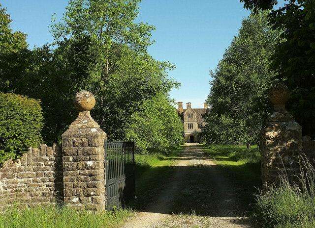
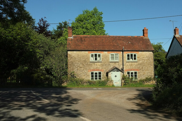
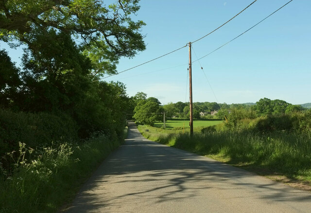
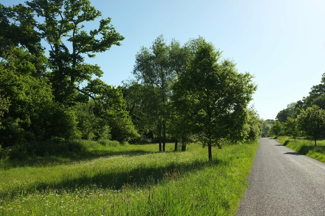
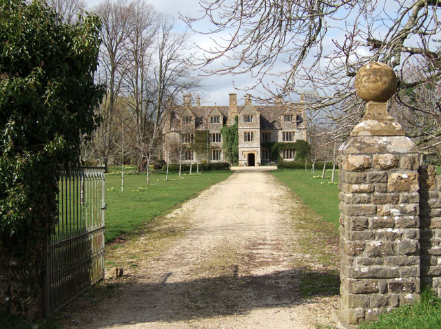
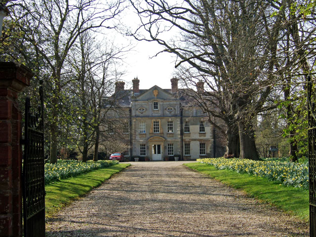
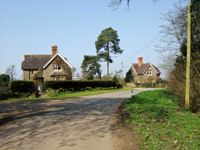
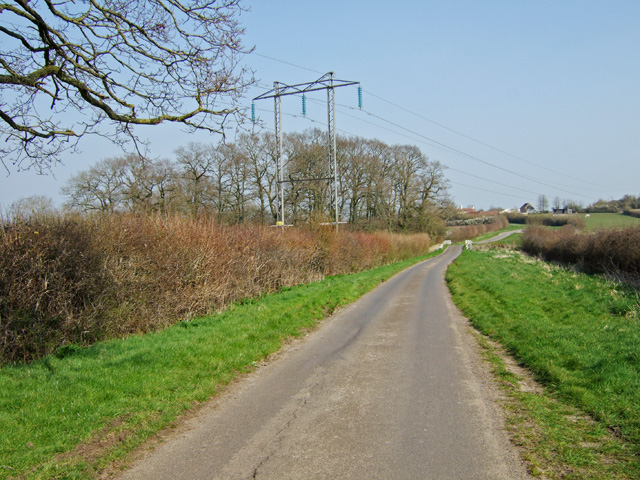
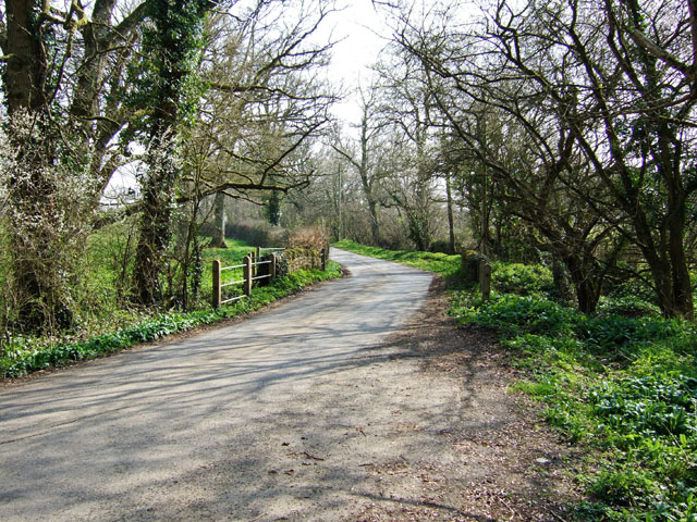
Boys Hill is a charming village located in the county of Dorset, situated in the southwest of England. Nestled amidst the picturesque countryside, this small and close-knit community offers a tranquil and idyllic setting for both residents and visitors alike.

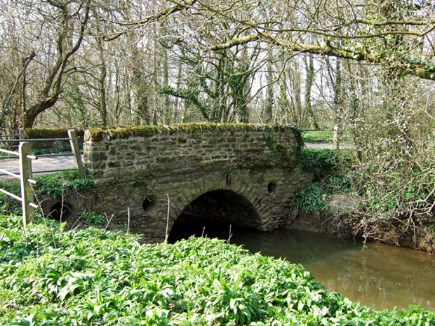
The village is noted for its historic significance, with evidence of human habitation dating back to the Roman era. The name "Boys Hill" is believed to have originated from the Old English word "bysceop" meaning bishop, suggesting a historical connection to ecclesiastical figures in the area.

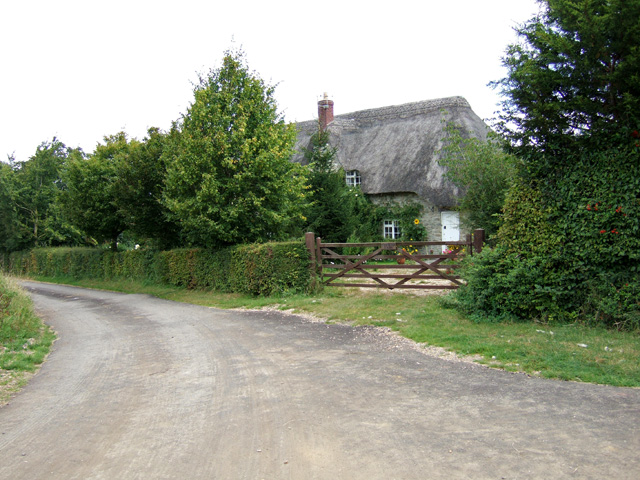
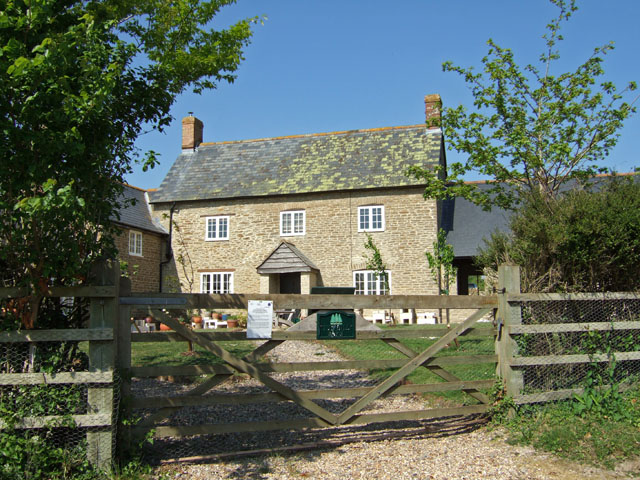
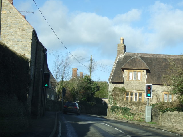
Boys Hill boasts an array of quintessential English cottages, characterized by their thatched roofs and charming facades. The village is known for its well-preserved architecture, with several buildings dating back to the 17th and 18th centuries. These historical structures add to the village's charm and provide a glimpse into its rich heritage.

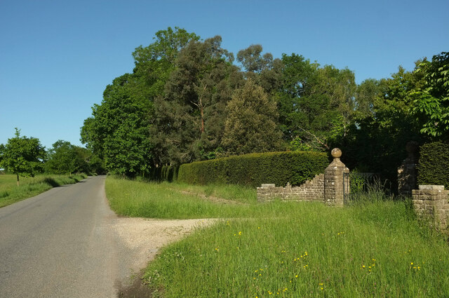
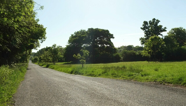
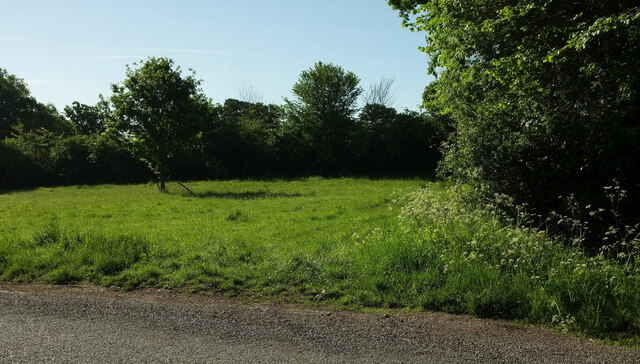
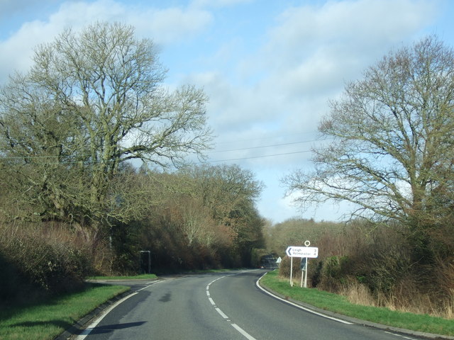
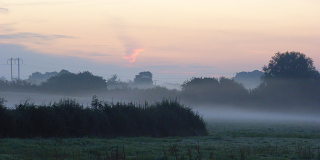
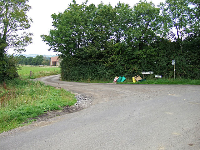
Nature enthusiasts will appreciate the surrounding countryside, which offers breathtaking views and ample opportunities for hiking and exploring. The nearby rolling hills provide a scenic backdrop, while the meandering river that runs through the village adds to its natural beauty.

Although small in size, Boys Hill has a strong sense of community spirit. The village hosts various events throughout the year, including summer fairs and Christmas markets, which bring residents together and attract visitors from neighboring areas.

With its historical significance, picturesque landscapes, and vibrant community, Boys Hill is a hidden gem in the Dorset countryside, offering a peaceful and charming retreat for all who visit.

If you have any feedback on the listing, please let us know in the comments section below.

Boys Hill Images

Images are sourced within 2km of 50.889884/-2.4662435 or Grid Reference ST6710. Thanks to Geograph Open Source API. All images are credited.

Holwell Manor House Grade II* listed. "Country House, C16 with much rebuilding of 1889" <span class="nowrap"><a title="https://historicengland.org.uk/listing/the-list/list-entry/1118845?section=official-list-entry" rel="nofollow ugc noopener" href="https://historicengland.org.uk/listing/the-list/list-entry/1118845?section=official-list-entry">Link</a><img style="margin-left:2px;" alt="External link" title="External link - shift click to open in new window" src="https://s1.geograph.org.uk/img/external.png" width="10" height="10"/></span> . Seen past the entrance gate on Holwell Drove <a href="https://www.geograph.org.uk/photo/7564503">ST6810 : Holwell Drove</a>.
Holwell Manor House
Grade II* listed. "Country House, C16 with much rebuilding of 1889" LinkExternal link . Seen past the entrance gate on Holwell Drove ST6810 : Holwell Drove.
Cottage, Sandhills Tess Cottage is opposite the junction of Holwell Drove (foreground) with Stock Hill Lane. Presumably named as a whimsical reference to Hardy's famous character who spent time in the Blackmore Vale, which we are in.
Cottage, Sandhills
Tess Cottage is opposite the junction of Holwell Drove (foreground) with Stock Hill Lane. Presumably named as a whimsical reference to Hardy's famous character who spent time in the Blackmore Vale, which we are in.
Stock Hill Lane Passing Rails Farm. To the right of the telegraph pole is Magog Farm.
Stock Hill Lane
Passing Rails Farm. To the right of the telegraph pole is Magog Farm.
Holwell Drove The unfenced symbol comes into play on maps here, as the western end of the road has the very wide verges characteristic of drove roads.
Holwell Drove
The unfenced symbol comes into play on maps here, as the western end of the road has the very wide verges characteristic of drove roads.
Holwell Drove The former drove road passes the entrance gateway to the Manor House, glimpsed at <a href="https://www.geograph.org.uk/photo/7184701">ST6810 : Holwell Manor House</a>
Holwell Drove
The former drove road passes the entrance gateway to the Manor House, glimpsed at ST6810 : Holwell Manor House
Holwell Drove Looking left from as the wide verge appears. See also <a href="https://www.geograph.org.uk/photo/7564475">ST6910 : Holwell Drove</a>.
Holwell Drove
Looking left from as the wide verge appears. See also ST6910 : Holwell Drove.
Verge by Holwell Drove Looking right from <a href="https://www.geograph.org.uk/photo/7564516">ST6810 : Holwell Drove</a>, with the wide verge ending abruptly.
Verge by Holwell Drove
Looking right from ST6810 : Holwell Drove, with the wide verge ending abruptly.
The turning to Leigh on the A352 near Holnest
Sandhills Manor House Grade II* listed manor house, C16 with extensive rebuilding in 1889.
Sandhills Manor House
Grade II* listed manor house, C16 with extensive rebuilding in 1889.
Buckshaw House Grade II* listed mid C18 house. Pevsner describes this as a 'handsome seven-bay facade of the mid 18th century, recrowned in 1894.'
Buckshaw House
Grade II* listed mid C18 house. Pevsner describes this as a 'handsome seven-bay facade of the mid 18th century, recrowned in 1894.'
Buckshaw House Estate Cottages
Building Site near Buckshaw House
Pylons near Boys Hill
Hunters Bridge Road bridge over The Cam southeast of Longburton.
Hunters Bridge
Road bridge over The Cam southeast of Longburton.
Hunters Bridge (2)
Hunters Bridge (2)
Daybreak in the Blackmore Vale Looking east from the A352 at Holnest at 6am on an autumnal August bank holiday morning. Here the flat pastures are drained by The Cam and its tributaries, the waters of which make their way to the Stour via Caundle Brook and the River Lydden. This is the western end of Hardy's "Vale of the Little Dairies".
Daybreak in the Blackmore Vale
Looking east from the A352 at Holnest at 6am on an autumnal August bank holiday morning. Here the flat pastures are drained by The Cam and its tributaries, the waters of which make their way to the Stour via Caundle Brook and the River Lydden. This is the western end of Hardy's "Vale of the Little Dairies".
Fosters Farm B & B Boys Hill
Boys Hill
Boys Hill
Show me another place!

Boys Hill is located at Grid Ref: ST6710 (Lat: 50.889884, Lng: -2.4662435)

Unitary Authority: Dorset

Police Authority: Dorset

What 3 Words

///commit.enveloped.household. Near Sherborne, Dorset

Nearby Locations

Boys Hill

Related Wikis

Holnest SSSI, Dorset

Holnest SSSI, Dorset (grid reference ST667106) is a 54.83 hectare biological Site of Special Scientific Interest in Dorset, notified in 2004.The site has...

Holnest

Holnest is a village and civil parish in the county of Dorset in southern England. It lies in the Blackmore Vale 4 miles (6.4 km) south of Sherborne. It...

Glanvilles Wootton

Glanvilles Wootton, or Wootton Glanville, is a village and civil parish in the county of Dorset in southern England. It is situated in the Blackmore Vale...

Holwell, Dorset

Holwell is a village and civil parish in the county of Dorset in southern England, situated approximately 5 miles (8.0 km) south-east of Sherborne. It...

St Peter and St Paul's Church, Caundle Marsh

St Peter and St Paul's Church is a Church of England parish church in Caundle Marsh, Dorset, England. It was designed by Robert Howard Shout and built...

Dungeon Hill

Dungeon Hill is an Iron Age hillfort, about 1+1⁄4 miles (2 kilometres) north of the village of Buckland Newton in Dorset, England. It is a scheduled monument...

Caundle Marsh

Caundle Marsh is a village and civil parish in northwest Dorset, England, situated in the Blackmore Vale, 4 miles (6.4 km) southeast of Sherborne. The...

Longburton

Longburton or Long Burton is a village in Dorset, England, three miles (5 km) south of Sherborne. It is sited on a narrow outcrop of Cornbrash limestone...

Nearby Amenities

Located within 500m of 50.889884,-2.4662435
Boys' Hill
Ele: 90
Natural: peak
Lat/Long: 50.8874461/-2.4686263
Colour: gray
Design: portal
Line Attachment: suspension
Material: metal
Power: tower
Source: bing
Structure: lattice
Lat/Long: 50.8877819/-2.4623433
Colour: gray
Design: portal
Line Attachment: suspension
Material: metal
Power: tower
Source: bing
Structure: lattice
Lat/Long: 50.888218/-2.4655628
Colour: gray
Design: portal
Line Attachment: suspension
Material: metal
Power: tower
Source: bing
Structure: lattice
Lat/Long: 50.888422/-2.4672763
Colour: gray
Design: portal
Line Attachment: suspension
Material: metal
Power: tower
Source: bing
Structure: lattice
Lat/Long: 50.8888781/-2.4696157
Colour: gray
Design: portal
Line Attachment: suspension
Material: metal
Power: tower
Source: bing
Structure: lattice
Lat/Long: 50.8895242/-2.4728247
Material: wood
Power: pole
Source: bing
Lat/Long: 50.8904216/-2.4618778
Material: wood
Power: pole
Source: bing
Lat/Long: 50.8906856/-2.466436
Material: wood
Power: pole
Source: bing
Lat/Long: 50.8909879/-2.4634842
Material: wood
Power: pole
Source: bing
Lat/Long: 50.892582/-2.4635389
Material: wood
Power: pole
Source: bing
Lat/Long: 50.8934257/-2.463409
Poles: bipole
Power: pole
Source: bing
Lat/Long: 50.8922728/-2.4669242
Power: pole
Source: bing
Lat/Long: 50.8915792/-2.4650855
Power: pole
Source: bing
Lat/Long: 50.8920013/-2.4633086
Power: pole
Source: bing
Lat/Long: 50.8919878/-2.4649662
Power: pole
Source: bing
Lat/Long: 50.8920131/-2.4617019
Power: pole
Source: bing
Lat/Long: 50.8924539/-2.4701831
Power: pole
Source: bing
Lat/Long: 50.892365/-2.4685456
Power: pole
Source: bing
Transformer: distribution
Lat/Long: 50.8888077/-2.4656032
Power: pole
Source: bing
Lat/Long: 50.8891529/-2.4660055
Power: pole
Source: bing
Lat/Long: 50.8895251/-2.4664414
Power: pole
Source: bing
Transformer: distribution
Lat/Long: 50.8900547/-2.4663502
Power: pole
Source: bing
Lat/Long: 50.8913364/-2.4665245
Power: pole
Source: bing
Lat/Long: 50.8919421/-2.4697472
Power: pole
Source: bing
Lat/Long: 50.8919446/-2.4682371
Power: pole
Source: bing
Lat/Long: 50.8919708/-2.4666278
Power: pole
Source: bing
Lat/Long: 50.8919175/-2.4724858
Power: pole
Source: bing
Lat/Long: 50.8919353/-2.4712721
The data included in this document is from www.openstreetmap.org. The data is made available under ODbL.

Have you been to Boys Hill?

Leave your review of Boys Hill below (or comments, questions and feedback).