Walland Cary

Settlement in Devon Torridge

England

Walland Cary

St Ann's church, Bucks Mills, Devon This church was built in 1861 by the Elwes family, who were the former landowners, for the estate workers. It nestles peacefully in this wooded valley, and is constructed from local stone. The remains of
 the quarry is now its car park.
St Ann's church, Bucks Mills, Devon Credit: Derek Voller

Walland Cary is a small village located in the county of Devon, England. Situated on the western edge of Dartmoor National Park, it is surrounded by picturesque countryside and offers a tranquil setting for residents and visitors alike. The village is part of the Teignbridge district and sits approximately 6 miles west of the market town of Newton Abbot.

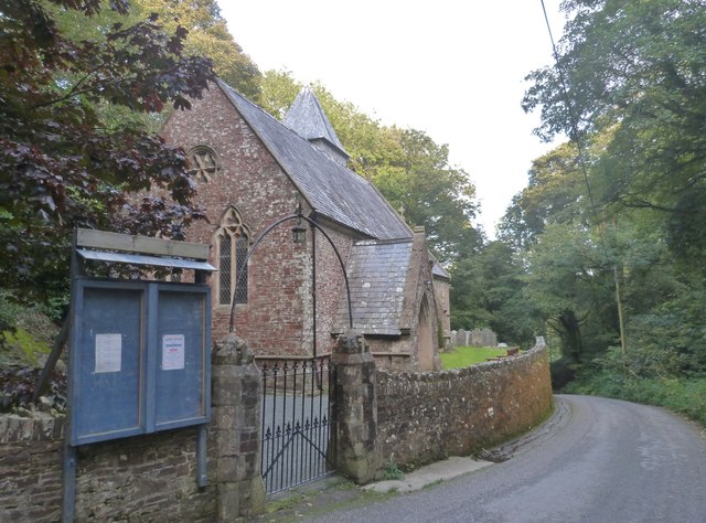
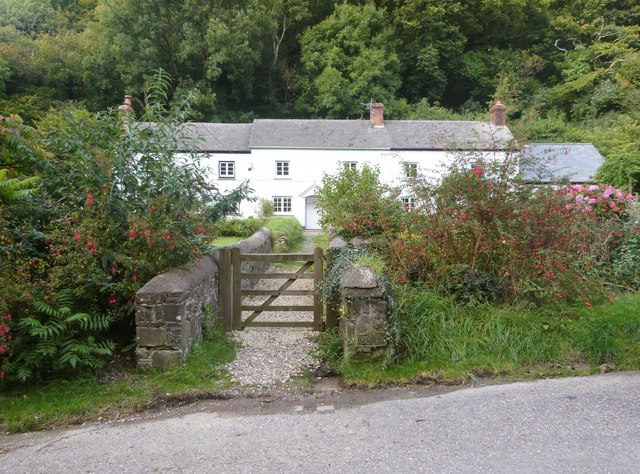
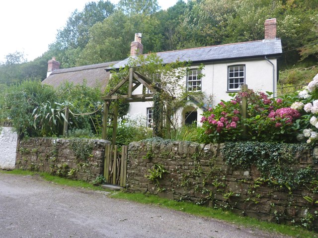
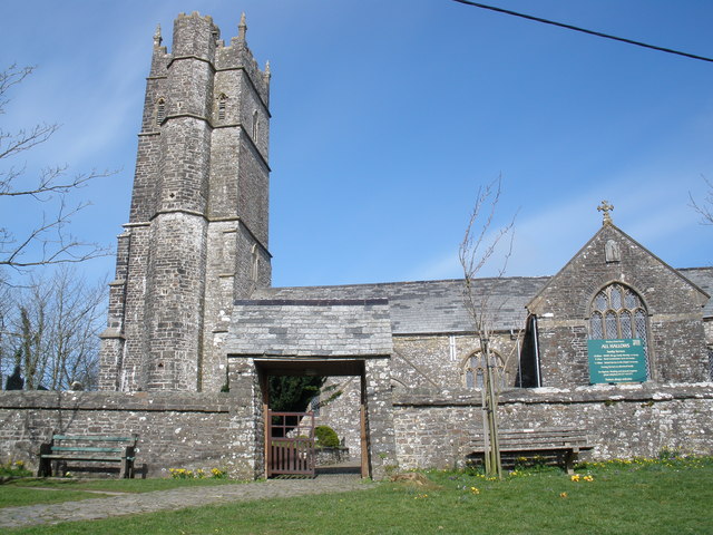
Despite its small size, Walland Cary boasts a rich history dating back centuries. It is home to several historic buildings, including the Grade I listed Walland House, a beautiful manor house that has stood since the 16th century. The village also features a charming church, St. Mary's, which dates back to the 12th century and is known for its intricate stained glass windows.

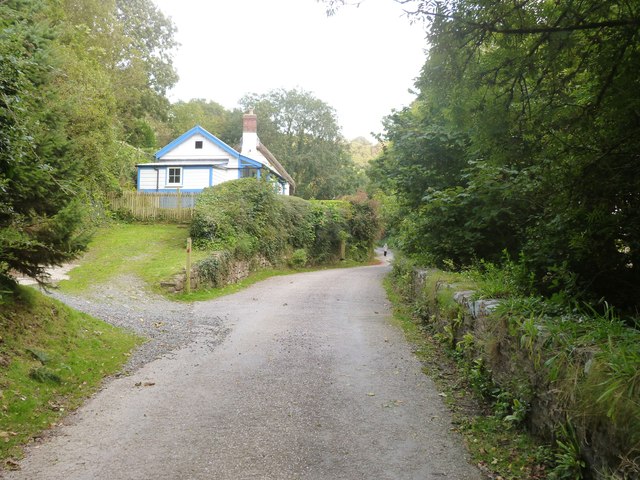
Nature enthusiasts will find plenty to explore in the area surrounding Walland Cary. The nearby Dartmoor National Park offers breathtaking landscapes, with rolling hills, ancient woodlands, and rugged tors. The park is a haven for hikers, cyclists, and wildlife enthusiasts, with numerous trails and nature reserves to discover.

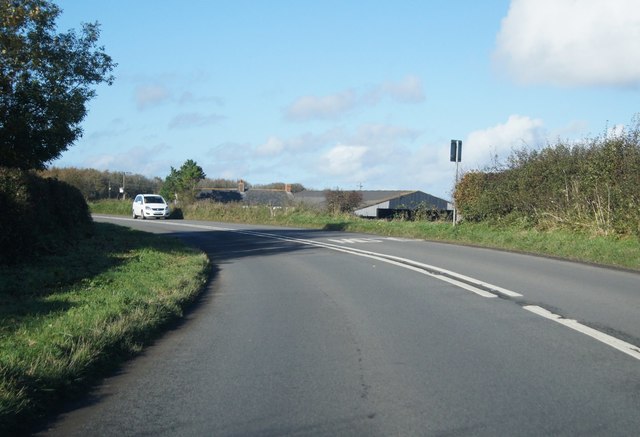
Despite its rural location, Walland Cary benefits from good transportation links. The A383 road runs through the village, connecting it to nearby towns and cities such as Newton Abbot and Exeter. The village is also served by several bus routes, providing access to surrounding areas.

Overall, Walland Cary offers a peaceful and idyllic village setting, blending history, natural beauty, and convenient access to amenities and attractions in the wider Devon region.

If you have any feedback on the listing, please let us know in the comments section below.
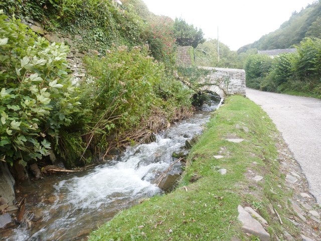
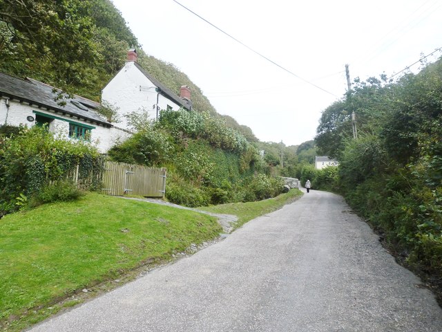
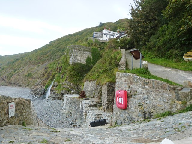
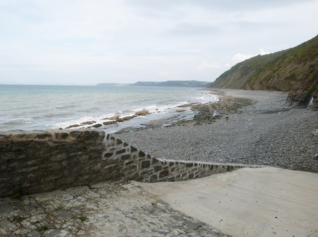
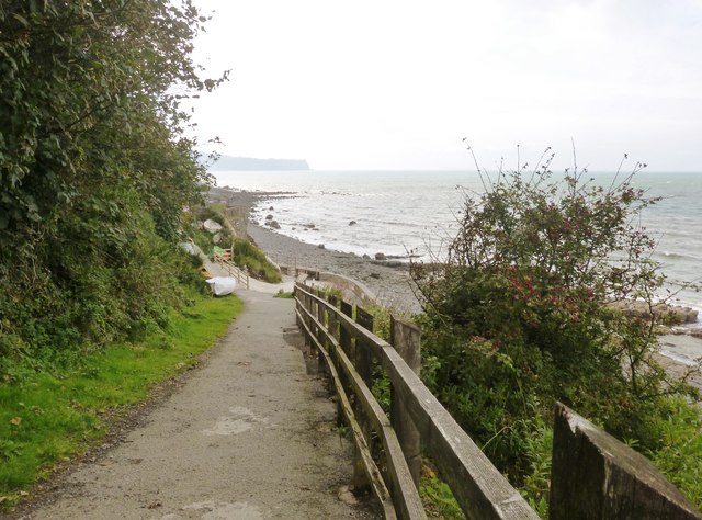
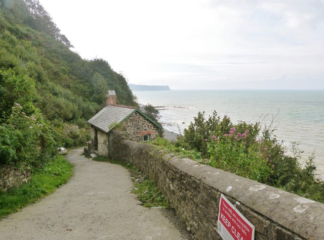
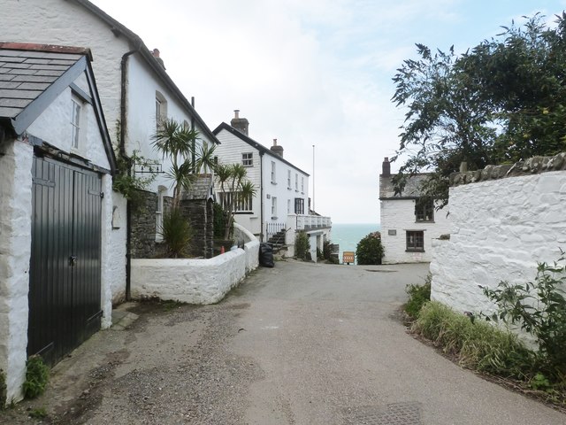
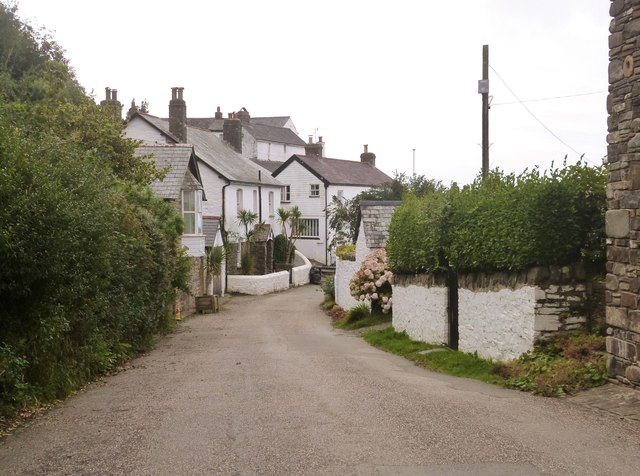
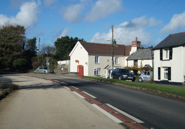
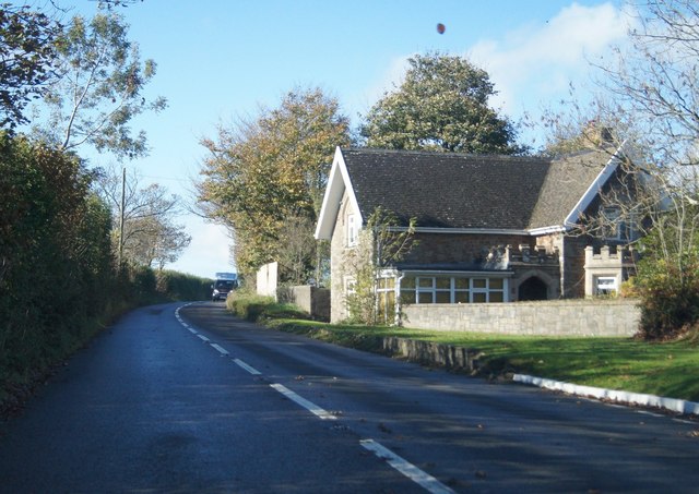
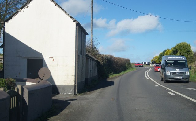
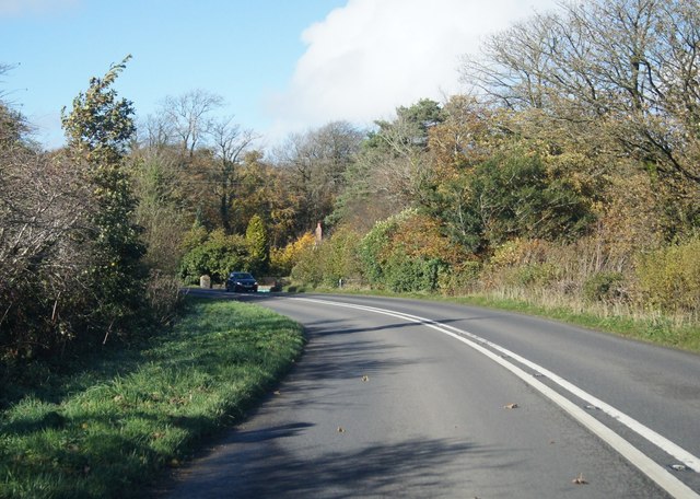
Walland Cary Images

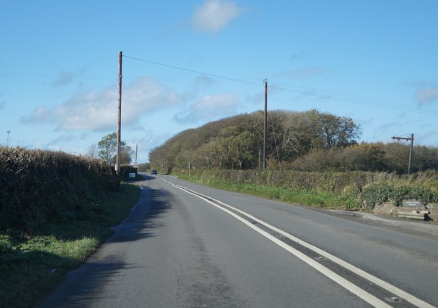
Images are sourced within 2km of 50.982412/-4.3662462 or Grid Reference SS3423. Thanks to Geograph Open Source API. All images are credited.

St Ann's church, Bucks Mills, Devon This church was built in 1861 by the Elwes family, who were the former landowners, for the estate workers. It nestles peacefully in this wooded valley, and is constructed from local stone. The remains of
 the quarry is now its car park.
St Ann's church, Bucks Mills, Devon
This church was built in 1861 by the Elwes family, who were the former landowners, for the estate workers. It nestles peacefully in this wooded valley, and is constructed from local stone. The remains of the quarry is now its car park.
Cottages at Bucks Mills, Devon
The lane through Bucks Mills, Devon
The fast running stream that passes through the village of Bucks Mills, Devon
The lane through Bucks Mills, Devon
The slipway and harbour at Bucks Mills, Devon The square building is all that remains of the old 19th century lime kiln. This picture also shows the steep path up to the village.
The slipway and harbour at Bucks Mills, Devon
The square building is all that remains of the old 19th century lime kiln. This picture also shows the steep path up to the village.
The slipway  at Bucks Mills, Devon
The slipway at Bucks Mills, Devon
Bottom of the steep path onto the beach and slipway at Bucks Mills, Devon Jutting out into the sea can be seen the "Gore", a pebble bank which legend has it that the Devil was building a causeway to Lundy Island, but gave up when the handle of his shovel broke.
Bottom of the steep path onto the beach and slipway at Bucks Mills, Devon
Jutting out into the sea can be seen the "Gore", a pebble bank which legend has it that the Devil was building a causeway to Lundy Island, but gave up when the handle of his shovel broke.
The steep path down to the sea at Bucks Mills, Devon
The village of Bucks Mills, Devon Ahead is the beginning of the steep path, complete with warning notice, that descends to the beach below
The village of Bucks Mills, Devon
Ahead is the beginning of the steep path, complete with warning notice, that descends to the beach below
The village of Bucks Mills, Devon Most of the dwellings in the village were built between 1812 and 1835 and were of mostly a few rooms. There was a water mill that pre-dated this but had no proper village around it. It was powered by the fast flowing stream that runs down the steep valley to the sea, finally ending up as a waterfall cascading on to the beach. Here was a small harbour constructed to unload the boats full of corn from farms up the coast and over on Lundy Island. The Napoleonic Wars created a need for more land for cultivation, which also created a need for lime as fertiliser for the poor soil, and so two beach-side kilns were built. This increased the population in a village that couldn't expand due to its narrow geographical location. Overcrowding was intense. Many parents reared six or so children in just a couple of rooms.  It was a very tight, insular  community that gained a reputation of hostility towards incomers. Close intermarriage during the 19th century caused Bucks Mills to be known as "The village with one surname".
The village of Bucks Mills, Devon
Most of the dwellings in the village were built between 1812 and 1835 and were of mostly a few rooms. There was a water mill that pre-dated this but had no proper village around it. It was powered by the fast flowing stream that runs down the steep valley to the sea, finally ending up as a waterfall cascading on to the beach. Here was a small harbour constructed to unload the boats full of corn from farms up the coast and over on Lundy Island. The Napoleonic Wars created a need for more land for cultivation, which also created a need for lime as fertiliser for the poor soil, and so two beach-side kilns were built. This increased the population in a village that couldn't expand due to its narrow geographical location. Overcrowding was intense. Many parents reared six or so children in just a couple of rooms. It was a very tight, insular community that gained a reputation of hostility towards incomers. Close intermarriage during the 19th century caused Bucks Mills to be known as "The village with one surname".
A39 in Bucks Cross
A39 in Bucks Cross
Very close to the A39 House by Bideford Caravan park.
Very close to the A39
House by Bideford Caravan park.
A39 at West Bucks
A39 at West Bucks
A39 near Hobby Lodge
A39 near Downland Cross
A39 by Burnstone Farm
Show me another place!

Walland Cary is located at Grid Ref: SS3423 (Lat: 50.982412, Lng: -4.3662462)

Administrative County: Devon

District: Torridge

Police Authority: Devon and Cornwall

What 3 Words

///lookout.mess.epidemics. Near Bideford, Devon

Related Wikis

The Milky Way (amusement park)

The Milky Way Adventure Park (Downland Farm) is an amusement park in North Devon. It was named as Devon's Large Attraction of the Year by Visit Devon in...

Lynbarn Railway

The 1 ft 11+1⁄2 in (597 mm) narrow gauge Lynbarn Railway opened in 1995 as a park ride at the Milky Way Adventure Park, a family-based theme park attraction...

Bucks Mills

Bucks Mills is a small English village within the parish of Woolfardisworthy on the north coast of Devon. It was anciently the mill of the manor of Bucks...

Woolfardisworthy, Torridge

Woolfardisworthy is a village and civil parish in the Torridge district of Devon, England. The village is accessible via the A39 road, 2 miles (3 km) from...

Nearby Amenities

Located within 500m of 50.982412,-4.3662462
West Bucks
Building: farm
Lat/Long: 50.9820003/-4.3625419
Bucks Barton
Building: farm
Lat/Long: 50.9840465/-4.3631795
Traffic Sign: maxspeed
Lat/Long: 50.9818377/-4.3621936
Give Way
Lat/Long: 50.9820143/-4.3621757
Direction: SSE
Fixme: Are these definitely solar panels - they look likely from the Bing imagery to be skylights instead?
Generator Method: photovoltaic
Generator Output Electricity: yes
Generator Solar Modules: 15
Generator Source: solar
Generator Type: solar_photovoltaic_panel
Location: roof
Power: generator
Lat/Long: 50.98226/-4.363313
Power: pole
Source: bing
Lat/Long: 50.9819391/-4.3711384
Power: pole
Source: bing
Lat/Long: 50.981837/-4.36993
Power: pole
Source: bing
Lat/Long: 50.9817205/-4.3687069
Power: pole
Source: bing
Lat/Long: 50.9788329/-4.3628329
Power: pole
Source: bing
Lat/Long: 50.9793547/-4.3632889
Power: pole
Source: bing
Lat/Long: 50.9800015/-4.3638495
Power: pole
Source: bing
Lat/Long: 50.9816057/-4.3675026
Power: pole
Source: bing
Lat/Long: 50.9814993/-4.3663251
Power: pole
Source: bing
Lat/Long: 50.9806735/-4.3644154
Power: pole
Source: bing
Lat/Long: 50.9813743/-4.3650243
Power: pole
Source: bing
Lat/Long: 50.9812426/-4.3635839
Material: wood
Power: pole
Source: bing
Lat/Long: 50.9811008/-4.3620577
Power: pole
Source: bing
Lat/Long: 50.9809724/-4.3606764
Fixme: Are these definitely solar panels - they look likely from the Bing imagery to be skylights instead?
Generator Method: photovoltaic
Generator Output Electricity: yes
Generator Source: solar
Generator Type: solar_photovoltaic_panel
Power: generator
Lat/Long: 50.9822335/-4.3637019
Fixme: Are these definitely solar panels - they look likely from the Bing imagery to be skylights instead?
Generator Method: photovoltaic
Generator Output Electricity: yes
Generator Source: solar
Generator Type: solar_photovoltaic_panel
Power: generator
Lat/Long: 50.9822437/-4.3636785
Fixme: Are these definitely solar panels - they look likely from the Bing imagery to be skylights instead?
Generator Method: photovoltaic
Generator Output Electricity: yes
Generator Source: solar
Generator Type: solar_photovoltaic_panel
Power: generator
Lat/Long: 50.9822565/-4.3636196
Fixme: Are these definitely solar panels - they look likely from the Bing imagery to be skylights instead?
Generator Method: photovoltaic
Generator Output Electricity: yes
Generator Source: solar
Generator Type: solar_photovoltaic_panel
Power: generator
Lat/Long: 50.9822623/-4.3635932
Fixme: Are these definitely solar panels - they look likely from the Bing imagery to be skylights instead?
Generator Method: photovoltaic
Generator Output Electricity: yes
Generator Source: solar
Generator Type: solar_photovoltaic_panel
Power: generator
Lat/Long: 50.9822764/-4.3635403
Fixme: Are these definitely solar panels - they look likely from the Bing imagery to be skylights instead?
Generator Method: photovoltaic
Generator Output Electricity: yes
Generator Source: solar
Generator Type: solar_photovoltaic_panel
Power: generator
Lat/Long: 50.9822815/-4.3635149
Fixme: Are these definitely solar panels - they look likely from the Bing imagery to be skylights instead?
Generator Method: photovoltaic
Generator Output Electricity: yes
Generator Source: solar
Generator Type: solar_photovoltaic_panel
Power: generator
Lat/Long: 50.9821714/-4.3636653
Fixme: Are these definitely solar panels - they look likely from the Bing imagery to be skylights instead?
Generator Method: photovoltaic
Generator Output Electricity: yes
Generator Source: solar
Generator Type: solar_photovoltaic_panel
Power: generator
Lat/Long: 50.9821772/-4.3636399
Fixme: Are these definitely solar panels - they look likely from the Bing imagery to be skylights instead?
Generator Method: photovoltaic
Generator Output Electricity: yes
Generator Source: solar
Generator Type: solar_photovoltaic_panel
Power: generator
Lat/Long: 50.9821893/-4.363585
Fixme: Are these definitely solar panels - they look likely from the Bing imagery to be skylights instead?
Generator Method: photovoltaic
Generator Output Electricity: yes
Generator Source: solar
Generator Type: solar_photovoltaic_panel
Power: generator
Lat/Long: 50.9821945/-4.3635525
Fixme: Are these definitely solar panels - they look likely from the Bing imagery to be skylights instead?
Generator Method: photovoltaic
Generator Output Electricity: yes
Generator Source: solar
Generator Type: solar_photovoltaic_panel
Power: generator
Lat/Long: 50.9822066/-4.3635037
Fixme: Are these definitely solar panels - they look likely from the Bing imagery to be skylights instead?
Generator Method: photovoltaic
Generator Output Electricity: yes
Generator Source: solar
Generator Type: solar_photovoltaic_panel
Power: generator
Lat/Long: 50.982213/-4.3634773
Fixme: Are these definitely solar panels - they look likely from the Bing imagery to be skylights instead?
Generator Method: photovoltaic
Generator Output Electricity: yes
Generator Source: solar
Generator Type: solar_photovoltaic_panel
Power: generator
Lat/Long: 50.9822117/-4.3634102
Fixme: Are these definitely solar panels - they look likely from the Bing imagery to be skylights instead?
Generator Method: photovoltaic
Generator Output Electricity: yes
Generator Source: solar
Generator Type: solar_photovoltaic_panel
Power: generator
Lat/Long: 50.9822226/-4.3633716
Fixme: Are these definitely solar panels - they look likely from the Bing imagery to be skylights instead?
Generator Method: photovoltaic
Generator Output Electricity: yes
Generator Source: solar
Generator Type: solar_photovoltaic_panel
Power: generator
Lat/Long: 50.9822309/-4.363337
Fixme: Are these definitely solar panels - they look likely from the Bing imagery to be skylights instead?
Generator Method: photovoltaic
Generator Output Electricity: yes
Generator Source: solar
Generator Type: solar_photovoltaic_panel
Power: generator
Lat/Long: 50.9822373/-4.3632933
Fixme: Are these definitely solar panels - they look likely from the Bing imagery to be skylights instead?
Generator Method: photovoltaic
Generator Output Electricity: yes
Generator Source: solar
Generator Type: solar_photovoltaic_panel
Power: generator
Lat/Long: 50.9822463/-4.3632537
Fixme: Are these definitely solar panels - they look likely from the Bing imagery to be skylights instead?
Generator Method: photovoltaic
Generator Output Electricity: yes
Generator Source: solar
Generator Type: solar_photovoltaic_panel
Power: generator
Lat/Long: 50.9822584/-4.363213
Fixme: Are these definitely solar panels - they look likely from the Bing imagery to be skylights instead?
Generator Method: photovoltaic
Generator Output Electricity: yes
Generator Source: solar
Generator Type: solar_photovoltaic_panel
Power: generator
Lat/Long: 50.9823243/-4.3632537
Fixme: Are these definitely solar panels - they look likely from the Bing imagery to be skylights instead?
Generator Method: photovoltaic
Generator Output Electricity: yes
Generator Source: solar
Generator Type: solar_photovoltaic_panel
Power: generator
Lat/Long: 50.9823147/-4.3632913
Power: pole
Source: bing
Lat/Long: 50.982141/-4.3647051
Power: pole
Source: bing
Lat/Long: 50.9825083/-4.3645468
Power: pole
Source: bing
Transformer: distribution
Lat/Long: 50.9830207/-4.3635812
Power: pole
Source: bing
Lat/Long: 50.9819502/-4.3713865
Addr Housename: White House Farm
Lat/Long: 50.982705/-4.3628007
The data included in this document is from www.openstreetmap.org. The data is made available under ODbL.

Have you been to Walland Cary?

Leave your review of Walland Cary below (or comments, questions and feedback).